
US Route 191 in the Gallatin Range of Yellowstone National Park

Since 1934 US Route 191 has traversed the Gallatin Range north of West Yellowstone, Montana to Bozeman Montana.  Since being extended to Bozeman during 1934 US Route 191 has remained the only US Route to ever be signed within the boundaries of Yellowstone National Park.  The course of US Route 191 north of West Yellowstone through the Gallatin Range takes it north through the Yellowstone National Park where it briefly dips into the State of Wyoming.  


Part 1; the history of US Route 191 in the Gallatin Range

The Gallatin Range is a sub-range of the Rocky Mountains and is located largely on the Montana/Wyoming State Line.  The Gallatin Range extends 75 miles north/south and largely is bisected by the Gallatin River.  The Gallatin Range takes it's name from Albert Gallatin who was the longest tenured US Secretary of the Treasury.  

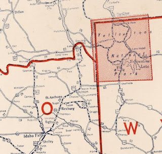
Road access through the Gallatin Range between West Yellowstone and Bozeman is largely tied to the development of West Yellowstone as the terminus of the Oregon Short Line Railroad.  West Yellowstone was plotted by the Oregon Short Line Railroad as it's eastern terminus during November of 1907.  The Oregon Short Line Railroad subsequently completed it's line to West Yellowstone by June of 1908.  The rail terminus of the Oregon Short Line Railroad in West Yellowstone was the head of a stage road via the Madison River into Yellowstone National Park.  The Oregon Short Line Railroad bypassed more well known Targhee Pass for the more favorable grades of nearby Reas Pass located southeast of modern US Route 20 ("US 20").  The Oregon Short Line Railroad can be seen terminating in West Yellowstone on the 1912 Rand McNally Map of Montana.  Notably the Gallatin Range is displayed in great detail north of West Yellowstone.  

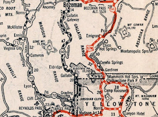
During the emergence of the automobile the Oregon Short Line Railroad was supplemented by a highway through the Gallatin Range.  The 1924 Rand McNally Map of Montana, Wyoming, Colorado, Idaho, Utah and Nevada shows Gallatin Way and the Great White Highway aligned as Auto Trails through the Gallatin Range from West Yellowstone to Bozeman.  Notably both Gallatin Way and Great White Highway are shown skirting through Wyoming via the boundaries of Yellowstone National Park.  The full extent of the Gallatin Way is shown be routed between West Yellowstone and Bozeman.  Even in modern times US 191 between West Yellowstone and Bozeman is known as Gallatin Road which ties back to it's Auto Trail origin.


The US Route System was created on November 11th, 1926 as a replacement for the preexisting Auto Trails.  US 191 was selected to be aligned from the western entrance of Yellowstone National Park towards Idaho Falls via Targhee Pass.  Notably no US Route was plotted through the Gallatin Mountains in the initial system grid nor did it have a State Route designation.  The 1927 National Company Map displays US 191 utilizing Targhee Pass and terminating at West Yellowstone.. 

The 1931 Clason's Road Map of Montana shows Montana Highway 60 ("MT 60") designated on Gallatin Way from West Yellowstone to Bozeman via the Gallatin Range.  It is unclear if the MT 60 designation was applied to the existing highway in the Gallatin Range within Yellowstone National Park.  

US 191was extended north from West Yellowstone to Bozeman circa 1934 via MT 60.  The extension of US 191 towards Bozeman left no US Route reaching the western entrance of Yellowstone National Park.  The Bozeman extension of US 191 was the first and only US Route to ever be approved for designation within the boundaries of Yellowstone National Park.  The exact date of the extension of US 191 to Bozeman isn't fully clear but it is referenced in a September 4th, 1934 letter from the Montana State Highway Commissioner to the Executive Secretary of the American Association of State Highway Officials ("AASHO").  The letter states the AASHO requested an updated route log from the State of Montana on August 20th, 1934 detailing the extension of US 191 to Bozeman.  


US 191 can be seen on the 1937 Gousha Map of Idaho extending north of West Yellowstone through the Gallatin Range to Bozeman. 

On October 30th, 1940 Idaho Department of Public Works acknowledged in a letter to the AASHO that US 20 had been extended through West Yellowstone via multiplex of US 191 to Sugar City.  The AASHO description of US 20 had it jog west via Idaho State Route 28 to Sage Junction to reach US 91.  The Idaho Department of Public Works requested US 20 be clarified to multiplex US 191 to Blackfoot (through Idaho Falls) to reach US 91 due to Idaho State Route 28 not being constructed to Sage Junction.  


1944 State Farm Map of Idaho shows US 20/US 191 multiplexing from West Yellowstone to US 91 in Idaho Falls.  


The truncation of US 191 from Idaho Falls to US 287 north of West Yellowstone at the edge of the Gallatin Range was approved by the AASHTO Executive Committee on during October 1978.  This left US 20 as the only highway aligned from West Yellowstone west over Targhee Pass to Idaho Falls.  


The extension of US 191 from US 287 near West Yellowstone to Interstate 40 in Chambers, AZ was approved by the AASHTO Executive Committee during June of 1981.  This extension of US 191 saw it multiplex US 20/US 287 through West Yellowstone to the west entrance of Yellowstone National Park.  


Part 2; a drive on US Route 191 from West Yellowstone to Big Sky via the Gallatin Range

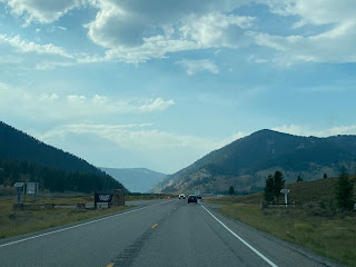
From the western entrance of Yellowstone National Park US 191 begins it's northern segment co-signed with US 287 and US 20 on Yellowstone Avenue.  US 191, US 20 and US 287 are discontinuous through the heart of Yellowstone National Park and don't have a implied connection via Grand Loop Road.  US 191, US 20 and US 287 make a right hand turn from Yellowstone Avenue northward onto Canyon Street.  


The Oregon Short Line Railroad stopped operating passenger trains to West Yellowstone circa 1960 due to declining ridership.  The Union Pacific Railroad subsequently deeded the Oregon Short Line buildings to the City of West Yellowstone after it incorporated on June 6th, 1966.  The West Yellowstone Oregon Short Line Terminus Historic District was added to the National Register of Historic Places during 1983.  The Oregon Short Line Railroad Depot located on Yellowstone Avenue was constructed during 1909.


US 191, US 20 and US 287 multiplex briefly on Canyon Street to Firehole Avenue.  US 20 splits west towards Targhee Pass via Firehole Avenue whereas US 191 and US 287 continue north via a multiplex on Canyon Street.  


US 191/US 287 northbound depart West Yellowstone via a multiplex on Gallatin Road and cross the Madison River.  Approaching Duck Creek US 287 splits from US 191 via Hebgen Lake Road towards Virginia City.  US 191 stays aligned northbound towards Bozeman via Gallatin Road.  


From the US 287 junction the alignment of US 191 northbound is signed as 39 miles from Big Sky and 80 miles from Bozeman.  


US 191 northbound on Gallatin Road ascends into the Gallatin Range where it briefly passes through Gallatin National Forest before entering the boundary of Yellowstone National Park.  


Within Yellowstone National Park US 191 dips into Wyoming following Grayling Creek to a pass where it picks up the course of the Gallatin River.  US 191 northbound begins to follow the Gallatin River northbound and reenters the State of Montana.  Upon returning to Montana US 191 enters Gallatin National Forest.  US 191 has one reassurance shield in both directions while in Yellowstone National Park and is signed with a 55 MPH speed limit.


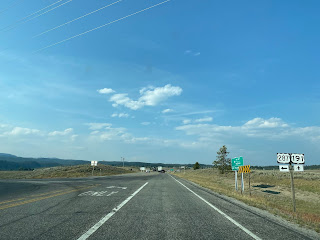
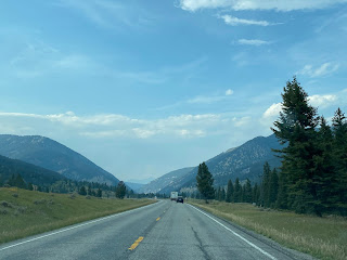
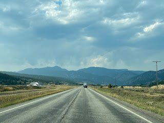
US 191 northbound on Gallatin Road follows the Gallatin River to a junction with MT 64/Lone Mountain Trail in Big Sky.  Traffic headed to Big Sky is directed to take westward MT 64 whereas Bozeman traffic is directed to continue another 40 miles northward through the Gallatin Range to Bozeman.


Part 3; exploring Montana Highway 64 and Big Sky

MT 64 is a 9.039 mile State Highway which begins at US 191 and follows Long Mountain Trail westward to the Mountain Village of the Big Sky Resort.  MT 64 was constructed during the 1970s when the resort community of Big Sky was being developed.  Downtown Big Sky can be found by following MT 64 west from US 191 to Ousel Falls Road.  


The community of Big Sky developed around the Big Sky Resort and has year-round population ranging from 2,000-3,000 residents.  Big Sky lies within Big Sky Valley of the Gallatin Range which was largely used as ranching prior to the 1970s.  The Big Sky Resort was founded during December 1973 by NBC Newscaster Chet Huntley at the base of nearby Lone Mountain.  The Big Sky Resort was later purchased by Boyce USA Resorts during 1976 which would go onto construct the community of Big Sky.


Comments

Popular posts from this blog

2018 Mojave Road Trip Part 2; The deadly desert highway (California State Route 127 and Nevada State Route 373)

After leaving Barstow via Old Highway 58 my next destination was in Death Valley.  To access Death Valley from rural San Bernardino County required a trek on north on Interstate 15 to California State Route 127 which becomes Nevada State Route 373 at the state line. Along I-15 I encountered the road sign oddity that is Zzyzx Road about eight miles south of Baker.   Zzyzx Road is a four mile road that used to go to the Zzyzx Mineral Springs and Health Spa.   The spa was founded in the 1940s and the owner made up the name "Zzyzx" to claim it was the last word in the English Language.  The spa has been shut down since the 1970s and is now part of a Desert Studies Center for California State University. The southern terminus of CA 127 in Baker is located at I-15 exit 246.  CA 127 is a 91 mile north/south highway which runs to the Nevada State Line in Inyo County.  CA 127 is called Death Valley Road from I-15 northward.  South of CA 127 ...

Finding the Pre-Emption Road of New York State

  The Pre-Emption Road (or rather a series of roads named Pre-Emption Road) follows a survey line called the Pre-Emption Line, drawn in the early days of the United States. The story begins with Massachusetts and New York having competing land claims to modern day Western New York State that have their roots in colonial charters granted by the British. After the Revolutionary War ended, this land became the frontier of the nation and its settlement became a priority for the new American government. During this era, there were a lot of competing land claims that needed to be settled. It was no different with the land claims between New York State and Massachusetts. On November 30, 1786, Massachusetts and New York sent representatives to Hartford, Connecticut to resolve their competing land claims. In less than three weeks, the representatives had reached a compromise. Massachusetts would receive pre-emption rights, meaning the right to sell the land after the Indian title ...

What's In a Name?: When the Roads Really Do Tell a Story

  Our tagline on the Gribblenation blog is "because every road tells a story". Some roads tell different stories than others. Along our travels, we may see historic markers that tell us a little story about the roads we travel or the places we pass by. Some historic markers are more general, as to telling us who lived where or what old trail traversed between two towns. During my travels across New York State and other states or provinces, I pass by many historic markers, some with interesting or amusing references to roads. I wanted to highlight a few of the markers I've seen along my travels around the Empire State and help tell their stories. Those stories may be as specific as explaining the tales of a tree that was used to help measure a distance of eight miles from Bath to Avoca in Steuben County, as referenced on the Eight Mile Tree historical marker above. They may also help point the way along historical roads first used centuries ago, or may help tell a local l...