
Washington State Route 20 the North Cascades Highway

Washington State Route 20 passes through the Cascades Range over the 5,477-foot-high Washington Pass.  The North Cascades Highway portion of Washington State Route 20 begins at Interstate 5 in Sedro-Woolley.  From Sedro-Woodley the North Cascades Highway follows the Skagit River eastward into Ross Lake Recreation Area where skirts the boundaries of North Cascades National Park.  The North Cascades Highway climbs eastward to the crest of the Cascade Range via Rainy Pass and Washington Pass.  From Washington Pass the North Cascades Highway descends eastward following the general course of the Methow River towards Winthrop and Twisp.  


Part 1; the history of the North Cascades Highway segment of Washington State Route 20

Note: much of the history of the North Cascades Highway in this blog is sourced from the historylink.org article regarding the topic.

History Link on the North Cascades Highway

The concept of a road across the northern extent of the Cascade Range of Washington was envisioned even before Statehood.  In 1893 the Washington State Legislature appropriated $20,000 dollars for construction of a wagon road from the north fork of Nooksack River near modern day Glacier.  Survey teams concluded construction of a road so close to Mount Baker was impractical and abandoned attempts to cross the Cascade Range at such a northerly location.  This early concept of a Trans-Cascade Road exists as Washington State Route 542/Mount Baker Highway.

Several alternative corridors for the Trans-Cascade Road were explored.  Ultimately a corridor originating at Marblemount at the confluence Skagit River and Cascade River was chosen by the State Road Commission during September of 1895.  The so called "Cascade Wagon Road" was to follow the Cascade River east to the 5,392-foot-high Cascade Pass.  From Cascade Pass the Cascade Wagon Road was planned to track eastward to Stehekin and onward to Twisp.  Construction of the Cascade Wagon Road began in 1896 as State Highway 1.  While construction of the Cascade Wagon Road was initially swift flooding began to wash-out segments of road soon after they were constructed.  Work on the Cascade Wagon Road was abandoned in 1899 which ultimately only led to a rough trail over the northern Cascade Range being the result of construction.   

Below in the Washington State Department Transportation photo the Cascade Wagon Road can be seen east of Marblemount.

The Cascade Wagon Road appears on the 1925 Rand McNally Map of Washington and Oregon as Washington State Highway 24.  A similar conceptual corridor known as the Methow Valley Highway is displayed to the north as Washington State Highway 23.  Washington State Highway 23 appears to be a very similar concept to the modern North Cascades Highway with the major exception being its planned route followed the Methow River to the north of Washington Pass towards Mazama.  Before Washington State Route 23 and Washington State Route 24 are shown as Secondary State Highways. 


During the 1920s advocates from the business communities in Skagit County and Okanogan County petitioned the State of Washington to complete the Cascade Wagon Road.  These attempts led to $250,000 dollars being appropriated to finish the Cascade Wagon Road.  These appropriations ultimately were withdrawn upon the onset of The Great Depression.  

Below the Cascade Wagon Road and Methow Valley Highway can be seen as planned highways on the 1927 Rand McNally Map of Washington.  Neither the Cascade Wagon Road nor the Methow Valley Highway are shown with the State Highway number.  

The 1931 Clason's Road Map of Washington State shows the concept of the Methow Valley Highway was to cross the Cascade Range via the 6,197-foot-high Harts Pass.

During 1932 State Highway Engineer Ike Munson surveyed a new route across the northern Cascade Range.  Munson originally surveyed a route which would pass through Stehekin eastward towards Twisp.  Ultimately a new route was chosen which was similar to the Methow Valley Highway.  The surveyed highway would begin in Marblemount ascending eastward towards Rainy Pass and Washington Pass towards Mazama.  The new route had the advantage in that it could incorporate the already constructed road from Marblemount to Diablo Dam.  

The 1939 Rand McNally Map of Washington State shows the future corridor of the North Cascades Highway assigned to several different route numbers.  The highway from Sedro-Woolley to Marblemount is shown to be assigned as Washington Secondary Highway 17A whereas the Methow Valley Highway is shown as part of Washington Primary Highway 16.  The Cascade Wagon Road is displayed as Washington Primary Highway 17.  


During 1953 the North Cross-State Highway Association formed and began to advocate for a northern Trans-Cascade Highway to be completed.  The conceptualized North Cascades Highway is shown following the surveyed 1932 Munson Route on the 1956 Shell Highway Map of Washington.  Washington Primary Highway 17 is shown to be realigned off of the Cascade Wagon Road from Marblemount towards Newhalem.  

Construction of the North Cascades Highway began in 1959 from Diablo Dam 5.9-miles to Thunder Arm.  During 1964 the North Cascades Highway was reassigned as part of Washington State Route 20 as part of the wider Washington State Highway Renumbering.  On October 2nd, 1968, Congress had authorized the creation of North Cascades National Park, Ross Lake National Recreation Area and Lake Chelan National Recreation Area.  Despite the newly designated recreational areas the grading of an unpaved North Cascades Highway was completed during 1968.  The unpaved North Cascades Highway (originally known as the North Cross-State Highway) was dedicated on September 29th, 1968, amid a crowd of off-highway/high clearance vehicles. 

Below then Washington State Governor Evans can be seen at Rainy Pass during the opening ceremony of the unpaved North Cross-State Highway in a Washington State Achieves sourced photo.  

During 1971 the North Cross-State Highway Association renamed as the North Cascades Highway Association.  Surfacing of the North Cascades Highway was completed during 1972 the highway was rededicated on September 2nd, 1972.  Below Governor Dan Evans can be seen at the North Cascades Highway dedication ceremony held in Winthrop (sourced Washington State Department of Transportation).  


Part 2; a drive on Washington State Route 20 over the North Cascade Highway

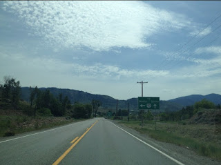
During May of 2015 Tom Fearer of Gribblenation drove the North Cascade Highway eastward from Washington State Route 530 in Skagit County at the Skagit River in Rockport.  Rockport lies within the boundaries of Mount Baker-Snoqualmie National Forest. 


The older alignment of the North Cascades Highway and Washington State Route 20 in Concrete is known as the Concrete Historic Byway.  Doug Kerr explored the Concrete Historic Byway in the 2020 Gribblenation blog feature below. 

Concrete Historic Byway

The Skagit River from the North Cascades Highway near Rockport.  


Washington State Route 20/North Cascades Highway follows the Skagit River east from Rockport to Marblemount.  Upon entering Marblemount Washington State Route 20 intersects Cascade River Road near the confluence of the Cascade River at the Skagit River.  Cascade River Road is where the Cascade Wagon Road branched away from the modern North Cascades Highway.  The Truss Bridge over the Skagit River in the third photo below was constructed during 1930.  Note: the former Cascade Wagon Road can still be utilized as a hiking trail to Cascade Pass. 


Washington State Route 20/North Cascades Highway follows the Skagit River east from Marblemount to Newhalem.  Approaching Newhalem Washington State Route 20 enters the boundary of the Ross Lake National Recreation Area and is bounded north/south by North Cascades National Park. 


Newhalem is a company town built by Seattle City Light to manage the hydroelectric dams upstream on the Skagit River Watershed.  Below a Baldwin 2-6-2 Locomotive known as "Old Number Six" can be seen on display in Newhalem.  Old Number Six had been constructed for Seattle City Light in 1928.  


The Gorge Powerhouse along the Skagit River in Newhalem.  


Washington State Route 20/North Cascades Highway along the Skagit River east of Newhalem. 


Gorge Dam can be seen from Washington State Route 20.  During 1917 the City of Seattle had obtained permission from the Department of Agriculture to build dams along the Skagit River as part of the Skagit River Hydroelectric Project.  Gorge Dam was the first Seattle City Light dam completed on the Skagit River and was dedicated during September 1924.  The original Gorge Dam was replaced with a 300-foot-high structure in 1961.  


Gorge Creek Falls can be viewed along Washington State Route 20 near Gorge Dam.  


Washington State Route 20/North Cascades Highway east of Gorge Dam passes through a small tunnel and crosses Gorge Lake. 


Washington State Route 20 east of Gorge Lake passes by Diablo Dam.  Diablo Dam was the second Skagit River Hydroelectric Project structure to be completed circa 1930.  At the time of its construction Diablo Dam was highest dam in the world at 389 feet in height.  Diablo Dam did not deliver electricity to Seattle until 1936 due to delays in building the powerhouse brought on by The Great Depression.  


The view along Diablo Dam Road which runs along the top of Diablo Dam. 


Washington State Route 20/North Cascades Highway east of Diablo Dam ascends to the Diablo Lake Overlook. 


Ross Dam can be seen on Washington State Route 20 immediately east of Diablo Dam Overlook.  Ross Dam was originally completed in 1940 but additional phases to the project brough the structure height to 540 feet by 1953.  


East of Ross Dam Washington State Route 20/North Cascades Highway reenters Mount Baker-Snoqualmie National Forest and ascends via Granite Creek to the 4,875-foot-high Rainy Pass. 


From Rainy Pass Washington State Route 20/North Cascades Highway ascends to Washington Pass.  From the Washington Pass Overlook the 7,720-foot-high peak of Liberty Bell Mountain can be observed along with Early Winters Creek.


Washington State Route 20/North Cascades Highway enters Okanogan County and descends from the Cascade Range via Early Winters Creek into Methow Valley. 


Washington State Route 20/North Cascades Highway eastbound picks up the Methow River and follows it into Winthrop.  


Within Winthrop Washington State Route 20 crosses the Methow River twice and follows Riverside Avenue.  Winthrop was settled in 1883 by those seeking gold claims along the Methow River watershed.  Methow incorporated during March 1924 and has become something of a tourist destination after the completion of the North Cascades Highway.  Despite the retro aesthetic the pedestrian bridge over the Methow River in Winthrop was completed during 2011.  The Truss Bridge carrying Washington State Route 20 over the Methow River departing Winthrop was built during 1929. 


From Winthrop Washington State Route 20/North Cascades Highway follows the Methow River east to Twisp.  Washington State Route 20 is aligned on Division Street within Twisp.  Twisp lies at the confluence of the Twisp River at the Methow River.  What is now Twisp was plotted during 1897 as Gloversville.  A second town site known Twisp was plotted next to Gloversville during 1899.  The two communities eventually merged into a single entity known as Twisp which incorporated during August 1909.  


Departing Twisp Washington State Route 20 intersects Washington State Route 153 which concludes the North Cascades Highway.   US Route 97 southbound traffic is directed to take Washington State Route 153 whereas northbound US Route 97 traffic is directed to stay on Washington State Route 20.  


Comments

Popular posts from this blog

Paper Highways: The Unbuilt New Orleans Bypass (Proposed I-410)

  There are many examples around the United States of proposed freeway corridors in urban areas that never saw the light of day for one reason or another. They all fall somewhere in between the little-known and the infamous and from the mundane to the spectacular. One of the more obscure and interesting examples of such a project is the short-lived idea to construct a southern beltway for the New Orleans metropolitan area in the 1960s and 70s. Greater New Orleans and its surrounding area grew rapidly in the years after World War II, as suburban sprawl encroached on the historically rural downriver parishes around the city. In response to the development of the region’s Westbank and the emergence of communities in St. Charles and St. John the Baptist Parishes as viable suburban communities during this period, regional planners began to consider concepts for new infrastructure projects to serve this growing population.  The idea for a circular freeway around the southern perimeter of t

Hernando de Soto Bridge (Memphis, TN)

The newest of the bridges that span the lower Mississippi River at Memphis, the Hernando de Soto Bridge was completed in 1973 and carries Interstate 40 between downtown Memphis and West Memphis, AR. The bridge’s signature M-shaped superstructure makes it an instantly recognizable landmark in the city and one of the most visually unique bridges on the Mississippi River. As early as 1953, Memphis city planners recommended the construction of a second highway bridge across the Mississippi River to connect the city with West Memphis, AR. The Memphis & Arkansas Bridge had been completed only four years earlier a couple miles downriver from downtown, however it was expected that long-term growth in the metro area would warrant the construction of an additional bridge, the fourth crossing of the Mississippi River to be built at Memphis, in the not-too-distant future. Unlike the previous three Mississippi River bridges to be built the city, the location chosen for this bridge was about two

Huey P. Long Bridge (New Orleans, LA)

Located on the lower Mississippi River a few miles west of New Orleans, the Huey P. Long Bridge is an enormous steel truss bridge that carries both road and rail traffic on an old-time structure that is a fascinating example of a bridge that has evolved in recent years to meet the traffic and safety demands of modern times. While officially located in suburban Jefferson Parish near the unincorporated community of Bridge City, this bridge’s location is most often associated with New Orleans, given that it’s the largest and most recognizable incorporated population center in the nearby vicinity. For this reason, this blog article considers the bridge’s location to be in New Orleans, even though this isn’t 100% geographically correct. Completed in 1935 as the first bridge across the Mississippi River in Louisiana and the first to be built in the New Orleans area, this bridge is one of two bridges on the Mississippi named for Huey P. Long, a Louisiana politician who served as the 40th Gove