
About 35 years ago, these blue and green signs that read "Twin Rivers Scenic Road" started popping up everywhere I went around my childhood home. I couldn't drive yet, but I wanted to know the route and where it went. I saw them on Route 48 and McKeesport Road in Elizabeth.
As I grew older and began driving, I forgot about this "scenic road" since I was more interested in exploring roads I had never traveled before. Around 1999, I became curious about this road again. And in transportation forums, a handful of Pittsburghers tried to hypothesize where the driving tour went and what and why it existed.
Fast forward to 2021, and a post in a Facebook group asking about the now completely faded signs; and what the road was for rekindled my interest in solving this mystery.
So what is this "Twin Rivers Scenic Road", where did it go, and where and why did it come about?
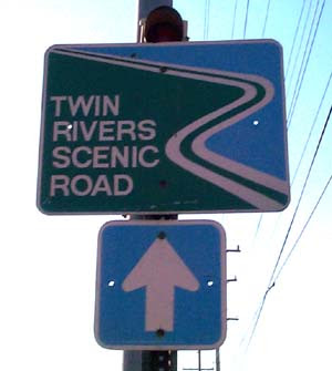 |
| A McKeesport-located Twin Rivers Scenic Road sign in better days (2000). Photo by Bruce Cridlebaugh. |
What:
My best guess is that this was a touring route created by the now-defunct Twin Rivers Council of Governments (TRCOG.) The driving tour most likely promoted local tourism and/or recreation activities in and along the Monongahela and Youghiogheny Rivers in Southeastern Allegheny County. The Twin Rivers Scenic Road (TRSR) had a spur to the Boston Riverfront Park off of PA 48, the Elizabeth Waterfront Park, and Allegheny County's Round Hill Park. A few Google and Newspaper Archive searches came up with next to nothing. E-mails seem to agree with the TRCOG theory or possibly the Mon-Yough Riverfront Entertainment Council - which is also defunct.
The TRCOG theory seems to me to be the best because of the name "Twin Rivers."
Recreating the Route:
Here is where the fun begins. In the map below, I try to figure out the route of the TRSR. Green pinpoints are where Twin River Scenic Road signs still exist. Blue pinpoints are where signs were known to exist (either verified via streetview or prior discussions). Purple pinpoints were known "destinations" of the TRSR, as they had larger signs in the same style as the road markers and would name that destination. The Blue driving lines are what I know of as confirmed routes (by existing signs or prior discussions). Pink lines are what I theorize the route to be. Purple is another possible route based on the theory that White Oak Park was part of the destinations. This is based on past discussions about the route, and a November 2025 discovery of a marker on PA 48 North, having the route turn right onto Lincoln Way to most likely White Oak Park via McClintock Road.
Discussions 20 years ago mention signs were located on Lincoln Way east of White Oak - which makes me believe that White Oak Park was involved. All of the communities the route goes through - Elizabeth Borough, Elizabeth Township, Forward Township, Glassport, McKeesport, White Oak, Versailles, etc. were all members of the TRCOG. Since the nearby community of West Newton was also a member, the Twin Rivers Scenic Road could possibly have been routed there. However, the remaining signs do not support that possibility.
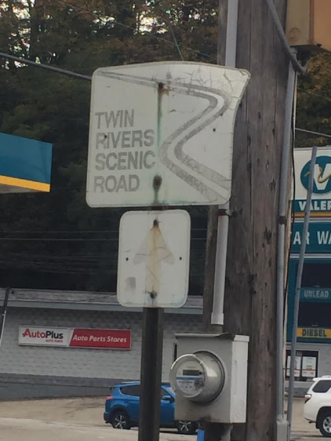 |
| It's basically hard to recognize the remaining TRSR signs today. (Mike Natale - October 2021.) |
What is known is that there are at least five remaining signs of the route, all in poor condition - faded nearly beyond recognition. Signs at the Boston Bridge were still up in 2012 but were gone by 2016.
Why:
The economic/recreational tourism promotion is probably the best theory. The Yellow and Orange Belts of the Allegheny County Belt System intersect and travel along the TRSR, so a basic navigational wayfinding system was already in place. In the late 1980s, the wayfinding you find in many towns - a result of many Main Street programs - was 20+ years away. The earliest known reference of the Twin Rivers Scenic Road is a Carnegie Mellon University post in 1991 about bike riding in the Mon Valley. It describes the Monogahela River section of the route.
I don't recall any brochures about the route or any local promotion. It appears the signs went up and if you wanted to figure it out - by all means, go for it. I am sure the TRCOG or whoever created the route did some publicity about it, but as of this writing, nothing has been found.
 |
| One of five known remaining TRSR signs - (Mike Natale - November 2021.) |
So, this mystery of the route isn't completely solved. However, with the help of technology we didn't have 20 years ago (social media and Google Streetview), we've been able to piece together some pieces of the puzzle. Yet a few questions remain. When did the route get signed, who or what organization was behind the scenic road, and what was its purpose?
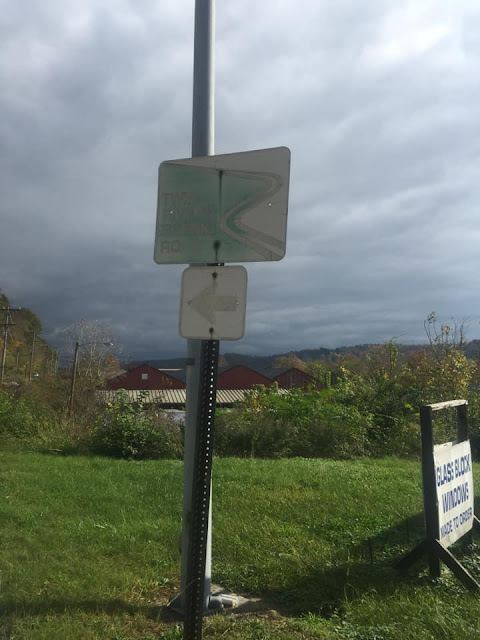
 |
| A severely weathered Twin Rivers Scenic Road shield at PA 48 North and Lincoln Way in White Oak. The sign directs drivers to Lincoln Way and most likely White Oak Park via McClintock Road. (Adam Prince - November 2025). |
If you have any information, photos of any other remaining signage, or otherwise about the route, feel free to leave a comment or drop me an e-mail.
Site Navigation:
Sources & Links:
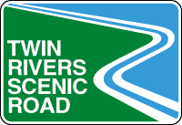
- Bruce Cridlebaugh - including Twin Rivers Scenic Road graphic at the top of the page.
- Mike Natale
- Jason Togyer
Page History:
- January 2, 2022 - Page First Published
- December 22, 2025 - Updated page with photo of TRSR Marker in White Oak and adjusted the TRSR routing map accordingly
Comments