
Middle Covered Bridge - Woodstock, Vermont


The Middle Covered Bridge spans over the Ottaquechee River as the centerpiece bridge of Woodstock, Vermont, just a stone's throw away from the downtown business district. Built in 1969 by Milton S. Graton and his sons (now Arnold M. Graton Associates), the 181 foot long covered bridge was designed in a Town lattice through truss design and replaced an iron truss bridge called the Middle Bridge that had been rendered obsolete.

The Middle Covered Bridge is the first public covered bridge built in the State of Vermont since 1889. Builder Milton Graton constructed this masterpiece near the crossing, then in July 1969, it was pulled across the river by a team of oxen named Ben and Jo. The covered bridge was built using traditional methods and materials down to the wooden pegs in lieu of nails. Details of the construction of the Middle Covered Bridge can also be found in a book written entitled The Last of the Covered Bridge Builders by covered bridge builder Milton Graton.

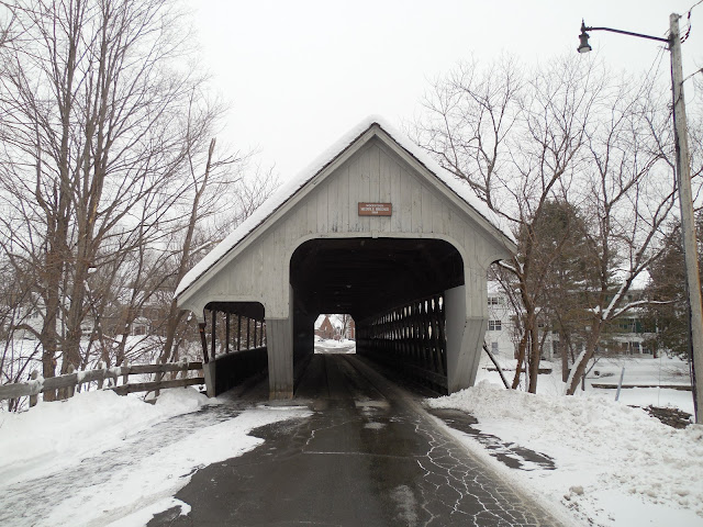
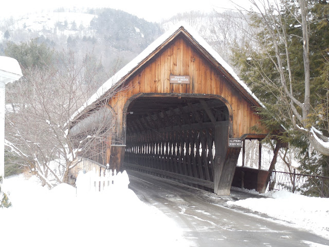
The covered bridge was burned by arsonists on May 11, 1974. Fortunately, Milton Graton came to the rescue and was able to restore the covered bridge. Today, the bridge can be enjoyed by drivers and pedestrians alike, especially with its separate portals for pedestrian traffic. Visitors to the bridge will notice that while most of the bridge has a stained wood look, the north entrance to the bridge has been painted a white or light gray color. The covered bridge has a nice view in the background of Mount Tom, which was once a ski area. When I visited the Middle Covered Bridge during a snowy New England day, I definitely got the classic vibes of the Vermont of yore. I think it blends perfectly with its surroundings.

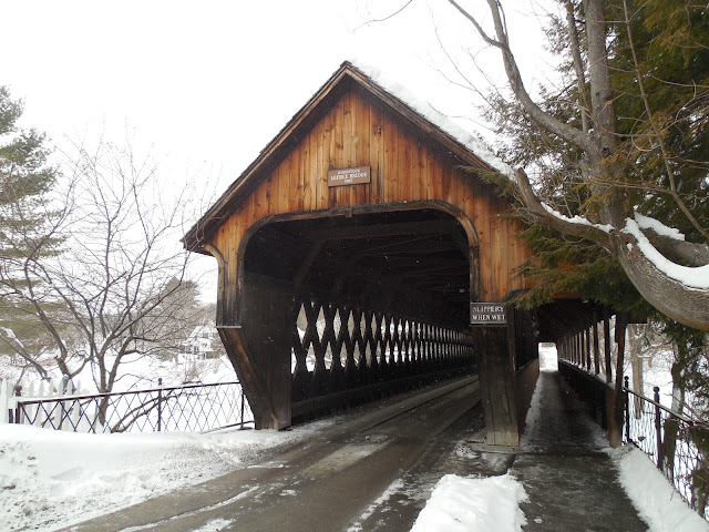
South entrance of the Middle Covered Bridge.

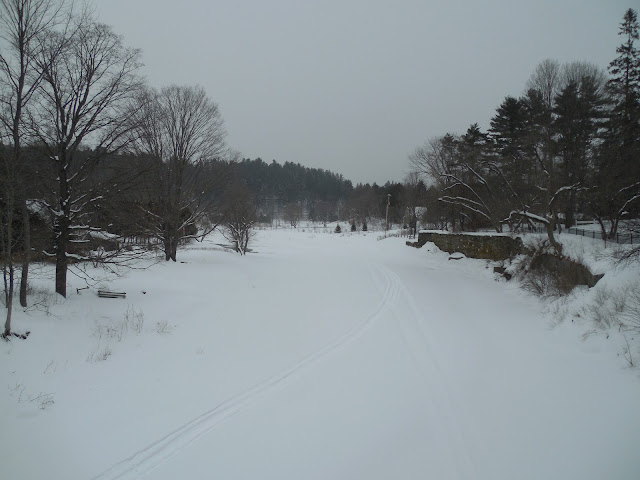
An icy, snowy Ottaquechee River, apparently with ice thick enough to run tracks along the river.
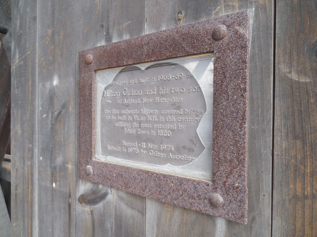
Bridge plaque.

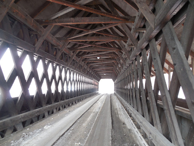
Inside the covered bridge. The open Town lattice design allows the light to come into the bridge.

A parting shot of the Middle Covered Bridge.


How to Get There:


Sources and Links:
The Travels of Tug 44 - Middle Covered Bridge
Bridgehunter.com - Middle Covered Bridge 45-14-15
Vermont Covered Bridge Society - Middle Covered Bridge
Woodstock, Vermont - 4 covered bridges that epitomize Vermont charm: A visual tour

Comments

Popular posts from this blog

North Carolina Continues to Move Forward with Rail

2023 and the first half of 2024 have seen continued growth in North Carolina's passenger rail system.  From increased daily trains from Raleigh to Charlotte, federal funds for studying additional corridors, and receiving a historic grant to begin the construction of high-speed rail between Raleigh and Richmond, the last 18 months have been a flurry of activity at NCDOT's Rail Division.  And that's just the tip of the iceberg. As ridership and routes increase - the engine of North Carolina passenger rail trains will become a more common sight. (Adam Prince) Increased Passenger Train Service: On July 10, 2023, a fourth Piedmont round-trip rail service between Raleigh and Charlotte commenced.  The four Piedmont trains plus the daily Carolinian (to Washington, DC, and New York) bring the total of trains serving the two cities daily to five. The current daily Piedmont and Carolinian schedule between Charlotte and Raleigh (NCDOT) The result was over 641,000 passengers utilized pa

US Route 101 in Benbow, Garberville and Redway

The communities of Benbow, Garberville and Redway can all be found along US Route 101 within southern Humboldt County.  The former surface alignment of US Route 101 in Garberville and Redway once crossed the Garberville Bluffs along what is now Redwood Drive via a corridor constructed as part of the Redwood Highway during the 1910s.  US Route 101 through Benbow, Garberville and Redway was modernized by 1935.  US Route 101 would eventually be upgraded to freeway standards in Benbow, Garberville and Redway by extension of the Redwood Freeway during 1966-68.  As the cover photo the original grade of US Route 101 and the Redwood Highway can be seen at the Garberville Bluffs during 1934.  US Route 101 can be seen in the communities of Benbow, Garberville and Redway on the 1935 Division of Highways Map of Humboldt County .   The history of US Route 101 in Benbow, Garberville and Redway Benbow, Garberville and Redway lie on the banks of the South Fork Eel River of southern Humboldt County.  D

The Midway Palm and Pine of US Route 99

Along modern day California State Route 99 south of Avenue 11 just outside the City limits of Madera one can find the Midway Palm and Pine in the center median of the freeway.  The Midway Palm and Pine denotes the halfway point between the Mexican Border and Oregon State Line on what was US Route 99.  The Midway Palm is intended to represent Southern California whereas the Midway Pine is intended to represent Northern California.  Pictured above the Midway Palm and Pine can be seen from the northbound lanes of the California State Route 99 Freeway.   This blog is part of the larger Gribblenation US Route 99 Page.  For more information pertaining to the other various segments of US Route 99 and it's three-digit child routes check out the link the below. Gribblenation US Route 99 Page The history of the Midway Palm and Pine The true timeframe for when the Midway Palm and Pine (originally a Deadora Cedar Tree) were planted is unknown.  In fact, the origin of the Midway Palm and Pine w