During November of 1926 the US Route System was approved by the AASHO. US 99 was approved as a single route from Red Bluff south to Davis. US 99 can be seen as a standalone route from Red Bluff south via LRN 7 to Woodland and via multiplex of US 40/LRN 6 to Sacramento on the
1927 National Map Company Sectional Map.
The January 1928 California Highways & Public Works describes US 99 as a single route heading south out of Red Bluff via LRN 7 towards Davis and via a multiplex of US 40/LRN 6 to Sacramento.
The AASHO data base has information pertaining to a request made by the California State Highway Engineer to have US 99 become a split route between Red Bluff south to Sacramento. In a letter dated June 13th, 1928 the rationale for splitting US 99 into an East/West Route was a two-to-one traffic ratio on LRN 3 on the east bank of the Sacramento River compared to LRN 7 on the west bank.
The proposed US 99W/US 99E split can be seen for the first time on this map (which was scanned upside down in the AASHO database).
The US 99W/US 99E split from Red Bluff to Sacramento was approved by the AASHO on August 6th, 1928.
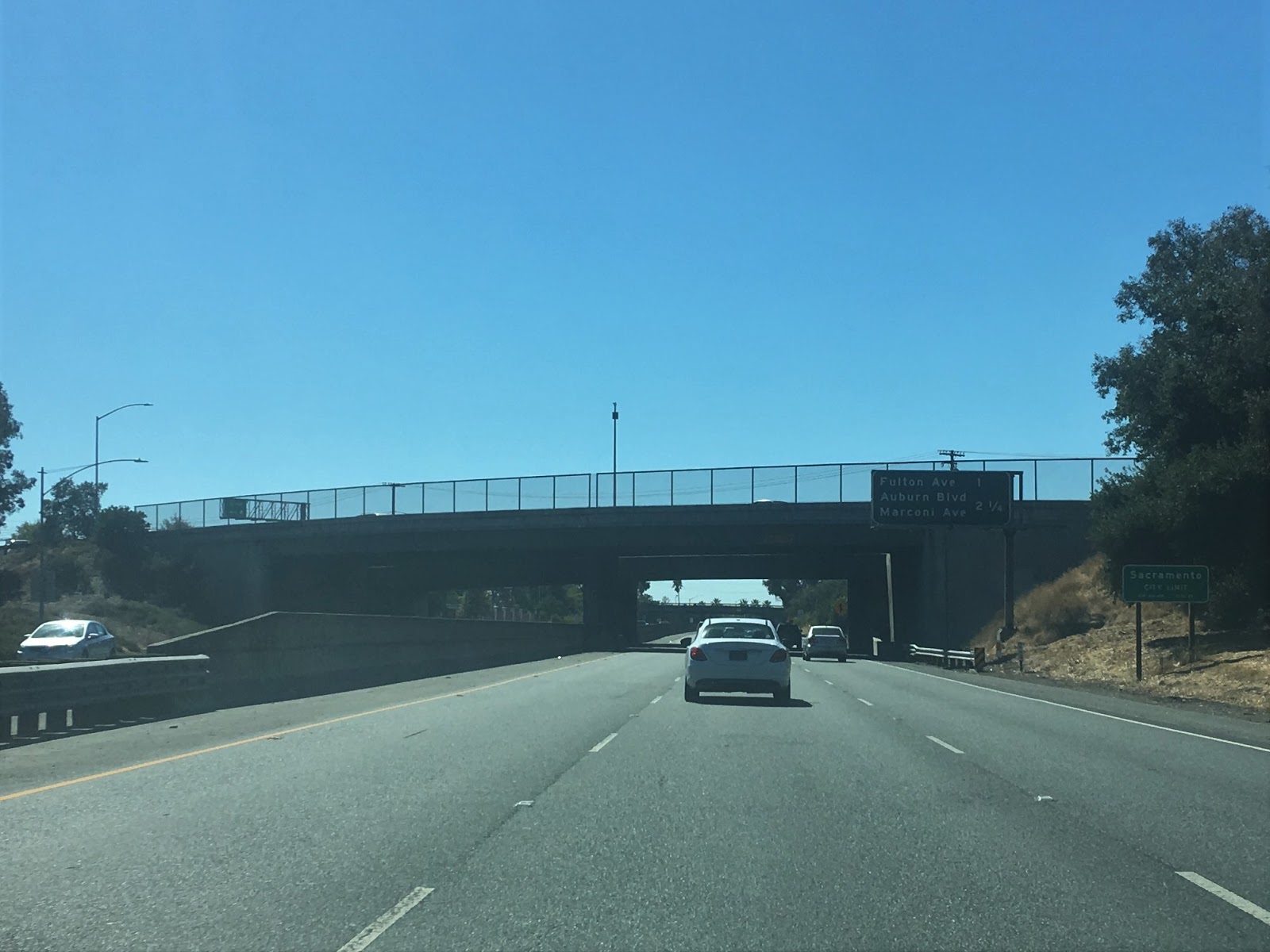
The December 1929 California Highways & Public Works features the recently widen segment of US 99E/US 40/LRN 3 in North Sacramento on Auburn Boulevard. The new alignment of US 99E/US 40/LRN 3 consisted of 8.7 miles of road surface expanded from 18 feet in width to 30 feet.
The first edition to display US 99 as a split route south of Red Bluff towards Sacramento can be seen on the 1930 Division of Highways State Map.
The
May 1930 California Highways & Public Works announced US 99E/LRN 3 through Wheatland was slated to be widened and realigned in a manner that would eliminate right-angle turns. Note; both US 99W/LRN 7 and US 99E/LRN 3 in the Sacramento-Red Bluff corridor were referred to as the Pacific Highways for several years in the California Highways & Public Works.
1933 was significant due to the State Legislature allowing the Division of Highways to assume maintenance of highways in Cities for the first time. This action by the Legislature led to a large addition of highway mileage throughout the State of California during 1933. The previous locally maintained segments of US 99E and LRN 3 within cities were assumed under the maintenance of the Division of Highways.
The 1935 Division of Highways Maps display where US 99E/LRN 3 was located in detail. The
1935 Division of Highways Map of Tehama County displays US 99E/LRN 3 southbound departing mainline US 99 co-signed with California State Route 36 ("CA 36") east from Main Street over the Sacramento River via Antelope Boulevard in Red Bluff. Near the City Limit limits of Red Bluff CA 36 split from US 99E/LRN 3 towards Susanville. US 99E/LRN 3 is shown following modern CA 99 through Dairyland onto Railroad Avenue in Los Molinos. From Los Molinos US 99E/LRN 3 southbound is shown following modern CA 99 to the Butte County Line.


The
1935 Division of Highways Map of Butte County displays US 99E/LRN 3 southbound following modern CA 99 towards the outskirts of Chico. Within Chico US 99E/LRN 3 southbound is shown following Esplande, Main Street and Park Avenue through the City. From Chico US 99E/LRN 3 is shown following Midway through Durham onward towards Richvale. From Richvale US 99E/LRN 3 jogs eastward on Richvale Highway where it turned south at Oroville Wye. From Oroville Wye US 99E/LRN 3 southbound followed modern CA 99 through Gridley to the Sutter County Line.
The
1935 Division of Highways Map of Sutter County displays US 99E/LRN 3 southbound passing through Live Oak via Live Oak Boulevard. South of Live Oak US 99E/LRN 3 is shown following Live Oak Boulevard into downtown Yuba City to CA 20 at Colusa Avenue. US 99E/CA 20 are shown jogging east via Colusa Avenue, south on Plumas Street and Bridge Street eastward over the Feather River Bridge into Marysville of Yuba County.
The
1935 Division of Highways Map of Yuba County displays US 99E/CA 20 entering Marysville via 5th Street. US 99E/LRN 3 southbound is shown departing CA 20 via E Street and crossing the Yuba River Bridge located at 2nd Street/D Street. From the Yuba River US 99E/LRN 3 is shown following North Beale Road, Lindhurst Avenue and Rancho Road towards Erie Siding. From Erie Siding US 99E/LRN 3 southbound is shown following modern CA 65/D Street through Wheatland to the Placer County Line.

The
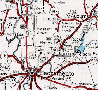
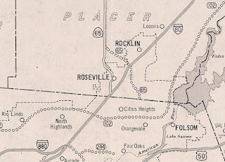
1935 Division of Highways Map of Placer County displays US 99E/LRN 3 southbound following modern CA 65 to the outskirts of Sheridan. US 99E/LRN 3 is shown passing through Sheridan via Sheridan-Lincoln Boulevard southward towards Lincoln. US 99E/LRN 3 is shown passing through Lincoln via Lincoln Boulevard towards Roseville. US 99E/LRN 3 southbound is displayed entering downtown Roseville on Lincoln Street and crossing the Southern Pacific Railroad where it picked US 40 westbound at Vernon Street. From downtown Roseville US 99E south/US 40 west followed LRN 3 via Vernon Street and Riverside Avenue to the Sacramento County Line.


The
1935 Division of Highways Map of Sacramento County shows US 99E south/US 40 west/LRN 3 following Sylvan Road to Auburn Boulevard. US 99E south/US 40 west/LRN 3 are shown following Auburn Boulevard through Twenty Mile House, Carmichael and Ben Ali to El Camino Avenue in North Sacramento. US 99E south/US 40 west/LRN 3 are shown following El Camino Avenue and Del Paso Boulevard over the American River into downtown Sacramento.
US 99E south is shown multiplexing US 40 west on LRN 3 via 16th Street to mainline US 99 at M Street (now Capitol Avenue) on the
1934 Division of Highways Map.
The
April 1935 California Highways & Public Works featured the expansion of the American River Bridge in Sacramento on the alignment of US 99E/US 40/LRN 3. The American River Bridge is stated to have been built during 1915 as a 22 foot wide two lane structure. The American River Bridge was retrofitted and upgraded to a four lane alignment which featured a 44 foot road width. The expanded American River Bridge was dedicated by the Governor on March 24th, 1935. The original 1887 American River Bridge is discussed along with the flaws that led to it's condemnation/demolition in 1914.
The
February 1941 California Highways & Public Works announced a four lane viaduct realignment of US 99E/US 40/LRN 3 around North Sacramento and Del Paso Boulevard was in the process of being arranged for funding. The existing alignment of US 99E/US 40/LRN 3 in North Sacramento on Del Paso Boulevard is cited to be flood prone and a continuous issue during rainy years. The new alignment of US 99E/US 40 is shown as a viaduct structure in the American River Overflow Channel.
The
June 1941 California Highways & Public Works announced the North Sacramento Viaduct across the American River as part of a realignment of US 99E/US 40 was put up for bid. The article states that construction of the North Sacramento River Viaduct and may break ground in July 1941.
The
1942 Division of Highways Map shows a minor extension of US 99E/LRN 3 multiplexed to mainline US 99 via 16th Street to N Street in Sacramento.
The
October 1942 California Highways & Public Works featured the recently opened new alignment of US 99E/US 40/LRN 3 on the North Sacramento Viaduct. Completion of the North Sacramento Viaduct is stated to have been prioritized due to the ongoing American involvement in World War II and was dedicated on September 14th, 1942.
The
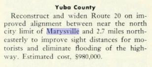
September/October 1946 California Highways & Public Works features the progress of construction of the new Feather River Bridge between Yuba City and Marysville. The existing Feather River Bridge is stated to have been completed during 1906 and was functionally obsolete due to it's road deck being designed to carry wagons. The new Feather River Bridge project included an overpass of the Southern Pacific Railroad and the Sutter Street Subway in Yuba City.
A secondary article in
September/October 1946 California Highways & Public Works detailed the upcoming alignment shifts of US 99E/LRN 3 and CA 20/LRN 15 in Yuba City-Marysville upon the completion of the new Feather River Bridge. US 99E/CA 20 would meet in Yuba City via Colusa Avenue and jog directly east over the Feather River to 10th Street in Marysville. CA 20 would depart US 99E via 9th Street in Marysville as opposed to the existing branch point via 5th Street.
The
January/February 1947 California Highways & Public Works features the upcoming Roseville Underpass project to realign US 99E/LRN 3. The Roseville Underpass project would see US 99E/LRN 3 shifted to a new alignment via a 1,400 foot long depression under the Southern Pacific Railroad via an extended Washington Boulevard which would intersect US 40 at Oak Street.
The relocation of US 99E/US 40/LRN 3 from the end of the North Sacramento Freeway via a bypass of Roseville was announced as being authorized by the California Highway Commission in the
September/October 1947 California Highways & Public Works. US 99E would depart the new freeway extension into Roseville via Riverside Avenue whereas US 40 would continue eastward on a full bypass of Roseville. The new freeway extension from the North Sacramento Freeway to Roseville is stated to be in the design stages.
The
March/April 1950 California Highways & Public Works features the opening of the Roseville Underpass. The Roseville Underpass opened to traffic on April 1st, 1950 and served as a realignment of US 99E and US 40 in downtown Roseville. US 99E/LRN 3 approached the Roseville Underpass via an extended Washington Boulevard and intersected US 40 at Oak Street.
The proposed Elvas Freeway/LRN 98 first appears on the
1951 Division Highways Map branching from US 99E/US 40/LRN 3 southward towards the American River and Sacramento.
The
November/December 1954 California Highways & Public Works announced the new US 99E/LRN 3 bypass of Durham and Richvale opened to traffic on December 17th, 1954. The new alignment of US 99E/LRN 3 is cited to be 19 miles in scope between Chico-Oroville Wye and eliminated numerous at-grade overpasses.
The
May/June 1955 California Highways & Public Works features the opening of the Elvas Freeway/LRN 98 from US 99E/US 40/LRN 3 across the American River to B Street in Sacramento on May 12th, 1955. The article stub notes that US 99E was moved to the new Elvas Freeway and followed one-way couplets via 29th Street/30th Street to Mainline US 99/LRN 4 at Broadway.


The new alignment of US 99E/LRN 98 on the Elvas Freeway and 29th/30th Streets appears on the
1956 Division of Highways Map. The shift of US 99E onto the Elvas Freeway left US 40 as the only highway on the North Sacramento Freeway.
The former alignment of US 99E/CA 20 on 1906 5th Street Bridge connecting Yuba City-Marysville was destroyed during the December 1955 Floods. Below the 1906 5th Street Bridge in a ruined state can be seen in an image hosted by the
University of California.
The
May/June 1956 California Highways & Public Works announced the opening of the Ben Ali-Roseville Freeway as the new alignment US 99E/US 40/LRN 3 on April 24th, 1956. US 99E was rerouted from the end of the Elvas Freeway along the Ben Ali-Roseville Freeway to the Riverside Avenue Exit.
On June 29th, 1956 the Federal Highway Aid Act of 1956 was signed into law on the Federal Level. The Federal Highway Aid Act of 1956 was the genesis point of the Interstate Highway System which would in the coming decade sew the demise via of US 99 in California. US 99E on the Elvas Freeway and Ben Ali-Roseville Freeway were ultimately selected to be incorporated into the alignment of Intestate 80.
The Ben Ali-Roseville Freeway and the new alignment of US 99E from the Elvas Freeway to Riverside Avenue in Roseville appear on the
1957 Division of Highways Map.
The
July/August 1959 California Highways & Public Works notes the new Yuba River Bridge was expected to be opened by May 1960. The same article also notes a contractor recently upgraded numerous bridges in Chico to provide the new dual couplet alignment of US 99E/LRN 3 on Main Street and Broadway which opened on April 5th, 1959.
The new Yuba River Bridge replaced the obsolete 1910 D Street Bridge in Marysville. The
D Street Bridge can be seen in this photo hosted on bridgehunter.com.
According to cahighways.org the
Sacramento Bee published a recommended freeway routing of US 99E/LRN 3 south of Red Bluff via bypass of Los Molinos.
The
November/December 1963 California Highways & Public Works notes US 99E/LRN 3 south of Red Bluff was selected as the future mainline corridor of US 99. The decision to shift mainline US 99 onto US 99E was due to the corridor of US 99W being consumed by the construction of Intestate 5.
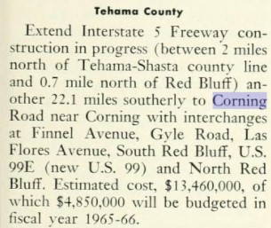
On New Year 1964 the California State Highway Renumbering took effect. The California State Highway Renumbering sought to eliminate all the Legislative Route Number designations in favor field signage, renumber certain highways to avoid duplication with the Interstates, eliminate suffixed routes and trim US Routes that did not cross the State Line. The 1
964 Division of Highways Map depicts the numerous effects of the 1964 Renumbering to the corridor of US 99E.
The corridor of US 99E from Roseville to Marysville was reassigned legislatively as CA 65. US 40A and what had been CA 24 from Yuba City south to Sacramento was reassigned legislatively as the so called New US 99.
The new route definition of CA 65 incorporating US 99E from Roseville to Marysville appears on the 1964 Division of Highways Map.
New US 99 appears as segment (B) of the route definition of US 99 on the 1964 Division of Highways Map.
Former US 99E/current US 40 on the North Sacramento Freeway is shown be legislatively assigned as part of CA 160 on the 1964 Division of Highways Map.

What became New US 99 in the Yuba City-Sacramento incorporated US 40A/LRN 87 from Yuba City south to Tudor. From Tudor to Catlett over the Feather River the corridor of New US 99 incorporated what was
LRN 245 which had added to the State Highway System as part of 1959 Legislative Chapter 1062. From Catlett south to Sacramento the corridor of New US 99 was added to the State Highway System as LRN 207 via 1949 Legislative Chapter 1467.
LRN 207 was seemingly duplicated in error. The duplicated LRN 207 appears on the
1950 Division of Highways Map as a planned highway with the below definition between Sacramento-Marysville.
The Marysville-Sacramento LRN 207 was renumbered to LRN 232 via 1951 Legislative Chapter 1562. LRN 232 first appears under the route definitions of the
1952 Division of Highways Map.
LRN 232 appears as a completed State Highway on the
1958 Division of Highways Map. LRN 232 incorporated the Jibboom Street Bridge over the American River in Sacramento which had been constructed in 1931.
The completion of LRN 232 and LRN 245 appears in
July/August 1959 California Highways & Public Works. The last unit of LRN 232/LRN 245 had been completed by June 1st, 1959 which consisted of; fourteen miles of new alignment, nine miles of reconstructed highway and two major bridges. LRN 232/LRN 245 had been in development as part of a Federal Aid Secondary program which began in March 1949. A major obstacle for completing LRN 232/LRN 245 was the replacement of the highway bridge over the Feather River at Nicolaus which had been destroyed during the December 1955 Floods. The completion of LRN 232/LRN 245 brought direct State Highway links from Sacramento north to Yuba City and Marysville. LRN 232 was reassigned as a realignment of CA 24 from Sacramento directly north to Marysville.


New US 99 appears as CA 99 north of Sacramento to Yuba City on the 1965 Division of Highways Map. CA 99 is shown to co-exist with US 99E, US 99W and mainline US 99 in the Sacramento Area. CA 99 is shown to originate with CA 70 in downtown Sacramento from Capitol Mall via one-way couplets on 5th Street and 3rd Street. CA 99 is shown multiplexing CA 70 northward to Catlett.
The AASHO Renumbering database shows that US 99 was approved to be truncated out of California by the AASHO Executive Committee on June 29th, 1965. This measure would have become effective on New Years Day 1966.
1965 Legislative Chapter 1372 added CA 256 to the State Highway System as a western freeway bypass of Roseville between Interstate 80 and CA 65/former US 99E. The planned route of CA 256 appears for the first time on the
1966 Division of Highways Map. Notably 1966 is the last Division of Highways Map which any segment of US 99 appears in California.
The planned realignment of Interstate 80 off of much of former US 99E on the Elvas Freeway and Ben Ali-Roseville Freeway is displayed on the
1966 Division of Highways Map.
CA 70/former US 99E on E Street in Marysville appears in the
November/December 1966 California Highways & Public Works.

Note; the California Highways & Public Works publication ended with the January/February 1967 issue. The
1967 Division of Highways Map shows CA 99 in the Sacramento-Red Bluff corridor with numerous adopted freeway segments; Red Bluff south of Vina, and Biggs south to Yuba City.
The 1967 Division of Highways Map displays CA 65 occupying the former alignment of US 99E through the Roseville Underpass. CA 256 is shown with an adopted freeway routing west of downtown Roseville whereas CA 65 is shown having an adopted freeway routing east of downtown Roseville north to via a planned bypass of Lincoln.
Former US 99E on 29th Street and 30th Street in Sacramento was fully replaced in 1968 when Interstate 80 on the Sutter Viaduct was completed to W/X Freeway west of CA 99. Interstate 5 north of the American River to the CA 99/CA 70 junction was completed by 1968. The construction of Interstate 5 from the American River north of downtown Sacramento shifted CA 99/CA 70 off of the Jibboom Street Bridge via a multiplex on the new freeway. The completed route of Interstate 80 on the Elvas Freeway and western W/X Freeway along wither Interstate 5/CA 99/CA 70 north of the American River appears on the
1969 Division of Highways Map.
Interstate 5/CA 99/CA 70 appears as a partially completed freeway in Old Sacramento along with the completed freeway north of CA 16/I Street on the
1970 Division of Highways Map.
The 1970 Division of Highways Map displays in detail the planned freeway bypass routes for CA 256 and CA 65 in Roseville.
The CA 99 freeway bypass north of Yuba City appears 1970 Division of Highways Map.
Interstate 5 was completed through Old Sacramento during 1970 which led to a new freeway multiplex with CA 99. It is unclear when CA 70 was truncated from Sacramento to the Elkhorn Y given it's Legislative Definition always had it terminate at CA 99 near Catlett Road. The
1975 Caltrans Map displays CA 99 multiplexed with Interstate 5 north of Sacramento and multiplexed with CA 70 north of the planned CA 102 junction on El Centro Road.
CA 99 was moved to a freeway alignment north of downtown Yuba City by 1970. CA 99 can be seen tying into the alignment of former US 99E north of Yuba City via Live Oak Boulevard on the
1975 Caltrans Map. A planned extension of the CA 99 freeway to Biggs is still shown as present. A planned bypass route of CA 65 south of Marysville also appears which had been added to the route definition via 1970 Legislative Chapter 1473.
CA 65 was moved to a freeway bypass of former US 99E of Olivehurst south of Marysville in 1971. The new freeway alignment of CA 65 first appears on the 1975 Caltrans Map through Olivehurst.

The planned western freeway bypass route of
CA 256 around downtown Roseville was cancelled during 1976. An
Environmental Impact Report (warning the EIR is 243 pages) notes that construction of CA 256 would have been too costly largely due to having to cross the Southern Pacific Railroad Switch Yard. Although CA 256 does not appear on the
1977 Caltrans Map it wasn't deleted until 1994 Legislative Chapter 1220.
The planned CA 99 freeway bypass of Red Bluff and Los Molinos no longer appears on the
1979 Caltrans Map.
1981 Legislative Chapter 292 defined much of former US 99E on the Ben Ali-Roseville Freeway and Elvas Freeway south to the American River as part of CA 51. Interstate 80 was moved to the corridor of the original Interstate 880 north of downtown Sacramento after attempts to rebuild the corridor through downtown Sacramento to Interstate standards fell through. CA 51 was legislatively mandated to be signed as Interstate 80 Business. Former US 99E/Interstate 80 appears as legislative CA 51 on the
1982 Caltrans Map.
CA 99 south of Red Bluff to CA 149 was expanded to four lane expressway standards during the mid-1980s and appears on the
1986 Caltrans Map. This was followed upon the northern terminus of CA 99 being changed from Interstate 5 near Red Bluff to CA 36 near Red Bluff via 1988 Legislative Chapter 106.
Following a
1984 Environmental Impact Report a new alignment of CA 65 bypassing former US 99E through the Roseville Underpass was selected. CA 65 followed an expressway alignment northwest of Interstate 80 via a 3.7 mile course to Blue Oaks Boulevard. The Roseville Bypass was constructed during the late 1980s and appears on the
1990 Caltrans Map.
During the early 2000s CA 65 on the Roseville Bypass was brought up to freeway standards. The Lincoln Bypass project broke ground in 2008 as a new alignment of CA 65 which would replace former US 99E on Lincoln Boulevard. According to CAhighways.org the 11 mile first phase of Lincoln Bypass alignment of CA 65 was completed by October 2012. Former US 99E on Lincoln Boulevard in the City of Lincoln was authorized for relinquishment by the California Transportation Commission during May 2014.
According to CAhighways.org in 2009 December Caltrans attempted to sell parcels of land east of Gridley purchased in the 1960s for the CA 99 bypass. The Gridley Bypass has been retained in the Butte County and City of Gridley general plans as a corridor of need.
CA 99 in Tudor was moved to a bypassing modern expressway alignment in 2010 according to CAhighways.org. A full interchange with CA 99 and CA 113 was completed during 2015. CA 99 south of Yuba City to Interstate 5 in Sacramento has been brought up to four lane expressway standards.
Part 2; a drive on California State Route 99 from Red Bluff to Sacramento
Historically US Route 99 ("US 99") entered Red Bluff headed southbound via Main Street on what was Legislative Route Number 3 ("LRN 3"). As US 99 headed south on Main Street it picked up California State Route 36 ("CA 36") eastbound at Beagum Road which was carried by LRN 29. US 99 south/CA 36 east continued south on Main Street/LRN 3 to downtown Red Bluff. At the intersection of Main Street and Antelope Boulevard US 99 split into a East/West Route. US 99E south turned eastbound along with CA 36 eastbound over the Sacramento River via Antelope Boulevard/LRN 3. On the outskirts of Red Bluff CA 36 east split from US 99E south via LRN 29 towards Lassen Volcanic National Park. US 99E make a southward turn towards Marysville and Roseville via LRN 3. The route of US 99W was far more conventional as it headed directly south on Main Street via LRN 7 towards Woodland. The below illustration depicts the historic alignments of; US 99, US 99E, US 99W, and CA 36 in Red Bluff.

Red Bluff is the Tehama County Seat and lies at an elevation of 305 feet above sea level due to it being located on the floor of Sacramento Valley. When gold was discovered in Yreka in 1851 it led to a rush which took travelers through Sacramento Valley. The rush to Yreka led to a small community developing at the confluence of Reeds Creek and the Sacramento River. The community was originally known as Leodocia and Covertsburg before Post Office Service opened as "Red Bluff" in October 1853. The name "Red Bluff" comes from formations near the community which were once apparent on the Sacramento River. When Tehama County was created in 1856 the community of Tehama was the initial County Seat but it was moved to Red Bluff in 1857. The Southern Pacific Railroad reached Red Bluff in 1872 and the community incorporated as a City in March of 1876.
Red Bluff can along the Southern Pacific Railroad on the 1873 Oregon, California, & Nevada Railroad Map.

What was US 99W entered Red Bluff headed north on Main Street. Main Street in Red Bluff is presently signed as Interstate 5 Business. Main Street at Exit 647 is slightly aligned east of where US 99W once was to approximately north to Luther Road.
Former US 99W/Interstate 5 Business continues north on Main Street to CA 36 at Antelope Boulevard. As noted above mainline US 99 continued straight on Main Street co-signed with CA 36 west. US 99E began at Antelope Boulevard co-signed with CA 36. The intersection of Main Street and Antelope Boulevard can be seen on in the third photo below.
From the intersection of Main Street and Antelope Boulevard Former US 99E/CA 36 east crosses the Sacramento River and intersects Interstate 5.
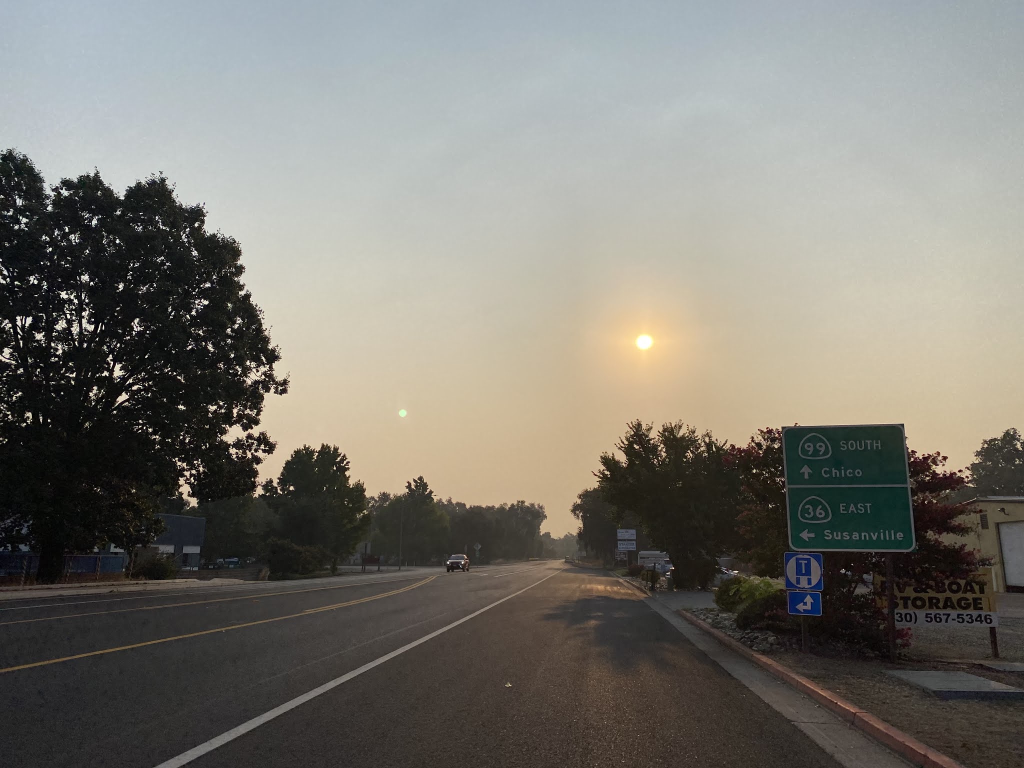
CA 36 east of Interstate 5 is co-signed as "TO CA 99" on Antelope Boulevard. At Postmile TEH 44.000 CA 36 east intersects CA 99. US 99E once split from CA 36 where CA 99 now is signed. CA 36 eastbound approaching CA 99 southbound indicates Chico is 42 miles away.
CA 99 southbound departing Red Bluff is signed as a Safety Corridor for the next 29 miles.
CA 99 southbound is signed as 12 miles from Los Molinos, 40 miles from Chico and 85 miles from Marysville.
At Postmile TEH 19.63 CA 99 southbound enters Dairyville.
Approaching Los Molinos CA 99 southbound intersects Tehama-Vina Road at Postmile TEH 12.53. Tehama-Vina Road is signed as access to Mill Creek-Tehama Recreation Area.
CA 99 southbound enters Los Molinos and intersects Tehama County Route A8/Aramayo Way at Postmile TEH 12.311.
Los Molinos traces it's origins back when it was a plotted as a Southern Pacific Railroad siding in the 1870s known as Sesma. Sesma was located the eastern bank of the Sacramento River opposite the older community of Tehama. When Sesma received Post Office in 1905 it's name changed to Los Molinos. Sesma can along the Southern Pacific Railroad near Tehama on the
1873 Oregon, California, & Nevada Railroad Map.
Departing Los Molinos CA 99 southbound is signed as 23 miles from Chico, 74 miles from Marysville and 113 miles from Sacramento.
CA 99 south of Los Molinos opens up to a somewhat rare 65 MPH two lane speed limit. CA 99 southbound bypasses the communities of Copeland and Vina before intersecting Tehama County Route A9/South Avenue at Postmile TEH 4.48.
CA 99 south of Tehama County Route A9 enters Butte County.


The Safety Corridor on CA 99 terminates a couple miles into Butte County as the speed limit drops to 55 MPH approaching Chico.
CA 99 southbound enters the City of Chico and intersects the original alignment of US 99E at Esplande at Postmile BUT T38.29.
Chico is the largest City in Butte County with a 2020 Census Population Estimate of 121,475 residents. Chico was founded in 1860 by John Bidwell during the California Gold Rush. During the American Civil War Camp Bidwell was established near Chico which brought continued prominence to the community. During 1870 the California & Oregon Line of the Southern Pacific Railroad reached Chico which led to the community incorporating as a City on January 8th, 1872. Chico can be seen on the
1873 Oregon, California, & Nevada Railroad Map along the Southern Pacific Railroad.
CA 99 southbound becomes a freeway in the City of Chico. CA 99 southbound Exit 387B accesses East Avenue.
CA 99 southbound Exit 387A accesses Cohasset Road and Mangrove Avenue.
CA 99 southbound Exit 386 accesses Bidwell's Mansion State Historic Park and First Avenue.
CA 99 southbound Exit 385 accesses CA 32 and downtown Chico.
CA 99 southbound Exit 384 accesses 20th Street.
Departing Chico CA 99 southbound accesses Skyway at Exit 383.
South of Chico CA 99 becomes the Ray E. Johnson expressway. CA 99 departing Chico is signed as 26 miles from Gridley, 42 miles from Yuba City and 83 miles from Sacramento.

CA 99 southbound Exit 376 accesses Durham and Lake Oroville State Recreation Area.
CA 99 southbound intersects CA 149 and drops to a two lane expressway approaching Dry Creek.
CA 99 south of CA 149 is signed as 16 miles from Gridley, 32 miles from Yuba City and 73 miles from Sacramento. CA 99 southbound becomes a Safety Corridor upon crossing Dry Creek.
At Postmile BUT 13.15 CA 99 south intersects the original alignment of US 99E at Richvale Highway and intersects CA 162.

CA 99 southbound multiplex CA 162 westbound along the Thermalito Afterbay to Butte City Highway at Postmile BUT 11.50. CA 162 westbound splits from CA 99 southbound via Butte City Highway.
CA 99 south of CA 162 is signed as 7 miles from Gridley, 14 miles from Live Oak and 23 miles from Yuba City.
CA 99 southbound enters the City of Gridley. Traffic is advised at Postmile BUT 4.30 that Hazel Street accesses the Gridley Museum and downtown Gridley.
Gridley was established as a siding of the Southern Pacific Railroad in 1870 on what was part of the ranch lands of George W. Gridley. Gridley would incorporate as a City November 23rd, 1905 and can be seen on the
1873 Oregon, California, & Nevada Railroad Map.
CA 99 southbound passes through Gridley and departs the City. CA 99 southbound departing Gridley is signed as 5 miles from Live Oak, 16 miles from Yuba City and 60 miles from Sacramento.
Approaching the Sutter County Line a large sign on CA 99 southbound as of September 2021 announces the active Safety Improvements ongoing in and around Live Oak.
CA 99 southbound enters the City of Live Oak where it is aligned on Live Oak Boulevard. CA 99 southbound on Live Oak Boulevard as of September 2021 was undergoing safety oriented improvements. As CA 99 southbound passes through Live Oak the 1905 Southern Pacific Railroad Depot can be observed. Live Oak was established as a Post Office location 1874 between the Southern Pacific Sidings of Gridley and Lomo. Live Oak would incorporate as a City on January 22nd, 1947.
CA 99 south of Live Oak follows Live Oak Boulevard to a Union Pacific Railroad crossing at Postmile SUT T35.95. Live Oak Boulevard and the original alignment US 99E split from CA 99 southbound via an inaccessible intersection at Postmile SUT 36.00. The safety improvements at the CA 99/Live Oak Boulevard intersection were constructed during 2021.
CA 99 southbound expands to a freeway approaching Yuba City.
CA 99 southbound Exit 344 accesses Eagar Road.
CA 99 southbound enters Yuba City and accesses Queens Avenue at Exit 342.
Yuba City is the Sutter County Seat and the county's largest community. Yuba City was part of a Mexican Land Grant to John Sutter located at the confluence of the Feather River and Yuba River. Following the discovery of gold at Sutter's Mill the lands at the Feather River and Yuba River would be sold to settlers looking to plot a town site. Yuba City by 1852 was a major ferry landing site and would become the Sutter County Seat in 1854. Yuba City would incorporate as a City on January 23rd, 1908. Yuba City can be at the confluence of the Feather River and Yuba River on the 1857 Britton & Rey's Map of California.
CA 99 southbound becomes an expressway approaching the junction with CA 20/Colusa Avenue at Postmile SUT T30.63.
CA 99 southbound passes through Yuba City and becomes an undivided expressway departing the City Limits.
CA 99 southbound traffic is advised at Postmile SUT 25.62 that Oswald Road can be used to accessed the Sutter National Wildlife Refuge.
At Postmile SUT 24.24 CA 99 southbound passes by historic plaque for Sutter's Hock Farm.
At Postmile SUT 20.00 CA 99 southbound intersects CA 99 and it's original alignment at Tudor Road.
CA 99 south of CA 113 is signed as 24 miles from Interstate 5 and 33 miles from Sacramento.
At Postmile SUT 12.63 CA 99 southbound crosses the Feather River. A ramp at the south end of the Feather River Bridge accesses Nicolaus.
CA 99 southbound traffic is advised that CA 70 northbound can be accessed via Striplin Road at Postmile SUT 9.25.
CA 99 southbound crosses over the south terminus of CA 70.
CA 99 south of CA 70 is signed as 11 miles from Interstate 5 and 18 miles from Sacramento.
CA 99 south of Catlett Road becomes a freeway at approximately Postmile SUT 7.07.
CA 99 southbound Exit 316 accesses Howsley Road and Exit 311 accesses Riego Road.
CA 99 south of Riego Road enters Sacramento County.
CA 99 southbound Exit 309 accesses Elverta Road whereas CA 99 Exit 307 accesses Sacramento County Route E14 on Elkhorn Boulevard.
CA 99 southbound merges onto Interstate 5 southbound and enters the City of Sacramento.
Interstate 5/CA 99 southbound Exit 525A accesses Del Paso Road, Exit 524 accesses Arena Boulevard and Exit 522 accesses Interstate 80.
Interstate 5/CA 99 southbound Exit 521 accesses Garden Highway. Interstate 5/CA 99 south of Garden Highway crosses the American River into downtown Sacramento where it accesses Richards Boulevard and the Jibboom Street Bridge at Exit 520. Interstate 5/CA 99 southbound Exit 519B accesses J Street.

Interstate 5/CA 99 southbound Exit 519A accesses Q Street. CA 99 southbound splits from Interstate 5 onto US 50 via Exit 518.
When I was staying in Chico back the Spring of 2017 I noticed that numerous CA 99 older shields could be found on the former alignment of US 99E on the City Streets. I found the CA 99 shield below at Park Avenue northbound approaching 19th Street.
As noted in Part 1 former US 99E over E Street in Marysville and the Yuba River is presently occupied by CA 70. From 9th Street CA 70 southbound splits from a multiplex with CA 20 westbound onto former US 99E on E Street.
CA 70 southbound follows E Street over former US 99E out of Marysville over the Yuba River where the highway expands to a freeway.


Comments