
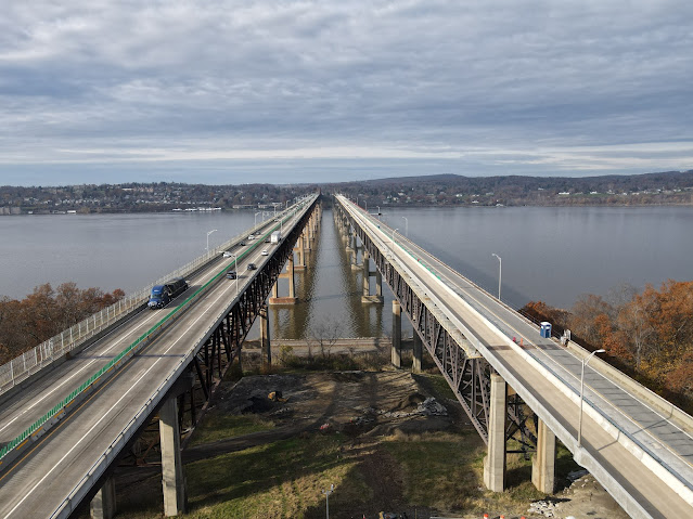
The dual-span Newburgh-Beacon Bridge (Interstate 84) spans the Hudson River at Newburgh, NY
A major milestone has been reached in the
ongoing project to replace the deck of the westbound span of the
Newburgh-Beacon Bridge (Interstate 84) in Newburgh, NY. The New York State
Bridge Authority (NYSBA) commenced this project in June 2020 in order to extend
the useful service life of the westbound bridge by another 40 years while
improving safety for travelers by upgrading bridge railings & parapets and
expansion joints to modern design & operational standards. The entirety of
the nearly 8,000 ft long deck is being removed down to the steel stringers and
a new concrete deck will be cast and poured, complete with modified expansion
joints and taller bridge parapets that meet modern interstate highway standards.
Altogether, this project involves replacing about 350,000 square feet of deck
space and is being executed in two distinct phases. The phase that was just completed
in November (hence the “important milestone” headline…) saw the replacement of the
southern half of the bridge deck in the manor described above. With this phase
complete, contractors will now repeat the same process for the northern half of
the deck in the coming year.

As with any other major interstate
highway/bridge project, the maintenance & protection of traffic has proven
challenging for the client agency and its prime contractor. In order to fast
track completion and provide as much contractor access to the westbound bridge
deck as possible, a temporary two-way traffic pattern was implemented on the
eastbound span of the bridge in a “two lanes per direction” configuration. The
westbound bridge has largely been closed to all traffic during off-peak hours,
however a single lane of traffic is allowed to cross this span during peak
periods as it serves as an extended on-ramp for traffic entering the westbound
interstate from Route 9D & Beacon. (During off-peak periods, this on-ramp
traffic is funneled onto the two-way eastbound span traffic pattern.) This
two-way traffic pattern on the eastbound bridge has also created an artificial
and temporary traffic bottleneck, as the original configuration of the two
spans allowed for three lanes of traffic per direction under normal conditions.
Traffic backups related to this project can stretch several miles in either
direction on a normal day and this situation is not helped by the fact that the
lack of shoulders in this temporary traffic setup prevents disabled vehicles
from moving out of travel lanes, which increases the likelihood of traffic jams
and rubbernecking delays.


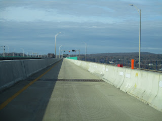
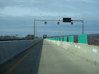
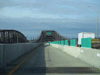
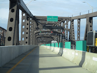
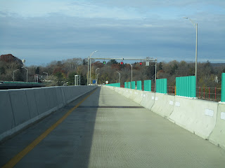
Eastbound views while crossing the eastbound span of the Newburgh-Beacon Bridge. The two-way traffic pattern has temporarily constrained the flow of traffic in the area; on the other hand, the implementation of cashless tolling and removal of the old toll plaza has been a positive development. Click on each photo to see a larger version.
Being built in parallel with this
redecking project is the conversion of this bridge (and its sister bridges
under NYSBA jurisdiction) to all-electronic toll collection; the tolling gantry
located on the Beacon approach just upstream from the old toll plaza was built
in the spring of 2021 and the cashless tolling system for this bridge went live
in July. The old 1980-built toll plaza has been subsequently demolished in
recent months and ongoing road works remain to be completed on the Beacon
approach in the coming year. As a life-long resident of southern Dutchess
County, NY (except for those few years I was in college out in Buffalo, NY), my
single least-favorite toll plaza in the entire country (and I’ve been through a
few…) was right here in Beacon. The plaza was a chronic source of traffic congestion
at most times and on most days as there were no high-speed EZ-Pass (the
electronic toll tag used/accepted by agencies around the northeastern U.S.) lanes
and cars still had to nearly come to a stop in the EZ-Pass lanes the plaza did
have since NYSBA used automated toll gates that impeded the flow of traffic
through. All in all, this is a toll plaza I’m very pleased to see fade into
history and this entire stretch of I-84 between Newburgh and Fishkill should
move a lot quicker and smoother once this project is completed.


Assorted aerial views of the dual-span bridges including a look at construction progress on the westbound bridge deck and toll plaza reconstruction. Click on each photo to see a larger version.
The two-year, $101 million contract issued
by NYSBA is being executed by a contracting outfit led by Yonkers Contracting
Company of Yonkers, NY. Major construction & substantial completion,
including finishing the remaining work for the new bridge deck, is expected for
late 2022 with final completion & close-out of additional punchlist items
planned for the first half of 2023. The completion of these final milestones
will be welcome news to Hudson Valley (and also long-distance) travelers
already tired of the traffic headaches associated with this project. While I’m
no fan of sitting in stuck traffic due to construction, this is one of those
projects I consider to be absolutely vital for the local and regional economy.
This is the first major overhaul for this span of the bridge since the early
1980s and it’s a project that’s been postponed for several years already due to
funding restrictions. I will be more than happy to put up with a little inconvenience
now in exchange for having a fully functional safe and sound bridge for the
next few decades.

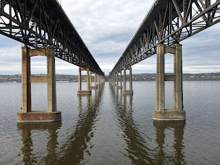


Assorted aerial views of the dual-span bridges spanning the Hudson River at Newburgh, NY. Click on each photo to see a larger version.
Bridge Information courtesy of NYSBA
Comments