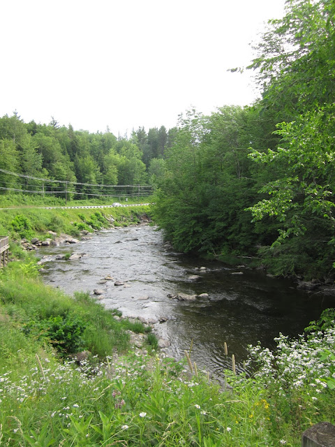
Power House Covered Bridge - Johnson, Vermont


Named for a water driven power house located just upstream on the Gihon River in Johnson, Vermont, the Power House Covered Bridge was first constructed in 1870 to connect School Street with the road that became VT Route 100C. In those early years, the covered was first referred to as the School Street Bridge. By 1895, the Village of Johnson constructed a water driven power house just above the bridge, and over time, the covered came to be known as the Power House Bridge.

Originally built as a Queenpost designed covered bridge, the original Power House Covered Bridge spanned 60 feet in length. The queenposts on the original bridge measured 12 by 10 inches, with the diagonal posts measuring 10 by 10 inches. The bridge was reconstructed in 1960, and because the bridge was developing a noticeable sag, further reconstruction of the bridge took place in 1993. The bridge's truss was renovated with much of the original timber replaced. Even with the reconstruction work, the covered bridge continued to sag, and the decision was made to close the bridge again in 1995 for additional restoration work.

On March 8, 2001, an unfortunate event had occurred. The original Power House Covered Bridge was lost on on that date, collapsing from a heavy snow load. The Town Of Johnson determined that the best course of action would be to have a replacement bridge rebuilt as soon as possible. The original bridge had been part of a popular route to and from Johnson State College (now Northern Vermont University-Johnson) and it was necessary to have that method of egress available for traffic to and from the college. The builders Blow and Cote of Morrisville, Vermont submitted the winning bid in November 2001. Work on the new covered bridge happened quickly, beginning in March 2002 and work was completed in June 2002.

The new Power House Covered Bridge stayed true to the original Queenpost design, but is now a 73 foot long bridge. There are open windows along the covered bridge where you can see the Gihon River along with the historic powerhouse. There's even a small cascading waterfall and some rapids. You may find some curiosity seekers along the way as well. I checked out the covered bridge and its surroundings on one fine summer's day, and lived to tell you about it.


How to Get There:


Sources and Links:
Bridgehunter.com - Power House Bridge 45-08-08
Vermont Covered Bridge Society - Power House Covered Bridge: 1870 - 2001
Vermont Covered Bridge Society - The Power House Covered Bridge
Vermont Covered Bridge Society - Power House Covered Bridge (Replacement)
Vermont Covered Bridge Society - Power House Covered Bridge Rebuild: 2001-2002

Comments

Popular posts from this blog

I-40 rockslide uncovers old debates on highway

The Asheville Citizen-Times continues to do a great job covering all the angles of the Interstate 40 Haywood County rock slide. An article in Sunday's edition provides a strong historical perspective on how the Pigeon River routing of Interstate 40 came about. And perhaps most strikingly, in an article that ran just prior to the highway's opening in the fall of 1968, how engineers from both Tennessee and North Carolina warned "...that slides would probably be a major problem along the route for many years." On February 12, 1969, not long after the Interstate opened, the first rock slide that would close I-40 occurred. Like many other Interstates within North Carolina, Interstate 40 through the mountains has a history prior to formation of the Interstate Highway System and was also a heated political battle between local communities. The discussion for a road that would eventually become Interstate 40 dates back to the 1940's as the idea for interregional high

Interstate 210 the Foothill Freeway

The combined Interstate 210/California State Route 210 corridor of the Foothill Freeway is approximately 85.31-miles.  The Interstate 210/California State Route 210 corridor begins at Interstate 5 at the northern outskirts of Los Angeles and travels east to Interstate 10 in Redlands of San Bernardino County.  Interstate 210 is presently signed on the 44.9-mile segment of the Foothill Freeway between Interstate 5 and California State Route 57.  California State Route 210 makes up the remaining 40.41 miles of the Foothill Freeway east to Interstate 10.  Interstate 210 is still classified by the Federal Highway Administration as existing on what is now signed as California State Route 57 from San Dimas south to Interstate 10.  The focus of this blog will mostly be on the history of Interstate 210 segment of the Foothill Freeway.   Part 1; the history of Interstate 210 and California State Route 210 Interstate 210 (I-210) was approved as a chargeable Interstate during September of

White Rock Road; the historic highway corridor serving Mariposa County since the 1850s

White Rock Road is a twenty-eight-mile-long highway corridor which begins at the Chowchilla River in Merced County and ends at Old Highway 18 in Mariposa County near the town site of Bridgeport.  The portion of White Rock Road between the Merced County and Mariposa County line to Bridgeport (via the town site of White Rock) is one of the oldest continuously used highway corridors in California.  Once known as the "Mariposa River Road" the corridor was developed in the 1850s as one of the two primary highways to the mining communities of Mariposa County.   White Rock Road was bypassed in 1918 when Legislative Route Number 18 was completed between Merced and Mariposa.  The corridor was for time known as Mariposa and Le Grand Road prior to the construction of Mariposa Creek Dam (formerly Mariposa River) in 1948.  Following construction of the dam the roadway took the name it has now and was extended through Merced County to the Chowchilla River.  Much of modern White Rock Road i