In the winter of 2018 I spent a considerable amount of time tracking down much of the early history and early alignments of the Wawona Road. The Wawona Road is historically tied to the Mariposa Grove which I revisited in the Fall of 2019.

Part 1; history of the Wawona Road and Mariposa Grove
The modern Wawona Road is approximately 28 miles in length from the north terminus of California State Route 41 at the boundary of Yosemite National Park to South Side Drive near Bridalveil Falls in Yosemite Valley. A large percentage of people entering Yosemite Valley use the Wawona Road. While the Wawona Road is generally considered a somewhat tame road and among the easiest to take Yosemite Valley that wasn't always the case.

The origins of the Wawona Road are tied to the Wawona Hotel but it does predate the complex. The original trail over the South Fork Merced River was plotted out by the Mann Brothers in 1855. The initial toll crossing of the South Fork Merced River was simply a large log which was replaced by a primitive bridge known as "Clark's Crossing" soon after Galen Clark arrived in the area. Galen Clark settled near the South Fork Merced River hoping to cure his tuberculosis. In 1857 Clark along with Milton Mann were the first Europeans to locate the nearby Mariposa Grove of Redwood Sequoias. Clark spent the ensuing years attempting to bolster tourism to the Wawona Area and the Mariposa Grove. These earliest efforts by Clark yielded a series of trails which became the earliest vestiges of the Wawona Road and Mariposa Grove Road.
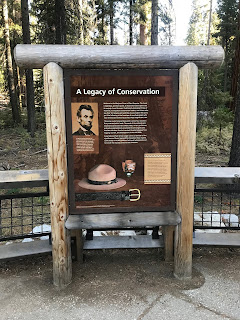
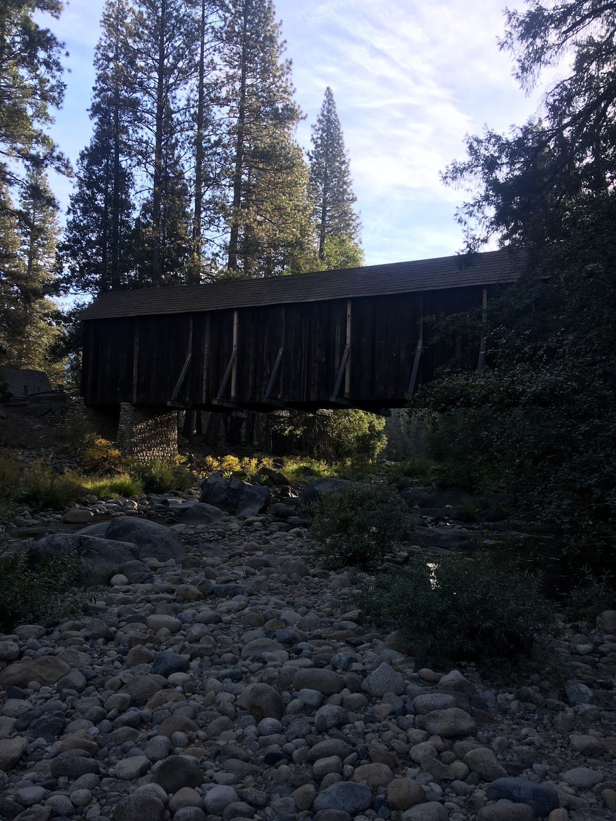
The 1855 Bridge over the South Fork Merced River apparently was frequently washed out and often repaired. In 1862 the original South Fork Merced River Bridge was washed out again and the crossing was replaced by felled trees. In 1864 President Lincoln signed law which led to the protection of Yosemite Valley and the Mariposa Grove. In 1868 Galen Clark constructed a new bridge crossing the South Fork Merced River. Clark intended to build a road to Yosemite Valley but ultimately failed to do so. In 1875 Clark's Station and the rest of Clark's property was purchased by the Washburn Brothers who subsequently covered the 1868 Bridge which soon came to be known as the Wawona Covered Bridge. The Wawona Covered Bridge was part of the Wawona Road until a replacement span over the South Fork Merced River was built about 700 feet to the west. More information about history of the Wawona Covered Bridge can be found on the report by Yosemite National Park below dated to 1991.
1991 report by Yosemite National Park on the Wawona Covered Bridge
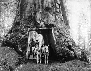
The first structure in the Wawona Hotel complex built by the Washburn Brothers complex dates back to 1876. At the time the Wawona Hotel was built to take advantage of tourism to the nearby Mariposa Grove via the Mariposa Grove Road. The name "Wawona" apparently comes from a similar Mono Tribal word describing a Redwood Sequoia Tree. The Washburn Brothers completed the Wawona Road from their new Hotel to Yosemite Valley by 1879. In 1881 a tunnel was dug through the Wawona Tree in the Mariposa Grove to attract stages to drive through. In 1895 a second tunnel was carved through the California Tree in the Mariposa Grove. A stage wagon in the tunnel through the Wawona Tree can be seen on this 1904 photo.
Despite only being less than 30 miles south of Yosemite Valley the Wawona Hotel was essentially a several days trip by foot through the wilderness. The Wawona Hotel was becoming popular and interest in a stage road north to Yosemite Valley was becoming a viable concept. Thus, the Yosemite Stage and Turnpike Company was founded in 1882 to facilitate stage route travel from the Wawona Hotel to Yosemite Valley. I found these two articles incredibly useful in terms of tracking down the early history of the Wawona Road.
Undiscovered Yosemite on the history of Wawona
yosemite.ca on Wawona Stages
This 1883 Topographical Map shows the early Wawona Road which apparently was once called "Madera or Merced Big Trees & Yosemite Road."
1883 Topographical Map of Yosemite

This 1885 map from the Yosemite Stage and Turnpike Company shows the entirety of the Yosemite Road to Wawona from Raymond and the full stage route north from the Wawona Hotel to Yosemite Valley. Note; this map is also one of the earliest to show the Mariposa Grove Road clearly.
1885 Yosemite Stage and Turnpike Company Map

Interestingly it appears that the Yosemite Road north out of Raymond had two branches that split at Ahwahnee. The railroad that serviced Raymond was a Southern Pacific line out of Madera and was still present on the 1935 California Division of Highways Map of Madera County.
1935 Madera County Highway Map

In October of 1890 Yosemite National Park was created followed by Sierra National Forest in 1893. Note: the Mariposa Grove was not within the original boundary of Yosemite National Park and wasn't added until 1906.
Traveling to Yosemite via the Wawona Road for a time must have been at minimum a weeklong commitment considering how much ground had to be covered on foot or by wagon. It is odd to think of travel to Yosemite being something one had to commit to so fully to considering it in the context of modern times. Today Yosemite Valley is within daytrip driving distance by car and modern highway no matter what route is taken. Apparently, it wasn't until 1916 that serious attempts to get cars over the Wawona Road to Yosemite Valley were made. The 1923 USGS Map of Yosemite shows the Wawona Road as it in the early automobile era.
1923 USGS Topographical Map of Yosemite


On the above 1923 USGS Map there are several stage stations that are named. Fort Monroe was the most notable stage station which was named after a stage driver George Monroe. Apparently during the wagon era the stage stations were used as stopping points to camp, not much changed during the early automotive era. It is hard to fathom Pre-War cars trying to traverse high dirt grades that were meant for wagons. Apparently the Washburn family had a garage at the Wawona Hotel that serviced vehicles that broke down on the Wawona Road.
Early automotive travel on the Wawona Road to Yosemite Valley also brought cars to the Mariposa Grove. The car in the middle of the Wawona Tree below is from a photo dated to 1918 and stands as a massive contrast to the obvious stage intended surface of the Mariposa Grove Road.

The Washburn family sold the Wawona Hotel and the Wawona Road to the National Park Service in 1932. The sale no doubt was likely due to the construction of the Wawona Tunnel which started in January of 1931. The Wawona Tunnel is a 4,233-foot-long tunnel which was bored through granite and provided a much more even grade for automobile traffic entering Yosemite Valley. The Wawona Tunnel opened in June of 1933 and has remained the longest in California. This document below from NPS.gov details the construction history of the Wawona Tunnel.
NPS.gov on the Construction of the Wawona Tunnel
The difference in the Wawona Road after the completion of the Wawona Tunnel was substantial. The Old Wawona Road cut directly north over high ridges towards Inspiration Point at Grouse Creek. The new road that accessed the Wawona Tunnel took a more gradual descent along the ridges. Both the Old and New Wawona Roads can be seen on the 1938 USGS Map of Yosemite.
1938 USGS Map of Yosemite

The Old Wawona Road appears to have quickly fallen into disuse after the completion of the Wawona Tunnel. The 1948 CSAA map of Yosemite below shows the Old Wawona Road as trail from Grouse Creek to Inspiration Point. My understanding is that the Pohono Trail once started at Inspiration Point when the Old Wawona Road crossed by it.
1948 CSAA Map of Yosemite

The 1951 USGS Map shows the Pohono Trail extended to Yosemite Valley utilizing parts of the Old Wawona Road.
1951 USGS Map of Yosemite

In February of 1969 the Wawona Tree under the heavy weight of snow. Below the Wawona Tree can be seen in the Mid-20th Century with cars passing through it.


Until recently shuttles ran through the Mariposa Grove via Mariposa Grove Road. In recent decades it was determined that the asphalt surface and drainage grade of Mariposa Grove Road was undermining the health of the Redwood Sequoia Trees. The Mariposa Grove Road was closed in the Spring of 2015 during which much of it was converted to a trail/dirt Park Service Road. The Mariposa Grove Road reopened in June of 2018 but is only accessible via Park Shuttle or with a handicap permit.
Part 2; a drive on the modern Wawona Road and hike to the original stage road
In the winter of 2018 I entered Yosemite via the north terminus of CA 41 which becomes the Wawona Road upon entering Yosemite National Park.

After passing the entrance station for Yosemite National Park there was a new roundabout at what used to be a T-junction with Mariposa Grove Road. The new roundabout was constructed as part of the restoration project in the Mariposa Grove.

From the entrance station Wawona is four miles away.

Wawona and the Wawona Hotel are located at about 4,000 feet above sea level on the South Fork Merced River. The Wawona Hotel hasn't changed much over the years and appears much as it always has. The hotel was shut down for the winter when I was passing through.


The Wawona Hotel is the location of the last gas before Yosemite Valley.

The Wawona Road crosses the South Fork Merced River on the 1937 South Fork Merced River Bridge. The Wawona Covered Bridge is located upstream to the right of this photo and apparently has been restored several times.

The Wawona Covered Bridge can be accessed via Forest Drive in the Pioneer Yosemite History Center.


One of the Yosemite Stage & Turnpike Company wagons is on display in the barn next to the Wawona Covered Bridge.

The Wawona Covered Bridge as stated above was part of the Wawona Road until 1937. The Wawona Covered Bridge was damaged by flooding on the South Fork Merced River in 1955 but was reconstructed as a center piece of the Pioneer Yosemite History Center. The Wawona Covered Bridge is one of twelve remaining in California.


The Pioneer Yosemite History Center has various other buildings from various periods of tourism within Yosemite.

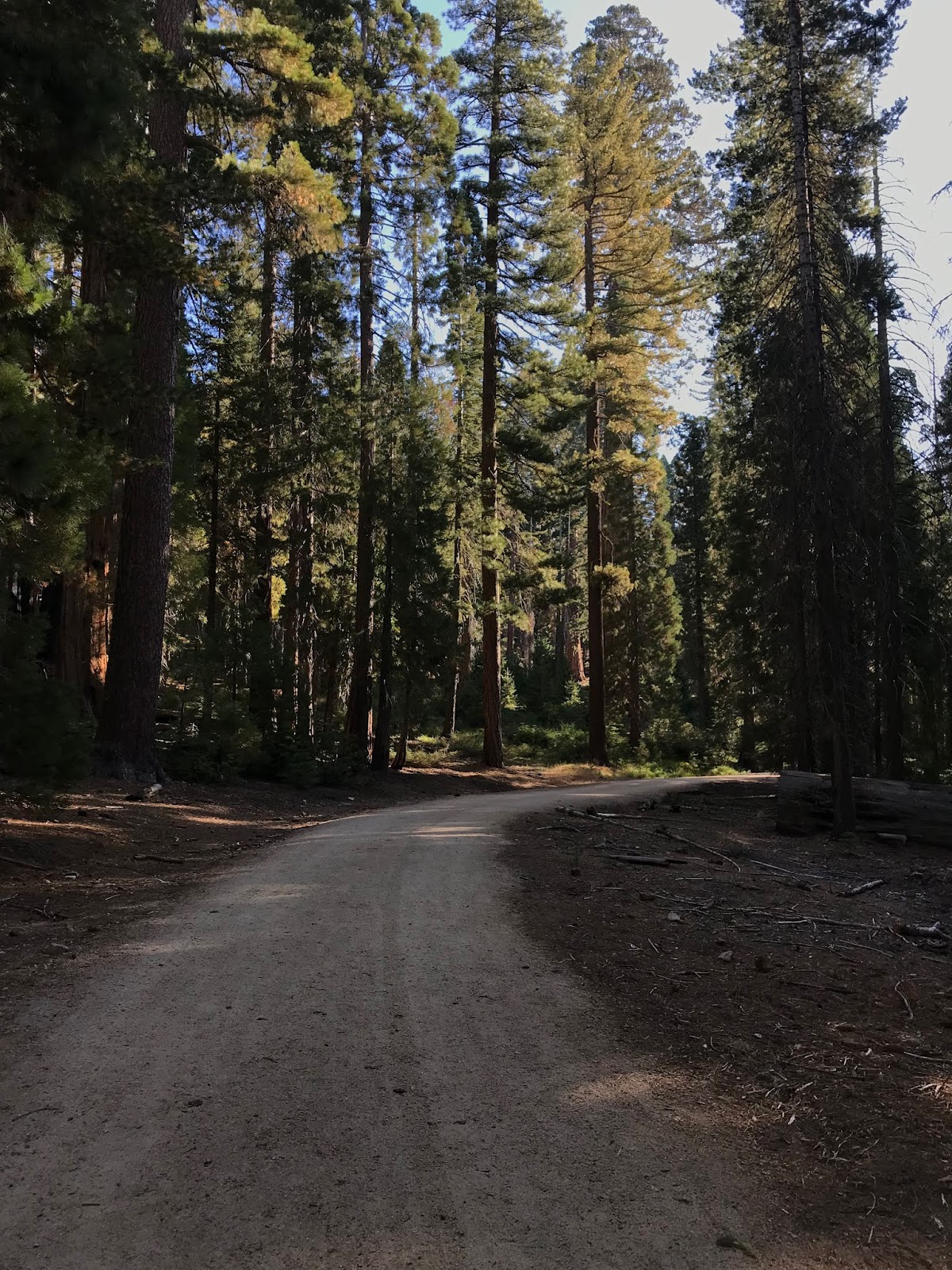
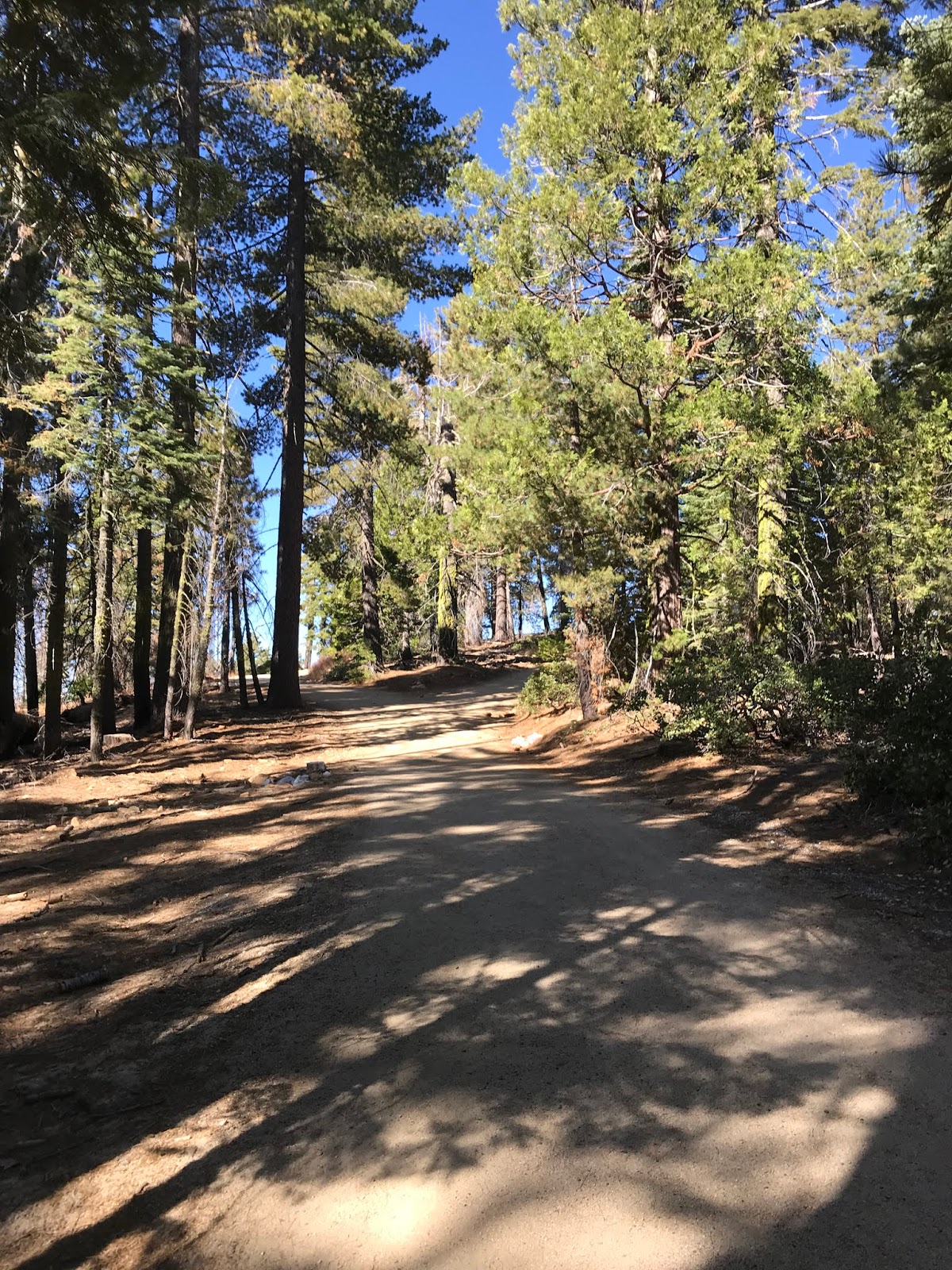
North of the Pioneer Yosemite History Center the Wawona Road is curvy but nothing too difficult. Most of the Wawona Road is signed as 35 MPH which I honestly think is a little on the slow side for most of the route. Most of the curves ascending up to Chinquapin are pretty generous but there are oddities like this one.

Yosemite West can be accessed from the Wawona Road. Yosemite West is an oddity that is just outside of the Yosemite National Park boundary in Sierra National Forest. There are various rental homes that are used by people visiting Yosemite.

The Glacier Point Road junction is located at Chinquapin which is the high point of the Wawona Road at about 6,000 feet above sea level. Yosemite has really odd looking California State Route spades and the Wawona/Glacier Point Road junction is no exception.


The Wawona Road begins it's descent to Yosemite Valley north of Glacier Point Road. Grouse Creek is a couple miles north of Glacier Point Road which is where the Old Wawona Road split from the modern alignment. I inspected Grouse Creek but I couldn't find anything resembling a road grade. What I do know for certain is that the Old Wawona Road turned on the north bank of Grouse Creek.


On the Yosemite History Facebook Page I was advised by Michael Mariant and Chris Falkstein that the grade of the Old Wawona Road is north of Grouse Creek and be easily spotted from a rock retaining wall. The Old Wawona Road apparently diverged slightly from the modern right-of-way westward from at Henness Ridge Drive.
Old Wawona Road Grade at Grouse Creek Google Street View
The descent to Yosemite Valley doesn't have a ton of pullouts but wide views can be seen. There are a couple dirt patches that allow good viewing points for the Merced River Canyon. There are some nice tall views of the granite cliffs approaching Yosemite Valley.


The Wawona Road makes an eastern swing towards the Wawona Tunnel and the first glimpse or Half Dome in addition to Yosemite Valley can be seen.
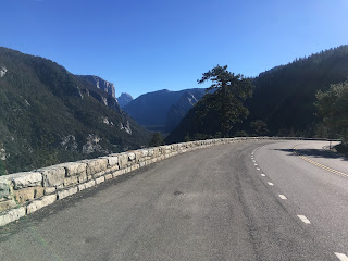
There is a lengthy view of the Merced River Canyon opening up into Yosemite Valley. The Big Oak Flat Road can be seen below.

Two of the tunnels on the 1940 Big Oak Flat Road can be seen as the road appears to be going directly through the granite rock face.


The Wawona Road descends the towards the granite rock wall up ahead towards the Wawona Tunnel.

Overhead clearance is listed as just over 10 feet for the Wawona Tunnel.

The shape of the bore that dug the Wawona Tunnel is obvious from the shape of the structure. The Wawona Tunnel is well lit and signed with a 35 MPH speed limit.

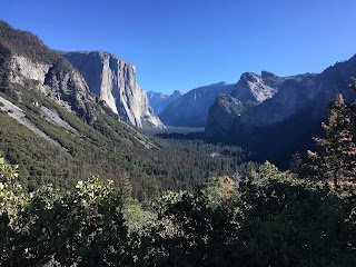
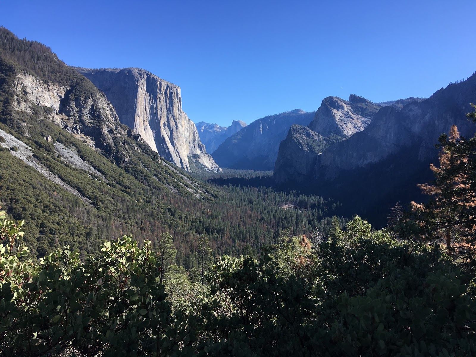
The Wawona Tunnel opens up into Yosemite Valley, Bridalveil Falls can be seen ahead to the east.

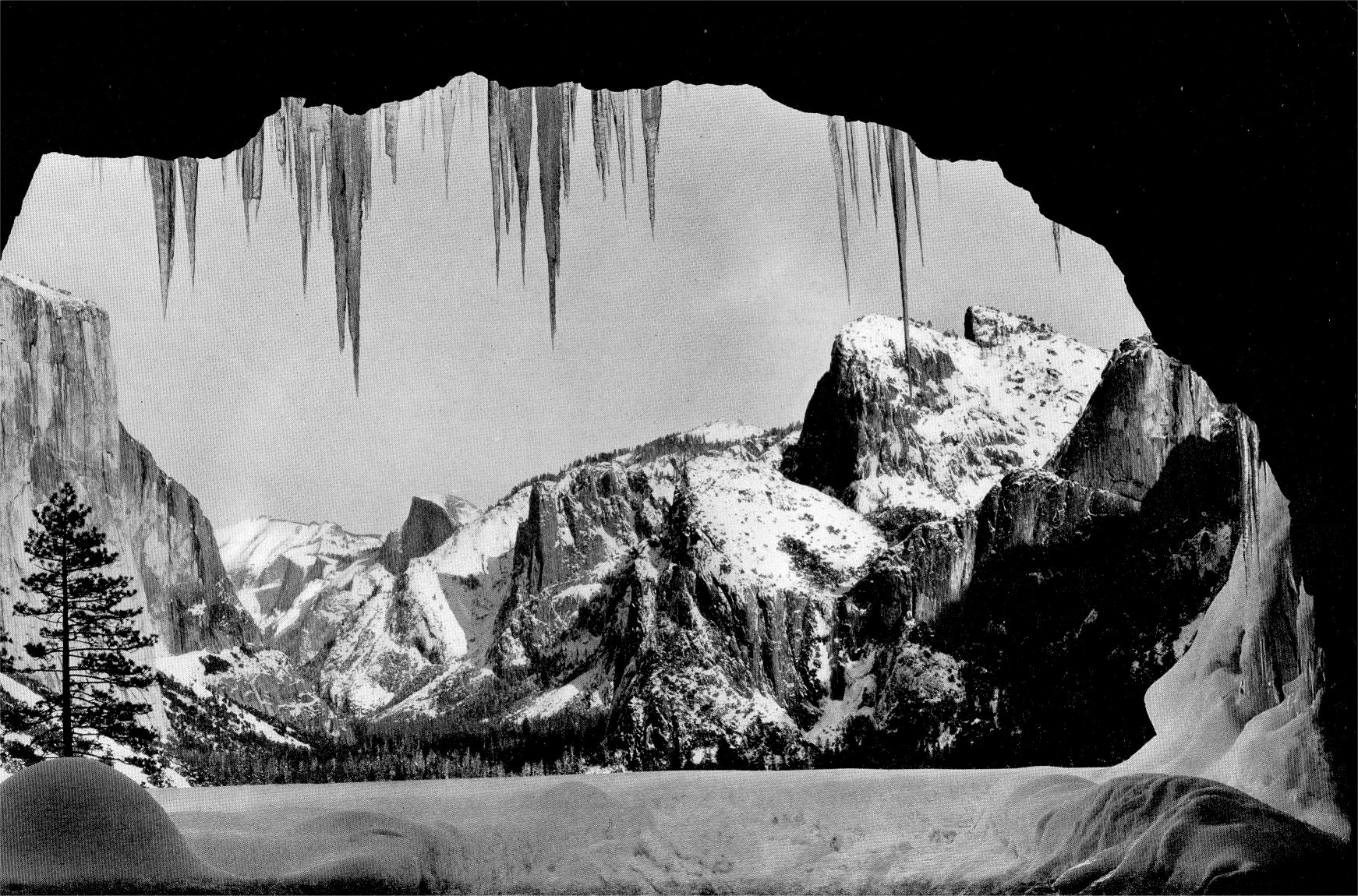
I'm fairly certain that Ansel Adam's photo of Yosemite can't be replicated from the Wawona Tunnel these days. I believe the current parking area is a somewhat new facility that was substantially different when the Wawona Tunnel opened in 1933.
Ansel Adams Tunnel View Photo
The winter of 2017 was way more severe than 2018 and this was my best attempt at replicating Ansel Adams Tunnel View photo. Suffice to say R1 chain controls were in place and I thought that I was lucky I didn't encounter R2.

The Tunnel View is one of the best in Yosemite National Park, so much so that I think it plays a large contributing factor as to why the Old Wawona Road has largely been forgotten.

The Yosemite Valley side of the Wawona Tunnel has a much more natural appearing face.

The Wawona Road actually has what appears to be mileage markers but are rather guidebook way points. The Wawona Road way points are listed as "W" with the Tunnel View being located at "W2."

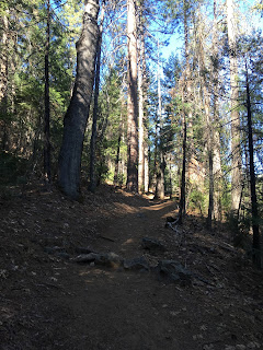
A connecting trail to up to the Pohono Trail starts at the Tunnel View. The Old Wawona Road is about 700 feet above the Wawona Tunnel about half way to Inspiration Point.

The climb up to the Old Wawona Road isn't exactly a smooth or well marked trail. The trail is obvious enough and has a somewhat moderate difficulty.


At a junction of three steel signs the Old Wawona Road grade is obvious. This picture is facing east looking down the Old Wawona Grade towards Bridalveil Falls.

Looking west on the Old Wawona Road the damage to road since the 1930s is obvious. Its hard to believe that wagons and cars really used to use this road to get to Yosemite Valley.

Looking west again the rock debris is a little more apparent on the Old Wawona Road grade. Its a real shame there isn't even a historical marker.

The hike back down to the Tunnel View had some really worthwhile views of Yosemite Valley.
Continuing east of the Tunnel View on the modern Wawona Road the Old Wawona Road grade can be observed where the "Speed Reduced to 25 MPH" sign is located approaching Bridalveil Falls. This particular part of the Old Wawona Road was so apparent that I actually found on the Google Street View.


The Wawona Road ends at South Side Drive near the Bridalveil Falls parking lot.


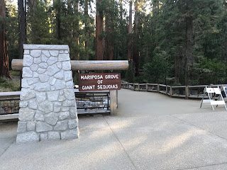
Part 3; hiking the "restored" Mariposa Grove Road to Wawona Point
In the fall of 2019 I returned to the Wawona Road to hike the Mariposa Grove. From the roundabout near the south entrance of Yosemite National Park I turned off the Wawona Road onto the Mariposa Grove Road.

Traffic on the Mariposa Grove Road is advised to use the shuttle services (handicap permits not withstanding) at the Mariposa Grove Welcome Plaza to reach the Mariposa Grove.

The Mariposa Grove Welcome Plaza has a huge parking lot designed to allow a large swath of visitors to shuttle to the Mariposa Grove quickly. The Washburn Trail can be taken as an alternate over the Park Shuttle to Mariposa Grove if so desired. The former route of the Mariposa Grove Road appears on maps as the Mariposa Grove Trail and Guardians Loop Trail.


The Mariposa Grove shuttle departs every 10 minutes from 8 AM to 8 PM everyday. The last shuttle departs Mariposa Grove at 8 PM.


The Park Shuttle over the Mariposa Grove only takes a couple minutes to drop traffic off at the Grove Arrival Area.


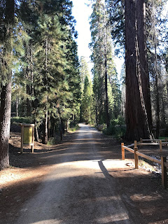
The Mariposa Grove Trail is initially planked to allow for natural flow of water. The planked trail is built atop what the prior alignment of the Mariposa Grove Road.


From the end of the planked path the route of the Mariposa Grove Trail is signed as 0.6 miles from the Grizzly Giant and 3.4 miles from Wawona Point.

The Mariposa Grove Trail continues eastward towards the Three Graces which are signed as 0.3 miles from the Grizzly Giant.


From the Three Graces part of remaining asphalted Mariposa Grove Road can be seen.


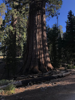
The Mariposa Grove trail continues to the Grizzly Giant.


Wawona Point is signed as 2.8 miles from the Grizzly Giant.

The California Tunnel Tree is located just off of the Mariposa Grove Trail on the Grizzly Giant Loop Trail. The California Tree includes a small historical plaque which has a vintage photo.


From the Grizzly Giant the Mariposa Grove Trail joins the grade of the Mariposa Grove Road and is signed as 0.7 miles from the Faithful Couple.


The Mariposa Grove Trail begins to climb in elevation on what is a very obvious road grade to the Faithful Couple which is a set of conjoined Redwood Sequoias.


The Mariposa Grove Trail ascends through a series of switchbacks to the Clothespin Tree.


Wawona Point is signed as 1.4 miles from the Clothespin Tree.

The Mariposa Grove trail ascends through another series of switchbacks to the main portion of the Mariposa Grove.


I detoured off the Mariposa Grove Trail onto the Guardian Loop Trail towards the site of Galen Clark's Cabin and the Wawona Tree. The Mariposa Grove Trail and Guardian Loop Trail were both spurs of the Mariposa Grove Road.


Galen Clark built a cabin on what is now the Guardian Loop Trail in 1864 which served as his office in the Mariposa Grove and a shelter. The present cabin was constructed in 1930 and was restored in 1983.


The Telescope Tree is signed as 0.4 miles from the Galen Clark Cabin Site.


The Telescope Tree is hollow inside which gives it the appearance of a telescope.


From the Telescope Tree the Guardian Trail Loop heads eastward to the Wawona Tree.


The Wawona Tree it now known as the Fallen Tunnel Tree. There is a small historical plaque regarding the Wawona Tree and some trace evidence of the Mariposa Grove Road via the retaining wall seen in several of the photos in Part 1.


From the Wawona Tree the Guardian Loop Trail terminates at the Mariposa Grove Trail.


The Mariposa Grove Trail makes a final 0.6 mile climb through a former section of the Mariposa Grove Road to Wawona Point. There are some significant portions of asphalted road deck on the final climb to Wawona Point which makes it very obvious it once a roadway.


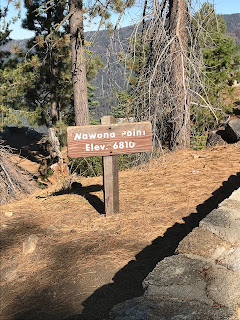
Wawona Point is located at 6,810 feet above sea level. Wawona Point overlooks the South Fork Merced River and Wawona Hotel complex.


Part 1; history of the Wawona Road and Mariposa Grove
The modern Wawona Road is approximately 28 miles in length from the north terminus of California State Route 41 at the boundary of Yosemite National Park to South Side Drive near Bridalveil Falls in Yosemite Valley. A large percentage of people entering Yosemite Valley use the Wawona Road. While the Wawona Road is generally considered a somewhat tame road and among the easiest to take Yosemite Valley that wasn't always the case.

The origins of the Wawona Road are tied to the Wawona Hotel but it does predate the complex. The original trail over the South Fork Merced River was plotted out by the Mann Brothers in 1855. The initial toll crossing of the South Fork Merced River was simply a large log which was replaced by a primitive bridge known as "Clark's Crossing" soon after Galen Clark arrived in the area. Galen Clark settled near the South Fork Merced River hoping to cure his tuberculosis. In 1857 Clark along with Milton Mann were the first Europeans to locate the nearby Mariposa Grove of Redwood Sequoias. Clark spent the ensuing years attempting to bolster tourism to the Wawona Area and the Mariposa Grove. These earliest efforts by Clark yielded a series of trails which became the earliest vestiges of the Wawona Road and Mariposa Grove Road.
The 1855 Bridge over the South Fork Merced River apparently was frequently washed out and often repaired. In 1862 the original South Fork Merced River Bridge was washed out again and the crossing was replaced by felled trees. In 1864 President Lincoln signed law which led to the protection of Yosemite Valley and the Mariposa Grove. In 1868 Galen Clark constructed a new bridge crossing the South Fork Merced River. Clark intended to build a road to Yosemite Valley but ultimately failed to do so. In 1875 Clark's Station and the rest of Clark's property was purchased by the Washburn Brothers who subsequently covered the 1868 Bridge which soon came to be known as the Wawona Covered Bridge. The Wawona Covered Bridge was part of the Wawona Road until a replacement span over the South Fork Merced River was built about 700 feet to the west. More information about history of the Wawona Covered Bridge can be found on the report by Yosemite National Park below dated to 1991.
1991 report by Yosemite National Park on the Wawona Covered Bridge
The first structure in the Wawona Hotel complex built by the Washburn Brothers complex dates back to 1876. At the time the Wawona Hotel was built to take advantage of tourism to the nearby Mariposa Grove via the Mariposa Grove Road. The name "Wawona" apparently comes from a similar Mono Tribal word describing a Redwood Sequoia Tree. The Washburn Brothers completed the Wawona Road from their new Hotel to Yosemite Valley by 1879. In 1881 a tunnel was dug through the Wawona Tree in the Mariposa Grove to attract stages to drive through. In 1895 a second tunnel was carved through the California Tree in the Mariposa Grove. A stage wagon in the tunnel through the Wawona Tree can be seen on this 1904 photo.

Despite only being less than 30 miles south of Yosemite Valley the Wawona Hotel was essentially a several days trip by foot through the wilderness. The Wawona Hotel was becoming popular and interest in a stage road north to Yosemite Valley was becoming a viable concept. Thus, the Yosemite Stage and Turnpike Company was founded in 1882 to facilitate stage route travel from the Wawona Hotel to Yosemite Valley. I found these two articles incredibly useful in terms of tracking down the early history of the Wawona Road.
Undiscovered Yosemite on the history of Wawona
yosemite.ca on Wawona Stages
This 1883 Topographical Map shows the early Wawona Road which apparently was once called "Madera or Merced Big Trees & Yosemite Road."
1883 Topographical Map of Yosemite

This 1885 map from the Yosemite Stage and Turnpike Company shows the entirety of the Yosemite Road to Wawona from Raymond and the full stage route north from the Wawona Hotel to Yosemite Valley. Note; this map is also one of the earliest to show the Mariposa Grove Road clearly.
1885 Yosemite Stage and Turnpike Company Map

Interestingly it appears that the Yosemite Road north out of Raymond had two branches that split at Ahwahnee. The railroad that serviced Raymond was a Southern Pacific line out of Madera and was still present on the 1935 California Division of Highways Map of Madera County.
1935 Madera County Highway Map

In October of 1890 Yosemite National Park was created followed by Sierra National Forest in 1893. Note: the Mariposa Grove was not within the original boundary of Yosemite National Park and wasn't added until 1906.
Traveling to Yosemite via the Wawona Road for a time must have been at minimum a weeklong commitment considering how much ground had to be covered on foot or by wagon. It is odd to think of travel to Yosemite being something one had to commit to so fully to considering it in the context of modern times. Today Yosemite Valley is within daytrip driving distance by car and modern highway no matter what route is taken. Apparently, it wasn't until 1916 that serious attempts to get cars over the Wawona Road to Yosemite Valley were made. The 1923 USGS Map of Yosemite shows the Wawona Road as it in the early automobile era.
1923 USGS Topographical Map of Yosemite

On the above 1923 USGS Map there are several stage stations that are named. Fort Monroe was the most notable stage station which was named after a stage driver George Monroe. Apparently during the wagon era the stage stations were used as stopping points to camp, not much changed during the early automotive era. It is hard to fathom Pre-War cars trying to traverse high dirt grades that were meant for wagons. Apparently the Washburn family had a garage at the Wawona Hotel that serviced vehicles that broke down on the Wawona Road.
Early automotive travel on the Wawona Road to Yosemite Valley also brought cars to the Mariposa Grove. The car in the middle of the Wawona Tree below is from a photo dated to 1918 and stands as a massive contrast to the obvious stage intended surface of the Mariposa Grove Road.

The Washburn family sold the Wawona Hotel and the Wawona Road to the National Park Service in 1932. The sale no doubt was likely due to the construction of the Wawona Tunnel which started in January of 1931. The Wawona Tunnel is a 4,233-foot-long tunnel which was bored through granite and provided a much more even grade for automobile traffic entering Yosemite Valley. The Wawona Tunnel opened in June of 1933 and has remained the longest in California. This document below from NPS.gov details the construction history of the Wawona Tunnel.
NPS.gov on the Construction of the Wawona Tunnel
The difference in the Wawona Road after the completion of the Wawona Tunnel was substantial. The Old Wawona Road cut directly north over high ridges towards Inspiration Point at Grouse Creek. The new road that accessed the Wawona Tunnel took a more gradual descent along the ridges. Both the Old and New Wawona Roads can be seen on the 1938 USGS Map of Yosemite.
1938 USGS Map of Yosemite

The Old Wawona Road appears to have quickly fallen into disuse after the completion of the Wawona Tunnel. The 1948 CSAA map of Yosemite below shows the Old Wawona Road as trail from Grouse Creek to Inspiration Point. My understanding is that the Pohono Trail once started at Inspiration Point when the Old Wawona Road crossed by it.
1948 CSAA Map of Yosemite

The 1951 USGS Map shows the Pohono Trail extended to Yosemite Valley utilizing parts of the Old Wawona Road.
1951 USGS Map of Yosemite

In February of 1969 the Wawona Tree under the heavy weight of snow. Below the Wawona Tree can be seen in the Mid-20th Century with cars passing through it.


Until recently shuttles ran through the Mariposa Grove via Mariposa Grove Road. In recent decades it was determined that the asphalt surface and drainage grade of Mariposa Grove Road was undermining the health of the Redwood Sequoia Trees. The Mariposa Grove Road was closed in the Spring of 2015 during which much of it was converted to a trail/dirt Park Service Road. The Mariposa Grove Road reopened in June of 2018 but is only accessible via Park Shuttle or with a handicap permit.
Part 2; a drive on the modern Wawona Road and hike to the original stage road
In the winter of 2018 I entered Yosemite via the north terminus of CA 41 which becomes the Wawona Road upon entering Yosemite National Park.

After passing the entrance station for Yosemite National Park there was a new roundabout at what used to be a T-junction with Mariposa Grove Road. The new roundabout was constructed as part of the restoration project in the Mariposa Grove.

From the entrance station Wawona is four miles away.

Wawona and the Wawona Hotel are located at about 4,000 feet above sea level on the South Fork Merced River. The Wawona Hotel hasn't changed much over the years and appears much as it always has. The hotel was shut down for the winter when I was passing through.


The Wawona Hotel is the location of the last gas before Yosemite Valley.

The Wawona Road crosses the South Fork Merced River on the 1937 South Fork Merced River Bridge. The Wawona Covered Bridge is located upstream to the right of this photo and apparently has been restored several times.

The Wawona Covered Bridge can be accessed via Forest Drive in the Pioneer Yosemite History Center.


One of the Yosemite Stage & Turnpike Company wagons is on display in the barn next to the Wawona Covered Bridge.

The Wawona Covered Bridge as stated above was part of the Wawona Road until 1937. The Wawona Covered Bridge was damaged by flooding on the South Fork Merced River in 1955 but was reconstructed as a center piece of the Pioneer Yosemite History Center. The Wawona Covered Bridge is one of twelve remaining in California.


The Pioneer Yosemite History Center has various other buildings from various periods of tourism within Yosemite.

North of the Pioneer Yosemite History Center the Wawona Road is curvy but nothing too difficult. Most of the Wawona Road is signed as 35 MPH which I honestly think is a little on the slow side for most of the route. Most of the curves ascending up to Chinquapin are pretty generous but there are oddities like this one.

Yosemite West can be accessed from the Wawona Road. Yosemite West is an oddity that is just outside of the Yosemite National Park boundary in Sierra National Forest. There are various rental homes that are used by people visiting Yosemite.

The Glacier Point Road junction is located at Chinquapin which is the high point of the Wawona Road at about 6,000 feet above sea level. Yosemite has really odd looking California State Route spades and the Wawona/Glacier Point Road junction is no exception.


The Wawona Road begins it's descent to Yosemite Valley north of Glacier Point Road. Grouse Creek is a couple miles north of Glacier Point Road which is where the Old Wawona Road split from the modern alignment. I inspected Grouse Creek but I couldn't find anything resembling a road grade. What I do know for certain is that the Old Wawona Road turned on the north bank of Grouse Creek.


On the Yosemite History Facebook Page I was advised by Michael Mariant and Chris Falkstein that the grade of the Old Wawona Road is north of Grouse Creek and be easily spotted from a rock retaining wall. The Old Wawona Road apparently diverged slightly from the modern right-of-way westward from at Henness Ridge Drive.
Old Wawona Road Grade at Grouse Creek Google Street View
The descent to Yosemite Valley doesn't have a ton of pullouts but wide views can be seen. There are a couple dirt patches that allow good viewing points for the Merced River Canyon. There are some nice tall views of the granite cliffs approaching Yosemite Valley.


The Wawona Road makes an eastern swing towards the Wawona Tunnel and the first glimpse or Half Dome in addition to Yosemite Valley can be seen.

There is a lengthy view of the Merced River Canyon opening up into Yosemite Valley. The Big Oak Flat Road can be seen below.

Two of the tunnels on the 1940 Big Oak Flat Road can be seen as the road appears to be going directly through the granite rock face.


The Wawona Road descends the towards the granite rock wall up ahead towards the Wawona Tunnel.

Overhead clearance is listed as just over 10 feet for the Wawona Tunnel.

The shape of the bore that dug the Wawona Tunnel is obvious from the shape of the structure. The Wawona Tunnel is well lit and signed with a 35 MPH speed limit.

The Wawona Tunnel opens up into Yosemite Valley, Bridalveil Falls can be seen ahead to the east.

I'm fairly certain that Ansel Adam's photo of Yosemite can't be replicated from the Wawona Tunnel these days. I believe the current parking area is a somewhat new facility that was substantially different when the Wawona Tunnel opened in 1933.
Ansel Adams Tunnel View Photo
The winter of 2017 was way more severe than 2018 and this was my best attempt at replicating Ansel Adams Tunnel View photo. Suffice to say R1 chain controls were in place and I thought that I was lucky I didn't encounter R2.

The Tunnel View is one of the best in Yosemite National Park, so much so that I think it plays a large contributing factor as to why the Old Wawona Road has largely been forgotten.

The Yosemite Valley side of the Wawona Tunnel has a much more natural appearing face.

The Wawona Road actually has what appears to be mileage markers but are rather guidebook way points. The Wawona Road way points are listed as "W" with the Tunnel View being located at "W2."

A connecting trail to up to the Pohono Trail starts at the Tunnel View. The Old Wawona Road is about 700 feet above the Wawona Tunnel about half way to Inspiration Point.

The climb up to the Old Wawona Road isn't exactly a smooth or well marked trail. The trail is obvious enough and has a somewhat moderate difficulty.


At a junction of three steel signs the Old Wawona Road grade is obvious. This picture is facing east looking down the Old Wawona Grade towards Bridalveil Falls.

Looking west on the Old Wawona Road the damage to road since the 1930s is obvious. Its hard to believe that wagons and cars really used to use this road to get to Yosemite Valley.

Looking west again the rock debris is a little more apparent on the Old Wawona Road grade. Its a real shame there isn't even a historical marker.

The hike back down to the Tunnel View had some really worthwhile views of Yosemite Valley.
Continuing east of the Tunnel View on the modern Wawona Road the Old Wawona Road grade can be observed where the "Speed Reduced to 25 MPH" sign is located approaching Bridalveil Falls. This particular part of the Old Wawona Road was so apparent that I actually found on the Google Street View.


The Wawona Road ends at South Side Drive near the Bridalveil Falls parking lot.


Part 3; hiking the "restored" Mariposa Grove Road to Wawona Point
In the fall of 2019 I returned to the Wawona Road to hike the Mariposa Grove. From the roundabout near the south entrance of Yosemite National Park I turned off the Wawona Road onto the Mariposa Grove Road.

Traffic on the Mariposa Grove Road is advised to use the shuttle services (handicap permits not withstanding) at the Mariposa Grove Welcome Plaza to reach the Mariposa Grove.

The Mariposa Grove Welcome Plaza has a huge parking lot designed to allow a large swath of visitors to shuttle to the Mariposa Grove quickly. The Washburn Trail can be taken as an alternate over the Park Shuttle to Mariposa Grove if so desired. The former route of the Mariposa Grove Road appears on maps as the Mariposa Grove Trail and Guardians Loop Trail.


The Mariposa Grove shuttle departs every 10 minutes from 8 AM to 8 PM everyday. The last shuttle departs Mariposa Grove at 8 PM.


The Park Shuttle over the Mariposa Grove only takes a couple minutes to drop traffic off at the Grove Arrival Area.


The Mariposa Grove Trail is initially planked to allow for natural flow of water. The planked trail is built atop what the prior alignment of the Mariposa Grove Road.


From the end of the planked path the route of the Mariposa Grove Trail is signed as 0.6 miles from the Grizzly Giant and 3.4 miles from Wawona Point.

The Mariposa Grove Trail continues eastward towards the Three Graces which are signed as 0.3 miles from the Grizzly Giant.


From the Three Graces part of remaining asphalted Mariposa Grove Road can be seen.


The Mariposa Grove trail continues to the Grizzly Giant.


Wawona Point is signed as 2.8 miles from the Grizzly Giant.

The California Tunnel Tree is located just off of the Mariposa Grove Trail on the Grizzly Giant Loop Trail. The California Tree includes a small historical plaque which has a vintage photo.


From the Grizzly Giant the Mariposa Grove Trail joins the grade of the Mariposa Grove Road and is signed as 0.7 miles from the Faithful Couple.


The Mariposa Grove Trail begins to climb in elevation on what is a very obvious road grade to the Faithful Couple which is a set of conjoined Redwood Sequoias.


The Mariposa Grove Trail ascends through a series of switchbacks to the Clothespin Tree.


Wawona Point is signed as 1.4 miles from the Clothespin Tree.

The Mariposa Grove trail ascends through another series of switchbacks to the main portion of the Mariposa Grove.


I detoured off the Mariposa Grove Trail onto the Guardian Loop Trail towards the site of Galen Clark's Cabin and the Wawona Tree. The Mariposa Grove Trail and Guardian Loop Trail were both spurs of the Mariposa Grove Road.


Galen Clark built a cabin on what is now the Guardian Loop Trail in 1864 which served as his office in the Mariposa Grove and a shelter. The present cabin was constructed in 1930 and was restored in 1983.


The Telescope Tree is signed as 0.4 miles from the Galen Clark Cabin Site.


The Telescope Tree is hollow inside which gives it the appearance of a telescope.


From the Telescope Tree the Guardian Trail Loop heads eastward to the Wawona Tree.


The Wawona Tree it now known as the Fallen Tunnel Tree. There is a small historical plaque regarding the Wawona Tree and some trace evidence of the Mariposa Grove Road via the retaining wall seen in several of the photos in Part 1.


From the Wawona Tree the Guardian Loop Trail terminates at the Mariposa Grove Trail.


The Mariposa Grove Trail makes a final 0.6 mile climb through a former section of the Mariposa Grove Road to Wawona Point. There are some significant portions of asphalted road deck on the final climb to Wawona Point which makes it very obvious it once a roadway.


Wawona Point is located at 6,810 feet above sea level. Wawona Point overlooks the South Fork Merced River and Wawona Hotel complex.


Comments
Great research on the old maps but, if I'm reading your post correctly, it seems like you think that the OWR follows the same alignment as the "new" road once it comes down to Grouse Creek. In fact, relatively little of the old and new roads are on the same alignment. Things get hard to follow because, the old road criss-crossed the alignment of the new road that when they built the new road, they destroyed anywhere from a couple dozen to 100 or so yards of the old road wherever it crossed the new road so you have to know where to look for these. I'll describe the route starting on South Side Drive because (for the most part) it's easier to describe in that direction.
If you head up the stretch starting just south of BVF, the road is quite clear (this stretch was actually kept open to cars as far as Inspiration Point until the late 1940's/early 1950's (I forget the exact date off the top of my head). You'll pass over Artist Creek (this spot also known as Artist Point and the location for more than a few famous historical paintings of the Valley), cross the current Pohono Trail on it's way down to Tunnel View (FYI, the Pohono Trail used to run quite a bit south of here, crossing the old road near Fort Monroe). Eventually you'll hit a couple of gorgeous switchbacks and make the final approach to Inspiration Point. Bear off to the right, and you'll see the old road continuing in a generally southerly direction. It gets quite a bit more overgrown from here but it's still pretty easy to follow if you don't mind pushing through a LOT of overgrowth. In another couple of miles, you'll come out into a big open clearing and see the current road a couple of hundred feet below you. This will start to switchback down towards the current road as it approaches Grouse Creek. Shortly before you reach the new road, the old road has been obliterated (part of the construction of the new road...I guess they didn't want people getting confused about which way to go). But if you just continue walking on a straight line, you'll cross the current road and be on the old road on the OTHER (i.e. the west side) of the current road. This section is VERY rough walking and VERY hard to follow. You're better off walking along the current road until you cross Grouse Creek. Then head west and in a couple of hundred feet, you'll find the old bridge abutments (if you're a completist, wade across the creek and the old road is a bit easier to follow back up to the current road). If you continue south from the bridge abutment, you'll almost immediately find a big clearing where the Grouse Creek Changing Station was...complete with bits of old foundation and some interesting bits of metal work).
Continuing straight (largely on faith...this next section is VERY overgrown although you can still see some of the edging along the sides of the road in places). In about a quarter mile, you'll back up to the current road and I think the alignments ARE the same for a stretch here.
- Starting about a mile north of Chinquapin, there's a somewhat easy-to-follow stretch which runs just west of the current road and comes up to Chinquapin behind the old ranger station. The level of the current road is about 10 or 15 feet lower than this area was when the old road came through here (the old Glacier Point Road joined the OWR approximately where the restrooms are now...if you go behind the restroom building, there's a little use trail that will take you up to beginning of the OGPR). It's hard to find the OWR from here but if you go a little farther south to where the small pullout for the Alder Creek trail is (on the east side of the current road), you'll find a short stretch of the OWR as it made it's final approach to the OGPR...consistent with the "obliteration" policy, it ends at big dropoff shortly before it would have joined the OGPR).
- the roads crossed again here and if you poke around behind the big construction project at the intersections with Hennness Ridge Road, you'll find a particularly nice and clear c.2mile stretch of the OWR (it's easy to walk but there are a LOT of fire service roads criss-crossing it, plus an old side road that went down to Eleven Mile Meadow) so you may make some wrong turns here.
- it crosses Strawberry and Rail Creeks and then comes back up to the current road near Bishop Creek...I think the alignments continued together for a bit here.
- If you drive down to Mosquito Creek and go into THAT branch of the Alder Creek trail, you can find a 4 mile stretch of the OWR that's fairly clear that eventually comes down near the current road across the street from the Wawona Campground.
I've got pictures and maps of a lot of this but I probably won't be able to post them for a while. Just wanted to thank you for your interest in this topic and to let you know that there's a LOT more OLD ROAD to walk in Yosemite!