Probably the most unique Trans-Sierra Highway Pass I encountered in 2016 was the only one that isn't a State Maintained Roadway; Sherman Pass Road and Signed County Route J41.
Getting to Sherman Pass Road requires traveling deep in to Sequoia National Forest. From the western Sierras the easiest routes are from California State Route 190 or from Signed County Route J22 east of CA 99. When I was on my way to Sherman Pass I ended up taking J22 in Tulare County from CA 99 east on Sierra Avenue and Avenue 56 to Fountain Springs. In Fountain Springs J22 has an eastern terminus but the road continues into Sequoia National Forest and through California Hot Springs as Mountain Route 56.
California Hot Springs essentially is a ghost town located at 3,081 feet above sea level. California Hot Springs opened up 1882 as a health resort which grew into a small community with a shopping center. The California Hot Springs Resort burned down in 1932 followed by the shopping center in 1968. The last census I could find showed only 37 people living in California Hot Springs as of 2010.
Regarding CR J22 it is an approximately 32 mile Signed County Route running east from Alpaugh near the Tulare Lake Bed to Fountain Springs in the Sierra Foothills. According to CAhighways.org CR J22 was designated in 1968. CR J22 was part of the Legislative Route Number 135 near Alpaugh to Ducor until at least 1953. Most of LRN 135 would later would be incorporated into CA 43.
CAhighways.org on Signed County Route J22
1953 State Highway Map
CAhighways.org on LRN 135
Just east of California Hot Springs Mountain Route 56 takes a southern jog towards Pine Flat whereas Mountain Route 50 heads towards northweast towards Johnsondale over Parker Pass. From California Hot Springs it is approximately 20 miles northeast to Johnsondale.
Mountain Route 50 is a winding road that ascends to Parker Pass roughly at 6,000 feet above sea level. There are several nice make-shift vistas just off to the shoulder.
Mountain Route 50 has a junction with Mountain Route 107. Mountain Route 107 continues northward as the Great Western Divide Highway to the western segment of CA 190. Mountain Route 50 continues east towards Johnsondale.
East of Mountain Route 107 Johnsondale and the Kern River Fault can be seen from Mountain Route 50.
Mountain Route 50 ends in Johnsondale and the road continues east towards Sherman Pass Road as Mountain Route 99. Johnsondale is located at approximately 4,700 feet above sea level.
Johnsondale was opened up in 1935 by the Mount Whitney Lumber Company which is likely how Mountain Route 50 and Mountain Route 107 were constructed. At the time what is now Mountain Route 99 existed east of the Kern River where it terminated in Road's End. In 1937 a bridge was built over the Kern River to facilitate easier access to Johnsondale via the Kern River Fault. Johnsondale's first sawmill burnt down in 1943 but lumber operations continued until 1979. Johnsondale was abandoned until it was purchased in by Great Western Ranches in 1984.
East of Johnsondale Mountain Route 99 continues eastward and descends into the Kern River Fault and to the Kern River.
At the Kern River the above mentioned 1937 bridge over the Kern River sits as a walking path next to the replacement span which was built in 1983. The Kern River is located at approximately 4,000 feet above sea level where it meets Mountain Route 99.
Immediately east of the Kern River Mountain Route 99 meets Sherman Pass Road. US Route 395 is signed a lengthy 67 miles to the east in the Mojave Desert.
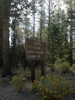
Sherman Pass Road is maintained by Sequoia National Forest and carries the designation of Forest Route 22S05. Sherman Pass Road climbs a huge uphill grade consisting of numerous switchbacks out of the Kern River Fault. Surprisingly Sherman Pass Road in the Kern River Fault is very well maintained as likely doesn't have any points where the grade exceeds 10%. The views ascending out of the Kern River Canyon are breath taking and wide.
Near the top of the uphill grade there is a pull-off which has a snow plow presumably waiting on stand-by for wintery weather. There is another vista looking southward towards the Kern River.
Sherman Pass Road ascends to the 9,200 foot Sherman Pass. Sherman Pass is the third highest highway pass in California after CA 120 at the Tioga Pass Entrance Station and CA 108 at Sonora Pass. Sherman Pass has an overlook of Mount Whitney the tallest mountain in the continental United States at 14,505 feet approximately 40 miles to the north.
From the Mount Whitney overlook Sherman Pass Road descends onto the Kern Plateau. Sherman Pass Road on the Kern Plateau isn't very challenging aside from rockfall but has access to numerous hiking trails. The older Sequoia National Forest road signage is nice to look at.
Sherman Pass Road descends the Kern Plateau to Kennedy Meadow roughly located at 6,214 feet above sea level.
Sherman Pass Road crosses the South Fork Kern River on a bridge that was constructed in 1960 where it exits Sequoia National Forest.
Kennedy Meadows has a small community by the same name which is the most eastern inhabited place in Tulare County. Sherman Pass Road ends in Kennedy Meadow and continues as Signed County Route J41 on Nine Mile Canyon Road.
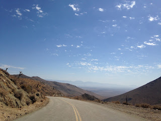
CR J41 much like the majority of Signed County Routes in Tulare County is no longer signed. CR J41 ascends to approximately 7,300 feet where it crosses into Inyo County before plunging into Nine Mile Canyon. CR J41 on Nine Mile Canyon Road has a massive 14-16% downhill grade which dumps into the Mojave Desert at approximately 3,500 feet. CR J41 follows a Los Angeles Aqueduct Pipeline from the descending Nine Mile Canyon. I found myself using a lot of 1st and 2nd gear descending through Nine Mile Canyon, the road is actually pretty intimidating when it bottlenecks to a single lane pushing against a guardrail.
CR J41 ends at US 395 near Pearsonville.
Truth be told, I'm not 100% certain when Sherman Pass Road was built but I can confirm it is by far the newest Trans-Sierra Highway Pass in California. Comparing topographical maps on historicaerials shows that Sherman Pass Road appears at some point between 1974 and 1987. My suspicion is that Sherman Pass Road was likely completed in the 1970s given that CR J41 was designated on Nine Mile Canyon Road in 1974.
CAhighways.org on CR J41


Comments