
Not far from the location where George Washington and his Continental Army famously crossed the Delaware River at the height of the American Revolution, thousands of motorists are now crossing the Delaware on a new & modern expressway bridge capable of handling the traffic demands of today and tomorrow. Begun in 2017, the Scudder Falls Bridge replacement project is a $534 million program undertaken by the Delaware River Joint Toll Bridge Commission (DRJTBC) and its prime contractor Trumbull Corporation aimed at replacing the aging/original interstate bridge over the Delaware River near Trenton, NJ with a wider/modern bridge built to the current interstate highway standards of the day. The original bridge opened in 1961 and included a narrow four-lane roadway without shoulders and substandard entry/exit ramps serving the interchanges at either end of the structure. For nearly 60 years, this bridge was part of the Interstate 95 corridor but in the aftermath of the realignment of the interstate onto the Pennsylvania & New Jersey Turnpikes near Bristol, PA upon Phase 1 completion of the Pennsylvania Turnpike/I-95 Direct Connection, this bridge has been part of an extended I-295 corridor since 2018.

A ride across the old Scudder Falls Bridge (1961-2019) was a cozy experience for drivers; notice the narrow lanes & shoulders from this 2016 photo.
The scope of this project involved
replacement of the 1961 river crossing with a double-wide bridge (which is to
say that the new bridge is approximately twice the width of the original),
while also making significant upgrades to the interchange with Route 29 on the
NJ side and the opposite interchange with Taylorsville Road on the PA side. In
order to keep traffic flowing on the existing bridge and its adjacent
interchanges during construction, a phased approach to construction was
necessary in order to minimize traffic disruptions and keep the number of
necessary long-term traffic detours to a minimum. The new bridge was therefore
constructed in “halves”; the northern half (completed westbound lanes) of the
bridge began carrying traffic in July 2019, after which demolition of the old
bridge and approaches was executed. In its place stands the southern half
(completed eastbound lanes) of the new bridge, completed and opened to traffic
in August 2021. Additional improvements made to the connecting roadways and
interchanges in the ensuing months enabled this project to achieve the landmark
“substantial completion” designation in mid-December 2021, with work expected
to continue on contractor demobilization and other bridge-related punchlist
items through the spring of 2022.


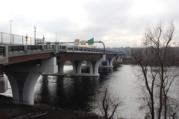
Interstate 295 westbound crossing the Delaware River on the new Scudder Falls Bridge; click on each individual photo (from December 2021) to see a larger version.
While not the most physically-attractive structure
to cross the Delaware, this bridge functions exactly as intended as a means of enabling
multi-modal travel at the speed of the 21st Century. Its roadways
combine to carry 8 thru-traffic lanes of Interstate 295 traffic (twice the
number of lanes of the original bridge) plus additional entry/exit ramp
acceleration/deceleration lanes and full-width emergency-use shoulders. The
north side of the bridge also features a pedestrian/bicycle pathway, a unique
facility in the area, that connects the already-existing Delaware & Raritan
Canal State Park Trail on the NJ side with the Delaware Canal Towpath Trail on
the PA side. A parking area associated with this pathway and its connecting
trails is available on the Pennsylvania side of the bridge at a “Park &
Ride” lot located off of Taylorsville Road near its interchange with I-295.


Interstate 295 eastbound crossing the Delaware River on the new Scudder Falls Bridge; click on each individual photo (from December 2021) to see a larger version.
As an additional historical note, this
bridge is located just a few miles downstream (south) of Washington Crossing State
Historic Park, the approximate location of the Continental Army’s infamous
crossing of the Delaware River on Christmas Night 1776 in advance of their
planned (and ultimately successful) attack on a garrison of German/Hessian
support troops stationed in nearby Trenton, NJ. The ensuing “Battle of Trenton”
was a pivotal engagement and is widely regarded by historians as one of the
early turning points of the American Revolution, but that’s another topic for
another day.


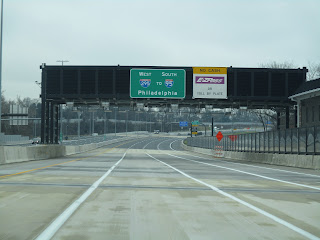
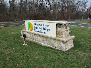
A source of controversy within the local community (and for some reason, the road-enthusiast “hobby”) was the decision made by the client agency (the DRJTBC) in 2009 to introduce tolling to the new bridge as part of the larger financing plan for the half-billion-dollar undertaking, the single-largest infrastructure investment in the agency’s history. Since the original & replacement bridges at this location had long been under the Bridge Commission’s jurisdiction (and were therefore fair game when it comes to toll collection), the move toward the tolling of an interstate bridge at this location was not subject to the same federal approval process that other new interstate highway toll proposals are subject to. It should also be mentioned that the Bridge Commission operates as a fully self-sufficient entity that does not receive revenues from gasoline taxes or any other federal/state funding sources. As tolling is its primary source of revenue, it’s perhaps unsurprising that the Commission decided to move to implement tolls on a Commission bridge, in spite of the fact that this step had not been needed or put in place for 60 years at this location. All-electronic toll collection at the crossing began in July 2019 in the days following the completion of the first phase of the new bridge and is expected to continue well into the long-term future.


Views of the completed Scudder Falls Bridge replacement as seen from the bridge's shared-use path facility, which can be easily accessed from both sides of the Delaware River; click on each individual photo (from December 2021) to see a larger version.


The above photos take you for a photo tour of the Scudder Falls Bridge shared-use path described above. The historic 1799 House on the Pennsylvania approach contains a visitor center & public restrooms and is open daily from dawn to dusk. Also presented & preserved here is an example of the old bridge's steel support bearings, refurbished and re-cast in concrete for presentational purposes; click on each individual photo (from December 2021) to see a larger version.
Comments