Grand Loop Road is a 140 mile loop highway which traverses the interior of Yellowstone National Park. Grand Loop Road connects all of the major attractions and geological features of Yellowstone National Park along with the entrance roads. Grand Loop Road is a seasonal highway and despite some conjecture never has been part of the US Route System.
Part 1; the history of Grand Loop RoadThe majority of history pertaining to Grand Loop Road was taken from the below National Park Service article:
Historic Roads - Yellowstone National Park (U.S. National Park Service) (nps.gov)
Yellowstone was declared the first National Park of the United States on March 1st, 1872. The first real highway to access Yellowstone National Park came in 1873 when a tolled facility was constructed from Bozeman, Montana via Yankee Jim Canyon to Mammoth Hot Springs. Numerous attempts were made to fund construction of roadway infrastructure during the early years of Yellowstone National Park but little success was found. Early Yellowstone National Park can be observed on the 1874 Map of the Military Department the Platte.

During April 1877 Philetus W. Norris was appointed as the second superintendent of Yellowstone National Park. During the early years of superintendent Norris's oversight the issue of a lack of a roadway network within in Yellowstone National Park was a prime issue reported to the U.S. Secretary of the Interior. Superintendent Norris was of the opinion that roads in Yellowstone National Park would not only benefit tourism but would facilitate commerce and aid the military by enhancing troop movements.
During 1878 superintendent Norris had received his first appropriation of $10,000 dollars to construct a road from Mammoth Hot Springs south to Lower Geyser Basin. 1878 saw numerous surveys facilitated by superintendent Norris . 1878 would also the start of a construction of a road from the Gardiner River south towards Yellowstone Falls and Yellowstone Lake along with a new highway from Mammoth Hot Springs north to Fort Ellis. The surveys conducted by Norris would form the basis of what would later become Grand Loop Road. By the end of 1878 there was 103 miles of roadway within Yellowstone National Park.
During 1879 superintendent Norris ordered a road to be constructed from Upper Geyser Basin to Yellowstone Lake. The road from Upper Geyser Basin was constructed to West Thumb of Yellowstone Lake was constructed via 22 mile alignment which took it over the Continental Divide. From West Thumb road construction continued north along the shore of Yellowstone Lake to it's outlet near what is now the East Entrance Road. Following the completion of the new road from Upper Geyser Basin-West Thumb and to the Yellowstone Lake outlet a functional loop highway of Yellowstone National Park was completed. The 1883 Map of Yellowstone (courtesy the Yellowstone National Park archives) shows the then existing loop road network of the park.

During the 1883-1890 era much of the road infrastructure in Yellowstone National Park was standardized. In numerous places the existing roadways were widened where they could be salvaged to meet new standards. Numerous realignment efforts were undertaken in other parts of Yellowstone National Park to bring the entire road network up to a uniform standard. Numerous bridging structures were built through Yellowstone National Park during the 1883-1890 era.
During 1891 U.S. Army Lieutenant Hiram Chittenden took oversight of construction of roadways in Yellowstone National Park. By 1899 Chittenden formulated a plan to construct 300 miles of modernized roads withing Yellowstone National Park. Part of Chittenden's 1899 plan for road development in Yellowstone included rebuilding the so called "Belt Line" road into a "Grand Loop." The existing Belt Line Road of Yellowstone National Park can be observed on the
1898 North Pacific Railway Company Map of Yellowstone.
Numerous improvements to the Belt Line Road and the rest of the infrastructure of Yellowstone National Park was made during the oversight of Chittenden. Notably the Gardiner Arch was completed during September 1903 along the North Entrance Road near Mammoth Hot Springs. Oversight of the road would remain under the supervision of Chittenden until 1905. The Gardiner Arch can be seen below during 1904 (sourced from the Yellowstone National Park Archives).
Below the 1903 Chittenden Bridge over the Yellowstone River immediately east of the Belt Line Road can be seen (courtesy the Yellowstone National Park Archives). This structure was replaced during the 1960s.

During the 1910s many of the highway bridges around Yellowstone National Park were replaced by higher capacity concrete structures. During the 1910s much of the existing road network within Yellowstone was received an oil surface. A decision to permit automobiles to enter Yellowstone National Park was made during August 1914 by the park superintendent. By May 1915 the restriction on allowing engine powered vehicles within Yellowstone National Park was lifted following a request by the Department of the Interior. Beginning August 1st, 1915 automobiles were permitted to enter Yellowstone National Park and access the Belt Line Road. The National Park Service was created on August 25th, 1916 and would assume full control of Yellowstone National Park by 1918.
During the Auto Trail era numerous highways were plotted with Yellowstone National Park as their end point. During 1920 the National Park-to-Park Highway was created and plotted as a Auto Trail purposed with connecting the National Parks. During 1923 Yellowstone National Park publicist renamed the Belt Line Road as the "Grand Loop Road." The 1925 Rand McNally Autotrails Map of Idaho-Montana-Wyoming displays numerous Auto Trails ending at Yellowstone National Park or not having an implied through routes on the Grand Loop Road. From the West Entrance Road at West Yellowstone Montana the Utah-Idaho National Highway (3), Vigilante Trail (15), Geysers to Glaciers Highway (67) and a spur of the National Parks Highway (91) can be seen terminating at the Yellowstone National Park boundary. From the North Entrance Road in Gardiner, Montana the Yellowstone Trail (1), Yellowstone-Glacier "B" Line (14), Regina-Yellowstone Highway (17), a spur of the National Park-to-Park Highway (64) and a spur of the National Parks Highway (91) can be seen terminating at the Yellowstone National Park boundary. No Auto Trails are seen following the Northeast Entrance Road to Yellowstone National Park. From the East Entrance Road along the Shoshone River in Wyoming the Black and Yellow Trail (7), Buffalo Highway (8), National Parks Pike (9), Yellowstone Highway (13), Glacier to Gulf Highway (23), Shortcut West Highway (32), a spur of the National Park-to-Park Highway (64) and Wyoming Highway 26 can be seen terminating at the Yellowstone National Park Boundary. From the South Entrance Road along the Lewis River in Wyoming the Rocky Mountain Highway (22), Grant Highway (28) and Wyoming Highway 80 can be seen terminating at the Yellowstone National Park Boundary.


On November 11th, 1926 the US Route System was approved by the American Association of State Highway Officials. ("AASHO"). From the outset no US Routes were plotted within the boundary of Yellowstone National Park or on the Grand Loop Road. US Route 191 is shown terminating at the West Entrance Road in Montana and US Route 20 at the East Entrance Road in Wyoming. US Route 87W is seen having a gap between the North Entrance Road and South Entrance Road with no implied connection on the Grand Loop Road. The Bureau of Public Roads assumed control the Grand Loop Road and the other Yellowstone National Park Roads beginning in 1926.


Some early commercial maps such as the
1927 National Map Company Sectional attempted to reconcile the gaps of the US Route System within Yellowstone National Park on the Grand Loop Road. These maps did not follow the official US Route descriptions from the AASHO.
By the 1930s most maps accurately displayed the lack of US Routes in Yellowstone National Park and the Grand Loop Road. One such example is the
1931 Clason's Road Map of Wyoming.
The only US Route ever to enter Yellowstone National Park came in 1934 when US Route 191 was extended from West Yellowstone through the Gallatin Mountains to Bozeman. More can be seen regarding US Route 191 in the Gallatin Mountains
here.
By late year 1966 the Grand Loop Road had been realigned onto a bypass of Norris Geyser Basin via provisions of the Mission 66 program. By 1969 the Old Faithful Interchange was constructed and Grand Loop Road was shifted to a small freeway bypass of the Old Faithful Geyser. Both the older alignments of the Grand Loop Road in the Norris Geyser Basin and Old Faithful Village were obliterated as part of their respective realignments. The Grand Loop Road was added to the National Register of Historic Places on December 23rd, 2003.
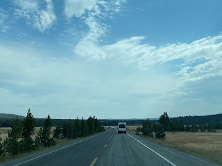
Part 2; a drive on the southern Grand Loop Road
From West Yellowstone, Montana modern US Route 20/191/287 follow Canyon Street and Yellowstone Avenue to the West Yellowstone Entrance Station. US Route 20/191/287 terminate at the Yellowstone National Park Boundary which becomes the West Entrance Road.


The West Entrance Road follows the Madison River east from West Yellowstone into the State of Wyoming to the Grand Loop Road at Madison Junction. The first West Entrance Road had been constructed during 1873 originating as a toll-free facility out of Virginia City, Montana by way of Madison Canyon. During 1880 a six mile shorter West Entrance Road was survey and constructed by superintendent Norris at the request of Yellowstone National Park mail contractors.
Madison Junction lies at an elevation of 6,806 feet above sea level. Madison Junction is the eastern terminus of the West Entrance Road at the Grand Loop Road. Madison Junction serves as the beginning of the Madison River at the confluence of the Firehole River and Gibbon River.
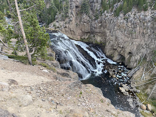
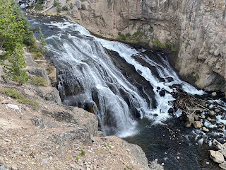
The Grand Loop Road north of Madison Junction follows the Gibbon River towards Norris Junction. Approaching Norris Junction a overlook of the 84 foot high Gibbon Falls can be found.
Approaching Norris Junction the Grand Loop Road northbound passes by Beryl Spring.
At Norris Junction the Grand Loop Road is signed as 21 miles from Mammoth Hot Springs. From Norris Junction traffic can access Norris Canyon Road to reach the Grand Canyon of the Yellowstone 12 miles to the east. Norris Geyser Basin is located at Norris Junction and is hottest basin in Yellowstone National Park due to being located at the junction of three fault lines.
Norris Canyon Road cuts directly east over the Continental Divide to the Grand Loop Road at Canyon Junction. Canyon Junction is located at 7,918 feet above sea level. Yellowstone Lake is signed as 17 miles south of Canyon Junction via the southbound Grand Loop Road.
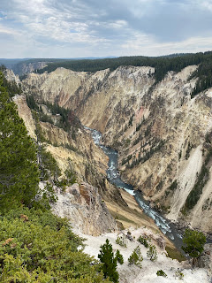
North Rim Drive can be accessed from the Grand Loop Road along with it's many vistas of Yellowstone Falls in the Grand Canyon of the Yellowstone via the North Rim Trail. North Rim Drive loops back to Canyon Junction via Canyon Village.
From the Grand Canyon of the Yellowstone southbound follows the Yellowstone River through Hayden Valley.
Southbound Grand Loop Road continues to follow the Yellowstone River to Yellowstone Lake at Fishing Bridge Junction. Fishing Bridge Junction lies at an elevation of 7,792 feet above sea level and serves as access to the East Entrance Road.
From the East Entrance Road the Grand Loop Road southbound is signed as 1 mile from Lake Village and 39 miles from Old Faithful.
Lake Village lies on the northern shore of Yellowstone Lake. Yellowstone Lake is the largest freshwater lake above 7,000 feet in North American and serves as the source of the Yellowstone River. Yellowstone Lake covers an area of 136 square miles.
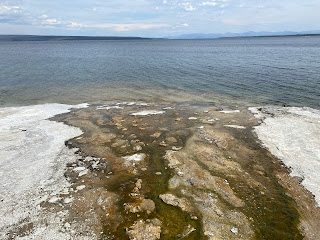
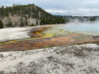
Southbound Grand Loop Road follows the western shore of Yellowstone Lake to West Thumb where the West Thumb Geyser Basin can be accessed. The West Thumb Geyser Basin is the largest basin along the shores of Yellowstone Lake and features numerous thermal vents in the water.
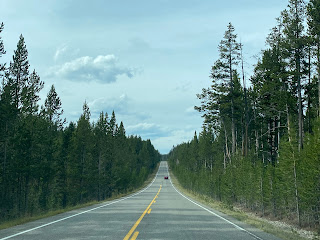
At West Thumb the Grand Loop Road intersects the South Entrance Road and turns west. Old Faithful is signed as 17 miles on Grand Loop Road from West Thumb.
Westbound Grand Loop Road climbs over the Continental Divide at 8,391 feet above sea level.
Westbound Grand Loop Road descends from the Continental Divide and crosses the Fire Hole River approaching Old Faithful Village. Westbound Grand Loop Road briefly becomes a freeway approaching the Old Faithful Interchange. The original Grand Loop Road passed next to the Old Faithful Geyser and followed the Firehole River northwest to the Biscuit Basin Geyser.
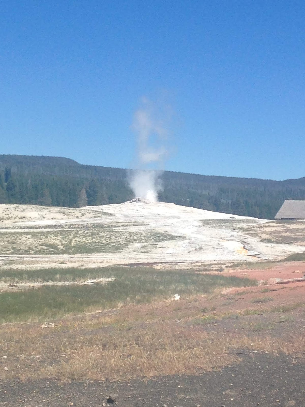
The Old Faithful Geyser is a highly predictable geyser which was first discovered in 1870. Old Faithful erupts on average every 90 minutes at heights generally ranging from about 106 to 185 feet. The Old Faithful Geyser seems to be relatively predictable in nature due to it not being tied to any other feature in Upper Geyser Basin. The steam erupting from Old Faithful generally ranges from 240F to 265F degrees.
From Old Faithful Village the Grand Loop Road swings northward and crosses the Firehole River at Biscuit Basin. Northbound Grand Loop Road follows the Firehole River to the Midway Geyser Basin where Grand Prismatic Spring can be found.
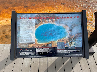
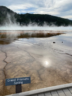
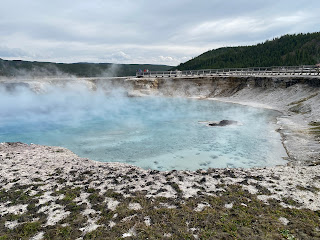
Grand Prismatic Spring is the largest hot spring in Yellowstone and the third largest in the world. The strange colors come from microbes which produce the effect near the rim of the 370 foot diameter hot spring. Grand Prismatic Spring is 160 feet deep and the clear blue color is endemic of the sterile environment. Grand Prismatic Spring has a temperatures close to 160F. The Opal Pool, Turqoise Pool, and Excelsior Pool are located within the vicinity of Grand Prismatic Spring.
Grand Loop Road northbound enters the Lower Geyser Basin where the Fountain Paint Pot Nature Trail can be found.
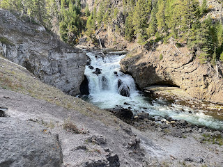
Northbound Grand Loop Road follows the Firehole River towards Madison Junction. Approaching the Gibbon River northbound Grand Loop Road intersects Firehole Canyon Drive.
Firehole Canyon Drive is a short one-way southbound loop from the Grand Loop Road which features views of Firehole Canyon and the 40 foot high Firehole Falls.
From Firehole Canyon Drive northbound Grand Loop Road approaches the Gibbon River and intersects the West Entrance Road at Madison Junction.


Comments