
Millmont Covered Bridge - Union County, Pennsylvania


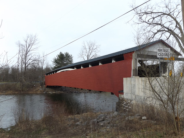
Also known as the Millmont Red Bridge, the Glen Iron Bridge or the Red Covered Bridge, the Millmont Covered Bridge is Union County, Pennsylvania's longest covered bridge. Spanning 159 feet across Penns Creek in the small community of Millmont in Hartley Township, the Millmont Covered Bridge was originally built in 1855 and designed with the style of a covered Burr arch-truss. Once the location of an important local crossing over Penns Creek, the bridge was bypassed by a modern bridge capable of handling heavier traffic in 1976. It now serves pedestrian and bicycle traffic, as it closed to motor vehicles in 1998.

The Millmont Covered Bridge has seen a few restorations over its history. There was a restoration of the bridge that took place in 1958. Another restoration took place in 2010. As the bridge was posted to the National Register of Historic Places on February 8, 1980, the Pennsylvania Historical & Museum Commission required the work to maintain the historical integrity of the original 1855 structure. While Union County was trying the secure and negotiate the $1.1 million needed in funding to restore the bridge, there was a windstorm with 55 to 65 mile per hour gusts took the roof off the bridge. But with the restoration having already been scheduled, that allowed for timely repair.
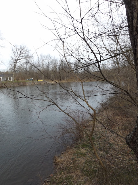
Penns Creek.

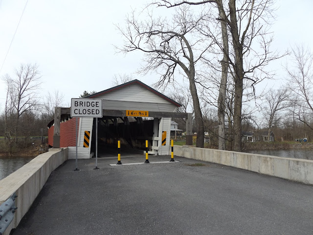
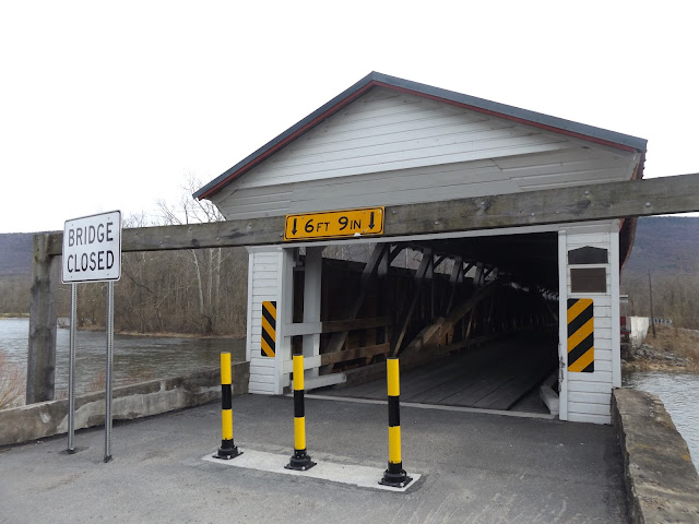
The bridge has a low clearance. It's best that it no longer serves motor vehicles.

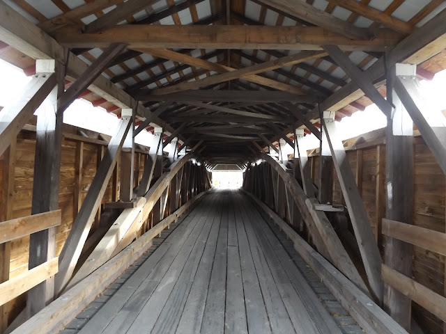
Inside the covered bridge


How to Get There:


Sources and Links:
PA Bucket List - Exploring the Millmont Covered Bridge in Union County
Bridgehunter - Millmont Covered Bridge 38-60-01 #2
PA Covered Bridges - Millmont/Red Bridge Restoration
Vermont Covered Bridge Society - Wind Takes Roof Off Millmont Covered Bridge


Update Log:
December 16, 2021 - Crossposted to Quintessential Pennsylvania (https://quintessentialpa.blogspot.com/2021/12/millmont-covered-bridge.html)

Comments

Popular posts from this blog

Chowchilla Mountain Road to Yosemite National Park

Chowchilla Mountain Road of Mariposa County is one of the oldest roadways servicing Yosemite National Park.  As presently configured this fourteen-mile highway begins at California State Route 49 near Elliot Corner and terminates at the Wawona Road in Yosemite National Park.  Chowchilla Mountain Road was constructed as a franchise toll road over Battalion Pass circa 1869-1870.  The highway was built at behest of Galen Clark to connect the town of Mariposa to his property near the South Fork Merced River at what is now Wawona.   In late 1874 the highway along with Clark’s Station would be purchased by the Washburn Brothers.  The Washburn Brothers would continue to toll Chowchilla Mountain Road as part of their Yosemite Stage Route lines.  The highway would ultimately become a Mariposa County public highway in 1917.  Mariposa would later be more directly linked with Yosemite Valley in 1926 following the completion of the Yosemite All-Year Highwa...

Interstate 40's Tumultuous Ride Through the Pigeon River Gorge

In the nearly 60 years Interstate 40 has been open to traffic through the Pigeon River Gorge in the mountains of Western North Carolina, it has been troubled by frequent rockslides and damaging flooding, which has seen the over 30-mile stretch through North Carolina and Tennessee closed for months at a time. Most recently, excessive rainfall from Hurricane Helene in September 2024 saw sections of Interstate 40 wash away into a raging Pigeon River. While the physical troubles of Interstate 40 are well known, how I-40 came to be through the area is a tale of its own. Interstate 40 West through Haywood County near mile marker 10. I-40's route through the Pigeon River Gorge dates to local political squabbles in the 1940s and a state highway law written in 1921. A small note appeared in the July 28, 1945, Asheville Times. It read that the North Carolina State Highway Commission had authorized a feasibility study of a "...water-level road down [the] Pigeon River to the Tennessee l...

Angus L. Macdonald Bridge

At 1.3 kilometers (or about 0.84 miles) in length, the Angus L. Macdonald Bridge is one of two bridges crossing over the Halifax Harbour between Halifax, Nova Scotia and Dartmouth, Nova Scotia, with the other bridge being the A. Murray Mackay Bridge . Opened in 1955 and named after former Nova Scotia Premier and Canadian Minister of Defense for Naval Services Angus L. Macdonald, the Macdonald Bridge was the first bridge that crossed Halifax Harbour that was opened to traffic. The Macdonald Bridge was also the subject of the Big Lift, which was only the second time in history that the span of a suspension bridge were replaced while the bridge was open to traffic. Planning began in 2010 for the Big Lift, while construction took place between 2015 and 2017. Similar work occurred on the Lion's Gate Bridge in Vancouver, British Columbia before the project took place on the Macdonald Bridge. At this time, much of the bridge infrastructure is new, leaving only the towers, main cables and...