The morning after climbing Camelback Mountain I headed out from Scottsdale towards Apache Junction to drive Arizona State Route 88 on the Apache Trail.

This article is the 27th entry in the 2016 Fall Mountain Trip Series. Part 26 covered the hike up Camelback Mountain from Echo Canyon.
2016 Fall Mountain Trip Part 26; Climbing Camelback Mountain
The history of AZ 88 is tied to the Salt River Project which was a reclamation project approved along the Salt River in 1903. The first reservoir to built along the Salt River Project was Roosevelt Dam which was under construction from 1903 to 1911. As part of the Salt River Project a Stage Route known as the Apache Trail was built from the Phoenix area to Roosevelt Dam. The Apache Trail was named as such due to it being built over a known trail that used to be utilized by the Apache Tribe to traverse the Salt River wilderness of the Superstition Range. Roosevelt Dam was completed in 1911 and for a short period of time was the largest reservoir in the world.
The Apache Trail was one of the earliest examples of an Auto Trail in Arizona. In full scale the Apache Trail began in Mesa and ended to the east in San Carlos. The Apache Trail appears on the 1925 Rand McNally Arizona/New Mexico Highway Map co-signed in sections with; the Lee Highway, the Bankhead Highway, the Southern National Highway, the Atlantic Pacific Highway, and the Old Spanish Trail. The 1925 Rand McNally Map also shows the Apache Trail as one of the Arizona Auto Club Routes.


The second Salt River Project Reservoir was Canyon Lake which was impounded by Mormon Flat Dam upon completion west of Tortilla Flat in 1925. The third reservoir called Apache Lake was completed upon construction of Horse Mesa Dam along the Apache Trail in 1927 (the year state highways became signed in Arizona) east Tortilla Flat. The only Salt River Project reservoir not along the Apache Trail was Saguaro Lake which is just west of Canyon Lake.
Essentially continued use of the Salt River Project ensured that AZ 88/Apache Trail continued to be a state highway into modern time despite little improvements over the years. The paved section is fun as hell for a weekend drive for lunch at Tortilla Flat while the dirt segment is hazardous enough to an off-road driver interested but just gentle enough for a car (emphasis on barely).
Present AZ 88 is one of the original 1927 run Sign State Highways. The current configuration of AZ 88 is about 46 miles long running from US 60 in Apache Junction northeast to AZ 188. The reputation of AZ 88 is among the most infamous in Arizona as it is one of the few remaining dirt state highways with approximately half the modern mileage unpaved. The entire unpaved portion of AZ 88 is east of Tortilla Flat along the Salt River in the remote Superstition Mountains to Roosevelt Dam.
AZ 88 was originally intended to be numbered as AZ 66 which can be seen on the 1927 Rand McNally Highway Map of Arizona/New Mexico. AZ 66 was renumbered to AZ 88 due to US Route 60 becoming US Route 66.

Originally in 1927 AZ 88 was substantially longer in length continuing east from Roosevelt Dam to the City of Globe. The eastern terminus of AZ 88 was cut back to Roosevelt Dam in 1999 when AZ 188 was extended southward to Globe. Originally AZ 88s western terminus was in Apache Junction at US 80 which eventually became a multiplex of US 60/70/80/89 before being reduced to US 60 by 1971. I'm not one hundred percent certain but I believe the western terminus of AZ 88 was shifted south on Idaho Avenue to the US 60 freeway when AZ 360 was renumbered in 1992.
On my way out to AZ 88 I encountered some colored AZ Freeway Loop shields in the wild. This blue AZ 101 shield was on an overhead gantry on east Shea Boulevard in Scottsdale approaching the freeway ramp to AZ 101.

On AZ 101/Pima Freeway south the exit to AZ 202 still has brown shields and even some button-copy directional arrows. I turned onto AZ 202 eastbound onto the Red Mountain Freeway in Mesa.


I should note that even AZ 303 once also had an off-color scheme that was on a black shield with a white background. The reason the Arizona Loop Freeway shields changed to the conventional black on white blanks was due to the colors fading out quickly in the Sonoran Desert sun.

I followed AZ 202 east on the Red Mountain Freeway and pulled onto US 60 east on the Superstition Freeway. I followed US 60 east into Pinal County and Apache Junction where I met AZ 88 at Idaho Road. AZ 88 makes a brief northward jog through downtown Apache Junction on Idaho Road where it turns off eastward onto North Apache Trail. From downtown Apache Junction a mileage distance sign places Roosevelt Dam 44 miles away to the east on AZ 88.


East of Apache Junction the ghost town of Goldfield can be accessed via AZ 88. Goldfield was established in 1893 but was quickly abandoned by 1898 when the gold mines were shuttered. Goldfield's mined reopened in 1920 and the town was renamed "Youngberg." Youngberg only remained viable into the late 1920s before shuttering again. Youngberg was restored and renamed Goldfield which eventually opened as a park. These photos of Goldfield were taken in 2012 when I was still living in the Phoenix Area.


Directly east of Goldfield is Lost Dutchman State Park which is easily observed by the towering bluffs of the Superstition Range. Supposedly the Lost Dutchman's Mine was found some time possibly in the 1870s within vicinity of a rock formation of Weaver's Needle. I would find that claim highly unlikely given how far south Weaver's Needle is of the Salt River. In used to hike out to Weaver's Needle via the Peralta Trail, the area really is hostile and foreboding as any story you've heard.


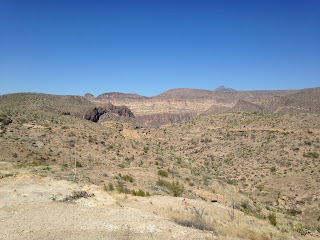
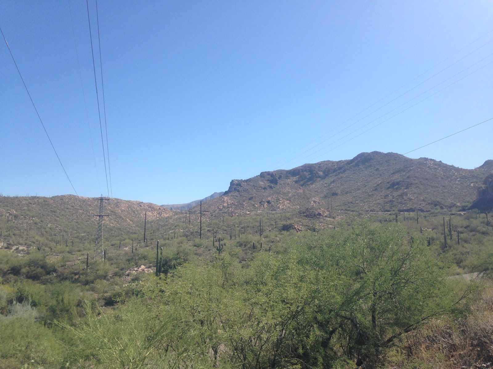
AZ 88 east of Goldfield and Lost Dutchman State Park enters Maricopa County and Tonto National Forest. Most of the paved section of AZ 88 east of Goldfield to Tortilla Flat is signed mostly as 25 MPH. The road is extremely twisty but comes out to some great overlooks of the Four Peaks to the north in the Mazatzal Range.


The first lake encountered on AZ 88 is Canyon Lake. Tonto National Forest has a scenic pullout and overlook of Canyon Lake.


At Canyon Lake AZ 88 first crosses the 1923 Fish Creek Bridge. The Fish Creek Bridge is a one-lane 73.8 foot long pony truss span which was built by the Missouri Valley Bridge & Iron Company.


AZ 88 east next crosses the 1937 Boulder Creek Bridge. The 1937 Boulder Creek Bridge is a four-span structure which is comprised of three Pratt truss spans and one Parker truss span. The three Pratt truss spans apparently were built in 1920 and were relocated from the Wickenburg Area. In total the 1937 Boulder Creek Bridge is 487.9 feet in length.

I stopped at the Canyon Lake Campground for a look west at the namesake Canyon Lake.

Upon pulling into Tortilla Flat I happened upon a large cruise of Phoenix Police Department Officers riding in on their motorcycles.


Tortilla Flat is stage station built in 1904 to facilitate travel to Roosevelt Dam. Tortilla Flat is often touted as the smallest community in Arizona with six residents. Much of Tortilla Flat's original structures burned in a fire and were later rebuilt. I believe the school building is an original structure.


AZ 88 east of Tortilla Flat crosses a ford of Tortilla Creek. AZ 88 begins to ascent towards it's dirt segment on an increasingly windy highway. AZ 88 has almost constant awesome views of the Superstition Mountains and Salt River watershed.


I reached the dirt segment of AZ 88 and gave it a go for a couple miles east. The heavy wash boarding coupled with smashed hood rattling from the UT 95 deer incident really wasn't something I was up for so I ended up turning around to head back to Phoenix.


On occasion took my truck out to AZ 88 in the early 2000s when the dirt roadway was in really rough shape. The road is essentially one and a half lanes which runs along the rim of a canyon above the Salt River and Apache Lake. There is a one-lane bridge on the dirt segment which is a pretty shocking site to behold when you realize it maintained by ADOT.
As for Roosevelt Dam and the eastern terminus of AZ 88, it has a hell of an overlook of the dam in addition to Roosevelt Lake. Roosevelt Dam was expanded in the 1990s which covered much of the masonry structure with concrete. Originally AZ 188 was created in 1950s it used to cross Roosevelt Dam before it was moved to a new suspension bridge. When the waters of Roosevelt Lake are low the old masonry section of the dam can still be seen.


Upon returning to the Phoenix area I spent some time at my Brother's since it was the last day of the trip before I headed back to California. My trip back to California would include the western terminus of US Route 60 and a drive through "Hell" in the Sonoran Desert.
2016 Fall Mountain Trip Part 28 (Finale); the western terminus of US Route 60

This article is the 27th entry in the 2016 Fall Mountain Trip Series. Part 26 covered the hike up Camelback Mountain from Echo Canyon.
2016 Fall Mountain Trip Part 26; Climbing Camelback Mountain
The history of AZ 88 is tied to the Salt River Project which was a reclamation project approved along the Salt River in 1903. The first reservoir to built along the Salt River Project was Roosevelt Dam which was under construction from 1903 to 1911. As part of the Salt River Project a Stage Route known as the Apache Trail was built from the Phoenix area to Roosevelt Dam. The Apache Trail was named as such due to it being built over a known trail that used to be utilized by the Apache Tribe to traverse the Salt River wilderness of the Superstition Range. Roosevelt Dam was completed in 1911 and for a short period of time was the largest reservoir in the world.
The Apache Trail was one of the earliest examples of an Auto Trail in Arizona. In full scale the Apache Trail began in Mesa and ended to the east in San Carlos. The Apache Trail appears on the 1925 Rand McNally Arizona/New Mexico Highway Map co-signed in sections with; the Lee Highway, the Bankhead Highway, the Southern National Highway, the Atlantic Pacific Highway, and the Old Spanish Trail. The 1925 Rand McNally Map also shows the Apache Trail as one of the Arizona Auto Club Routes.


The second Salt River Project Reservoir was Canyon Lake which was impounded by Mormon Flat Dam upon completion west of Tortilla Flat in 1925. The third reservoir called Apache Lake was completed upon construction of Horse Mesa Dam along the Apache Trail in 1927 (the year state highways became signed in Arizona) east Tortilla Flat. The only Salt River Project reservoir not along the Apache Trail was Saguaro Lake which is just west of Canyon Lake.
Essentially continued use of the Salt River Project ensured that AZ 88/Apache Trail continued to be a state highway into modern time despite little improvements over the years. The paved section is fun as hell for a weekend drive for lunch at Tortilla Flat while the dirt segment is hazardous enough to an off-road driver interested but just gentle enough for a car (emphasis on barely).
Present AZ 88 is one of the original 1927 run Sign State Highways. The current configuration of AZ 88 is about 46 miles long running from US 60 in Apache Junction northeast to AZ 188. The reputation of AZ 88 is among the most infamous in Arizona as it is one of the few remaining dirt state highways with approximately half the modern mileage unpaved. The entire unpaved portion of AZ 88 is east of Tortilla Flat along the Salt River in the remote Superstition Mountains to Roosevelt Dam.
AZ 88 was originally intended to be numbered as AZ 66 which can be seen on the 1927 Rand McNally Highway Map of Arizona/New Mexico. AZ 66 was renumbered to AZ 88 due to US Route 60 becoming US Route 66.

Originally in 1927 AZ 88 was substantially longer in length continuing east from Roosevelt Dam to the City of Globe. The eastern terminus of AZ 88 was cut back to Roosevelt Dam in 1999 when AZ 188 was extended southward to Globe. Originally AZ 88s western terminus was in Apache Junction at US 80 which eventually became a multiplex of US 60/70/80/89 before being reduced to US 60 by 1971. I'm not one hundred percent certain but I believe the western terminus of AZ 88 was shifted south on Idaho Avenue to the US 60 freeway when AZ 360 was renumbered in 1992.
On my way out to AZ 88 I encountered some colored AZ Freeway Loop shields in the wild. This blue AZ 101 shield was on an overhead gantry on east Shea Boulevard in Scottsdale approaching the freeway ramp to AZ 101.

On AZ 101/Pima Freeway south the exit to AZ 202 still has brown shields and even some button-copy directional arrows. I turned onto AZ 202 eastbound onto the Red Mountain Freeway in Mesa.


I should note that even AZ 303 once also had an off-color scheme that was on a black shield with a white background. The reason the Arizona Loop Freeway shields changed to the conventional black on white blanks was due to the colors fading out quickly in the Sonoran Desert sun.

I followed AZ 202 east on the Red Mountain Freeway and pulled onto US 60 east on the Superstition Freeway. I followed US 60 east into Pinal County and Apache Junction where I met AZ 88 at Idaho Road. AZ 88 makes a brief northward jog through downtown Apache Junction on Idaho Road where it turns off eastward onto North Apache Trail. From downtown Apache Junction a mileage distance sign places Roosevelt Dam 44 miles away to the east on AZ 88.


East of Apache Junction the ghost town of Goldfield can be accessed via AZ 88. Goldfield was established in 1893 but was quickly abandoned by 1898 when the gold mines were shuttered. Goldfield's mined reopened in 1920 and the town was renamed "Youngberg." Youngberg only remained viable into the late 1920s before shuttering again. Youngberg was restored and renamed Goldfield which eventually opened as a park. These photos of Goldfield were taken in 2012 when I was still living in the Phoenix Area.


Directly east of Goldfield is Lost Dutchman State Park which is easily observed by the towering bluffs of the Superstition Range. Supposedly the Lost Dutchman's Mine was found some time possibly in the 1870s within vicinity of a rock formation of Weaver's Needle. I would find that claim highly unlikely given how far south Weaver's Needle is of the Salt River. In used to hike out to Weaver's Needle via the Peralta Trail, the area really is hostile and foreboding as any story you've heard.


AZ 88 east of Goldfield and Lost Dutchman State Park enters Maricopa County and Tonto National Forest. Most of the paved section of AZ 88 east of Goldfield to Tortilla Flat is signed mostly as 25 MPH. The road is extremely twisty but comes out to some great overlooks of the Four Peaks to the north in the Mazatzal Range.


The first lake encountered on AZ 88 is Canyon Lake. Tonto National Forest has a scenic pullout and overlook of Canyon Lake.


At Canyon Lake AZ 88 first crosses the 1923 Fish Creek Bridge. The Fish Creek Bridge is a one-lane 73.8 foot long pony truss span which was built by the Missouri Valley Bridge & Iron Company.


AZ 88 east next crosses the 1937 Boulder Creek Bridge. The 1937 Boulder Creek Bridge is a four-span structure which is comprised of three Pratt truss spans and one Parker truss span. The three Pratt truss spans apparently were built in 1920 and were relocated from the Wickenburg Area. In total the 1937 Boulder Creek Bridge is 487.9 feet in length.

I stopped at the Canyon Lake Campground for a look west at the namesake Canyon Lake.

Upon pulling into Tortilla Flat I happened upon a large cruise of Phoenix Police Department Officers riding in on their motorcycles.

Tortilla Flat is stage station built in 1904 to facilitate travel to Roosevelt Dam. Tortilla Flat is often touted as the smallest community in Arizona with six residents. Much of Tortilla Flat's original structures burned in a fire and were later rebuilt. I believe the school building is an original structure.


AZ 88 east of Tortilla Flat crosses a ford of Tortilla Creek. AZ 88 begins to ascent towards it's dirt segment on an increasingly windy highway. AZ 88 has almost constant awesome views of the Superstition Mountains and Salt River watershed.


I reached the dirt segment of AZ 88 and gave it a go for a couple miles east. The heavy wash boarding coupled with smashed hood rattling from the UT 95 deer incident really wasn't something I was up for so I ended up turning around to head back to Phoenix.


On occasion took my truck out to AZ 88 in the early 2000s when the dirt roadway was in really rough shape. The road is essentially one and a half lanes which runs along the rim of a canyon above the Salt River and Apache Lake. There is a one-lane bridge on the dirt segment which is a pretty shocking site to behold when you realize it maintained by ADOT.
As for Roosevelt Dam and the eastern terminus of AZ 88, it has a hell of an overlook of the dam in addition to Roosevelt Lake. Roosevelt Dam was expanded in the 1990s which covered much of the masonry structure with concrete. Originally AZ 188 was created in 1950s it used to cross Roosevelt Dam before it was moved to a new suspension bridge. When the waters of Roosevelt Lake are low the old masonry section of the dam can still be seen.


Upon returning to the Phoenix area I spent some time at my Brother's since it was the last day of the trip before I headed back to California. My trip back to California would include the western terminus of US Route 60 and a drive through "Hell" in the Sonoran Desert.
2016 Fall Mountain Trip Part 28 (Finale); the western terminus of US Route 60
Comments