California State Route 210 (legacy of California State Route 30)

 
California State Route 210 is a forty-mile-long limited access State Highway located in Los Angeles County and San Bernardino County.  California State Route 210 exists as a non-Interstate continuation of Interstate 210 and the Foothill Freeway between California State Route 57 in San Dimas east to Interstate 10 Redlands.  California State Route 210 was previously designated as California State Route 30 until the passage of 1998 Assembly Bill 2388, Chapter 221.  Since 2009 the entirety of what was California State Route 30 has been signed as California State Route 210 upon the completion of the Foothill Freeway extension.  Below westbound California State Route 210 can be seen crossing the Santa Ana River as the blog cover.  California State Route 30 can be seen for the last time on the 2005 Caltrans Map below. 


Part 1; the evolution of California State Route 30 into California State Route 210

What was to become California State Route 30 (CA 30) entered the State Highway System during 1933 as part of Legislative Route Number 190 (LRN 190).  The original definition of LRN 190 was as follows: 

"LRN 9 (US Route 66) near San Dimas to LRN 26 (US Route 99) near Redlands via Highland Avenue."

LRN 190 was not assigned one of the original Sign State Routes which were announced in the August 1934 California Highways & Public Works.  The future alignment of CA 30 appears on the 1934 Division of Highways Map as LRN 190 on Orange Street between Highland-Redlands.  From Highlands LRN 190 can be seen following numerous jogs to Highland Avenue.  LRN 190 can be seen following Highland Avenue west towards San Dimas and US Route 66/LRN 9.    


LRN 190 on Orange Street appears on the 1935 Division of Highways Map of San Bernardino County.  Between Highland Avenue and Orange Street the alignment of LRN 190 is shown making numerous jogs, including Baseline Street.  


The 1935 Division of Highways Map displays LRN 190 passing through San Bernardino and following westward towards Upland.  From Upland LRN 190 followed jogs to Olive Street and Baseline Street to the Los Angeles County Line.


The 1935 Division of Highways Map of Los Angeles County displays LRN 190 entering from San Bernadino County via Baseline Avenue.  LRN 190 can be observed taking several jogs through La Verne and continuing to San Dimas via Baseline Avenue.  


The 1936-1937 Division of Highways Map displays LRN 190 straightened onto a new alignment through La Verne. 


City Creek Road was added to the State Highway System as part of 1937 Legislative Chapter 15 as Legislative Route Number 207 (LRN 207).  City Creek Road was brought into the State Highway System due to the existing roadway being inadequate to handle modern traffic.  LRN 207 originally carried the following definition:

"LRN 190 near Highland northeasterly to LRN 43 (CA 18); also from a point on said LRN 43 near where it crosses Deep Creek, thence northeasterly to and connecting Forest Service North Side Road in Green Valley."

LRN 207 first appears on the 1938 Division of Highways Map.  LRN 207 appears with a second segment east of Running Springs which ended in Green Valley via Green Valley Lake Road.  


1939 Legislative Chapter 473 recreated LRN 207 but did not make an alteration to the route definition.  The definition of LRN 207 was altered by 1941 Legislative Chapter 142 which removed the Green Valley segment from the State Highway System.  The truncated LRN 207 appears on the 1942 Division of Highways Map aligned between LRN 190 near Highland to CA 18/LRN 43 near Running Springs. 


The paving and grading of LRN 207 over a distance of 16.4 miles appears in November/December 1943 California Highways & Public Works as a post-World War II project approved by the California Highway Commission.  

The May/June 1946 California Highways & Public Works notes contracts had been awarded to pave 3.2 miles of LRN 207/City Creek Road and install a new bridge over City Creek.  


The November/December 1947 California Highways & Public Works announced the construction and paving of a new bridge on LRN 190/Baseline Street had been budgeted for the 1948-49 Fiscal Year. 


The September/October 1947 California Highways & Public Works announced grading and construction of structures along LRN 207 from City Creek to Plunge Creek as being added to the 1947-48 Fiscal Year budget.  

The September/October 1948 California Highways & Public Works announced LRN 207 from Long Point to 1.3 miles west of Running Springs was funded for grading/surfacing during the 1949-50 Fiscal Year.  


A contract to construct the realignment of LRN 190 between Baseline Street and Orange Street was announced in the November/December 1948 California Highways & Public Works.  


The realignment of LRN 190 connecting Highland Avenue to Orange Street via Boulder Avenue appears on the 1950 Division of Highways Map.  


The September/October 1951 California Highways & Public Works announced the completion of the modernization of City Creek Road as part of LRN 207.  City Creek Road was modernized via five construction units which fully opened to traffic by August 19th, 1951.  


The new alignment of City Creek Road and LRN 207 appears on the 1952 Division of Highways Map.  The modernized alignment of City Creek Road is notably elongated from the 1891 variant to lessen the gradient of the climb into the San Bernardino Mountains.  


The May/June 1953 California Highways & Public Works announced CA 30 as a new Sign State Route.  CA 30 originally followed LRN 190 from US Route 66/LRN 9 near to La Verne east to LRN 207, the entirety of LRN 207 via City Creek Road to CA 18/LRN 43 at Running Springs.


CA 30 first appears on the 1954 Division of Highways Map.  


The January/February 1955 California Highways & Public Works announced a contract to expand LRN 190 between CA 30/LRN 207 to Baseline Street to a four-lane divided highway.  


The 1957 Division of Highways Map displays CA 30 multiplexing CA 18/LRN 43 east of LRN 207 to Bear Valley Dam and running along the south shore of Big Bear Lake.  


The November/December 1958 California Highways & Public Works in a District VIII report announced work had commenced on an extension of CA 30 from Big Bear City over planned LRN 190 towards Barton Flats via a then unnamed 8,400-foot-high summit in San Bernardino National Forest.  Five miles of CA 30/LRN 190 east of Barton Flats are stated to be in the process of construction. 


The Freeway & Expressway System was created during 1959.  The entirety of LRN 207 was added as an initial component due to it being designed as an expressway grade.  

The 1961 Division of Highways Map displays LRN 190 as complete between US Route 99/US Route 70/LRN 26 in Redlands and CA 30/LRN 43 near Big Bear Lake.  The entire corridor is shown to have been assigned as part of the newly designated CA 38.  


The September/October 1961 California Highways & Public Works announced the completion of CA 38/LRN 190 in San Bernardino Mountains during July 1961.  The completion of CA 38/LRN 190 in the San Bernardino Mountains is stated to have included numerous contracts administered by the Division of Highways, the Forest Service and Bureau of Public Roads.  The new segment of CA 38/LRN 190 is referred to the "Barton Flats to Big Bear Loop" which spanned 16 miles in total length.  Construction on closing the gap in LRN 190 began during June 1959.  The article notes the entire new segment of CA 38/LRN 190 to be a freeway, but this likely was an intended to read as an "expressway."  Opening ceremonies for the completion of CA 38/LRN 190 are stated to have been held on August 12th, 1961, at Onyx Summit.  It is unclear why CA 30 was not designated east of Big Bear Lake over LRN 190 as cited in the November/December 1958 California Highways & Public Works.  


The November/December 1962 California Highways & Public Works announced a segment of CA 30/LRN 207 was budgeted to be widened to four lanes during the 1963-64 Fiscal Year.  


An adopted freeway alignment for LRN 190 between Highland and Redlands was announced in the July/August 1963 California Highways & Public Works.  The LRN 190 freeway between Redlands to Highlands included a new interchange at CA 30/LRN 207.  Another corridor for the CA 30/LRN 190 freeway is shown as being selected as a continuation to a previous adoption near Muscoy.  The Highland-Redlands Freeway and CA 30/LRN 190 freeway alignments were selected by the California Highway Commission during their May-June 1963 meetings.


As part of the 1964 State Highway Renumbering the Legislative Route Numbers were dropped in favor of field signage and unnecessary multiplexes were largely eliminated.  Subsequently LRN 207 was dropped in favor of becoming Legislatively defined as part of CA 30.  CA 30 was truncated from Big Bear City to CA 18 at Running Springs.  The new definition of CA 30 appears on the 1964 Division of Highways Map.  


 In the case of LRN 190 between Highland and Redlands it was assigned as CA 106.  The original definition of CA 106 was "Route 38 near Redlands to Route 30 near Highland."  CA 106 appears for the first time on the 1964 Division of Highways Map.


The 1965 Division of Highways Map depicts the planned CA 106 freeway, the freeway routing for the CA 30/CA 106 freeway interchange, the planned transition to City Creek Road and CA 30 freeway through San Bernardino to Muscoy.  


The planned freeway corridor of CA 30 between Interstate 210 in San Dimas to the vicinity Upland appears on the 1969 Division of Highways Map.  


CA 106 was short lived as 1972 Legislative Chapter 1216 transferred it to a realigned CA 30.  1972 Legislative Chapter 1216 also defined CA 330 as "Route 30 near Highland northeasterly to Route 18" via transfer from CA 30.  CA 30 can be seen replacing CA 106 between Highland and Redlands on the 1975 Caltrans Map.


CA 330 first appears on the 1975 Caltrans Map and is one of the few instances of a California State Highway having a designated three-digit child route. 


Part of CA 30 in Redlands in is shown on the 1986 Caltrans State Map to be moved to a new expressway alignment.


According to CAhighways CA 30 was moved to a freeway alignment between Highland and Interstate 10 in Redlands during July 1993.  In 1997 the remaining Los Angeles County freeway segment of CA 30 began being constructed.  Through 1998 the remaining segments of the CA 30 freeway west from the Interstate 15 interchange began construction.  1998 Assembly Bill 2388, Chapter 221 reassigned CA 30 as an extension of Route 210.  Assembly Bill 2388, Chapter 221 stipulated the corridor of CA 30 would be signed as CA 210 upon being completed to freeway standards.  

The undated/unsubmitted application by Caltrans to the AASHTO to extend Interstate 210 to Redlands can be seen below.  The application to extend Interstate 210 notes a requested reclassification of the highway between CA 30 and I-10 as an extension of CA 57.  The below application is stored in the 1997 files in the AASHTO database files.  


Caltrans submitted a request to extend Interstate 210 to Redlands to the AASHTO on September 16, 1998.  The request was heard by the AASHTO Executive Committee on November 7, 1999.  The AASHTO deferred acting on extending Interstate 210 requesting clarification from Caltrans.  


A letter from the Caltrans Direction to AASHTO Executive Director dated March 4, 1999, noted CA 30 had been reclassified as part of Route 210 by way of 1998 Assembly Bill 2388, Chapter 221.  The Caltrans Director noted the intention to sign CA 210 as part of Interstate 210 upon completion of the corridor to Interstate standards.  The Caltrans Director noted the agency requested the Federal Highway Administration reclassify existing Interstate 210 between San Dimas-Pomona as CA 57 and included it as an attachment (dated February 19, 1999).  


A letter by the AASHTO Executive Director to the Director of Caltrans dated March 19, 1999, noted receipt of a request to extend Interstate 210 to Redlands.  A handwritten attachment notes Caltrans withdrew the request to extend Interstate 210 by phone call to AASHTO on March 24, 1999.  


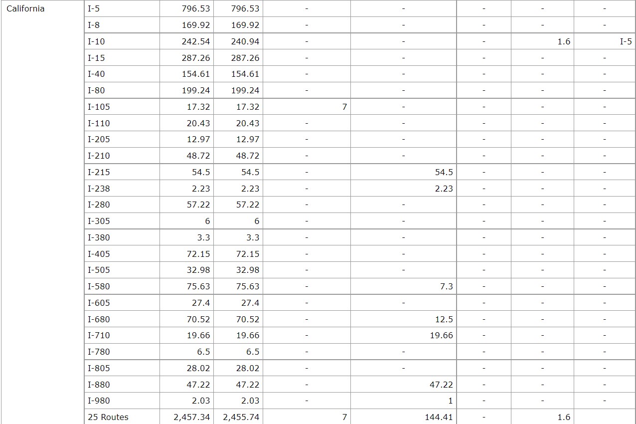
It is unclear if Caltrans submitted a withdrawal of the submission to the Federal Highway Administration to delete existing I-210 between San Dimas-Pomona.  The segment still appears in the current Federal Highway Administration Interstate Route Log.  Essentially by Federal Highway Administration classification CA 57 between San Dimas-Pomona is still Interstate 210.  


CA 210 opened as a freeway from Sierra Avenue in Fontana west to CA 57/Interstate 210 during November 2002.  According to CAhighways CA 30 remained signed east of Interstate 215 whereas the remaining freeway segment was signed as CA 210.  Oddly the 2005 Caltrans State Map shows Interstate 210 cosigned with CA 30 from CA 57 east to I-215 (it appears that Caltrans may have been jumping the gun on the segment becoming Interstate 210).  Most of CA 30 east of Interstate 215 is shown to be to freeway standards with a remaining expressway segment near CA 18/Waterman Avenue.


According to CAhighways the route of CA 210 was completed to freeway standards east of Sierra Avenue to Interstate 10 by 2007.  All freeway CA 30 reassurance shields were reported to be removed by 2008 although some surface shields have been to have remained up to 2009. 


Part 2; a drive on California State Route 210 to Interstate 215

Westbound CA 210 begins from Interstate 10 Exit 77C in Redlands.  Exit 77C denotes CA 210 can be used to access CA 30. 


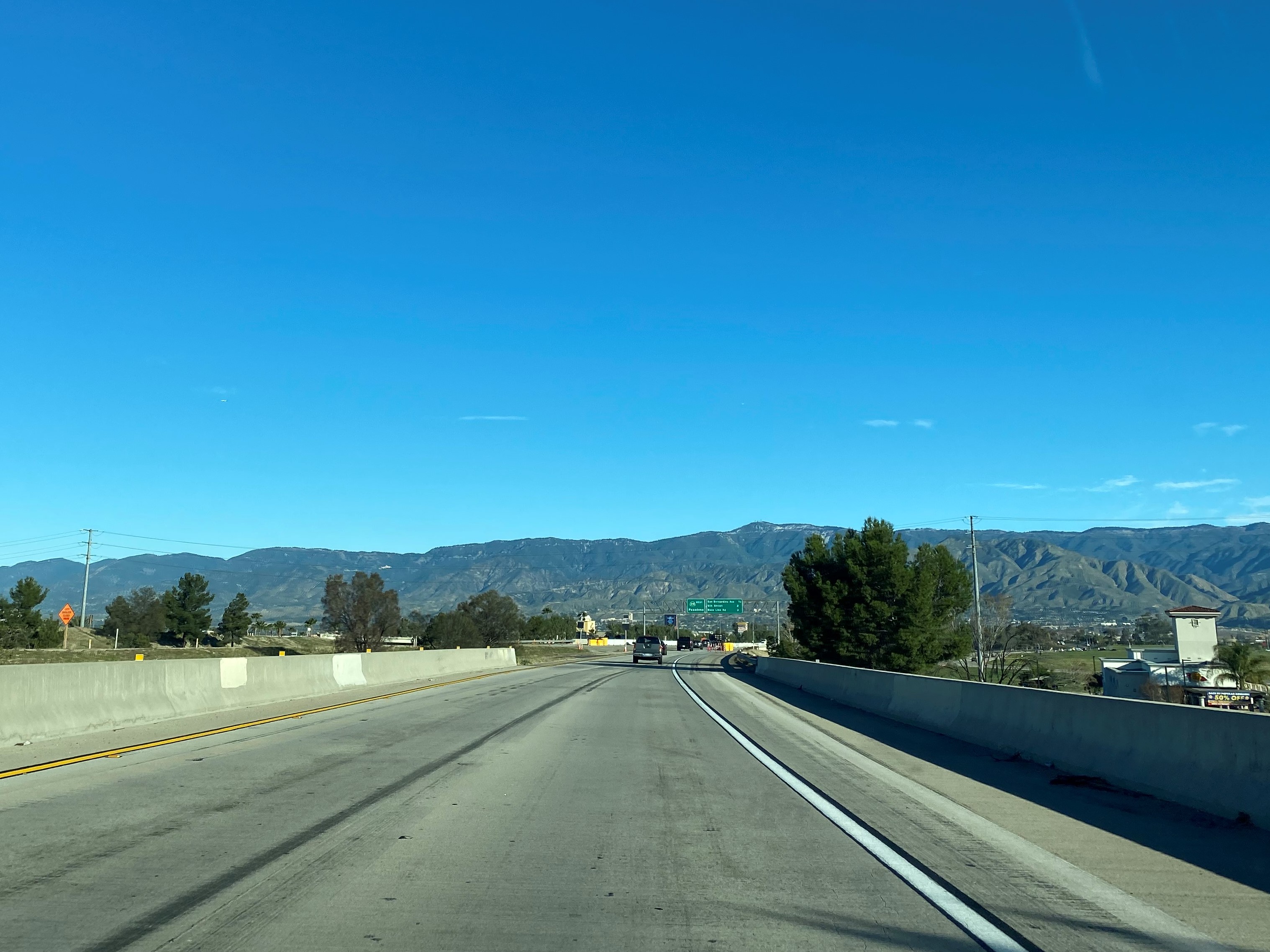
CA 210 westbound Exit 84 accesses San Bernardino Avenue.  


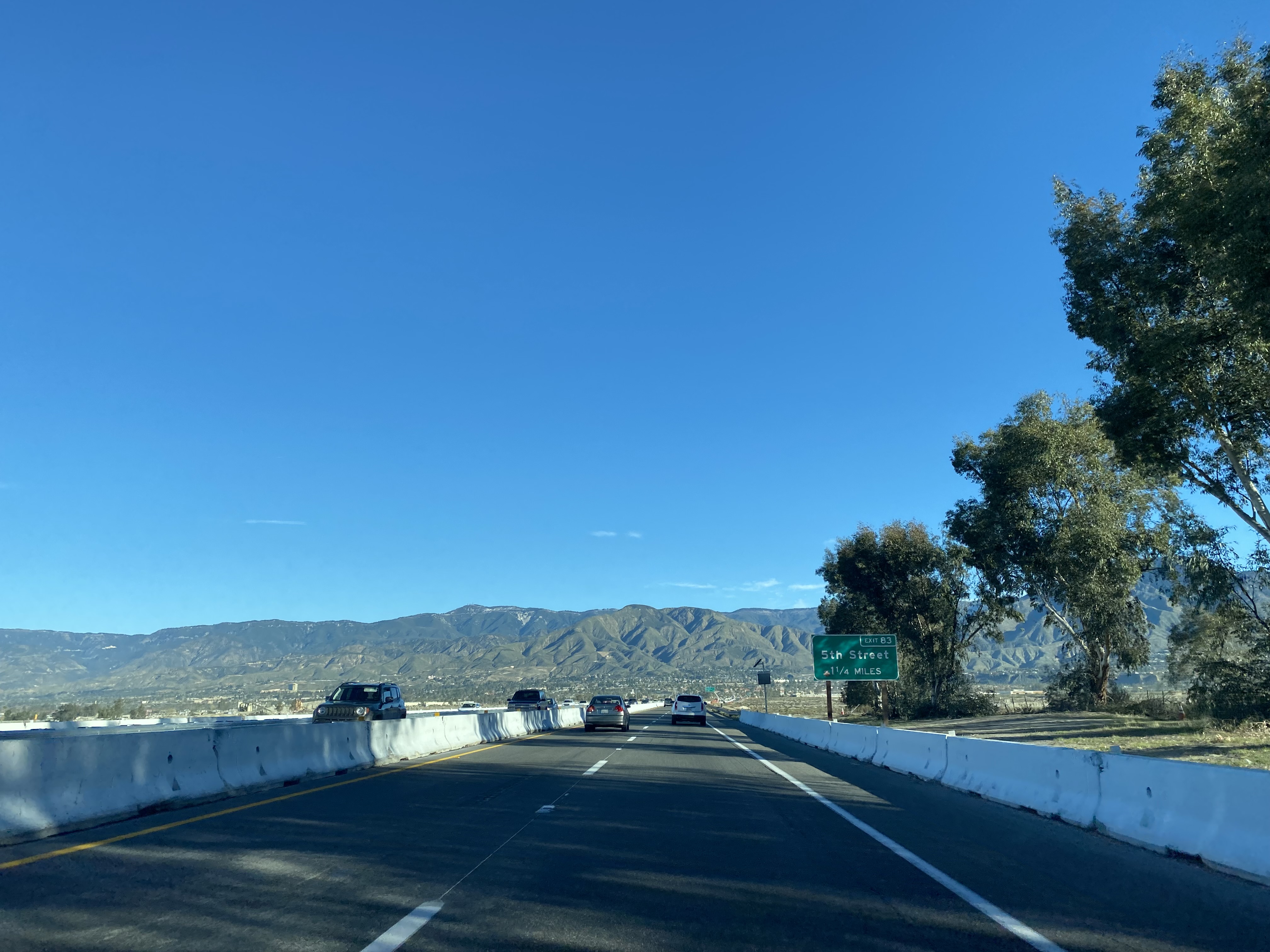
CA 210 westbound crosses the Santa Ana River and enters Highland.  CA 210 westbound Exit 83 accesses 5th Street. 


CA 210 westbound Exit 82 accesses Baseline Road. 


CA 210 westbound enters San Bernardino and intersects CA 330 at Exit 81.  


CA 210 westbound Exit 79 accesses Highland Avenue.  


CA 210 westbound Exit 78 accesses Del Rosa Avenue.  


CA 210 westbound Exit 76 accesses CA 18 at Waterman Avenue.  


CA 210 westbound Exit 75B accesses unsigned CA 259 towards southbound Interstate 215, Exit 75A accesses H Street.  


CA 210 westbound Exit 74 accesses northbound Interstate 215.  


Part 3; the transition of Interstate 210 to California State Route 210

I-210 eastbound terminates at Exit 45 at CA 57.  East of CA 57 the Foothill Freeway continues as CA 210.  As noted in Part 1 the alignment of CA 57 south to I-10 in Pomona is still classified by the Federal Highway Administration as I-210.  


Comments

Popular posts from this blog

Cajon Pass; Cajon Pass Toll Road, National Old Trails Road, US Route 66/91/395 and Interstate 15

This past weekend I spent some time in Cajon Pass traversing the many historic road alignments. Cajon Pass is located in San Bernardino County, California along the San Andreas Fault.  Cajon Pass  serves the boundary line between the Mojave Desert, the San Gabriel Mountains, San Bernardino Mountains and San Bernardino Valley.  Cajon Pass is historically one of the most traveled transportation corridors in American California and presently is served by four rail lines, Interstate 15 and California State Route 138. While Cajon Pass is known mostly for carrying US Route 66 it has carried numerous other signed highways that have had a significant impact on regional and national road travel.  While this is my best attempt to compile everything from the best sources I could find into one single transportation history blog regarding road travel in Cajon Pass I suspect as time goes on this article will be frequently updated.  If you have any information that you ...

Pardee Dam Road

Pardee Dam is a 358-foot-high concrete structure located near Campo Seco at the Calaveras County and Amador County Line.  Pardee Dam impounds the Mokelumne River which forms the namesake Pardee Reservoir.  Pardee Dam was completed during 1929 and is part of the East Bay Municipal Utility District.  Pardee Dam is accessed by the namesake Pardee Dam Road which crosses the structure via the one-lane road seen as the blog cover photo.   Part 1; the history of Pardee Dam Road The closest community to Pardee Dam is that of Campo Seco on the Calaveras County side of the Mokelumne River.  Campo Seco was founded in 1850 by Mexican Miners who worked placer claims in Oregon Gulch during the height of the California Gold Rush.  Campo Seco would reach a population of about three hundred by 1860 spurred by the numerous mining claims in the area.  Main Street of Campo Seco flowed directly into the Campo Seco Turnpike which had been authorized by the California L...

California State Route 82/Old US Route 101 on the El Camino Real from San Francisco to Interstate 380

After completing Interstate 380 I made my way northward into the City Limits of San Francisco to drive the northernmost portion of California State Route 82. CA 82 is 52 mile State Route between I-280 in San Francisco southward to Interstate 880 in San Jose.  CA 82 is significant due to it being part of the historical surface alignment of US Route 101 and the El Camino Real. The "El Camino Real" was a Spanish Highway in Las Californias and Alta California which connected the 21 Catholic Missions along the coast.  Essentially the route of the El Camino Real was plotted out in the late 1700s from two Spanish survey expeditions.  The Missions were plotted approximately 30 miles apart along the 600 mile route so that they would be a single day journey by horse.  The El Camino Real name fell into disuse after the Mexican Revolution of 1821 but was revived by American highway promoters in the 1890s and 1900s.  Today the El Camino Real is mostly associated...