One of the goals of my recent Florida trip was to obtain pictures of the highways I used to frequent that I didn't manage to obtain back in 2017. One of the most common longer State Roads I used to drive in Florida is State Road 50 between Orlando and Weeki Wachee. This series will be four parts covering the entirety of the route of FL 50 along with it's history. The first entry in this series covers the general history of FL 50 and the highway in Hernando County.

FL 50 is an approximately 114 mile State Road stretching across the state from US 19 in Weeki Wachee near the Gulf of Mexico east to US 1 in Titusville on the Indian River. FL 50 was designated in during the 1945 State Road renumbering as one of the X0 Roadways. The X0 State Roads designate an east/west Road that is considered to be the most significant. Conversely X5 State Roads designate what was considered to be the most important north/south Roads. The X0 State Roads ascend southward whereas the X5 State Roads ascend westward. This in effect created a grid system that the Florida State Roads still generally adhere to. FL 50 is also the general starting point for all 5XX State Roads which by the numbering convention should be between FL 50 and FL 60.
Prior to 1945 Florida State Roads were numbered in the order they were designated by the State Legislature. From 1923 State Roads were added in a generally illogical manner and often had spurs routes. The system was one of the earliest examples of a total State Highway renumbering that was meant to aid motorists navigation. FL 50 was created in 1945 from the following highways:
- FL 15 from Weeki Wachee east to Brooksville. (this was the original US 19 alignment)
- FL 51/34 from Brooksville to Rolling Acres
- FL 51 from Rolling Acres to Ridge Manor
- FL 51/210 from Ridge Manor to Mabel
- FL 51/22 from Mabel to Mascotte
- FL 51/22/2 from Mascotte to Groveland (there appears to have been several spur FL 2s west to Hernando County and the Green Swamp)
- FL 51/22 from Groveland to Tildenville
- FL 51/22/208 through Tildenville
- FL 51/22/434 from Tildenville to Minorville
- FL 51/22 from Minorville to Gotha
- FL 51/22 from Gotha to Orlando
- FL 22 from Orlando to Indian River City in modern Titusville
While I don't have maps for every county showing the 1945 State Roads I have located several along with many pre-1945 State Road maps.
Pre-1945 State Road Maps
1931 Florida State Road Map
1939 Florida State Road Map
1940 Florida State Road Map
1936 West and East Hernando County Road Maps
West Hernando County
East Hernando County
1936 Sumter County Road Map
Mid-Sumter County Road Map
1936 Lake County Road Map
Mid-Lake County Road Map
1934-1935 General highway map Orange County
Orange County Road Map
1936 Brevard County Road Map
North-Brevard County Road Map
The only extension of FL 50 post-1945 was west from US 19 to the Gulf of Mexico at the Bayport ghost town on what is now Hernando County Route 550. This extension appears to have taken place in the 1950s as can be seen on the 1956 State Road Map below.
1956 Florida State Road Map
The last topographical map I can find showing FL 50 at Bayport was from 1990. I'm uncertain on the exact time frame FL 50 was truncated back to US 19.
FL 50 once began at the mouth of the Weeki Wachee River at the Gulf of Mexico in Bayport. Much of town of Bayport today is part of Bayport Park. When FL 50 was extended Cortez Boulevard was routed all the way to the Weeki Wachee River. There is now a historic marker for the town of Bayport now where FL 50 once ended.


At the entrance of Bayport Park CR 550 and Cortez Boulevard begin.


Approximately 2 miles east of Bayport CR 550/Cortez Boulevard has a junction with CR 495. CR 495 continues north to Pine Island and was once signed as part of FL 595 when FL 50 was still routed to Bayport.

East of CR 495 the route of CR 550/Cortez Boulevard passes CR 597/Shoal Line Boulevard and travels approximately 4 miles east to Weeki Wachee. CR 550 terminates at US 19/FL 50 in Weeki Wachee. FL 50 begins it's 114 mile trek eastbound towards Titusville on Cortez Boulevard. The segment of FL 50 east from Weekie Wachie was part of the original alignment of US 19 when it was extended to Florida in 1930.

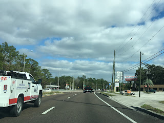
FL 50 eastbound begins as a six lane surface highway and quickly enters Spring Hill. Brooksville is signed as 12 miles to the east and Orlando 77 miles to the east.

FL 50 east in Spring Hill first has a junction with CR 589/Deltona Boulevard. Oddly the "TO" FL 589/Suncoast Parkway shield is posted right next to the CR 589 shield.

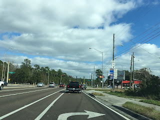
As FL 50 east continues through the Spring Hill shopping district it encounters CR 587 at Mariner Boulevard.


At Sunshine Grove Road FL 50 east encounters CR 493 which continues through Brookridge.


At Barclay Avenue FL 50 east encounters CR 585.


FL 50 east encounters the Suncoast Parkway on FL 589 at the northeast outskirt of Spring Hill.


East of FL 589/Suncoast Parkway the route of FL 50 eastbound enters the small community of Wiscon. At Wiscon Road FL 50 east encounters CR 570.

Presently FL 50 continues east on Cortez Boulevard from Wiscon to Brooksville. The original right of way for FL 50 originally utilized the following alignment from Wiscon to reach Brooksville:
- CR 570/Wiscon Road
- CR 484/Fort Dade Avenue
- Likely US 98 and FL 700 on Ponce de Leon Boulevard
- Likely Harvard Street to Broad Street.
The alignment described above can be seen on the Western 1936 Hernando County Road Map.
At Fort Dade Avenue FL 50 east meets CR 484.

Interestingly the original town site of Spring Mill is located two miles north of FL 50 on CR 484 on Fort Dade Avenue. All that's left of the original Spring Hill today is the cemetery.


Spring Hill first appeared on the Hernando County Map in 1856. The modern community of about 110,000 residents was part of a planned development dating back to 1967 centered around US 19 on Commercial Way and Spring Hill Drive.
1856 Hernando County Map
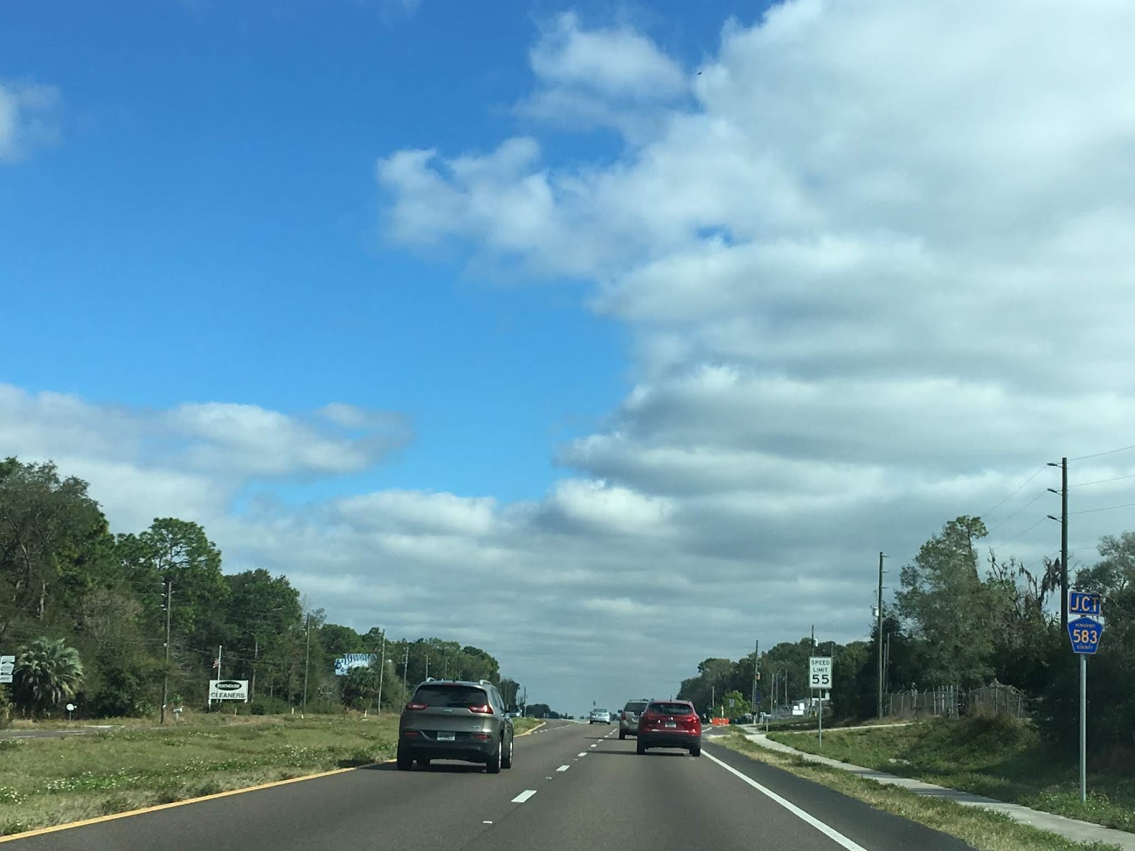
At California Street FL 50 east meets CR 583.

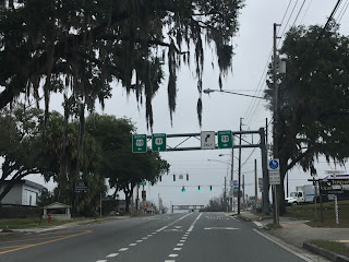
Approaching Cobb Street/CR 485 the route of FL 50 east enters the City of Brooksville. Modern FL 50 continues south of downtown on a bypass along Cortez Boulvard. FL 50A which is an older alignment of FL 50 continues directly into downtown Brooksville on Jefferson Street.


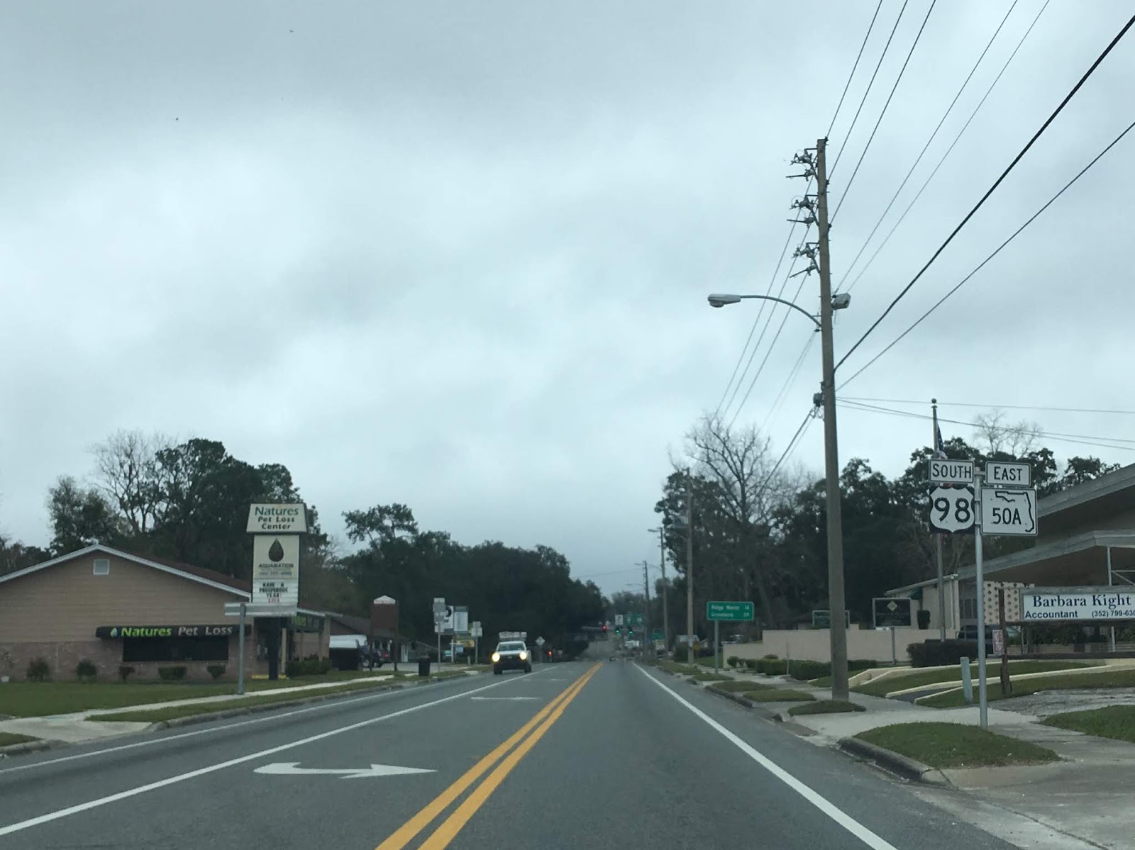
Detouring from the FL 50 mainline the route of FL 50A continues on Jefferson Street where it picks up US Route 98 south (yes it's signed south) at Ponce de Leon Boulevard. Oddly the normally hidden FL 700 splits away briefly from US 98 on Ponce de Leon Boulevard and continues south to Broad Street.


East of Ponce de Leon Boulevard the community of Ridge Manor is signed as being 14 miles to the east. FL 50A east and US 98 south meet US 41 south at Mildred Avenue. FL 50A east and US 98 south begin a one-way configuration that starts on Mildred Avenue and continues onto Broad Street.


FL 50A east/US 98 south/US 41 north use Broad Street through downtown Brooksville. Conversely FL 50A west/US 98 north/US 41 south use Jeffereson Street.

Brooksville is the County Seat of Hernando County, at Main Street the County Courthouse can be seen. Before the 1945 Highway Renumbering the right of way through Brooksville actually turned south on Main Street and east on Dr. Martin Luther King Boulevard. US 41 northbound likely used Main Street and Howell Avenue to exit Brooksville originally. Main Street is actually part of Hernando County Route 445.


The Hernando County Courthouse is a Florida Heritage site. The historic marker is actually incorrect as Brooksville is the second Hernando County Seat after Bayport. The Hernando County Courthouse was built in 1913.


North of Jefferson Street the site of Weeks Hardware is located on Main Street. Weeks Hardware has been in business since 1913.

East of downtown Jefferson Street intersects Broad Street. FL 50A east and US 98 south split from US 41 north on Jefferson Street.


Ridge Manor is signed as being 13 miles to the east on FL 50A east/US 98 south.

At Emerson Road FL 50A east/US 98 south meet CR 581.
FL 50A terminates at FL 50 on Cortez Boulevard east of downtown Brooksville. US 98 south begins a multiplex of FL 50 east towards Ridge Manor.


The mainline FL 50 east route bypassing downtown Brooksville is far more conventional on Cortez Boulevard. FL 50 on Cortez Boulevard is slightly longer than FL 50A with Ridge Manor being signed as 17 miles away. Modern FL 50 on Cortez Boulevard appears on some topographical maps as being under construction during the late 1980s.

At Broad Street FL 50 east meets US 41. FL 50 east is signed as "TO" route for US 98 south.


At Main Street FL 50 east meets CR 445.

East of Main Street FL 50 east crosses a set of railroad tracks (FL 50A utilizes a bridge on Broad Street) and meets CR 581 at Emerson Road.


East of CR 581 there is a historic marker for the Upper Creek Settlement of Chocochatti which was located nearby. Chocochatti was first inhabited as early 1767 and remained an active settlement until the Upper Creek were forced to move in 1836 after the passage of the 1830 Indian Removal Act.

East of the Chocochatti historic marker FL 50 east meets the east terminus of FL 50A and US 98. FL 50 east begins a multiplex of US 98 on Cortez Boulevard towards I-75.


East of Brooksville FL 50 east/US 98 south opens up to an expressway. At Spring Lake Highway/Mondon Hill Road the route of FL 50 east/US 98 south meets CR 484 and CR 541. CR 541 was once part of FL 41 which continues southward towards Dade City.

Modern FL 50 east/US 98 south continue directly east on Cortez Boulevard towards the Withlacoochee River and Ridge Manor. The original right of way shown on the 1936 Hernando County Road Maps reveals a far different alignment which began near Spring Lake Highway:
- The original highway split from Cortez Boulevard on Olympia Road.
- Olympia Road eastward to Spring Lake Highway.
- Spring Lake Highway south to Old Trilby Road.
- Old Trilby Road eastward on an alignment that no longer exists to the vicinity of I-75 and Cortez Boulevard at a community known as Rital near the Withlacoochee River.
East of Spring Lake Highway the route of FL 50 east/US 98 south enters a small community known as Rolling Acres. Ridge Manor is signed as being 7 miles away to the east with Orlando being signed 62 miles to the east.

Approaching I-75 the route of FL 50 east/US 98 south is presently shifted for in a construction of a new overpass. The previous interchange with I-75 at FL 50/US 98 was substandard in height and width.


East of I-75 the route of FL 50 east/US 98 south crosses by Croom-Rital Road which was once part of FL 39. Croom-Rital Road continues northward into Withlacoochee State Forest and generally follow the Withlacoochee River.


East of Croom-Rital Road the route of FL 50 east/US 98 south crosses under the Withlacoochee State Trail. While the overpass is modern much of the Withlacoochee State Trail is located on a former rail grade which followed the Withlacoochee River.

East of the Withlacoochee State Trail the route of FL 50 east/US 98 south enters Ridge Manor and crosses the Withlacoochee River.


The original right of way east of the Withlacoochee River as described on the 1936 Hernando County Road Map split from Cortez Boulevard onto Ridge Manor Boulevard. The original highway emerged east of US 301 at the front entrance of a phosphate mine immediately north of FL 50 on Cortez Boulevard.
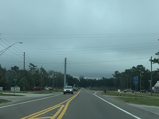
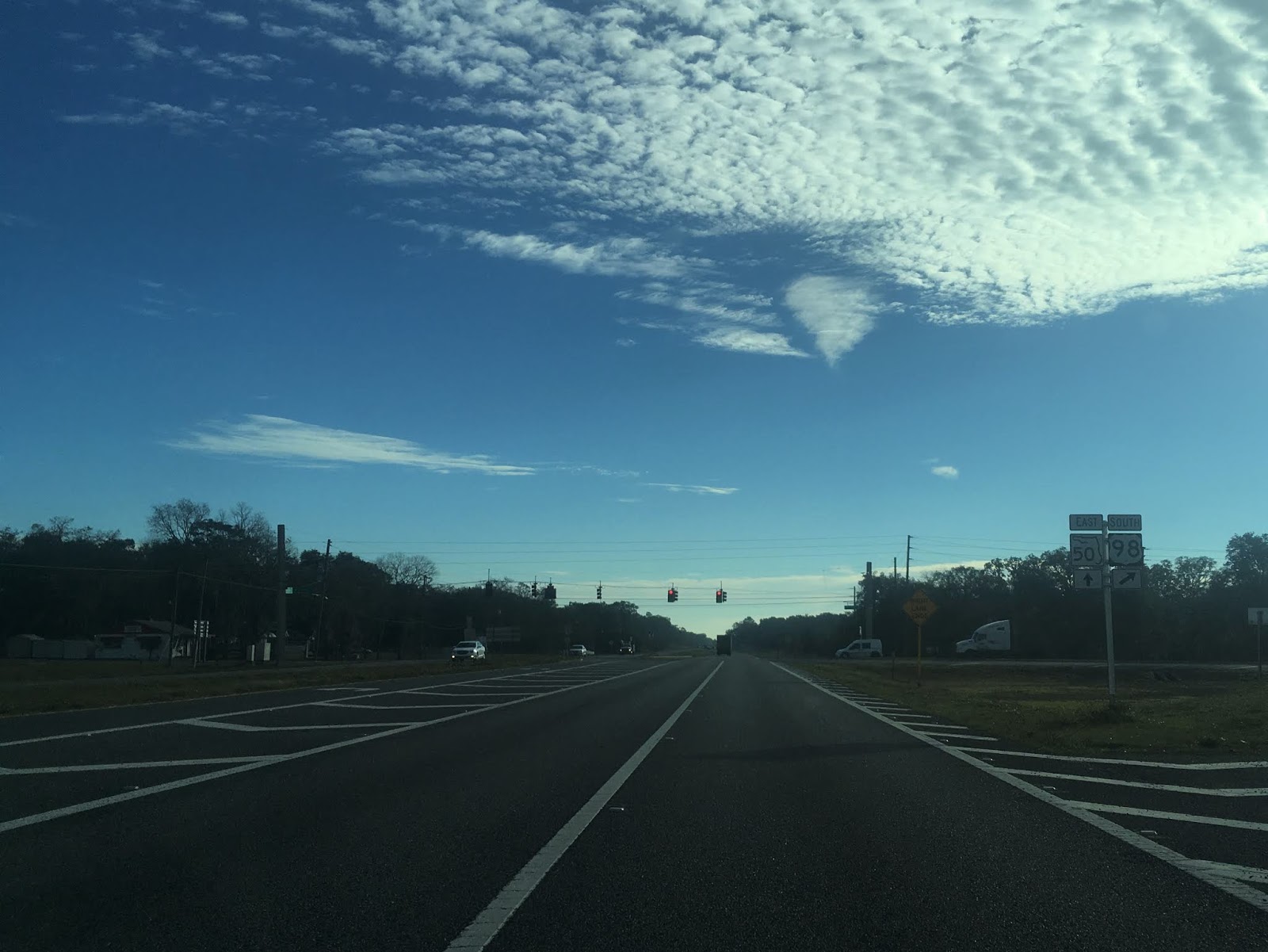
At McKethan Road US 98 south splits away from FL 50 east towards Dade City. FL 50 east continues on Cortez Boulevard and drops to a two-lane highway. Groveland is signed 24 miles to the east and Orlando is shown as 54 miles eastward.


I could never really truly find an answer to the naming convention of "Ridge Manor." My suspicion is that the name comes from the nearby Brooksville Ridge coupled with this mansion located at Cortez Boulevard and Emerald Drive.

At Treiman Boulevard the route FL 50 east intersects US 301.


East of US 301 the route of FL 50 east crosses a set of railroad tracks and meets a junction with CR 575 at Burwell Road.


East of CR 575 the route of FL 50 enters the Green Swamp and Withlacoochee State Forest. The Green Swamp lies on a small plateau which forms the head waters of the Withlacoochee and Little Withlacoochee River. The Green Swamp is one of the largest largely undeveloped wet lands in Florida and still spans about 560,000 acres. Much of the Green Swamp is protected as part of Withlacoochee State Forest and the Green Swamp Wilderness Preserve.

The original highway right of way described on the 1936 Hernando County Road maps split from FL 50/Cortez Boulevard at Richloam-Clay Sink Road. The original highway crossed over an Atlantic Coast Line rail grade to the community of Richloam where continued to the Little Withlacoochee River and Sumter County Line on Riverland Road.


Part 3 of this series covers the route of FL 50 in Lake County:
Florida State Road 50 Part 3; Lake County
Part 4 of this series covers the route of FL 50 in Orange County and Brevard County:
Florida State Road 50 Part 4; Orange County and Brevard County

FL 50 is an approximately 114 mile State Road stretching across the state from US 19 in Weeki Wachee near the Gulf of Mexico east to US 1 in Titusville on the Indian River. FL 50 was designated in during the 1945 State Road renumbering as one of the X0 Roadways. The X0 State Roads designate an east/west Road that is considered to be the most significant. Conversely X5 State Roads designate what was considered to be the most important north/south Roads. The X0 State Roads ascend southward whereas the X5 State Roads ascend westward. This in effect created a grid system that the Florida State Roads still generally adhere to. FL 50 is also the general starting point for all 5XX State Roads which by the numbering convention should be between FL 50 and FL 60.
Prior to 1945 Florida State Roads were numbered in the order they were designated by the State Legislature. From 1923 State Roads were added in a generally illogical manner and often had spurs routes. The system was one of the earliest examples of a total State Highway renumbering that was meant to aid motorists navigation. FL 50 was created in 1945 from the following highways:
- FL 15 from Weeki Wachee east to Brooksville. (this was the original US 19 alignment)
- FL 51/34 from Brooksville to Rolling Acres
- FL 51 from Rolling Acres to Ridge Manor
- FL 51/210 from Ridge Manor to Mabel
- FL 51/22 from Mabel to Mascotte
- FL 51/22/2 from Mascotte to Groveland (there appears to have been several spur FL 2s west to Hernando County and the Green Swamp)
- FL 51/22 from Groveland to Tildenville
- FL 51/22/208 through Tildenville
- FL 51/22/434 from Tildenville to Minorville
- FL 51/22 from Minorville to Gotha
- FL 51/22 from Gotha to Orlando
- FL 22 from Orlando to Indian River City in modern Titusville
While I don't have maps for every county showing the 1945 State Roads I have located several along with many pre-1945 State Road maps.
Pre-1945 State Road Maps
1931 Florida State Road Map
1939 Florida State Road Map
1940 Florida State Road Map
1936 West and East Hernando County Road Maps
West Hernando County
East Hernando County
1936 Sumter County Road Map
Mid-Sumter County Road Map
1936 Lake County Road Map
Mid-Lake County Road Map
1934-1935 General highway map Orange County
Orange County Road Map
1936 Brevard County Road Map
North-Brevard County Road Map
The only extension of FL 50 post-1945 was west from US 19 to the Gulf of Mexico at the Bayport ghost town on what is now Hernando County Route 550. This extension appears to have taken place in the 1950s as can be seen on the 1956 State Road Map below.
1956 Florida State Road Map
The last topographical map I can find showing FL 50 at Bayport was from 1990. I'm uncertain on the exact time frame FL 50 was truncated back to US 19.
FL 50 once began at the mouth of the Weeki Wachee River at the Gulf of Mexico in Bayport. Much of town of Bayport today is part of Bayport Park. When FL 50 was extended Cortez Boulevard was routed all the way to the Weeki Wachee River. There is now a historic marker for the town of Bayport now where FL 50 once ended.


At the entrance of Bayport Park CR 550 and Cortez Boulevard begin.


Approximately 2 miles east of Bayport CR 550/Cortez Boulevard has a junction with CR 495. CR 495 continues north to Pine Island and was once signed as part of FL 595 when FL 50 was still routed to Bayport.

East of CR 495 the route of CR 550/Cortez Boulevard passes CR 597/Shoal Line Boulevard and travels approximately 4 miles east to Weeki Wachee. CR 550 terminates at US 19/FL 50 in Weeki Wachee. FL 50 begins it's 114 mile trek eastbound towards Titusville on Cortez Boulevard. The segment of FL 50 east from Weekie Wachie was part of the original alignment of US 19 when it was extended to Florida in 1930.

FL 50 eastbound begins as a six lane surface highway and quickly enters Spring Hill. Brooksville is signed as 12 miles to the east and Orlando 77 miles to the east.

FL 50 east in Spring Hill first has a junction with CR 589/Deltona Boulevard. Oddly the "TO" FL 589/Suncoast Parkway shield is posted right next to the CR 589 shield.

As FL 50 east continues through the Spring Hill shopping district it encounters CR 587 at Mariner Boulevard.


At Sunshine Grove Road FL 50 east encounters CR 493 which continues through Brookridge.


At Barclay Avenue FL 50 east encounters CR 585.


FL 50 east encounters the Suncoast Parkway on FL 589 at the northeast outskirt of Spring Hill.


East of FL 589/Suncoast Parkway the route of FL 50 eastbound enters the small community of Wiscon. At Wiscon Road FL 50 east encounters CR 570.

Presently FL 50 continues east on Cortez Boulevard from Wiscon to Brooksville. The original right of way for FL 50 originally utilized the following alignment from Wiscon to reach Brooksville:
- CR 570/Wiscon Road
- CR 484/Fort Dade Avenue
- Likely US 98 and FL 700 on Ponce de Leon Boulevard
- Likely Harvard Street to Broad Street.
The alignment described above can be seen on the Western 1936 Hernando County Road Map.
At Fort Dade Avenue FL 50 east meets CR 484.

Interestingly the original town site of Spring Mill is located two miles north of FL 50 on CR 484 on Fort Dade Avenue. All that's left of the original Spring Hill today is the cemetery.


Spring Hill first appeared on the Hernando County Map in 1856. The modern community of about 110,000 residents was part of a planned development dating back to 1967 centered around US 19 on Commercial Way and Spring Hill Drive.
1856 Hernando County Map
At California Street FL 50 east meets CR 583.
Approaching Cobb Street/CR 485 the route of FL 50 east enters the City of Brooksville. Modern FL 50 continues south of downtown on a bypass along Cortez Boulvard. FL 50A which is an older alignment of FL 50 continues directly into downtown Brooksville on Jefferson Street.


Detouring from the FL 50 mainline the route of FL 50A continues on Jefferson Street where it picks up US Route 98 south (yes it's signed south) at Ponce de Leon Boulevard. Oddly the normally hidden FL 700 splits away briefly from US 98 on Ponce de Leon Boulevard and continues south to Broad Street.


East of Ponce de Leon Boulevard the community of Ridge Manor is signed as being 14 miles to the east. FL 50A east and US 98 south meet US 41 south at Mildred Avenue. FL 50A east and US 98 south begin a one-way configuration that starts on Mildred Avenue and continues onto Broad Street.


FL 50A east/US 98 south/US 41 north use Broad Street through downtown Brooksville. Conversely FL 50A west/US 98 north/US 41 south use Jeffereson Street.

Brooksville is the County Seat of Hernando County, at Main Street the County Courthouse can be seen. Before the 1945 Highway Renumbering the right of way through Brooksville actually turned south on Main Street and east on Dr. Martin Luther King Boulevard. US 41 northbound likely used Main Street and Howell Avenue to exit Brooksville originally. Main Street is actually part of Hernando County Route 445.


The Hernando County Courthouse is a Florida Heritage site. The historic marker is actually incorrect as Brooksville is the second Hernando County Seat after Bayport. The Hernando County Courthouse was built in 1913.


North of Jefferson Street the site of Weeks Hardware is located on Main Street. Weeks Hardware has been in business since 1913.

East of downtown Jefferson Street intersects Broad Street. FL 50A east and US 98 south split from US 41 north on Jefferson Street.


Ridge Manor is signed as being 13 miles to the east on FL 50A east/US 98 south.

At Emerson Road FL 50A east/US 98 south meet CR 581.

FL 50A terminates at FL 50 on Cortez Boulevard east of downtown Brooksville. US 98 south begins a multiplex of FL 50 east towards Ridge Manor.


The mainline FL 50 east route bypassing downtown Brooksville is far more conventional on Cortez Boulevard. FL 50 on Cortez Boulevard is slightly longer than FL 50A with Ridge Manor being signed as 17 miles away. Modern FL 50 on Cortez Boulevard appears on some topographical maps as being under construction during the late 1980s.

At Broad Street FL 50 east meets US 41. FL 50 east is signed as "TO" route for US 98 south.


At Main Street FL 50 east meets CR 445.

East of Main Street FL 50 east crosses a set of railroad tracks (FL 50A utilizes a bridge on Broad Street) and meets CR 581 at Emerson Road.


East of CR 581 there is a historic marker for the Upper Creek Settlement of Chocochatti which was located nearby. Chocochatti was first inhabited as early 1767 and remained an active settlement until the Upper Creek were forced to move in 1836 after the passage of the 1830 Indian Removal Act.

East of the Chocochatti historic marker FL 50 east meets the east terminus of FL 50A and US 98. FL 50 east begins a multiplex of US 98 on Cortez Boulevard towards I-75.


East of Brooksville FL 50 east/US 98 south opens up to an expressway. At Spring Lake Highway/Mondon Hill Road the route of FL 50 east/US 98 south meets CR 484 and CR 541. CR 541 was once part of FL 41 which continues southward towards Dade City.

Modern FL 50 east/US 98 south continue directly east on Cortez Boulevard towards the Withlacoochee River and Ridge Manor. The original right of way shown on the 1936 Hernando County Road Maps reveals a far different alignment which began near Spring Lake Highway:
- The original highway split from Cortez Boulevard on Olympia Road.
- Olympia Road eastward to Spring Lake Highway.
- Spring Lake Highway south to Old Trilby Road.
- Old Trilby Road eastward on an alignment that no longer exists to the vicinity of I-75 and Cortez Boulevard at a community known as Rital near the Withlacoochee River.
East of Spring Lake Highway the route of FL 50 east/US 98 south enters a small community known as Rolling Acres. Ridge Manor is signed as being 7 miles away to the east with Orlando being signed 62 miles to the east.

Approaching I-75 the route of FL 50 east/US 98 south is presently shifted for in a construction of a new overpass. The previous interchange with I-75 at FL 50/US 98 was substandard in height and width.


East of I-75 the route of FL 50 east/US 98 south crosses by Croom-Rital Road which was once part of FL 39. Croom-Rital Road continues northward into Withlacoochee State Forest and generally follow the Withlacoochee River.


East of Croom-Rital Road the route of FL 50 east/US 98 south crosses under the Withlacoochee State Trail. While the overpass is modern much of the Withlacoochee State Trail is located on a former rail grade which followed the Withlacoochee River.

East of the Withlacoochee State Trail the route of FL 50 east/US 98 south enters Ridge Manor and crosses the Withlacoochee River.


The original right of way east of the Withlacoochee River as described on the 1936 Hernando County Road Map split from Cortez Boulevard onto Ridge Manor Boulevard. The original highway emerged east of US 301 at the front entrance of a phosphate mine immediately north of FL 50 on Cortez Boulevard.
At McKethan Road US 98 south splits away from FL 50 east towards Dade City. FL 50 east continues on Cortez Boulevard and drops to a two-lane highway. Groveland is signed 24 miles to the east and Orlando is shown as 54 miles eastward.


I could never really truly find an answer to the naming convention of "Ridge Manor." My suspicion is that the name comes from the nearby Brooksville Ridge coupled with this mansion located at Cortez Boulevard and Emerald Drive.

At Treiman Boulevard the route FL 50 east intersects US 301.


East of US 301 the route of FL 50 east crosses a set of railroad tracks and meets a junction with CR 575 at Burwell Road.


East of CR 575 the route of FL 50 enters the Green Swamp and Withlacoochee State Forest. The Green Swamp lies on a small plateau which forms the head waters of the Withlacoochee and Little Withlacoochee River. The Green Swamp is one of the largest largely undeveloped wet lands in Florida and still spans about 560,000 acres. Much of the Green Swamp is protected as part of Withlacoochee State Forest and the Green Swamp Wilderness Preserve.

The original highway right of way described on the 1936 Hernando County Road maps split from FL 50/Cortez Boulevard at Richloam-Clay Sink Road. The original highway crossed over an Atlantic Coast Line rail grade to the community of Richloam where continued to the Little Withlacoochee River and Sumter County Line on Riverland Road.


FL 50 east on Cortez Boulevard crosses over the Little Withlacoochee River into Sumter County.


Part 2 of this series covers the route of FL 50 in Sumter County:
Part 3 of this series covers the route of FL 50 in Lake County:
Florida State Road 50 Part 3; Lake County
Part 4 of this series covers the route of FL 50 in Orange County and Brevard County:
Florida State Road 50 Part 4; Orange County and Brevard County
Comments