Viewpoints in Seattle; Dr. Jose Rizal Park, Jose Rizal Bridge, South Day Street Park and East Portal Viewpoint
Before leaving Seattle I checked out some of the more notable view points in the city; Dr. Jose Rizal Park and the East Portal Viewpoint.

Dr. Jose Rizal Park is located south of I-90 on 12th Avenue on Beacon Hill. The park dates back to the late 1970s and overlooks downtown Seattle looking northwest over I-5. Safeco Field, Centurylink Field, Smith Tower, Pioneer Square, the Seattle Waterfront and Columbia Center are all clearly visible.

At the intersection of 12th Avenue and Charles Street the Jose Rizal Bridge can be seen. The Jose Rizal Bridge was built in 1911 and was originally known 12th Avenue Bridge. The first permanent steel bridge installed in Seattle, it currently crosses over I-90.

South Day Street Park is located at the intersection of Day Street and Lake Side Avenue on the shores of Lake Washington. The substructure of Homer M. Hadley Memorial Bridge and Lacey V. Murrow Memorial Bridge can be seen from the shore of Lake Washington. The Murrow Bridge 6,620 foot long floating bridge which opened in 1940 and carries the eastbound lanes of I-90. The Hadley Bridge is 5,811 foot long floating bridge which carries westbound I-90 traffic and was opened in 1989.

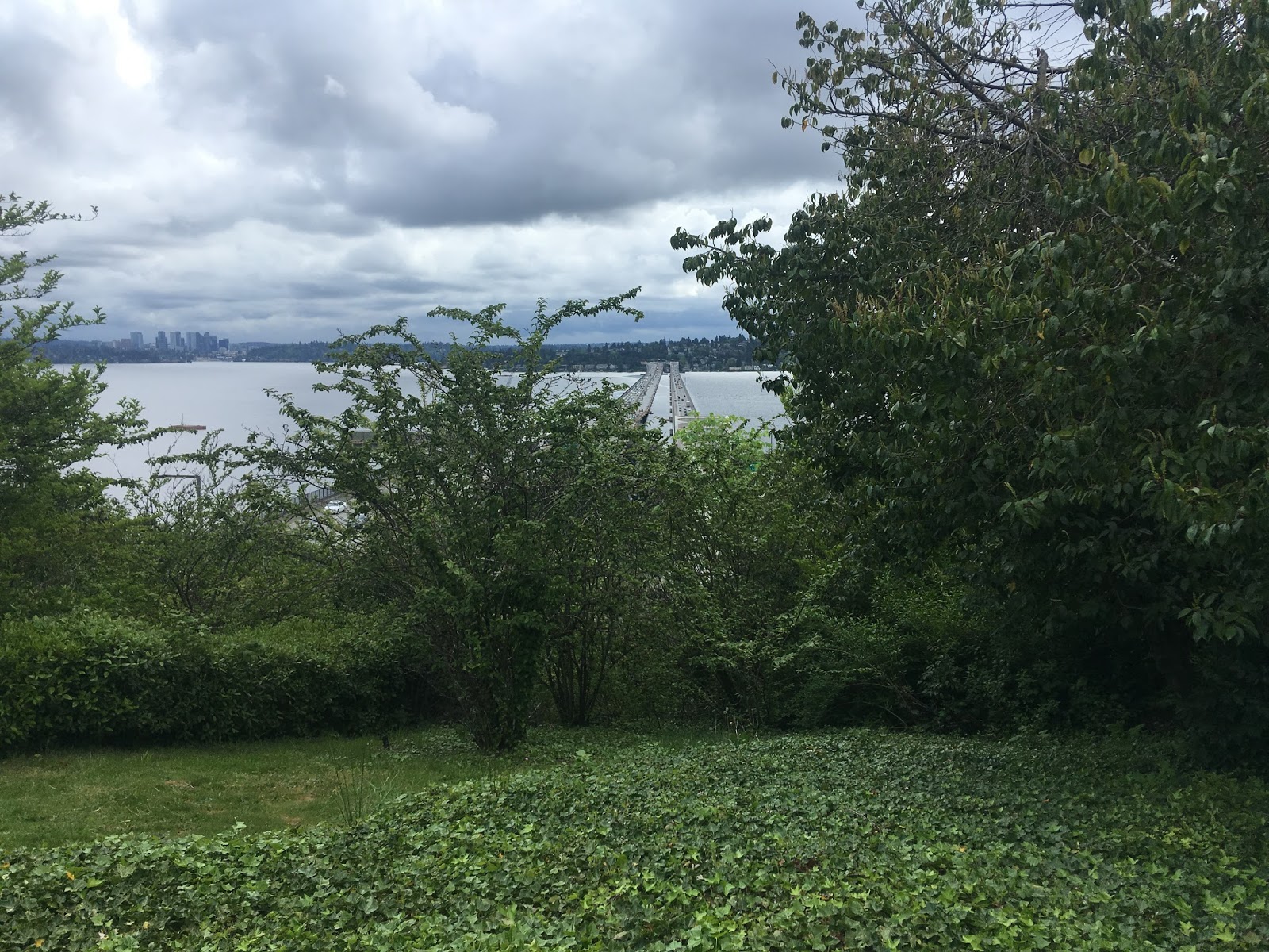
East Portal Viewpoint can be accessed from Lake Washington Boulevard. The East Portal Viewpoint overlooks the Hadley and Murrow Bridges as it crosses Lake Washington towards Bellevue.


Dr. Jose Rizal Park is located south of I-90 on 12th Avenue on Beacon Hill. The park dates back to the late 1970s and overlooks downtown Seattle looking northwest over I-5. Safeco Field, Centurylink Field, Smith Tower, Pioneer Square, the Seattle Waterfront and Columbia Center are all clearly visible.

At the intersection of 12th Avenue and Charles Street the Jose Rizal Bridge can be seen. The Jose Rizal Bridge was built in 1911 and was originally known 12th Avenue Bridge. The first permanent steel bridge installed in Seattle, it currently crosses over I-90.

South Day Street Park is located at the intersection of Day Street and Lake Side Avenue on the shores of Lake Washington. The substructure of Homer M. Hadley Memorial Bridge and Lacey V. Murrow Memorial Bridge can be seen from the shore of Lake Washington. The Murrow Bridge 6,620 foot long floating bridge which opened in 1940 and carries the eastbound lanes of I-90. The Hadley Bridge is 5,811 foot long floating bridge which carries westbound I-90 traffic and was opened in 1989.

East Portal Viewpoint can be accessed from Lake Washington Boulevard. The East Portal Viewpoint overlooks the Hadley and Murrow Bridges as it crosses Lake Washington towards Bellevue.


Comments