Interstate 80 east of the City of Sacramento ascends into the Sierra Nevada Mountains towards the Nevada State Line. Interstate 80 climbs to the 7,240 foot high Donner Summit and gradually descends into Nevada following the course of the Truckee River Canyon. Interstate 80 in the Sierra Nevada Mountains builds upon the historic corridors of; the Dutch Flat & Donner Lake Road, First Transcontinental Railroad, the Lincoln Highway, Victory Highway and US Route 40.
Part 1; the history of Interstate 80 in the Sierra Nevada MountainsEven prior to the California Gold Rush the present corridor of Interstate 80 was well known due to the relatively low crossing of the Sierra Nevada Mountains via what now is known as Donner Pass. The first known wagon crossing of Donner Pass occurred during 1844. The infamous Donner Party saga occurred in the winter of 1846-47 during which only 48 of the 87 party members survived. Although the Donner Party incident is largely attributed to poor planning and the ill-conceived Hastings Cutoff it largely led to the infamous reputation of Donner Pass.
During 1861 the State of California granted the Central Pacific Railroad a 10-year franchise on toll rights to the Dutch Flat & Donner Lake Road (DF&DLR) which completed by 1864. The DF&DLR was used to finance the Central Pacific Railroad's construction of the First Transcontinental Railroad from 1864 to 1868. The DF&DLR was likely not tolled after the Central Pacific Railroad was completed over the Sierra Nevada Mountains during Spring of 1868. The DF&DLR became a public highway in 1871 and was only loosely maintained given rail service had become the easiest form of transportation over Donner Pass. The website below goes into far more detail about the Dutch Flat & Donner Lake Wagon Road.
Dutch Flat and Donner Lake Toll Road on cprr.org
In addition to the DF&DLR there was two additional wagon routes that were used near Donner Pass; Coldstream Pass and Roller Pass. Both routes were apparently in use by 1846 when the Donner Party had reached Donner Pass. This site has some excellent links to maps showing all the wagon routes alongside Donner Pass Road in addition to the rail alignments.
Donner Pass Wagon, Highway, and Railroad Routes on donsnotes.com
Below the Central Pacific Railroad can be seen on the 1873 Bancroft's Map of California, Nevada, Utah and Arizona. The DLDLWR essentially acted as a frontage road of the Central Pacific Railroad in the Sierra Nevada Mountains.
The DF&DLR in its original form can be viewed on this
1889 Topographical Map of the Donner Pass Area. At Donner Pass the DF&DLR can be seen crossing the Central Pacific Railroad several times heading east from Donner Pass to the north shore of Donner Lake. It should be noted that the DF&DLR crosses the Placer County Line and Nevada County Line numerous times.

The emergence of the automobile in the early 20th Century led to the 1909 First State Highway Bond Act which was approved by voters during 1910. The majority of the highways approved as part of the First State Highway Bond Act were largely well-established routes of travel which included much of the DF&DLR. According to CAhighways.org the DF&DLR was adopted as part of the Emigrant Gap State Road under Legislative Chapter 224 with the following description:
"An act to make an appropriation for the location, survey and construction of a state highway from Emigrant Gap...to the west end of Donner Lake..."
"...for the location, survey, and construction of a state highway from Emigrant Gap, Placer County in an E-ly direction through what is known as the Truckee Pass (Donner Pass) to the W end of Donner Lake in Nevada County... and it shall be the duty of the department to locate, survey, and construct said road along the line of the wagon road known as the Dutch Flat and Donner Lake wagon road..."
The 1909 First State Highway Bond Act also defined other State Highways would become components of Interstate 80 east of Sacramento. What would become
LRN 17 was defined during the 1909 First State Highway Bond Act as a highway aligned from Roseville to Nevada City. LRN 17 between Roseville to Auburn would eventually become part of the corridor of Interstate 80. The original definition of
LRN 3 was from Sacramento to the Oregon Line. LRN 3 between Sacramento and Roseville would eventually become part of Interstate 80.
The
May 1913 California Highway Bulletin notes that streets within incorporated cities could not be yet maintained as State Highways. The City of Roseville is cited to have passed a bond measure to improve the implied through route of LRN 3 to State Highway standards. Author's note: the concept of no self-respecting city allowing one of their streets to be maintained by a State Transportation Department is laughable through modern lenses.
During 1915 Legislative Chapter 203 extended LRN 37 with the following definition:
"....the wagon road extending along W side of Lake Tahoe, from McKinney's in El Dorado Cty to Tahoe City, connecting with the present state highway from Emigrant Gap"
1915 Legislative Chapter 678 made a further extension of LRN 37:
"...the county road extending from Auburn in an E-ly direction and connecting with the Emigrant Gap state road at a point near Emigrant Gap."
The 1916 Legislative Chapter 619 added the following provision to the Emigrant Gap State Highway (LRN 37):
"for making a change in the location of the Emigrant Gap state road so as to eliminate the grade crossing of said road over the railroad track near Summit Station provided that the Southern Pacific company shall contribute not less than $3,500 for the same person."
The above measure served to remove the at-grade rail crossing on LRN 37 took at Central Pacific Railroad Tunnel #6 (which was leased to the Southern Pacific in 1885) and replaced it with underpass between Tunnel #7 and Tunnel #8 in Donner Pass. The Gribblenation blog explores the Donner Pass underpass and early Northern Lincoln Highway/Victory Highway:
1919 Third State Highway Bond Act added an addition to LRN 38 with the following definition:
"A certain highway Nevada and Sierra counties, running as follows: From a point in the town of Truckee where the present state highway branches at the subway under the Southern Pacific tracks going toward Lake Tahoe, continuing through the town of Truckee, crossing Prosser Creek and over what is known as the "Dog Valley Grade" as far as the state line about 1 mi NW of Verdi, Nevada..."
The Victory Highway was formally organized during 1921 as a coast-to-coast highway aligned from New York to San Francisco. The Victory Highway Association lived on after the creation of the US Route System and became the US Route 40 Association in 1938.
During 1912 Indiana Businessman Carl G. Fisher conceptualized the Lincoln Highway as a major transcontinental Auto Trail. The Lincoln Highway was formally dedicated on October 31st, 1913 and was aligned west of Fallon via split branches over the Sierra Nevada Mountains. The original northern branch of the Lincoln Highway (displayed in blue) is shown on the Lincoln Highway Association's Official Map from Sacramento eastward to Verdi, Nevada.
Sacramento-Roseville
Roseville-Newcastle-Auburn
Auburn-Weimar
Weimar-Dutch Flat
Dutch Flat-Emigrant Gap
Emigrant Gap-Donner Pass
Donner Pass-Truckee-Nevada State Line
1923 Legislative Chapter 100 amended the 1919 Third State Highway Bond Act addition of LRN 37 as
LRN 38 with the following definition:
"From a point in the town of Truckee where the present state highway branches at the subway under the Southern Pacific tracks going toward Lake Tahoe, continuing through the Town of Truckee and by the most practicable route to the Nevada State Line at or near Verdi, Nevada"
The
June 1924 California Highways & Public Works noted the initial grading LRN 38 between Truckee along the Truckee River to Boca was underway. Grading on a new alignment of LRN 37 over Donner Pass is stated to be underway.
The new grade of LRN 37 from Donner Pass to Donner Lake appears as the cover of the
November 1924 California Highways & Public Works. The attached article notes the new road to Donner Pass carried a 7% grade compared to the 18% grade of the previous alignment. The new alignment of LRN 37 over Donner Pass is stated to have been completed by October 25th, 1924.
The
June 1925 California Highways & Public Works noted surveys were underway to find the final location of LRN 38 within Truckee. The grading of LRN 37 in the Colfax-Gold Run corridor is stated to have been recently completed.
The
September 1925 California Highways & Public Works referenced paving operations as being nearly completed in the Auburn-Colfax corridor of LRN 37.

The initial draft of the US Route System was approved by the Secretary of Agriculture during November of 1925. The US Route System within California was approved by California Highway Commission ("CHC") with no changes recommended by
January 1926. The alignment of US Route 40 (US 40) east of Sacramento was planned to follow the existing Northern Branch of the Lincoln Highway and Victory Highway over LRN 3, LRN 17, LRN 37 and LRN 38 to the Nevada State Line at Verdi.
Thusly US 40 appears on the 1925 Rand McNally Map of California east of Sacramento to Verdi, Nevada.
The January 1926 California Highways & Public Works features the recently completed LRN 37 in the corridor of Colfax-Gold Run. Interestingly the article notes LRN 37 in the Colfax-Gold Run to be part of US 40 despite the US Route System not having been finalized.
The May 1926 California Highways & Public Works announced a contract to surface LRN 37 between Colfax-Emigrant Gap had recently been awarded. LRN 38 in the Truckee River Canyon between Truckee and the Nevada State Line is stated to have been fully graded. The new segment of LRN 38 is stated to have a planned opening on June 10th, 1926 and is noted to bypass the infamous Dog Valley Grade.
The completed Donner Summit Bridge appears on the cover of the September 1926 California Highways & Public Works. The opening ceremony at the Donner Summit Bridge is depicted in the adjoining volume article.
The Donner Summit Bridge is commonly referred to as the "Rainbow Bridge." Former US 40 on Donner Pass Road from Truckee west to the Donner Summit Bridge/Rainbow Bridge is featured in the Gribblenation blog below:
Old US Route 40 on Donner Pass Road
The US Route System was formally approved by the American Association of State Highway Officials on November 11th, 1926. The approval of the US Route System formally brought US 40 into existence east of Sacramento to the Nevada State Line. Notably US 40 east of Sacramento to the Nevada State Line was referred to as the Victory Highway in numerous official documents into the 1930s.
The April 1927 California Highways & Public Works announced the CHC decided to eliminate numerous railroad crossings on US 40/LRN 37 in the Auburn-Colfax corridor.
The Donner Summit Bridge as seen in November 1927 California Highways & Public Works.
The January 1928 California Highways & Public Works announced surfacing projects on US 40/LRN 37 from Cisco-Soda Springs and Donner Monument-Tahoe Junction. Six railroad separations on US 40/LRN 37 were also announced.
The May/June 1928 California Highways & Public Works announced overhead crossings on US 40/LRN 37 in Bowman and Weimar had been recently completed.The November/December 1928 California Highways & Public Works referenced US 40/LRN 17 from Roseville to Rocklin was to the graded and surfaced.
The January/February 1929 California Highways & Public Works announced a 0.9 mile grade separation for US 40/LRN 17 in Newcastle was budgeted for the 1929-31 Fiscal Years. US 40/LRN 37 near Donner Pass as featured in the January/February 1929 California Highways & Public Works. The surfacing conditions on US 40 east of Auburn to the Nevada State Line as featured in the January/February 1929 California Highways & Public Works. US 40/LRN 37 at Donner Lake as seen in the October 1929 California Highways & Public Works. The October 1929 California Highways & Public Works announced US 40/LRN 38 was being applied with an experimental surfacing between Boca and the Nevada State Line. The surfacing project is stated to be a cooperative between the Division of Highways and Bureau of Public Roads. The December 1929 California Highways & Public Works features the recently widen segment of US 99E/US 40/LRN 3 in North Sacramento on Auburn Boulevard. The new alignment of US 99E/US 40/LRN 3 consisted of 8.7 miles of road surface expanded from 18 feet in width to 30 feet.
Concept art of the Newcastle Tunnel and a feature on the project can be found in the
November 1930 California Highways & Public Works. The existing alignment of US 40/LRN 17 in Newcastle through the Newcastle Subway is compared to the planned realignment through the Newcastle Tunnel.


US 40/LRN 37 at Donner Pass as seen in the January 1932 California Highways & Public Works.
The
February 1932 California Highways & Public Works noted the completion the Newcastle Tunnel had come on December 21st, 1931. The Newcastle Tunnel is stated to be in the process of a paving contract and was slated to open as a realignment of US 40/LRN 17 during the coming May.
The Newcastle Tunnel and the original alignment of US Route 40 through the 1910 Newcastle Subway (possibly the first State Highway Subway in California) can be observed in the below Gribblenation blog.
The
August 1932 California Highways & Public Works describes the upcoming realignment of US 40/LRN 37 in the Gold Run-Airport corridor. The Gold Run-Airport realignment of US 40/LRN 37 is stated to include the removal of three rail crossings. The article notes upon the completion of the Gold Run-Airport corridor US 40/LRN 37 between Auburn and Truckee would consist entirely of modern highway.
1933 was significant due to the State Legislature allowing the Division of Highways to assume maintenance of highways in Cities for the first time. This action by the Legislature led to a large addition of highway mileage throughout the State of California during 1933. The previous locally maintained segments of US 40 within cities were assumed under the maintenance of the Division of Highways.
The
March 1933 California Highways & Public Works notes the Gold Run-Airport realignment of US 40/LRN 37 was nearing completion. The article notes once the Gold Run-Airport upcoming corridor paving project had completed US 40 east of Sacramento to the Nevada State Line would be fully brought up to modern standards.
The
February 1934 California Highways Public Works featured the completed Gold Run-Airport realignment of US 40/LRN 37. The article stub notes the Gold Run-Airport corridor of US 40/LRN 37 was completed during late 1933. The last segment of US 40 east of Sacramento stated to remain unimproved was at the shore of Donner Lake.
The
April 1934 California Highways & Public Works features the progressing construction of realignment of US 40/LRN 17 in the Loomis-Newcastle corridor. The new alignment of US 40/LRN 17 in the Loomis-Newcastle corridor is stated to eliminate 42 curves and bypass Penryn. The Loomis-Newcastle corridor realignment of US 40/LRN 17 is stated to have an anticipated opening on May 29th 1934.
The 1935 Division of Highways Maps display where US 40 from Sacramento to Verdi, Nevada was located in detail.


The
April 1935 California Highways & Public Works featured the expansion of the American River Bridge in Sacramento on the alignment of US 99E/US 40/LRN 3. The American River Bridge is stated to have been built during 1915 as a 22 foot wide two lane structure. The American River Bridge was retrofitted and upgraded to a four lane alignment which featured a 44 foot road width. The expanded American River Bridge was dedicated by the Governor on March 24th, 1935. The original 1887 American River Bridge is discussed along with the flaws that led to its condemnation/demolition in 1914.
The
March 1936 California Highways & Public Works features snow plowing operations on US 40/LRN 37 at Donner Pass. The snow plowing operations largely consisted of a twenty-four-day snowstorm which only closed the highway for thirty-four hours. 1936 is largely considered the first year US 40/LRN 37 over Donner Pass was kept functionally open the duration of the winter season.
The beautification of US 40 east of Sacramento is featured in the
October 1937 California Highways & Public Works along with the progressing realignment/paving along Donner Lake. The beautification projects along with the Donner Lake realignment are stated in the article to have planned completion dates sometime during October 1937.
The
May 1939 California Highways & Public Works features the construction of the new US 40/LRN 37 bypass route of Colfax. The new alignment of US 40/LRN 37 in Colfax is stated to include a rail overpass and was anticipated to be complete sometime during June 1939.
US 40/LRN 37 at Donner Pass is depicted on the cover photo of the
March 1940 California Highways & Public Works. An accompanying article discusses snow plowing operations at Donner Pass.


The
February 1941 California Highways & Public Works announced a four-lane viaduct realignment of US 99E/US 40/LRN 3 around North Sacramento and Del Paso Boulevard was in the process of being arranged for funding. The existing alignment of US 99E/US 40/LRN 3 in North Sacramento on Del Paso Boulevard is cited to be flood prone and a continuous issue during rainy years. The new alignment of US 99E/US 40 is shown as a viaduct structure in the American River Overflow Channel.
The
June 1941 California Highways & Public Works announced the North Sacramento Viaduct across the American River as part of a realignment of US 99E/US 40 was put up for bid. The article states that construction of the North Sacramento River Viaduct and may break ground in July 1941.

The
October 1942 California Highways & Public Works featured the recently opened new alignment of US 99E/US 40/LRN 3 on the North Sacramento Viaduct. Completion of the North Sacramento Viaduct is stated to have been prioritized due to the ongoing American involvement in World War II and was dedicated on September 14th, 1942.
The
December 1942 California Highways & Public Works discusses snow plowing operations on US 50 at Echo Summit being scaled back due to World War II. US 40/LRN 37 over Donner Pass is stated in the article to remain open at the request of the U.S. Army.
The
July/August 1946 California Highways & Public Works noted the realignment of US 40 in Auburn was underway and included three major grade separations.


The
January/February 1947 California Highways & Public Works features the upcoming Roseville Underpass project to realign US 99E/LRN 3. The Roseville Underpass project would see US 99E/LRN 3 shifted to a new alignment via a 1,400-foot-long depression under the Southern Pacific Railroad via an extended Washington Boulevard which would intersect US 40 at Oak Street.
The
July/August 1947 California Highways & Public Works announced US 99E/US 40/LRN 3 would be realigned onto the new North Sacramento Freeway by September 1st, 1947 as part of the State Fair. The article notes it was unclear if the US 40 bypass would be open in time for the State Fair.
The relocation of US 99E/US 40/LRN 3 from the end of the North Sacramento Freeway via a bypass of Roseville was announced as being authorized by the California Highway Commission in the
September/October 1947 California Highways & Public Works. US 99E would depart the new freeway extension into Roseville via Riverside Avenue whereas US 40 would continue eastward on a full bypass of Roseville. The new freeway extension from the North Sacramento Freeway to Roseville is stated to be in the design stages.

The
July/August 1949 California Highways & Public Works notes the Auburn Freeway bypass was opened as a realignment of US 40 during November 1947. The article details the extension of the Auburn Freeway to Applegate which was bid upon during April 1949. The Auburn-Applegate corridor is stated to be in the process of construction.
The
March/April 1950 California Highways & Public Works features the opening of the Roseville Underpass. The Roseville Underpass opened to traffic on April 1st, 1950 and served as a realignment of US 99E and US 40 in downtown Roseville. US 99E/LRN 3 approached the Roseville Underpass via an extended Washington Boulevard and intersected US 40 at Oak Street.


The
July/August 1950 California Highways & Public Works notes the planned US 99E/US 40/LRN 3 freeway extension from the North Sacramento Freeway to Roseville was upheld by the California Supreme Court. The proposed realignment of US 99E/US 40/LRN 3 was challenged in Holloway vs. Purcell under the pretense that the California Highway Commission and Department of Public Works did not have the authority to relocate an existing highway which was authorized under provisions of the 1909 First State Highway Bond Act.
The proposed Elvas Freeway/LRN 98 first appears on the
1951 Division Highways Map branching from US 99E/US 40/LRN 3 southwards towards the American River and Sacramento.
Snow removal operations on US 40/LRN 37 at Donner Pass as depicted in the January/February 1952 California Highways & Public Works.


The
May/June 1955 California Highways & Public Works features the opening of the Elvas Freeway/LRN 98 from US 99E/US 40/LRN 3 across the American River to B Street in Sacramento on May 12th, 1955. The article stub notes that US 99E was moved to the new Elvas Freeway and followed one-way couplets via 29th Street/30th Street to Mainline US 99/LRN 4 at Broadway.
The
July/August 1955 California Highways & Public Works describes a recommended freeway realignment of US 40/LRN 17 between Roseville and Newcastle. The proposed freeway corridor between Roseville and Newcastle is stated to be considered by the CHC during August 1955. Construction of a new freeway grade along US 40/LRN 37 from Applegate 2.7 miles east to Heather Glen. A new freeway grade of US 40/LRN 17 between Newcastle and Auburn is stated to have a budgeted allocation for the 1955-56 Fiscal Year.


The new alignment of US 99E/LRN 98 on the Elvas Freeway and 29th/30th Streets appears on the
1956 Division of Highways Map. The shift of US 99E onto the Elvas Freeway left US 40 as the only highway on the North Sacramento Freeway.

The
May/June 1956 California Highways & Public Works announced the opening of the Ben Ali-Roseville Freeway as the new alignment US 99E/US 40/LRN 3 on April 24th, 1956. US 99E was rerouted from the end of the Elvas Freeway along the Ben Ali-Roseville Freeway to the Riverside Avenue Exit. The Newcastle-Auburn freeway, Heather Glen-Colfax expressway, Colfax-Magra expressway and Floriston- Nevada State Line expressway all are described as being budgeted for future realignments of US 40.
On June 29th, 1956, the Federal Highway Aid Act of 1956 was signed into law on the Federal Level. The Federal Highway Aid Act of 1956 was the genesis point of the Interstate Highway System which would in the coming decade sew the demise via of US 99 and US 40 in California. The Elvas Freeway, Ben Ali-Roseville Freeway and US 40 east of Roseville were ultimately selected to be incorporated into the alignment of Intestate 80.
The
September/October 1956 California Highways & Public Works features a progress report on US 40 east of Roseville. The Newcastle-Auburn expressway segment of US 40/LRN 17 is stated to be under construction and the Roseville-Newcastle freeway is stated to be in design stages. The new four-lane alignment of US 40/LRN 37 between Applegate and Heather Glen is stated to be complete. Freeway alignments of US 40 around Emigrant Gap and Donner Pass are stated to be under study.
The Ben Ali-Roseville Freeway and the new alignment of US 99E from the Elvas Freeway to Riverside Avenue in Roseville appear on the
1957 Division of Highways Map.

The
November/December 1957 California Highways & Public Works features numerous updates to US 40 in the Sierra Nevada Mountains. US 40/LRN 17 in the Newcastle-Auburn corridor is stated to be 75% complete. US 40/LRN 37 in the Heather Glen-Colfax corridor is stated to be in the process of grading. The US 40/LRN 37 freeway in the Colfax-Magra corridor as well as Truckee-Nevada State Line is noted to be in the process of construction.
An additional article in the
November/December 1957 California Highways & Public Works states US 40/LRN 37 freeway bypasses Emigrant Gap and Donner Pass were adopted. All active projects east of Roseville are stated to have anticipated completion dates during late 1959 in anticipation of the 1960 Squaw Valley Winter Olympics. The article notes US 40 in the Sierra Nevada Mountains to be part of the Interstate Highway System.
The
July/August 1958 California Highways & Public Works notes the US 40/LRN 17 freeway in the Newcastle-Auburn corridor was slated to open during the summer of 1958. The Heather Glen-Colfax freeway corridor of US 40/LRN 37 is stated to have an anticipated opening during summer 1958. The Colfax-Magra freeway corridor of US 40/LRN 37 is stated to have an anticipated opening during fall 1958. The Boca-Stateline freeway corridor of US 40/LRN 38 is stated to have an anticipated opening during summer 1958.

The July/August 1959 California Highways & Public Works notes the Roseville-Newcastle freeway alignment of US 40/LRN 17 was anticipated to open on December 1st, 1959. The Auburn-Heather Glen expressway corridor of US 40/LRN 37 is stated to be in the early stages of a freeway agreement with Placer County. The US 40/LRN 37 Heather Glen-Magra freeway corridor is stated to have been completed during 1958. The Baxter-Emigrant Gap freeway corridor of US 40/LRN 37 is stated to be under contract. The Hampshire Rocks-Soda Springs freeway corridor of US 40/LRN 37 is stated to have an anticipated opening during November 1959. The Donner Lake-Boca freeway corridor of US 40 is stated to have an anticipated opening during November 1959 and would bypass Truckee.


The
November/December 1959 California Highways & Public Works provides an update on the progression of US 40 being converted to a full freeway in the Sierra Nevada Mountains. The Gold Run-Emigrant gap corridor is stated to have an anticipated opening during 1961. Right of way for the Emigrant-Hampshire Rocks corridor is stated to be in the process of acquisition. Construction of the Donner Pass bypass corridor is stated to be ready to begin construction during 1960. Numerous new freeway segments on US 40 in the Sierra Nevada Mountains are displayed.


The
November/December 1961 California Highways & Public Works provides updates on the remaining segments of US 40 in the Sierra Nevada Mountains not yet converted to freeway standards. A 5.4-mile segment of US 40 freeway is stated to be in the process of construction. 6.3 miles of freeway near Cisco and a 10-mile segment over Donner Pass are stated to be funded. A 5-mile freeway segment west of Baxter is stated to have been completed during November 1961.

The
January/February 1962 California Highways & Public Works provides an update on the freeway conversion of US 40 (now noted also as Interstate 80) in the Sierra Nevada Mountains. The article notes US 40/Interstate 80 was aligned on 72 miles of continuous freeway/expressway from Sacramento to Emigrant Gap at the time of publishing. Numerous construction photos of the new alignment of US 40/Interstate 80/LRN 37 over Donner Summit are shown. The Emigrant-Hampshire Rocks corridor of US 40/Interstate 80/LRN 37 is stated to have an anticipated completion during 1963.
The
November/December 1962 California Highways & Public Works notes several updates to US 40/Interstate 80/LRN 37. The 5.4-mile segment of freeway east of Emigrant Gap is stated to have planned opening by Fall 1963. The 6.3-mile freeway segment near Cisco Grove is stated to have a planned opening during 1964. The new 10.5-mile alignment over Donner Summit is stated to have an anticipated opening during the summer of 1963.
The
March/April 1963 California Highways & Public Works provides an update to the Emigrant Gap, Cisco Grove and Donner Summit corridors of US 40/Interstate 80/LRN 37. The article notes US 40/Interstate 80 was expected to be completed to freeway standards over the Sierra Nevada Mountains sometime during 1964.
The Division of Highways submitted an application for US 40 to be truncated from San Francisco to California State Route 89 in Truckee on August 26th, 1963. In a letter to the AASHO dated September 24th, 1964 the California State Highway Engineer noted even through US 40 was approved by the Executive Committee to be truncated to Truckee signage would be retained until approximately 1967 when Interstate 80 was completed in the State. It is unclear the exact date US 40 was officially truncated to California State Route 89 in Truckee.
The
November/December 1963 California Highways & Public Works notes full scale of the Emigrant Hampshire Rocks corridor of US 40/Interstate 80/LRN 37 was anticipated to be completed by fall 1964. The opening of US 40/Interstate 80/LRN 37 over Donner Summit is stated to be upcoming during 1964.
During the 1964 State Highway Renumbering all the Legislative Route Numbers were dropped. US 40 east of Roseville appears legislatively as Interstate 80 on the
1964 Division of Highways Map. US 99E on the Elvas Freeway in Sacramento along with US 40/US 99E on the Ben Ali-Roseville Freeway are shown legislatively as Interstate 80.


The AASHO Renumbering database shows that US 99 was approved to be truncated out of California by the AASHO Executive Committee on June 29th, 1965. This measure would have become effective on New Years Day 1966. This measure removed US 99E from the Elvas Freeway and left only Interstate 80.


The planned realignment of Interstate 80 off of much of former US 99E on the Elvas Freeway and Ben Ali-Roseville Freeway is displayed on the
1966 Division of Highways Map.
The
1967 Division of Highways Map is the first edition to display US 40 truncated to Truckee in favor of standalone Interstate 80 over the Sierra Nevada Mountains.

On November 15th, 1974 the Nevada Department of Transportation in conjunction with states of California and Utah submitted a request to truncate US Route 40 from Truckee, California to Park City, Utah. The request to truncate US 40 was approved by the AASHO Executive Committee on June 17th, 1975. The request by Nevada to remove US Route 40 seems to have been spurred by the completion of Interstate 80 through Reno. This action officially removed US 40 from the State of Nevada and the Sierra Nevada Mountains of California.
1981 Legislative Chapter 292 defined much of former US 40/US 99E on the Ben Ali-Roseville Freeway and Elvas Freeway south to the American River as part of California State Route 51. Interstate 80 was moved to the corridor of the original Interstate 880 north of downtown Sacramento after attempts to rebuild the corridor through downtown Sacramento to Interstate standards fell through. California State Route 51 was legislatively mandated to be signed as Interstate 80 Business. Former Interstate 80 on the Ben Ali-Roseville Freeway, Elvas Freeway and the W/X Freeway appears as legislative California State Route 51 on the
1982 Caltrans Map.
Part 2; a drive on Interstate 80 from Sacramento over the Sierra Nevada Mountains to Reno
California State Route 51/Interstate 80 Business has a terminus in the eastern City limits of Sacramento and transitions onto modern Interstate 80. In 1996 the entirety of California State Route 51 and Interstate 80 Business (including US Route 50/hidden Interstate 305) was renamed to the Capitol City Freeway by the Sacramento Regional Planning Authority.
Interstate 80 eastbound Exit 96 accesses Madison Avenue.
Departing Sacramento Interstate 80 eastbound is signed as 7 miles from Roseville and 122 miles from Reno.
Interstate 80 eastbound Exit 98 accesses Elkhorn Boulevard and Greenback Lane.
Interstate 80 eastbound passes a weigh station and accesses Antelope Road at Exit 100.
At Exit 102 Interstate 80 eastbound accesses Auburn Boulevard.
Interstate 80 eastbound enters Placer County and City of Roseville.
Interstate 80 eastbound Exit 103 A&B access Douglas Boulevard.
Interstate 80 eastbound Exit 105A accesses Atlantic Street and Eureka Road whereas Exit 105B accesses Taylor Road and Pacific Street.
Interstate 80 eastbound Exit 106 accesses California State Route 65.
Interstate 80 east of California State Route 65 is signed as 13 miles from Auburn and 113 miles from Reno.

Interstate 80 eastbound Exit 108 accesses Rocklin Road.
Interstate 80 eastbound Exit 109 accesses Sierra College Boulevard.
Interstate 80 eastbound Exit 110 accesses Horseshoe Bar Road.
Interstate 80 eastbound Exit 112 accesses Penryn Road.

Interstate 80 eastbound Exit 115 accesses Newcastle Road.
Interstate 80 eastbound enters Newcastle and accesses the western segment of California State Route 193 at Exit 116.
Interstate 80 eastbound passes under the Piggy Back Bridge and accesses Maple Street at Exit 119A in Auburn. Exit 119B in Auburn accesses California State Route 49 north towards Grass Valley whereas Exit 119C accesses California State Route 49 south towards Placerville.
Interstate 80 eastbound Exit 120 accesses Lincoln Way whereas Exit 121 accesses Forest Hill Road.
Interstate 80 eastbound Exit 122 accesses Bowman.
Interstate 80 eastbound Exit 123 accesses Dell Road.
Interstate 80 eastbound Exit 124 accesses Dry Creek Road.
Interstate 80 eastbound Exit 125 accesses Meadow Vista and Clipper Gap.
East of Exit 125 Interstate 80 is signed as 10 miles from Colfax, 62 miles from Truckee and 96 miles from Reno.
Interstate 80 eastbound Exit 128 accesses Applegate.

Interstate 80 eastbound Exit 129 accesses Heather Glen and crosses the 2,000-foot elevation line.

Interstate 80 eastbound Exit 130 accesses West Paoli Lane.
Interstate 80 eastbound Exit 131 accesses Weimar and Cross Road.
Interstate 80 eastbound Exit 133 accesses Canyon Way and Placer Hills Road.
Interstate 80 eastbound Exit 135 accesses California State Route 174 in Colfax.
Interstate 80 eastbound crosses under the Union Pacific Railroad and Secret Town Road at Exit 140.
Interstate 80 east of Exit 140 climbs above 3,000 feet above sea level.
Interstate 80 eastbound Exit 143 accesses Gold Run.
East of Exit 143 Interstate 80 passes a Rest Area.


Interstate 80 eastbound Exit 145 accesses Dutch Flat.

Interstate 80 eastbound Exit 146 accesses Alta.
Interstate 80 eastbound Exit 148A accesses Crytal Springs whereas Exit 148B accesses Baxter.
East of Exit 148 A&B Interstate 80 climbs above 4,000 feet above sea level.

Interstate 80 eastbound Exit 150 accesses Drum Forebay Road.
East of Exit 150 Interstate 80 climbs above 5,000 feet above sea level.
Interstate 80 eastbound Exit 155 accesses Blue Canyon.
Interstate 80 eastbound Exit 156 accesses Nyack Road.
Interstate 80 eastbound Exit 158A accesses Emigrant Gap whereas Exit 158B accesses Laing Road.
Interstate 80 eastbound enters Nevada County and accesses Yuba Gap at Exit 160.
Interstate 80 eastbound Exit 161 accesses California State Route 20.
Interstate 80 east of California State Route 20 is signed as 25 miles from Truckee and 59 miles from Reno.

Interstate 80 eastbound Exit 164 accesses Eagle Lakes Road.
Interstate 80 eastbound dips into Placer County accesses Cisco Grove at Exit 165.
Interstate 80 eastbound Exit 166 accesses Big Bend.
Interstate 80 eastbound Exit 168 accesses Rainbow Road.
Interstate 80 eastbound Exit 171 accesses Kingvale.
Interstate 80 eastbound reenters Nevada County and accesses Soda Springs/Norden at Exit 174. Traffic is advised Historic US Route 40 can be accesses via Exit 174 towards Donner Pass.
Interstate 80 eastbound Exit 176 accesses Castle Peak and Barrel Ridge Road.
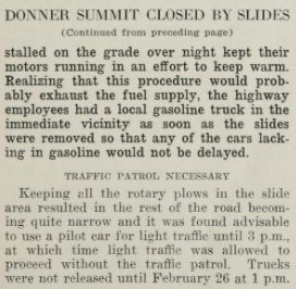
Interstate 80 eastbound climbs to a Rest Area at the 7,227-foot-high Donner Summit.
Donner Summit during the winter of 2017. Interstate 80 eastbound begins to descend from Donner Summit. On the downhill grade an overlook of Donner Lake can be found.


Donner Lake during the winter of 2017.
Interstate 80 eastbound Exit 180 accesses Donner Lake.
Interstate 80 eastbound descends to Truckee and accesses Donner Pass Road at Exit 184.
Interstate 80 eastbound Exit 185 accesses California State Route 89.
Interstate 80 eastbound multiplexes California State Route 89 through Truckee. Interstate 80 eastbound Exit accesses Central Truckee.
Interstate 80 eastbound Exit 188B serves as the split for California State Route 89 northbound and accesses to California State Route 267.
East of Exit 188B Interstate 80 is signed 21 miles from Verdi and 31 miles from Reno.
Interstate 80 eastbound Exit 190 accesses Overland Trail.
Interstate 80 eastbound enters the Truckee River Canyon and accesses Hirschdale Road at Exit 194.
Interstate 80 eastbound descends through the Truckee River Canyon and accesses Floriston at Exit 199.


Interstate 80 eastbound continues to descend through the Truckee River Canyon and accesses Farad at Exit 201.
Interstate 80 eastbound continues to descend through the Truckee River Canyon to the Sierra County.
Interstate 80 eastbound follows the Truckee River Canyon through Sierra County and enters Washoe County Nevada.
Upon entering Nevada Interstate 80 eastbound is signed as 4 miles from Verdi and 12 miles from Reno.
Interstate 80 eastbound emerges from the Truckee River Canyon and accesses Verdi via the Interstate 80 Business Loop at Exit 2.


Interstate 80 eastbound Exit 4 accesses Boomtown and Garson Road.
Interstate 80 eastbound Exit 7 accesses Mogul.
Interstate 80 eastbound Exit 8 accesses former US 40 in Reno on 4th Street.

Interstate 80 eastbound Exit 9 accesses Robb Drive.
Interstate 80 eastbound Exit 10 accesses McCarren Boulevard.
Interstate 80 eastbound approaches downtown Reno and accesses the Interstate 80 Business Loop via Exit 12.
Interstate 80 eastbound Exit 13 accesses downtown Reno via Virginia Street.
Interstate 80 eastbound Exit 14 accesses Wells Avenue.


Interstate 80 eastbound Exit 15 accesses US 395 and Interstate 580.


Comments