
Hueston Woods Covered Bridge - Ohio


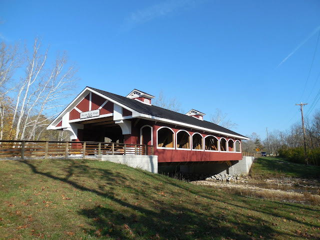
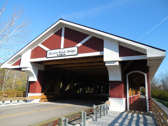
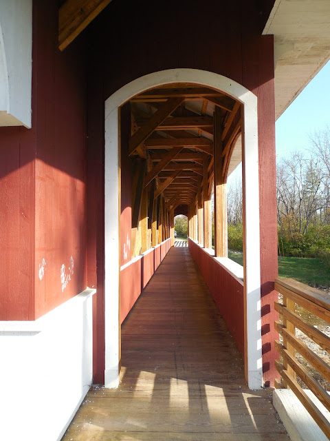
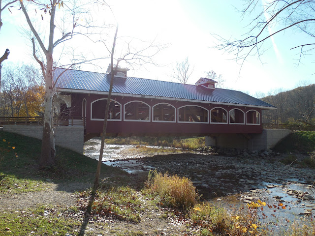
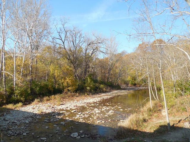
One of eight covered bridges in Preble County, Ohio, the Hueston Woods Covered Bridge was built in 2012 to span over the Four Mile Creek at Hueston Woods State Park. The 108 foot long single span modified Burr arch truss designed covered bridge replaced a metal pony truss bridge at the same location on Camden College Corner Road, just a few miles east of the state line between Ohio and Indiana. A six foot walkway is located on each side of the bridge to allow for a safer area for pedestrian traffic, along with providing a scenic viewing area of the creek below.

The covered bridge was constructed at a cost of $1,997,500, is a brainchild of J. Stephen Simmons, who is a retired Preble County engineer. Simmons was instrumental in 2007 for enabling Preble County to receive most of the funding needed for the new covered bridge from the Federal Highway Administration, administered through the Ohio Department of Transportation. As the covered bridge is at a state park, it was decided that a covered bridge would make a nice attraction and addition to the park, so when it was determined that a new bridge had to be built, a covered bridge was selected to be built in place. A Burr truss design with an arch was chosen in homage to another covered bridge in Preble County, the Roberts Covered Bridge.

During a visit to the western part of Ohio, I had a chance to visit the Hueston Woods Covered Bridge. On a nice day, it is a good place to check out to admire the bridge and the surrounding scenery. The powers that be made a good decision to place a covered bridge at this location.


How to Get There:


Sources and Links:
Bridgehunter.com - Hueston Woods Covered Bridge 35-68-51
HistoricBridges.org - Camden College Corner Road Bridge
Hueston Woods Region Visitors Bureau - Covered Bridge
Hueston Woods Lodge & Conference Center - Covered Bridge
Journal-News (Butler County, Ohio) - New bridge rooted in ‘Burr’ history (June 18, 2012)

Comments

Popular posts from this blog

What's In a Name?: When the Roads Really Do Tell a Story

  Our tagline on the Gribblenation blog is "because every road tells a story". Some roads tell different stories than others. Along our travels, we may see historic markers that tell us a little story about the roads we travel or the places we pass by. Some historic markers are more general, as to telling us who lived where or what old trail traversed between two towns. During my travels across New York State and other states or provinces, I pass by many historic markers, some with interesting or amusing references to roads. I wanted to highlight a few of the markers I've seen along my travels around the Empire State and help tell their stories. Those stories may be as specific as explaining the tales of a tree that was used to help measure a distance of eight miles from Bath to Avoca in Steuben County, as referenced on the Eight Mile Tree historical marker above. They may also help point the way along historical roads first used centuries ago, or may help tell a local l...

2018 Mojave Road Trip Part 2; The deadly desert highway (California State Route 127 and Nevada State Route 373)

After leaving Barstow via Old Highway 58 my next destination was in Death Valley.  To access Death Valley from rural San Bernardino County required a trek on north on Interstate 15 to California State Route 127 which becomes Nevada State Route 373 at the state line. Along I-15 I encountered the road sign oddity that is Zzyzx Road about eight miles south of Baker.   Zzyzx Road is a four mile road that used to go to the Zzyzx Mineral Springs and Health Spa.   The spa was founded in the 1940s and the owner made up the name "Zzyzx" to claim it was the last word in the English Language.  The spa has been shut down since the 1970s and is now part of a Desert Studies Center for California State University. The southern terminus of CA 127 in Baker is located at I-15 exit 246.  CA 127 is a 91 mile north/south highway which runs to the Nevada State Line in Inyo County.  CA 127 is called Death Valley Road from I-15 northward.  South of CA 127 ...

May 2023 Ontario Trip (Part 3 of 3)

  Over the years, I have made plenty of trips to Ontario, crisscrossing the southern, central and eastern parts of the province. Living in Upstate New York, it's pretty easy to visit our neighbor to the north, or is that our neighbor to the west? Ottawa is one of my favorite cities to visit anywhere in the world, plus I've discovered the charm of Kingston, the waterfalls of Hamilton (which is on the same Niagara Escarpment that brings us Niagara Falls), the sheer beauty of the Bruce Peninsula, and more. But I hadn't explored much of Cottage Country. So I decided to change that, and what better time to go than over Memorial Day weekend, when the daylight is long and I have an extra day to explore. On the third and final day of my trip, I started in Huntsville and made my way through Muskoka District and Haliburton County, passing by many lakes along the way. I stopped in towns such as Dorset, Haliburton and Bancroft before making a beeline down to Belleville and then over th...