Civil War Road Trip Day 1 - Into the Shenandoah Valley

My oldest son, who's 10, enjoys history.  So we embarked on a trip to Harpers Ferry, Antietam, and Gettysburg - plus some surprises along the way.

Day 1 was from Charlotte to his grandparent's house near Staunton, Virginia.  The complete set of photos from the first day's trip can be found here.

Route:

I-77, VA 69, US 52, I-81, VA 262, US 11.


Our first stop was Shot Tower Historical State Park in Virginia.  The over 200-year-old shot tower is easily seen from Interstate 77 as it overlooks the New River below.


The tower is a nice and easy side trip off of the Interstate and offers great views of the bridge that carries I-77 over the New River.  The bridge originally opened in 1978 as a twin span over the river.  In the early 2000s, a rehabilitation project widened both bridges to accommodate a future three lanes in each direction.  This was done by building a new bridge superstructure between the two existing bridges. 


In addition to the shot tower, the park has access to the New River Trail State Park and great views of the surrounding countryside.

From there, it was a drive north along Interstate 81.  While extremely scenic, the highway is full of traffic.  With the Interstate only being two lanes in each direction, traffic can slow when trucks attempt to pass each other on even the slightest incline.  

An example of the heavier I-81 traffic just north of the Interstate 77 South split.

Floyd is a charming town about 20 miles south of this interchange. 

If you enjoy exploring caves, there are plenty along I-81 in Virginia.

There is a large construction project between Salem and Roanoke - that along with heavy traffic due to slower vehicles took away from some of the scenery.

Interstate 81 approaching the Interstate 581 interchange. 

I'd love to see the color here in the fall.

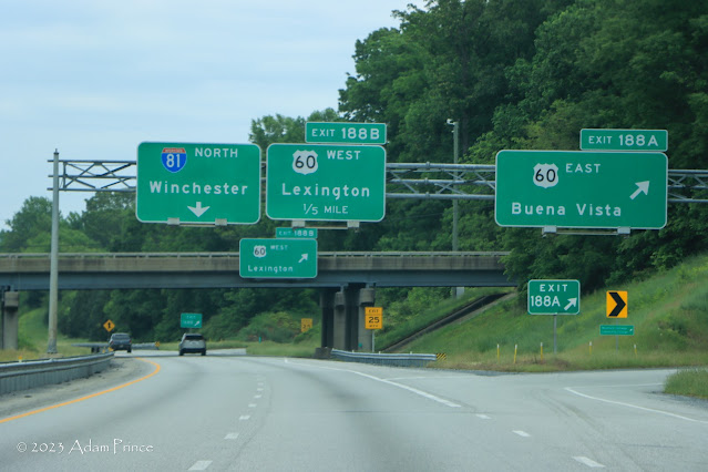
Virginia likes to include measurements to the fifth of a mile.  It's a sneaky little quirk.

Between Lexington and Staunton, Interstate 81 is joined by Interstate 64 as it comes from West Virginia on its way to Charlottesville, Richmond, and Virginia Beach.  Traffic on this stretch wasn't as heavy as it was from Interstate 77 to Roanoke.
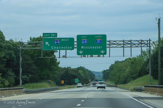
Interstate 64 East joins I-81 in Lexington then leaves it in Staunton.


We then spent a relaxing evening with his grandparents.  I took some time to attempt to take photos of some birds.  There were a few cardinals but they always flew away when I sat down.  So I took photos of some other birds instead.


Day 2 is a visit to Antietam and Harpers Ferry.

Site Navigation:

Comments

Popular posts from this blog

North Carolina Continues to Move Forward with Rail

2023 and the first half of 2024 have seen continued growth in North Carolina's passenger rail system.  From increased daily trains from Raleigh to Charlotte, federal funds for studying additional corridors, and receiving a historic grant to begin the construction of high-speed rail between Raleigh and Richmond, the last 18 months have been a flurry of activity at NCDOT's Rail Division.  And that's just the tip of the iceberg. As ridership and routes increase - the engine of North Carolina passenger rail trains will become a more common sight. (Adam Prince) Increased Passenger Train Service: On July 10, 2023, a fourth Piedmont round-trip rail service between Raleigh and Charlotte commenced.  The four Piedmont trains plus the daily Carolinian (to Washington, DC, and New York) bring the total of trains serving the two cities daily to five. The current daily Piedmont and Carolinian schedule between Charlotte and Raleigh (NCDOT) The result was over 641,000 passengers utilized pa

The Midway Palm and Pine of US Route 99

Along modern day California State Route 99 south of Avenue 11 just outside the City limits of Madera one can find the Midway Palm and Pine in the center median of the freeway.  The Midway Palm and Pine denotes the halfway point between the Mexican Border and Oregon State Line on what was US Route 99.  The Midway Palm is intended to represent Southern California whereas the Midway Pine is intended to represent Northern California.  Pictured above the Midway Palm and Pine can be seen from the northbound lanes of the California State Route 99 Freeway.   This blog is part of the larger Gribblenation US Route 99 Page.  For more information pertaining to the other various segments of US Route 99 and it's three-digit child routes check out the link the below. Gribblenation US Route 99 Page The history of the Midway Palm and Pine The true timeframe for when the Midway Palm and Pine (originally a Deadora Cedar Tree) were planted is unknown.  In fact, the origin of the Midway Palm and Pine w

US Route 101 in Benbow, Garberville and Redway

The communities of Benbow, Garberville and Redway can all be found along US Route 101 within southern Humboldt County.  The former surface alignment of US Route 101 in Garberville and Redway once crossed the Garberville Bluffs along what is now Redwood Drive via a corridor constructed as part of the Redwood Highway during the 1910s.  US Route 101 through Benbow, Garberville and Redway was modernized by 1935.  US Route 101 would eventually be upgraded to freeway standards in Benbow, Garberville and Redway by extension of the Redwood Freeway during 1966-68.  As the cover photo the original grade of US Route 101 and the Redwood Highway can be seen at the Garberville Bluffs during 1934.  US Route 101 can be seen in the communities of Benbow, Garberville and Redway on the 1935 Division of Highways Map of Humboldt County .   The history of US Route 101 in Benbow, Garberville and Redway Benbow, Garberville and Redway lie on the banks of the South Fork Eel River of southern Humboldt County.  D