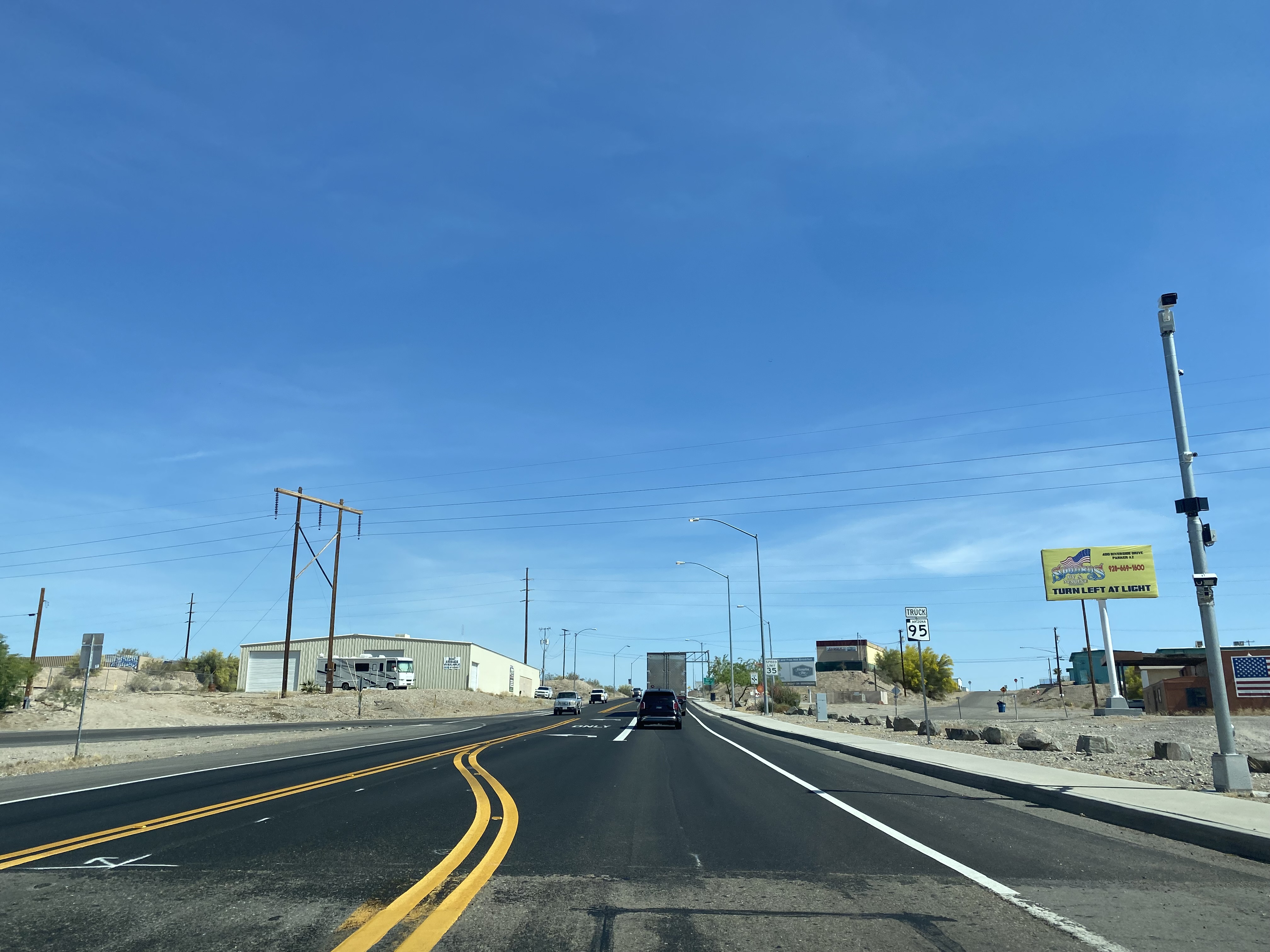
Arizona State Route 95 Truck is a 0.85-mile-long spur of Arizona State Route 95 located in Parker. Arizona State Route 95 Truck follows California Avenue north of Riverside Drive to California State Route 62 at the Colorado River Bridge. What is now Arizona State Route 95 Truck was originally a ferry crossing of the Colorado River and later part of Arizona State Route 72. The Colorado River in Parker was bridged by a pontoon highway crossing during late 1935 with a permanent span being completed during 1937. Arizona State Route 95 Truck was created in 1962 when the mainline highway was extended north of Parker. The current Colorado River Bridge carrying Arizona State Route 95 Truck and California State Route 62 opened during 2014. Featured as the blog cover is the 1937 Colorado River Bridge when it was part of Arizona State Route 72.
Part 1; the history of Arizona State Route 95 Truck
In 1908 Parker was established in what was then Yuma County as a siding of the Arizona & California Railway. Parker was named in honor of Ely S. Parker who had been Commissioner of Indian Affairs under the Presidency of Ulysses Grant. The Arizona & California Railway was originally a short line subdivision of the Atchison, Topeka & Santa Railway. The Arizona & California Railway originated in Cadiz, California and ended at Matthie siding near Wickenburg. The Arizona & California Railway crossed the Colorado River via a truss span which still stands in Parker.
Originally no highway service existed from Parker over the Colorado River into California. This changed during May 1915 when ferry service was established in Parker via a paddle-wheel ship known as the "Iola."
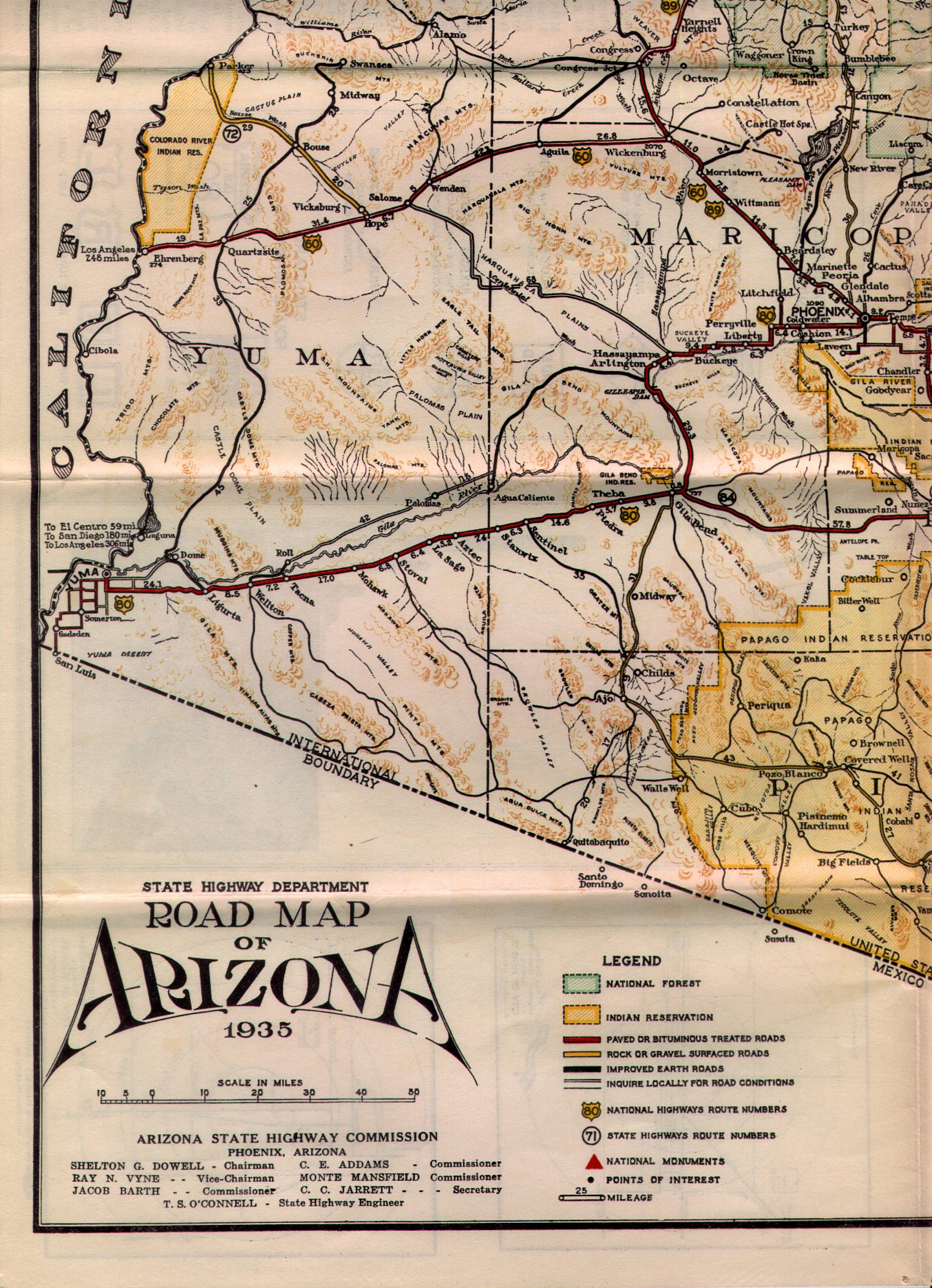
What is now Arizona State Route 95 Truck was commissioned into the Arizona State Highway System as a component of Arizona State Route 72 in the early 1930s. Arizona State Route 72 as originally began at US Route 60 at Hope and ended at the Colorado River Ferry in Parker. Arizona State Route 72 can be seen in detail between Hope-Parker on the 1935 State Highway Department Map of Arizona.
During December 1935 a pontoon bridge crossing the Colorado River in Parker was erected. This pontoon structure was made possible due to the upstream Hoover Dam slowing the currents of the Colorado River. The Colorado River Pontoon Bridge was located at the western terminus of Arizona State Route 72. The Colorado River Pontoon Bridge can be seen from Parker in a University of California hosted photo.
The pontoon bridge at the Colorado River was intended to be a temporary crossing until a permanent structure could be built. The October 1937 Arizona Highways features the completed Colorado River Bridge in Parker. The article stub notes the Colorado River Bridge to be located at the western terminus of Arizona State Route 72. The Colorado River Bridge was constructed with funds via State appropriations and from the Bureau of Public Roads. The paved highway on the California side of the Colorado River in San Bernardino County was constructed by the Metropolitan Water District of Southern California as part of the Colorado River Aqueduct project.
Parker would incorporate as a town during 1948. During the early 1960s Arizona State Route 95 had been straightened directly north of Quartzsite. During 1962 Arizona State Route 95 was extended and replaced Arizona State Route 172 north of Parker. Subsequently Arizona State Route 72 was truncated to a junction with Arizona State Route 95 in the southern outskirts of Parker. The Colorado River Bridge in Parker and California Avenue north of Riverside Drive were reassigned as Arizona State Route 95 Truck.
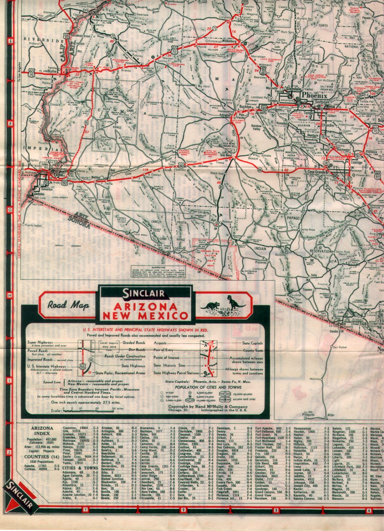
1970 California Legislative Chapter 1473 extended California State Route 62 from Twentynine Palms east to the Colorado River Bridge at the Arizona state line. The California Division of Highways assumed maintenance of the existing Aqueduct Road which connected US Route 95 at Vidal Junction to The Colorado River Bridge. California State Route 62 can be seen terminating at the Colorado River Bridge near Parker on the 1975 Caltrans Map.
Parker became the seat of the newly created La Paz County on January 1, 1983. On April 12, 2010, the Metropolitan Water District received an application from Caltrans and the Arizona Department of Transportation to replace the Colorado River Bridge. The stream under the Colorado River Bridge is noted to have dropped twenty feet which led to the loss of lateral support and embedment in the structure pilings.
The current Colorado River Bridge opened during 2014 and was dedicated on October 1st of said year. The current Colorado River Bridge can be seen in a YouTube video by BigRiver Drone. The 1937 Colorado River Bridge was demolished following the opening of the current span.
Part 2; a drive on Arizona State Route 95 Truck
From the community of Earp in San Bernardino County eastbound California State Route 62 makes a right-hand turn from Aqueduct Road towards the Colorado River Bridge.
California State Route 62 eastbound crosses under the 1908 Arizona & California Railway Bridge to a terminus at the foot of the Colorado River Bridge. The 1908 Arizona & California Railway Bridge partially burned during September 2019, but the structure did not fail. The Arizona & California Railway came under the ownership of RailAmerica during 2012.
California Avenue crosses the Colorado River Bridge and becomes Arizona State Route 95 Truck. An Arizona State Route 95 Truck shield can be found as the highway enters Parker.
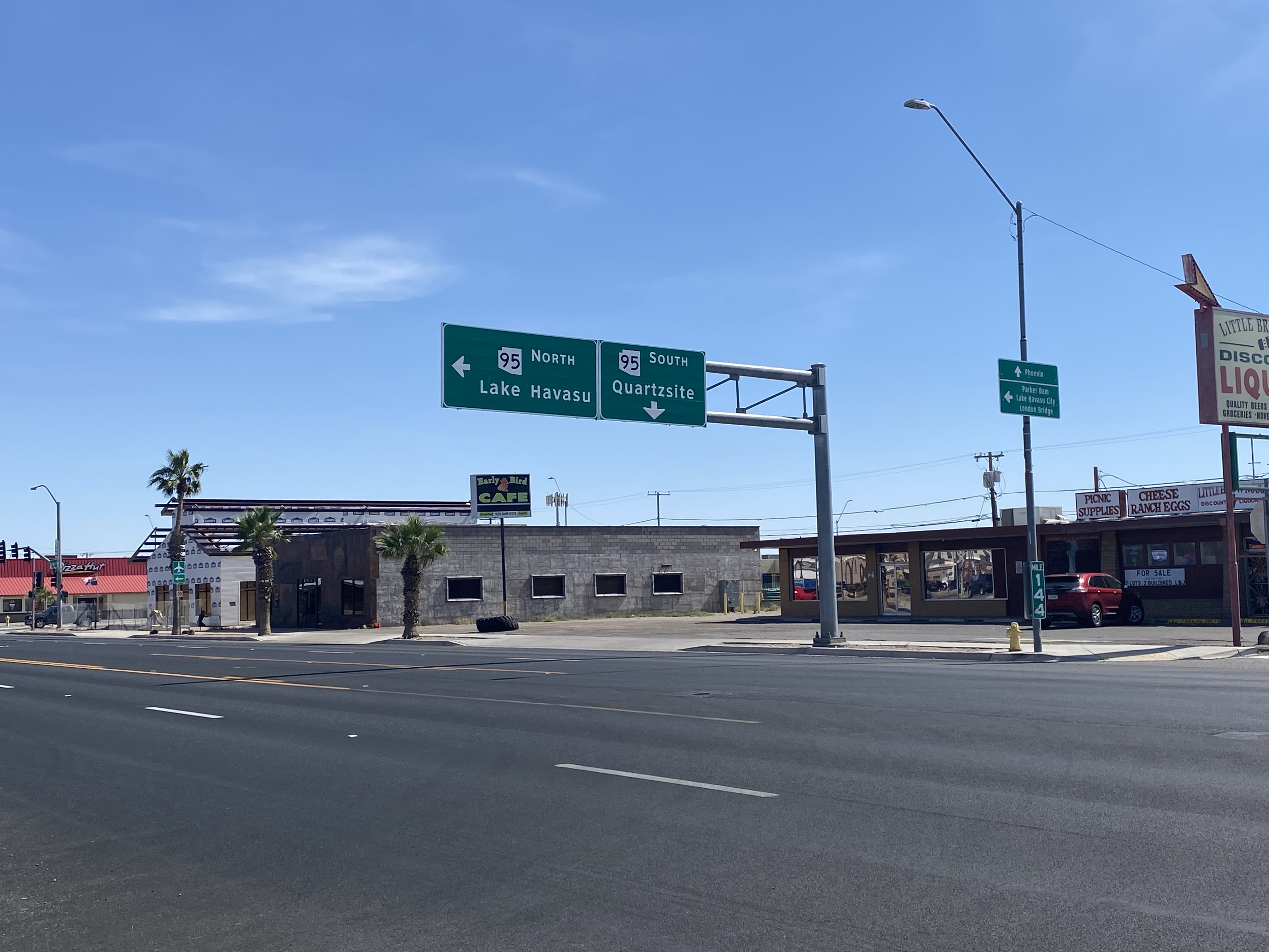
Arizona State Route 95 Truck follows California Avenue to a terminus at mainline Arizona State Route 95 at Riverside Drive.
From northbound Arizona State Route 95 a guide sign denotes Arizona State Route 95 Truck as "To California State Route 62."
The Pre-Emption Road (or rather a series of roads named Pre-Emption Road) follows a survey line called the Pre-Emption Line, drawn in the early days of the United States. The story begins with Massachusetts and New York having competing land claims to modern day Western New York State that have their roots in colonial charters granted by the British. After the Revolutionary War ended, this land became the frontier of the nation and its settlement became a priority for the new American government. During this era, there were a lot of competing land claims that needed to be settled. It was no different with the land claims between New York State and Massachusetts. On November 30, 1786, Massachusetts and New York sent representatives to Hartford, Connecticut to resolve their competing land claims. In less than three weeks, the representatives had reached a compromise. Massachusetts would receive pre-emption rights, meaning the right to sell the land after the Indian title ...
Our tagline on the Gribblenation blog is "because every road tells a story". Some roads tell different stories than others. Along our travels, we may see historic markers that tell us a little story about the roads we travel or the places we pass by. Some historic markers are more general, as to telling us who lived where or what old trail traversed between two towns. During my travels across New York State and other states or provinces, I pass by many historic markers, some with interesting or amusing references to roads. I wanted to highlight a few of the markers I've seen along my travels around the Empire State and help tell their stories. Those stories may be as specific as explaining the tales of a tree that was used to help measure a distance of eight miles from Bath to Avoca in Steuben County, as referenced on the Eight Mile Tree historical marker above. They may also help point the way along historical roads first used centuries ago, or may help tell a local l...
After leaving Barstow via Old Highway 58 my next destination was in Death Valley. To access Death Valley from rural San Bernardino County required a trek on north on Interstate 15 to California State Route 127 which becomes Nevada State Route 373 at the state line. Along I-15 I encountered the road sign oddity that is Zzyzx Road about eight miles south of Baker. Zzyzx Road is a four mile road that used to go to the Zzyzx Mineral Springs and Health Spa. The spa was founded in the 1940s and the owner made up the name "Zzyzx" to claim it was the last word in the English Language. The spa has been shut down since the 1970s and is now part of a Desert Studies Center for California State University. The southern terminus of CA 127 in Baker is located at I-15 exit 246. CA 127 is a 91 mile north/south highway which runs to the Nevada State Line in Inyo County. CA 127 is called Death Valley Road from I-15 northward. South of CA 127 ...


Comments