The Claypool Tunnel and the history of the Miami-Superior Highway (US Route 180, US Route 60 and US Route 70)

The Claypool Tunnel is part of an abandoned alignment of the first US Route 180, US Route 60 and US Route 70. The Claypool Tunnel can be found in Queen Creek Canyon on the eastern outskirts of the town of Superior, Arizona. The Claypool Tunnel was completed during 1922 as the final leg of the Miami-Superior Highway and replaced the Apache Trail as the primary highway between Phoenix-Globe. The Claypool Tunnel was replaced by the Queen Creek Tunnel which was constructed during 1952 and opened to traffic during 1953. The US Routes of Superior were originally carried through the community on Magma Avenue and Main Street prior to the modern bypass opening in 1955. This blog will examine the history the of the Claypool Tunnel, Miami-Superior Highway and the US Route alignments of Superior.

Part 1; the history of the Claypool Tunnel, Miami-Superior Highway and the US Route alignments of Superior
The land the town of Superior lies upon and much of eastern Pinal County was once part of a large Apache Reservation. During 1872 an Apache raiding group was ambushed by the United States Army Calvary near the mouth of Queen Creek Canyon. After losing most of their men, the Apache retreated to a peak above Queen Creek Canyon and leapt to their deaths. This peak today is now known as Apache Leap.
On March 22, 1875, Charles G. Mason and four associates staked the Silver King Mine north of what is now Superior. On March 29, 1875, the Silver Mine was staked atop the southern rim of Queen Creek Canyon near Apache Leap. A boom town originally known as "Queen" began to develop at the mouth of Queen Creek Canyon to facilitate workers of the Silver King Mine and Silver Queen Mine. When the Silver Queen Mine Company was organized in 1880 the community of Queen had a population of approximately 100. The Silver King Mine can be seen east of Weavers Peak on the 1882 Bradley Map of Arizona & New Mexico.

During 1900 the community's name was changed from Hastings to "Superior." Superior was named in honor of the Lake Superior & Copper Company. The town site of Superior was formally plotted during 1902 by George Lobb. Post Office Service in Superior was established on December 29, 1902. Economic development in Superior would improve in 1910 when the Silver Queen Mine was merged into the Magma Copper Company by William Boyce Thompson and George Gunn.
On December 10, 1914, the Magma-Arizona Railroad was formally organized. The Magma-Arizona Railroad was initially constructed as a narrow-gauge line originating at Southern Pacific Railroad at Magma junction near modern day San Tan Valley. The Magma-Arizona Railroad was completed to Superior on April 19, 1915. Conversion of the Magma-Arizona Railroad to standard-gauge would begin during 1922.
During the emergence of the automobile there was no good roads between Superior east to the mines of Miami and Globe. The primary highway used by automobiles between Phoenix and Globe was the Apache Trail (modern Arizona State Route 88) which had been developed as a haul road during the construction of the Roosevelt Dam. Construction of the Miami-Superior Highway would begin during July 1920. Superior can be seen at the end of a dead-end highway on the 1920 George F. Cram Highway Map of Arizona.

The nearly completed Miami-Superior Highway was reported on in the April 23, 1922, El Paso Times. The completed Claypool Tunnel is featured as the centerpiece of the 20-mile Miami-Superior Highway which reportedly cost $1,000,000. The Queen Creek Bridge west of the Claypool Tunnel had also been completed during 1922. The article notes the full opening of the Miami-Superior Highway was scheduled for April 29, 1922 (courtesy Arizona History).


The opening of the Miami-Superior Highway was featured in the April 30, 1922, Arizona Republic (courtesy Arizona History). Surveys for the Miami-Superior Highway are noted to have been undertaken by the State during 1917. Within Superior the Miami-Superior Highway entered westbound via Magma Avenue from Queen Creek Canyon via the Claypool Tunnel and Queen Creek Bridge. The Miami-Superior Highway followed Main Street through Superior towards Florence Junction.


The Miami-Superior Highway is featured as part of the so-called "Apache Loop Highway" in a September 10, 1922, Arizona Republic (courtesy Arizona History). The Apache Loop Highway was comprised of the Apache Trail along the Salt River and the Miami-Superior Highway through Queen Creek Canyon.


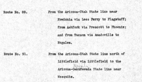
The US Route System was formally created by the American Association of State Highway Officials (AASHO) on November 11, 1926. The Miami-Superior Highway was selected as part of the corridor US Route 180. US Route 180 as initially configured began at US Route 85 in Caballo, New Mexico and ended US Route 80 at Florence Junction west of Superior. The November 11, 1926, US Route descriptions for Arizona depict US Route 180 utilizing the Miami-Superior Highway.

US Route 180 can be seen following the Miami-Superior Highway on the 1927 Rand McNally Highway Map of Arizona & Nevada.

As originally envisioned in the early drafts of US Route System what became US Route 66 in Arizona was intended to be US Route 60. The designation of the Chicago-Los Angeles corridor was intended to carry a X0 route number given it was to denote a major east/west US Route. Ultimately the State of Kentucky petitioned to have a X0 US Route and the Chicago-Los Angeles corridor became US Route 66 in the finalized US Route System created by AASHO during November 1926.
US Route 60 would rapidly be extended after the US Route System was created and would come into play in Arizona and California during the early 1930s. A letter from the AASHO Executive Secretary to the California State Highway Engineer dated Marth 30, 1931 noted that US Route 60 had been tentatively approved to be extended to California during the AASHO Executive Committee on May 26, 1930. The approval of US Route 60 being extended to California carried the stipulation that the Colorado River Bridge in Blythe be purchased by the California Division of Highways and Arizona State Road Department. The letter noted California and Arizona had taken steps through their respective legislatures to purchase the Colorado River Bridge.


A letter from the California State Highway Engineer to the AASHO Executive Secretary on April 13, 1931, noted legislation to purchase the Colorado River Bridge had been passed in California. The purchase of the Colorado River Bridge effectively made the extension of US Route 60 into California via Arizona active. US Route 60 had been extended from Amarillo, Texas and multiplexed US Route 180 west from the San Carlos Reservation to Florence Junction via the Miami-Superior Highway.

US Route 60 and US Route 180 can be seen multiplexing from San Carlos Reservation west to Florence Junction on the 1933 Mid-West Map Company Highway Map of Arizona & Nevada. When US Route 60 was extended through Arizona it initially followed Arizona State Route 73 through the San Carlos Reservation due to the highway through Salt River Canyon not being yet complete.

US Route 60 and US Route 180 can be seen signed from Florence Junction during the early 1930s (photo courtesy usends.com and Preserving Arizona)

During 1934 the State of California, Arizona, New Mexico and Texas submitted an application to extend US Route 70 to Los Angeles. An August 30, 1934, letter by the Arizona Engineer of Plans to the AASHO Executive Secretary describes the alignment of US Route 70 in Arizona. US Route 70 absorbed the entire existing alignment of US Route 180 from the New Mexico State Line west to Florence Junction via the Miami-Superior Highway. The extension of US Route 70 to California led directly to the deletion of the original US Route 180.


US Route 60 and US Route 70 can be seen during 1936 entering downtown Superior via Magma Avenue and turning left on Main Street (courtesy of Darin Kuna).

US Route 60 and US Route 70 can be seen heading eastbound into Superior in a late 1930s era photo (courtesy of Darin Kuna).

US Route 60 and US Route 70 can be seen departing westbound from Superior towards Picket Post mountain in a 1930s era photo (courtesy Darin Kuna).

US Route 60 and US Route 70 can be seen departing Queen Creek Canyon onto Magma Avenue in a late 1930s era photo (courtesy Kelli Elliot).

The eastbound portal of the Claypool Tunnel can be seen in an undated photo (courtesy Jim Shipman).


The turn from Main Street to Magma Avenue in downtown Superior can be seen in a 1941 photo from Arizona History.

US Route 60/US Route 70 departing the east portal of the Claypool Tunnel can be seen below in a 1948 postcard (courtesy Growing Up Globe). The Miami-Superior Highway is referred to as the "Million Dollar Highway" on the postcard. This was a reference to the construction cost of the road during the early 1920s.


US Route 60 and US Route 70 westbound through the Claypool Tunnel can be seen in an Arizona Department of Transportation photo during the 1940s.

During 1937 the Miami-Superior Highway began to be upgraded by the State. An illustration in the December 1941 issue of Arizona Builder & Contractor Magazine (courtesy Darin Kuna) depicted the upgrades to the Miami-Superior Highway. During 1937 a 1-mile s segment west of Miami had been realigned. During 1938 a 1.8-mile segment around the vicinity of Oak Flat was realigned. During 1939 a 2.7-mile segment in the vicinity of Top-of-the-World was improved and realigned. During 1940-41 a 1.7-mile segment in Devils Canyon was improved and realigned. A 3-mile segment in east of Pinto Creek to Bloody Tank is noted to be in the process of improvement. The Miami-Superior Highway east of Top-of-the-World to Pinto Creek is noted to be slated for future construction.

During 1949 the Pinto Creek Bridge (in Gila County) was completed leading to a major realignment of the Miami-Superior Highway. The original Pinto Creek Bridge can be seen as part of US Route 60 and US Route 70 in an undated postcard (courtesy Mike Ward). The original Pinto Creek Bridge was 637 feet long and featured a steel arch design.

The Pinto Creek Bridge opening ceremony during 1950 can be seen featured in a series of three photos featured on Growing up in Globe.


Construction of the Queen Creek Tunnel would begin on July 5, 1950. The Queen Creek Tunnel would be completed during December 1952 but had a delayed opening until February 26, 1953, due to poor weather. The Queen Creek Tunnel was a direct replacement for the Claypool Tunnel which was abandoned. The 1,217-foot-long Queen Creek Tunnel was dedicated on May 16, 1953 (photos courtesy Darin Kuna).


The Queen Creek Bridge was also opened during 1953 as part of the new alignment to Magma Avenue. The Queen Creek Bridge can be seen in a 1953 era photo below (courtesy Kelli Elliot). The opening of the 1953 Queen Creek Bridge led to the abandonment of the 1921 span.

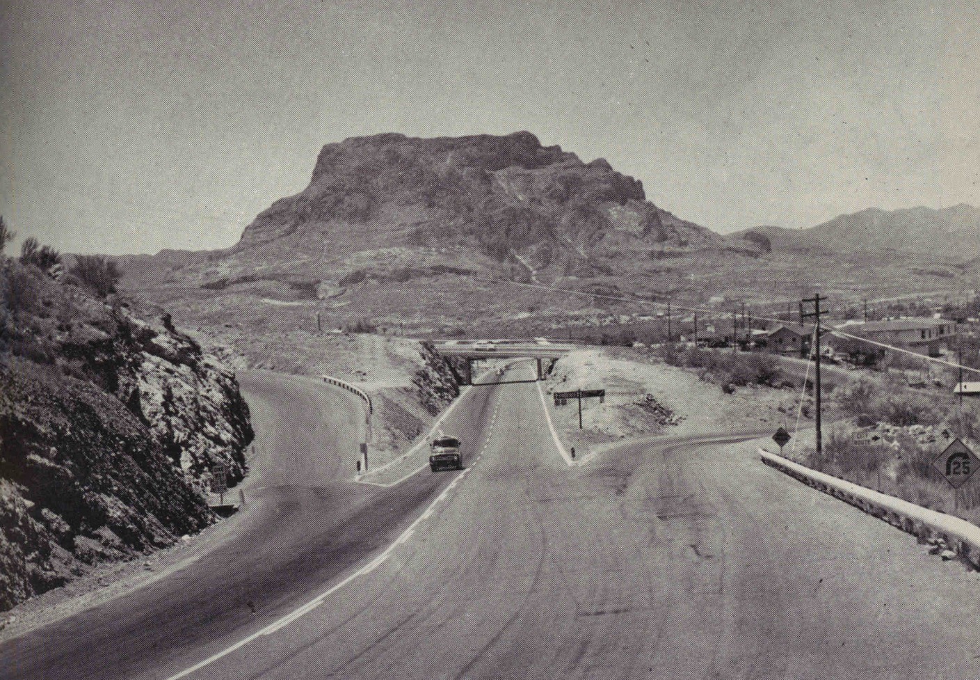
During 1955 a new bypass alignment for US Route 60 and US Route 70 in Superior opened to traffic. The new bypass alignment continued straight upon departing Queen Creek Canyon instead of entering downtown Superior via Magma Avenue. The bypass alignment of US Route 60 and US Route 70 in Superior bypassed the so called "death curve" which was notably accident prone (article snips and photos courtesy Darin Kuna).


On June 24, 1969, AASHO approved an Arizona Highway Department request to truncate US Route 70 from the California State Line to Globe. The truncation of US Route 70 removed it from the Miami-Superior Highway and left only US Route 60. US Route 70 had previous been truncated from Los Angeles to the US Route 95 in Blythe, California by AASHO on August 26, 1963.


The corner of Magma Avenue and Main Street can be seen below during 1975 two decades after US Route 60 had been realigned (photo courtesy Darin Kuna).

Bids were opened during August 2018 to award a contract to replace the 1949 Pinto Creek Bridge. The new Pinto Creek Bridge can be seen in the process of construction next to the 1949 span on a March 2, 2021, photo by the Arizona Department of Transportation.

During 2021 the US Route 60 expressway was east of Queen Creek and bypassed what is now Arboretum Way. The four-lane expansion of US Route 60 continued into Superior east to the Arizona State Route 177 junction.
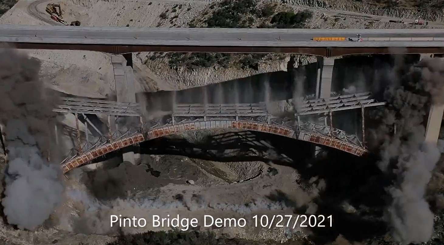
The new Pinto Creek Bridge was completed during 2021 and US Route 60 was realigned onto the new span during September 12-17. The 1949 Pinto Creek Bridge was demolished via implosion on October 27, 2021.


During summer 2023 the Arizona Department of Transportation will be closing access to the Claypool Tunnel and 1922 Queen Creek Bridge. Access is being barred due to the original alignment of the Miami-Superior Highway being used as a staging area for the span replacing the 1953 Queen Creek Bridge in addition to the Waterfall Canyon Bridge.

Part 2; a drive on US Route 60 through Superior and Queen Creek Canyon to the Queen Creek Tunnel
Modern US Route 60 eastbound intersects Arizona State Route 79 at Florence Junction. Notably a historic US Route 80 shield was recently installed directing traffic onto southbound Arizona State Route 79. Despite US Route 89 following the same alignment towards Florence there is no additional historic shield to be found.


US Route 60 east of Florence Junction is signed as 14 miles from Superior.


US Route 60 eastbound intersects Queen Valley Road and crosses the tracks of the Magma Arizona Railroad.

US Route 60 eastbound ascends into the mountains and enters Tonto National Forest.


US Route 60 eastbound continues to climb upon entering Tonto National Forest and crosses Gonzales Pass. Gonzales Pass lies at an elevation of 2,631 feet above sea level.


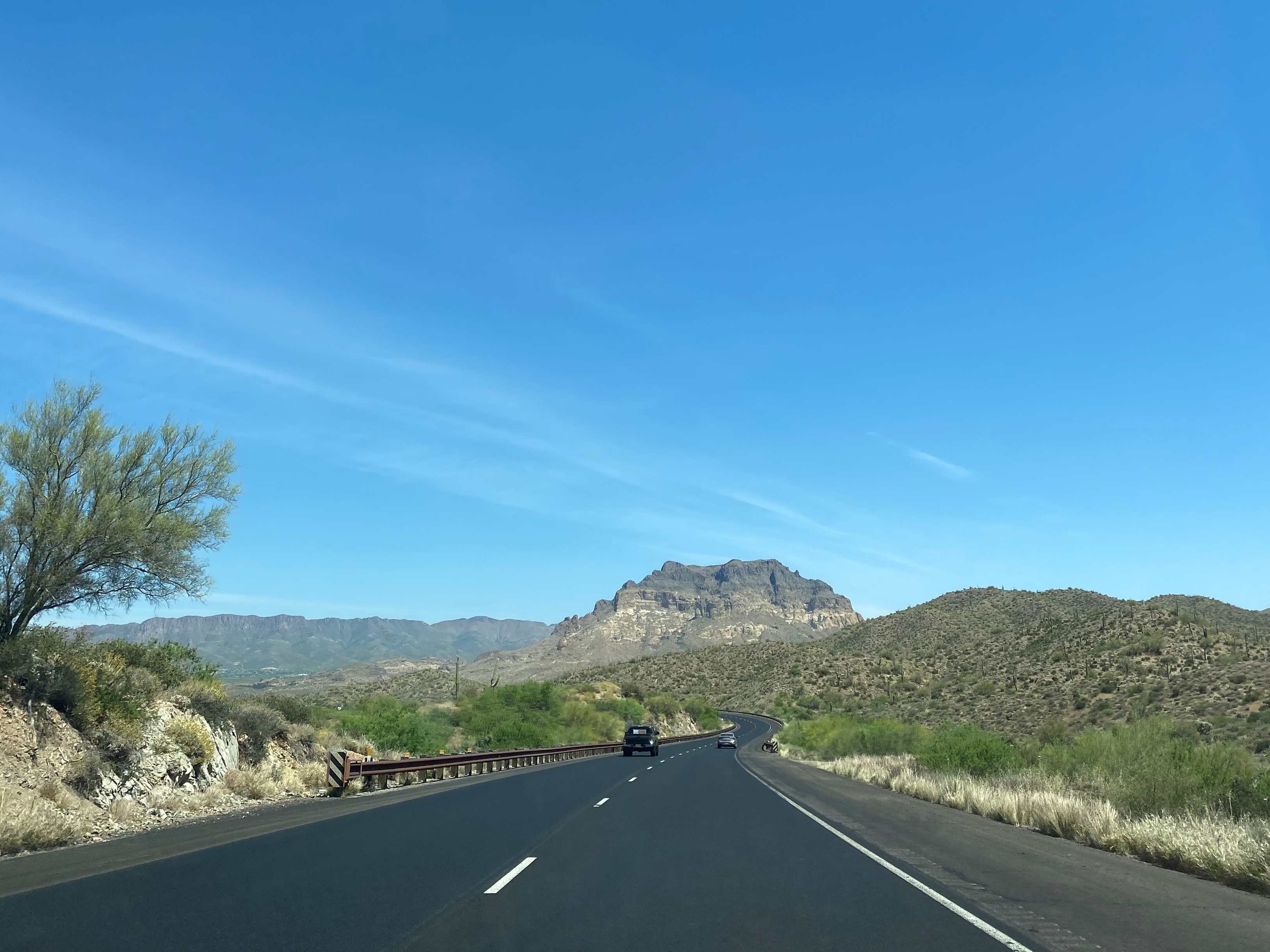
US Route 60 eastbound begins to descend from Gonzales Pass towards Picket Post Mountain. US Route 60 crosses Queen Creek and enters the town limit of Superior. The modern highway intersects the recently bypassed Arboretum Way on the western outskirts of Superior. Arboretum Way can be used as access to Boyce Thompson Arboretum. Superior formally incorporated as a town during 1976.


US Route 60 eastbound is signed 26 miles from Globe east of Arboretum Way.

US Route 60 eastbound crosses through Superior and intersects Arizona State Route 177 at the mouth of Queen Creek Canyon. The exit to Arizona State Route 177 can be utilized to reach the original alignment of US Route 60 on Magma Avenue.


US Route 60 eastbound enters Queen Creek Canyon and crosses the 1953 Queen Creek Bridge.


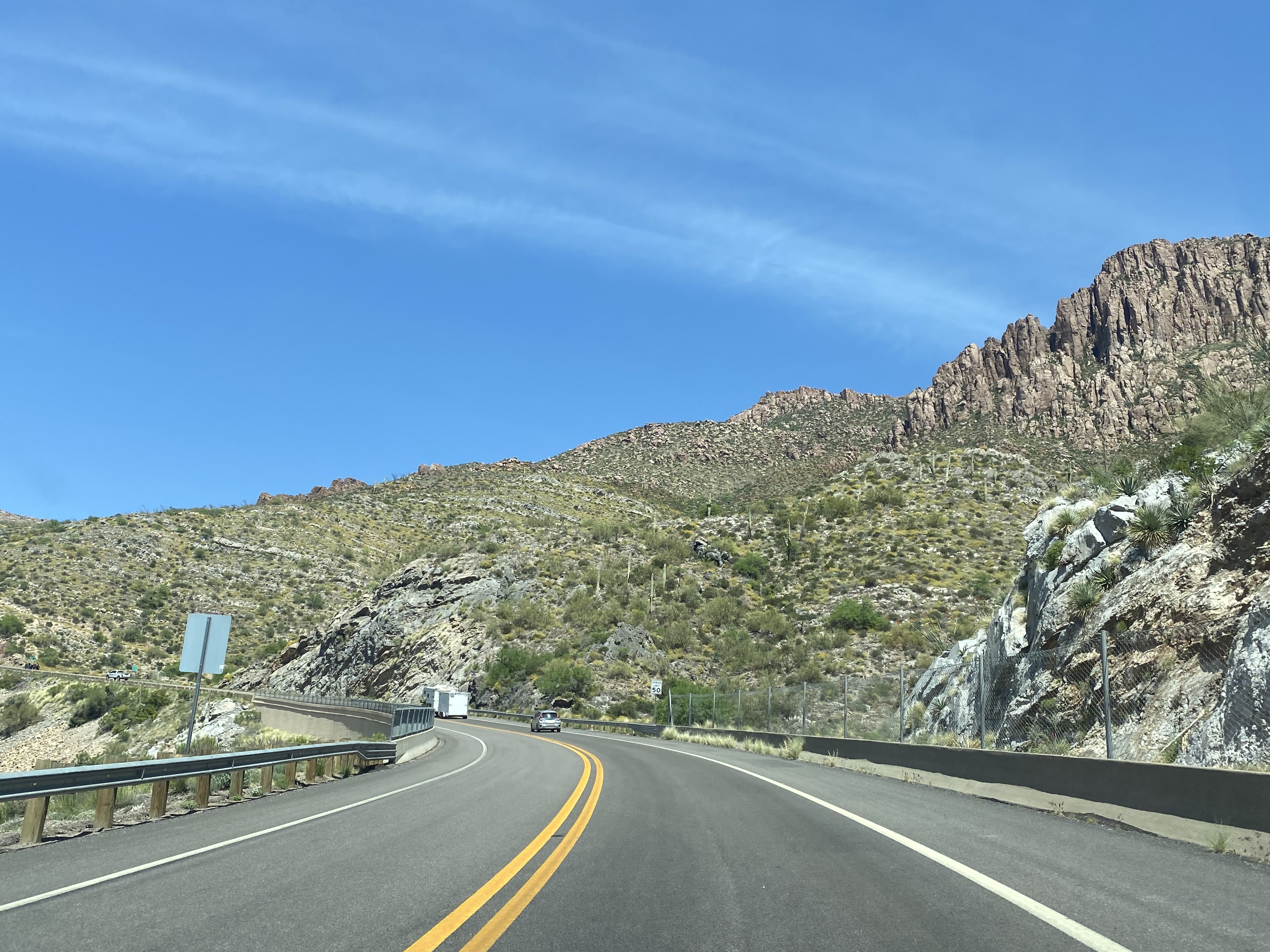
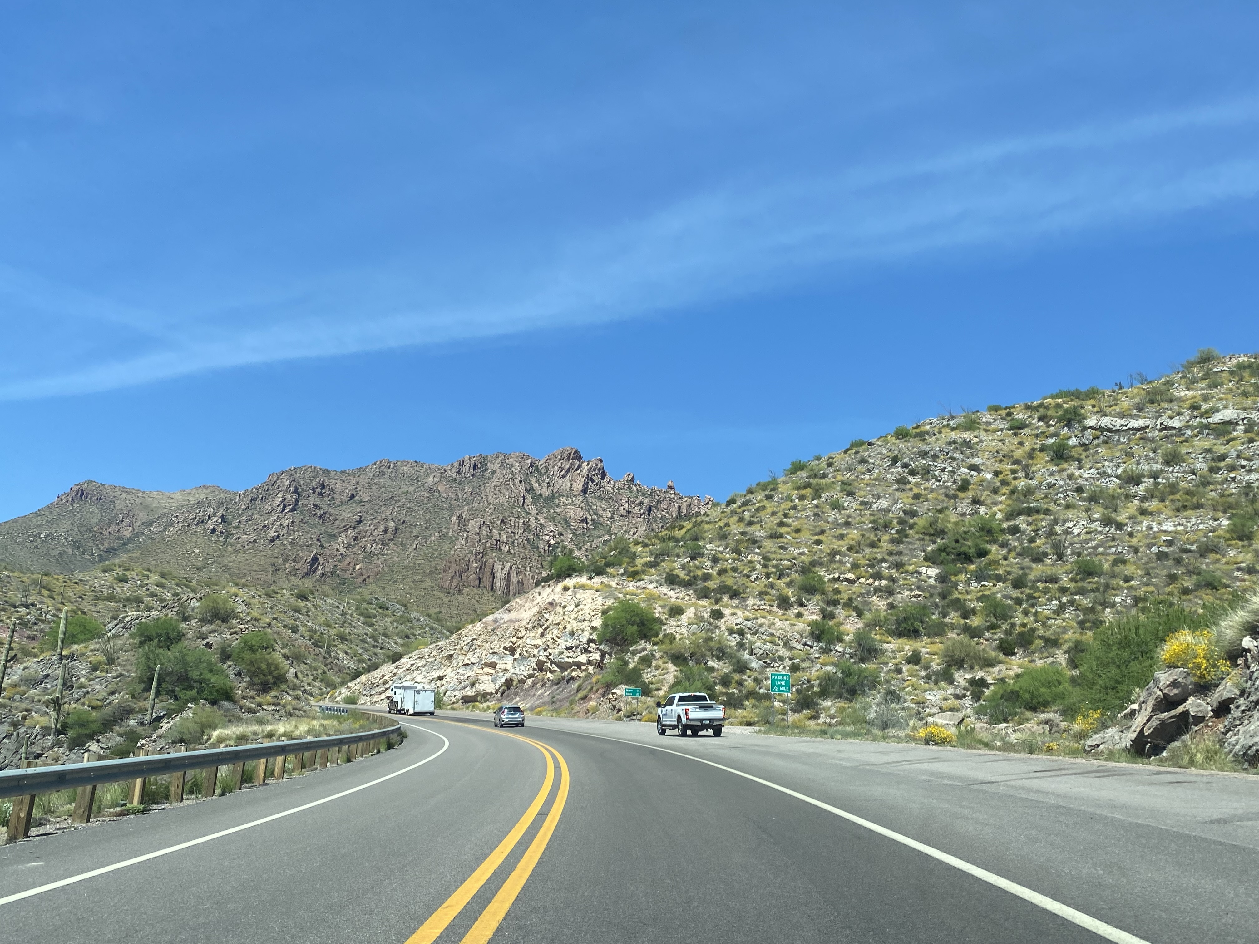
Eastbound US Route 60 gains a climbing lane and ascends through the Queen Creek Tunnel.


Part 3; hiking the Claypool Tunnel and 1922 Miami-Superior Highway
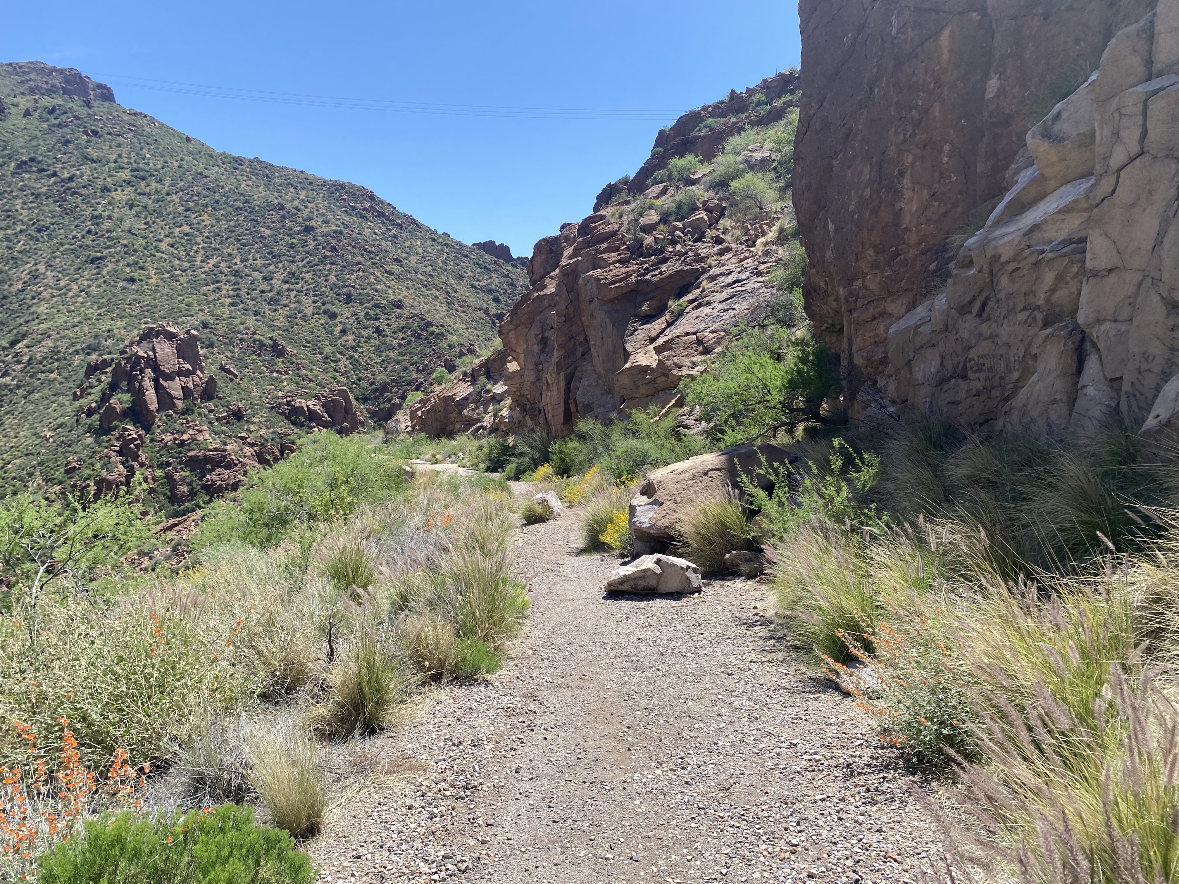
From the shoulder east of the Queen Creek Tunnel the 1922 Miami-Superior Highway can be seen looking west into Queen Creek Canyon.

Hiking westward accesses the 1922 Miami-Superior Highway and the Legends of Superior Trailhead.


The 1922 Miami-Superior Highway becomes more and more apparent descending to the Claypool Tunnel.


The 1922 Miami-Superior Highway descends the portal of the Claypool Tunnel.


The view west from inside the Claypool Tunnel.

Exiting the Claypool Tunnel the 1922 Miami-Superior Highway and 1953 Queen Creek Bridge can be seen below in Queen Creek Canyon.


Facing eastward towards the portal of the Claypool Tunnel.


The eastbound ascent from the Claypool Tunnel back up the 1922 Miami-Superior Highway to modern US Route 60.


A derelict portion of the 1922 Miami-Superior Highway can be found north of the Queen Creek Tunnel. The 1922 Miami-Superior Highway was partially covered with fill used to level the approach to the Queen Creek Tunnel.


The original alignment of US Route 60 and US Route 70 can be accessed from the modern westbound highway by exiting at the bottom of Queen Creek Canyon and turning right onto Magma Avenue.


The bottom of the 1922 Miami-Superior Highway can be found directly east of Magma Avenue south of Queen Creek.


Magma Avenue crosses northbound over Queen Creek into downtown Superior. Prior to 1955 US Route 60 and US Route 70 would have turned left onto Main Street.


US Route 60 and US Route 70 westbound would have passed through Superior on Main Street towards Picket Post Mountain. Main Street ends at the 1955 bypass alignment now carrying modern US Route 60.


Comments