
California State Route 62 is a 151-mile State Highway located in Riverside County and San Bernardino County. California State Route 62 begins at Interstate 10 near San Gorgonio Pass and the western flank of the Sonoran Desert near Whiteriver. California State Route 62 ascends Morongo Canyon and crosses through the Mojave Desert to an eastern terminus at the Colorado River Bridge at the Arizona state line in Parker. California State Route 62 was initially defined during 1964 with a terminus in Twentynine Palms. California State Route 62 was extended to the Arizona state line during 1970.

Part 1; the history of California State Route 62
Modern California State Route 62 has an eastern terminus at the Colorado River at Parker, Arizona. In 1908 Parker was established in what was then Yuma County as a siding of the Arizona & California Railway. Parker was named in honor of Ely S. Parker who had been Commissioner of Indian Affairs under the Presidency of Ulysses Grant. The Arizona & California Railway was originally a short line subdivision of the Atchison, Topeka & Santa Railway (ATSF). The Arizona & California Railway originated in Cadiz, California and ended at Matthie siding near Wickenburg. The Arizona & California Railway crossed the Colorado River via a truss span which still stands in Parker.
Originally no highway service existed from Parker over the Colorado River into California. This changed during May 1915 when ferry service was established in Parker via a paddle-wheel ship known as the "Iola."
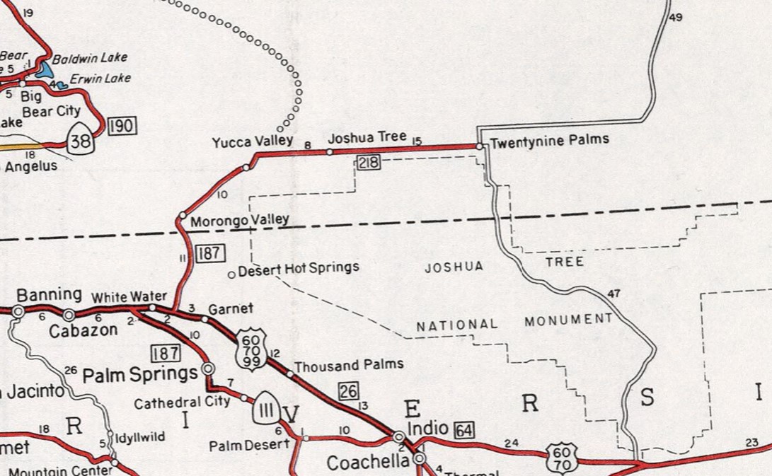
The first segment of road now comprising California State Route 62 entered the State Highway System via 1933 Legislative Chapter 767. Legislative Chapter 767 defined Legislative Route Number 187 (LRN 187). The fifth segment of LRN 187 was defined as "Whitewater to Morongo Valley.
The Whitewater-Morongo Valley segment of LRN 187 appears for the first time on the 1934 Division of Highways Map.


Much of what is now California State Route 62 east of California State Route 177 was built by the Metropolitan Water District of Southern California as the Colorado River Aqueduct Road. Construction of the Colorado River Aqueduct began during January 1933 near Thousand Palms and was made functional on January 7, 1939. The Colorado River Aqueduct Road (Aqueduct Road) was constructed from Parker Dam west towards modern day California State Route 62 in San Gorgonio Pass. Modern California State Route 177 and Dillon Road are also segments of road that was originally built as Aqueduct Road.
The Whiteriver-Morongo Valley segment of LRN 187 appears in detail on the 1935 Division of Highways Maps of Riverside County and San Bernardino County. LRN 187 can be seen ending in Morongo Valley with a major San Bernardino County highway continuing to Twentynine Palms. A minor road east from Twentynine Palms is displayed ending at New Dale.


The Aqueduct Road can be seen branching east from modern California State Route 177 to the Colorado River at the Arizona state line on the 1935 Division of Highways Map of San Bernardino County.

During December 1935 a pontoon bridge crossing the Colorado River in Parker was erected. This pontoon structure was made possible due to the upstream Hoover Dam slowing the currents of the Colorado River. The Colorado River Pontoon Bridge was located at the western terminus of Arizona State Route 72. The Colorado River Pontoon Bridge can be seen from Parker in a University of California hosted photo.

The pontoon bridge at the Colorado River was intended to be a temporary crossing until a permanent structure could be built. The October 1937 Arizona Highways features the completed Colorado River Bridge in Parker. The article stub notes the Colorado River Bridge to be located at the western terminus of Arizona State Route 72. The Colorado River Bridge was constructed with funds via State appropriations and from the Bureau of Public Roads. The paved highway on the California side of the Colorado River in San Bernardino County was constructed by the Metropolitan Water District of Southern California as part of the Colorado River Aqueduct project.


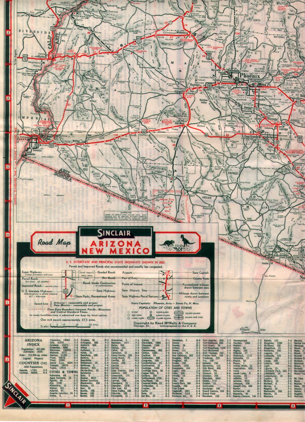
The completed Colorado River Bridge in Parker can be seen on the 1938 Sinclair Map of Arizona.


A highway spanning east from Utah Trail Road in Twentynine Palms towards the Aqueduct Road between Desert Center and Rice can be seen on the 1956 Gousha Map of California. This connecting road east of Twentynine Palms appears to have been constructed by San Bernardino County during the 1950s.

The November/December 1956 California Highways & Public Works noted LRN 187 from US Route 99-60-70 to Morongo Valley was to be regraded and widened during the 1957-58 Fiscal Year.
The November/December 1958 California Highways & Public Works announced LRN 187 from US Route 99-60-70 to Morongo Valley had an adopted freeway corridor which was selected by the California Highway Commission the previous June.

Legislative Chapter 1062 extended Legislative Route Number 187 (LRN 187) from Morongo Valley to Lucerne Valley. The Morongo Valley-Lucerne Valley segment of LRN 187 was initially defined as part of the Freeways & Expressways System. The Morongo Valley-Lucerne Valley segment of LRN 187 appears for the first time on the 1960 Division of Highways Map as a planned State Highway.


LRN 218 first appears on the 1962 Division of Highways Map.
The November/December 1962 California Highways & Public Works announced 7 miles expressway expansion of LRN 187 from US Route 99-60-70 towards Morongo Valley was budgeted for the 1963-64 Fiscal Year.
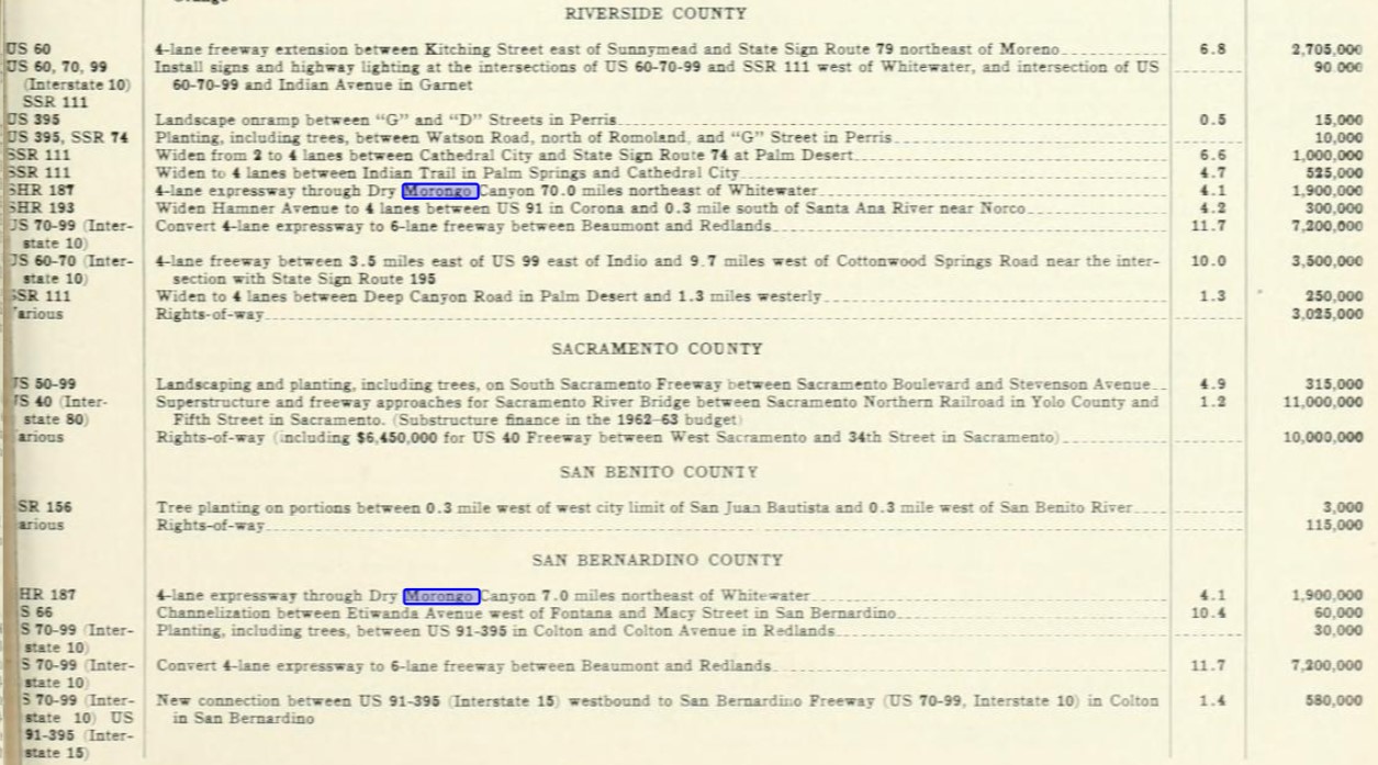

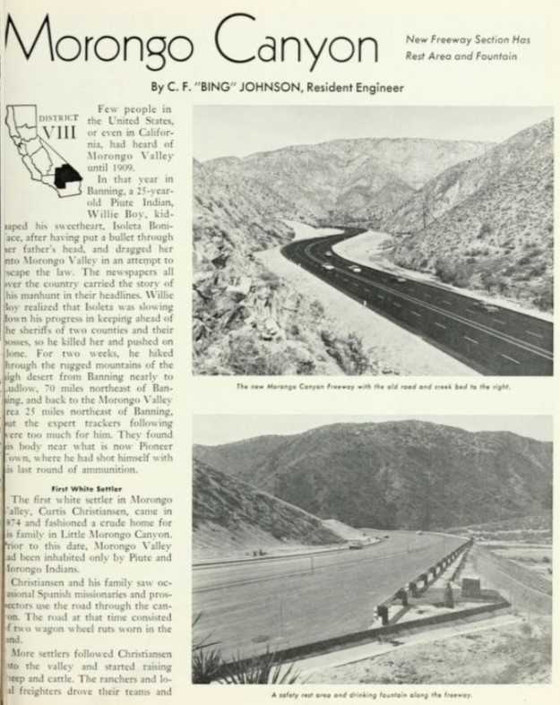
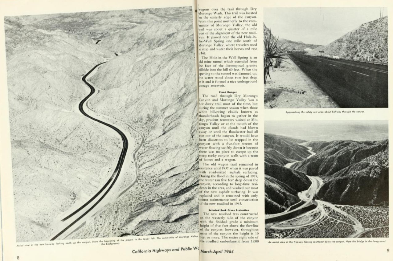
The March/April 1964 California Highways & Public Works featured completion of the Morongo Canyon Freeway segment of California State Route 62. LRN 187 within in Morongo Canyon is noted to have been originally constructed during the 1870s after the Christiansen family settled in the area. Early LRN 187 used the Christiansen Road until it was destroyed by floods during 1938. LRN 187 was rebuilt at a new location in Morongo Canyon flowing the floods of 1938. Work began to reconstruct the highway in Morongo Canyon to limited access standards on during January 1963 and was completed by the following August.

The November/December 1964 California Highways & Public Works announced California State Route 62 between Morongo Valley and Yucca Valley was to be widened to four lanes during the 1965-66 Fiscal Year.


1981 Legislative Chapter 291 corrected the error of "White River" to "Whiteriver" in the Legislative description of California State Route 62.
On April 12, 2010, the Metropolitan Water District received an application from Caltrans and the Arizona Department of Transportation to replace the Colorado River Bridge. The stream under the Colorado River Bridge is noted to have dropped twenty feet which led to the loss of lateral support and embedment in the structure pilings.


The current Colorado River Bridge opened during 2014 and was dedicated on October 1st of said year. The current Colorado River Bridge can be seen in a YouTube video by BigRiver Drone. The 1937 Colorado River Bridge was demolished following the opening of the current span.
Part 2; a drive on California State Route 62
California State Route 62 eastbound begins from Interstate 10 Exit 117. Traffic wishing to access Joshua Tree National Park is directed to utilize California State Route 62.


California State Route 62 eastbound is initially signed as the "Twentynine Palms Highway."


At Post Mile RIV R0.819 California State Route 62 eastbound intersects Dillon Road.


Twentynine Palms is signed as 41 miles away on California State Route 62 eastbound.


California State Route 62 eastbound intersects Indian Canyon Drive at Post Mile RIV R6.446.


California State Route 62 eastbound enters the San Bernardino Mountains and passes through Morongo Canyon. California State Route 62 continues through Morongo Canyon as an expressway into San Bernardino County where it emerges into Morongo Valley at Post Mile SBD 1.207.


California State Route 62 eastbound passes through Morongo Valley. Traffic is advised that Big Morongo Canyon Preserve is accessible via East Drive.


California State Route 62 east of Morongo Valley is signed as 17 miles from Joshua Tree and 32 miles from Twentynine Palms.

California State Route 62 eastbound continues to ascend through the San Bernardino Mountains into Yucca Valley of the Mojave Desert at Post Mile SBD 8.356.


At Post Mile SBD 10.531 California State Route 62 eastbound intersects Pioneertown Road in Yucca Valley. Pioneertown Road travels westward to the community of the same name which has been a popular Western filming backdrop.


At Post Mile SBD 12.392 California State Route 62 intersects California State Route 247/Old Woman Springs Road in Yucca Valley.


Joshua Tree is signed 6 miles from Yucca Valley on California State Route 62.

California State Route 62 eastbound continues into Joshua Tree and intersects Park Boulevard at Post Mile SBD 18.267. Park Boulevard is western entrance for traffic to Joshua Tree National Park.


Eastbound California State Route 62 is signed as 14 miles from Twentynine Palms departing Joshua Tree.

Eastbound California State Route 62 intersects 49 Palms Canyon Road at Postmile SBD 29.183. 49 Palms Canyon Road accesses the namesake trail in Joshua Tree National Park.


California State Route 62 eastbound enters the city of Twentynine Palms and intersects Adobe Road at Postmile SBD 33.207. Adobe Road connects to Marine Corps Communications-Electronics School and Amboy Road towards Amboy.


Eastbound California State Route 62 intersects Utah Trail at Postmile SBD 34.228. Utah Trail connects to the eastern side of Joshua Tree National Park and Amboy Road. Utah Trail as noted in Part 1 is the original eastern terminus of California State Route 62.


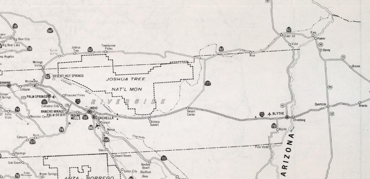
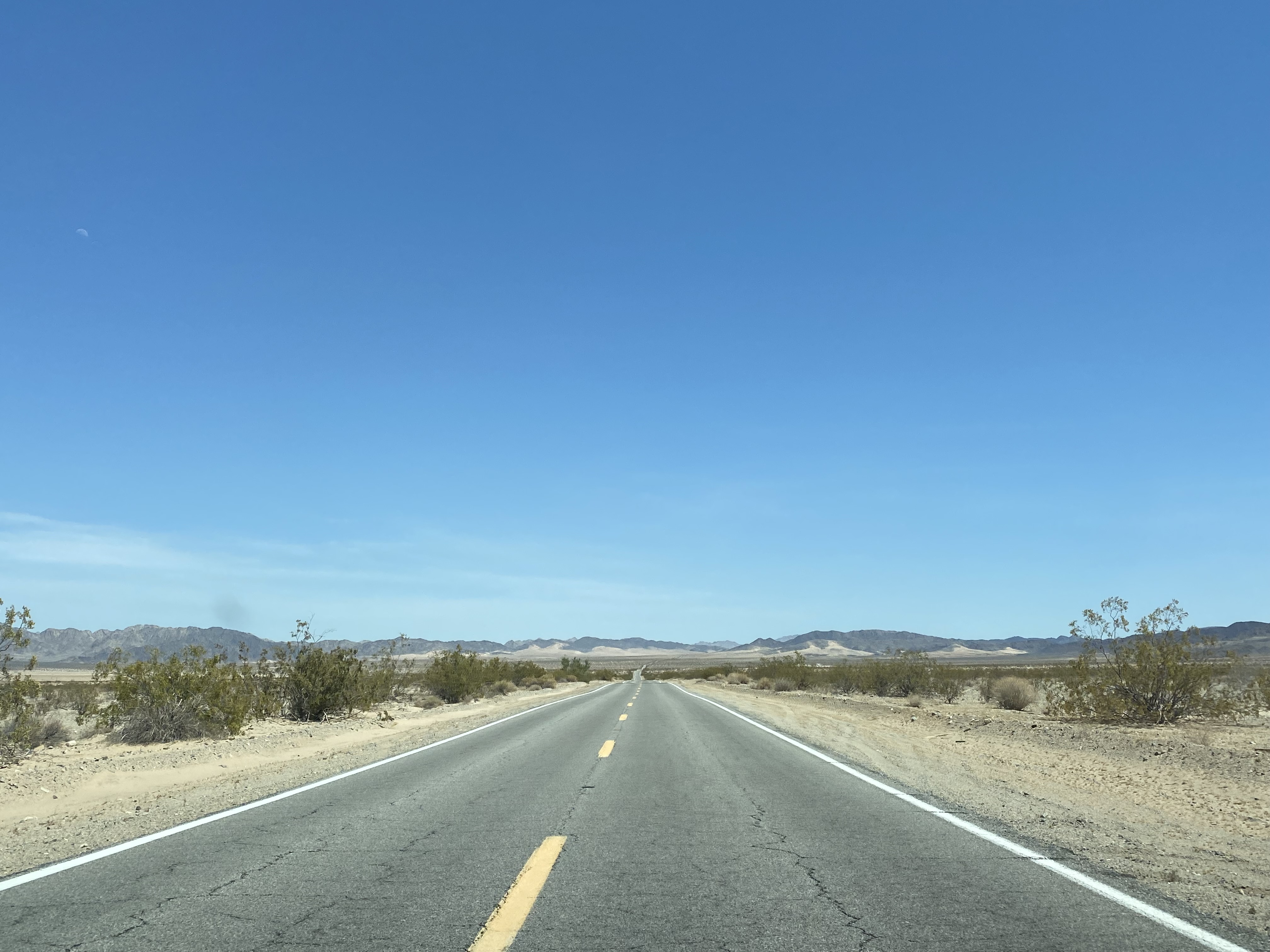
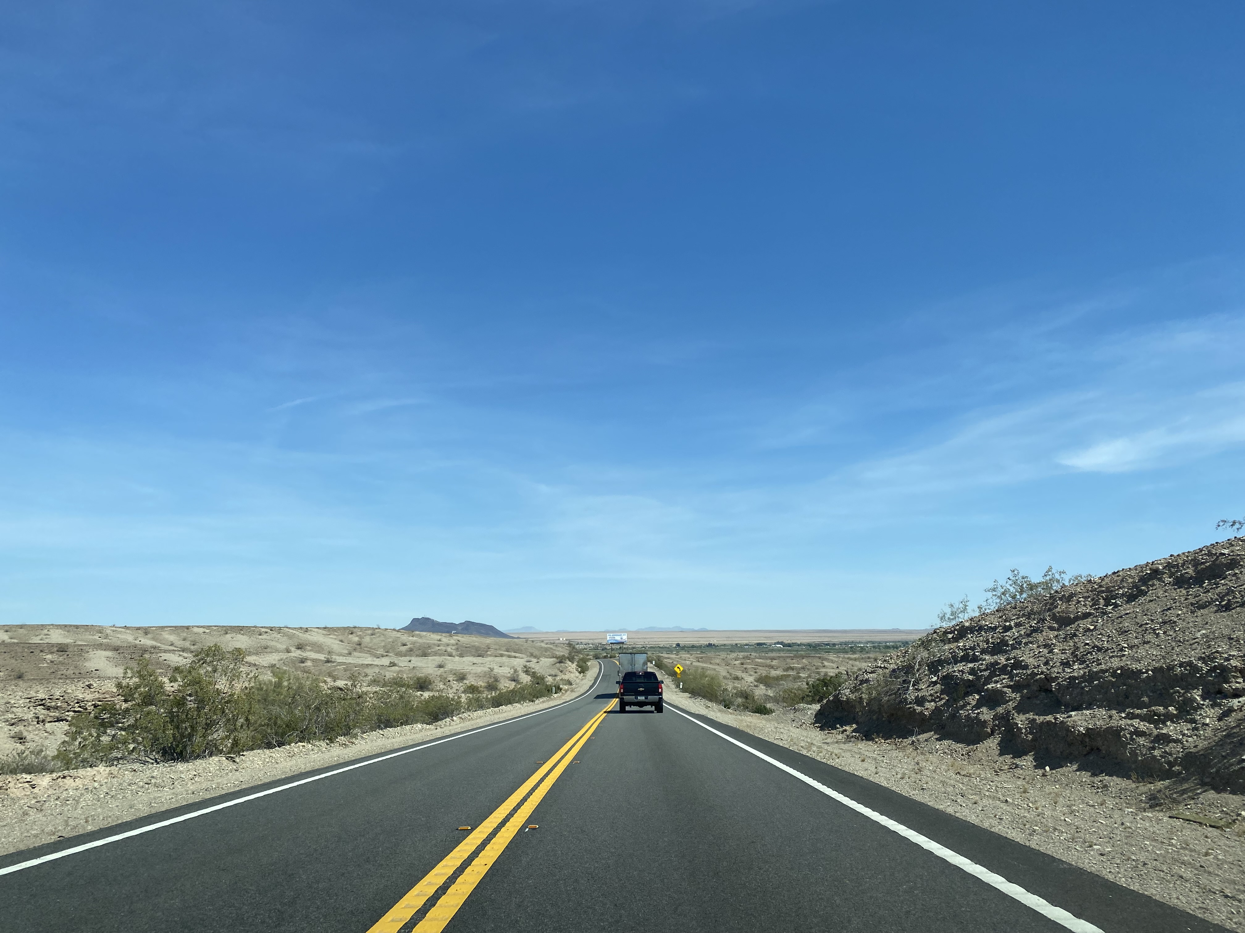
California State Route 62 eastbound passes through a desolate stretch of the Mojave Desert. As California State Route 62 approaches California State Route 177 (Rice Road) it enters Riverside County. The California State Route 62/California State Route 177 junction is located at Postmile RIV 85.55. The Postmiles of California State Route 62 in Riverside County are continuous with that of San Bernardino County.


Eastbound California State Route 62 from the California State Route 177 junction is signed as 41 miles from US Route 95 and 58 miles from Parker.


California State Route 62 eastbound reenters San Bernardino County at Postmile SBD 90.203.


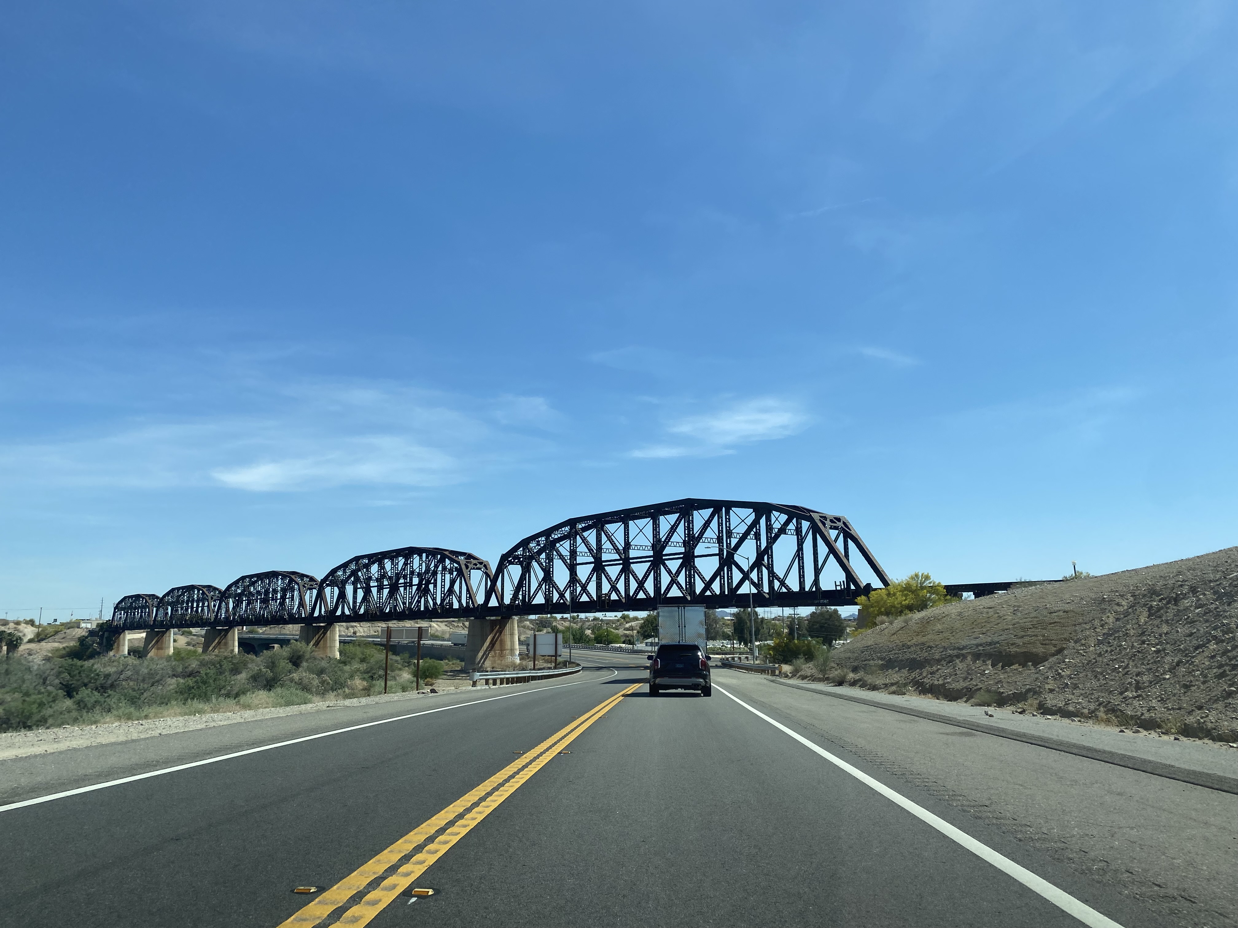
California State Route 62 eastbound begins to run alongside the tracks of the Arizona & California Railway. California State Route 62 eastbound enters the ghost town of Rice at approximately Postmile SBD 107.236.


Rice began life as a siding of the California Southern Railroad which was incorporated in 1914. The California Southern Railroad began at the ATSF tracks at Rice which was originally known as Blythe Junction. The California Southern Railroad traversed southeast 42.2 miles through the Big Maria Mountains and Little Maria Mountains to Blythe in the Sonoran Desert of Riverside County. The California Southern Railroad was completed by 1916 and was extended about another 7 miles to Ripley in 1920. The ATSF began to lease the California Southern Railroad in 1921 and purchased it during 1942.
Rice was a rather unremarkable rail siding until World War II and the creation of the Rice Army Airfield in 1942. The Rice Army Airfield was part of the Desert Training Center run by Major General George S. Patton which is best known today as a significant tank training ground during World War II. Rice apparently had several thousand enlisted personnel living in the town during the war years when the Army Airfield was operating. Supposedly the Rice Army Airfield was one of the three locations in the running for the Trinity Test which was the first detonation of a nuclear weapon. According to conjecture/rumor the Rice Army Field was not selected to slight Patton and was moved to White Sands in New Mexico instead.
Rice was largely depopulated after World War II. The Army Airfield was turned over to civilian use but was abandoned sometime in the 1950s. The ruins of the gas station in Rice opened in the 1970s. The ATSF sold the rights to the line between Rice and Ripley to the Arizona & California Railway in 1991. Rice was largely known in modern times for a shoe tree that burned in 2003 only to be replaced by a shoe fence which still exists to this day. The last train to run from Rice to Ripley was in December of 2007. In 2009 all but the first four miles of rials south out of Rice were abandoned and were removed in 2011. Aside from building foundations there isn't much left to indicate anything significant ever happened in Rice or the roll it played during World War II.
Rice was largely depopulated after World War II. The Army Airfield was turned over to civilian use but was abandoned sometime in the 1950s. The ruins of the gas station in Rice opened in the 1970s. The ATSF sold the rights to the line between Rice and Ripley to the Arizona & California Railway in 1991. Rice was largely known in modern times for a shoe tree that burned in 2003 only to be replaced by a shoe fence which still exists to this day. The last train to run from Rice to Ripley was in December of 2007. In 2009 all but the first four miles of rials south out of Rice were abandoned and were removed in 2011. Aside from building foundations there isn't much left to indicate anything significant ever happened in Rice or the roll it played during World War II.


The view south on Rice-Midland Road from Rice.

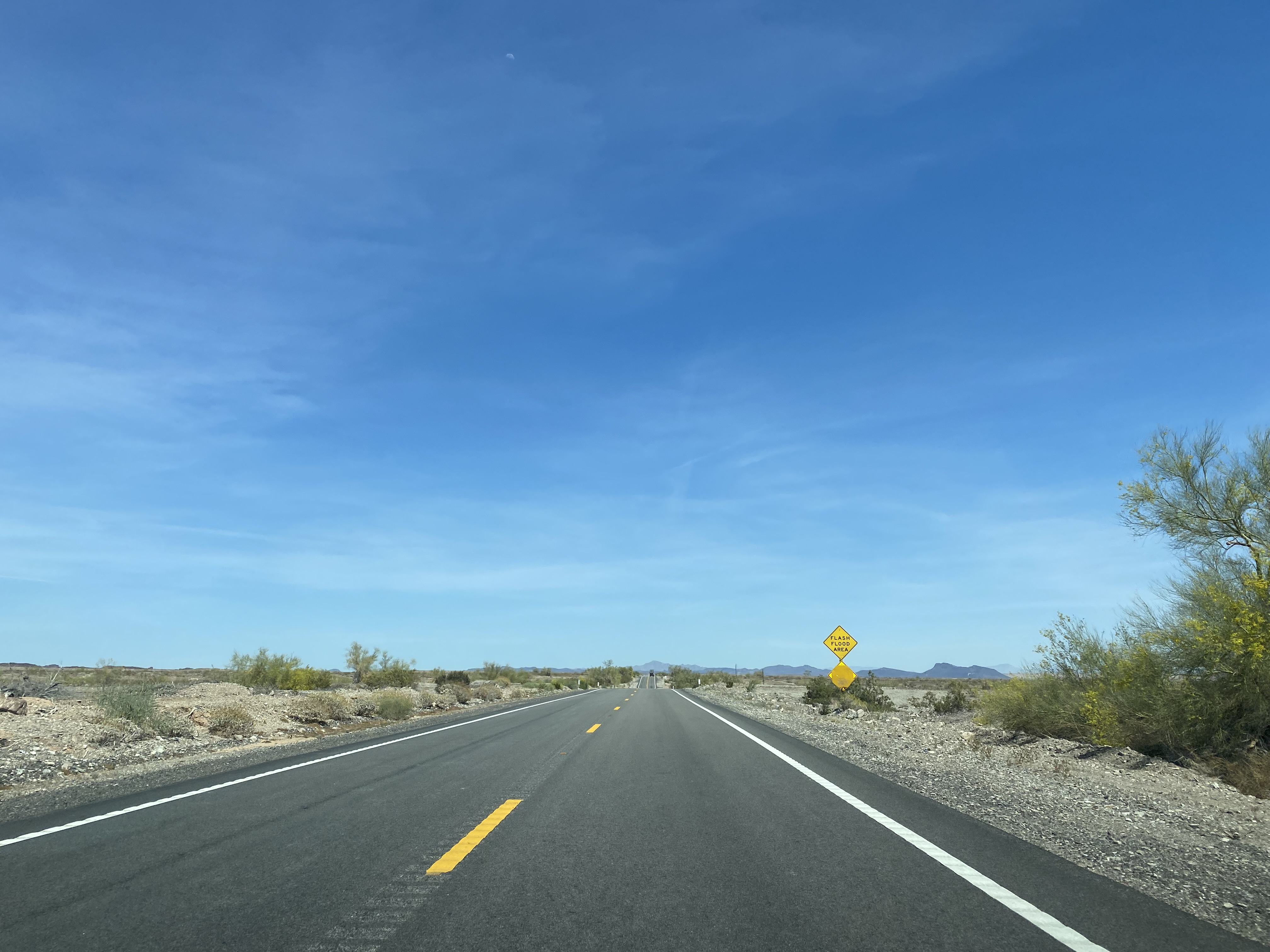
California State Route 62 east of Rice transitions into the Sonoran Desert and intersects US Route 95 at Postmile SBD 125.77.


California State Route 62 east of Vidal Junction shifts onto Aqueduct Road and is signed as 17 miles from Parker.

California State Route 62 eastbound passes through the community of Big River. At Postmile SBD 142.248 makes a right-hand turn towards Parker via California Avenue.


California State Route 62 eastbound crosses under the 1908 Arizona & California Railway Bridge. California State Route 62 terminates at the Colorado River Bridge and Arizona state line. California Avenue continues into Parker as Arizona State Route 95 Truck.


Update History
- Blog first published on 4/15/2018
- Update #1 on 5/24/2023
Comments
Made the drive between the Blythe Airport and Needles Airport many times. I was a weather observer that worked both sites before they were automated. Late 1980s and early 1990s. Very desolate drive, lots of dips that is for sure!
We must have crossed paths. I too worked at FCWOS EED and BLH along with PRC. Made the triangle trip many times.
Observer Initials WS