This past November I drove Interstate 80 over the Carquinez Strait via the 2003 Carquinez Bridge towards the San Francisco-Oakland Bay Bridge.

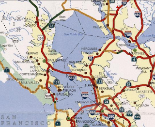
I-80 from the Carquinez Bridges traverses Contra Costa County and Alameda County westward approximately 19 miles to the I-580/I-880 interchange at the foot the San Francisco-Oakland Bay Bridge ("Bay Bridge"). This particular segment of I-80 is noteworthy for carrying a wrong-way multiplex with I-580.
Part 1; early US Route 40, the late Lincoln Highway and the Carquinez Bridges
The first automotive crossing via the Caquinez Strait was located at the well established Martinez-Benicia Ferry. By 1915 a steam ferry known as the City of Seattle was the first to carry automotive traffic across the Carquinez Strait. Access to the Martinez-Benicia Ferry was by way of Legislative Route 14 and Legislative Route 7. LRN 14 was originally defined as part of the 1909 First State Highway Bond Act according CAhighways. LRN 14 was routed into Martinez via what is now Carquinez Scenic Drive east of Crockett. Carquinez Scenic Drive as a State Highway was completed by 1912. Likewise LRN 7 between Tehama Junction and Benicia was also established as part of the 1909 First State Highway Bond Act according to CAhighways. LRN 7 entered Benicia via 2nd Street. LRN 14 and LRN 7 can be seen meeting at the Carquinez Strait at the Martinez-Benicia Ferry on the 1918 Division of Highways Map.

In late 1926 the US Route System was created. The initial routing of US Route 40 was aligned over LRN 7 into Benicia, over the Martinez-Benicia Ferry and LRN 14 towards Oakland. From Crockett US 40 followed LRN 14 west on San Pablo Avenue to Oakland to a terminus at 14th Street and Broadway. US 40 can be seen aligned over the Martinez-Benicia Ferry on the 1930 Automobile Club of Southern California Map.
 The primary driver of US 40 being routed away from Benicia and Martinez
was the completion of the original Carquinez Bridge in 1927. The
Carquinez Bridge originally carried the final alignment of the Lincoln
Highway when it opened as a private toll bridge. The Lincoln Highway was originally aligned over Altamont Pass on a route which eventually became US 48 and finally US 50. The original Carquinez Bridge can be seen during it's opening ceremony on May 21st, 1927.
The primary driver of US 40 being routed away from Benicia and Martinez
was the completion of the original Carquinez Bridge in 1927. The
Carquinez Bridge originally carried the final alignment of the Lincoln
Highway when it opened as a private toll bridge. The Lincoln Highway was originally aligned over Altamont Pass on a route which eventually became US 48 and finally US 50. The original Carquinez Bridge can be seen during it's opening ceremony on May 21st, 1927.

In 1929 the Martinez-Benicia Ferry was acquired by the American Toll Bridge Company which also operated the Carquinez Bridge. According to CAhighways a spur route of LRN 7 was adopted from LRN 14 in Crockett through the American Canyon Route in 1931. This spur route of LRN 7 appears to have been completed some time in 1932. US 40 was reported rerouted through Vallejo via the Carquinez Bridge and the American Canyon Route on the 8th Biannual Report by the Division of Highways in November 1932.

During June 1955 a California Senate Bill was signed with authorized construction of a second Carquinez Bridge. By June 1956 The Federal Aid Highway Act was passed on the Federal Level which was the birth of the Interstate System. Interstate 80 was selected to follow the path of US 40 within California which would route it over the Carquinez Strait. The January/February 1956 California Highway and Public Works Guide discusses the upcoming project to upgrade US 40/LRN 14 from Richmond to the Carquinez Strait to Freeway Standards. The second Carquinez Bridge was projected to be completed in late 1958.


The 1958 Division of Highways State Map shows the new freeway grade of US 40/I-80/LRN 14/LRN 7 as a planned route between Richmond and the Carquinez Bridges.

The second Carquinez Bridge opened to traffic on November 25th, 1958. The second Carquinez Bridge would become the northbound lanes of the US 40/I-80 freeway and remain so on the modern Interstate. The opening of the second Carquinez Bridge was the marque story on the January/February 1959 California and Public Works Guide.


The 1959 Division of Highways State Map shows the new freeway grade of US 40/I-80/LRN 14/LRN 7 replacing San Pablo Avenue between Richmond and the Carquinez Bridges.

The 1964 State Highway Renumbering saw all Legislative Routes dropped. Subsequently only US 40/I-80 show up as the highways crossing the Carquinez Bridges on the 1964 Division of Highways State Map.

US 40 is shown dropped in favor of I-80 entirely in California on the 1967 Division of Highways State Map.

The 1927 Carqueinz Bridge was determined to be seismically unstable following the 1989 Loma Prieta Earthquake. Subsequently a new Carquinez Bridge was built to carry westbound I-80, this structure opened on November 11th, 2003. Upon the completion of the 2003 Carquinez Bridge the 1927 structure was demolished piecemeal which was completed in 2007. The 1927 Carquinez Bridge can be seen wedged between the 2003 and 1958 Bridges in this stock photo from 2006.

Part 2; a drive on I-80 eastbound over the 1958 Carquinez Bridge
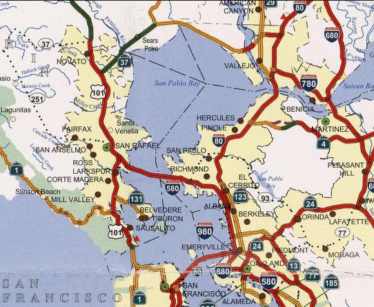
My initial path of travel was headed towards to US 101 by way of CA 29 and CA 37. That being the I case I made my way out to I-80 eastbound via CA 4 westbound.


I-80 east Exit 24 accesses Willow Avenue.


I-80 eastbound begins to approach Crockett. At Exit 26 I-80 eastbound accesses Cummings Skyway.


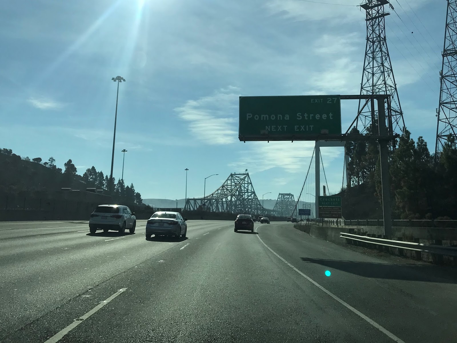
Ponoma Street in Crockett at Exit 27 on I-80 eastbound is the last turnoff before the toll booth at the 1958 Carquinez Bridge.


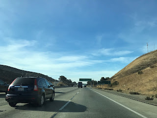
I-80 eastbound crosses the Carquinez Strait and enters Solano County. The toll facility for I-80 eastbound is located within the City Limit of Vallejo. Presently the toll rate on I-80 eastbound to cross the 1958 Carquinez Bridge is $6 dollars.


I-80 eastbound Exit 29A in Vallejo accesses CA 29 on Sonoma Boulevard.


Part 3; a drive on I-80 westbound over the 2003 Carquinez Bridge
On my return trip towards the Central Valley I took CA 29 southbound onto I-80 west. From I-80 westbound I crossed the 2003 Carquinez Bridge into Crockett of Alameda County. I made a detour onto Exit 27/Ponoma Street to partake in the Vista Point of the Carquinez Bridges. The 2003 Carquinez Bridge unlike the 1958 span doesn't carry a toll.


The 2003 and 1958 Carquinez Bridges can easily be seen from the Dead Fish restaurant. The 2003 Carquinez Bridge carries a pedestrian path known as the Carquinez Bridge Trail.

From the Carquinez Bridge Trail both the 2003 and 1958 Carquinez Bridges can be viewed. The 1958 Carquinez Bridge is a 3,300 foot long cantilever design. The 2003 Carquinez Bridge is a 3,465 foot long suspension span. The 1958 Carquinez Bridge has a 140 foot clearance above the Carquinez Strait whereas the 2003 span has a 148 foot clearance. The 2003 Carquinez Bridge is officially known as the Alfred Zampa Memorial Bridge.

The Carquinez Bridge Trail is also part of the San Francisco Bay Trail and Bay Area Ridge Trail.


Returning the freeway I-80 westbound accesses Cummings Skyway at Exit 26. From Cummings Skyway I-80 westbound is signed as 27 miles from San Francisco.


I-80 westbound enters Hercules and accesses Willow Avenue at Exit 24.


I-80 east Exit 23 is signed as direct access to Hercules.

I-80 west enters Pinole, at Exit 22 there is access to Pinole Valley Road. I-80 west Exit 21 is signed as access to Appian Way.


I-80 westbound Exit 20 is signed as access to I-580 westbound via Fitzgerald Drive


I-80 west Exit 19B accesses Hilltop Mall whereas Exit 19A accesses El Portal Drive.


I-80 westbound Exit 18 accesses San Pablo Avenue via Dam Road and in turn San Pablo.


I-80 westbound Exit 17 accesses McBryde Avenue.

I-80 westbound Exit 16 accesses San Pablo Avenue a directly.


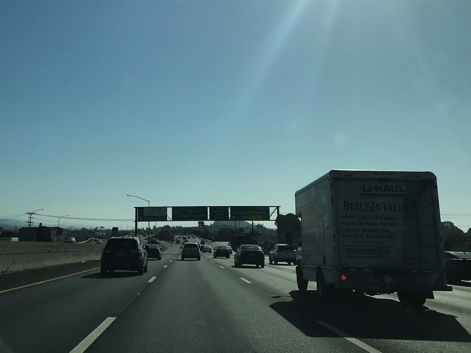
I-80 westbound Exit 15 accesses Cutting Boulevard. Cutting Boulevard presently is part of the north terminus of CA 123 which is comprised of mostly of former US 40 on San Pablo Avenue.


I-80 westbound Exit 14A accesses Central Avenue whereas Exit 14B accesses Carison Boulevard.


I-80 westbound merges over I-580 eastbound onto a wrong-way multiplex. I-80 west Exit 13 accesses Cleveland Avenue in Albany.


I-80 west/I-580 east Exit 12 accesses Gilman Street.

I-80 west/I-580 east accesses University Avenue in Berkeley.


CA 13 on Ashby Avenue is accesses via I-80 west/I-580 east Exit 10.


Central Valley traffic is directed to follow I-580 eastbound onto the MacArthur Freeway. Oakland International Airport traffic is directed to I-880 southbound.


I-80 west/I-580 east crosses under numerous digital highway shields approaching Exit 9 for Powell Street in Emeryville.


I-80 westbound splits from I-580 eastbound towards San Francisco and the Bay Bridge at an interchange in Oakland. I-80 westbound traffic splits into the right lanes whereas I-580 eastbound and I-880 southbound follows the left lanes.


Previously I-80 over the Bay Bridge into San Francisco was featured on Gribblenation on the blog below:
Interstate 80 over the San Francisco-Oakland Bay Bridge
The story of early US 40 on San Pablo Avenue and it's terminus points in the Bay Area can be found on the blog below:
CA 123/Old US 40 on San Pablo Avenue and terminus points in Oakland
Former early US 40 on Carquinez Scenic Drive and the Martinez-Benicia Ferry can be found on the blog below:
The original US 40 alignment on the Martinez-Benicia Ferry and Carquinez Scenic Drive

I-80 from the Carquinez Bridges traverses Contra Costa County and Alameda County westward approximately 19 miles to the I-580/I-880 interchange at the foot the San Francisco-Oakland Bay Bridge ("Bay Bridge"). This particular segment of I-80 is noteworthy for carrying a wrong-way multiplex with I-580.
Part 1; early US Route 40, the late Lincoln Highway and the Carquinez Bridges
The first automotive crossing via the Caquinez Strait was located at the well established Martinez-Benicia Ferry. By 1915 a steam ferry known as the City of Seattle was the first to carry automotive traffic across the Carquinez Strait. Access to the Martinez-Benicia Ferry was by way of Legislative Route 14 and Legislative Route 7. LRN 14 was originally defined as part of the 1909 First State Highway Bond Act according CAhighways. LRN 14 was routed into Martinez via what is now Carquinez Scenic Drive east of Crockett. Carquinez Scenic Drive as a State Highway was completed by 1912. Likewise LRN 7 between Tehama Junction and Benicia was also established as part of the 1909 First State Highway Bond Act according to CAhighways. LRN 7 entered Benicia via 2nd Street. LRN 14 and LRN 7 can be seen meeting at the Carquinez Strait at the Martinez-Benicia Ferry on the 1918 Division of Highways Map.

In late 1926 the US Route System was created. The initial routing of US Route 40 was aligned over LRN 7 into Benicia, over the Martinez-Benicia Ferry and LRN 14 towards Oakland. From Crockett US 40 followed LRN 14 west on San Pablo Avenue to Oakland to a terminus at 14th Street and Broadway. US 40 can be seen aligned over the Martinez-Benicia Ferry on the 1930 Automobile Club of Southern California Map.


In 1929 the Martinez-Benicia Ferry was acquired by the American Toll Bridge Company which also operated the Carquinez Bridge. According to CAhighways a spur route of LRN 7 was adopted from LRN 14 in Crockett through the American Canyon Route in 1931. This spur route of LRN 7 appears to have been completed some time in 1932. US 40 was reported rerouted through Vallejo via the Carquinez Bridge and the American Canyon Route on the 8th Biannual Report by the Division of Highways in November 1932.

During June 1955 a California Senate Bill was signed with authorized construction of a second Carquinez Bridge. By June 1956 The Federal Aid Highway Act was passed on the Federal Level which was the birth of the Interstate System. Interstate 80 was selected to follow the path of US 40 within California which would route it over the Carquinez Strait. The January/February 1956 California Highway and Public Works Guide discusses the upcoming project to upgrade US 40/LRN 14 from Richmond to the Carquinez Strait to Freeway Standards. The second Carquinez Bridge was projected to be completed in late 1958.


The 1958 Division of Highways State Map shows the new freeway grade of US 40/I-80/LRN 14/LRN 7 as a planned route between Richmond and the Carquinez Bridges.

The second Carquinez Bridge opened to traffic on November 25th, 1958. The second Carquinez Bridge would become the northbound lanes of the US 40/I-80 freeway and remain so on the modern Interstate. The opening of the second Carquinez Bridge was the marque story on the January/February 1959 California and Public Works Guide.


The 1959 Division of Highways State Map shows the new freeway grade of US 40/I-80/LRN 14/LRN 7 replacing San Pablo Avenue between Richmond and the Carquinez Bridges.

The 1964 State Highway Renumbering saw all Legislative Routes dropped. Subsequently only US 40/I-80 show up as the highways crossing the Carquinez Bridges on the 1964 Division of Highways State Map.

US 40 is shown dropped in favor of I-80 entirely in California on the 1967 Division of Highways State Map.

The 1927 Carqueinz Bridge was determined to be seismically unstable following the 1989 Loma Prieta Earthquake. Subsequently a new Carquinez Bridge was built to carry westbound I-80, this structure opened on November 11th, 2003. Upon the completion of the 2003 Carquinez Bridge the 1927 structure was demolished piecemeal which was completed in 2007. The 1927 Carquinez Bridge can be seen wedged between the 2003 and 1958 Bridges in this stock photo from 2006.

Part 2; a drive on I-80 eastbound over the 1958 Carquinez Bridge
My initial path of travel was headed towards to US 101 by way of CA 29 and CA 37. That being the I case I made my way out to I-80 eastbound via CA 4 westbound.


I-80 east Exit 24 accesses Willow Avenue.


I-80 eastbound begins to approach Crockett. At Exit 26 I-80 eastbound accesses Cummings Skyway.


Ponoma Street in Crockett at Exit 27 on I-80 eastbound is the last turnoff before the toll booth at the 1958 Carquinez Bridge.


I-80 eastbound crosses the Carquinez Strait and enters Solano County. The toll facility for I-80 eastbound is located within the City Limit of Vallejo. Presently the toll rate on I-80 eastbound to cross the 1958 Carquinez Bridge is $6 dollars.


I-80 eastbound Exit 29A in Vallejo accesses CA 29 on Sonoma Boulevard.


Part 3; a drive on I-80 westbound over the 2003 Carquinez Bridge
On my return trip towards the Central Valley I took CA 29 southbound onto I-80 west. From I-80 westbound I crossed the 2003 Carquinez Bridge into Crockett of Alameda County. I made a detour onto Exit 27/Ponoma Street to partake in the Vista Point of the Carquinez Bridges. The 2003 Carquinez Bridge unlike the 1958 span doesn't carry a toll.


The 2003 and 1958 Carquinez Bridges can easily be seen from the Dead Fish restaurant. The 2003 Carquinez Bridge carries a pedestrian path known as the Carquinez Bridge Trail.

From the Carquinez Bridge Trail both the 2003 and 1958 Carquinez Bridges can be viewed. The 1958 Carquinez Bridge is a 3,300 foot long cantilever design. The 2003 Carquinez Bridge is a 3,465 foot long suspension span. The 1958 Carquinez Bridge has a 140 foot clearance above the Carquinez Strait whereas the 2003 span has a 148 foot clearance. The 2003 Carquinez Bridge is officially known as the Alfred Zampa Memorial Bridge.

The Carquinez Bridge Trail is also part of the San Francisco Bay Trail and Bay Area Ridge Trail.


Returning the freeway I-80 westbound accesses Cummings Skyway at Exit 26. From Cummings Skyway I-80 westbound is signed as 27 miles from San Francisco.


I-80 westbound enters Hercules and accesses Willow Avenue at Exit 24.


I-80 west enters Pinole, at Exit 22 there is access to Pinole Valley Road. I-80 west Exit 21 is signed as access to Appian Way.


I-80 westbound Exit 20 is signed as access to I-580 westbound via Fitzgerald Drive


I-80 west Exit 19B accesses Hilltop Mall whereas Exit 19A accesses El Portal Drive.


I-80 westbound Exit 18 accesses San Pablo Avenue via Dam Road and in turn San Pablo.


I-80 westbound Exit 17 accesses McBryde Avenue.

I-80 westbound Exit 16 accesses San Pablo Avenue a directly.


I-80 westbound Exit 15 accesses Cutting Boulevard. Cutting Boulevard presently is part of the north terminus of CA 123 which is comprised of mostly of former US 40 on San Pablo Avenue.

I-80 westbound Exit 14A accesses Central Avenue whereas Exit 14B accesses Carison Boulevard.


I-80 westbound merges over I-580 eastbound onto a wrong-way multiplex. I-80 west Exit 13 accesses Cleveland Avenue in Albany.


I-80 west/I-580 east Exit 12 accesses Gilman Street.

I-80 west/I-580 east accesses University Avenue in Berkeley.


CA 13 on Ashby Avenue is accesses via I-80 west/I-580 east Exit 10.


Central Valley traffic is directed to follow I-580 eastbound onto the MacArthur Freeway. Oakland International Airport traffic is directed to I-880 southbound.


I-80 west/I-580 east crosses under numerous digital highway shields approaching Exit 9 for Powell Street in Emeryville.


I-80 westbound splits from I-580 eastbound towards San Francisco and the Bay Bridge at an interchange in Oakland. I-80 westbound traffic splits into the right lanes whereas I-580 eastbound and I-880 southbound follows the left lanes.


Previously I-80 over the Bay Bridge into San Francisco was featured on Gribblenation on the blog below:
Interstate 80 over the San Francisco-Oakland Bay Bridge
The story of early US 40 on San Pablo Avenue and it's terminus points in the Bay Area can be found on the blog below:
CA 123/Old US 40 on San Pablo Avenue and terminus points in Oakland
Former early US 40 on Carquinez Scenic Drive and the Martinez-Benicia Ferry can be found on the blog below:
The original US 40 alignment on the Martinez-Benicia Ferry and Carquinez Scenic Drive
Comments