This past April I had a long layover while in Denver. Given that I had some down time I ventured out into Denver and took Pena Boulevard back to Denver International Airport.

Pena Boulevard is a 11.1 mile freeway connecting Interstate 70 to Denver International Airport ("DIA"). Pena Boulevard is unique freeway in that it is owned and maintained by the City of Denver and essentially only exists to service traffic to-from DIA. Pena Boulevard opened alongside DIA in 1995. DIA itself was a replacement for the earlier for Stapleton International Airport which was located much closer to downtown Denver.
My approach to Pena Boulevard was from I-70 west. From I-70 west there is no direct access ramp to Pena Boulevard which requires traffic to briefly take Airport Boulevard to access it.


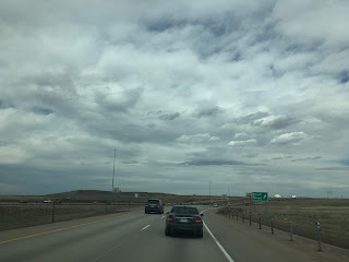
Despite mainly being a service freeway for DIA the route of Pena Boulevard does have several local exits. The first exit is at Green Valley Ranch Boulevard.

The next exit on Pena Bouelvard is located at 56th Avenue.


North of 56th Avenue Pena Bouelvard traffic is advised that the terminal of DIA is 7 miles away.

Pena Boulevard is advised as where specific airlines can be located.


Pena Boulevard curves east towards DIA, there are numerous signed facilities off the exit at Tower Road.


The only numbered exit on Pena Boulevard is "Exit 6" for E470.


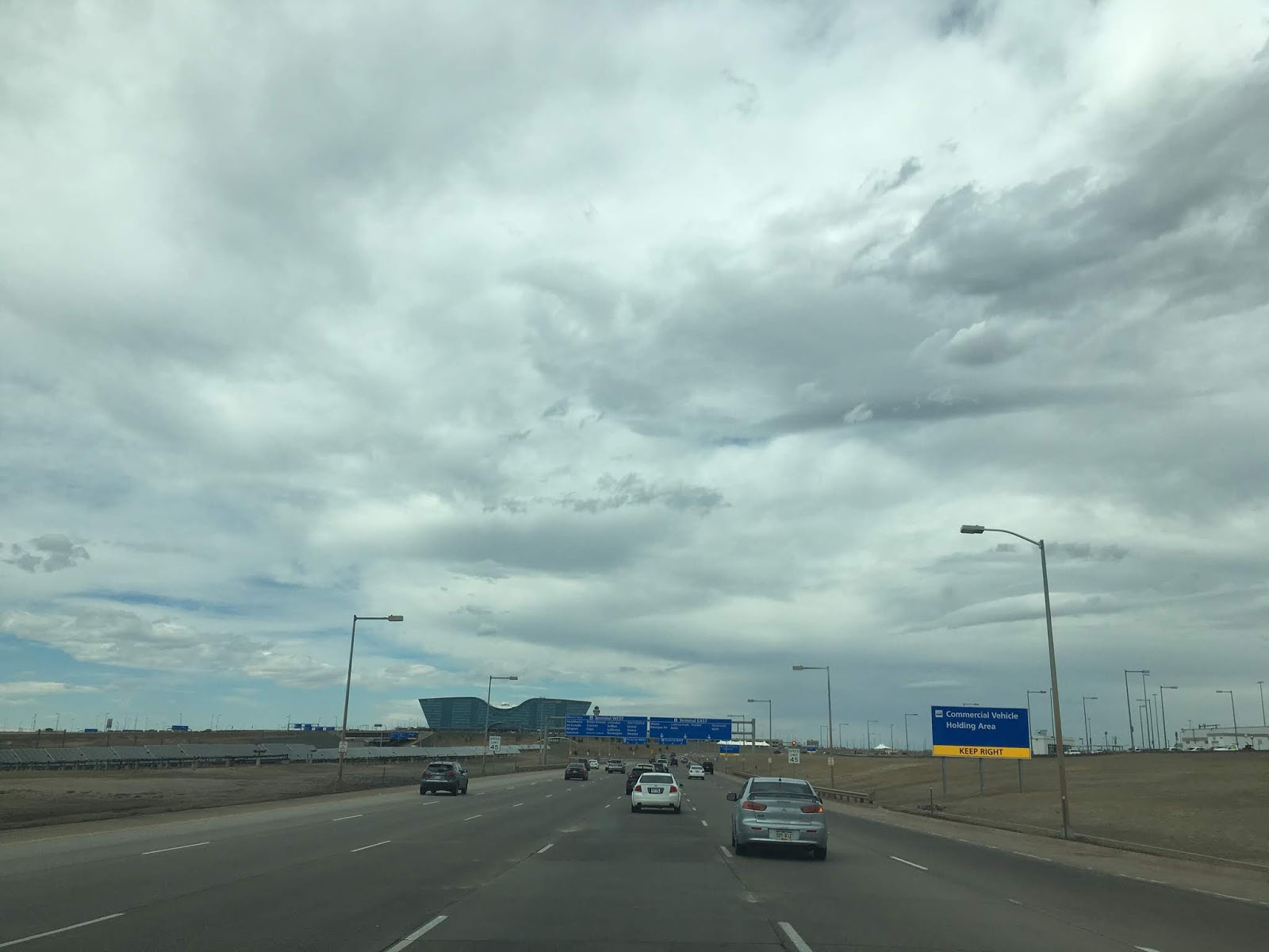
Traffic on Pena Boulevard east of E470 is greeted with a giant Denver International Airport.

Pena Boulevard next has an exit at 75th Avenue which is signed as access to the DIA rental car facilities. Amusingly a connector road under Pena Boulevard is named "Gun Club Road" which I thought was an interesting choice for an airport.


Pena Boulevard passes by the former toll facility which was removed from service in 2000.

Additional access to the rental car facilities is signed from the Jackson Gap Road exit. Some of the airline overhead signage begins before Jackson Gap Road.


Approaching "Blucifer" there are additional overhead airline signs. The sculpture that is locally known as "Blucifer" is technically called the Blue Mustang. Blucifer was installed on Pena Boulevard in 2008 after it accidentally fell on and killed it's creator in 2006. Blucifer has bright red eye and a somewhat demonic looking appearance. No doubt Blucifer has contributed to the conspiracy theories surrounding DIA.


Pena Boulevard swings north again on a final approach to DIA. Advisory signs direct traffic either to the West or East side of the Terminal Building.


My flight was on the East side of the Terminal building.


The Terminal Building of DIA has a massive central hall that serves as something akin to a grand hall. The facade of DIA has inspired several conspiracy theories about what the construction design is supposed to represent. Some of the more popular theories include stuff about a "One-World Order," the Knights Templar, the Stone Masons and Satanic symbolism. My personal favorite conspiracy theory is that DIA is somehow home to the Lizard People who somehow rule the world from the airport (someone obviously watched V: the Final Battle before coming up with that).
The roof the terminal building at DIA is supposed to represent the snowy peaks of the Front Range of the Rocky Mountains.


Westbound flights out of DIA has a fantastic view of Pena Boulevard; note that Pikes Peak is in the background.

The view of downtown Denver with Pikes Peak in the background is pretty nice too.


Pena Boulevard is a 11.1 mile freeway connecting Interstate 70 to Denver International Airport ("DIA"). Pena Boulevard is unique freeway in that it is owned and maintained by the City of Denver and essentially only exists to service traffic to-from DIA. Pena Boulevard opened alongside DIA in 1995. DIA itself was a replacement for the earlier for Stapleton International Airport which was located much closer to downtown Denver.
My approach to Pena Boulevard was from I-70 west. From I-70 west there is no direct access ramp to Pena Boulevard which requires traffic to briefly take Airport Boulevard to access it.


Despite mainly being a service freeway for DIA the route of Pena Boulevard does have several local exits. The first exit is at Green Valley Ranch Boulevard.

The next exit on Pena Bouelvard is located at 56th Avenue.


North of 56th Avenue Pena Bouelvard traffic is advised that the terminal of DIA is 7 miles away.

Pena Boulevard is advised as where specific airlines can be located.


Pena Boulevard curves east towards DIA, there are numerous signed facilities off the exit at Tower Road.


The only numbered exit on Pena Boulevard is "Exit 6" for E470.


Traffic on Pena Boulevard east of E470 is greeted with a giant Denver International Airport.

Pena Boulevard next has an exit at 75th Avenue which is signed as access to the DIA rental car facilities. Amusingly a connector road under Pena Boulevard is named "Gun Club Road" which I thought was an interesting choice for an airport.


Pena Boulevard passes by the former toll facility which was removed from service in 2000.

Additional access to the rental car facilities is signed from the Jackson Gap Road exit. Some of the airline overhead signage begins before Jackson Gap Road.


Approaching "Blucifer" there are additional overhead airline signs. The sculpture that is locally known as "Blucifer" is technically called the Blue Mustang. Blucifer was installed on Pena Boulevard in 2008 after it accidentally fell on and killed it's creator in 2006. Blucifer has bright red eye and a somewhat demonic looking appearance. No doubt Blucifer has contributed to the conspiracy theories surrounding DIA.


Pena Boulevard swings north again on a final approach to DIA. Advisory signs direct traffic either to the West or East side of the Terminal Building.


My flight was on the East side of the Terminal building.


The Terminal Building of DIA has a massive central hall that serves as something akin to a grand hall. The facade of DIA has inspired several conspiracy theories about what the construction design is supposed to represent. Some of the more popular theories include stuff about a "One-World Order," the Knights Templar, the Stone Masons and Satanic symbolism. My personal favorite conspiracy theory is that DIA is somehow home to the Lizard People who somehow rule the world from the airport (someone obviously watched V: the Final Battle before coming up with that).
The roof the terminal building at DIA is supposed to represent the snowy peaks of the Front Range of the Rocky Mountains.


Westbound flights out of DIA has a fantastic view of Pena Boulevard; note that Pikes Peak is in the background.

The view of downtown Denver with Pikes Peak in the background is pretty nice too.

Comments