While visiting the San Bernardino area this past year I drove the entirety of California State Route 18 up the Rim of the World Highway in the San Bernardino Mountains to California State Route 138 in the Mojave Desert

CA 18 is one of the original 1934 Signed State Highways and perhaps has the oddest alignment which forms an almost 270 degree semi-circle. The present route of CA 18 begins in San Bernardino and ends 114 miles to the northwest in the Mojave Desert in Los Angeles County at CA 138. CA 18 between Sierra Way in San Bernardino close to the vicinity of CA 330 is known as the Rim of the World Highway. The "Rim of the World" name refers to the fact that CA 18 runs along the ridge line of the San Bernardino Mountains which offers almost countless scenic vistas. In my personal opinion CA 18 between CA 210 and CA 138 is the most unique, scenic and engaging at-grade expressway in the California State Highway system.

History of California State Route 18 and the Rim-of-the-World Highway
The genesis of what became CA 18 between San Bernardino and Victorville was part of Legislative Route Number 43. LRN 43 was first adopted into the State Highway System in 1917 according to CAhighways.org between the end of the San Bernardino County maintained pavement in Waterman Canyon easterly towards Bear Valley. At the time the Rim of the World Highway was known as the equally appropriately named Crest Drive. The initial path of LRN 43 on Crest Drive can be seen as a "Special Appropriations Road" on the 1918 State Highway Map.

Waterman Canyon has been a source of transportation since the California Gold Rush. Crest Drive/Rim of the World Highway was initially constructed in 1852 as a logging road by Mormon settlers in what is now modern day San Bernardino County. The building of Crest Drive is eluded to in this City of San Bernardino article regarding Arrowhead Springs.
City of San Bernardino on Arrowhead Springs
Transportation up Crest Drive became suddenly increasingly important following the discovery of Gold in Holcomb Valley located near modern day Bear Lake. A large town known as Belleville developed around the Holcomb Valley mining claims. Growth in Belleville was so rapid that it almost took the San Bernardino County seat from San Bernardino. Although the Gold Rush in Holcomb Valley last about a decade mining continued in the area until the 1910s. By the turn of the 20th Century the crest of the San Bernardino Mountains had become an increasingly popular locale for recreation. It appears that one of the primary drivers in adding Crest Drive to the State Highway system was likely to eliminate the toll facility that can be seen present on the 1908 USGS Map of San Bernardino below.

A 1919 Third State Highway Bond Act measure extended LRN 43 over Bear Valley Dam, this is reflected on the 1920 State Highway Map. Previously LRN 43 had been routed north of Big Bear Lake. The 1919 Third State Highway Bond Act routed LRN 43 on both shores of Big Bear Lake.

According to CAhighways.org LRN 43 was extended south from Waterman Canyon to Newport Beach in 1931 and to Victorville by 1933. These two changes are reflective on the 1934 State Highway Map.

By 1934 CA 18 was added to LRN 178 and to LRN 43 between CA 19 in Artesia north to US 66 in Victorville via D Street. LRN 178 was a 1933 addition to the State Highway System according CAhighways.org. CA 18 along with the other Signed State Routes was announced in a August 1934 Department of Public Works Publication.

CA 18 first can be seen on the 1935 Goshua State Highway Map of California.

On the Goshua City Insert of Los Angeles the south terminus of CA 18 is seen terminating at CA 19/Cerritos Avenue via Carson Street.

CA 18 can be seen in even greater detail on the 1938 State Highway Map.


In 1947 US 91 was extended south from Barstow to Long Beach. US 91 was co-signed on CA 18 between San Bernardino southwest to CA 19 which can be first seen on the 1948 State Highway Map.

In 1954 CA 30 appears to have first been signed from US 66 near Glendora eastward into the San Bernardino Mountains to CA 18 in Running Springs via LRN 190 and LRN 207. According to CAhighways.org LRN 190 was added to the State Highway System and LRN 207 was added in 1937. CA 30 can be seen routed between US 66 in Glendora and CA 18 in Running Springs on the 1954 State Highway Map.

The 1954 State Highway Map also shows part of LRN 178 which was CA 18/US 91 deleted between US 101/LRN 2 in Anaheim east to CA 55/LRN 43 in Santa Ana Canyon. It is unclear if CA 18/US 91 was stilled signed over former LRN 178 on Lincoln Avenue, was multiplexed somewhere or had a signage gap.

In 1957 CA 30 appears to have been co-signed with CA 18 east from Running Springs to Big Bear Lake. It appears that CA 18 ran along the north shore of Big Bear Lake whereas CA 30 ran on the south shore. CA 18 prior to 1964 likely was always signed on the north shore of Big Bear Lake as it appears there on every topographical map of the area I can find before the 1964 Stare Highway Renumbering. The co-signage of CA 18/CA 30 first appears on the 1957 State Highway Map.

The 1961 State Highway Map is the first edition to show LRN 190 completed between San Bernarino and Big Bear City. LRN 190 between San Bernardino and Big Bear City was assigned CA 38.

In 1962 CA 18 was truncated to US 91/395 in San Bernardino onto what would eventually become the unsigned CA 259 Freeway. The new south terminus of CA 18 can be first seen on the 1962 State Highway Map.

During the 1964 State Highway Renumbering CA 18 was extended from Victorville westward towards Llano on what was the unbuilt LRN 268. LRN 268 was defined by the State Legislature in 1959 according to CAhighways.org. CA 18 appears to have been routed south of Big Bear Lake during the 1964 State Highway Renumbering with CA 38 extended along the north shore. These changes can be seen on the 1964 State Highway Map.

In 1965 CA 18 was truncated from I-15/US 66/US 395 to CA 30 in San Bernardino. The previous southern jog of CA 18 to I-15/US 66/US 395 was reassigned as CA 259. This change can be seen on the 1966 State Highway City Insert.

According to CAhighways.org the extension of CA 18 west from Victorville was completed by 1967. The new extension of CA 18 west of Victorville to CA 138 near Llano can be seen on the 1969 State Highway Map.

The 1969 State Highway Map is also notable in that it shows part of CA 18 from San Bernardino to Crestline partially built up to four-lane expressway standards. The 1970 map shows the same alignment built up to four-lane expressway standards.

According to CAhighways.org the route of CA 18 through Big Bear Lake Village was rerouted in 1991 via Paine Road and Lakeview Drive. The previous alignment of CA 18 on Village Drive and Pine Knot Avenue was reassigned as CA 18 Business.
Driving California State Route 18 and the Rim-of-the-World Highway
My approach to CA 18 and the Rim of the World Highway was via CA 259 north to CA 210 east. From CA 210 east I took the Waterman Avenue exit for CA 18.


CA 18 begins at Post Mile SBD T6.148. CA 18 heads directly northbound on Waterman Avenue towards Waterman Canyon. Truck traffic is given several length advisory warnings.


CA 18 traffic heading north towards Waterman Canyon is advised there is a historic marker of the "Arrowhead." The Arrowhead refers to a rock formation located in the San Bernardino mountains.

At Sierra Way the route of CA 18 on Waterman Avenue becomes Rim of the World Highway.


Traffic on CA 18 heading north on the Rim of the World Highway is advised there is 14 miles of climbing ahead.

CA 18 on Rim of the World Highway enters San Bernardino National Forest at Post Mile SBD 8.659.

CA 18 meets the original Waterman Canyon Route alignment at Old Waterman Canyon Road at Post Mile SBD 9.136. It appears this segment of road was ultimately replaced when LRN 43 was extended south into San Bernardino and Newport Beach.

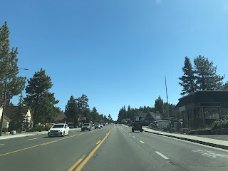
The climb through Waterman Canyon on CA 18/Rim of the World Highway is fast and steady.


The four-lane expressway winds through the terrain and has several traffic pullouts which double as vistas. This particular vista looks below to Old Waterman Canyon Road.

CA 18/Rim of the World Highway has a second junction with Old Waterman Canyon Road at Post Mile SBD R13.29. Just prior to the junction CA 18 crosses over 3,000 feet above sea level.


CA 18/Rim of the World Highway continues to twist through the San Bernardino Mountains to an elevation of 4,000 feet above sea level.


The vista at 4,000 feet offers a wide view of San Bernardino Valley and the Rim of the World Highway ascending the San Bernardino Mountains. I-215 can even be seen to the west in the second picture below.


CA 18/Rim of the World Highway continues as a four-lane expressway to CA 138 at Post Mile SBD R17.731 before dropping to two-lanes.


CA 18 continues eastward and meets CA 189 (which is unsigned from CA 18) at Lake Gregory Drive at Post Mile SBD 20.607.


CA 18 east of CA 189 is signed as 28 miles from Big Bear Lake.


CA 18 continues east and passes through Rimforest at Post Mile SBD 22.778. At Post Mile SBD 24.716 meets the south terminus of CA 173 on the outskirts of Lake Arrowhead.


CA 18 east of CA 173 is signed as 26 miles from Big Bear Lake.

At Post Mile SBD 25.81 CA 18 passes through Skyforest.


At Post Mile SBD 26.414 CA 18 passes by Sky Park at Santa's Village. Santa's Village opened in 1955 as a Christmas themed park which gradually changed towards an outdoor sports aesthetic.


CA 18 east of Santa's Village ascends over 6,000 feet above sea level which provides some excellent views of the Inland Empire below the San Bernardino Mountains.


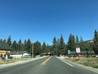
CA 18 continues into Running Springs and meets CA 330 (formerly CA 30) at City Creek Road at Post Mile SBD 31.876. Running Springs was originally known as Hunsaker Flats and popped up in the 1920s as LRN 43 was improved.


CA 18 east of CA 330 is signed on Hilltop Boulevard. CA 18 east of Running Springs is signed as 17 miles from Big Bear Lake.


At Post Mile SBD 33.559 CA 18 passes through Arrowbear. Arrowbear apparently takes it's name as the mid-way point between Lake Arrowhead and Big Bear Lake.


CA 18 east of Arrowbear briefly expands to four lanes passing by several ski resorts before dropping back down to two-lanes as it climbs above 7,000 feet above sea level.


CA 18 ascends eastward to Lake View Point at 7,112 feet. Lake View Point is highest point anywhere on CA 18.


From Lake View Point a wide vista overlooking the canyons carved out by North Fork Bear Creek and Bear Creek can be observed. To the distance to the east the waters of Big Bear Lake can be seen along with CA 18 snaking through the San Bernardino Mountains.


CA 18 expands to a four lane expressway which drops to two-lanes approaching Bear Lake Dam and CA 38. At Post Mile SBD 44.316 CA 18 meets CA 38 on North Shore Drive at Bear Valley Dam.


Big Bear Lake lies at an elevation of 6,743 feet above sea level in Bear Valley. Big Bear Lake lies along Bear Creek and is impounded by Bear Valley Dam which is a multiple arch structure constructed in 1912. The original Bear Valley Dam lies about 300 feet upstream under the waters of Big Bear Lake and was completed in 1884. The Old Bear Valley Dam only held about 25,000 acre feet of water whereas the 1912 Dam holds up to 73,000 acre feet. Bear Valley was named in 1845 by Benjamin Wilson who led a search party looking for Native Americans suspect of a raid in Riverside. The name "Bear Valley" comes from the numerous California Brown Bears that were observed by Wilson during his expedition.


CA 18 east of CA 38 continues on the south shore of Big Bear Lake on Big Bear Boulevard. CA 18 enters the City of Big Bear Lake where it meets it's former alignment in Big Bear Village at Post Mile SBD 48.507. As noted above the former alignment of CA 18 through Big Bear Village is signed as CA 18 Business on Village Drive and Pine Knot Avenue. Big Bear Lake developed after the completion of the 1912 Bear Valley Dam and incorporated as a City in 1980.


CA 18 meets the opposite side of the CA 18 Business Loop at Pine Knot Avenue at Post Mile SBD 49.108.


CA 18 continues along the south shore of Big Bear Lake where it follows Big Bear Boulevard into Big Bear City (which amusingly isn't incorporated). At Post Mile SBD 53.917 CA 18 meets CA 38 again.


CA 18 makes a left hand turn onto Greenway Drive on a multiplex with CA 38 over Bear Creek. At Post Mile SBD 54.54 CA 18 makes a right hand turn off of CA 38 onto North Shore Drive.


Lucerne Valley in the Mojave Desert is signed 19 miles to the north on CA 18.

CA 18 northbound passes by Lake Baldwin which is a natural intermittent alkali lake. Lake Baldwin was discovered in 1845 by Benjamin Wilson who originally called it Lake Big Bear. At Post Mile SBD 58.162 CA 18 northbound meets Holcomb Valley Road which accesses the former mine sites of Holcomb Valley.


CA 18 northbound meets the Pacific Crest Trail at Post Mile SBD 58.933 at Nelson Ridge. From Nelson Ridge the northbound drop in CA 18 into Lucerne Valley of the Mojave Desert is easily observed. Approaching Nelson Ridge CA 18 north traffic is advised of a 6% downhill grade.


CA 18 northbound has a massive descent through canyons into the Mojave Deser which have grades as high as 10%. CA 18 northbound passes through Cactus Flats and Whiskey Springs before emerging from San Bernardino National Forest at Post Mile SBD 65.192.


CA 18 northbound continues to descend into Lucerne Valley. At Post Mile SBD 73.756 CA 18 north meets CA 247 on Old Woman Springs Road in Lucerne Valley. Luceren Valley lies at an elevation of 2,953 feet above sea level in the Mojave Desert which is an almost 4,000 foot drop from Bear Valley in the San Bernardino Mountains.


CA 18 from CA 247 turns westward towards Victorville. At Post Mile SBD 77.07 CA 18 westbound passes by two monuments for Chimney Rock at Rabbit Springs Road. Chimney Rock was the site of the last battle between Native Tribes and American forces in Southern California in February 1867.


CA 18 west of Rabbit Springs Road is signed as a Safety Corridor for 6 miles into Apple Valley at Post Mile SBD 86.874.


CA 18 westbound continues Apple Valley as Happy Trails Highway. At Apple Valley Ridge at approximately Post Mile SBD 94.97 CA 18 west enters the City of Victorville.


CA 18 west crosses the Mojave River and the many freight rail lines next to 1928 Mineral Road Steel Arch Bridge. CA 18 west emerges into downtown Victorville on D Street and picks up the historic alignment of US 66/91 at 7th Street. The historic alignment of US 66/91 is presently signed as the I-15 Business Loop in Victorville. Prior to the US Route System the main highway through Victorville would have been would have been the National Old Trails Road which diverged for the later alignments at Center Street. Victorville dates back to 1885 when it was established as a siding on the ATSF California Southern Railroad known as "Victor."


At 16825 D Street the California Route 66 Museum can be accessed from CA 18/I-15 BL. The California Route 66 Museum was established in 1995 and houses numerous signs in addition to historic artifacts regarding US Route 66.


CA 18 west diverges from the historic route of US 66/91 on D Street at I-15 south. The I-15 BL terminates at the junction for I-15.


CA 18 west multiplexes I-15 south to Exit 150 at Palmdale Road.


CA 18 west continues on Palmdale Road to Adelanto where it meets US 395 at Post Mile SBD 100.948.


CA 18 west continues on Palmdale Road where it enters Los Angeles County at Post Mile SBD 115.908 at a railroad overpass. Upon entering Los Angeles CA 18 west enters Llano and is signed on Pearblossom Highway.


CA 18 west terminates at CA 138 at Post Mile LA 4.47. There is virtually no indication that CA 18 west has terminated other than the through signage indicating that Pearblossom Highway continues as CA 138 west.


CA 18 is one of the original 1934 Signed State Highways and perhaps has the oddest alignment which forms an almost 270 degree semi-circle. The present route of CA 18 begins in San Bernardino and ends 114 miles to the northwest in the Mojave Desert in Los Angeles County at CA 138. CA 18 between Sierra Way in San Bernardino close to the vicinity of CA 330 is known as the Rim of the World Highway. The "Rim of the World" name refers to the fact that CA 18 runs along the ridge line of the San Bernardino Mountains which offers almost countless scenic vistas. In my personal opinion CA 18 between CA 210 and CA 138 is the most unique, scenic and engaging at-grade expressway in the California State Highway system.

History of California State Route 18 and the Rim-of-the-World Highway
The genesis of what became CA 18 between San Bernardino and Victorville was part of Legislative Route Number 43. LRN 43 was first adopted into the State Highway System in 1917 according to CAhighways.org between the end of the San Bernardino County maintained pavement in Waterman Canyon easterly towards Bear Valley. At the time the Rim of the World Highway was known as the equally appropriately named Crest Drive. The initial path of LRN 43 on Crest Drive can be seen as a "Special Appropriations Road" on the 1918 State Highway Map.

Waterman Canyon has been a source of transportation since the California Gold Rush. Crest Drive/Rim of the World Highway was initially constructed in 1852 as a logging road by Mormon settlers in what is now modern day San Bernardino County. The building of Crest Drive is eluded to in this City of San Bernardino article regarding Arrowhead Springs.
City of San Bernardino on Arrowhead Springs
Transportation up Crest Drive became suddenly increasingly important following the discovery of Gold in Holcomb Valley located near modern day Bear Lake. A large town known as Belleville developed around the Holcomb Valley mining claims. Growth in Belleville was so rapid that it almost took the San Bernardino County seat from San Bernardino. Although the Gold Rush in Holcomb Valley last about a decade mining continued in the area until the 1910s. By the turn of the 20th Century the crest of the San Bernardino Mountains had become an increasingly popular locale for recreation. It appears that one of the primary drivers in adding Crest Drive to the State Highway system was likely to eliminate the toll facility that can be seen present on the 1908 USGS Map of San Bernardino below.

A 1919 Third State Highway Bond Act measure extended LRN 43 over Bear Valley Dam, this is reflected on the 1920 State Highway Map. Previously LRN 43 had been routed north of Big Bear Lake. The 1919 Third State Highway Bond Act routed LRN 43 on both shores of Big Bear Lake.

According to CAhighways.org LRN 43 was extended south from Waterman Canyon to Newport Beach in 1931 and to Victorville by 1933. These two changes are reflective on the 1934 State Highway Map.

By 1934 CA 18 was added to LRN 178 and to LRN 43 between CA 19 in Artesia north to US 66 in Victorville via D Street. LRN 178 was a 1933 addition to the State Highway System according CAhighways.org. CA 18 along with the other Signed State Routes was announced in a August 1934 Department of Public Works Publication.

CA 18 first can be seen on the 1935 Goshua State Highway Map of California.

On the Goshua City Insert of Los Angeles the south terminus of CA 18 is seen terminating at CA 19/Cerritos Avenue via Carson Street.

CA 18 can be seen in even greater detail on the 1938 State Highway Map.


In 1947 US 91 was extended south from Barstow to Long Beach. US 91 was co-signed on CA 18 between San Bernardino southwest to CA 19 which can be first seen on the 1948 State Highway Map.

In 1954 CA 30 appears to have first been signed from US 66 near Glendora eastward into the San Bernardino Mountains to CA 18 in Running Springs via LRN 190 and LRN 207. According to CAhighways.org LRN 190 was added to the State Highway System and LRN 207 was added in 1937. CA 30 can be seen routed between US 66 in Glendora and CA 18 in Running Springs on the 1954 State Highway Map.

The 1954 State Highway Map also shows part of LRN 178 which was CA 18/US 91 deleted between US 101/LRN 2 in Anaheim east to CA 55/LRN 43 in Santa Ana Canyon. It is unclear if CA 18/US 91 was stilled signed over former LRN 178 on Lincoln Avenue, was multiplexed somewhere or had a signage gap.

In 1957 CA 30 appears to have been co-signed with CA 18 east from Running Springs to Big Bear Lake. It appears that CA 18 ran along the north shore of Big Bear Lake whereas CA 30 ran on the south shore. CA 18 prior to 1964 likely was always signed on the north shore of Big Bear Lake as it appears there on every topographical map of the area I can find before the 1964 Stare Highway Renumbering. The co-signage of CA 18/CA 30 first appears on the 1957 State Highway Map.

The 1961 State Highway Map is the first edition to show LRN 190 completed between San Bernarino and Big Bear City. LRN 190 between San Bernardino and Big Bear City was assigned CA 38.

In 1962 CA 18 was truncated to US 91/395 in San Bernardino onto what would eventually become the unsigned CA 259 Freeway. The new south terminus of CA 18 can be first seen on the 1962 State Highway Map.

During the 1964 State Highway Renumbering CA 18 was extended from Victorville westward towards Llano on what was the unbuilt LRN 268. LRN 268 was defined by the State Legislature in 1959 according to CAhighways.org. CA 18 appears to have been routed south of Big Bear Lake during the 1964 State Highway Renumbering with CA 38 extended along the north shore. These changes can be seen on the 1964 State Highway Map.

In 1965 CA 18 was truncated from I-15/US 66/US 395 to CA 30 in San Bernardino. The previous southern jog of CA 18 to I-15/US 66/US 395 was reassigned as CA 259. This change can be seen on the 1966 State Highway City Insert.

According to CAhighways.org the extension of CA 18 west from Victorville was completed by 1967. The new extension of CA 18 west of Victorville to CA 138 near Llano can be seen on the 1969 State Highway Map.
The 1969 State Highway Map is also notable in that it shows part of CA 18 from San Bernardino to Crestline partially built up to four-lane expressway standards. The 1970 map shows the same alignment built up to four-lane expressway standards.

According to CAhighways.org the route of CA 18 through Big Bear Lake Village was rerouted in 1991 via Paine Road and Lakeview Drive. The previous alignment of CA 18 on Village Drive and Pine Knot Avenue was reassigned as CA 18 Business.
Driving California State Route 18 and the Rim-of-the-World Highway
My approach to CA 18 and the Rim of the World Highway was via CA 259 north to CA 210 east. From CA 210 east I took the Waterman Avenue exit for CA 18.


CA 18 begins at Post Mile SBD T6.148. CA 18 heads directly northbound on Waterman Avenue towards Waterman Canyon. Truck traffic is given several length advisory warnings.


CA 18 traffic heading north towards Waterman Canyon is advised there is a historic marker of the "Arrowhead." The Arrowhead refers to a rock formation located in the San Bernardino mountains.

At Sierra Way the route of CA 18 on Waterman Avenue becomes Rim of the World Highway.


Traffic on CA 18 heading north on the Rim of the World Highway is advised there is 14 miles of climbing ahead.

CA 18 on Rim of the World Highway enters San Bernardino National Forest at Post Mile SBD 8.659.

CA 18 meets the original Waterman Canyon Route alignment at Old Waterman Canyon Road at Post Mile SBD 9.136. It appears this segment of road was ultimately replaced when LRN 43 was extended south into San Bernardino and Newport Beach.

The climb through Waterman Canyon on CA 18/Rim of the World Highway is fast and steady.


The four-lane expressway winds through the terrain and has several traffic pullouts which double as vistas. This particular vista looks below to Old Waterman Canyon Road.

CA 18/Rim of the World Highway has a second junction with Old Waterman Canyon Road at Post Mile SBD R13.29. Just prior to the junction CA 18 crosses over 3,000 feet above sea level.


CA 18/Rim of the World Highway continues to twist through the San Bernardino Mountains to an elevation of 4,000 feet above sea level.


The vista at 4,000 feet offers a wide view of San Bernardino Valley and the Rim of the World Highway ascending the San Bernardino Mountains. I-215 can even be seen to the west in the second picture below.


CA 18/Rim of the World Highway continues as a four-lane expressway to CA 138 at Post Mile SBD R17.731 before dropping to two-lanes.


CA 18 continues eastward and meets CA 189 (which is unsigned from CA 18) at Lake Gregory Drive at Post Mile SBD 20.607.


CA 18 east of CA 189 is signed as 28 miles from Big Bear Lake.


CA 18 continues east and passes through Rimforest at Post Mile SBD 22.778. At Post Mile SBD 24.716 meets the south terminus of CA 173 on the outskirts of Lake Arrowhead.


CA 18 east of CA 173 is signed as 26 miles from Big Bear Lake.

At Post Mile SBD 25.81 CA 18 passes through Skyforest.


At Post Mile SBD 26.414 CA 18 passes by Sky Park at Santa's Village. Santa's Village opened in 1955 as a Christmas themed park which gradually changed towards an outdoor sports aesthetic.


CA 18 east of Santa's Village ascends over 6,000 feet above sea level which provides some excellent views of the Inland Empire below the San Bernardino Mountains.


CA 18 continues into Running Springs and meets CA 330 (formerly CA 30) at City Creek Road at Post Mile SBD 31.876. Running Springs was originally known as Hunsaker Flats and popped up in the 1920s as LRN 43 was improved.


CA 18 east of CA 330 is signed on Hilltop Boulevard. CA 18 east of Running Springs is signed as 17 miles from Big Bear Lake.


At Post Mile SBD 33.559 CA 18 passes through Arrowbear. Arrowbear apparently takes it's name as the mid-way point between Lake Arrowhead and Big Bear Lake.


CA 18 east of Arrowbear briefly expands to four lanes passing by several ski resorts before dropping back down to two-lanes as it climbs above 7,000 feet above sea level.


CA 18 ascends eastward to Lake View Point at 7,112 feet. Lake View Point is highest point anywhere on CA 18.


From Lake View Point a wide vista overlooking the canyons carved out by North Fork Bear Creek and Bear Creek can be observed. To the distance to the east the waters of Big Bear Lake can be seen along with CA 18 snaking through the San Bernardino Mountains.


CA 18 expands to a four lane expressway which drops to two-lanes approaching Bear Lake Dam and CA 38. At Post Mile SBD 44.316 CA 18 meets CA 38 on North Shore Drive at Bear Valley Dam.


Big Bear Lake lies at an elevation of 6,743 feet above sea level in Bear Valley. Big Bear Lake lies along Bear Creek and is impounded by Bear Valley Dam which is a multiple arch structure constructed in 1912. The original Bear Valley Dam lies about 300 feet upstream under the waters of Big Bear Lake and was completed in 1884. The Old Bear Valley Dam only held about 25,000 acre feet of water whereas the 1912 Dam holds up to 73,000 acre feet. Bear Valley was named in 1845 by Benjamin Wilson who led a search party looking for Native Americans suspect of a raid in Riverside. The name "Bear Valley" comes from the numerous California Brown Bears that were observed by Wilson during his expedition.


CA 18 east of CA 38 continues on the south shore of Big Bear Lake on Big Bear Boulevard. CA 18 enters the City of Big Bear Lake where it meets it's former alignment in Big Bear Village at Post Mile SBD 48.507. As noted above the former alignment of CA 18 through Big Bear Village is signed as CA 18 Business on Village Drive and Pine Knot Avenue. Big Bear Lake developed after the completion of the 1912 Bear Valley Dam and incorporated as a City in 1980.


CA 18 meets the opposite side of the CA 18 Business Loop at Pine Knot Avenue at Post Mile SBD 49.108.


CA 18 continues along the south shore of Big Bear Lake where it follows Big Bear Boulevard into Big Bear City (which amusingly isn't incorporated). At Post Mile SBD 53.917 CA 18 meets CA 38 again.


CA 18 makes a left hand turn onto Greenway Drive on a multiplex with CA 38 over Bear Creek. At Post Mile SBD 54.54 CA 18 makes a right hand turn off of CA 38 onto North Shore Drive.


Lucerne Valley in the Mojave Desert is signed 19 miles to the north on CA 18.

CA 18 northbound passes by Lake Baldwin which is a natural intermittent alkali lake. Lake Baldwin was discovered in 1845 by Benjamin Wilson who originally called it Lake Big Bear. At Post Mile SBD 58.162 CA 18 northbound meets Holcomb Valley Road which accesses the former mine sites of Holcomb Valley.


CA 18 northbound meets the Pacific Crest Trail at Post Mile SBD 58.933 at Nelson Ridge. From Nelson Ridge the northbound drop in CA 18 into Lucerne Valley of the Mojave Desert is easily observed. Approaching Nelson Ridge CA 18 north traffic is advised of a 6% downhill grade.


CA 18 northbound has a massive descent through canyons into the Mojave Deser which have grades as high as 10%. CA 18 northbound passes through Cactus Flats and Whiskey Springs before emerging from San Bernardino National Forest at Post Mile SBD 65.192.


CA 18 northbound continues to descend into Lucerne Valley. At Post Mile SBD 73.756 CA 18 north meets CA 247 on Old Woman Springs Road in Lucerne Valley. Luceren Valley lies at an elevation of 2,953 feet above sea level in the Mojave Desert which is an almost 4,000 foot drop from Bear Valley in the San Bernardino Mountains.


CA 18 from CA 247 turns westward towards Victorville. At Post Mile SBD 77.07 CA 18 westbound passes by two monuments for Chimney Rock at Rabbit Springs Road. Chimney Rock was the site of the last battle between Native Tribes and American forces in Southern California in February 1867.


CA 18 west of Rabbit Springs Road is signed as a Safety Corridor for 6 miles into Apple Valley at Post Mile SBD 86.874.


CA 18 westbound continues Apple Valley as Happy Trails Highway. At Apple Valley Ridge at approximately Post Mile SBD 94.97 CA 18 west enters the City of Victorville.


CA 18 west crosses the Mojave River and the many freight rail lines next to 1928 Mineral Road Steel Arch Bridge. CA 18 west emerges into downtown Victorville on D Street and picks up the historic alignment of US 66/91 at 7th Street. The historic alignment of US 66/91 is presently signed as the I-15 Business Loop in Victorville. Prior to the US Route System the main highway through Victorville would have been would have been the National Old Trails Road which diverged for the later alignments at Center Street. Victorville dates back to 1885 when it was established as a siding on the ATSF California Southern Railroad known as "Victor."


At 16825 D Street the California Route 66 Museum can be accessed from CA 18/I-15 BL. The California Route 66 Museum was established in 1995 and houses numerous signs in addition to historic artifacts regarding US Route 66.


CA 18 west diverges from the historic route of US 66/91 on D Street at I-15 south. The I-15 BL terminates at the junction for I-15.


CA 18 west multiplexes I-15 south to Exit 150 at Palmdale Road.


CA 18 west continues on Palmdale Road to Adelanto where it meets US 395 at Post Mile SBD 100.948.


CA 18 west continues on Palmdale Road where it enters Los Angeles County at Post Mile SBD 115.908 at a railroad overpass. Upon entering Los Angeles CA 18 west enters Llano and is signed on Pearblossom Highway.


CA 18 west terminates at CA 138 at Post Mile LA 4.47. There is virtually no indication that CA 18 west has terminated other than the through signage indicating that Pearblossom Highway continues as CA 138 west.


Comments