Ontario's oldest surviving bridge is located in the picturesque village of
Lyndhurst, in the eastern part of the province. Constructed in 1857 over the Gananoque River, some 10 years prior to
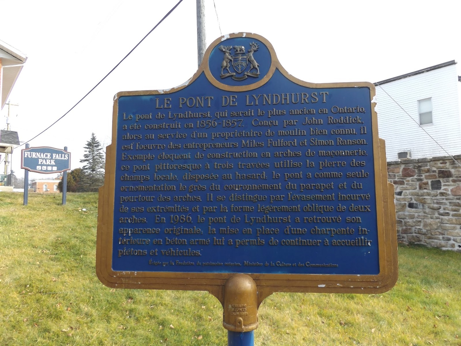
Canadian Confederation, the Lyndhurst Bridge is a beautiful and traditionally designed three arch bridge made of local field stone and local Nepean sandstone. The Lyndhurst Bridge was designed and constructed by local residents. While the bridge was built by Miles Fulford and Simon Ransom, the bridge was designed by an employee of a local mill owner, Scottish native John Donald Roddick, who came to Lyndhurst about 1853. It is said that the design of the Lyndhurst Bridge is similar to older bridges that are in Scotland. Using local materials also meant that the bridge was able to use some local touches in the construction of the bridge, such as mill stones from local mill owner Henry Green for decoration.

Once the bridge was completed, it became the focal point of the
Lyndhurst community, which was once home to five mills at the time the
bridge was built. The arches of the bridge also divided the water rights
between the mill owners, one of whom was John Donald Roddick. The
Lyndhurst Bridge still is a focal point of Lyndhurst, and while traffic
only holds one lane at a time, the bridge was strengthened in 1986 by
the addition of a load bearing concrete slab inside the deck system.
While this retrofitting relieves the bridge from having to bear the
loads of traffic, but some engineering historians may not be thrilled
that the arch no longer serves a functional purpose. The alteration is
not visible to anyone since it is hidden under the deck, and it likely
prevented the need for alterations to the stonework, which appears to
retain its historic integrity. Today, local residents and curiosity
seekers can enjoy the history and uniqueness of the oldest bridge in
Ontario by taking a stroll across the bridge or viewing it from nearby
Furnace Falls Park.
 |
| The story of the Lyndhurst Bridge in English. |
 |
| ... and in French. |
 |
| Viewing the bridge from nearby Furnace Falls Park. |
 |
| The bridge is one lane wide, and you can also spy the flared edge of the end of the bridge. |
 |
| The stone work on the bridge itself looks quite long. |
 |
| A close-up of the local stone used in the bridge's stonework. Using local stone meant not having to obtain stone from a far away quarry. |
 |
| This bridge is indeed historic. |
The surrounding village of Lyndhurst is also worth checking out. If you have some time to poke around town, it is certainly a charming place to visit.
 |
| The Green Gecko. |
 |
| A home painted like gift wrap. I passed through a few weeks before Christmas, so this may be a fitting decoration. |
 |
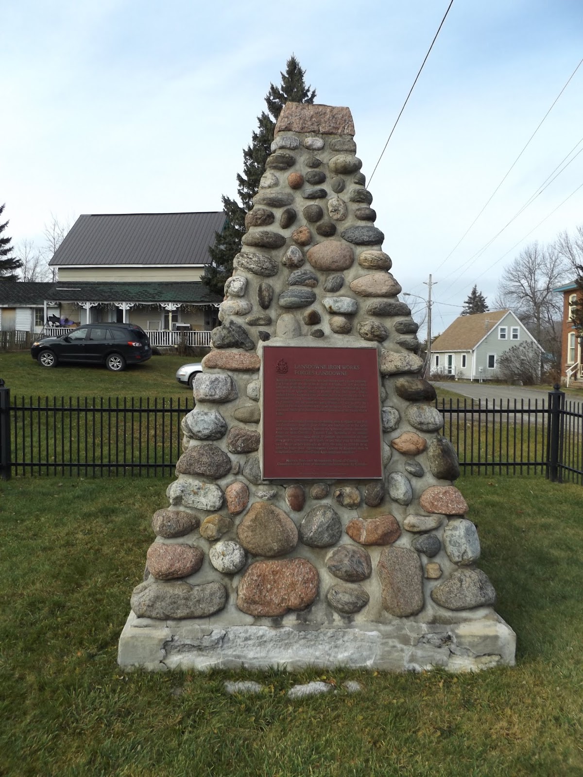
| This cairn is to remember the Lansdowne Iron Works, which was the first iron works located in Upper Canada. The Lansdowne Iron Works is a national historic site that opened in 1801, but was destroyed by fire in 1811. Not much remains of the iron works today. |
 |
| Remains of a mill on the Gananoque River, just beyond the Lyndhurst Bridge. |
How to Get There:
Sources and Links:
HistoricBridges.org -
Lyndhurst Bridge
Frontenac Arch Biosphere -
Lyndhurst Heritage Walking Tour
Ontario's Historical Plaques -
The Lyndhurst Bridge
Ontario Beneath Our Feet -
Lyndhurst Bridge
Ontario Heritage Trust -
The Lyndhurst Bridge


Comments