This past month I was traveling through Oroville in Butte County of Northern California. From California State Route 70 I turned east on California State Route. My aim was to drive the eastern segment of CA 162 over the 1965 Bidwell Bar Bridge and visit the 1856 structure.

CA 162 as an overall highway is segmented with a large unconstructed segment through Mendocino National Forest. In total CA 162 has 112 constructed miles with 62 remaining unbuilt stretching from US 101 near Laytonville east to Lake Oroville near Berry Creek.

Part 1; the history of California State Route 162
The current route of CA 162 was cobbled together from the following:
- From US 101 east to I-5 near Willows was added to the State Highway system in 1965 as CA 261 and can be seen on the 1966 State Division of Highways State Map as a proposed highway. This segment was transferred to CA 162 in 1972 according to CAhighways. CA 162 from US 101 east to I-5 was partially built but never was constructed through Mendocino National Forest.

- LRN 45 from I-5 east to CA 99. This segment of LRN 45 was added to the State Highway system by the State Legislature in 1919.
- LRN 21 from CA 99 east to Oroville. This segment of LRN 21 was part of the 1909 First State Highway Bond Act.
More information about CA 162 in the above segments can be found on CAhighways.org.
CAhighways.org on CA 162
The segment of CA 162 east of Oroville over the Bidwell Bar Bridge is the really interesting segment of the highway. While the modern highway is definitively linked to the Lake Oroville Project the route has a far older history of State Maintenance.
Prior to the completion of the Feather River Highway in 1936 which realigned CA 24 and was part of LRN 21 the primary route between Oroville and Quincy was on LRN 30 which was State Maintained on Oroville-Quincy Highway. LRN 30 dates back to the 1909 First State Highway Bond Act as one of the early State Highways. The route of LRN 30 east of Oroville used the following route:
- From modern CA 162 Bridge Street east to Oroville-Quincy Highway.
- Oroville-Quincy Highway back to modern CA 162.
- CA 162 to Heritage Road.
- Heritage Road into Lake Oroville via Bidwell Canyon.
- A now sunken portion of what was LRN 30 beneath Lake Oroville to the Middle Fork Feather River. LRN 30 would have crossed the Middle Fork Feather River via the 1855 Bidwell's Bar Bridge.
- LRN 30 would have emerged from Lake Oroville via what is now Foreman Creek Road.
- Foreman Creek Road to the modern terminus of CA 162.
- From the modern terminus of CA 162 the route of LRN 30 continued east on Oroville-Quincy Road on Plumas National Forest Route 119 to Quincy.
I should note that it is very unclear if CA 24 was actually signed on the path of LRN 30. The original definition of CA 24 in 1934 seems to imply that the highway was signed along the path of LRN 30 before the Feather River Highway opened in 1936.
CAhighways.org on CA 24
On the 1935 California Division of Highway Maps of Butte and Plumas Counties the incomplete Feather River Highway can be seen along with the former LRN 30 on Oroville-Quincy Highway. The 1935 Butte County Map also displays the original alignment of the Feather River Highway. The original alignment of the Feather River Highway used Oroville Dam Boulevard/Signed County Route B2 approximately the site of Oroville Dam. From Oroville Dam the Feather River Highway crossed the North Fork Feather River and used Dark Canyon Road to the current alignment of CA 70.
1935 Butte County Map

1935 Plumas County Map

The Feather River Highway was originally an extension of LRN 21 which was extended from Oroville to Quincy in 1919. The Feather River Highway was meant to replace the Oroville-Quincy Highway which was the temporary routing of LRN 21. The Oroville-Quincy Highway was part of the 1909 definition of LRN 30 which was deleted when LRN 21 was extended.
CAhighways.org on LRN 21
Former LRN 30 wouldn't come into play again in regards to State Maintenance until the Lake Oroville Reservoir Project. That said Oroville-Quincy Highway despite not being state maintained after 1936 was still a very active route between Oroville and Quincy. When the Lake Oroville Project began in 1961 it required both the Feather River Highway (which was US 40A at the time) and Oroville-Quincy Highway to be moved to higher terrain outside of the reservoir project area.
Former LRN 30 does appear as Signed County Route B1 on the 1966 Goshua Highway Map of California. It is likely that County Route B1 was approved in 1964 just as County Route B2 was.

The original Bidwell's Bar Bridge from 1856 remained in use to traffic until 1954. During the Lake Oroville Project a new suspension bridge was built just east of the 1855 structure by 1965. The 1965 Bidwell Bar Bridge featured a massive 627 foot clearance before Lake Oroville began to rise by 1969. The 1965 Bidwell Bar Bridge was added to the State Highway system in 1970 when CA 162 was extended over Lake Oroville. CA 162 first appears on the 1975 Division of Highways Map extending east of Oroville.

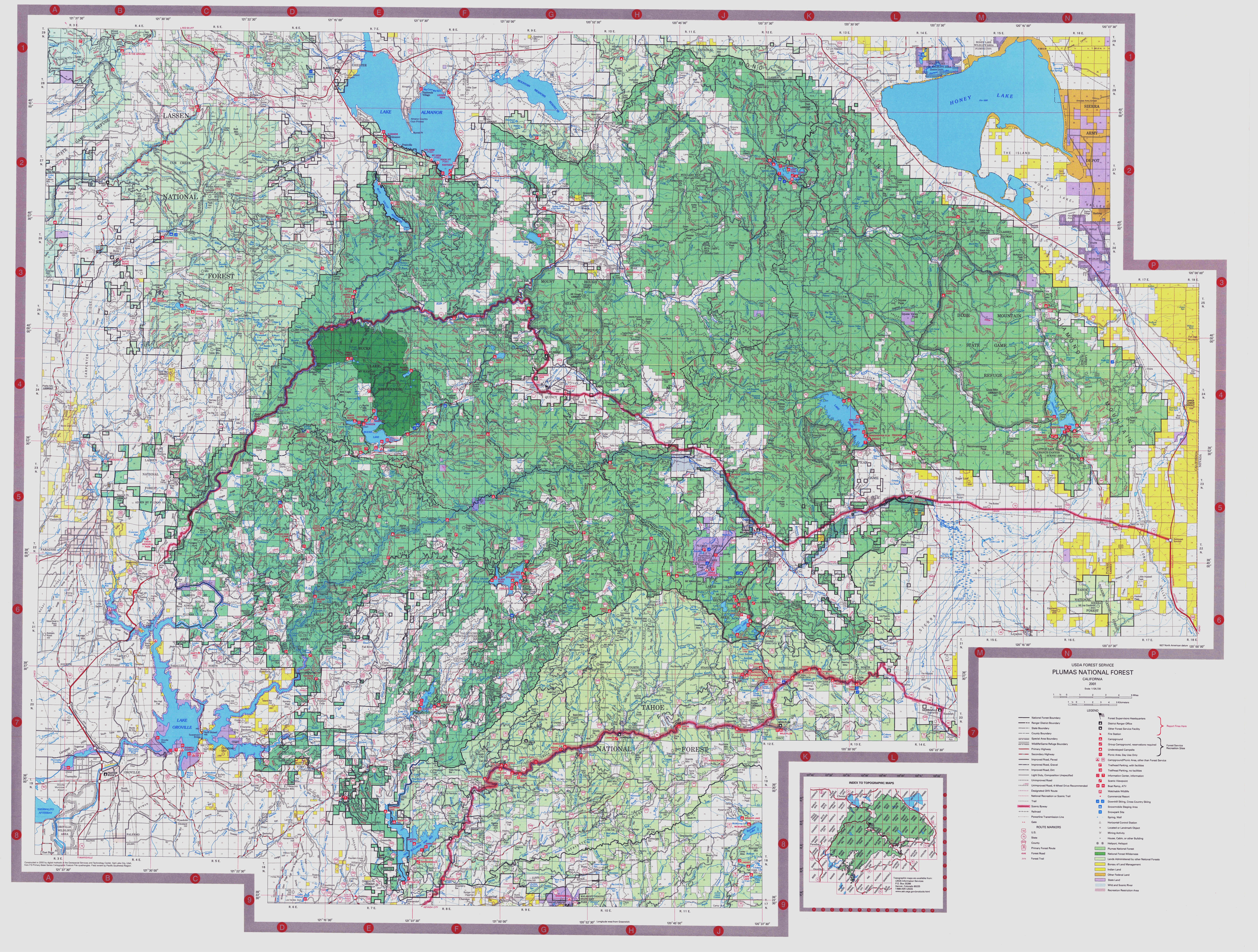
Former LRN 30 can still be seen on the Pulmas National Forest Road Map connecting CA 162 to Quincy via FR 119.
Pulmas National Forest Road Map
Part 2; a drive on CA 162 east over Lake Oroville
My approach to CA 162 was from CA 70 south.


CA 162 in Oroville heads east from CA 70 via Oroville Dam Boulevard. Pars of CA 162 on Oroville Dam Boulevard is co-signed as CA 70 Business. The visitor center for Lake Oroville is signed as being 9.5 miles to the east.


CA 162 east drops below a rail underpass and the truck route of the highway ends at Lincoln Street.


CA 70 Business traffic is routed off CA 162 onto Myers Street.

CA 162 east makes a right hand turn off Oroville Dam Boulevard onto Olive Highway. The Lake Oroville State Recreation Area is signed as 6 miles away.


CA 162 begins to ascend into the Sierra Foothills heading east out of Oroville. Just outside the City Limit of Oroville CA 162 passes by a casino.


East of the Casino CA 162 picks up Oroville-Quincy Highway.

Access to the Oroville Dam Spillway Boat ramp is signed from CA 162 at Canyon Drive.


CA 162 east drops from a large ridge and descends to Kelly Ridge Road. Kelly Ridge Road is signed as access to the Lake Oroville Visitor Center and Bidwell Canyon Marina. The 1856 Bidwell's Bar Bridge is now located at Bidwell Canyon Marina at the Boat Ramp.


Bidwell's Bar Bridge was the first steel suspension bridge in California and was completed in 1856. The 1855 Bidwell's Bar Bridge is 372 feet in length and cost $34,922 dollars to construct.


The Bidwell's Bar Bridge was built to facilitate travel over the Middle Fork Feather River in the community of Bidwell's Bar. Bidwell's Bar was founded in 1848 after John Bidwell discovered that the local tribes knew of gold ore in the nearby rocks. A previous bridge structure over the Middle Fork Feather River was destroyed by floods in 1852. Bidwell's Bar grew to about 2,000 residents and was second Butte County seat between 1853 to 1856. The end of the mining boom in Bidwell's Bar came by 1857 and the town largely depopulated. It is reported that by 1882 there was only 30 people left in Bidwell's Bar. By the time the Lake Oroville project was coming to fruition Bidwell's Bar was a ghost town for several decades.


The Bidwell's Bar Bridge Toll House was part of the 1856 crossing. Both the Toll House and 1856 Bidwell's Bar Bridge were reconstructed on the site of Bidwell Canyon Marina in 1977. The 1856 Bidwell's Bar Bridge apparently had a 40 ton weight capacity which would be incredibly strong by Gold Rush Era California standards. The strength of the 1856 structure is likely why it remained in use until the 1950s. The Toll House apparently also served as the Post Office for Bidwell's Bar. A nearby historical placard shows detailed information regarding the 1856 Bridge and a photo of when it was over the Middle Fork Feather River.


Another survivor of Bidwell's Bar is the Mother Orange Tree. The Mother Orange Tree was planted next to the 1856 Bidwell's Bar Bridge. The Mother Orange Tree was meant to be a novelty that wouldn't last but the tree actually grew to over 60 feet at one point. The Mother Orange Tree was moved in 1862 to avoid the large scale floods occurring on the Middle Fork Feather River.


Returning to CA 162 east of Kelly Ridge Road traffic is advised that Oroville-Quincy Highway is closed for the winter at Mountain House.

CA 162 skirts around Bidwell Canyon to the foot of the 1965 Bidwell Bar Bridge.


CA 162 east crosses over Lake Oroville via the 1965 Bidwell Bar Bridge. The height the structure above the water is striking considering how low Lake Oroville is due to the emergency spillway repairs ongoing from 2017.


The 1965 Bidwell Bar Bridge has an overlook on the north bank of Lake Oroville. The 1965 Bidwell Bar Bridge is suspension structure with a 1,792 feet long. The green hue the bridge is painted in gives it distinct look often not seen in 1960s era bridge designs.

Just because I could I walked out the center of the 1965 Bidwell Bar Bridge.


Looking west Bidwell Canyon can be seen. Its hard to believe that a town that was a county seat much less a suspension bridge from the 1850s would have been located far below the waters.

Crossing over the bridge looking east offers a view of the Middle Fork Feather River Canyon.

Heading back to the north side of the 1965 Bidwell Canyon Bridge from the northbound lane the anchorage into the cliffs can be seen.


From the overlook there is a small informational map showing important locations on Lake Oroville.


North of the 1965 Bidwell Bar Bridge CA 162 east continues to another large structure over Canyon Creek. The impressive heights aren't very apparent aside from the should of CA 162.


CA 162 east ends at Foreman Creek Road which is the original alignment of LRN 30. Oroville-Quincy Highway continues eastward as Forest Route 119 upon entering Berry Creek.


CA 162 as an overall highway is segmented with a large unconstructed segment through Mendocino National Forest. In total CA 162 has 112 constructed miles with 62 remaining unbuilt stretching from US 101 near Laytonville east to Lake Oroville near Berry Creek.

Part 1; the history of California State Route 162
The current route of CA 162 was cobbled together from the following:
- From US 101 east to I-5 near Willows was added to the State Highway system in 1965 as CA 261 and can be seen on the 1966 State Division of Highways State Map as a proposed highway. This segment was transferred to CA 162 in 1972 according to CAhighways. CA 162 from US 101 east to I-5 was partially built but never was constructed through Mendocino National Forest.

- LRN 45 from I-5 east to CA 99. This segment of LRN 45 was added to the State Highway system by the State Legislature in 1919.
- LRN 21 from CA 99 east to Oroville. This segment of LRN 21 was part of the 1909 First State Highway Bond Act.
More information about CA 162 in the above segments can be found on CAhighways.org.
CAhighways.org on CA 162
The segment of CA 162 east of Oroville over the Bidwell Bar Bridge is the really interesting segment of the highway. While the modern highway is definitively linked to the Lake Oroville Project the route has a far older history of State Maintenance.
Prior to the completion of the Feather River Highway in 1936 which realigned CA 24 and was part of LRN 21 the primary route between Oroville and Quincy was on LRN 30 which was State Maintained on Oroville-Quincy Highway. LRN 30 dates back to the 1909 First State Highway Bond Act as one of the early State Highways. The route of LRN 30 east of Oroville used the following route:
- From modern CA 162 Bridge Street east to Oroville-Quincy Highway.
- Oroville-Quincy Highway back to modern CA 162.
- CA 162 to Heritage Road.
- Heritage Road into Lake Oroville via Bidwell Canyon.
- A now sunken portion of what was LRN 30 beneath Lake Oroville to the Middle Fork Feather River. LRN 30 would have crossed the Middle Fork Feather River via the 1855 Bidwell's Bar Bridge.
- LRN 30 would have emerged from Lake Oroville via what is now Foreman Creek Road.
- Foreman Creek Road to the modern terminus of CA 162.
- From the modern terminus of CA 162 the route of LRN 30 continued east on Oroville-Quincy Road on Plumas National Forest Route 119 to Quincy.
I should note that it is very unclear if CA 24 was actually signed on the path of LRN 30. The original definition of CA 24 in 1934 seems to imply that the highway was signed along the path of LRN 30 before the Feather River Highway opened in 1936.
CAhighways.org on CA 24
On the 1935 California Division of Highway Maps of Butte and Plumas Counties the incomplete Feather River Highway can be seen along with the former LRN 30 on Oroville-Quincy Highway. The 1935 Butte County Map also displays the original alignment of the Feather River Highway. The original alignment of the Feather River Highway used Oroville Dam Boulevard/Signed County Route B2 approximately the site of Oroville Dam. From Oroville Dam the Feather River Highway crossed the North Fork Feather River and used Dark Canyon Road to the current alignment of CA 70.
1935 Butte County Map

1935 Plumas County Map

The Feather River Highway was originally an extension of LRN 21 which was extended from Oroville to Quincy in 1919. The Feather River Highway was meant to replace the Oroville-Quincy Highway which was the temporary routing of LRN 21. The Oroville-Quincy Highway was part of the 1909 definition of LRN 30 which was deleted when LRN 21 was extended.
CAhighways.org on LRN 21
Former LRN 30 wouldn't come into play again in regards to State Maintenance until the Lake Oroville Reservoir Project. That said Oroville-Quincy Highway despite not being state maintained after 1936 was still a very active route between Oroville and Quincy. When the Lake Oroville Project began in 1961 it required both the Feather River Highway (which was US 40A at the time) and Oroville-Quincy Highway to be moved to higher terrain outside of the reservoir project area.
Former LRN 30 does appear as Signed County Route B1 on the 1966 Goshua Highway Map of California. It is likely that County Route B1 was approved in 1964 just as County Route B2 was.


Former LRN 30 can still be seen on the Pulmas National Forest Road Map connecting CA 162 to Quincy via FR 119.
Pulmas National Forest Road Map
Part 2; a drive on CA 162 east over Lake Oroville
My approach to CA 162 was from CA 70 south.


CA 162 in Oroville heads east from CA 70 via Oroville Dam Boulevard. Pars of CA 162 on Oroville Dam Boulevard is co-signed as CA 70 Business. The visitor center for Lake Oroville is signed as being 9.5 miles to the east.


CA 162 east drops below a rail underpass and the truck route of the highway ends at Lincoln Street.


CA 70 Business traffic is routed off CA 162 onto Myers Street.

CA 162 east makes a right hand turn off Oroville Dam Boulevard onto Olive Highway. The Lake Oroville State Recreation Area is signed as 6 miles away.


CA 162 begins to ascend into the Sierra Foothills heading east out of Oroville. Just outside the City Limit of Oroville CA 162 passes by a casino.


East of the Casino CA 162 picks up Oroville-Quincy Highway.

Access to the Oroville Dam Spillway Boat ramp is signed from CA 162 at Canyon Drive.


CA 162 east drops from a large ridge and descends to Kelly Ridge Road. Kelly Ridge Road is signed as access to the Lake Oroville Visitor Center and Bidwell Canyon Marina. The 1856 Bidwell's Bar Bridge is now located at Bidwell Canyon Marina at the Boat Ramp.


Bidwell's Bar Bridge was the first steel suspension bridge in California and was completed in 1856. The 1855 Bidwell's Bar Bridge is 372 feet in length and cost $34,922 dollars to construct.


The Bidwell's Bar Bridge was built to facilitate travel over the Middle Fork Feather River in the community of Bidwell's Bar. Bidwell's Bar was founded in 1848 after John Bidwell discovered that the local tribes knew of gold ore in the nearby rocks. A previous bridge structure over the Middle Fork Feather River was destroyed by floods in 1852. Bidwell's Bar grew to about 2,000 residents and was second Butte County seat between 1853 to 1856. The end of the mining boom in Bidwell's Bar came by 1857 and the town largely depopulated. It is reported that by 1882 there was only 30 people left in Bidwell's Bar. By the time the Lake Oroville project was coming to fruition Bidwell's Bar was a ghost town for several decades.


The Bidwell's Bar Bridge Toll House was part of the 1856 crossing. Both the Toll House and 1856 Bidwell's Bar Bridge were reconstructed on the site of Bidwell Canyon Marina in 1977. The 1856 Bidwell's Bar Bridge apparently had a 40 ton weight capacity which would be incredibly strong by Gold Rush Era California standards. The strength of the 1856 structure is likely why it remained in use until the 1950s. The Toll House apparently also served as the Post Office for Bidwell's Bar. A nearby historical placard shows detailed information regarding the 1856 Bridge and a photo of when it was over the Middle Fork Feather River.


Another survivor of Bidwell's Bar is the Mother Orange Tree. The Mother Orange Tree was planted next to the 1856 Bidwell's Bar Bridge. The Mother Orange Tree was meant to be a novelty that wouldn't last but the tree actually grew to over 60 feet at one point. The Mother Orange Tree was moved in 1862 to avoid the large scale floods occurring on the Middle Fork Feather River.


Returning to CA 162 east of Kelly Ridge Road traffic is advised that Oroville-Quincy Highway is closed for the winter at Mountain House.

CA 162 skirts around Bidwell Canyon to the foot of the 1965 Bidwell Bar Bridge.


CA 162 east crosses over Lake Oroville via the 1965 Bidwell Bar Bridge. The height the structure above the water is striking considering how low Lake Oroville is due to the emergency spillway repairs ongoing from 2017.


The 1965 Bidwell Bar Bridge has an overlook on the north bank of Lake Oroville. The 1965 Bidwell Bar Bridge is suspension structure with a 1,792 feet long. The green hue the bridge is painted in gives it distinct look often not seen in 1960s era bridge designs.

Just because I could I walked out the center of the 1965 Bidwell Bar Bridge.


Looking west Bidwell Canyon can be seen. Its hard to believe that a town that was a county seat much less a suspension bridge from the 1850s would have been located far below the waters.

Crossing over the bridge looking east offers a view of the Middle Fork Feather River Canyon.

Heading back to the north side of the 1965 Bidwell Canyon Bridge from the northbound lane the anchorage into the cliffs can be seen.


From the overlook there is a small informational map showing important locations on Lake Oroville.


North of the 1965 Bidwell Bar Bridge CA 162 east continues to another large structure over Canyon Creek. The impressive heights aren't very apparent aside from the should of CA 162.


CA 162 east ends at Foreman Creek Road which is the original alignment of LRN 30. Oroville-Quincy Highway continues eastward as Forest Route 119 upon entering Berry Creek.


Comments