California State Route 207 I & II

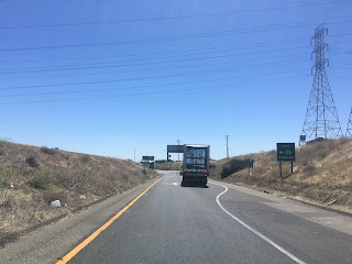
On my way home from the the San Francisco Bay Area I took California State Route 152 east over Pacheco Pass to California State Route 33 north towards Santa Nella.  This particular segment of California State Route 33 was once the original California State Route 207.  In this article we examine the history of both iterations of California State Route 207.


The current California State Route 207 ("CA 207") is a one mile State Highway which connects California State Route 4 near Lake Alpine to the Bear Valley Ski Area.  CA 207 is located within the Sierra Nevada Mountains of Alpine County.  


Part 1; the history of California State Route I

The original CA 207 was created during the 1964 State Highway Renumbering out of Legislative Route 121 ("LRN 121") from CA 152 north to CA 33 in Santa Nella.  The original CA 207 was a short 3 mile highway which was aligned over an important regional connecting corridor.  LRN 121 was added to the State Highway System in 1933 according to CAhighways.org.  The first CA 207 can be seen on the 1964 Division of Highways State Map


According to CAhighways.org the original CA 207 was deleted in 1972 when CA 33 was shifted onto it.  Originally CA 33 was aligned west of Los Banos to Santa Nella by way of Volta.  The new alignment of CA 33 west of Los Banos over the corridor of what was the first CA 207 can be seen on the 1975 Caltrans State Map


Part 2; a drive on what was California State Route I
 
The first CA 207 would have begun at CA 152 and run north from the expressway on Santa Nella Boulevard.


For a 3 mile route the first CA 207 had a lot going on as it would have quickly had a junction with the Medeiros Recreation Area almost immediately north of CA 152.


The first CA 207 would have crossed the O'Neill Forebay followed by Delta Mendota Canal before entering Santa Nella.


The first CA 207 would have terminated at CA 33/Henry Miller Avenue.


Part 3; the history of California State Route 207 II

According to CAhighways.org the second CA 207 was added to the State Highway System as part of 1979 Legislative Chapter 572.  The second CA 207 originally carried a definition of Lake Alpine to the Mount Reba Ski Area.  The second CA 207 first appears on the 1981 Caltrans State Highway Map.  


The Bear Valley Ski Area traces it's history to Harvey Blood's Toll Station on the Ebbetts Pass Road which became a tolled facility in the early 1860s.  The first written documentation referring to the area as "Bear Valley" is first cited in 1869 according to bearvalley.com.  In 1910 the Ebbetts Pass Toll Road was made a free highway as it was added to the State Highway System as Legislative Route 24 as part of the 1909 First State Highway Bond Act.  Blood's Station continued to operate until 1920 when it was sold to the Bishop Mining and Cattle Company.  

In 1952 the Orvis Family purchased 480 acres of land from the Bishop Mining and Cattle Company.  The Orvis Family later purchased 400 additional acres of Stanislaus National Forest parcels north of Bear Valley towards Mount Reba in 1963 with the intentions of building a ski resort.  The Mount Reba Ski Area opened in 1967 (along with what would become CA 207 II) for the winter ski season.  In June of 1991 the Mount Reba Ski Area was purchased and renamed to the Bear Valley Ski Area.


Part 4; a drive on California State Route 207 II

CA 4 eastbound intersects modern CA 207 at Postmile ALP R2.906.  CA 4 eastbound has two reassurance shields for CA 207 mounted above light posts approaching the actual junction.  


The 24% gradient warning for CA 4 eastbound over Ebbetts Pass can be found at the junction with modern CA 207.  The 24% grades ahead mostly apply in reality to Pacific Grade Summit but nonetheless are very real. 

Modern CA 207 travels northwest from CA 207 and has at least one reassurance shield.  Modern CA 207 is known as "Mount Reba Road" and State Maintenance ends at Postmile ALP 1.36.  CA 207 ends within view of Mount Reba.  


Comments

Popular posts from this blog

Abandoned US Route 40 in the Truckee River Canyon

Within the Truckee River Canyon in the Sierra Nevada range numerous abandoned portions of US Route 40 can be found alongside modern Interstate 80.   This segment of highway was opened during 1926 as a bypass of the Dog Valley Grade which carried the early North Lincoln Highway and Victory Highway. The corridor of the Truckee River Canyon State Highway would be assigned as US Route 40 when the US Route System was commissioned during November 1926. During 1958 the segment of Interstate 80 between Boca, California and the Nevada state line was complete. When Interstate 80 opened east of Boca numerous obsolete portions of US Route 40 were abandoned. Some of these abandoned segments have been incorporated into the Tahoe-Pyramid Trail.  Part 1; the history of US Route 40 in the Truckee River Canyon The Truckee River Canyon for centuries has been an established corridor of travel known to native tribes crossing the Sierra Nevada range.  The first documented wagon crossi...

Former US Route 50 and the Pioneer Route Lincoln Highway on Johnson's Pass Road

Johnson's Pass Road is one of the oldest highway corridors in California.  Johnson's Pass was part of the Lake Tahoe Wagon Road as it was completed during 1856 over the Sierra Nevada.  The pass would later be incorporated into the Pioneer Branch of the Lincoln Highway in 1913 and US Route 50 in 1926.  Johnson's Pass Road would be bypassed by a new alignment of US Route 50 over Echo Summit in 1938.  A replacement of the Meyers Grade east of Johnson's Pass would be opened to traffic in 1947.   Johnson's Pass Road remains accessible to traffic and is still signed by the Lincoln Highway Association.  Pictured as the blog cover is the view from the top of Johnson's Pass Road overlooking modern US Route 50 and Lake Tahoe.   Part 1; the history of Johnson's Pass Much of the history of what become the Lake Tahoe Wagon Road is discussed in the  September 1950 California Highways & Public Works  during its Centennial Edition.  The or...

Former US Route 50 and the South Lincoln Highway from Folsom east to Placerville

The corridor of Folsom of Sacramento County east to Placerville of El Dorado County has been a long established corridor of overland travel dating back to the California Gold Rush.  The Folsom-Placerville corridor was once part of the path of the Lake Tahoe Wagon Road which became the first California State Highway and later the South Lincoln Highway.  In time the South Lincoln Highway's surface alignment was inherited by US Route 50.  The Folsom-Placerville corridor also includes the communities of; Clarksville, Shingle Springs and El Dorado. Part 1; the history of the Lake Tahoe Wagon Road, South Lincoln Highway and US Route 50 through Folsom-Placerville Folsom is located on the American River/Lake Natoma of eastern Sacramento County.  That lands now occupied by the City of Folsom were part of Rancho Rio de los Americanos prior to the finding of gold at Sutter's Mill during 1848.  During the California Gold Rush the lands of Rancho Rio de los Americanos were p...