Over the past couple years I've taken about every single conceivable noteworthy road in and out of the California Coast as far south as Malibu northward towards Point Reyes. Generally I try to avoid the more popular routes due to the high traffic capacity which often overwhelms existing highways. That being the case I've often found myself in need of getting to the Monterey Peninsula from San Joaquin Valley in a hurry which often means a trip on California State Route 156.

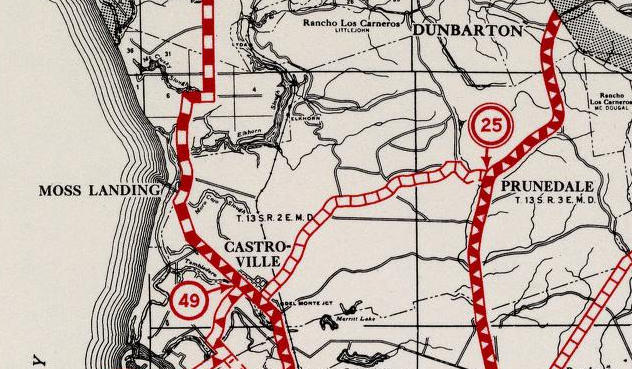
CA 156 is a 25 mile route from CA 152 in Santa Clara County west to CA 1 near the mouth of the Salinas River in Castroville of Monterey County.

Part 1; the history of California State Route 156
All of modern CA 156 was part of Legislative Route 22. LRN 22 was defined during the 1909 First State Highway Bond Act between as a route between San Juan Bautista and Hollister. During the 1919 Third State Highway Bond Act LRN 22 was extended east from Hollister to the Pacheco Pass Road (future CA 152). In 1933 LRN 22 was extended west to Castroville which occurred after US 101/LRN 2 was realigned from the San Juan Grade through Prunedale.
CA 156 was not one of the original run of Signed State Routes which was announced in a August 1934 Department of Public Works Guide.

CA 156 first appears as a Signed State Highway on the 1938 Division of Highways Map of California. Oddly no Department of Public Work Publications aside from State Maps appear to reference CA 156 at all even through the 1940s.


On the 1966 Division of Highways State Map the route of CA 156 west of San Juan Bautista is shown upgraded to a new expressway.


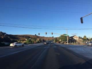
CA 156 westbound starts by traversing underneath CA 152 Zanger Memorial Flyover. Oddly if you are heading east on CA 156 and want to access CA 152 west you have to go all the way to Casa de Fruita and turn around.


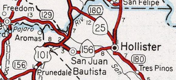
From the junction with CA 152 it is 8 miles west on CA 156 to Hollister.


CA 156 is only in Santa Clara County briefly before entering San Benito County.

CA 156 has a well signed Business Route through Hollister that is the original alignment of the highway. Westbound CA 156 used to traverse through Hollister on San Felipe Road and San Juan Road. The modern alignment of CA 156 bypasses Hollister to the northwest.


CA 156 west becomes a two-lane expressway until the junction with Castroville Boulevard.


From Castroville Boulevard CA 156 becomes a short freeway west to a terminus at CA 1


Part 3; the ghost expressway stub of CA 156 in Castroville
From CA 1 northbound approaching CA 156 eastbound in Castroville the flow of the freeway clearly shows that it was once part of the former route. Interestingly as CA 156 east passes by CA 183 towards Castroville Boulevard a ghost expressway stub can be seen as the highway becomes two-lanes.


Part 4; former CA 156 through Hollister on the CA 156 Business Loop
As stated above CA 156 was moved to a new bypass route of Hollister by 1997. The former surface route of CA 156 is now signed as the CA 156 Business Route.

CA 156 Business diverges from CA 156 westbound at San Felipe Road north of downtown Hollister.


CA 156 Business heads south towards Hollister and expands to a four-lane highway near Hollister Airport. CA 156 Business has a major junction with CA 25 near downtown Hollister.


CA 156 Business south of CA 25 enters downtown Hollister on San Benito Street. There are some scant CA 156 Business shield assemblies located in downtown Hollister which are some of the only indicators of a signed highway. CA 156 Business makes a right hand turn in downtown Hollister onto 4th Street.


CA 156 Business follows 4th Street out of downtown Hollister and over San Benito Creek.


West of San Benito River the original route of CA 156 followed San Juan-Hollister Road towards what is now Union Avenue. The modern CA 156 Business Route bisects San Juan-Hollister Road (seen in the first, third and fourth photos below) and takes a more direct alignment back to CA 156.


Part 5; former CA 156 through San Juan Bautista
Most of what was CA 156 through San Juan Bautista is hidden on both sides of the modern highway.

The former surface route of CA 156 branches from the modern at Old San Juan-Hollister Road.


Old CA 156 follows Old San Juan-Hollister Road to The Alameda. The Alameda was part of the San Juan Grade of US 101 prior to the Prunedale Cut-Off being completed in 1932 and is presently part of Signed County Route G1.


There is an older service station at the southeast corner of Old San Juan-Hollister Road and The Alameda which offers a hint that it was once along US 101. US 101 was routed over what the American El Camino Real which was began being signed with Mission Bells 1906. El Camino Real took it's name from the previous Spanish route of travel between all the Catholic Missions of Las Californians. The American El Camino Real was one of the earliest examples of what would be come to be known as "Auto Trails." The Auto Trail system was organized usually by private promoters and was often signed on whatever roads were available at the time. Prior to 1915 the American El Camino Real entered San Juan Bautista via Old Stage Road which was part of the namesake Spanish Trail. Construction of the San Juan Grade was born out of the 1909 First State Highway Bond Act which designated Legislative Route 2 as a highway between San Francisco and Los Angeles.

The corner of Old San Juan-Hollister Road and The Alameda once had a historical marker for the San Juan Pacific Railway. The marker seems to have been removed due to recent real estate development but it once read:
"The San Juan Pacific Railway was incorporated May 4, 1907, becoming the California Central Railroad in 1912. Some of the locals referred to it as The San Juan Terrific. Built to haul the expected large quantities of Portland cement from the Old Mission Cement Company Plant nearby. The main line extended 7.94 miles from Chittenden to San Juan junction. Ceasing railroad operations in 1930, the track was ripped up after the last locomotive, Ocean Shore No. 5 was steamed up and shipped to Nevada in 1937. A narrow gauge 'road' reached the limestone quarry up the San Juan Canyon."
The San Juan Pacific Railway from Chittenden to San Juan Canyon is still visible on the 1935 California Division of Highways Map of San Benito County.

Old CA 156 follows G1 on The Alameda/former US 101 back to modern CA 156. G1 has a northern terminus at modern CA 156 in San Juan Bautista.


Old CA 156 follows The Alameda/former US 101 across modern CA 156 into downtown San Juan Bautista. The Alameda/former US 101 becomes 3rd Street in downtown San Juan Bautista.


A right hand turn from 3rd Street onto Washington Street accesses Mission San Juan Bautista and San Juan Bautista State Historical Park at the corner of 2nd Street at Plaza Square.

Mission San Juan Bautista was founded back in 1797 in Spanish Las Californians. The current structure at the site was built from 1803 to 1812 and has been in continuous service ever since. Mission San Juan Bautista has a signature Mission Bell of El Camino Real next to the structure.

Mission San Juan Bautista actually has an original dirt segment of the Spanish El Camino Real located on the north side of the facility in the San Andreas Fault. The intact portion of the Spanish El Camino Real is known as the Earthquake Walk.

The City of San Juan Bautista was founded in 1834 as was centered around the Mission in Plaza Square. Plaza Square contains many historic structures aside from Mission San Juan Bautista and is now a California State Historical Park.


Old CA 156 on 3rd Street/former US 101 continues through San Juan Bautista to Monterey Street. Old CA 156 makes a left hand turn onto Monterey Street whereas former US 101 made a right hand turn.


At the corner of Third Street and Monterey Street is a former Standard Gas Station. This station is now the Luck Museum and home to the San Juan Bautista Historical Society. A Mission Bell can be observed just outside the Luck Museum denoting it's presence on the American El Camino Real and former US 101.

Old CA 156 follows Monterey Street back to modern the modern highway.


Part 6; former LRN 22 on Rocks Road
As noted above when LRN 22 was extended west of San Juan Bautista to Castroville in 1933 it utilized Rocks Road until 1935.

Modern CA 156 west of San Juan Bautista intersects Rocks Road a couple miles east of US 101.


Rocks Road headed westbound skirts the northern tip of the Gablian Range and is very narrow. Rocks Road includes a one-lane bridge crossing a creek.


Rocks Road continues through a narrow landscape where the namesake geological formations can be seen overhead.


Rocks Road enters a grove of Eucalyptus Tree grove where it terminates the northbound lanes of US 101 on the Prunedale Cut-Off.


When the Prunedale Cut-Off opened in 1932 it was only two lanes. Presently the northbound lanes of US 101 occupy the original alignment of the Prunedale Cut-Off. Given that US 101 is technically is an expressway on the Prunedale Cut-Off traffic can cross the northbound lanes to make a left hand turn onto US 101 southbound from the western terminus of Rocks Road. Given the volume of traffic on US 101 making the crossing to the southbound lanes is difficult as illustrated by the photo below.

Part 7; former CA 156 on Castroville Boulevard
The former route of CA 156 diverges from the modern multiplex of US 101 at San Miguel Canyon and Castroville Boulevard.

Former CA 156 is accessible from modern US 101 south/CA 156 west Exit 337 onto San Miguel Canyon Road. San Miguel Canyon Road is part of Signed County Route G12 which is erroneously signed as County Route 12.


Former CA 156 followed San Miguel Canyon Road northward to Castroville Boulevard. Former CA 156 made a left hand turn onto westbound Castroville Boulevard towards Castroville.


Former CA 156 on Castroville Boulevard heads directly west before making a southern jog at Dolan Road.


Castroville Boulevard enters the City of Castroville and begins to approach modern CA 156.


As Castroville Boulevard swings left towards modern CA 156 the abandoned highway can be seen ahead approaching the Union Pacific Railroad tracks. CA 156 would have originally crossed the tracks at an at-grade crossing onto Salinas Street in Castroville. A pedestrian overpass now exists where the at-grade highway crossing once existed.

Castroville Boulevard terminates at modern CA 156.

Part 8; former CA 156 in Castroville
Below is an illustration of the original alignment of CA 156 within Castroville.

Below is the current eastern end of Salinas Street looking towards the Union Pacific Railroad tracks. CA 156 would have crossed over the railroad tracks where the pedestrian overpass presently is located.

CA 156 would have originally headed westbound on Salinas Street to Merritt Street. Originally CA 156 turned northward towards downtown Castroville and CA 1 before 1944. After 1944 CA 156 terminated at Merritt Street where it meet CA 1 which would have come in from the opposite direction on Salinas Street. Southbound Merritt Street was LRN 118 which became CA 183 during the 1964 Highway Renumbering.


The original alignment of CA 156 continued northward on Merritt Street where it would have terminated at CA 1 which was on Preston Road. The intersection of Merritt Street and Preston Road is easily identified by the "Castroville; The Artichoke Center Of The World" sign.


Part 1; the history of California State Route 156
All of modern CA 156 was part of Legislative Route 22. LRN 22 was defined during the 1909 First State Highway Bond Act between as a route between San Juan Bautista and Hollister. During the 1919 Third State Highway Bond Act LRN 22 was extended east from Hollister to the Pacheco Pass Road (future CA 152). In 1933 LRN 22 was extended west to Castroville which occurred after US 101/LRN 2 was realigned from the San Juan Grade through Prunedale.
CA 156 was not one of the original run of Signed State Routes which was announced in a August 1934 Department of Public Works Guide.
CA 156 first appears as a Signed State Highway on the 1938 Division of Highways Map of California. Oddly no Department of Public Work Publications aside from State Maps appear to reference CA 156 at all even through the 1940s.

Within San Benito County the original path of Legislative Route 22 used the following route west of CA 152:
- The present alignment from the Santa Clara County Line southwest to San Felipe Road.
- San Felipe Road southward into downtown Hollister which becomes San Benito Street.
- San Benito Street west to 4th Street.
- 4th Street west to San Juan-Hollister Road. San Juan-Hollister Road used to connect to modern CA 156 before the present bypass route was built. Much of the alignment described above is now part of CA 156 Business in Hollister.
- Modern CA 156 on San Juan Road west to Old San Juan-Hollister Road.
- Old San Juan-Hollister Road west to the The Alameda (which was part of the San Juan Grade of US 101).
- The Alameda north into downtown San Juan Baustista to Third Street.
- Third Street to Monterey Street.
- West on Monterey Street back to the modern CA 156 expressway.
- The CA 156 expressway was to Rocks Road.
- Rocks Road west to US 101 on the Prunedale Grade.
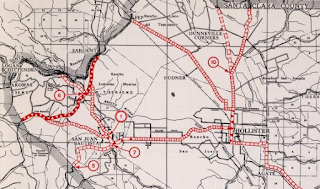
The above alignment can be seen on the 1935 Division of Highways Map of San Benito County. It is unclear at what point when CA 156 was first signed between 1935-1938.

Within Monterey County LRN 22 westbound multiplexed US 101 southbound
through Prunedale to San Miguel Canyon Road. From San Miguel Canyon Road LRN 22 turned west onto Castroville Boulevard where it continued onward to Salinas Street in Castroville. Within Castroville LRN 22 and later CA 156 swung north onto Merritt Street to meet CA 1 at Preston Road.
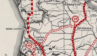
This alignment can be seen on the 1935 Division of Highways Map of Monterey County.
On the September 1935 Department of Public Works guide the new route of LRN 22 west of San Juan Buatista to US 101/LRN 2 (referred to the Prunedale Cut-Off) is discussed. The original route of LRN 22 on Rocks Road is referred to as "a winding county road" that was immediately improved temporarily with an oiled earth application upon being adopted in 1933. The new junction with LRN 22 and US 101/LRN 2 is shown to be a Y-Configuration.


CA 156 between Prunedale west to Castroville was realigned onto the modern two-lane expressway circa 1944. The new route of CA 156 from Prunedale to Castroville is discussed in the September/October 1944 California Highway and Public Works guide. The realignment of CA 156 between Castroville and Prunedale was built in conjunction with a realignment of CA 1 through Castroville. CA 156 subsequently met CA 1 at western terminus along Salinas Street at Merritt Street.

CA 156 went through the 1964 California State Highway Renumbering essentially unchanged aside from LRN 22 being dropped. Note; the first Division of Highways Map to clearly show CA 156 west of US 101 was on the 1964 Edition. Given how that LRN 22 was a significant connecting route between Prunedale and Castroville it is highly likely in my opinion that said segment was either signed by 1938 or when it was improved in 1944. Regardless, no Division of Highway document that I can find spells out the status of CA 156 west of US 101 clearly until 1964. That said, I'll be referring to former segments of LRN 22 west of US 101 as Old CA 156 below.

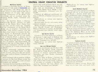
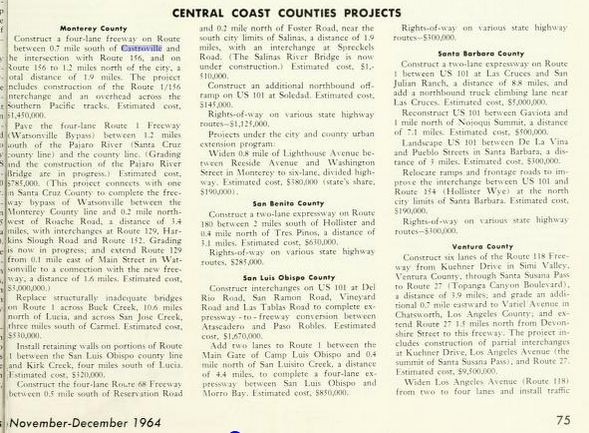
On November/December 1964 California Highways and Public Works guide a new freeway alignment of CA 1 in Castroville is discussed which included a new junction with CA 156. This new alignment included CA 156 being routed over a new overpass of the Southern Pacific Railroad in Castroville.
On the 1966 Division of Highways State Map the route of CA 156 west of San Juan Bautista is shown upgraded to a new expressway.
On the 1967 Division of Highways State Map the new route of CA 1 and CA 156 in Castroville appear as completed. Note; CA 156 is shown having a planned freeway route east to Prunedale which was never built. The 1967 Map shows the planned US 101/CA 156 Prunedale Bypass which also was never built.

At some point between 1979 and 1981 CA 1 was relocated west of Castroville onto a bypass. The realignment of CA 1 extended CA 156 west onto the Castroville Freeway grade to it's present west terminus. The new alignment of CA 1 and CA 156 can be seen on the 1981 Caltrans State Highway Map.

According to CAhighways.org the Hollister Bypass of CA 156 opened in 1997. The plan scope for the CA 156 bypass route was to expand to a four-lane expressway which has yet to happen. In recent years CA 156 has become one of the busiest two-lane highways in all of California from CA 183 east to US 101. There is a recent talk about using SB1 funds to construct a full expressway grade on CA 156 between CA 183 east to US 101, discussion can be found in this article.
Part 2; driving modern California State Route 156


From the junction with CA 152 it is 8 miles west on CA 156 to Hollister.


CA 156 is only in Santa Clara County briefly before entering San Benito County.

CA 156 has a well signed Business Route through Hollister that is the original alignment of the highway. Westbound CA 156 used to traverse through Hollister on San Felipe Road and San Juan Road. The modern alignment of CA 156 bypasses Hollister to the northwest.
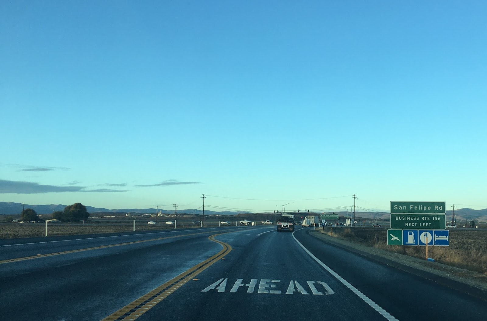

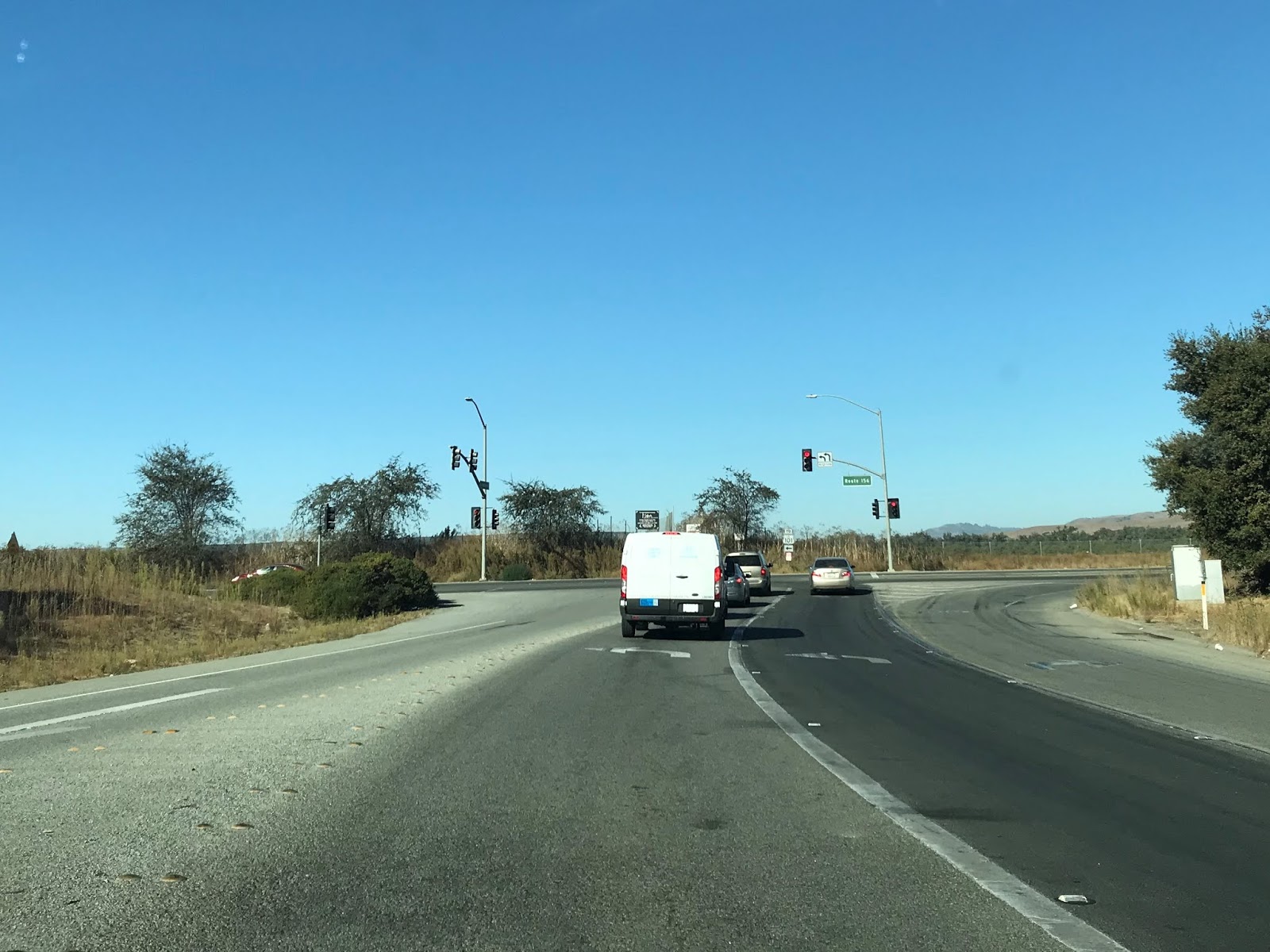
CA 156 intersects CA 25 (the Airline Highway) north of Hollister.

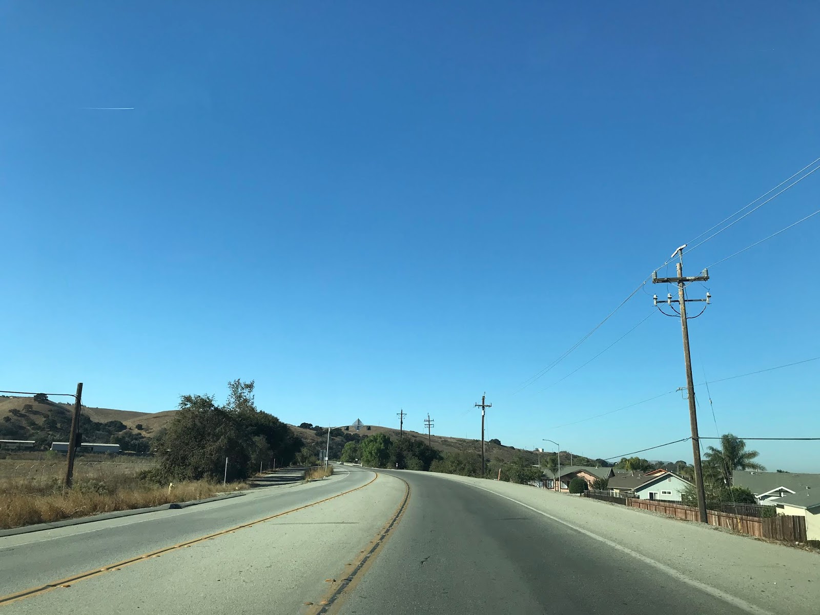
As CA 156 swings around Hollister westbound it meets it's business loop on San Juan Road and offers a view of Fremont Peak in the Gabilan Range.


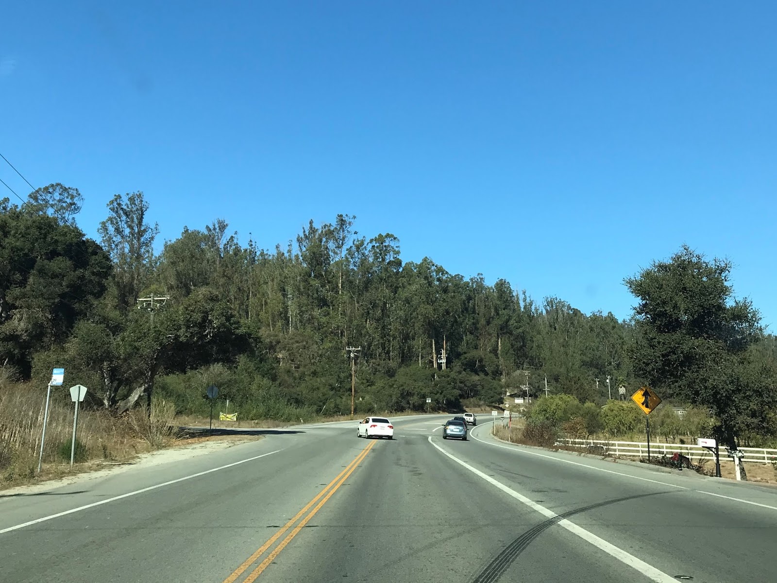
CA 156 enters San Juan Bautista and meets County Route G1 at the Alameda. G1 heads south to the top of Fremont Peak.


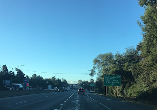
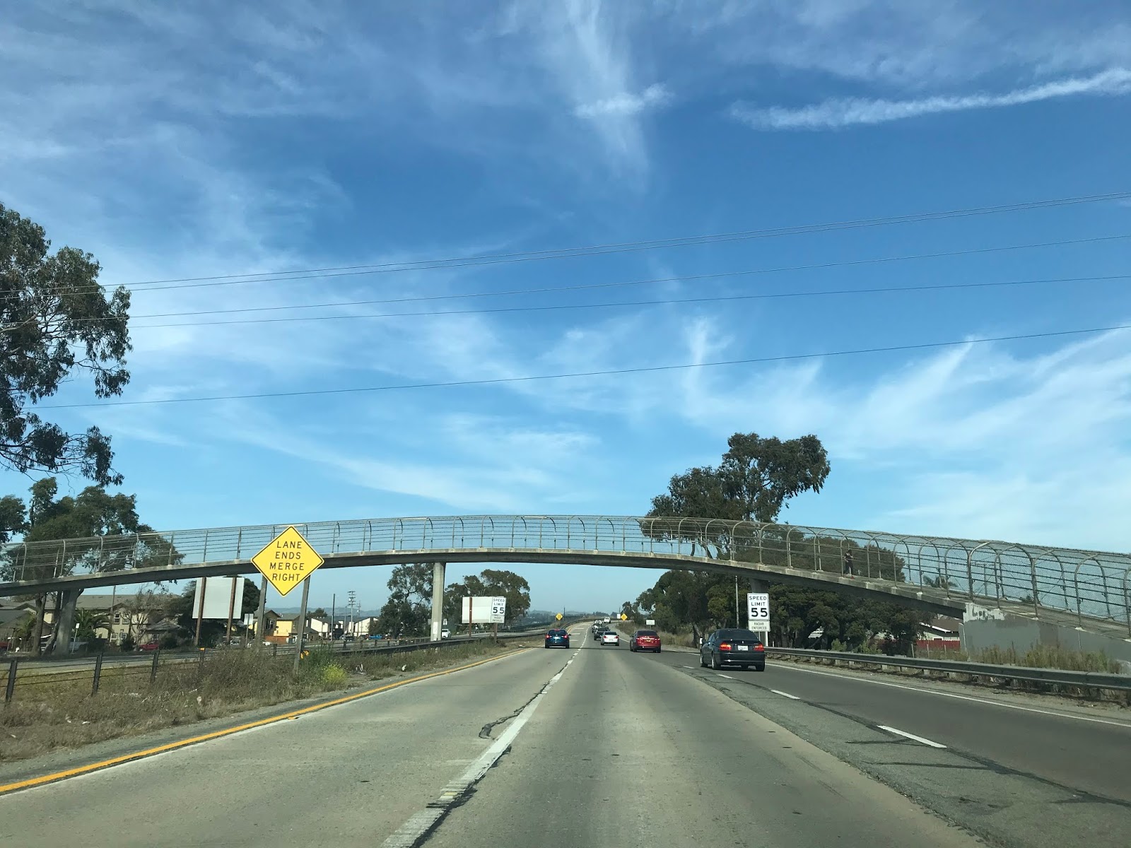
Westbound CA 156 becomes an expressway as it approaches US 101. The intersection with Monterey Street is notable due to it being part of the original alignment of CA 156.

CA 156 west joins the US 101 southbound expressway which enters Monterey County.


CA 156 west /US 101south junctions County Route G11 at San Juan Road.

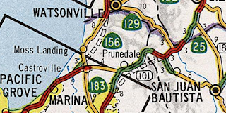
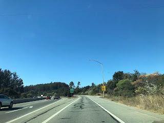
CA 156 exits US 101 in Prunedale at exit 336 to continue west to Castroville.


CA 156 west becomes a two-lane expressway until the junction with Castroville Boulevard.


Part 3; the ghost expressway stub of CA 156 in Castroville
From CA 1 northbound approaching CA 156 eastbound in Castroville the flow of the freeway clearly shows that it was once part of the former route. Interestingly as CA 156 east passes by CA 183 towards Castroville Boulevard a ghost expressway stub can be seen as the highway becomes two-lanes.


Part 4; former CA 156 through Hollister on the CA 156 Business Loop
As stated above CA 156 was moved to a new bypass route of Hollister by 1997. The former surface route of CA 156 is now signed as the CA 156 Business Route.

CA 156 Business diverges from CA 156 westbound at San Felipe Road north of downtown Hollister.


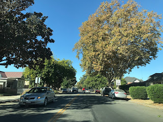
CA 156 Business heads south towards Hollister and expands to a four-lane highway near Hollister Airport. CA 156 Business has a major junction with CA 25 near downtown Hollister.


CA 156 Business south of CA 25 enters downtown Hollister on San Benito Street. There are some scant CA 156 Business shield assemblies located in downtown Hollister which are some of the only indicators of a signed highway. CA 156 Business makes a right hand turn in downtown Hollister onto 4th Street.


CA 156 Business follows 4th Street out of downtown Hollister and over San Benito Creek.


West of San Benito River the original route of CA 156 followed San Juan-Hollister Road towards what is now Union Avenue. The modern CA 156 Business Route bisects San Juan-Hollister Road (seen in the first, third and fourth photos below) and takes a more direct alignment back to CA 156.


Part 5; former CA 156 through San Juan Bautista
Most of what was CA 156 through San Juan Bautista is hidden on both sides of the modern highway.

The former surface route of CA 156 branches from the modern at Old San Juan-Hollister Road.


Old CA 156 follows Old San Juan-Hollister Road to The Alameda. The Alameda was part of the San Juan Grade of US 101 prior to the Prunedale Cut-Off being completed in 1932 and is presently part of Signed County Route G1.


There is an older service station at the southeast corner of Old San Juan-Hollister Road and The Alameda which offers a hint that it was once along US 101. US 101 was routed over what the American El Camino Real which was began being signed with Mission Bells 1906. El Camino Real took it's name from the previous Spanish route of travel between all the Catholic Missions of Las Californians. The American El Camino Real was one of the earliest examples of what would be come to be known as "Auto Trails." The Auto Trail system was organized usually by private promoters and was often signed on whatever roads were available at the time. Prior to 1915 the American El Camino Real entered San Juan Bautista via Old Stage Road which was part of the namesake Spanish Trail. Construction of the San Juan Grade was born out of the 1909 First State Highway Bond Act which designated Legislative Route 2 as a highway between San Francisco and Los Angeles.

The corner of Old San Juan-Hollister Road and The Alameda once had a historical marker for the San Juan Pacific Railway. The marker seems to have been removed due to recent real estate development but it once read:
"The San Juan Pacific Railway was incorporated May 4, 1907, becoming the California Central Railroad in 1912. Some of the locals referred to it as The San Juan Terrific. Built to haul the expected large quantities of Portland cement from the Old Mission Cement Company Plant nearby. The main line extended 7.94 miles from Chittenden to San Juan junction. Ceasing railroad operations in 1930, the track was ripped up after the last locomotive, Ocean Shore No. 5 was steamed up and shipped to Nevada in 1937. A narrow gauge 'road' reached the limestone quarry up the San Juan Canyon."
The San Juan Pacific Railway from Chittenden to San Juan Canyon is still visible on the 1935 California Division of Highways Map of San Benito County.

Old CA 156 follows G1 on The Alameda/former US 101 back to modern CA 156. G1 has a northern terminus at modern CA 156 in San Juan Bautista.


Old CA 156 follows The Alameda/former US 101 across modern CA 156 into downtown San Juan Bautista. The Alameda/former US 101 becomes 3rd Street in downtown San Juan Bautista.


A right hand turn from 3rd Street onto Washington Street accesses Mission San Juan Bautista and San Juan Bautista State Historical Park at the corner of 2nd Street at Plaza Square.

Mission San Juan Bautista was founded back in 1797 in Spanish Las Californians. The current structure at the site was built from 1803 to 1812 and has been in continuous service ever since. Mission San Juan Bautista has a signature Mission Bell of El Camino Real next to the structure.

Mission San Juan Bautista actually has an original dirt segment of the Spanish El Camino Real located on the north side of the facility in the San Andreas Fault. The intact portion of the Spanish El Camino Real is known as the Earthquake Walk.

The City of San Juan Bautista was founded in 1834 as was centered around the Mission in Plaza Square. Plaza Square contains many historic structures aside from Mission San Juan Bautista and is now a California State Historical Park.


Old CA 156 on 3rd Street/former US 101 continues through San Juan Bautista to Monterey Street. Old CA 156 makes a left hand turn onto Monterey Street whereas former US 101 made a right hand turn.


At the corner of Third Street and Monterey Street is a former Standard Gas Station. This station is now the Luck Museum and home to the San Juan Bautista Historical Society. A Mission Bell can be observed just outside the Luck Museum denoting it's presence on the American El Camino Real and former US 101.

Old CA 156 follows Monterey Street back to modern the modern highway.


Part 6; former LRN 22 on Rocks Road
As noted above when LRN 22 was extended west of San Juan Bautista to Castroville in 1933 it utilized Rocks Road until 1935.

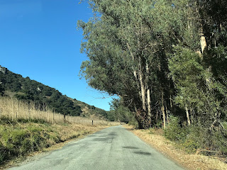
Modern CA 156 west of San Juan Bautista intersects Rocks Road a couple miles east of US 101.


Rocks Road headed westbound skirts the northern tip of the Gablian Range and is very narrow. Rocks Road includes a one-lane bridge crossing a creek.


Rocks Road continues through a narrow landscape where the namesake geological formations can be seen overhead.


Rocks Road enters a grove of Eucalyptus Tree grove where it terminates the northbound lanes of US 101 on the Prunedale Cut-Off.


When the Prunedale Cut-Off opened in 1932 it was only two lanes. Presently the northbound lanes of US 101 occupy the original alignment of the Prunedale Cut-Off. Given that US 101 is technically is an expressway on the Prunedale Cut-Off traffic can cross the northbound lanes to make a left hand turn onto US 101 southbound from the western terminus of Rocks Road. Given the volume of traffic on US 101 making the crossing to the southbound lanes is difficult as illustrated by the photo below.

Part 7; former CA 156 on Castroville Boulevard
The former route of CA 156 diverges from the modern multiplex of US 101 at San Miguel Canyon and Castroville Boulevard.

Former CA 156 is accessible from modern US 101 south/CA 156 west Exit 337 onto San Miguel Canyon Road. San Miguel Canyon Road is part of Signed County Route G12 which is erroneously signed as County Route 12.


Former CA 156 followed San Miguel Canyon Road northward to Castroville Boulevard. Former CA 156 made a left hand turn onto westbound Castroville Boulevard towards Castroville.


Former CA 156 on Castroville Boulevard heads directly west before making a southern jog at Dolan Road.


Castroville Boulevard enters the City of Castroville and begins to approach modern CA 156.


As Castroville Boulevard swings left towards modern CA 156 the abandoned highway can be seen ahead approaching the Union Pacific Railroad tracks. CA 156 would have originally crossed the tracks at an at-grade crossing onto Salinas Street in Castroville. A pedestrian overpass now exists where the at-grade highway crossing once existed.

Castroville Boulevard terminates at modern CA 156.

Part 8; former CA 156 in Castroville
Below is an illustration of the original alignment of CA 156 within Castroville.

Below is the current eastern end of Salinas Street looking towards the Union Pacific Railroad tracks. CA 156 would have crossed over the railroad tracks where the pedestrian overpass presently is located.


The original alignment of CA 156 continued northward on Merritt Street where it would have terminated at CA 1 which was on Preston Road. The intersection of Merritt Street and Preston Road is easily identified by the "Castroville; The Artichoke Center Of The World" sign.


Comments