Former US Route 99 in Imperial

The city of Imperial lies within the Sonoran Desert of Imperial County and once was part of the alignment of US Route 99.  US Route 99 originally was aligned on Imperial Avenue through the city of Imperial.  US Route 99 was realigned immediately east of Imperial Avenue onto a bypass expressway during 1950.  US Route 99 would in Imperial would be replaced by California State Route 86 during 1963 when the former was truncated to downtown Los Angeles.  The blog cover depicts the original alignment of US Route 99 along Imperial Avenue in the city of Imperial during 1940.  US Route 99 can be seen passing through Imperial via Imperial Avenue on the 1935 Division of Highways Map of Imperial County.  


This blog is part of the larger Gribblenation US Route 99 Page.  For more information pertaining to the other various segments of US Route 99 and it's three-digit child routes check out the link the below.


The history of US Route 99 in Imperial

The town of Imperial was plotted during 1902 by the Imperial Land Company and named by engineer George Chaffey.  The Imperial Land Company was responsible for the development of numerous communities in Imperial Valley which lies in the Sonoran Desert south of the Salton Sea.  Imperial incorporated as a city on July 12, 1904 and was in the running to become the first Imperial County Seat.  Imperial would ultimately lose the County Seat to nearby El Centro when Imperial County was created out of eastern San Diego County on August 7, 1907.  

What would become US Route 99 through Imperial was added to the State Highway System as part of the 1916 Second State Highway Bond Act in the form of Legislative Route Number 26 (LRN 26).  The initial definition of LRN 26 originated in San Bernardino and terminated in El Centro.  The extension of LRN 26 through Imperial is referenced in the 1916 California Highway Bulletin


LRN 26 appears as a planned highway through Imperial on the 1918 California Highway Commission map.


The 1924 Rand McNally Map of California reveals LRN 26 through Imperial was not part of any major Auto Trails.  The alignment of LRN 26 through Imperial appears to be aligned Imperial Avenue. 

The initial draft of the US Route System was approved by the Secretary of Agriculture during November of 1925.  The US Route System within California was approved by California Highway Commission (CHC) with no changes recommended which can be seen in January 1926 California Highways & Public Works.  US Route 99 is shown departing San Bernardino via LRN 26 towards El Centro via Imperial.  


Thusly planned US Route 99 appears on the 1925 Rand McNally Map of California following LRN 26 through Imperial.  


The May 1925 California Highways & Public Works referenced LRN 26 from Brawley towards Imperial as being in an active grading contract.  


The March 1926 California Highways & Public Works noted the grading of LRN 26 between Brawley and Imperial had been recently completed with macadam surfacing.  


The US Route System was formally approved by the American Association of State Highway Engineers (AASHO) on November 11th, 1926. which formally brought US Route 99 into existence on LRN 26 through Imperial. 


The January 1928 California Highways & Public Works references an upcoming surfacing and oil project along US Route 99/LRN 26 between Brawley-El Centro. 


The September/October 1928 California Highways & Public Works noted the paving of US Route 99/LRN 26 between Brawley-El Centro had been budgeted during the September California Highway Commission meeting. 

US Route 99/LRN 26 can be seen passing through Imperial via Imperial Avenue on the 1935 Division of Highways Map of Imperial County.  
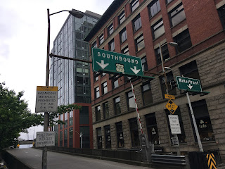

The original alignment of US Route 99 along Imperial Avenue in the city of Imperial during 1940 can be observed in the postcard below.  


The repaving of US Route 99/LRN 26 between Brawley-El Centro is cited in the July/August 1946 California Highways & Public Works as being approved as a post-World War II project.  The repaving project in the Brawley-El Centro corridor included new bridging structures. 


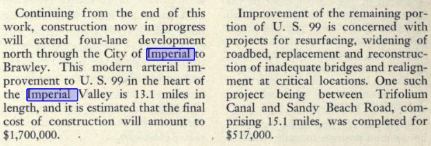
The November/December 1948 California Highways & Public Works references US Route 99/LRN 26 in El Centro having been recently expanded to four lanes.  The article stub notes that a continuation project would expand US Route 99/LRN 26 to four lanes in Imperial north to Brawley.


The May/June 1951 California Highways & Public Works discusses the effects of US Route 99/LRN 26 being rerouted off Imperial Avenue in Imperial onto a new expressway bypass.  The bypass realignment of US Route 99/LRN 26 in Imperial is stated to have opened during 1950 and was compared to the similarly sized city of Folsom.  


The truncation of US Route 99 from Calexico to the junction of the Golden State Freeway and San Bernardino Freeway in Los Angeles was approved by the AASHO Executive Committee on June 19th, 1963.  The justification by the California Division of Highways to truncate US Route 99 was to avoid what the agency viewed as confusing multiplexes on the new Interstate corridors of Southern California.  The truncation of US Route 99 did not take effect until New Year's Day 1964 and was part of the run up to the 1964 State Highway Renumbering.


During the 1964 State Highway Renumbering numerous changes were made to the State Highway System.  All the Legislative Route Numbers were dropped in favor of highway designations matching field signage.  The former corridor of US Route 99 from Indio to El Centro by way of Imperial was subsequently replaced with California State Route 86.  California State Route 86 through Imperial first appears on the 1964 Division of Highways Map.  


On October 9, 2013, Senate Bill 788, permitted the relinquishment of California State Route 86 within the cities of El Centro, Imperial and Brawley.  During December 2016 the California Transportation commission authorized the relinquishment of California State Route 86 within the city of Imperial. 


Further Reading

Continuing north on US Route 99 to Brawley?


Continuing south on US Route 99 to El Centro? 

Comments

Popular posts from this blog

New River Gorge National Park & Preserve - Thurmond

New River Gorge National Park and Preserve is best known for whitewater rafting and other forms of adventure tourism.  Yet, found in the hollows and isolated valleys are quiet farms and former coal mining towns.  Well off the beaten path and isolated from much of its surroundings, Thurmond provides a unique view into Central West Virginia's industrial past. Thurmond began as a railroad town in the late 1800s.  Sparked by the arrival of the Chesapeake & Ohio Railroad and the local coal industry, Thurmond quickly grew into a sizeable transportation and coal center.  When it incorporated as a town in 1903, Thurmond was a full-fledged community - home to two banks, two hotels, and many other services and stores. A CSX freight train passes the old coaling tower in Thurmond.  It was here that many steam locomotives would refill and refuel. Thurmond was home to a C&O railyard which serviced the numerous steam engines passing through the narrow valley.  Thu...

The Tale of Tollhouse Road, western California State Route 168 and failed Piute Pass Highway

Western California State Route 168 is entirely located in Fresno County and is linked historically to the Tollhouse Road corridor.   Tollhouse Road is one of the oldest highways in the Sierra Nevada range of Fresno County. The corridor presently begins in at Clovis Avenue in downtown Clovis and extends northeast to Huntington Lake. In 1866 the Woods Brothers established mining claims on Pine Ridge. In 1867 Fresno County would grant the brothers a toll franchise to construct a roadway to the desirable logging areas atop Pine Ridge and near Dinkey Creek. The Woods would establish a tollhouse at the start of their franchise road and lumber mill. The lumber mill attracted settlers which led to the establishment of the mountain town of Tollhouse. Fresno County would purchase the Tollhouse Road in 1878 and make it a public highway. The county would remove the tolls and incorporate the corridor into the existing county road network. Prior to the establishment of Clovis in 1...

Old Dunlap Road (former California State Route 180 in Yokuts Valley)

When California State Route 180 was commissioned in August 1934 the alignment in took in Sierra Nevada range was very different than from today.  The original highway alignment from Squaw Valley (now Yokuts Valley) to east Grant Grove (then part of General Grant National Park) originally followed what is now Ruth Hill Road, Dunlap Road, Pinehurst Road (modern California State Route 245), Dark Canyon Road (partially now Forest Road 14S45).  After funding fell through for the planned Kings Canyon Road the was corridor eventually picked up as a 30-mile-long cooperative project between the Division of Highways and Federal Government.  Much of current alignment of California State Route 180 bypassing Squaw Valley (now Yokuts Valley) and Dunlap was complete by 1941.  The post-1941 alignment of California State Route 180 in Squaw Valley was shifted onto what was once Dunlap Road in Squaw Valley.  This alignment itself was later bypassed by modern California State Route...