
Interstate 495 in Delaware


Interstate 495 within Delaware is a 11.47-mile auxiliary of Interstate 95 and bypass of downtown Wilmington.  Interstate 495 opened during 1977 and between 1978-1980 briefly served as mainline Interstate 95 while the South Wilmington Viaduct was being reconstructed.  Interstate 495 in addition to bypassing downtown Wilmington serves as access to the Port of Wilmington.  


Part 1; the history of Interstate 495

During 1948 the Wilmington Transportation Study proposed two limited access corridors to connect from Wilmington to the Pennsylvania State Line.  The first corridor would have followed what is now Interstate 95 (Plan A) whereas the second followed what is now modern Interstate 495 (Plan B) as a bypass of Wilmington.  By 1950 Plan A was selected as a limited access corridor from downtown Wilmington to the Pennsylvania State Line.  

On June 29th, 1956, the Federal Highway Aid Act of 1956 was signed into law on the Federal Level.  The Federal Highway Aid Act of 1956 was the genesis point of the Interstate Highway System and established the corridor of Federal Aid-Interstate #3.  Federal Aid-Interstate #3 would go through the process of design during 1960 and be assigned the designation of Interstate 495 during 1962.  

Construction of Interstate 495 would commence during 1968.  The Christina River Bridge would be completed by 1975 and first completed segment of Interstate 495 between US Route 13 to Interstate 95 in Claymont would open during 1976.  During June 1977 the remainder of Interstate 495 would open to traffic. 

On June 28, 1978, the AASHTO approved realigning Interstate 95 onto Interstate 495.  Existing Interstate 95 through Wilmington was requested to be designated as Interstate 595.  The justification for moving Interstate 95 to Interstate 495 was the higher capacity of the then new freeway bypass which had been completed during 1977.  A secondary justification is noted to be the reconstruction of Interstate 95 through Wilmington.  The designation of existing Interstate 95 through Wilmington as Interstate 595 was deferred by the AASHTO in favor of designating a suggested even numbered three-digit Interstate. 


What had been Interstate 95 through Wilmington was approved to be signed as Interstate 195 and Interstate 395 by the AASHTO on October 27, 1978.  Interstate 395 was to be designated from US Route 202 in Wilmington to what had been the Interstate 495 interchange near the Pennsylvania State Line.  Interstate 195 was to be designated from what was the southern Interstate 495 interchange to Delaware Route 141 in Wilmington.  


Interstate 195 and Interstate 395 through Wilmington were approved by the AASHTO to be renumbered to Interstate 895 on June 26, 1979.  


Interstate 95 was redesignated along the corridor of Interstate 895 by the AASHTO on November 15, 1980.  Likewise, the corridor Interstate 495 was restored to what had been briefly designated as Interstate 95.  The justification for restoring the corridor of Interstate 95 was that the project through Wilmington had been completed. 


During June 2014 the Christina River Bridge on Interstate 495 was closed for emergency repairs after tilting support columns were discovered.  The southbound lanes of Interstate 495 would reopen on July 31st whereas the northbound lanes would reopen on August 23th.  


Part 2; a drive on Interstate 495

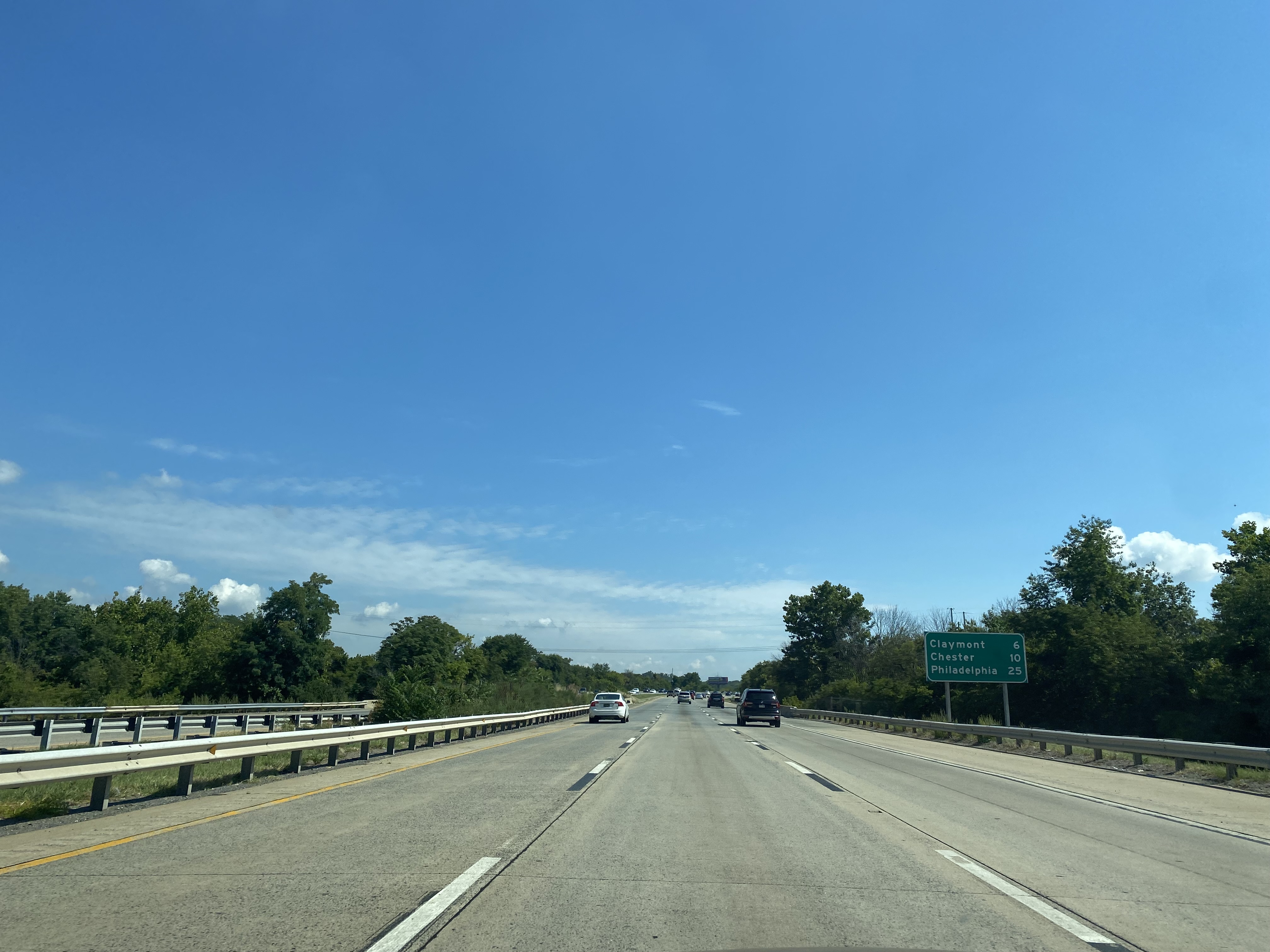
South of Wilmington, Interstate 495 splits from northbound Interstate 95 via a right-hand transition.  Traffic headed to Philadelphia and the Port of Wilmington are directed onto Interstate 495. 


Traffic on Interstate 495 northbound is advised the Port of Wilmington is 2 miles away whereas Philadelphia is 30 miles.  Interstate 495 is named the Vietnam Veterans Memorial Highway. 


Interstate 495 northbound Exit 1 accesses US Route 13 Business in Wilmington. 


Interstate 495 northbound Exit 2 accesses Delaware Route 9A and the Port of Wilmington.  


Interstate 495 northbound crosses the Christina River Bridge and accesses 12th Street at Exit 3.  


Northbound Interstate 495 Exit 4 accesses Delaware Route 3 and US Route 13 in Edgemoor.


Interstate 495 northbound follows the shore of the Delaware River to Exit 5/US Route 13 in Claymont.  Interstate 495 terminates at Interstate 95 in Claymont approaching the Pennsylvania State Line.  


Comments

Popular posts from this blog

The rogue G28-2 California State Highway Spades

In this short blog we look at the somewhat rare but not unheard-of rogue G28-2 California State Highway Spades affixed to guide signs. Part 1; what is the G28-2 California State Highway Spade?  The  Caltrans Manual of Uniform Traffic Control Devices Sign Chart from 2014  ("Caltrans MUTCD") dictates the types of signs and highway shields permitted for traffic control use in California.  California is known for it's more ornate cut-out shields which are used for, US Routes, Interstate Highways, and State Routes.  These shields are intended to be applied as standalone reassurance signs but aren't explicitly limited to said function and occasionally appear in error on guide signs.  The common shields which are typically found through California are: US Route:  G26-2 Interstate:  G27-2 State Highway:  G28-2 The Caltrans MUTCD provides alternative shields for, US Routes, Interstate Highways, and State Routes.  These alternative shields are intended for guide sign usage.  Th

Former Greater Pittsburgh International Airport Terminal

For just over four decades, the former main terminal of Greater Pittsburgh International Airport was the city's gateway to the world.  Located nearly 20 miles west of Downtown Pittsburgh, the Joseph Hoover-designed terminal would see millions of travelers pass through its doors.  Known best for the terrazzo compass in the main lobby, the terminal had many other distinguishing features.  The well-landscaped entrance led up to the curved stepped design of the terminal. Each level of the terminal would extend out further than the other allowing for numerous observation decks.  The most popular observation deck, the "Horizon Room", was located on the fourth floor. The former Greater Pittsburgh Airport Terminal - October 1998 From when it opened in the Summer of 1952 until its closing on September 30, 1992, the terminal would grow from a small regional airport to the main hub for USAir.  The terminal would see numerous expansions and renovations over its 40 years of

Highways in and around Old Sacramento; US 40, US 99W, CA 16, CA 24, CA 70, CA 99, CA 275, and more

This past weekend I was visiting the City of Sacramento for a wedding.  That being the case I decided to head out on a morning run through Old Sacramento, Jibboom Street Bridge, I Street Bridge, Tower Bridge, and path of US Route 40/US Route 99W towards the California State Capitol.  My goal was to retrace the paths of the various highways that once traversed the Old Sacramento area. This blog is part of the larger Gribblenation US Route 99 Page.  For more information pertaining to the other various segments of US Route 99 and it's three-digit child routes check out the link the below. Gribblenation US Route 99 Page The old highway alignments of Sacramento The City of Sacramento lies at the confluence of the Sacramento River and American River in Sacramento Valley.  Sacramento Valley was discovered by Spanish Explorer Gabriel Moraga in 1808.  Moraga referred to the fertile Sacramento Valley akin to a "Blessed Sacrament."  By 1839 John Sutter Sr. settled in Mexican held