Brawley is a city located in Imperial Valley of the Sonoran Desert of Imperial County, California. US Route 99 through its history in Brawley was largely aligned on Main Street and 1st Street until it was truncated to downtown Los Angeles in 1963. This blog will explore the history of US Route 99 in Brawley. Pictured as the blog covered is the dedication ceremony along US Route 99 on the then new New River Bridge in Brawly on July 17, 1953. Below US Route 99 can be observed on the 1935 Division of Highways Map of Imperial County passing through Brawley.

This blog is part of the larger Gribblenation US Route 99 Page. For more information pertaining to the other various segments of US Route 99 and it's three-digit child routes check out the link the below.
The history of US Route 99 in Brawley
During 1902 the Imperial Land Company plotted out a town site that was to become Brawley. The Imperial Land Company intended the new town to be known as "Braly" to honor the previous owner J.H. Braly. Braly refused to have the town Imperial Land Company town site named after him and the community's name was changed to "Brawley." Brawley incorporated as a city on April 6, 1909.
What would become US Route 99 through Brawley was added to the State Highway System as part of the 1916 Second State Highway Bond Act in the form of
Legislative Route Number 26 (LRN 26). The initial definition of LRN 26 originated in San Bernardino and terminated in El Centro. The extension of LRN 26 through Brawley is referenced in the
1916 California Highway Bulletin.


The
1924 Rand McNally Map of California reveals LRN 26 through Brawley was not part of any major Auto Trails. The alignment of LRN 26 through Brawley appears to be aligned on Main Street and Western Avenue.

The initial draft of the US Route System was approved by the Secretary of Agriculture during November of 1925. The US Route System within California was approved by California Highway Commission (CHC) with no changes recommended which can be seen in January 1926 California Highways & Public Works. US Route 99 is shown departing San Bernardino via LRN 26 towards El Centro via Brawley.
The US Route System was formally approved by the American Association of State Highway Engineers (AASHO) on November 11th, 1926. which formally brought US Route 99 into existence on LRN 26 through Brawley.
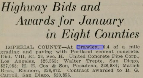
The
January/February 1929 California Highways & Public Works noted the paving of US Route 99/LRN 26 between Brawley-Westmorland was budgeted for the 1929-31 Fiscal Years.

The
April 1932 California Highways & Public Works notes the city of Brawley had requested assistance with improving US Route 99/LRN 26 on Western Avenue at the California Highway Commission meeting in Riverside. Prior to 1933 the Division of Highways was not permitted to actively maintain roadways within cities but could participate in cooperative upgrades.


The
July 1940 California Highways & Public Works featured a photo of damage to US Route 99/LRN 26 west of Brawley due to an earthquake on May 18, 1940. The New River Bridge is shown to have been shoved off its pilings along with damage to the surface to US Route 99/LRN 26. Repairs to the New River Bridge are stated to have taken a week to complete.
The repaving of US Route 99/LRN 26 between Brawley-El Centro is cited in the
July/August 1946 California Highways & Public Works as being approved as a post-World War II project. The repaving project in the Brawley-El Centro corridor included new bridging structures.
The
May/June 1950 California Highways & Public Works announced a contract to install a traffic light on US Route 99/LRN 26 in Brawley at the intersection of Main Street and 1st Street.

The
October/November 1953 California Highways & Public Works featured the opening of the new New River Bridge and resurfacing of US Route 99/LRN 26 in Brawley. The new New River Bridge was dedicated on July 17, 1953 and was a replacement for the timber span which had been damaged during the May 1940 earthquake.


The truncation of US Route 99 from Calexico to the junction of the Golden State Freeway and San Bernardino Freeway in Los Angeles was approved by the AASHO Executive Committee on June 19th, 1963. The justification by the California Division of Highways to truncate US Route 99 was to avoid what the agency viewed as confusing multiplexes on the new Interstate corridors of Southern California. The truncation of US Route 99 did not take effect until New Year's Day 1964 and was part of the run up to the 1964 State Highway Renumbering.
During the 1964 State Highway Renumbering numerous changes were made to the State Highway System. All the Legislative Route Numbers were dropped in favor of highway designations matching field signage. The former corridor of US Route 99 from Indio to El Centro by way of Brawley was subsequently replaced with California State Route 86. California State Route 86 through Brawley first appears on the
1964 Division of Highways Map.


During 1970 California State Route 78 would be extended through Brawley via multiplex of California State Route 86 following the addition of Ben Hulse Highway as part of the State Highway System. The road connecting Brawley to Glamis opened on August 13th, 1958, according to a San Diego Tribune article. The opening of the new road to Glamis saw it incorporated into the planned extension of LRN 146 defined by 1959 Legislative Chapter 1062. The completion of Ben Hulse Highway from California State Route 115 to existing California State Route 78 near Palo Verde was reported as being dedicated in the March 22nd, 1964, San Diego Union. Ben Hulse Highway reported was signed as Imperial County Route S78 upon being dedicated, it unclear if the County Route designation was co-signed on California State Route 86 or US Route 99 on Main Street through Brawley. Ben Hulse Highway ultimately appears as part of California State Route 78 on the 1970 Division of Highways Map. Notably the
1970 Division of Highways Map displays the planned but never constructed alignment approved by the California Highway Commission during 1961.

The Brawley Bypass opened during 2012 which saw California State Route 78 realigned off the multiplex of California State Route 86 on Main Street in Brawley. California State Route 86 within Brawley was authorized for relinquishment by way of 2013 Senate Bill 788/Chapter 525. To date the relinquishment of California State Route 86 in Brawley has not been acted upon by the California Transportation Commission.
Further Reading
Continuing north on US Route 99 to Westmorland?
Former US Route 99 in Westmorland (gribblenation.org)
Continuing south on US Route 99 to Imperial?
"Former US Route 99 in Imperial publishes on November 20, 2022.


Comments