
Maui County Route 33


Maui County Route 33 is a short half mile highway located on North Market Street in Wailuku on the Island of Maui.  Maui County Route 33 begins at Hawaii Route 32/Main Street and has a northern terminus at Maui County Route 330/Kahekili Highway.  Maui County Route 33 is a component of what was once Hawaii Route 33.  


Part 1; the history of Maui County Route 33 and Hawaii Route 33

The Island of Maui seemingly was not part of the original World War II era Hawaii Route System.  Circa 1955 the United States Bureau of Public Roads renumbered the Hawaii Route System.  The 1955 Hawaii Route Renumbering saw most of the conventions utilized by the current Hawaii State Route System established.  Primary Hawaii Routes were given two-digit numbers whereas Secondary Hawaii Routes were given three-digit numbers.  The Hawaii Routes were assigned in sequence for what Island/County they were located on coupled with what Federal Aid Program number they were tied to.  In the case of the Island of Maui it was assigned numbers in the range of 30-40.

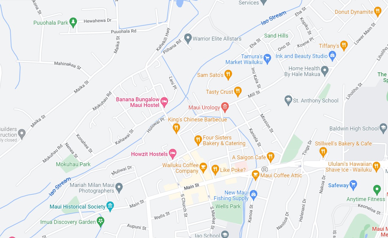
Hawaii Route 33 was designated as originating in Wailuku at Hawaii Route 32.  Hawaii Route 33 initially followed North Market Steet and the entirety of Kahekili Highway along the northwest coast of Maui to Hawaii Route 30 at Honokohau.  Hawaii Route 33 also had a bypass of downtown Wailuku which originated at Hawaii Route 32/Main Street.  The Hawaii Route 33 bypass route followed Mill Street and Central Street from Hawaii Route 32 to mainline Hawaii Route 33 at North Market Street. 

Hawaii Route 33 can be seen on the 1959 Gousha Highway Map of Hawaii.  

During the 1960s the Hawaii Route System was simplified, and numerous minor routes were shed from the State inventory.  According to hawaiihighways.com Hawaii Route 33 on North Market Street and Kahekili Highway to Waiehu Beach Road were redesignated as Maui County Route 330 during 1968.  The remaining portion of Kahekili Highway was redesignated as Hawaii Route 340 to Camp Maluhia and Maui County Route 340 to Honokohau.  

It is unclear when signage of North Market Street in Wailuku reverted to be signed Maui County Route 33 or if it ever was signed as Maui County Route 330.  An embossed Hawaii Route 33 shield once present on North Market Street in Wailuku can be seen in Wailuku in a 2000 era image hosted by hawaiihighways.com here.  


Part 2; a drive on Maui County Route 33

Wailuku is the Maui County Seat and is the longest-lived continuous community on the Island of Maui. What is now Wailuku was the site of Kamehameha's victory at the Battle of Kepaniwai during 1790.  During 1860s the site of Wailuku became the hub location for the operations of the Wailuku Sugar Company.  By 1905 Wailuku became the Maui County Seat and has retained it since.  

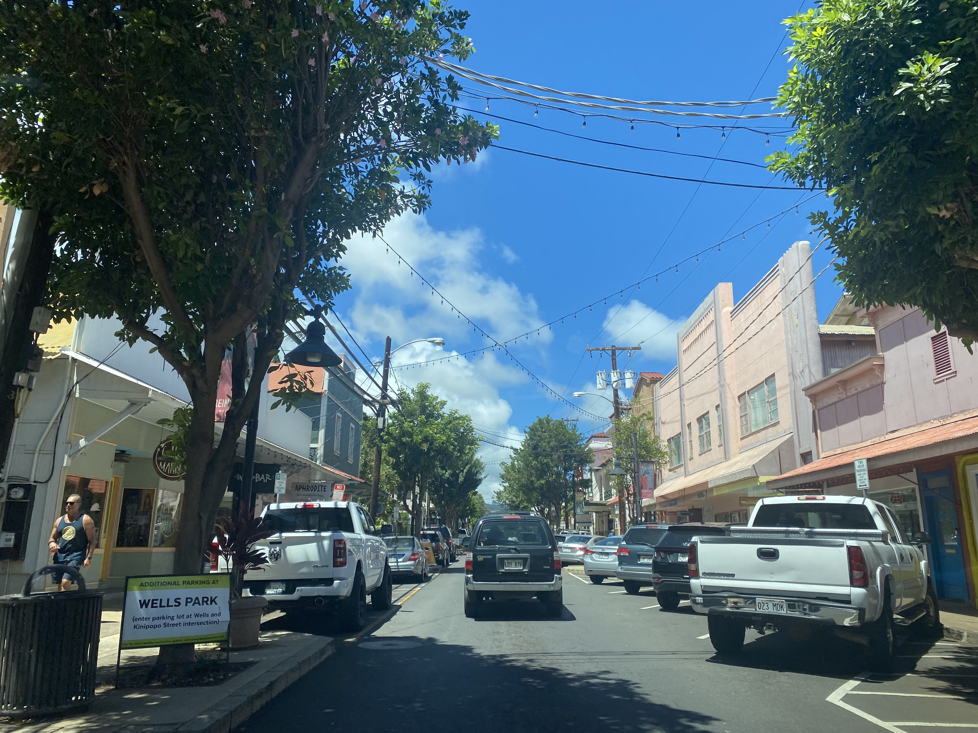
Maui County Route 33 northbound begin with a left hand turn as Hawaii Route 32 eastbound on Main Street intersects North Market Street.  Strangely Maui County Route 33 is adorned with newer reassurance shields on Hawaii Route 32.  The Hawaii Route shield and Hawaiian County Route shields functionally are the same design.  The only tangible way to know the difference between Hawaii Routes and Hawaiian County Routes is to examine the Highway Department of Transportation mileage logs (which are hosted on hawaiihighways.com)


Maui County Route 33 begins with a one-way northbound on jog on North Main Street to Vineyard Street.  Maui County Route 33 isn't signed with a southbound routing between Main Street-Vineland Street which functionally makes the highway only possible to complete heading northbound.  


Maui County Route 33 continues on North Main Street and crosses Iao Stream.  Maui County Route 33 terminates at Hawaii Route 330/Kahekili Highway.  


Comments

Popular posts from this blog

US Route 62 and US Route 180 in the Guadalupe Mountains

US Route 62/US Route 180 between El Paso, Texas and Carlsbad, New Mexico passes through the Guadalupe Mountains.  The Guadalupe Mountains comprise the highest peaks of Texas which are largely protected as part Guadalupe Mountains National Park.  The automotive highway through the Guadalupe Mountains was constructed in the late 1920s as part of Texas State Road 54.  US Route 62 was extended from Carlsbad through the Guadalupe Mountains to El Paso during 1932.  US Route 62 was joined in the Guadalupe Mountains by US Route 180 in 1943.  The Guadalupe Mountains comprise a portion of the 130 mile "No Services" zone on US Route 62/US Route 180 between El Paso-Carlsbad. Part 1; the history of US Route 62 and US Route 180 in the Guadalupe Mountains The Guadalupe Mountains lie within the states of Texas and New Mexico.  The Guadalupe Mountains essentially is a southern extension of the larger Rocky Mountains.  The Guadalupe Mountains is the highest range in Texas with the peak elevati

Paper Highways; unbuilt California State Route 100 in Santa Cruz

This edition of Paper Highways examines the unbuilt California State Route 100 in Santa Cruz. The History of Unbuilt California State Route 100 The route that became CA 100 was added to the State Inventory in 1959 as part of the Freeway & Expressway System as Legislative Route 287 .  According to CAhighways.org the initial definition of LRN 287 had it begin at LRN 5 (CA 17) and was defined over the below alignment to LRN 56 (CA 1) through downtown Santa Cruz. -  Ocean Street -  2nd Street -  Chestnut Street For context the above alignment would required tearing down a large part of the densely populated Santa Cruz.  A modern Google imagine immediately reveals how crazy an alignment following Ocean Street, 2nd Street, and Chestnut Street would have been. LRN 287 first appears on the 1960 Division of Highways State Map . In 1961 the definition of LRN 287 was generalized to; from LRN 5 via the beach area in Santa Cruz to LRN 56 west of the San Lorenzo River. 

New Mexico State Road 7 (Carlsbad Caverns Highway)

New Mexico State Road 7 is approximately a seven-mile highway in the Guadalupe Mountains of Eddy County. New Mexico State Road 7 connects US Route 62/US Route 180 at Whites City to the visitor center of Carlsbad Caverns National Park via Walnut Canyon. The so-called Carlsbad Caverns Highway to the National Park visitor center complex was constructed following the designation of the namesake National Monument in 1923. The current iteration of New Mexico State Road 7 was designated by the New Mexico State Highway Commission during June 1929. A proposal once was once floated to connect New Mexico State Road 7 to a cavern drive which would have been blasted into Big Room. Part 1; the history of New Mexico State Road 7 What are now Carlsbad Caverns was explored in the Guadalupe Mountains of Eddy County by local Jim White during 1898.  White explored the caverns via a homemade ladder and named several of the more notable rooms.  The name "Carlsbad Caverns" was derived from the