After hiking Devil's Slide I made my way south to Half Moon Bay on California State Route 1 to Half Moon Bay. I made an eastern turn on California State Route 92 towards Hayward via the Santa Cruz Mountains and San Mateo Bridge over San Francisco Bay.

CA 92 is a 28 mile State Highway connecting from CA 1 in Half Moon Bay east to downtown Hayward. CA 92 is unique in that it traverses it's entire alignment on varied right-of-way ranging from rural mountain road, freeway, one of the longest bridges in the world to an urban surface highway.
CA 92 was created during the 1964 State Highway Renumbering from Legislative Route 105 and never built LRN 259. CA 92 can be seen appearing by comparing the 1963 State Highway Map to the 1964 edition.
1963 State Highway Map
1964 State Highway Map
LRN 105 was adopted as a State Highway in 1933 between Half Moon Bay eastward on an implied path over the San Mateo-Hayward Bridge to Hayward and northward to Oakland on modern CA 185 according to CAhighways.org. Only the section of LRN 105 between Half Moon Bay east Hayward ultimately became part of CA 92.
CAhighways.org on LRN 105
The first San Mateo-Hayward Bridge was opened by the San Francisco Bay Toll-Bridge company in March of 1929 as the San Francisco Bay toll bridge. At the time of it's opening the 1929 San Mateo-Hayward Bridge was the longest in the world at about 7 miles in length over San Francisco Bay. The 1929 San Mateo-Hayward Bridge was mostly a causeway structure which featured center vertical lift which had a 135 height above the water when raised. In late 1951 the 1929 San Mateo Bridge was purchased by the California Division of Highways which closed in much of the gap in LRN 105 through San Mateo. This change can be seen by comparing the 1951 State Highway Map to the 1952 edition.
1951 State Highway Map
1952 State Highway Map
Originally LRN 105 in San Mateo was only State Maintained between CA 1/LRN 56 in Half Moon Bay east to US 101/LRN 2 in San Mateo. LRN 105 began at Main Street/CA 1 in Half Moon Bay and followed the modern course of CA 92 eastward over the Santa Cruz Mountains to the Crystal Springs Reservoirs. From the Crystal Springs Reservoirs LRN 105 followed Skyline Boulevard and Crystal Springs Road to reach US 101/LRN 2 on El Camino Real in San Mateo. The implied connection to the eastern segment of LRN 105 followed 3rd Avenue to the 1929 San Mateo-Hayward Bridge. The alignment described above can be seen on the 1935 California Division of Highways Map of San Mateo County.
1935 San Mateo County Highway Map
About mid-way across San Francisco Bay is the line for Alameda County. The Alameda County side of LRN 105 began at the eastern approach to the 1929 San Mateo-Hayward Bridge just slightly west of CA 17 when it ran on Hesperian Boulevard. LRN 105 entered downtown Hayward via Jackson Street to Mission Boulevard which is still part of CA 92 (mostly but I'll get to that below). Much of the freeway route occupied by CA 92 in Alameda County today was built over the original alignment of LRN 105. The 1935 California Division of Highways Map of Alameda County shows the original routing of LRN 105 between the 1929 San Mateo Bridge to downtown Hayward.
1935 Alameda County Highway Map
The next change in LRN 105 occurred when the 19th Avenue alignment was adopted in southern San Mateo according to CAhighways.org.
CAhighways.org on CA 92
In 1959 the planned alignment of LRN 259 east of downtown Hayward to US 50 (modern I-580) according to CAhighways.org was defined. Said alignment appears on the 1960 State Highway and ended up as a planned extension of CA 92 that was never built following the 1964 State Highway renumbering.
1960 State Highway Map
By 1964 the planned alignment of CA 92 on the 19th Avenue Freeway appears on the State Highway Map (link above).
On the 1965 and 1966 State Highway Maps the 19th Avenue Freeway is shown partially completed.
1965 State Highway Map
1966 State Highway Map
The 19th Avenue Freeway alignment of CA 92 is shown on the 1967 State Highway Map as completed. 1967 was also the year that the current San Mateo-Hayward Bridge was completed after construction began in 1961. Following the completion of the 1967 San Mateo-Hayward Bridge the 1929 was largely demolished.
1967 State Highway Map
As of the 2005 State Highway Map the proposed route of CA 92 east of Hayward to I-580 is still shown. However back in 2010 the alignment of CA 92 from Atherton Street to Mission Boulevard (CA 238) was authorized to be relinquished the City of Hayward essentially killing any planned extension.
2005 State Highway Map
As stated above my approach to CA 92 east was from CA 1 south in Half Moon Bay.


CA 92 east in Half Moon Bay quickly intersects Old CA 1 on Main Street before dropping to a two-lane highway.


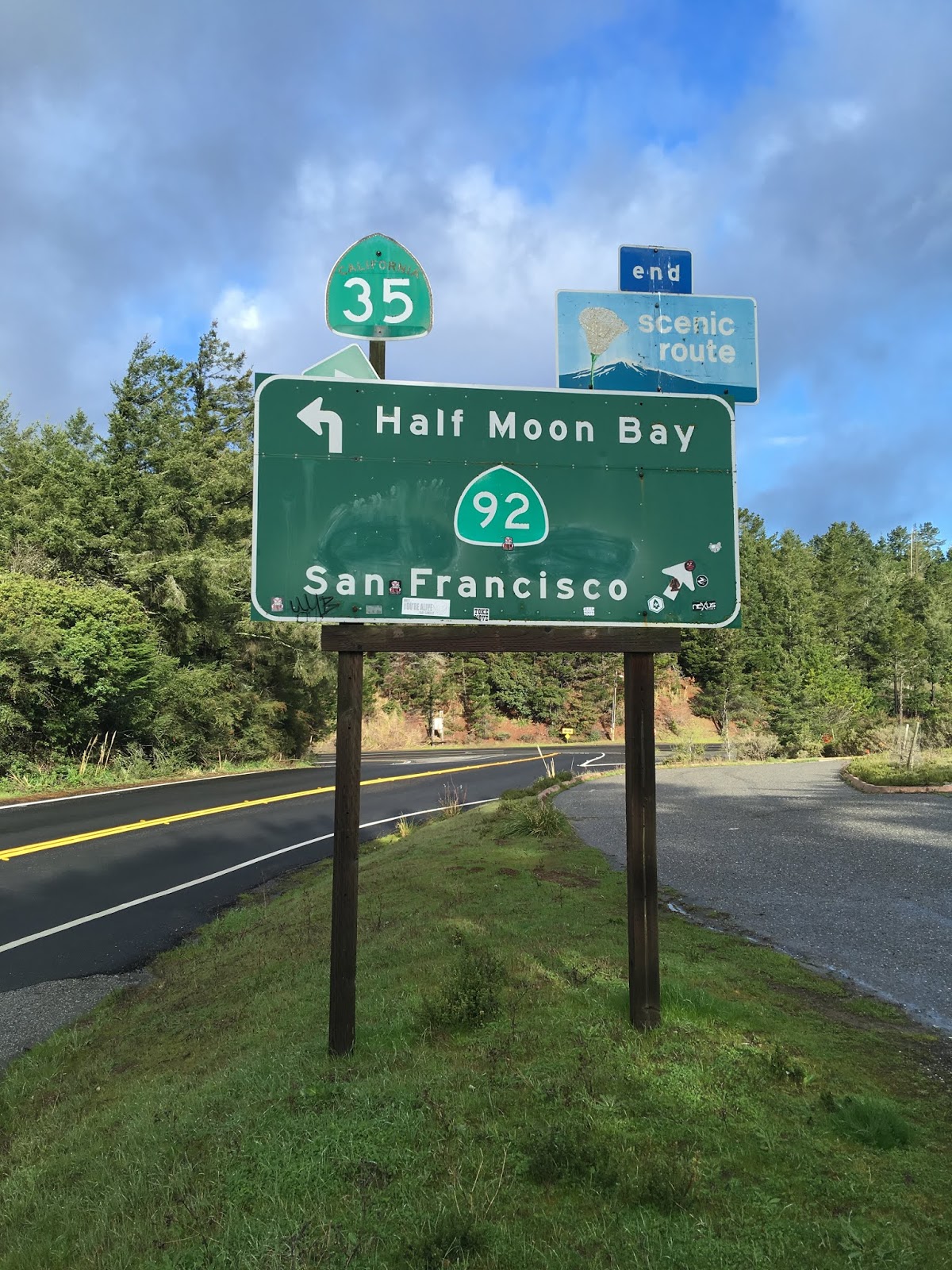
From the limits of Half Moon Bay on CA 92 east there is a guide sign showing CA 35 only 4 miles away while I-280 is shown as 6 miles away. Suffice to say said guide sign has seen infinitely better days.

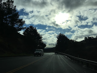
CA 92 wanders the low terrain of the Santa Cruz Mountains before entering a section with a concrete divider. The concrete divider is present on CA 92 east ascending up to the junction with CA 35 at Skyline Boulevard.


From the junction of CA 92 and CA 35 there is a vista point looking eastward towards Upper Crystal Springs Reservoir. CA 92 east/CA 35 north can be descending from the vista point towards Upper Crystal Springs Reservoir.


CA 92 east/CA 35 north descend towards Crystal Springs Reservoir before emerging on a causeway. Said causeway is the 1877 Crystal Springs Dam which impounds Upper Crystal Springs Reservoir via Laguna Creek. Lower Crystal Springs Reservoir was formed by impounding San Mateo Creek via Crystal Springs Dam to the north on CA 35 in 1888.


CA 35 north splits from CA 92 east at Skyline Boulevard . CA 92 traffic is advised the junction with I-280 is ahead.


CA 92 skirts the eastern rim of Upper Crystal Springs Reservoir to the junction of I-280. At I-280 the alignment of CA 92 east enters the 19th Avenue Freeway grade.


CA 92 east enters the City of San Mateo on what is known as the J. Arthur Younger Freeway. Despite the Freeway grade the route of CA 92 through San Mateo is signed at 55 MPH.


CA 92 is a 28 mile State Highway connecting from CA 1 in Half Moon Bay east to downtown Hayward. CA 92 is unique in that it traverses it's entire alignment on varied right-of-way ranging from rural mountain road, freeway, one of the longest bridges in the world to an urban surface highway.
CA 92 was created during the 1964 State Highway Renumbering from Legislative Route 105 and never built LRN 259. CA 92 can be seen appearing by comparing the 1963 State Highway Map to the 1964 edition.
1963 State Highway Map
1964 State Highway Map
LRN 105 was adopted as a State Highway in 1933 between Half Moon Bay eastward on an implied path over the San Mateo-Hayward Bridge to Hayward and northward to Oakland on modern CA 185 according to CAhighways.org. Only the section of LRN 105 between Half Moon Bay east Hayward ultimately became part of CA 92.
CAhighways.org on LRN 105
The first San Mateo-Hayward Bridge was opened by the San Francisco Bay Toll-Bridge company in March of 1929 as the San Francisco Bay toll bridge. At the time of it's opening the 1929 San Mateo-Hayward Bridge was the longest in the world at about 7 miles in length over San Francisco Bay. The 1929 San Mateo-Hayward Bridge was mostly a causeway structure which featured center vertical lift which had a 135 height above the water when raised. In late 1951 the 1929 San Mateo Bridge was purchased by the California Division of Highways which closed in much of the gap in LRN 105 through San Mateo. This change can be seen by comparing the 1951 State Highway Map to the 1952 edition.
1951 State Highway Map
1952 State Highway Map
Originally LRN 105 in San Mateo was only State Maintained between CA 1/LRN 56 in Half Moon Bay east to US 101/LRN 2 in San Mateo. LRN 105 began at Main Street/CA 1 in Half Moon Bay and followed the modern course of CA 92 eastward over the Santa Cruz Mountains to the Crystal Springs Reservoirs. From the Crystal Springs Reservoirs LRN 105 followed Skyline Boulevard and Crystal Springs Road to reach US 101/LRN 2 on El Camino Real in San Mateo. The implied connection to the eastern segment of LRN 105 followed 3rd Avenue to the 1929 San Mateo-Hayward Bridge. The alignment described above can be seen on the 1935 California Division of Highways Map of San Mateo County.
1935 San Mateo County Highway Map
About mid-way across San Francisco Bay is the line for Alameda County. The Alameda County side of LRN 105 began at the eastern approach to the 1929 San Mateo-Hayward Bridge just slightly west of CA 17 when it ran on Hesperian Boulevard. LRN 105 entered downtown Hayward via Jackson Street to Mission Boulevard which is still part of CA 92 (mostly but I'll get to that below). Much of the freeway route occupied by CA 92 in Alameda County today was built over the original alignment of LRN 105. The 1935 California Division of Highways Map of Alameda County shows the original routing of LRN 105 between the 1929 San Mateo Bridge to downtown Hayward.
1935 Alameda County Highway Map
The next change in LRN 105 occurred when the 19th Avenue alignment was adopted in southern San Mateo according to CAhighways.org.
CAhighways.org on CA 92
In 1959 the planned alignment of LRN 259 east of downtown Hayward to US 50 (modern I-580) according to CAhighways.org was defined. Said alignment appears on the 1960 State Highway and ended up as a planned extension of CA 92 that was never built following the 1964 State Highway renumbering.
1960 State Highway Map
By 1964 the planned alignment of CA 92 on the 19th Avenue Freeway appears on the State Highway Map (link above).
On the 1965 and 1966 State Highway Maps the 19th Avenue Freeway is shown partially completed.
1965 State Highway Map
1966 State Highway Map
The 19th Avenue Freeway alignment of CA 92 is shown on the 1967 State Highway Map as completed. 1967 was also the year that the current San Mateo-Hayward Bridge was completed after construction began in 1961. Following the completion of the 1967 San Mateo-Hayward Bridge the 1929 was largely demolished.
1967 State Highway Map
As of the 2005 State Highway Map the proposed route of CA 92 east of Hayward to I-580 is still shown. However back in 2010 the alignment of CA 92 from Atherton Street to Mission Boulevard (CA 238) was authorized to be relinquished the City of Hayward essentially killing any planned extension.
2005 State Highway Map
As stated above my approach to CA 92 east was from CA 1 south in Half Moon Bay.


CA 92 east in Half Moon Bay quickly intersects Old CA 1 on Main Street before dropping to a two-lane highway.


From the limits of Half Moon Bay on CA 92 east there is a guide sign showing CA 35 only 4 miles away while I-280 is shown as 6 miles away. Suffice to say said guide sign has seen infinitely better days.

CA 92 wanders the low terrain of the Santa Cruz Mountains before entering a section with a concrete divider. The concrete divider is present on CA 92 east ascending up to the junction with CA 35 at Skyline Boulevard.


From the junction of CA 92 and CA 35 there is a vista point looking eastward towards Upper Crystal Springs Reservoir. CA 92 east/CA 35 north can be descending from the vista point towards Upper Crystal Springs Reservoir.

CA 92 east/CA 35 north descend towards Crystal Springs Reservoir before emerging on a causeway. Said causeway is the 1877 Crystal Springs Dam which impounds Upper Crystal Springs Reservoir via Laguna Creek. Lower Crystal Springs Reservoir was formed by impounding San Mateo Creek via Crystal Springs Dam to the north on CA 35 in 1888.


CA 35 north splits from CA 92 east at Skyline Boulevard . CA 92 traffic is advised the junction with I-280 is ahead.


CA 92 skirts the eastern rim of Upper Crystal Springs Reservoir to the junction of I-280. At I-280 the alignment of CA 92 east enters the 19th Avenue Freeway grade.


CA 92 east enters the City of San Mateo on what is known as the J. Arthur Younger Freeway. Despite the Freeway grade the route of CA 92 through San Mateo is signed at 55 MPH.


At Exit 12A CA 92 east meets CA 82 which was the original surface alignment of US 101.


At Exits 13A & B CA 92 east meets US 101 on the Bay Shore Freeway.


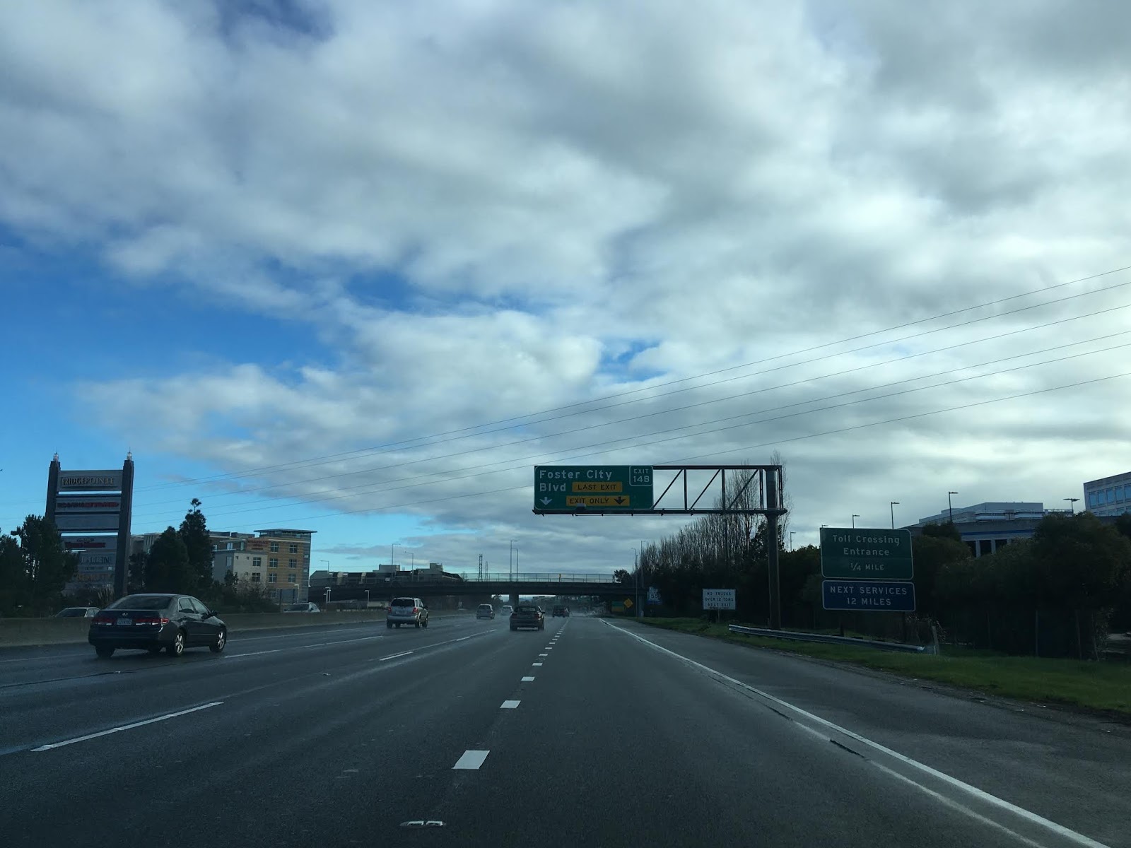
CA 92 east opens up to 65 MPH entering Foster City approaching San Francisco Bay. Exit 14A is the last exit before the San Mateo-Hayward Bridge and is the access point to the remains of the 1929 Bridge.
Access to the 1929 San Mateo-Hayward Bridge remains can be obtained at Bridgeview Park. After much of the 1929 Bridge was demolished San Mateo County bought the remaining western approach and operated it as a fishing pier until 1996 under land lease from the Division of Highways. While the 1929 Bridge is no longer accessible the land was purchased by Foster City which opened Bridgeview Park in 2015. The 1929 Bridge next to the 1967 structure is almost immediately apparent upon entering Bridgeview Park.


A historical information placard is maintained at the foot of the 1929 Bridge which has several vintage photos of the structure.


Suffice to say there is a massive difference in design between the 1929 and 1967 San Mateo-Hayward Bridges.


North of the 1967 Bridge much of San Francisco Bay can be seen from Bridgeview Park.

Returning to CA 92 east the former approach to the 1929 Bridge can still be made out approaching the 1967 Bridge.


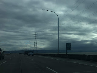
The 1967 San Mateo-Hayward Bridge doesn't have a lift span but rather rises to a maximum clearance of 135 feet above San Francisco Bay. Atop the 1967 San Mateo-Hayward Bridge almost all of eastern San Francisco Bay can be seen.


Upon descending the high span of the 1967 San Mateo-Hayward Bridge CA 92 east enters Hayward and Alameda County.


Approaching the shore of San Francisco Bay in Hayward the westbound CA 92 toll booths can be seen. Tolls are only collected on CA 92 westbound at a rate of $6 dollars for two-axle vehicles.


At Exit 25B CA 92 east intersects former CA 17 on Hesperian Boulevard. Access to I-880 is obtained from Exit 26A & B.


Entering downtown Hayward CA 92 east drops to a surface street grade on Jackson Street.


CA 92 east dips under two rail underpasses. The second underpass is next to Atherton Street which is the relinquishment point described above.


CA 92 east once ended at CA 238 at Mission Boulevard in downtown Hayward. CA 238 continued north through downtown Hayward towards I-238 and I-580 via Foothill Boulevard.


Comments