On a recent trip to the Bay Area I drove/clinched numerous highways. Some of them had oddities like not being signed, not completed as planned or even relinquished segments. None was as strange as California State Routes 112, 61 and 260 which all essentially serve as a signed version of CA 61.

As completed CA 112, 61 and 260 serve as a functionally signed (mostly...) CA 61 which starts at CA 185 in downtown San Leandro and traverses northwest through Alameda to downtown Oakland at I-880. Below is a historic summary of each highway which serves to make up the signed portions of CA 61.
CA 112, CA 61 and CA 260 were all part of Legislative Route Number 69 which was added to the State Highway system in 1925 according to CAhighways.org. LRN 69 originally only was part of the highway system from LRN 1 (future US 101) in San Rafael eastward to Point San Quentin where the Richmond-San Rafael Bridge would later be located. LRN 69 was extended in 1933 which extended it southward to LRN 5 in Warm Springs. LRN 69 after it's 1933 extension encompassed almost all of what is now CA 260, CA 61 and CA 112. LRN 69 was even signed as part of CA 17 (originally CA 13 in the 1934 plan for State Highways) from San Leandro south to Warm Springs which can be seen on the 1938 State Highway Map. Note; the Posey Tube opened in 1928 and was maintained by Alameda County which is why it doesn't show as part of LRN 69.
1938 State Highway Map
In 1947 the legislature created a new definition of LRN 252 for the highway between San Leandro through Alameda to the Posey Tube according to CAhighways.org. This change was due to LRN 69 being shifted to the future alignment of the Nimitz Freeway. The change in definition to LRN 252 and the difference in the planned route of LRN 69 can be seen by comparing the 1946 State Highway Map to the 1948 edition.
1946 State Highway Map
1948 State Highway Map
In 1949 LRN 252 was changed to LRN 226 but there wasn't much difference in the actual route between San Leandro to the Posey Tube.
CAhighways.org on LRN 226
The change to LRN 226 can be seen on the 1950 State Highway Map.
1950 State Highway Map
In 1955 the legislature added a definition to LRN 226 by which maintenance of the Posey Tube would be assumed by the state upon completion of a second tunnel between Oakland and Alameda.
In 1959 LRN 258 was defined by the legislature according to CAhighways.org. LRN 258 was to run from Newark at LRN 107 (modern CA 84) north to LRN 226 at Davis Street and back to LRN 5 (US 50 at the time). LRN 258 south of Davis Street eventually became part of the never completed southern segment CA 61 and the planned route can be seen on the 1960 State Highway Map.
1960 State Highway Map
During the 1964 State Highway renumbering LRN 226 was split into CA 112 and CA 61. The State assumed maintenance of the Posey Tunnel upon the completion of the neighboring Webster Street Tunnel in 1963. CA 61 incorporated the planned route of LRN 258 south of Davis Street to CA 84. In addition the planned route of CA 61 continued north along San Francisco Bay through Oakland via what was planned as LRN 257. LRN 257 was also defined in 1959 according to CAhighways.org. The changes described can be seen by comparing the 1963 State Highway Map to the 1964 edition.
1963 State Highway Map
1964 State Highway Map
According to CAhighways.org a new route for CA 61 west of Webster Street was defined in 1965. The Webster/Posey Tube alignments of CA 61 became part of CA 260 which can be seen on 1966 State Highway Map City Insert.
1966 State Highway Map City Insert
According to CAhighways.org much of Webster Street in Alameda on CA 260 from CA 61 to the Webster/Posey Tube was authorized for relinquishment in 2004. The legislative definition of CA 260 was updated to reflect the Webster Street relinquishment.
CAhighways.org on CA 260
According to CAhighways.org the legislature considered relinquishing almost all of CA 112 back in 2005 but nothing appears to have come of it since.
CAhighways.org on CA 112
CA 61 essentially has remained status quo even with the unbuilt portions since the 1960s.
CAhighways.org on CA 61
I began my tour of CA 112, CA 61 and CA 260 from downtown San Leandro from CA 185 north. From CA 185 I turned west on Davis Street towards CA 61. CA 112 in present configuration is only 2 miles in length.

CA 112 westbound is completely unsigned on Davis Street. CA 112 west crosses a set of rails out of downtown San Leandro and meets junction with I-880.


West of I-880 the route of CA 112 crosses over another set of rails on Jack D. Mallester/Mario Polvorosa overpass.


CA 112 west terminates at CA 61 on Doolittle Drive at the City Limits of Oakland.

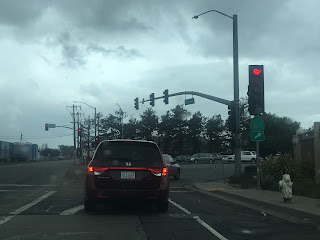
From CA 61 southbound on Doolittle Drive traffic is advised that CA 61 continues east on Davis Street instead of CA 112.
CA 61 directional sign to Davis Street
In 2012 there appears to have been CA 112 signage on Davis Street eastbound according to Chris Sampang.
Chris Sampang CA 112 eastbound album
Said CA 112 eastbound signage is still present on 2018 Google images. This means that CA 112 is signed as both CA 61 and CA 112.
CA 112 eastbound sign image
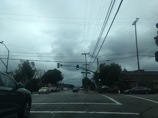
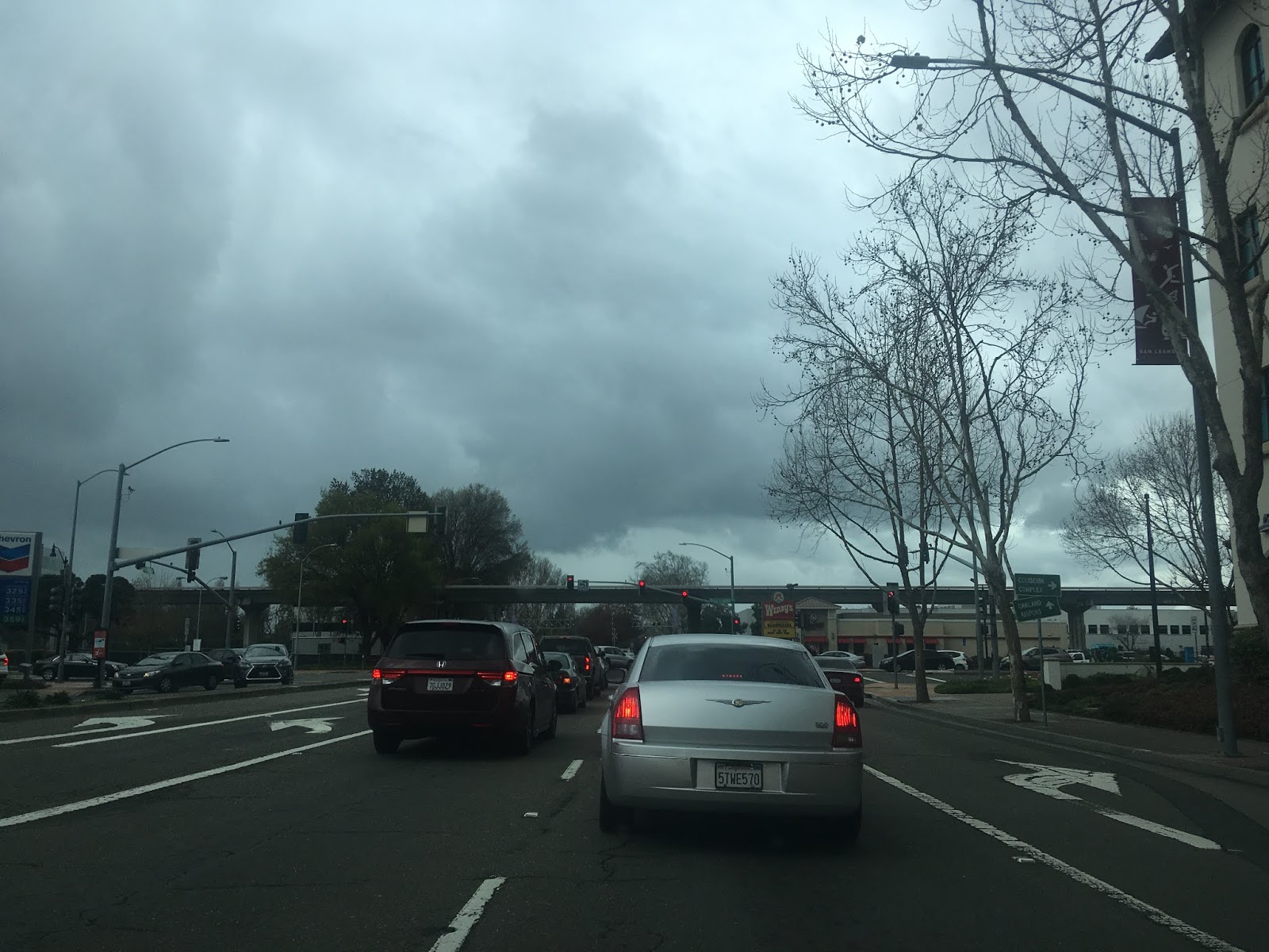
Turning onto CA 61 northward towards Oakland there are numerous reassurance shields. In present configuration only 7 of 31 miles of CA 61 have been built.
CA 61 follows Doolittle Drive past Oakland International Airport and runs alongside San Leandro Bay.


CA 61 rises above San Leandro Bay on the 1953 Bay Farm Island Bridge to Alameda on Otis Drive. The Bay Farm Island Bridge is a single-leaf bascule drawbridge which is 750 feet long.


CA 61 is directed on Otis Drive towards downtown Alameda. Oakland traffic is directed to use Ferndale Boulevard which continues to High Street.

CA 61 traffic makes a right hand turn from Otis Drive onto Broadway.

CA 61 follows Broadway to Encinal Avenue and make a left turn towards downtown Alameda.


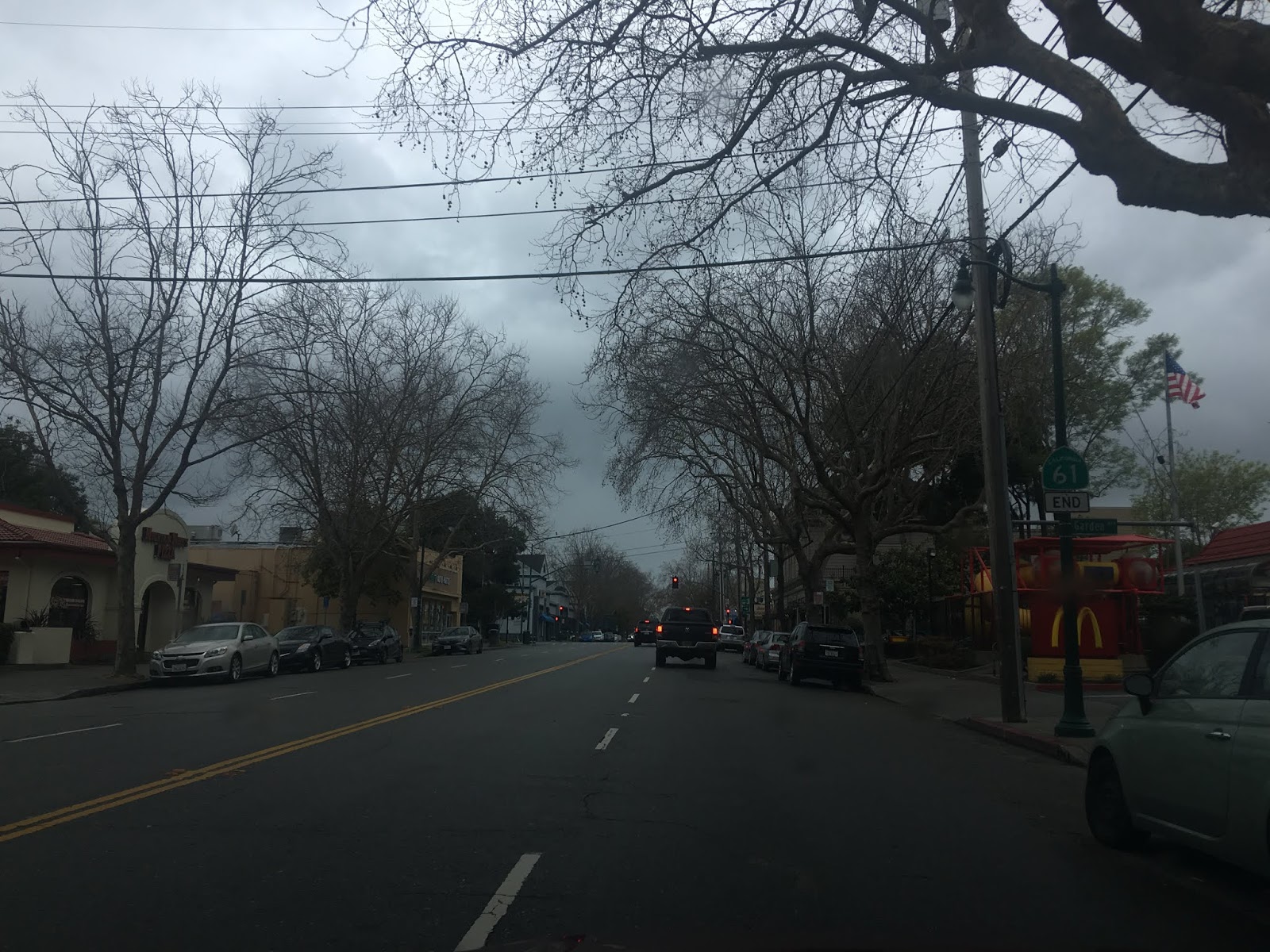
CA 61 follows Encinal Avenue through downtown Alameda to Central Avenue.


CA 61 follows Central Avenue to it's official terminus at Webster Street. The un-constructed route of CA 61 had it following Central Avenue towards Oakland Estuary. CA 61 once made a turn on Webster Street towards the Posey Tube and CA 260 until recently had a south terminus located here.


The relinquished portion of CA 260 northbound runs along Webster Street until State Maintenance begins just north of Atlantic Avenue at Alameda College. Traffic heading towards the USS Hornet is directed to turn west on Appezzato Memorial Parkway.


CA 260 northbound traffic uses the Posey Tube and CA 260 uses the Webster Street Tube. Traffic from both tubes converge at Willie Stargell Avenue in Alameda.

As noted above the Posey Tube on CA 260 northbound was completed in 1928 but wasn't assumed under state maintenance until the Webster Street Tube was completed. The Posey Tube traverses under Oakland Estuary where it emerges into downtown Oakland. Interestingly Alameda doesn't exist on a true island as the Oakland Estuary was first dredged in 1853.


CA 260 north enters Oakland on Harrison Street and terminates at 7th Street. Interestingly CA 61 is signed at 7th Street with a second "false" end. I-880/I-980 traffic is directed to use 7th Street and Jackson Street.


As completed CA 112, 61 and 260 serve as a functionally signed (mostly...) CA 61 which starts at CA 185 in downtown San Leandro and traverses northwest through Alameda to downtown Oakland at I-880. Below is a historic summary of each highway which serves to make up the signed portions of CA 61.
CA 112, CA 61 and CA 260 were all part of Legislative Route Number 69 which was added to the State Highway system in 1925 according to CAhighways.org. LRN 69 originally only was part of the highway system from LRN 1 (future US 101) in San Rafael eastward to Point San Quentin where the Richmond-San Rafael Bridge would later be located. LRN 69 was extended in 1933 which extended it southward to LRN 5 in Warm Springs. LRN 69 after it's 1933 extension encompassed almost all of what is now CA 260, CA 61 and CA 112. LRN 69 was even signed as part of CA 17 (originally CA 13 in the 1934 plan for State Highways) from San Leandro south to Warm Springs which can be seen on the 1938 State Highway Map. Note; the Posey Tube opened in 1928 and was maintained by Alameda County which is why it doesn't show as part of LRN 69.
1938 State Highway Map
In 1947 the legislature created a new definition of LRN 252 for the highway between San Leandro through Alameda to the Posey Tube according to CAhighways.org. This change was due to LRN 69 being shifted to the future alignment of the Nimitz Freeway. The change in definition to LRN 252 and the difference in the planned route of LRN 69 can be seen by comparing the 1946 State Highway Map to the 1948 edition.
1946 State Highway Map
1948 State Highway Map
In 1949 LRN 252 was changed to LRN 226 but there wasn't much difference in the actual route between San Leandro to the Posey Tube.
CAhighways.org on LRN 226
The change to LRN 226 can be seen on the 1950 State Highway Map.
1950 State Highway Map
In 1955 the legislature added a definition to LRN 226 by which maintenance of the Posey Tube would be assumed by the state upon completion of a second tunnel between Oakland and Alameda.
In 1959 LRN 258 was defined by the legislature according to CAhighways.org. LRN 258 was to run from Newark at LRN 107 (modern CA 84) north to LRN 226 at Davis Street and back to LRN 5 (US 50 at the time). LRN 258 south of Davis Street eventually became part of the never completed southern segment CA 61 and the planned route can be seen on the 1960 State Highway Map.
1960 State Highway Map
During the 1964 State Highway renumbering LRN 226 was split into CA 112 and CA 61. The State assumed maintenance of the Posey Tunnel upon the completion of the neighboring Webster Street Tunnel in 1963. CA 61 incorporated the planned route of LRN 258 south of Davis Street to CA 84. In addition the planned route of CA 61 continued north along San Francisco Bay through Oakland via what was planned as LRN 257. LRN 257 was also defined in 1959 according to CAhighways.org. The changes described can be seen by comparing the 1963 State Highway Map to the 1964 edition.
1963 State Highway Map
1964 State Highway Map
According to CAhighways.org a new route for CA 61 west of Webster Street was defined in 1965. The Webster/Posey Tube alignments of CA 61 became part of CA 260 which can be seen on 1966 State Highway Map City Insert.
1966 State Highway Map City Insert
According to CAhighways.org much of Webster Street in Alameda on CA 260 from CA 61 to the Webster/Posey Tube was authorized for relinquishment in 2004. The legislative definition of CA 260 was updated to reflect the Webster Street relinquishment.
CAhighways.org on CA 260
According to CAhighways.org the legislature considered relinquishing almost all of CA 112 back in 2005 but nothing appears to have come of it since.
CAhighways.org on CA 112
CA 61 essentially has remained status quo even with the unbuilt portions since the 1960s.
CAhighways.org on CA 61
I began my tour of CA 112, CA 61 and CA 260 from downtown San Leandro from CA 185 north. From CA 185 I turned west on Davis Street towards CA 61. CA 112 in present configuration is only 2 miles in length.

CA 112 westbound is completely unsigned on Davis Street. CA 112 west crosses a set of rails out of downtown San Leandro and meets junction with I-880.


West of I-880 the route of CA 112 crosses over another set of rails on Jack D. Mallester/Mario Polvorosa overpass.


CA 112 west terminates at CA 61 on Doolittle Drive at the City Limits of Oakland.

From CA 61 southbound on Doolittle Drive traffic is advised that CA 61 continues east on Davis Street instead of CA 112.
CA 61 directional sign to Davis Street
In 2012 there appears to have been CA 112 signage on Davis Street eastbound according to Chris Sampang.
Chris Sampang CA 112 eastbound album
Said CA 112 eastbound signage is still present on 2018 Google images. This means that CA 112 is signed as both CA 61 and CA 112.
CA 112 eastbound sign image
Turning onto CA 61 northward towards Oakland there are numerous reassurance shields. In present configuration only 7 of 31 miles of CA 61 have been built.

CA 61 follows Doolittle Drive past Oakland International Airport and runs alongside San Leandro Bay.


CA 61 rises above San Leandro Bay on the 1953 Bay Farm Island Bridge to Alameda on Otis Drive. The Bay Farm Island Bridge is a single-leaf bascule drawbridge which is 750 feet long.


CA 61 is directed on Otis Drive towards downtown Alameda. Oakland traffic is directed to use Ferndale Boulevard which continues to High Street.

CA 61 traffic makes a right hand turn from Otis Drive onto Broadway.


CA 61 follows Broadway to Encinal Avenue and make a left turn towards downtown Alameda.


CA 61 follows Encinal Avenue through downtown Alameda to Central Avenue.


CA 61 follows Central Avenue to it's official terminus at Webster Street. The un-constructed route of CA 61 had it following Central Avenue towards Oakland Estuary. CA 61 once made a turn on Webster Street towards the Posey Tube and CA 260 until recently had a south terminus located here.


The relinquished portion of CA 260 northbound runs along Webster Street until State Maintenance begins just north of Atlantic Avenue at Alameda College. Traffic heading towards the USS Hornet is directed to turn west on Appezzato Memorial Parkway.


CA 260 northbound traffic uses the Posey Tube and CA 260 uses the Webster Street Tube. Traffic from both tubes converge at Willie Stargell Avenue in Alameda.

As noted above the Posey Tube on CA 260 northbound was completed in 1928 but wasn't assumed under state maintenance until the Webster Street Tube was completed. The Posey Tube traverses under Oakland Estuary where it emerges into downtown Oakland. Interestingly Alameda doesn't exist on a true island as the Oakland Estuary was first dredged in 1853.


CA 260 north enters Oakland on Harrison Street and terminates at 7th Street. Interestingly CA 61 is signed at 7th Street with a second "false" end. I-880/I-980 traffic is directed to use 7th Street and Jackson Street.


Comments