Signed County Route J37; the last Signed Tulare County Route and the Lone Pine to Porterville High Sierra Road
Recently I drove the entirety of Signed County Route J37 located in rural Tulare County. Signed County Route J37 is notable in that it is the last Signed County Route which actually has field signage left in Tulare County and was intended to be part of a Trans-Sierra Highway known as the Lone Pine to Porterville High Sierra Road.

While researching California State Route 190 and more specifically the gap in the highway over the Sierra Nevada Range it became quickly apparent that there was far more to J37/Balch Park Road than initially thought. The previous blog on California State Route 190 can be found here:
California State Route 190; the Trans-Sierra Highway that could have been
On the above blog I attached an article from 1926 written by the Los Angeles Times detailing the route of the Lone Pine to Porterville High Sierra Road which was slated to begin construction in 1927. The route of the Lone Pine to Porterville High Sierra Road would have followed Carroll Creek southward out of Lone Pine ascending to Mulky Pass at 11,300 feet above sea level. The Lone Pine to Porterville High Sierra Road was to cross the Kern River Fault emerging via the North Fork of the Middle Fork Tule River in Balch Park. The route of the Lone Pine to Porterville High Sierra Road was to continue west to Milo on what is now Balch Park Road/J37 to Springville with a branch splitting northwest on Yokohl Valley Drive to Visalia.
For ease of reference I posted a direct link to the 1926 Los Angeles Times article regarding the Lone Pine to Porterville High Sierra Road.
owensvalleyhistory.com regading the Lone Pine to Porterville High Sierra Road
The initial survey for the route of the Lone Pine to Porterville High Sierra Road was conducted in 1923 and was to be funded by; Tulare Couny, Kern County, and Inyo County. Road building input was provided to the aforementioned counties by the California Division of Highways in addition to the Automobile Club of Southern California. Monetary assistance was provided by the City of Los Angeles which fronted $170,000 to build part of the Lone Pine to Porterville High Sierra Road eastward from Mulky Pass towards Lone Pine. Much of the route of the Lone Pine to High Sierra Road was built from Lone Pine westward towards Carroll Creek but never to Mulky Pass. This section would be adopted by the California Division of Highways in 1933 as part of Legislative Route Number 127 which became California State Route 190 in 1934.
In 1926 the original road from Balch Park west to Springville was Bear Creek Road. Bear Creek Road was built in 1884 along Bear Creek by L.B. Frasier to service his sawmill located within what is now Mountain Home State Forest. Mountain Home State Forest was once the site of a resort known as "Mountain Home" which was constructed in 1885 and was accessed by Frasier's Bear Creek Road. Frasier's Mill ran into financial instability leading him to abandon Bear Creek Road which continued to be maintained by the Mountain Home Resort. Frasier attempted to toll Bear Creek Road in 1889 but lost in court to the operators of the Mountain Home Resort.
What is now Balch Park was first settled in 1884 by John Doyle who constructed an access road from Bear Creek Road. Doyle intended to operate a resort called Summer Home on his land but the plans never came to fruition. Doyle sold his tract to the Mount Whitney Power and Light Company 1906. The Mount Whitney Power and Light Company initially planned to cut down the 200 redwoods located within Doyle's tract to build a log flume but those plans ultimately never came to fruition.
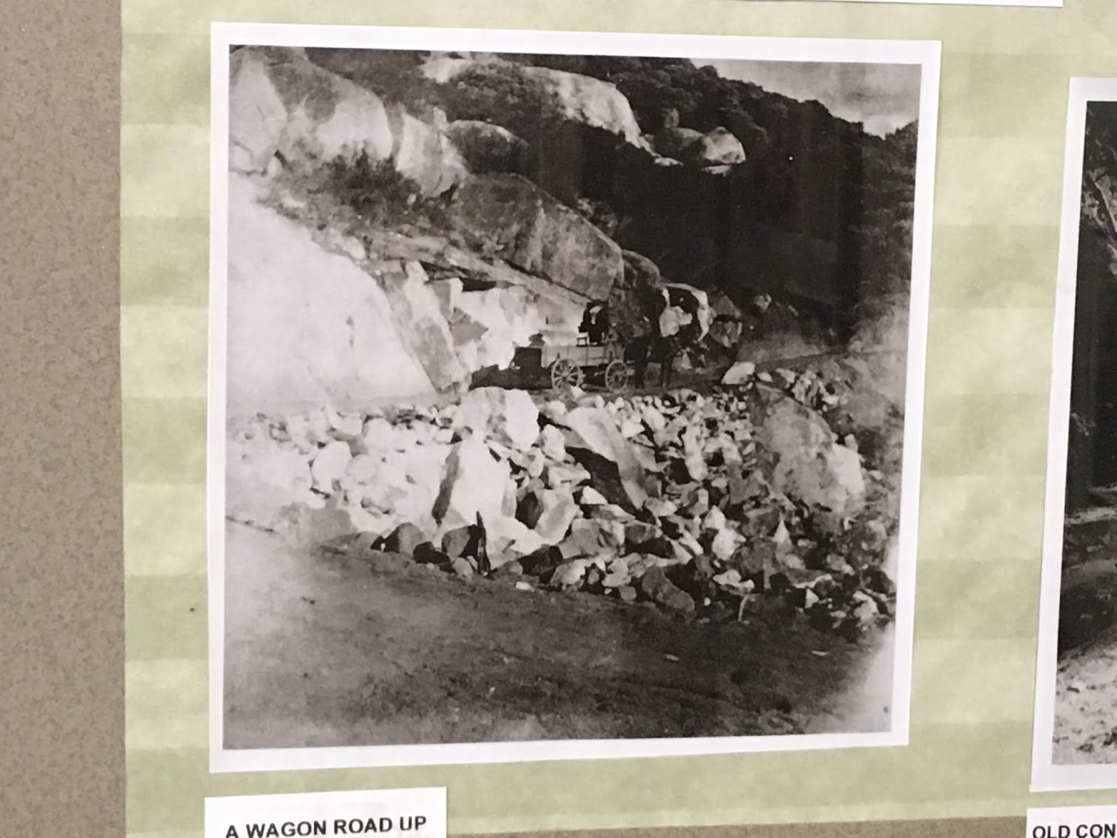
In 1923 the Mount Whitney Power and Light Company sold the rights to the Doyle tract to the Balch Family. The Balch Family bought the Doyle tract with the intention of donating it to Tulare County as a park. A condition of the donation Tulare County by the Balch Family was to build a better road to the Doyle Tract which would be part of the Lone Pine to Porterville High Sierra Road. Construction on what is now Balch Park Road/J37 began in 1927 as stated above and was completed to the Doyle Tract by 1930. The Balch Family in turn donated the Doyle Tract to Tulare County which renamed it as Balch Park in their honor.
The Balch Park Road just like the rest of the planned route of Lone Pine to Porterville High Sierra Road was unsurfaced dirt. Conditions on the Balch Park Road were so bad that Tulare County operated the roadway in one-way control times until 1942. By 1956 the Balch Park Road was completely paved which eventually led to it being designated as Signed County Route J37 in 1975.
So with all that in mind J37 is a 25.17 mile Signed County Route from CA 190 in Springville northeast to Balch Park.
CAhighways.org on Signed County Route J37
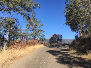
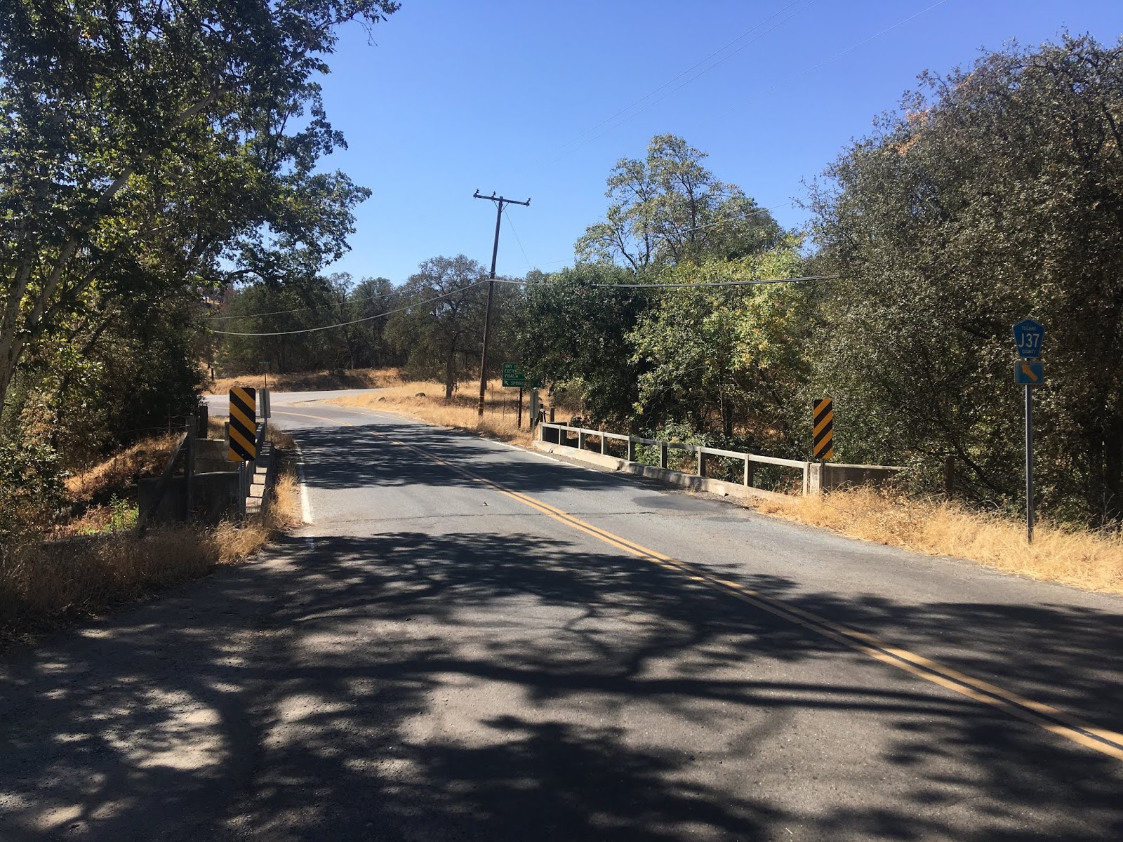
J37 begins on the eastern outskirts of Springville and runs on entirely on Balch Park Road which is designated over three Tulare County Mountain Roads. From CA 190 traffic is directed to Balch Park and Mountain Home State Forest but there is no J37 shield.

Traffic on J37/Balch Park Road eastbound is immediately warned there are no services ahead. The first J37 reassurance shield is located behind the services warning sign. The first 6 miles of J37/Balch Park Road run on Mountain Road 239.


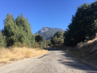
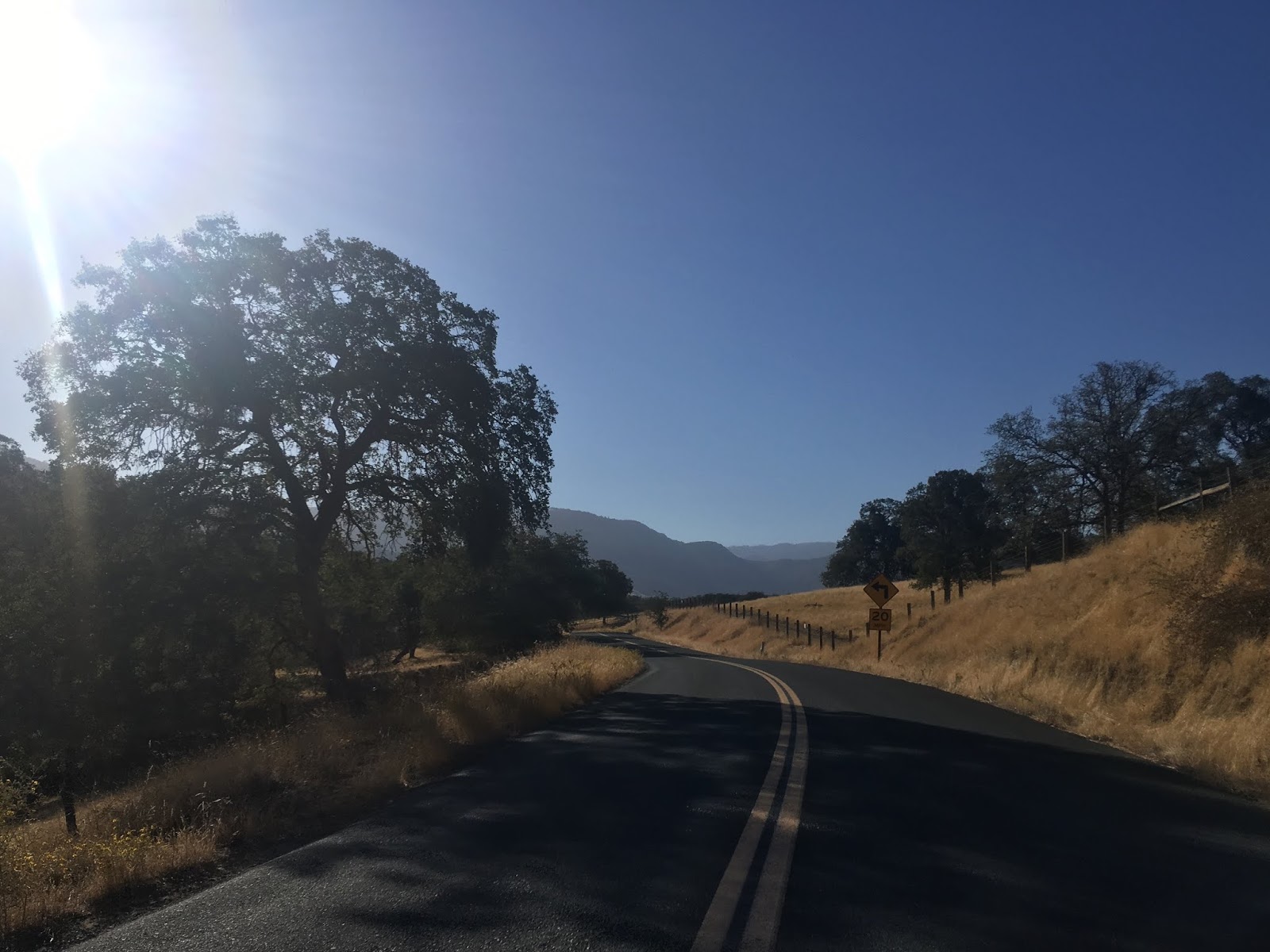
J37/Balch Park Road on Mountain Road 239 follows the west bank of the North Fork Tule River and has a largely flat grade.


J37/Balch Park Road intersects Bear Creek Road/Mountain Road 220 about 4 mile north of CA 190. Bear Creek Road is the original roadway to Balch Park and is far shorter with a substantially higher grade than J37/Balch Park Road. Bear Creek Road is also a paved roadway and for what little I drove of it at higher elevations seems to fairly well maintained.


At Post Mile 6 on Mountain Road 239 J37/Balch Road intersects Yokohl Valley Drive/Mountain Road 296. From Yokohl Valley Drive the alignment of J37/Balch Park Road shifts to Mountain Road 296. The intersection of Balch Park Road and Yokohl Valley Drive is where the community of Milo was located. There doesn't seem to be much to Milo today aside from ranching homesteads.


Previously I wrote about Yokohl Valley Drive/Mountain Road 296 which is in it's own right a highly scenic roadway.
Yokohl Valley Drive/Mountain Road 296
Traffic on J37/Balch Park Road east of Yokohl Valley Drive is warned that chains may be required at higher elevations.

J37/Balch Park Road quickly crosses a small creek with a bridge dating back to 1949.


Immediately east of the above bridge an advisory sign stated Balch Park Road was closed to snow 13 miles ahead which in early September after a dry summer was obviously an oversight by Tulare County.

One of the most obvious features of the construction of the Lone Pine to Porterville High Sierra Road is the North Fork Tule River Bridge which J37/Balch Park Road crosses. The time stamp on the North Fork Tule River Bridge shows a completion year of 1927.


East of the North Fork Tule River Bridge the alignment of J37/Balch Park Road begins to rise in elevation and passes by what is known as Battle Mountain.


At Blue Ridge Road the route of J37/Balch Park Road is at about 3,000 feet above sea level. J37/Balch Park Road east of Blue Ridge Road drops to a one-lane highway and is quickly warned that encounters with log trucks is possible. The final 15 miles of J37/Balch Park Road are all one-lane.


Between 3,000 feet eastward up to 5,500 feet the alignment of J37/Balch Park Road ascends approximately 13 large hairpin switchbacks. The switchbacks are numerous enough that the alignment of J37/Balch Park Road east of Blue Ridge Road apparently has a sustained grade of approximately 5% which is actually impressively shallow. Pjammycycling actually has an extensive feature on the grade of J37/Balch Park Road from Yokohl Valley Drive east to Balch park.
Pjammycyling on Balch Park Road
J37/Balch Park Road climbs quickly into Sequoia National Forest the hairpin switchbacks has some open vistas through the scrubs. At approximately 3,500 feet above sea level there is a small monument regarding Battle Mountain which is where Tule River War of 1856 took place.


East of the Battle Mountain Monument J37/Balch Park Road crosses through a sharp hair pin and ascends through cattle guards into open range.


Its very apparent on the climb along J37/Balch Park Road from 3,500 feet to 5,000 feet above sea level why the Division of Highways selected the Middle Fork Tule River Canyon route for LRN 127/CA 190. The routing of J37/Balch Park Road is extremely narrow with almost no room for expansion or even shoulders. Commercial traffic or large vehicles would find a Trans-Sierra Highway crossing on J37/Balch Park Road extremely difficult at best or impossible at worst. The turning radius of several of the hairpin switchbacks is close to a 180 degree change of direction in several instances. Aside from high clearance four wheel drive roads I've never encountered a roadway that rapidly ascends the terrain so rapidly via hairpins.


At approximately 5,000 feet above sea level the routing of J37/Balch Park Road is very much within in the forest but still following the cliff-face. I found an open vista off to the side looking west towards the Tule River Watershed descend to Porterville in San Joaquin Valley.


There are some private cabins located above 5,000 feet on J37/Balch Park Road as it pulls away from the cliff-face.


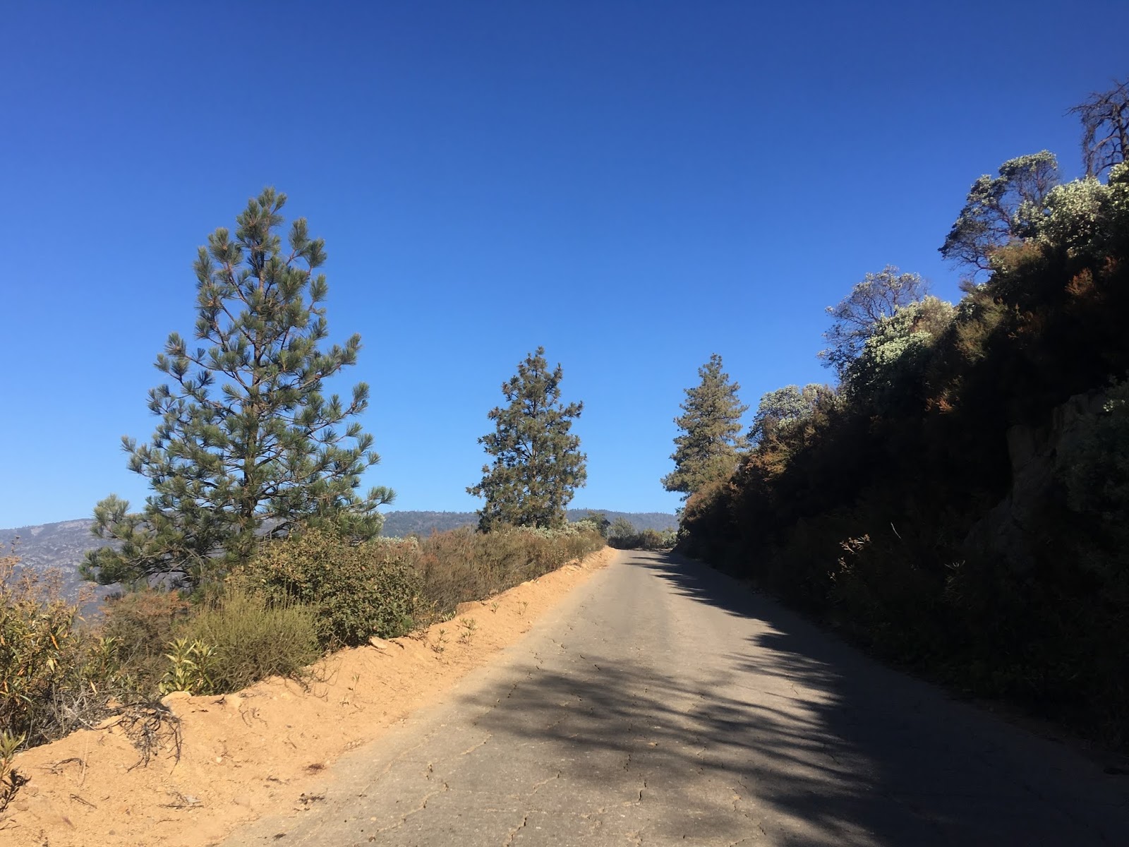
The remainder of J37/Balch Park Road alignment is through heavily forested lands. Just east of the cabins the alignment of J37/Balch Park Road enters Mountain Home State Demonstration Forest. The land the Mountain Home Resort was located on was sold to the State of California in 1946 which became Mountain Home State Demonstration Forest. The Mountain Home Resort was subsequently demolished in 1947.


J37/Balch Park Road continues through Mountain Home State Demonstration Forest to Bear Creek Road. Bear Creek Road loops east of Balch Park towards the watershed of the North Fork of the Middle Fork Tule River. J37/Balch Road continues on Mountain Road 220.


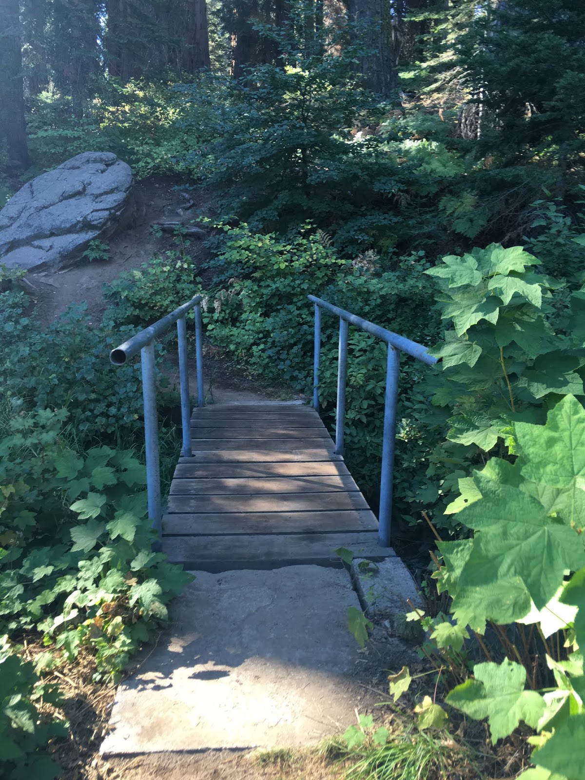
J37/Balch Park Road on Mountain Road 220 is relatively flat and enters the Mountain Home Grove of Redwood Sequoias. There are various campgrounds and small hiking trails alongside J37/Balch Park Road along with a couple Mountain Road 220 Postmile paddles.


Signed County Route J37 ends near the gate to Balch Park which is located 6,430 feet above sea level. Balch Park Road continues a couple miles beyond the eastern terminus of J37 to Bear Creek Road.


At the gate of Balch Park is the Tunnel Log. The Tunnel Log was first mentioned in historical records in 1856 when it was used as a military headquarters during the Tule River War. John Doyle later used the Tunnel Log as his cabin and then a fruit cellar.


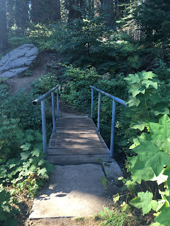
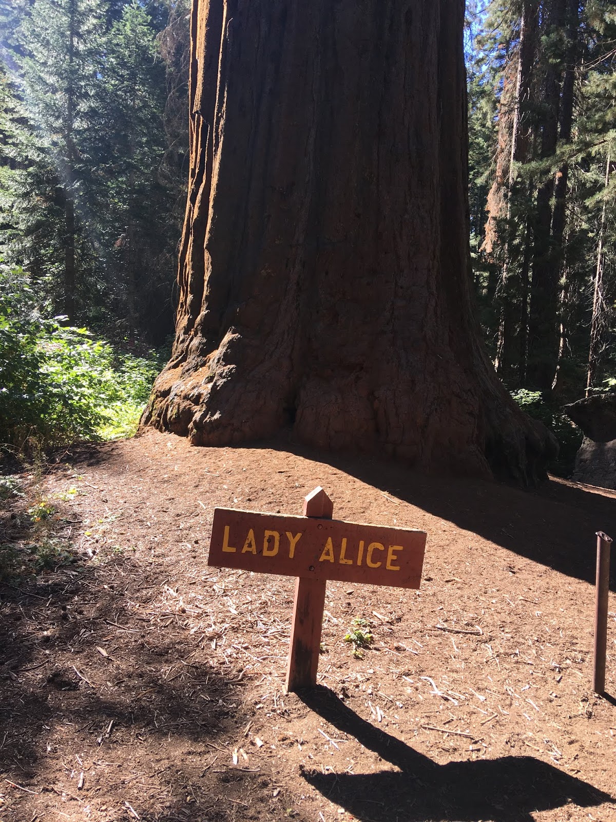
Balch Park contains a large number of the Redwood Sequoias in the Mountain Home Grove.


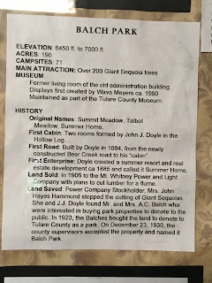
Balch Park has a small museum which details the history of the site. I used the historical set pieces to fill in the gaps on when Bear Creek Road and Balch Park Road were completed.


Balch Park has a large fishing pond which I'm to understand was built to house logs from the nearby sawmills. There are Redwoods lining the entirety of the pond along with a surprisingly large number of frogs.


Leaving Balch Park I returned to Springville via J37. From Blue Ridge Road I didn't encounter another vehicle on the ascent or descent on J37/Balch Park Road.

It was hard to fathom on the descent on J37/Balch Park Road the logic of plotting a Trans-Sierra Route from Balch Park east to the vicinity Mount Whitney and Lone Pine via Mulky Pass. The Division of Highways obviously believed that the route was at least partially viable given that the alignment over Mulky Pass stayed on the books until the 1960s as part as CA 190. Given how much of the Lone Pine to Porterville High Sierra Road was actually built on both sides of the Sierras it makes me wonder if the Great Depression played some sort of role in the late 1920s in killing the project. Either way the legacy of the unbuilt Lone Pine to Porterville High Sierra Road adds even more weight to what is already a unique experience along Signed County Route J37.

While researching California State Route 190 and more specifically the gap in the highway over the Sierra Nevada Range it became quickly apparent that there was far more to J37/Balch Park Road than initially thought. The previous blog on California State Route 190 can be found here:
California State Route 190; the Trans-Sierra Highway that could have been
On the above blog I attached an article from 1926 written by the Los Angeles Times detailing the route of the Lone Pine to Porterville High Sierra Road which was slated to begin construction in 1927. The route of the Lone Pine to Porterville High Sierra Road would have followed Carroll Creek southward out of Lone Pine ascending to Mulky Pass at 11,300 feet above sea level. The Lone Pine to Porterville High Sierra Road was to cross the Kern River Fault emerging via the North Fork of the Middle Fork Tule River in Balch Park. The route of the Lone Pine to Porterville High Sierra Road was to continue west to Milo on what is now Balch Park Road/J37 to Springville with a branch splitting northwest on Yokohl Valley Drive to Visalia.
For ease of reference I posted a direct link to the 1926 Los Angeles Times article regarding the Lone Pine to Porterville High Sierra Road.
owensvalleyhistory.com regading the Lone Pine to Porterville High Sierra Road
The initial survey for the route of the Lone Pine to Porterville High Sierra Road was conducted in 1923 and was to be funded by; Tulare Couny, Kern County, and Inyo County. Road building input was provided to the aforementioned counties by the California Division of Highways in addition to the Automobile Club of Southern California. Monetary assistance was provided by the City of Los Angeles which fronted $170,000 to build part of the Lone Pine to Porterville High Sierra Road eastward from Mulky Pass towards Lone Pine. Much of the route of the Lone Pine to High Sierra Road was built from Lone Pine westward towards Carroll Creek but never to Mulky Pass. This section would be adopted by the California Division of Highways in 1933 as part of Legislative Route Number 127 which became California State Route 190 in 1934.
In 1926 the original road from Balch Park west to Springville was Bear Creek Road. Bear Creek Road was built in 1884 along Bear Creek by L.B. Frasier to service his sawmill located within what is now Mountain Home State Forest. Mountain Home State Forest was once the site of a resort known as "Mountain Home" which was constructed in 1885 and was accessed by Frasier's Bear Creek Road. Frasier's Mill ran into financial instability leading him to abandon Bear Creek Road which continued to be maintained by the Mountain Home Resort. Frasier attempted to toll Bear Creek Road in 1889 but lost in court to the operators of the Mountain Home Resort.
What is now Balch Park was first settled in 1884 by John Doyle who constructed an access road from Bear Creek Road. Doyle intended to operate a resort called Summer Home on his land but the plans never came to fruition. Doyle sold his tract to the Mount Whitney Power and Light Company 1906. The Mount Whitney Power and Light Company initially planned to cut down the 200 redwoods located within Doyle's tract to build a log flume but those plans ultimately never came to fruition.
In 1923 the Mount Whitney Power and Light Company sold the rights to the Doyle tract to the Balch Family. The Balch Family bought the Doyle tract with the intention of donating it to Tulare County as a park. A condition of the donation Tulare County by the Balch Family was to build a better road to the Doyle Tract which would be part of the Lone Pine to Porterville High Sierra Road. Construction on what is now Balch Park Road/J37 began in 1927 as stated above and was completed to the Doyle Tract by 1930. The Balch Family in turn donated the Doyle Tract to Tulare County which renamed it as Balch Park in their honor.
The Balch Park Road just like the rest of the planned route of Lone Pine to Porterville High Sierra Road was unsurfaced dirt. Conditions on the Balch Park Road were so bad that Tulare County operated the roadway in one-way control times until 1942. By 1956 the Balch Park Road was completely paved which eventually led to it being designated as Signed County Route J37 in 1975.
So with all that in mind J37 is a 25.17 mile Signed County Route from CA 190 in Springville northeast to Balch Park.
CAhighways.org on Signed County Route J37
J37 begins on the eastern outskirts of Springville and runs on entirely on Balch Park Road which is designated over three Tulare County Mountain Roads. From CA 190 traffic is directed to Balch Park and Mountain Home State Forest but there is no J37 shield.

Traffic on J37/Balch Park Road eastbound is immediately warned there are no services ahead. The first J37 reassurance shield is located behind the services warning sign. The first 6 miles of J37/Balch Park Road run on Mountain Road 239.


J37/Balch Park Road on Mountain Road 239 follows the west bank of the North Fork Tule River and has a largely flat grade.


J37/Balch Park Road intersects Bear Creek Road/Mountain Road 220 about 4 mile north of CA 190. Bear Creek Road is the original roadway to Balch Park and is far shorter with a substantially higher grade than J37/Balch Park Road. Bear Creek Road is also a paved roadway and for what little I drove of it at higher elevations seems to fairly well maintained.


At Post Mile 6 on Mountain Road 239 J37/Balch Road intersects Yokohl Valley Drive/Mountain Road 296. From Yokohl Valley Drive the alignment of J37/Balch Park Road shifts to Mountain Road 296. The intersection of Balch Park Road and Yokohl Valley Drive is where the community of Milo was located. There doesn't seem to be much to Milo today aside from ranching homesteads.


Previously I wrote about Yokohl Valley Drive/Mountain Road 296 which is in it's own right a highly scenic roadway.
Yokohl Valley Drive/Mountain Road 296
Traffic on J37/Balch Park Road east of Yokohl Valley Drive is warned that chains may be required at higher elevations.

J37/Balch Park Road quickly crosses a small creek with a bridge dating back to 1949.


Immediately east of the above bridge an advisory sign stated Balch Park Road was closed to snow 13 miles ahead which in early September after a dry summer was obviously an oversight by Tulare County.

One of the most obvious features of the construction of the Lone Pine to Porterville High Sierra Road is the North Fork Tule River Bridge which J37/Balch Park Road crosses. The time stamp on the North Fork Tule River Bridge shows a completion year of 1927.


East of the North Fork Tule River Bridge the alignment of J37/Balch Park Road begins to rise in elevation and passes by what is known as Battle Mountain.


At Blue Ridge Road the route of J37/Balch Park Road is at about 3,000 feet above sea level. J37/Balch Park Road east of Blue Ridge Road drops to a one-lane highway and is quickly warned that encounters with log trucks is possible. The final 15 miles of J37/Balch Park Road are all one-lane.


Between 3,000 feet eastward up to 5,500 feet the alignment of J37/Balch Park Road ascends approximately 13 large hairpin switchbacks. The switchbacks are numerous enough that the alignment of J37/Balch Park Road east of Blue Ridge Road apparently has a sustained grade of approximately 5% which is actually impressively shallow. Pjammycycling actually has an extensive feature on the grade of J37/Balch Park Road from Yokohl Valley Drive east to Balch park.
Pjammycyling on Balch Park Road
J37/Balch Park Road climbs quickly into Sequoia National Forest the hairpin switchbacks has some open vistas through the scrubs. At approximately 3,500 feet above sea level there is a small monument regarding Battle Mountain which is where Tule River War of 1856 took place.


East of the Battle Mountain Monument J37/Balch Park Road crosses through a sharp hair pin and ascends through cattle guards into open range.


Its very apparent on the climb along J37/Balch Park Road from 3,500 feet to 5,000 feet above sea level why the Division of Highways selected the Middle Fork Tule River Canyon route for LRN 127/CA 190. The routing of J37/Balch Park Road is extremely narrow with almost no room for expansion or even shoulders. Commercial traffic or large vehicles would find a Trans-Sierra Highway crossing on J37/Balch Park Road extremely difficult at best or impossible at worst. The turning radius of several of the hairpin switchbacks is close to a 180 degree change of direction in several instances. Aside from high clearance four wheel drive roads I've never encountered a roadway that rapidly ascends the terrain so rapidly via hairpins.


At approximately 5,000 feet above sea level the routing of J37/Balch Park Road is very much within in the forest but still following the cliff-face. I found an open vista off to the side looking west towards the Tule River Watershed descend to Porterville in San Joaquin Valley.


There are some private cabins located above 5,000 feet on J37/Balch Park Road as it pulls away from the cliff-face.


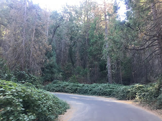
The remainder of J37/Balch Park Road alignment is through heavily forested lands. Just east of the cabins the alignment of J37/Balch Park Road enters Mountain Home State Demonstration Forest. The land the Mountain Home Resort was located on was sold to the State of California in 1946 which became Mountain Home State Demonstration Forest. The Mountain Home Resort was subsequently demolished in 1947.


J37/Balch Park Road continues through Mountain Home State Demonstration Forest to Bear Creek Road. Bear Creek Road loops east of Balch Park towards the watershed of the North Fork of the Middle Fork Tule River. J37/Balch Road continues on Mountain Road 220.


J37/Balch Park Road on Mountain Road 220 is relatively flat and enters the Mountain Home Grove of Redwood Sequoias. There are various campgrounds and small hiking trails alongside J37/Balch Park Road along with a couple Mountain Road 220 Postmile paddles.


Signed County Route J37 ends near the gate to Balch Park which is located 6,430 feet above sea level. Balch Park Road continues a couple miles beyond the eastern terminus of J37 to Bear Creek Road.


At the gate of Balch Park is the Tunnel Log. The Tunnel Log was first mentioned in historical records in 1856 when it was used as a military headquarters during the Tule River War. John Doyle later used the Tunnel Log as his cabin and then a fruit cellar.


Balch Park contains a large number of the Redwood Sequoias in the Mountain Home Grove.

Balch Park has a small museum which details the history of the site. I used the historical set pieces to fill in the gaps on when Bear Creek Road and Balch Park Road were completed.


Balch Park has a large fishing pond which I'm to understand was built to house logs from the nearby sawmills. There are Redwoods lining the entirety of the pond along with a surprisingly large number of frogs.


Leaving Balch Park I returned to Springville via J37. From Blue Ridge Road I didn't encounter another vehicle on the ascent or descent on J37/Balch Park Road.

It was hard to fathom on the descent on J37/Balch Park Road the logic of plotting a Trans-Sierra Route from Balch Park east to the vicinity Mount Whitney and Lone Pine via Mulky Pass. The Division of Highways obviously believed that the route was at least partially viable given that the alignment over Mulky Pass stayed on the books until the 1960s as part as CA 190. Given how much of the Lone Pine to Porterville High Sierra Road was actually built on both sides of the Sierras it makes me wonder if the Great Depression played some sort of role in the late 1920s in killing the project. Either way the legacy of the unbuilt Lone Pine to Porterville High Sierra Road adds even more weight to what is already a unique experience along Signed County Route J37.
Comments
Thanks for documenting your adventure. I enjoyed reading and viewing it!
Dave in Morro Bay