Hawaii Route 3800 is an approximately 1.5-mile State Highway located on the Island of Maui. Hawaii Route 3800 begins at Hawaii Route 311/Hawaii Route 3500 in Kahului. Hawaii Route 3800 continues eastbound to Kahului Airport via a short multiplex of Hawaii Route 380 on Dairy Road and Mayor Elmer F. Cravalho Way. Hawaii Route 3800 is the newest State Highway on Maui and was fully opened to traffic on July 23, 2016. Much of Hawaii Route 3800 was originally known as Kahului Airport Access Road and assumed the current name of Mayor Elmer F. Cravalho Way effective July 1, 2017.
This page is part of the Gribblenation Hawaii Roads series. A compellation of all Hawaii-related media from both Gribblenation and RoadwayWiz can be found by clicking
here.
Part 1; the history of Hawaii Route 3800Phase 1 construction of the Kahului Airport Access Road began on November 8, 2013. The Kahului Airport Access Road was intended to supplement existing Hawaii Route 36A on Keolani Place as the primary access to Kahului Airport. The Kahului Airport Access Road was planned as an expressway by the Airport Division of the Hawaii Department of Transportation. Phase 1 of the Kahului Airport Access Road consisted of 1.1-miles of new roadway which was paid for by way of an 80% Federal/20% State split in funding. Phase 2 of the Kahului Airport Extension Road was slated to begin during 2014. Phase 2 of the Kahului Airport Extension Road included construction of the Lanui Loop at the Kahului Airport Terminal. Kahului Airport Extension Road was assigned the designation of Hawaii Route 3800.
Hawaii Route 3800 and the Kahului Airport Extension Road were fully opened to traffic and connected with the Lanui Loop of Kahului Airport on
July 23, 2016. Total construction of Hawaii Route 3800 was noted by the Hawaii Department of Transportation to have been funded by $56 million in rental car customer charges.
2021 Hawaii Senate Bill 651 renamed Kahului Airport Access Road as Mayor Elmer F. Cravalho Way effective July 1, 2021. Elmer F. Cravalho was born in Paia on the Island Maui and was the first speaker of the state house upon Hawaii becoming a State on August 21, 1959. Cravalho would later serve as the first Maui County Mayor from 1969 to 1979.
Part 2; a drive on Hawaii Route 3800
Hawaii Route 3800 and Mayor Elmer F. Cravalho Way begin westbound departing Kahului Airport via the Lanui Loop. Traffic entering Hawaii Route 3800 is greeted with an "Aloha, Welcome to Maui" marque.
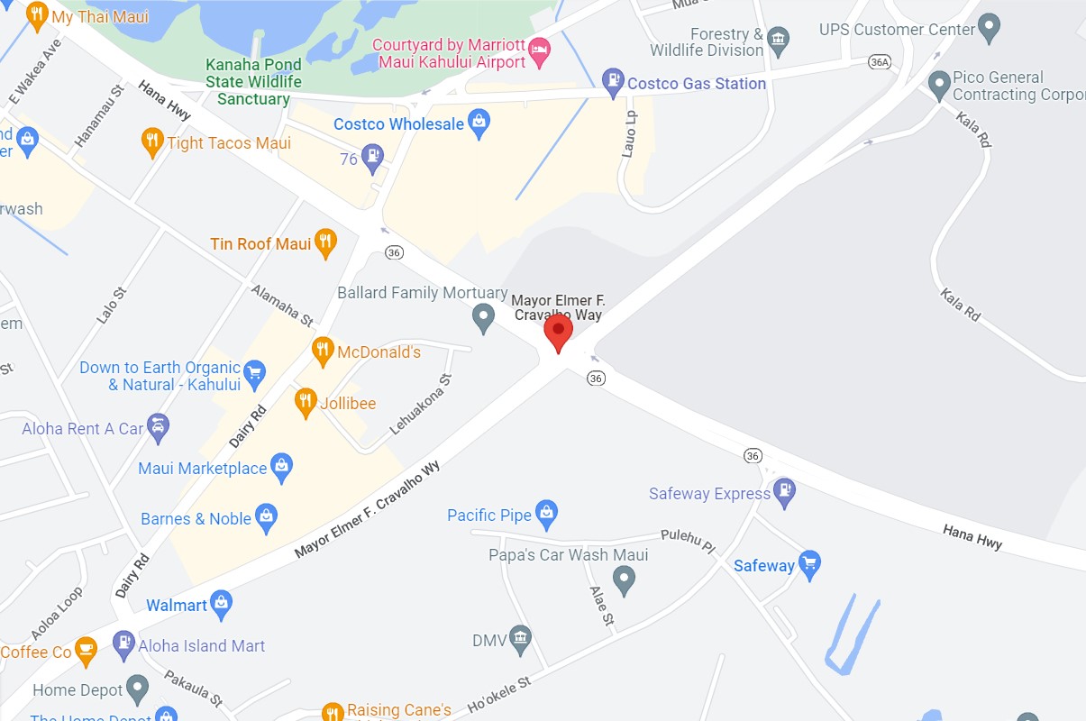
Hawaii Route 3800 westbound crosses over Kala Road and intersects Hawaii Route 36/Hana Highway. From Hawaii Route 36 the alignment of Hawaii Route 3800 continues west to Dairy Road where it picks up a multiplex of Hawaii Route 380. Hawaii Route 3800 and Hawaii Route 380 continue multiplexed via Dairy Road to Hawaii Route 311/Hawaii Route 3500 where the former terminates.
Eastbound Hawaii Route 3800 begins co-signed with Hawaii Route 380 via Dairy Road at the junction of Hawaii Routes 311 and Hawaii Route 3500. Below view is taken from the northern terminus of Hawaii Route 311. Hawaii Route 3800 can be seen beginning eastbound via multiplex of Hawaii Route 380 upon a right hand turn onto Dairy Road.
Hawaii Route 3800 eastbound splits from Hawaii Route 380/Dairy Road onto Mayor Elmer F. Cravalho Way. Hawaii Route 380 notably is signed as a Business Route as it continues from Hawaii Route 3800 via Dairy Road.
Hawaii Route 3800 eastbound intersects Hawaii Route 36/Hana Highway approaching Kahului Airport via Mayor Elmer F. Cravalho Way.
Hawaii Route 3800 eastbound and Mayor Elmer F. Cravalho Way terminate upon entering Kahului Airport and the Lanui Loop. Traffic can continue back to westbound Hawaii Route 3800 following Lanui Loop past the Kahului Airport Terminal and Rental Car Facility.
Lanui Loop is maintained by the Airport Division of the Hawaii Department of Transportation. A shuttle connects pedestrian traffic from the Kahului Airport Terminal to Rental Car Facility.


Comments