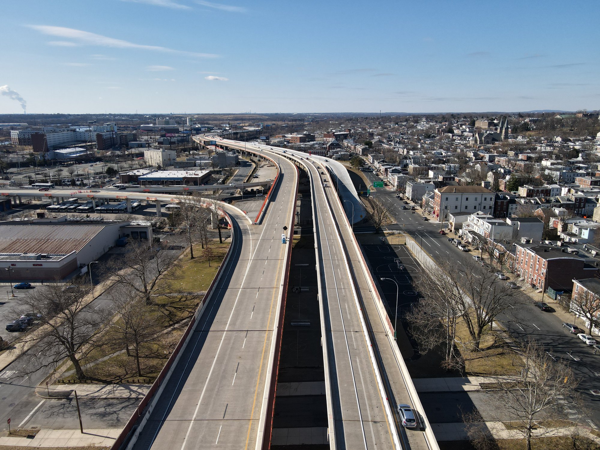
The State of Delaware carries 23.42 miles of Interstate 95 via the Delaware Expressway and Delaware Turnpike. Delaware was the third state to complete Interstate 95 as the entire corridor open to traffic by 1968. From the Pennsylvania State Line south to the US Route 202/Delaware Route 141 interchange Interstate 95 is free to access. From US Route 202 south to the Maryland State Line Interstate 95 is carried by the tolled Delaware Turnpike. Pictured as the blog cover is an aerial photo taken by Dan Murphy of Roadwaywiz of Interstate 95/US Route 202 facing northward towards downtown Wilmington.
Part 1; the history of Interstate 95 in Delaware
Prior to the emergence of the US Route System traffic between the Maryland State Line-Pennsylvania State Line was carried by the Auto Trails. The
1926 Rand McNally Map of Delaware, Maryland, Virginia and West Virginia displays the Maryland-Pennsylvania State Line corridor as being carried by the Victory Highway (17) and partially the South Coastal Atlantic Highway (3).
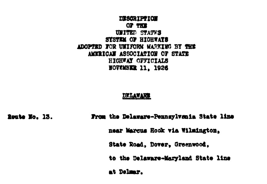
The American Association of State Highway Officials (AASHO) formally created the US Route System on November 11, 1926. The Maryland-Pennsylvania State Line corridor was initially carried by US Route 40 from Maryland to the vicinity and Wilmington and US Route 13 from northward the Pennsylvania State Line. The initial AASHO definitions of US Route 40 and US Route 13 can be seen below.
During 1948 the Wilmington Transportation Study proposed two limited access corridors to connect from Wilmington to the Pennsylvania State Line. The first corridor would have followed what is now Interstate 95 (Plan A) whereas the second followed what is now modern Interstate 495 (Plan B) as a bypass of Wilmington. By 1950 Plan A was selected as a limited access corridor from downtown Wilmington to the Pennsylvania State Line.
On June 29th, 1956, the Federal Highway Aid Act of 1956 was signed into law on the Federal Level. The Federal Highway Aid Act of 1956 was the genesis point of the Interstate Highway System and established the corridor Interstate 95 in Delaware. Ultimately the planned routing of Interstate 95 in Delaware was selected during 1957 and incorporated the planned Freeway from Wilmington to the Pennsylvania State Line. A new corridor from Wilmington south to the Maryland State Line was selected which was initially planned as a toll-free Interstate segment. Federal funding was not available to complete the Wilmington-Maryland State Line corridor of Interstate 95 until 1967 which necessitated the issuance of bonds to construct it as the tolled Delaware Turnpike.
Construction of the Delaware Turnpike segment of Interstate 95 commenced during 1958 and would be dedicated on November 15, 1963. The Delaware Turnpike was dedicated by President John F. Kennedy, Delaware Governor Elbert N. Carvel and Maryland Governor J. Millard Tawes. Following the assassination of John F. Kennedy, the Delaware Turnpike was renamed in his honor during December 1963.
Construction of Interstate 95 north from the Christina River Interchange would begin during 1964. The construction of Interstate 95 north of the Christina River was planned as a free facility and would result in 360-370 homes in Wilmington being demolished. The segment of Interstate 95 north of the Christina River was completed by November 1, 1968. The opening through Wilmington marked the completion of Interstate 95 Delaware. Delaware was the third state to complete their full mileage of Interstate 95.
On June 28, 1978, the AASHTO approved realigning Interstate 95 onto Interstate 495. Existing Interstate 95 through Wilmington was requested to be designated as Interstate 595. The justification for moving Interstate 95 to Interstate 495 was the higher capacity of the then new freeway bypass which had been completed during 1977. A secondary justification is noted to be the reconstruction of Interstate 95 through Wilmington. The designation of existing Interstate 95 through Wilmington as Interstate 595 was deferred by the AASHTO in favor of designating a suggested even numbered three-digit Interstate.


What had been Interstate 95 through Wilmington was approved to be signed as Interstate 195 and Interstate 395 by the AASHTO on October 27, 1978. Interstate 395 was to be designated from US Route 202 in Wilmington to what had been the Interstate 495 interchange near the Pennsylvania State Line. Interstate 195 was to be designated from what was the southern Interstate 495 interchange to Delaware Route 141 in Wilmington.
Interstate 195 and Interstate 395 through Wilmington were approved by the AASHTO to be renumbered to Interstate 895 on June 26, 1979. Interstate 95 was redesignated along the corridor of Interstate 895 by the AASHTO on November 15, 1980. Likewise, the corridor Interstate 495 was restored to what had been briefly designated as Interstate 95. The justification for restoring the corridor of Interstate 95 was that the project through Wilmington had been completed. On December 8, 1984, the AASHTO approved a request to extend US Route 202 concurrent with Interstate 95 through Wilmington to the Delaware Route 141 interchange. Previously terminus of US Route 202 had been truncated from US Route 13 out of downtown Wilmington to Interstate 95 during 1970. The new terminus of US Route 202 was located at US Route 13 near New Castle
Part 2; a drive on Interstate 95 in DelawareSouth of Boothwyn and Linwood Interstate 95 enters Delaware. Interstate 95 southbound reaches the northern Interstate 495 interchange at Exit 11. Interstate 95 within Delaware is still signed with sequential exit numbers instead of being mileage based. Traffic heading south towards downtown Delaware is directed to stay on Interstate 95.
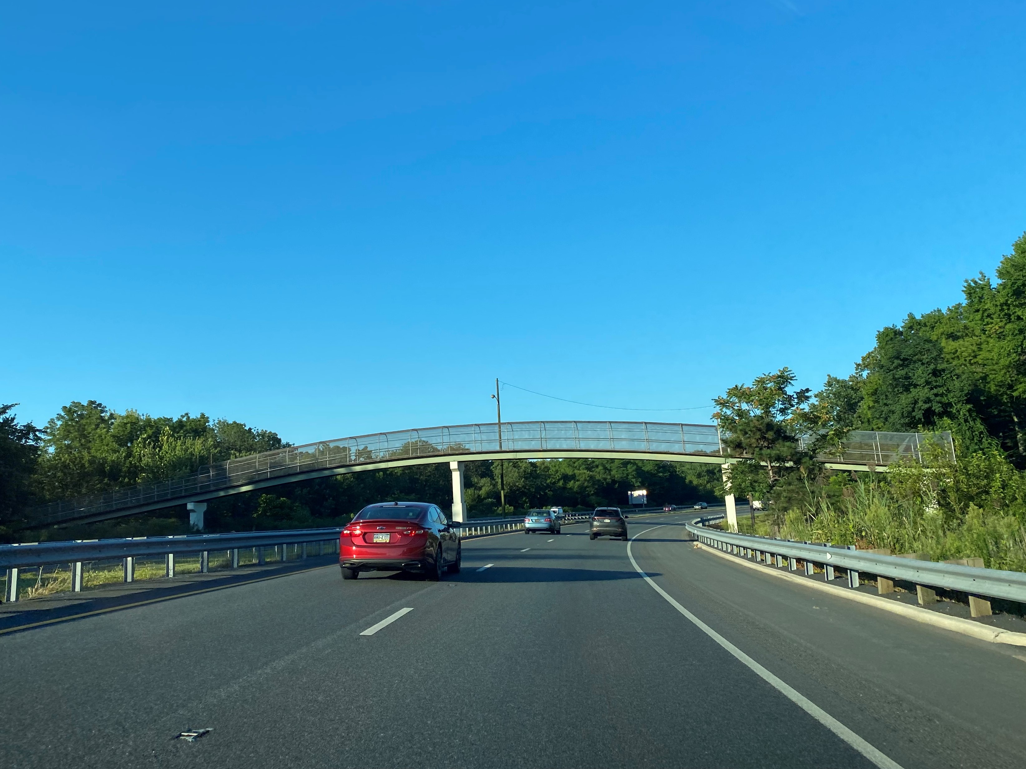
The "Welcome to Delaware" on southbound Interstate 95 is located just beyond the Interstate 495 interchange.
Interstate 95 southbound Exit 9 accesses Delaware Route 3 at Marsh Road.
Traffic on Interstate 95 southbound is advised of the upcoming exits in the Wilmington area. Interstate 95 southbound intersects US Route 202/Concord Pike at Exit 8. The former southern terminus of US Route 202 in Wilmington can be accessed from Exit 8 by following Delaware Route 202 on Concord Avenue.
Interstate 95 southbound begins a multiplex of southbound US Route 202. Interstate 95/US Route 202 southbound enter the city of Wilmington where the next interchange is located at Exit 7A/7B for Delaware Route 52/Delaware Avenue. Approaching Exit 7A/7B Interstate 95/US Route 202 southbound cross Brandywine Creek which denotes the start of a current DelDOT reconstruction project.
Interstate 95/US Route 202 southbound pass-through downtown Wilmington. Interstate 95/US Route 202 southbound access Delaware Route 9/4th Street at Exit 6. Although Delaware Route 48 is not signed from the gantry it can be accessed from Exit 6 towards Martin Luther King Junior Boulevard.
Upon departing Delaware Interstate 95/US Route 202 southbound cross the Christina River. Interstate 295 towards the Delaware Memorial Bridge can be accessed from Exit 5C. Upon crossing the Christina River Interstate 95/US Route 202 merge with the southern terminus of Interstate 495. The southern terminus of Interstate 495 denotes the end of the DelDOT project zone on Interstate 95/US Route 202 southbound.
US Route 202 southbound splits from Interstate 95 southbound at Exit 5A towards New Castle. Oddly US Route 202 is not displayed on the Exit 5A in gantry in lieu of only Delaware Route 141 southbound. Interstate 95 southbound Exit 5B accesses Delaware Route 141 northbound. The US Route 202/Delaware Route 141 interchange demarks the transition of Interstate 95 to the Delaware Turnpike.
Delaware Routes 1, 7 and 58 are all listed as being accessible from Interstate 95 southbound Exits 4A/4B.
Delaware Route 273 can be accessed from Interstate 95 southbound Exit 3. Approaching Exit 3 traffic on Interstate 95 southbound is advised of the food services available at the Biden Welcome Center.
South of Exit 3 traffic on Interstate 95 can access the Biden Welcome Center in the Delaware Turnpike median. The Biden Welcome Center was dedicated with current naming convention on September 17, 2018, prior to Joe Biden becoming the current President.
Suffice to say the Hilton Garden Inn of Woodbridge, Virginia knows how to market to the Interstate 95 traveler.
Upon departing the Biden Welcome Center traffic on Interstate 95 southbound accesses Delaware Route 896 at Exits 1A/1B. Delaware Route 896 is the last exit before the Delaware Turnpike toll gantry and can be used as a free bypass into Maryland in conjunction with Elkton Road.
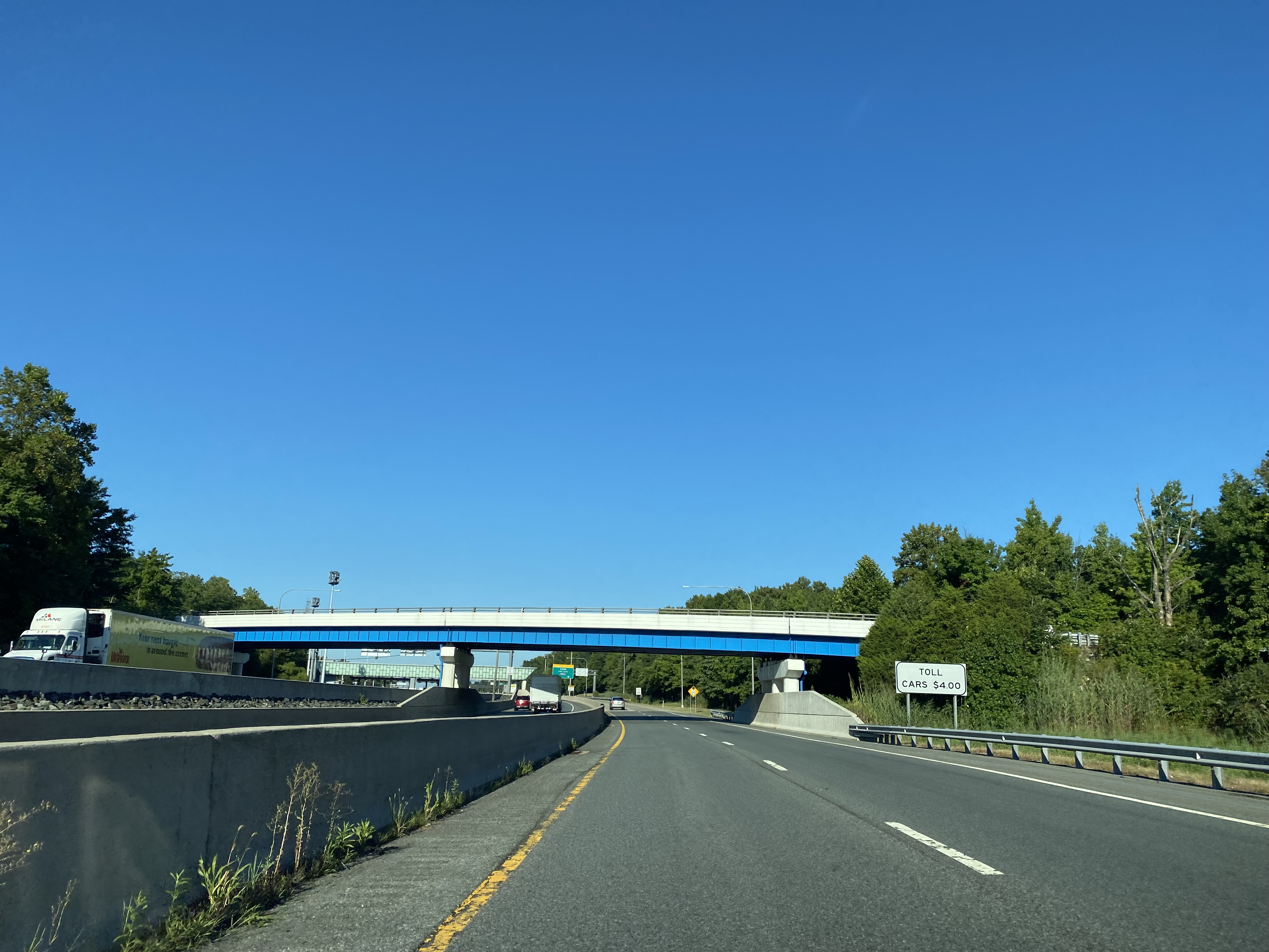
Interstate 95 southbound passes through the Delaware Turnpike toll gantry, the current rate for passenger traffic is $4.00. Upon passing through the Delaware Turnpike gantry Interstate 95 crosses the Maryland State Line.
Part 3; an aerial overview of the reconstruction of Interstate 95 in Wilmington
During March 2021 Dan Murphy of Roadwaywiz (and Gribblenation) featured an aerial overview of Interstate 95 corridor presently being reconstructed from Interstate 295 north through Wilmington to Brandywine Creek.


Comments