
Former US Route 101 on Alta Street in Gonzales

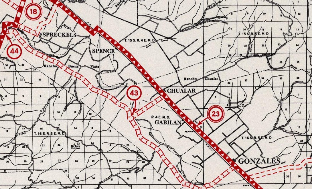
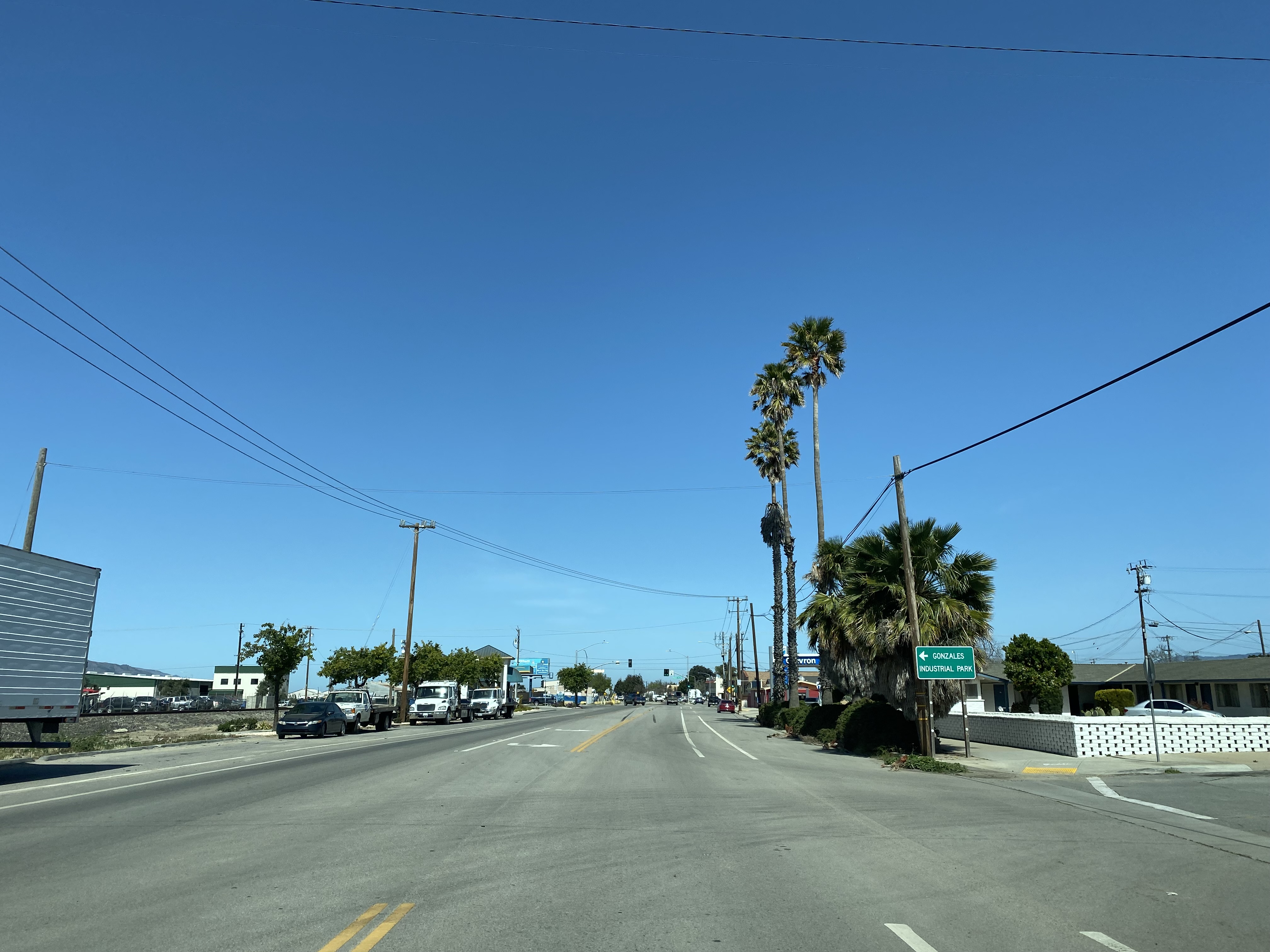
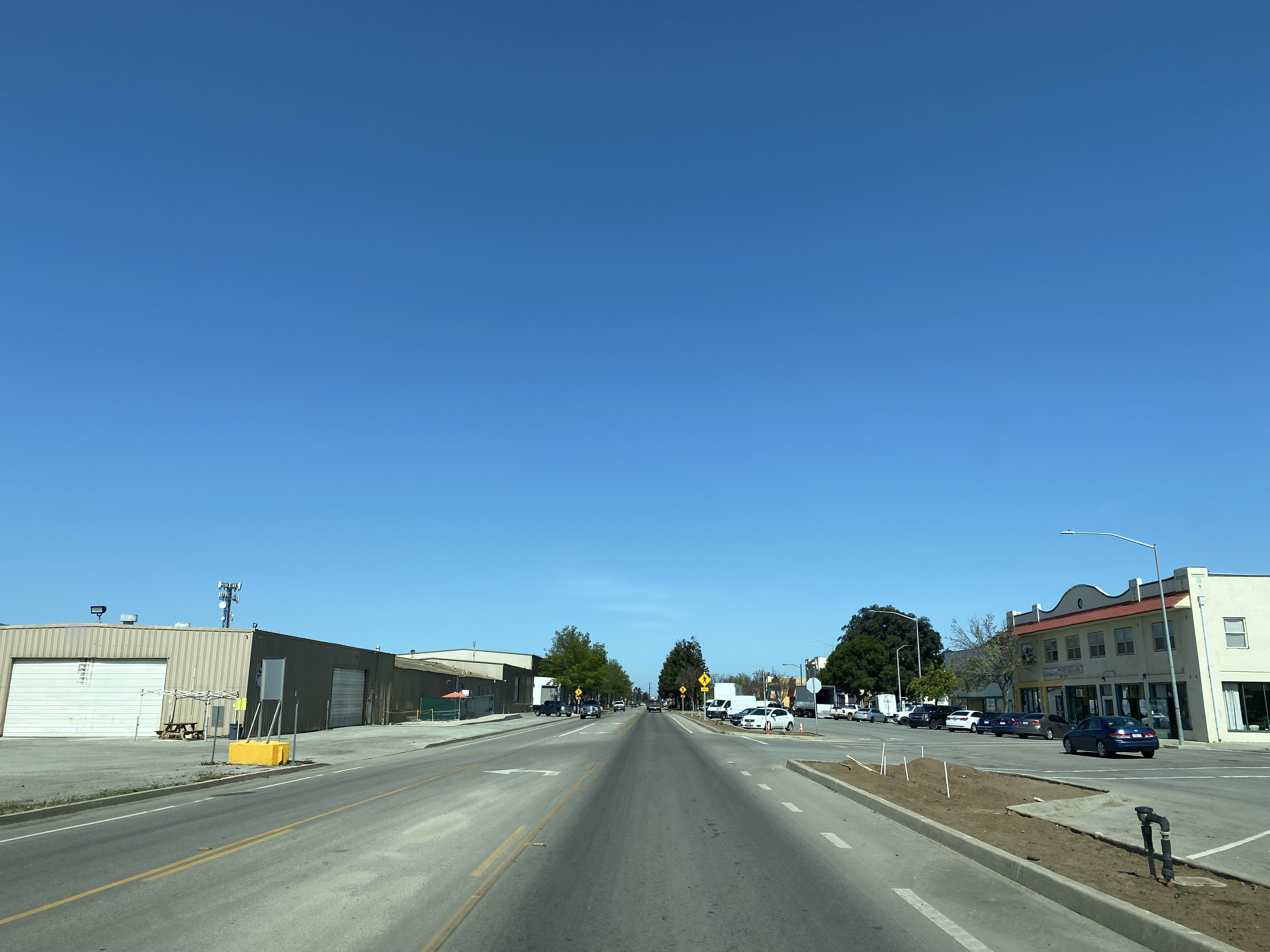
Gonzales is a city located in Salinas Valley of Monterey County, California.  Modern US Route 101 is aligned around Gonzales via a freeway bypass which swings east of downtown.  The original alignment of US Route 101 in Gozales was aligned directly through the community on Alta Street.  Above the cover photo of this blog is a view on former US Route 101 in Gonzales on Alta Street.  Below Gonzales can be seen along US Route 101 on the 1935 Division of Highways Map of Monterey County.  


Part 1; the history of US Route 101 in Gonzales

The lands now occupied by the city of Gonzales was once part of Rancho Rincon de la Puente del Monte.  Rancho Rincon de la Puente del Monte was granted to Teodoro Gonzales in 1836 who was then serving as the Alcalde of Monterey.  Following the Mexican American War, the Mexican Land Grants were honored by the American government.  Ownership of Rancho Rincon de la Puente del Monte thusly remained in the hands of the Gonzales family. 

During 1872 Dr. Mariano Gonzales and his brother Alfredo Gonzales granted an easement through their lands to the Southern Pacific Railroad.  In 1874 the Gonzales brother would plot a town site along the Southern Pacific Railroad which they named after their family.  Gonzales can be seen on the Southern Pacific Railroad on the 1882 Bancroft's Map of California and Nevada.  

Salinas Valley was ultimately part of the American El Camino Real which began being signed as an Auto Trail starting in 1906.  The era of State Highway Maintenance through Salinas Valley would ultimately begin with the 1909 First State Highway Bond Act which was approved by voters in 1910.  One of the highways approved through the 1909 First State Highway Bond Act was a 481.8-mile highway originating at the City Limits of San Francisco which terminated in San Diego.  This highway would ultimately come to be known in time as Legislative Route Number 2 ("LRN 2").  Within Salinas Valley much of LRN 2 would follow the existing corridor along the frontage roads of the Southern Pacific Railroad which included the community of Gonzales.  

Gonzales can be seen on the 1917 California State Automobile Association Map along LRN 2 via Alta Street.  


The 1920 Rand McNally Highway Map of California shows El Camino Real and the Pacific Highway following LRN 2 through Gonzales.  


The 1924 Rand McNally Map of California shows the California Banff Bee-Line Highway co-signed with the Pacific Highway through Gonzales. 


The initial draft of the US Route System was approved by the Secretary of Agriculture during November of 1925.  The US Route System within California was approved by California Highway Commission with no changes recommended by January 1926.  The initial alignment of US Route 101 ("US 101") was planned to follow LRN 2 from San Francisco to San Diego via Salinas Valley.  US 101 is shown on a map published in the 1926 California Highways & Public Works following LRN 2 south from San Francisco towards San Diego.


During November of 1926 the US Route System was approved by the ASSHO.  US Route 101 can be seen aligned through Gonzales on the 1926 Rand McNally Junior Map of California.  

The March 1933 California Highways & Public Works announced reconstruction of US Route 101/LRN 2 from Chualar to Camphora by way of Gonzales was underway.  The existing highway is stated to be too narrow and breaking apart too quickly.  

The 1935 Division of Highways Map of Monterey County displays US Route 101/LRN 2 aligned through Gonzales along Alta Street. 


The March 1937 California Highways & Public Works features an article regarding a new edge cutting surfacing device which was first tested when US Route 101/LRN 2 was repaved between Soledad-Gonzales during 1936.  


Gonzales would incorporate as a city on January 14, 1947.  The May/June 1950 California Highways & Public Works announced an awarded contract to repave US Route 101/LRN 2 between Gonzales and Chualar.


The November/December 1953 California Highways & Public Works announced a contract to grade and pave US Route 101/LRN 2 from Chualar south to Gonzales.  


The July/August 1954 California Highways & Public Works announced US Route 101/LRN 2 had been expanded to expressway standards from Chualar south to Gonzales.  

The November/December 1957 California Highways & Public Works US Route 101/LRN 2 between Soledad and Gonzales was budgeted to be converted to four lane expressway standards.


The July/August 1958 California Highways & Public Works announced the completion of the US Route 101/LRN 2 freeway through Chualar.  The Chualar Freeway corridor is stated to have broken ground during April 1957 and took approximately a year to complete.  The former corridor of US Route 101 on Grant Street is stated to have been converted to a frontage road of the new Chualar Freeway.  The Chualar Freeway corridor is stated to terminate two miles north of Gonzales.  The article stub notes design plans were underway to build US Route 101/LRN 2 to a freeway east of downtown Gonzales. 


The September/October 1958 California Highways & Public Works noted the contractor responsible for converting US Route 101/LRN 2 to expressway standards in the Gonzales-Soledad corridor was given 275 days to complete the project.  Part of the expressway conversion between Gonzales-Soledad was construction of an interchanges at Camphora-Gloria Road and Soledad Medium Security State Prison. 


The September/October 1959 California Highways & Public Works notes the conversion of US Route 101/LRN 2 to four lane expressway standards between Soledad-Gonzales was expected to be complete by November.  


The November/December 1960 California Highways & Public Works notes the US Route 101/LRN 2 freeway bypass of Soledad had opened earlier in the year.  The article stub references the planned freeway bypass of Gonzales as being budgeted.  


The November/December 1961 California Highways & Public Works notes the US Route 101/LRN 2 freeway bypass of Greenfield was complete and construction of the freeway bypass of Gonzales was underway.  


The November/December 1963 California Highways & Public Works notes the US Route 101/LRN 2 freeway bypass of Gonzales opened during the previous July.  


Since the completion of the freeway grade during 1963 there has been no major alterations to US Route 101 in Gonzales.  The Legislative Route Numbers were dropped as part of the 1964 State Highway Renumbering which left US Route 101 as the legislative designation through Gonzales. 


Part 2; a drive on former US Route 101 in Gonzales on Alta Street

From modern US Route 101 northbound traffic can access the older alignment on Alta Street via Exit 310.  


Northbound Alta Street enters downtown Gonzales.  


From downtown Gonzales, Alta Street continues northbound and loops back to the modern freeway alignment of US Route 101. 


Comments

Popular posts from this blog

2018 Mojave Road Trip Part 2; The deadly desert highway (California State Route 127 and Nevada State Route 373)

After leaving Barstow via Old Highway 58 my next destination was in Death Valley.  To access Death Valley from rural San Bernardino County required a trek on north on Interstate 15 to California State Route 127 which becomes Nevada State Route 373 at the state line. Along I-15 I encountered the road sign oddity that is Zzyzx Road about eight miles south of Baker.   Zzyzx Road is a four mile road that used to go to the Zzyzx Mineral Springs and Health Spa.   The spa was founded in the 1940s and the owner made up the name "Zzyzx" to claim it was the last word in the English Language.  The spa has been shut down since the 1970s and is now part of a Desert Studies Center for California State University. The southern terminus of CA 127 in Baker is located at I-15 exit 246.  CA 127 is a 91 mile north/south highway which runs to the Nevada State Line in Inyo County.  CA 127 is called Death Valley Road from I-15 northward.  South of CA 127 ...

New Idria Road to the New Idria ghost town

New Idria Road is an approximately 21.5-mile rural highway located in the Diablo Range of San Benito County.  From Panoche Road to approximately 20.6 miles to the south the corridor is maintained as the paved San Benito County Road 107.  The remaining 0.9 miles to the New Idria ghost town are no longer maintained and have eroded into a high clearance dirt roadway.  Upon reaching New Idria the roadway continues south as Clear Creek Road which passes through the Bureau of Land Management owned Clear Creek Management Area.   The New Idria Mercury Mine claim was staked in 1854.  Following the theme set by New Almaden the community and mine of New Idria were named after the famous Slovenian mercury mining town of Idrija.  Following a slow start the mines of New Idria would boom and the community would reach a peak population of approximately 4,000 by 1880.  New Idria Road and Panoche Road were constructed to facilitate stage travel to San Juan Bautista...

What's In a Name?: When the Roads Really Do Tell a Story

  Our tagline on the Gribblenation blog is "because every road tells a story". Some roads tell different stories than others. Along our travels, we may see historic markers that tell us a little story about the roads we travel or the places we pass by. Some historic markers are more general, as to telling us who lived where or what old trail traversed between two towns. During my travels across New York State and other states or provinces, I pass by many historic markers, some with interesting or amusing references to roads. I wanted to highlight a few of the markers I've seen along my travels around the Empire State and help tell their stories. Those stories may be as specific as explaining the tales of a tree that was used to help measure a distance of eight miles from Bath to Avoca in Steuben County, as referenced on the Eight Mile Tree historical marker above. They may also help point the way along historical roads first used centuries ago, or may help tell a local l...