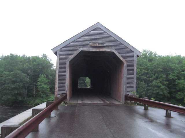
One of nine historic covered bridges remaining within the state of Maine, the Low's Covered Bridge (also known as the Lowe's Covered Bridge) spans the Piscataquis River of Maine on Lowe's Bridge Road off of ME 6, ME 15 and ME 16 between Guilford and Sangerville, not far west of Dover-Foxcroft. The 130 foot long through truss covered bridge is the fourth covered bridge at this location, having been built in 1990 after a flood washed away the previous bridge on April 1, 1987. A modern covered bridge, patterned after the original bridge, was built on the original abutments in 1990. The replacement bridge was built to have a larger load capacity and the abutments were raised in order to prevent future flood damage. The Low's Covered Bridge has also been named as a national historic landmark.
The Low's Covered Bridge sits adjacent to land once owned by Robert Low, an early settler of Guilford, Maine. In order to make local travel easier for commercial purposes, the towns of Guilford and Sangerville built the original covered bridge in 1830. However, a flood washed away the first bridge in 1832, so the second covered bridge was built in the same location. The second covered bridge washed away in a flood in 1857. I have noticed that 1832 and 1857 were years that brought devastating flooding to covered bridges in northern New England.
The third Low's Covered Bridge was rebuilt in 1857, spanned 130 feet across the scenic Piscataquis River and by modern standards was one lane wide. The foundation and approach to the covered bridge were constructed by Isaac Wharff, who hauled the granite used for the abutments more than 7 miles by oxen team from Guilford Mountain. Leonard Knowlton, who was the bridge's carpenter, used a patented Long truss design which used mathematical calculations to develop a truss design that looked like the letter X. The third covered bridge lasted 130 years until a major flood on April 1, 1987 destroyed the bridge.
Plans to rebuild this treasured local landmark and a tribute to early engineering ingenuity, began as soon as the flood waters along the Piscataquis receded. Ryan-Biggs Associates of New York designed a bridge that replicated the original as closely as possible and strengthened the overall structure bringing it into compliance with current codes and standards. Chesterfield Associates of Westport Island, Maine assembled the new Low's Covered Bridge offsite and more than 1,000 people watched as it was rolled into place on August 23. 1990. The new covered bridge sits on the original stone-masonry abutments that were raised almost 3 feet to reduce the potential for future flood damage.
I visited the Low's Covered Bridge during a trip to Maine over the 4th of July weekend in 2014. The covered bridge wasn't originally on my to-see list for that trip, but since I saw a covered bridge and a place to pull over, I had to stop and take pictures. There is a small picnic area near the bridge to enjoy your surroundings on a nice day. Here are some photos from my visit to the bridge.
 |
| Bridge portal on the north bank of the Piscataquis River. |
 |
| Low's Covered Bridge as seen from the picnic area. |
 |
| The Villages of Piscataquis County sign is for an audio driving tour that highlights the scenic and historic attractions of Piscataquis County, Maine. |
 |
| Interpretive storyboard that explains the history of the Low's Covered Bridge. |
 |
| National Historic Landmark marker. |
 |
| Looking west at the Piscataquis River. The Piscataquis River flows from small creeks and glacial ponds from its headwaters just south of Greenville for approximately 65 miles to its confluence with the Penobscot River in Howland. |
 |
| Looking east the Piscataquis River. You can see the small picnic area at the left of the photo. |
How to Get There:
Sources and Links:
Bridgehunter.com - Lowe's Covered Bridge 19-11-01 #2
MaineDOT - Lowes Bridge, Guilford-Sangerville, Maine


Comments