
Former US Route 101 in Bradley

Bradley is located in Salians Valley of southern Monterey County along the eastern bank of the Salinas River.  Former US Route 101 before the present freeway was constructed was carried via Bradley Road.


Part 1; the history of US Route 101 in Bradley

Bradley was plotted by the Southern Pacific Railroad in 
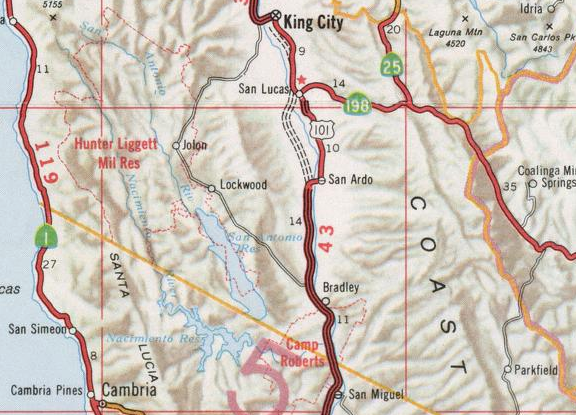
1886 as siding facility.  Bradley is named in honor of Bradley V. Sargent who's property the siding facility was constructed upon.  Bradley was set up alongside the nearby sidings of San Lucas and San Ardo.  Although Bradley doesn't appear on the 1890 George F. Cram Railroad Map of California it was plotted approximately ten miles due south of San Ardo.

The era of State Highway Maintenance through Bradley ultimately begin with the 1909 First State Highway Bond Act which was approved by voters in 1910.  One of the highways approved through the 1909 First State Highway Bond Act was a 481.8 mile highway originating at the City Limits of San Francisco which terminated in San Diego.  This highway would ultimately come to be known in time as Legislative Route Number 2 ("LRN 2").

Bradley was ultimately part of the American El Camino Real which began being signed as an Auto Trail starting in 1906.  Unlike the Spanish El Camino Real which was aligned largely west of the Salinas River to stay on path to Mission San Antonio de Padua and Mission Nuestra Senora de la Soledad the path of LRN 2 was aligned mostly through the center of Salinas Valley.  Early LRN 2 and the American El Camino Real can be seen on what is now Bradley Road through Bradley on the 1917 California State Automobile Association Map


LRN 2 through Bradley is shown on the 1920 Clason Highway Map of California as part of the American El Camino Real and the Pacific Highway.  The Pacific Highway was plotted out as an Auto Trail association in 1913.  

 
The initial draft of the US Route System was approved by the Secretary of Agriculture during November of 1925.  The US Route System with in California was approved by California Highway Commission with no changes recommended by January 1926.  The initial alignment of US Route 101 ("US 101") was planned to follow LRN 2 from San Francisco to San Diego.  US 101 is shown on a map published in the 1926 California Highways & Public Works following LRN 2 south from San Francisco towards San Diego.


During November of 1926 the US Route System was approved by the AASHO.  US 101 can be seen aligned through Bradley on the 1927 National Map Company Sectional Map

Headed southbound US 101/LRN 2 originally crossed the Salinas River to Dixie Street.  From Dixie Street US 101/LRN 2 swung via a couple 90 turns via Pleyto Street to Meadow Avenue.  The July/August 1929 California Highways & Public Works noted that US 101/LRN 2 would be realigned and a new bridge over the Salinas River was being considered.  


The August 1930 California Highways & Public Works describes the second Bradley Bridge as being in very poor condition.  The original Bradley Bridge was constructed in 1883 by Monterey County.  Details regarding the design of the new Bradley Bridge and new alignment of US 101/LRN 2 are also described.  Ultimately the new Bradley Bridge was completed in 1930. 
 

The April 1932 California Highways & Public Works features an article pertaining to the 1930 Bradley Bridge.  Both the 1930 Bradley Bridge and it's 1883 predecessor are pictured.  


US 101/LRN 2 can be seen in detail through Bradley on the 1935 California Division of Highways Map of Monterey County.  


The May/June 1965 California Highways & Public Works discusses US 101 being upgraded to a freeway from San Ardo south to Bradley.  


The November/December 1965 California Highways & Public Works notes that US 101 from San Miguel to Camp Roberts had recently been realigned to a freeway during August.  Completion of the new bypass of Bradley was anticipated to be complete by summer of 1966.  


Thusly the planned bypass realignment of US 101 around Bradley appears on the 1966 Division of Highways State Map.  

US 101 is shown bypassing Bradley on the 1967 Division of Highways State Map


Part 2; a drive on former US Route 101 on Bradley Road

Modern US 101 southbound accesses it's former alignment on Bradley Road at Exit 251. 


Bradley Road quickly approaches the 1930 Bradley Bridge.  


The Bradley Bridge is a Warren Truss design which features a total length of 1,668.1 feet.  The 1888 Bradley Bridge pilings can be seen upstream in the Salinas River looking southward.  

Bradley Road crosses the 1930 Bradley Bridge into Bradley. 


Bradley Road passes southward through the heart of Bradley. 


Bradely Road departing Bradley is signed as 5 miles from modern US 101. 

Bradley Road follows as a western frontage of the Union Pacific Railroad towards the confluence of the Salinas River and Nacimiento River.  South of the confluence Bradley Road approaches the 1940 Salinas River Bridge. 


Bradley Road crosses the 1940 Salinas River Bridge and terminates at modern US 101 on the outskirts of Camp Roberts.


Comments

Popular posts from this blog

North Carolina Continues to Move Forward with Rail

2023 and the first half of 2024 have seen continued growth in North Carolina's passenger rail system.  From increased daily trains from Raleigh to Charlotte, federal funds for studying additional corridors, and receiving a historic grant to begin the construction of high-speed rail between Raleigh and Richmond, the last 18 months have been a flurry of activity at NCDOT's Rail Division.  And that's just the tip of the iceberg. As ridership and routes increase - the engine of North Carolina passenger rail trains will become a more common sight. (Adam Prince) Increased Passenger Train Service: On July 10, 2023, a fourth Piedmont round-trip rail service between Raleigh and Charlotte commenced.  The four Piedmont trains plus the daily Carolinian (to Washington, DC, and New York) bring the total of trains serving the two cities daily to five. The current daily Piedmont and Carolinian schedule between Charlotte and Raleigh (NCDOT) The result was over 641,000 passengers utilized pa

The Midway Palm and Pine of US Route 99

Along modern day California State Route 99 south of Avenue 11 just outside the City limits of Madera one can find the Midway Palm and Pine in the center median of the freeway.  The Midway Palm and Pine denotes the halfway point between the Mexican Border and Oregon State Line on what was US Route 99.  The Midway Palm is intended to represent Southern California whereas the Midway Pine is intended to represent Northern California.  Pictured above the Midway Palm and Pine can be seen from the northbound lanes of the California State Route 99 Freeway.   This blog is part of the larger Gribblenation US Route 99 Page.  For more information pertaining to the other various segments of US Route 99 and it's three-digit child routes check out the link the below. Gribblenation US Route 99 Page The history of the Midway Palm and Pine The true timeframe for when the Midway Palm and Pine (originally a Deadora Cedar Tree) were planted is unknown.  In fact, the origin of the Midway Palm and Pine w

US Route 101 in Benbow, Garberville and Redway

The communities of Benbow, Garberville and Redway can all be found along US Route 101 within southern Humboldt County.  The former surface alignment of US Route 101 in Garberville and Redway once crossed the Garberville Bluffs along what is now Redwood Drive via a corridor constructed as part of the Redwood Highway during the 1910s.  US Route 101 through Benbow, Garberville and Redway was modernized by 1935.  US Route 101 would eventually be upgraded to freeway standards in Benbow, Garberville and Redway by extension of the Redwood Freeway during 1966-68.  As the cover photo the original grade of US Route 101 and the Redwood Highway can be seen at the Garberville Bluffs during 1934.  US Route 101 can be seen in the communities of Benbow, Garberville and Redway on the 1935 Division of Highways Map of Humboldt County .   The history of US Route 101 in Benbow, Garberville and Redway Benbow, Garberville and Redway lie on the banks of the South Fork Eel River of southern Humboldt County.  D