
The roughly 130 mile distance on US 6 between I-15 in Spanish Fork, Utah and I-70 near Green River, Utah is chock full of mountainous and desert scenery along with a bit of transportation history as well. Traveling eastbound, you quickly leave the suburban sprawl of the Wasatch Front, then go through the Spanish Fork Canyon and Price Canyon, bypassing the cities of Price and Helper, then settling into flatter desert terrain closer to I-70. US 6 through this part of Utah is part of a major shortcut between the Salt Lake City and Provo areas of the Wasatch Front with Moab and neighboring Colorado. Amtrak's California Zephyr also runs along the same corridor as US 6 in this area as well, so one can enjoy the terrain and scenery by rail as well as by road.
This stretch of US 6 was considered for construction of an Interstate highway between Denver and the Salt Lake City area (likely to have been part of I-70). It was argued that due to the terrain, it would have been very costly to built an Interstate along the US 6 corridor in Utah. This was spearheaded more by Colorado officials wanted an east-west Interstate across Colorado to go further west than Denver. State officials attributed Denver's dead end status during the early planning of the Interstate highway system to the failure to reach agreement with Utah on whether to extend the route along a northern alignment via US 40 west of Craig, Colorado, to Salt Lake City or a southern alignment via US 6 (and then, US 50 as well) west of Grand Junction, Colorado, to Spanish Fork, south of Salt Lake City. Ultimately, a more southerly track was planned instead and I-70 went out to Cove Fort, Utah instead, leaving US 6 to fend for itself.
US 6 between Spanish Fork and I-70 also has a reputation for being a dangerous highway. Back in 1996, both Reader’s Digest and the BBC proclaimed the winding road that is US 6 in central Utah as one of America’s deadliest highways. In the decade that followed, more than 150 people died there in more than 500 accidents that involved serious injuries. However, since 2006, the rate of crashes with serious injuries there dropped by 75% after a long series of safety projects. That also came as traffic on the highway increased by about 50% in that time. In 2006, the Utah Department of Transportation began a series of projects that would widen the highway in key locations, add passing lanes, eliminate some dangerous curves and adding interchanges at busy crossroads. Since 2016, nineteen safety improvement projects costing $150 million were completed along US 6 in Utah, with two other projects currently in the works, which includes a new interchange in Price. More projects are planned until the highway eventually will have multiple lanes in each direction for most of its length. This will ultimately make US 6 a safe and scenic route between major destinations in Utah. I traveled US 6 in this area in 1995, 2012 and 2020 and I've noticed the changes that took place over time.
 |
Exiting onto US 6 eastbound from I-15 southbound in Spanish Fork. If you continue on I-15 southbound, it will take you to southern Utah, St. George and eventually to Las Vegas, Nevada and San Diego, California. But we're going down US 6 instead.
|
 |
US 6 in Spanish Fork, which is part of the suburbs of Provo and Salt Lake City. The name Spanish Fork comes from the explorations of two Franciscan friars, Silvestre Valez de Escalante and Francisco Atanasio de Dominguez, who were some of the first explorers to pass through the Spanish Fork area in September 1776. The friars were in quest of a direct route from Santa Fe, New Mexico, to Monterey, California. After traveling down Spanish Fork Canyon, they camped somewhere near the present day city limits. The name "Spanish Fork" appeared on John C. Fremont's map of the area published in 1845. Soon after Spanish Fork was incorporated in 1855, the first Icelandic pioneers to Utah settled in the Spanish Fork area and established the first permanent Icelandic settlement in the United States.
|
 |
There are plenty of commercial developments along US 6 in Spanish Fork, as seen in August 2020.
|
 |
In July 2012, it looks like ground was just being broken on those same commercial developments.
|
 |
US 89 joins US 6 for a hot minute. If you take a left here on US 89, it will eventually take you to Salt Lake City, Yellowstone National Park and the Alberta-Montana border.
|
 |
The ascent up the canyon is scenic.
|
 |
It's pretty narrow and busy driving up and through the canyon as well.
|
 |
Down below is the old US 6 and US 89 road to what was the town of Thistle. Buried in April of 1983 by a massively devastating landslide that cost millions of dollars in damage, Thistle was once a bustling railroad junction. It is now a ghost town, barely recognizable from the days of yore. US 89 splits off from US 6 near Thistle and heads to southern Utah and Flagstaff, Arizona.
|
 |
Beyond the junction with US 89, US 6 continues its trek through the Spanish Fork Canyon. It was apparently a good day to resurface the road with fresh oil and chips.
|
 |
I'll be following this truck and the railroad line for a bit as I head up the canyon.
|
 |
As things flatten out, I've passed the truck and now we have a passing lane. Truck traffic (and vehicular traffic in general) is common on US 6, whether it is long distance truckers using the highway as a shortcut or for truckers hauling goods and materials for some of the local mining industries. Meanwhile, let's enjoy the scenery of the canyons, terrain and nearby Solider Creek for a while.
|


 |
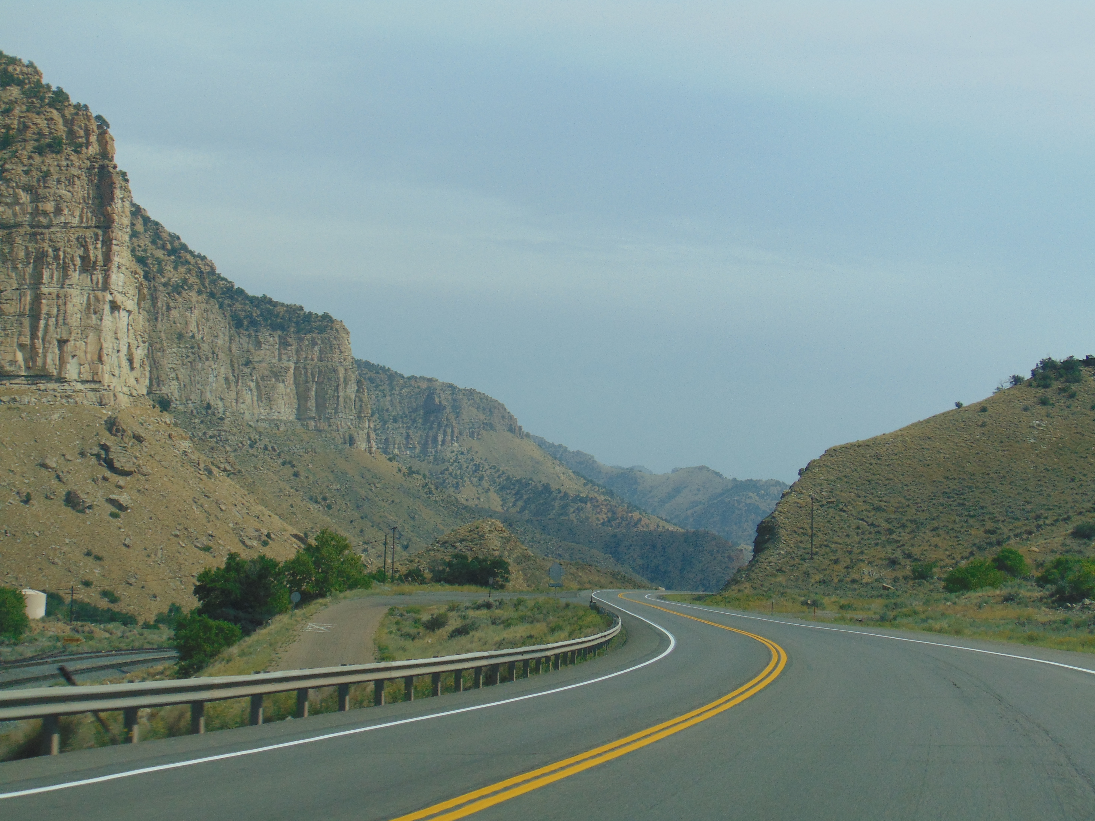
Starting the descent into the Price Canyon and the Price Canyon Recreation Area. I think that the part of US 6 that goes through the Price Canyon is one of the most scenic and dramatic stretches along the highway between Spanish Fork and Green River. There's some incredible cliffs to be seen, both of the natural variety along the Price River and some man-made rock cuts as well.
|
 |
Towards the bottom of the Price Canyon, US 6 gains a new friend in the form of US 191. If you go north on US 191 from here, you'll traverse your way through eastern Utah by way of Duchense and the Flaming Gorge. US 191 eventually connects with Rock Springs, Jackson Hole and the Grand Tetons in Wyoming on its way to Montana.
|
 |
We're greeted by a passing freight train on our way down into the historic city of Helper. The city has a lot of history and a burgeoning arts scene that can be discovered by taking a walking tour around town.
|
 |
Starting our way onto the Helper Bypass on US 6 and US 191. The Helper Bypass was initially built in the 1950s as a way to bypass downtown Helper. There is a great article about the highways of Helper that's found on the Utah Highways blog.
|
 |
There is a business loop into town as seen in this August 2020 photo.
|
 |
In July 2012, there was also mention of UT 244 on the sign at this exit. However, in 2013, UT 244 was decommissioned and removed from the Utah state highway system, as it was a short route that followed the US 6 business loop into downtown Helper.
|
 |
Four lane divided highway between Helper and Price.
|
 |
Some changes were also afoot between 2012 and 2020 for the signage at Exit 240.
|
 |
Exit for UT 10 southbound will take you to Castle Dale or Emery.
|
 |
Exit 243 is at the south end of the Price Bypass and at the other end of UT 55. By 2020, UT 55 was mentioned in the exit signage.
|
 |
At the end of the Price Bypass, it is a good 57 miles to I-70, but only 4 miles to Wellington. Watch your speed, as Wellington is a known speed trap in the area.
|
 |
UT 123 is a spur highway to Sunnyside, Utah.
|
 |
But from here it's a lot of arid desert scenery down to I-70.
|
 |
I-70 and US 50, coming up! US 50 used to follow the alignment that US 6 takes between Green River and Spanish Fork, but when I-70 was built across the San Rafael Swell and over to I-15, US 50 was rerouted to follow I-70 west to Salina, Utah, then US 50 meets US 6 again in Delta, Utah.
|
 |
If you take I-70 and US 6 east from here, it will take you to Grand Junction, Colorado and points east. US 191 splits off from I-70 east of Green River on its way to Moab. It is here where we conclude our journey across central and eastern Utah on US 6, only to follow the modern Interstate highway from here.
|
How to Get There:
Sources and Links:
Utah Highways on Blogger -
Utah HighwaysColorado Department of Transportation -
The History of I-70 in ColoradoFederal Highway Administration -
Why Does I-70 End in Cove Fort, Utah?The Salt Lake Tribune -
Utah’s U.S. 6 transformed from a deathtrap into ‘as safe of a road as we have’ (November 13, 2020)


Comments