This past week I drove California State Route 58 west of CA 43 in Kern County over the Temblor Range and La Panza Range to US Route 101 near Santa Margarita of San Luis Obispo County.

CA 58 west of Bakersfield and CA 99 in general is a mostly two-lane highway that traverses some very remote territory of Central California. I chose to cover CA 58 west of CA 43 specifically due to the changes in the alignment that are to come when the West Side Parkway connects to the Centennial Corridor project. The Centennial Corridor will connect CA 58 west of CA 99 to the already completed segment of Freeway on the West Side Parkway.
Westside Parkway and the Centennial Corridor; Future California State Route 58
CA 58 from Barstow west to Bakersfield was carved out of what was US Route 466 during the 1964 State Highway Renumbering. CA 58 west of Bakersfield to Santa Margarita was carved out of what was part of CA 178. The change from CA 178 to CA 58 west of Bakersfield to Santa Margarita can be observed by comparing the 1963 State Highway Map to the 1964 Edition.
1963 State Highway Map
1964 State Highway Map
Interestingly Legislative Route Number 58 was assigned on a corridor that was used by US 66 west from the Arizona State Line to Barstow, US 466 west to Bakersfield and CA 178 west to Santa Margarita. It would seem the adoption of CA 58 from Barstow west to Santa Margarita was assigned in 1964 to mach what the Legislative Route had been. According to CAhighways.org the adoption of LRN 58 occurred in the following timeline:
- The first segment of LRN 58 west added between Needles west to Mojave as part of the 1919 Third State Highway Bond Act.
- The second segment of LRN 58 extended it east of Needles to the Arizona State Line in 1925.
- In 1931 LRN 58 was extended west of Mojave over Tehachapi Pass to Bakersfield.
- In 1933 LRN 58 west extended west from Bakersfield to Santa Margarita.
More details on the legislative extensions of LRN 58 can be found below:
CAhighways.org on CA 58/LRN 58
More regarding current CA 58 east of Bakersfield over Tehachapi Pass can be found on the blog below:
CA 58 east of CA 99 Bakersfield to US 395 in Kramer Junction
CA 58 from CA 43 is about 96 miles from Santa Margarita and US 101. As noted above CA 58 west of CA 43 traverses the Temblor Range and La Panza Range. While this lack of civilization might be off-putting to some the route CA 58 west of CA 43 is fairly well maintained and a lot of fun to drive.

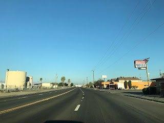
My approach to CA 58 west was from CA 43 south near Shafter in San Joaquin Valley of Kern County. CA 58 west of CA 43 begins roughly at Post Mile KER 39.956 and is signed as 25 miles from McKittrick.


CA 58 west of CA 43 is initially signed on Rosedale Highway. At approximately Post Mile KER 37.763 CA 58 west picks up the Union Pacific tracks that run alongside the eastbound lane in the community of Rio Bravo.


West of Rio Bravo CA 58 enters Buttonwillow. At Post Mile KER 31.748 CA 58 west accesses Interstate 5 north via Tracy Avenue. Tracy Avenue essentially now acts as the main commercial district of Buttonwillow since it essentially exits to serve travelers on I-5 on the West Side Freeway.


CA 58 west crosses under I-5 and is signed as 17 miles from McKittrick.


CA 58 west of I-5 is signed on McKittrick Highway and enters downtown Buttonwillow. Buttonwillow was a siding of the Southern Pacific Railroad which was originally founded as Buena Vista in 1895. Buena Vista took it's name from the nearby lake which was the second largest in the Tulare Lake Basin which largely dried up by the turn of the 20th Century. The name Buttonwillow comes from a buttonbush which was located on a trans-San Joaquin Valley trail used by the Yokut and likely by the Spanish on El Camino Viejo.


From Buttonwillow CA 58 begins to swing southwest towards McKittrick and the Elk Hills. At Post Mile KER 23.046 CA 58 west crosses the California Aqueduct.


CA 58 west of the California Aqueduct quickly is signed with a "End Truck Route" sign and ascends into the low lying Elk Hills Mountain Range. The Elk Hills peak out at a high elevation of 1,227 feet above sea level and are mostly known for the large oil field located there. The Elk Hills Oil Field was discovered in 1911 and presently is the seventh most productive in the United States. CA 58 west enters McKittrick after crossing the Elk Hills and meets CA 33 at approximately Post Mile KER 15.427.


CA 58 west/CA 33 south enter McKittrick on 2nd Street. McKittrick dates back to 1910 and is named after a local rancher. The only notable structure truly left in McKittrick is the McKittrick Hotel.


CA 58 west splits from CA 33 onto Santa Maria Valley Highway towards the Temblor Range at Post Mile KER 15.403.


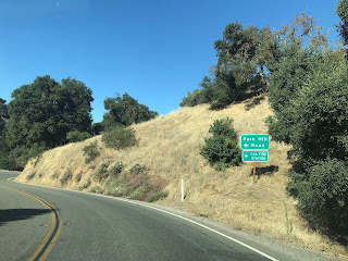
At Post Mile KER 14.998 CA 58 west traffic is advised that there is no services for the next 70 miles, Santa Margarita is 74 miles away and that trucks over 30 feet in length are not recommended.

CA 58 west begins to climb into the Temblor Range. At Post Mile 9.425 CA 58 west meets Reward Road in Santa Maria Valley.


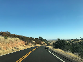
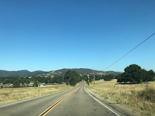
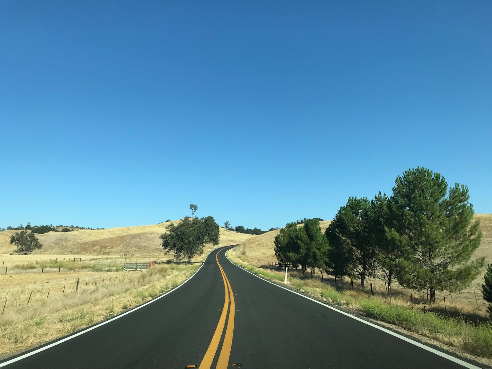
CA 58 west of Reward Road climbs into the a very curvy alignment which snakes to the top of the Temblor Range. The name "Temblor" is fitting as it is Spanish for "Earthquake." The Temblor Range is skirted on it's western flank by the San Andreas Fault and the area is known to be highly seismically active. The Temblor Range is a moderately tall mountain range which which has a peak elevation at McKittrick Peak located at 4,331 feet above sea level. CA 58 west climbing through the Temblor Range is almost within in a constant vista of San Joaquin Valley and ascends to approximately 3,750 feet above sea level at an unnamed summit.


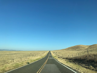
At the summit of the Temblor Range CA 58 west enters San Luis Obispo County and the road becomes Carrisa Highway at approximately Post Mile SLO 57.147. CA 58 west descends through a series of canyons to the San Andreas Fault overlooking Carrizo Plain at Post Mile SLO 54.68 at 7 Mile Road. In the distance Soda Lake of Carrizo Plains National Monument can be seen along with the La Panza Range. From 7 Mile Road CA 58 west is signed 52 miles from Santa Margarita.


Carrizo Plain is the largest remaining grassland in California and roughly stretches the valley created by San Andreas Fault between the Temblor Range west to the La Panza Range. Soda Lake is a 64 square mile dry lake located at the bottom of Carrizo Plain at approximately 1,900 feet above sea level. Much of Carrizo Plain was proclaimed a National Monument in 2001. CA 58 west traverses through Carrizo Plain on an alignment which dips and dives with the San Andreas Fault. CA 58 west accesses Carrizo Plains National Monument via Soda Lake Road at Post Mile SLO 45.199.


Back in 2016 I visited Soda Lake and drove much of Soda Lake Road through Carrizo Plains National Monument.


CA 58 west continues through Carrizo Plain and has a major junction with Bitterwater Road at Post Mile SLO 39.014.


Bitterwater Road is a north/south highway which stretches 32 miles to CA 46/41 along the western flank of the Temblor Range. Bitterwater Road is highly scenic and makes for an interesting day of driving when coupled with the Parkfield Grade.
Bitterwater Road
CA 58 west of Bitterwater Road begins to approach the La Panza Range. Some of the older sections of what was CA 178 are easily observed from the southern flank of the highway.


CA 58 west crosses San Juan Creek and meets the original alignment of CA 178 at Pozo Road at Post Mile SLO 34.687.


From 1934 to 1956 CA 178/LRN 58 had an alignment along Pozo Road through the La Panza Range. This routing along Pozo Road is observable on the 1938 and 1955 California State Highway Maps with the modern alignment to the north appearing on the 1956 Map.
1938 State Highway Map
1955 State Highway Map
1956 State Highway Map
In the winter of 2017 I visited early CA 178 on Pozo Road which goes into far more detail about the alignment.
Old Signed State Route 178, Legislative Route 137 and the 1914 Salinas River Bridge
CA 58 west of Pozo Road crosses Windmill Creek at approximately Post Mile SLO 30.000.


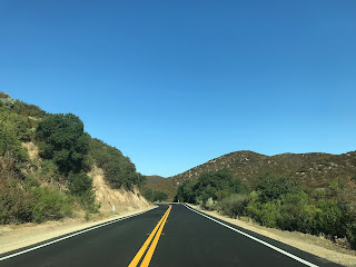
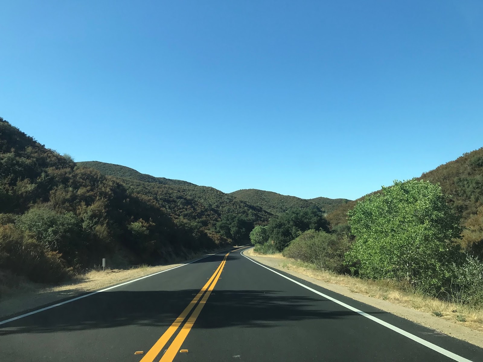
CA 58 west glides gently through the La Panza Range through what essentially is uninhabited back country. At Post Mile SLO 18.399 CA 58 west meets La Panza Road in Wilson's Corner.


CA 58 west continues through the La Panza Range on Calf Canyon Highway with the next significant intersection coming at Post Mile SLO 11.782 at O'Donovan Road.


CA 58 west continues on Calf Canyon Highway to the junction for CA 229/Webster Road at Post Mile SLO 6.888.


CA 229 north to Creston is one of the last remaining single-lane State Highways and was covered on a blog in 2018.
Legacy of US Route 466 Part 3; Morro Bay to Shandon (CA 229 and CA 41)
Prior to 1956 what is now CA 229 north to Creston and present CA 58 west to Pozo Road were part of LRN 137. When CA 178 was realigned in 1956 the route of LRN 137 was truncated to the present junction of CA 58 and CA 229.
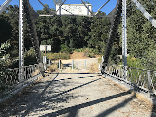
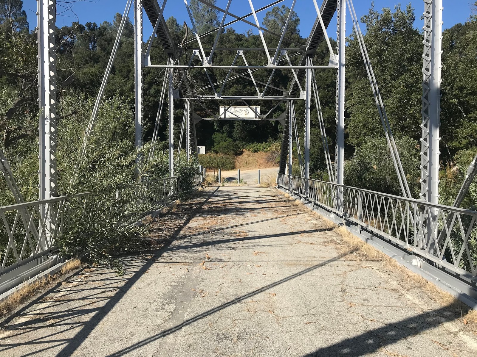
At Post Mile SLO 4.983 CA 58 approaches the Salinas River and the original alignment of LRN 137 to the 1914 Salinas River Bridge.


The 1914 Salinas River Bridge is a Parker Through Truss span which is 163.1 feet in length. The 1914 Salinas River Bridge was assumed into State Maintenance in 1933 when LRN 137 was created. Surprisingly for a one-lane span the 1914 Salinas River Bridge was only recently replaced in 1997.


CA 58 west crosses the Salinas River and rejoins Pozo Road on the outskirts of Santa Margarita at Post Mile SLO 3.143.


CA 58 west enters Santa Margarita on Pozo Road. CA 58 west snakes through Santa Margarita on J Street and Estrada Avenue where it crosses the Union Pacific Railroad to former US 101 on El Camino Real at Post Mile SLO 1.627.


Santa Margarita is situated near Cuesta Pass and was founded as a Southern Pacific Railroad siding in 1889. Santa Margarita prospered early as the rail grade down Cuesta Pass was under construction until 1894. Santa Margarita continued as a primary path of travel during the early State Highway era along LRN 2 which became US 101 in late 1926. US 101 ran through Santa Margarita on El Camino Real until the modern expressway bypass route was built to the west.


CA 58 west terminates at US 101 on the outskirts of Santa Margarita near Cuesta Pass.


CA 58 west of Bakersfield and CA 99 in general is a mostly two-lane highway that traverses some very remote territory of Central California. I chose to cover CA 58 west of CA 43 specifically due to the changes in the alignment that are to come when the West Side Parkway connects to the Centennial Corridor project. The Centennial Corridor will connect CA 58 west of CA 99 to the already completed segment of Freeway on the West Side Parkway.
Westside Parkway and the Centennial Corridor; Future California State Route 58
CA 58 from Barstow west to Bakersfield was carved out of what was US Route 466 during the 1964 State Highway Renumbering. CA 58 west of Bakersfield to Santa Margarita was carved out of what was part of CA 178. The change from CA 178 to CA 58 west of Bakersfield to Santa Margarita can be observed by comparing the 1963 State Highway Map to the 1964 Edition.
1963 State Highway Map
1964 State Highway Map
Interestingly Legislative Route Number 58 was assigned on a corridor that was used by US 66 west from the Arizona State Line to Barstow, US 466 west to Bakersfield and CA 178 west to Santa Margarita. It would seem the adoption of CA 58 from Barstow west to Santa Margarita was assigned in 1964 to mach what the Legislative Route had been. According to CAhighways.org the adoption of LRN 58 occurred in the following timeline:
- The first segment of LRN 58 west added between Needles west to Mojave as part of the 1919 Third State Highway Bond Act.
- The second segment of LRN 58 extended it east of Needles to the Arizona State Line in 1925.
- In 1931 LRN 58 was extended west of Mojave over Tehachapi Pass to Bakersfield.
- In 1933 LRN 58 west extended west from Bakersfield to Santa Margarita.
More details on the legislative extensions of LRN 58 can be found below:
CAhighways.org on CA 58/LRN 58
More regarding current CA 58 east of Bakersfield over Tehachapi Pass can be found on the blog below:
CA 58 east of CA 99 Bakersfield to US 395 in Kramer Junction
CA 58 from CA 43 is about 96 miles from Santa Margarita and US 101. As noted above CA 58 west of CA 43 traverses the Temblor Range and La Panza Range. While this lack of civilization might be off-putting to some the route CA 58 west of CA 43 is fairly well maintained and a lot of fun to drive.

My approach to CA 58 west was from CA 43 south near Shafter in San Joaquin Valley of Kern County. CA 58 west of CA 43 begins roughly at Post Mile KER 39.956 and is signed as 25 miles from McKittrick.


CA 58 west of CA 43 is initially signed on Rosedale Highway. At approximately Post Mile KER 37.763 CA 58 west picks up the Union Pacific tracks that run alongside the eastbound lane in the community of Rio Bravo.


West of Rio Bravo CA 58 enters Buttonwillow. At Post Mile KER 31.748 CA 58 west accesses Interstate 5 north via Tracy Avenue. Tracy Avenue essentially now acts as the main commercial district of Buttonwillow since it essentially exits to serve travelers on I-5 on the West Side Freeway.


CA 58 west crosses under I-5 and is signed as 17 miles from McKittrick.


CA 58 west of I-5 is signed on McKittrick Highway and enters downtown Buttonwillow. Buttonwillow was a siding of the Southern Pacific Railroad which was originally founded as Buena Vista in 1895. Buena Vista took it's name from the nearby lake which was the second largest in the Tulare Lake Basin which largely dried up by the turn of the 20th Century. The name Buttonwillow comes from a buttonbush which was located on a trans-San Joaquin Valley trail used by the Yokut and likely by the Spanish on El Camino Viejo.


From Buttonwillow CA 58 begins to swing southwest towards McKittrick and the Elk Hills. At Post Mile KER 23.046 CA 58 west crosses the California Aqueduct.


CA 58 west of the California Aqueduct quickly is signed with a "End Truck Route" sign and ascends into the low lying Elk Hills Mountain Range. The Elk Hills peak out at a high elevation of 1,227 feet above sea level and are mostly known for the large oil field located there. The Elk Hills Oil Field was discovered in 1911 and presently is the seventh most productive in the United States. CA 58 west enters McKittrick after crossing the Elk Hills and meets CA 33 at approximately Post Mile KER 15.427.


CA 58 west/CA 33 south enter McKittrick on 2nd Street. McKittrick dates back to 1910 and is named after a local rancher. The only notable structure truly left in McKittrick is the McKittrick Hotel.


CA 58 west splits from CA 33 onto Santa Maria Valley Highway towards the Temblor Range at Post Mile KER 15.403.


At Post Mile KER 14.998 CA 58 west traffic is advised that there is no services for the next 70 miles, Santa Margarita is 74 miles away and that trucks over 30 feet in length are not recommended.

CA 58 west begins to climb into the Temblor Range. At Post Mile 9.425 CA 58 west meets Reward Road in Santa Maria Valley.


CA 58 west of Reward Road climbs into the a very curvy alignment which snakes to the top of the Temblor Range. The name "Temblor" is fitting as it is Spanish for "Earthquake." The Temblor Range is skirted on it's western flank by the San Andreas Fault and the area is known to be highly seismically active. The Temblor Range is a moderately tall mountain range which which has a peak elevation at McKittrick Peak located at 4,331 feet above sea level. CA 58 west climbing through the Temblor Range is almost within in a constant vista of San Joaquin Valley and ascends to approximately 3,750 feet above sea level at an unnamed summit.


At the summit of the Temblor Range CA 58 west enters San Luis Obispo County and the road becomes Carrisa Highway at approximately Post Mile SLO 57.147. CA 58 west descends through a series of canyons to the San Andreas Fault overlooking Carrizo Plain at Post Mile SLO 54.68 at 7 Mile Road. In the distance Soda Lake of Carrizo Plains National Monument can be seen along with the La Panza Range. From 7 Mile Road CA 58 west is signed 52 miles from Santa Margarita.


Carrizo Plain is the largest remaining grassland in California and roughly stretches the valley created by San Andreas Fault between the Temblor Range west to the La Panza Range. Soda Lake is a 64 square mile dry lake located at the bottom of Carrizo Plain at approximately 1,900 feet above sea level. Much of Carrizo Plain was proclaimed a National Monument in 2001. CA 58 west traverses through Carrizo Plain on an alignment which dips and dives with the San Andreas Fault. CA 58 west accesses Carrizo Plains National Monument via Soda Lake Road at Post Mile SLO 45.199.


Back in 2016 I visited Soda Lake and drove much of Soda Lake Road through Carrizo Plains National Monument.


CA 58 west continues through Carrizo Plain and has a major junction with Bitterwater Road at Post Mile SLO 39.014.


Bitterwater Road is a north/south highway which stretches 32 miles to CA 46/41 along the western flank of the Temblor Range. Bitterwater Road is highly scenic and makes for an interesting day of driving when coupled with the Parkfield Grade.
Bitterwater Road
CA 58 west of Bitterwater Road begins to approach the La Panza Range. Some of the older sections of what was CA 178 are easily observed from the southern flank of the highway.


CA 58 west crosses San Juan Creek and meets the original alignment of CA 178 at Pozo Road at Post Mile SLO 34.687.


From 1934 to 1956 CA 178/LRN 58 had an alignment along Pozo Road through the La Panza Range. This routing along Pozo Road is observable on the 1938 and 1955 California State Highway Maps with the modern alignment to the north appearing on the 1956 Map.
1938 State Highway Map
1955 State Highway Map
1956 State Highway Map
In the winter of 2017 I visited early CA 178 on Pozo Road which goes into far more detail about the alignment.
Old Signed State Route 178, Legislative Route 137 and the 1914 Salinas River Bridge
CA 58 west of Pozo Road crosses Windmill Creek at approximately Post Mile SLO 30.000.


CA 58 west glides gently through the La Panza Range through what essentially is uninhabited back country. At Post Mile SLO 18.399 CA 58 west meets La Panza Road in Wilson's Corner.


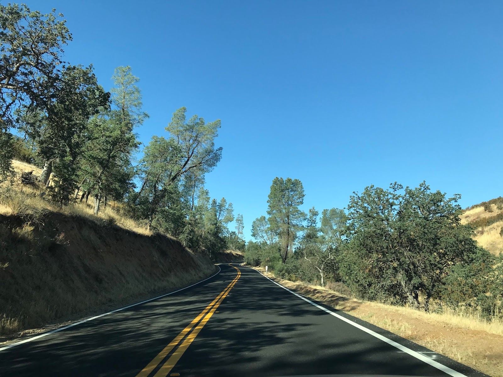


CA 58 west continues through the La Panza Range on Calf Canyon Highway with the next significant intersection coming at Post Mile SLO 11.782 at O'Donovan Road.


CA 58 west continues on Calf Canyon Highway to the junction for CA 229/Webster Road at Post Mile SLO 6.888.


CA 229 north to Creston is one of the last remaining single-lane State Highways and was covered on a blog in 2018.
Legacy of US Route 466 Part 3; Morro Bay to Shandon (CA 229 and CA 41)
Prior to 1956 what is now CA 229 north to Creston and present CA 58 west to Pozo Road were part of LRN 137. When CA 178 was realigned in 1956 the route of LRN 137 was truncated to the present junction of CA 58 and CA 229.
At Post Mile SLO 4.983 CA 58 approaches the Salinas River and the original alignment of LRN 137 to the 1914 Salinas River Bridge.


The 1914 Salinas River Bridge is a Parker Through Truss span which is 163.1 feet in length. The 1914 Salinas River Bridge was assumed into State Maintenance in 1933 when LRN 137 was created. Surprisingly for a one-lane span the 1914 Salinas River Bridge was only recently replaced in 1997.


CA 58 west crosses the Salinas River and rejoins Pozo Road on the outskirts of Santa Margarita at Post Mile SLO 3.143.


CA 58 west enters Santa Margarita on Pozo Road. CA 58 west snakes through Santa Margarita on J Street and Estrada Avenue where it crosses the Union Pacific Railroad to former US 101 on El Camino Real at Post Mile SLO 1.627.


Santa Margarita is situated near Cuesta Pass and was founded as a Southern Pacific Railroad siding in 1889. Santa Margarita prospered early as the rail grade down Cuesta Pass was under construction until 1894. Santa Margarita continued as a primary path of travel during the early State Highway era along LRN 2 which became US 101 in late 1926. US 101 ran through Santa Margarita on El Camino Real until the modern expressway bypass route was built to the west.


CA 58 west terminates at US 101 on the outskirts of Santa Margarita near Cuesta Pass.


Comments