Part 3 of the US Route 466 Legacy series consists of the roadways that made up the highway between Morro Bay and Shandon of San Luis Obispo County. The San Luis Obispo County segment of US Route 466 is notable due to it having been carried via a dirt segment through Rocky Canyon from 1933 to 1958. Pictured in the cover photo of this blog is former US Route 466 facing westward into Rocky Canyon.
Part 1; mapping early US Route 466 in San Luis Obispo County
As discussed in Part 1 of the US Route 466 Legacy series the western terminus of US Route 466 ("US 466") from it's inception until truncation in the 1965 was located in Morro Bay at California State Route 1 ("CA 1"). US 466 between Morro Bay and Shandon had two two primary alignments through it's history. The initial 1933 routing of US 466 east from Morro Bay to Shandon was on Legislative Route Number 125 ("LRN 125") as follows:
US 466/LRN 125 began at CA 1 at the corner of Main Street and Atascadero Road in Morro Bay. US 466/LRN 125 followed Morro Creek and Atascadero Creek eastward on Atascadero Road to the City Limits of Atascadero. US 466/LRN 125 entered the City of Atascadero on Morro Road.


Within the City of Atascadero US 466/LRN 125 briefly multiplexed US 101/El Camino Real to West Mall. US 466/LRN 125 followed West Mall to the 1921 Atascadero Creek Bridge and transitioned onto Capistrano Avenue. US 466/LRN 125 eastbound followed Capistrano Avenue underneath the 1902 Southern Pacific Railroad Underpass to Sycamore Road. US 466/LRN 125 followed Sycamore Road southeast to Acacia Road where it crossed the Salinas River to Rocky Canyon Road.
US 466/LRN 125 followed Rocky Canyon Road into what is now the CalPortland Rocky Canyon Quarry. US 466/LRN 125 passed through the Rocky Canyon Quarry and ascended what is now the Rocky Canyon Trail. US 466/LRN 125 would have transitioned onto the eastern segment of Rocky Canyon Road atop of Rocky Canyon.
US 466/LRN 125 followed Rocky Canyon Road and merged onto what is now CA 229 at the southern outskirts of Creston.
US 466/LRN 125 followed modern CA 229/Webster Road to a now razed bridge at Huerhuero Creek. US 466/LRN 125 followed La Panza Road and Little Farms Road to modern CA 41.
US 466/LRN 125 followed modern CA 41 from Little Farm Road to Centre Street near Shandon. Unlike modern CA 41 which heads west on Centre Street the alignment of US 466/LRN 125 carried it east directly through Shandon.
Part 2; the history of US Route 466 in San Luis Obispo CountyLRN 125 was defined as a State Highway via 1933 Legislative Chapter 767 with the following definition:
A primitive LRN 125 from Morro Bay east to Shandon is displayed on the
1934 Division of Highways State Map. LRN 125 can be seen traversing Rocky Canyon east of Atascadero towards Shandon.
The first documents acknowledging the existence of US 466 in California can be found during October/November 1933 in the AASHO Database. Interestingly the document from October 25th, 1933 seems to imply the AASHO assumed US 466 was intended to utilize LRN 33 from Shandon west to Paso Robles and multiplex US 101/LRN 2 to Atascadero. The December reply by the Division of Highways omits Paso Robles from the alignment of US 466 from Atascadero east to Shandon.
The
January 1934 California Highways & Public Works announced five miles of US 466/LRN 125 between Morro Bay and Atascadero were slated to be reconstructed.

The
July 1938 California Highways & Public Works describes the newly reconstructed segment of US 466/LRN 125 between Morro Bay and Atascadero. The Morro Bay-Atascadero segment of US 466/LRN 125 is described as having had a dedication ceremony held on June 19th, 1938. US 466 is described as the most direct route from San Joaquin Valley to the Pacific Coast but it's alignment is not expounded upon east of Atascadero.


The 1938 Division of Highways Map shows US 466 on LRN 125 between Morro Bay and Atascadero. No detail pertaining to the alignment of US 466 east of Atascadero is provided until the vicinity of Cholame.
The
September 1950 California Highways & Public Works notes the 1921 Atascadero Creek Bridge on US 466/LRN 125 as one of the first concrete arch bridges constructed in California. The 1921 Atascadero Creek Bridge is noted to have been constructed by San Luis Obispo County.

During June of 1958 the Division of Highways sought and obtained permission to relocate US 466 off of LRN 125 between Atascadero and Shandon. The Division of Highways noted that CA 41/LRN 33 between Paso Robles-Shandon had recently been improved and was by far the favored highway for traffic. LRN 125 between Atascadero-Shandon is noted to be substandard in design and despite being part of US 466 since 1933 was never signed as such. US 101 through Paso Robles is noted to be in the process of going through a freeway upgrade which was supplemented by existing bypasses in Templeton and Atascadero. The new alignment of US 466 would see it multiplex CA 41/LRN 33 west of Shandon to Paso Robles and US 101/LRN 2 south to Atascadero.


The
September/October 1958 California Highways & Public Works announced Shandon bypass project for US 466/CA 41/LRN 33 had been approved for construction. The project is stated to have an origin point two miles east of the Estrella River and would extend to the Kern County Line. The design of the new alignment of US 466/CA 41/LRN 33 is stated to be a two lane expressway design which could be expanded to four lanes.
The new alignment of US 466 multiplexing CA 41/LRN 33 west of Shandon and US 101/LRN 2 south of Paso Robles is depicted on the
1959 Division of Highways Map.
The March/April 1962 California Highways & Public Works notes LRN 125/Rocky Canyon Road had been given to San Luis Obipso County via a maintenance swap in exchange for Creston-Eureka Road. This measure added Creston-Eureka Road to LRN 125 and extended LRN 137 from Rocky Canyon Road north through Creston.
The new alignment of LRN 125 on Creston-Eureka Road and the extended LRN 137 through Creston can be seen on the
1963 Division of Highways Map.
In 1964 the California State Highway renumbering took place. While US 466 was still present it's legislative designations were replaced by LRN 41 between Morro Bay to Atascadero and LRN 46 between US 101 to US 99. CA 41 was assigned to the route of LRN 125 between Shandon and Atascadero while CA 46 was signed over what was CA 41 west of US 101/US 466. LRN 137 became the current CA 229 while CA 178 west of Bakersfield was renumbered to CA 58.
US 466 was approved for truncation from Morro Bay to CA 127 in Baker by the AASHO Executive Committee during June 1964. This truncation would see US 466 terminate on Baker Boulevard at the intersection with CA 127/Death Valley Road.
Part 3; a drive and hike on the original alignment of former US Route 466 from Morro Bay to Shandon
As noted in Part 1 US 466 eastbound began in Morro Bay at the intersection of Main Street (formerly CA 1) and Atascadero Road. US 466 began heading eastbound towards US 101 on Atascardro Road on what is now CA 41.
US 466/LRN 125 traversed approximately 16 miles between Morro Bay east to Atascadero. US 466 ascended through a small pass along Morro Creek.
US 466/LRN 125 entered Atascadero on Morro Road where it began a brief multiplex of US 101 on El Camino Real. US 101 moved to the current freeway in 1957 which would have briefly left US 466 as the stand alone highway on El Camino Real in downtown Atascadero.
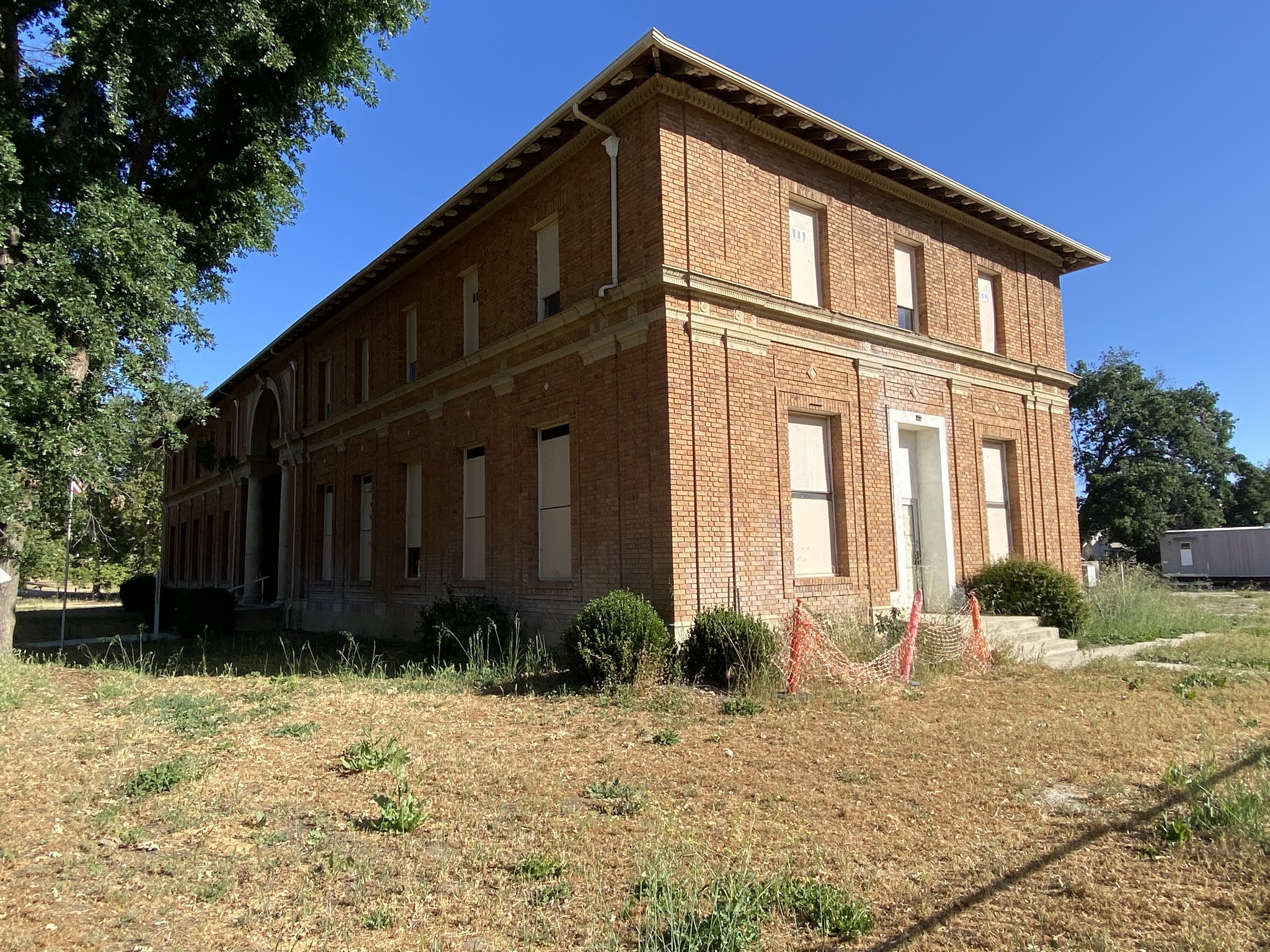
US 466/LRN 125 eastbound departed US 101/El Camino Real with a right hand turn onto West Mall in downtown Atascadero.
Former US 466/LRN 125 on West Mall faces the Atascadero Administration Building.
Atascadero was founded by east coast publisher Edward Gardner Lewis in 1913 as a planned community. The community of Atascadero was centralized around the Sunken Gardens and the Atascadero Administration Building. The Atascadero Administration Building was completed in 1918 and serves the Atascadero City Hall. Atascadero incorporated as a City July 2nd, 1979.
Former US 466/LRN 125 headed eastward on West Mall where passed by the Printery Building at Olmeda Avenue. The Printery Building was completed in 1915 and was the first administrative building in Atascadero. The Printery Building is presently vacant but is planned to be refurbished into a community center.
Former US 466/LRN 125 followed West Mall over the 1921 Atascadero Creek Bridge to Capistrano Avenue.
The pedestrian pathway on the 1921 Atascadero Creek Bridge mentioned in Part 2.
The 1921 Atascadero Creek Bridge still has it's pre-1964 Postmile markings painted onto the structure. The contractor who constructed the 1921 Atascadero Creek Bridge along with a list of San Luis Obispo County supervisors can be found on a plaque. The Postmile marking likely survived due to the 1921 Atascadero Creek Bridge being part of post-1964 CA 41 until 2003.

The substructure of the 1921 Atascadero Creek Bridge.
Former US 466/LRN 125 followed Capistrano Avenue eastward under the 1902 Southern Pacific Railroad Underpass and veered via right hand turn to Sycamore Road. The 1902 Southern Pacific Railroad Underpass has a 13'2 foot overhead clearance.
The 1902 Southern Pacific Railroad Overpass from the same position it was depicted in the September 1950 California Highways & Public Works.
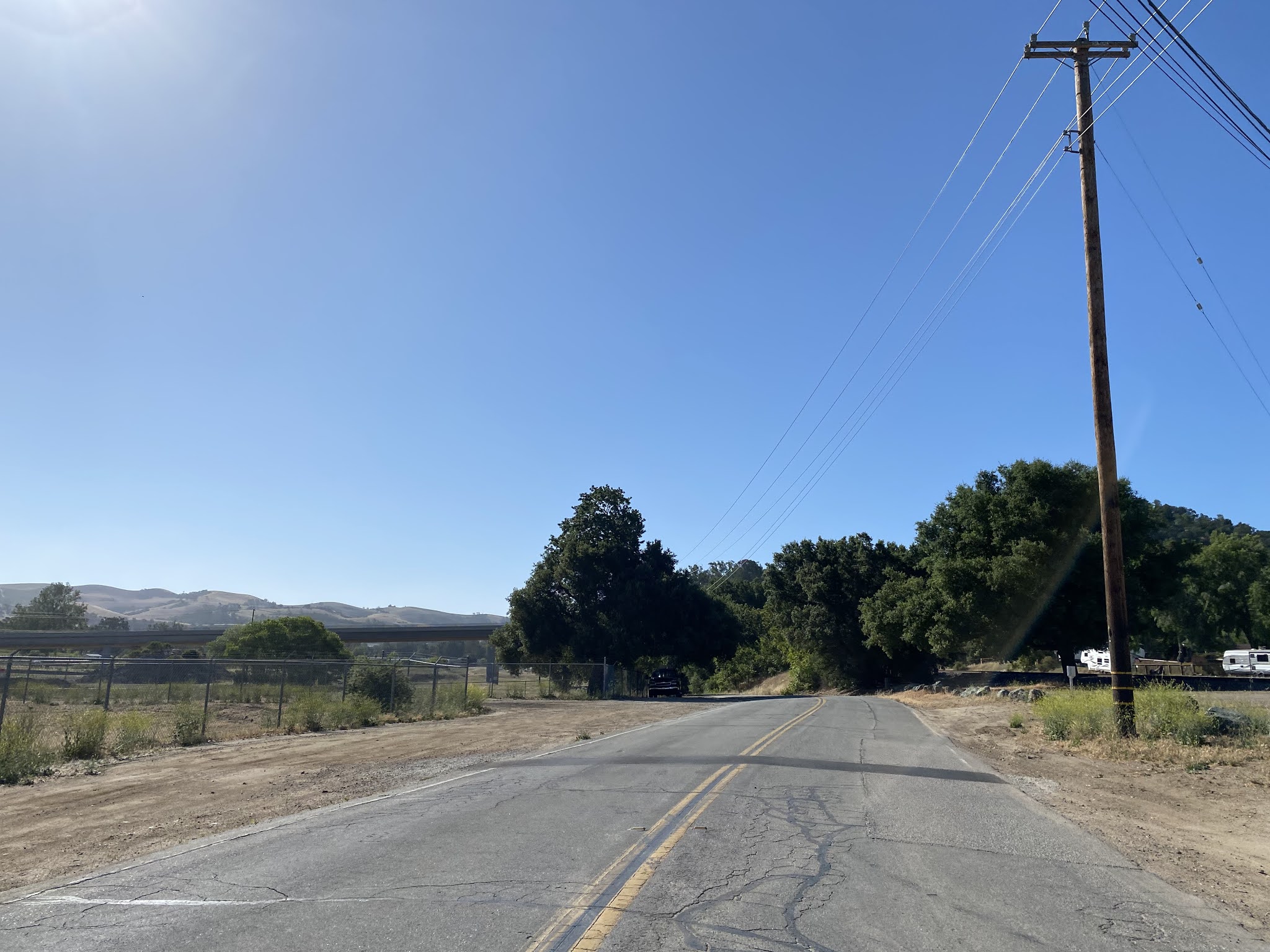
Former US 466/LRN 125 followed the Salinas River southeast via Sycamore Road underneath modern CA 41 to to Acacia Road.
Former US 466/LRN 125 followed Acacia Road to the location where the Salinas River Bridge once stood. Upon crossing the Salinas River Bridge US 466/LRN 125 would have turned right onto Rocky Canyon Road. Post-1964 CA 41 would have turned left onto Creston-Eureka Road.
The Salinas River Bridge was destroyed in March 1995 when the Salinas River flooded over according to the
San Luis Obispo Tribune. The destruction of the Salinas River Bridge led to CA 41 being realigned over the Salinas River Viaduct by 2003.
Looking westward from Rocky Canyon Road towards the site of the Salinas River Bridge.
Former US 466/LRN 125 followed Rocky Canyon Road southeast to the intersection with Halcon Road. The publicly drivable accessible part of Rocky Canyon Road ends at Halcon Road at the entrance to the CalPortland Rocky Canyon Quarry. Former US 466 in Rocky Canyon is still accessible to hikers and mountain bikers via the Rocky Canyon Trail.
The CalPortland Quarry opened in 1985 which made Rocky Canyon Road inaccessible as a through route to Creston. It is unclear when Rocky Canyon Road closed to traffic after it was transferred to San Luis Obispo County in 1962. Access to the Rocky Canyon Quarry is made easier for heavy freight vehicles via the Halcon Road Low Water Bridge over the Salinas River.
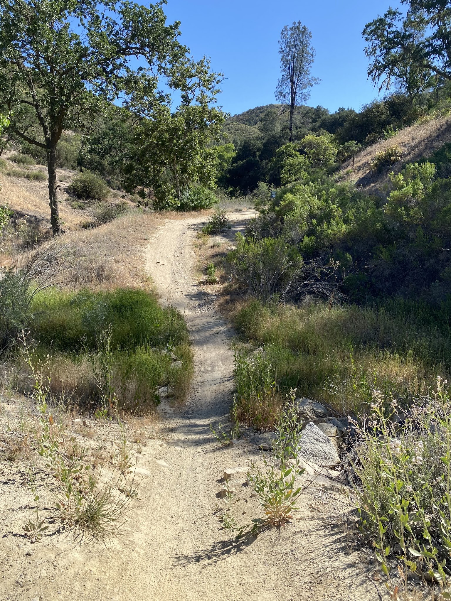
Roughly the first mile of the Rocky Canyon Trail is aligned on the paved part of former US 466/LRN 125 on Rocky Canyon Road in the CalPortland Quarry.
Hikers on the Rocky Canyon Trail are directed onto a trail on the opposite of the right-of-way of former US 466/LRN 125 and Rocky Canyon Creek past the CalPortland Quarry Plant.
The Rocky Canyon Trail rejoins the former right-of-way of US 466/LRN 125 northeast to where the trail splits eastward towards Creston via Rocky Canyon Creek.
Former US 466/LRN 125 on the Rocky Canyon Trail begins to ascend Rocky Canyon eastward and crosses Rocky Canyon Creek. It appears US 466/LRN 125 crossed Rocky Canyon Creek via a ford as no evidence of bridge can be found, although there is some evidence of road grade foundations.
Former US 466/LRN 125 barely resembles a roadway as it is heavily eroded climbing eastward to the top of Rocky Canyon. Towards the top of Rocky Canyon the grade of former US 466/LRN 125 becomes more recognizable and there is fencing structures present.
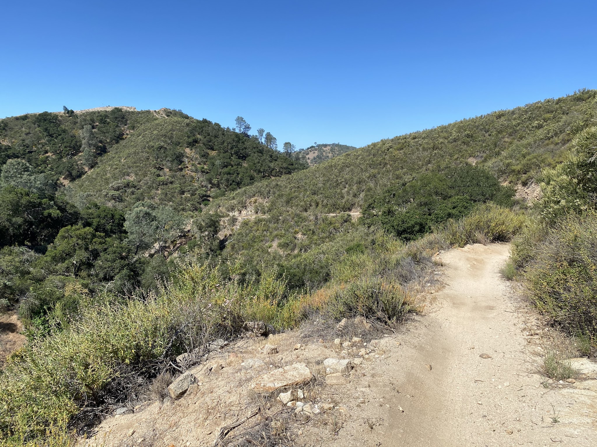
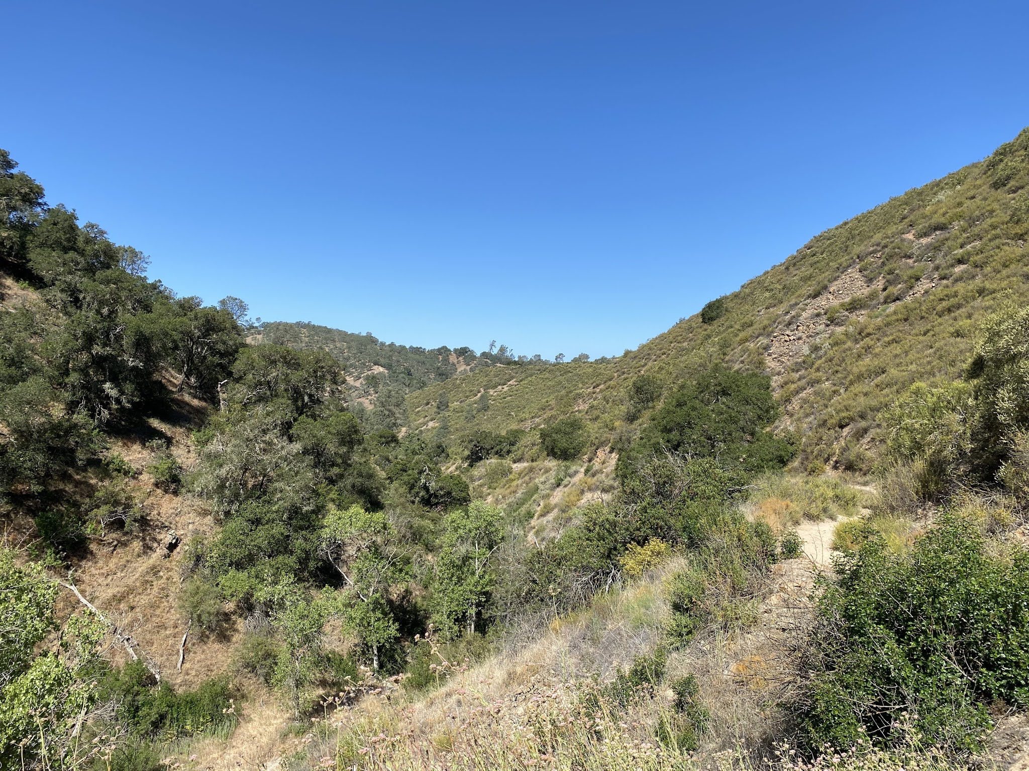
A westward look from the top of Rocky Canyon over former US 466/LRN 125.
Former US 466/LRN 125 continues east through overgrowth to a fence line where maintained Rocky Canyon Road resumes. Some stray macadam surfacing can be found in the overgrowth which has been worn into part of the Rocky Canyon Trail.
Former US 466/LRN 125 followed Rocky Canyon Road eastward to the modern two lane segment of CA 229 approaching Creston.
A look west on former US 466/LRN 125 reveals what Rocky Canyon Road probably looked like during it's prime as a State Maintained Highway.
Former US 466/LRN 125 followed CA 229/Webster Road eastward into Creston.
Creston was founded in 1884 on land that was part of Rancho Huerhuero. While CA 229 continues directly north to CA 41 the alignment of US 466/LRN 125 crossed Huerhuero Creek to La Panza Road. As noted in Part 1 US 466/LRN 125 transitioned from La Panza Road to reach modern CA 41 via Little Farm Road.
East of Little Farm Road former US 466/LRN 125 is carried by modern CA 41 towards Centre Street near Shandon.
Since 2011 at Centre Street CA 41 turns left to reach CA 46 via the Estrella River. US 466/LRN 125 turned east on Centre Street where it traversed Shandon and crossed the Estrella River to modern CA 41/CA 46.
Publishing and Revision History
- Published; 12/26/2018
- Revision 1; 5/23/2021


Comments