This past month I drove the entirety of California State Route 34 in located in Ventura County.

CA 34 is presently an approximately 11 mile State Highway which spans from future CA 1 on Rice Avenue in Oxnard east to CA 118 near Somis. The present route of CA 34 was added to the State Highway System as Legislative Route Number 153 in 1933 according to CAhighways.org.
CAhighways.org on LRN 153
The originally definition of LRN 153 began at Port Hueneme on Hueneme Road and swung north into Oxnard via Saviers Road. LRN 153 multiplexed LRN 60 (future CA 3 and US 101A) on Oxnard Boulevard to 5th Street. From 5th Street the route of LRN 153 is almost identical eastward to Somis as modern CA 34. The original alignment of LRN 153 can be seen on the 1935 Division of Highways Map of Ventura County.
1935 Ventura Highway Map
LRN 153 essentially remained unchanged until it was assigned CA 34 during the 1964 California State Highway Renumbering. The change from LRN 153 to CA 34 can be seen by comparing the 1963 State Highway Map to the 1964 Edition.
1963 State Highway Map
1964 State Highway Map
In 1965 the portion of CA 34 on Hueneme Road and Saviers Road was deleted which truncated the highway to CA 1 at 5th Street and Oxnard Boulevard. CAhighways.org states that CA 34 had a 1965 era planning map which showed a plan freeway route.
CAhighways.org on CA 34
The 1966 State Highway Map shows the planned freeway route of CA 34 traveling directly south from Camarillo towards CA 1 near Point Magu. Interestingly CA 34 between Port Hueneme and Oxnard is still displayed.
1966 State Highway Map
It seems that CA 34 between Port Hueneme and Oxnard may have been transferred temporarily to CA 257. CA 257 was defined in 1965 as a new freeway running between US 101 near Ventura to CA 34 near Point Magu according to CAhighways.org. The planned route of CA 257 first appears on the 1966 State Highway Map above. The 1967 State Highway Map shows that CA 257 appears to be assigned to the former segment of CA 34 between Port Hueneme and Oxnard.
CAhighways.org on CA 257
1967 State Highway Map
Former CA 34 between Port Hueneme and Oxnard finally disappears off the State Highway Map by 1975.
1975 State Highway Map
Daniel Faigin the webmaster for CAhighways.org offered an alternate explanation for why the former route of CA 34 between Port Hueneme and Oxnard appeared on State Highway Maps until 1975. The following was posted on the AAroads Forum on the CA 34 thread dated 11/9/19:
"In 1965, the portion from Port Hueneme to Route 1 was legislatively deleted, changing the definition to "from Route 1 between Point Mugu and the City of OxnardPort Hueneme
to Route 118 near Somis.". For the existing signed route, this
technically removed the portion of the route on Hueneme Road and Saviers
Road, truncating the route to start at Route 1 at 5th Street and Oxnard
Boulevard1. However, that deleted portion remained on the
state highway maps until at least 1970, disappearing by the 1975 map.
Quite likely, what happened is that it took until the early 1970s to
relinquish the route to the local entities, and so it remained as signed
Route 34, and was state maintained, even though it was no longer part
of the official definition (think something along the lines of Route
34U). But the state highway maps since 1965 also show a new alignment
(likely a freeway alignment) running from the curve in 5th Street near
Pleasant Valley Road diagonally parallel to Lewis Road, Las Posas, and
Hueneme Road to Point Mugu. That alignment (unbuilt) remained on the
books until the the late 2000 relinquishments, and was officially
deleted in the 2014 change in the legislative definition."
A 1970 Topographical Map was posted by Faigin as well which shows CA 34 still on it's recently deleted segment to Port Hueneme. Said 1970 Topographical Map can be found below:
1970 USGS Oxnard Topographical Overlay Map
The 2005 State Highway Map City Insert is the last to show the planned freeway route of CA 34 in great detail.
2005 State Highway Map City Insert
In 2008 CA 34 in the City of Oxnard was put up for relinquishment. In 2013 the route of CA 34 was relinquished in Oxnard to Rice Avenue which was the planned route of Rice Avenue. In 2014 the definition of CA 34 was changed to reflect the new west terminus of CA 34 was at Rice Avenue. Interestingly the relinquishment agreement states that the City of Oxnard will maintain CA 34 signage to Oxnard Boulevard. As of May of 2019 the City of Oxnard has continued to sign CA 34 from Oxnard Boulevard at 5th Street.
May 2019 Google Street Car Image of Oxnard Boulevard and 5th Street
My approach to CA 34 east was from future CA 1 north on Rice Avenue in Oxnard. CA 34 east officially begins at Post Mile Ven 6.27 on 5th Street.


The hang up with Caltrans adopting Rice Avenue appears to be the interchange at CA 34/Rice Avenue. Caltrans likely will not adopt Rice Avenue until a rail overpass at 5th Street (the rails are immediately north of CA 34) is constructed. Said railroad overpass is slated to be complete by 2023 according to CAhighways.org.
CAhighways.org on CA 1
Route 1/Rice Avenue in Oxnard on AAroads
At Post Mile VEN 8.42 CA 34 east has a major junction with Pleasant Valley Road.

CA 34 east of Pleasant Valley Road continues directly ahead towards the Santa Monica Mountains before curving northeast towards Camarillo at Post Mile VEN 11.647.


CA 34 east continues northeast on 5th Street before merging on to Pleasant Valley Road at Post Mile VEN 12.447.


CA 34 east traffic on Pleasant Valley Road is directed north towards US 101 via Lewis Road at Post Mile VEN 12.787.


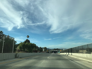
CA 34 east enters the City of Camarillo on Lewis Road and utilizes a rail overpass to reach US 101 at approximately Post Mile VEN R13.589.


CA 34 east follows Lewis Road out of Camarillo as it becomes Somis Road. CA 34 east enters Somis at approximately Post Mile VEN 17.036.


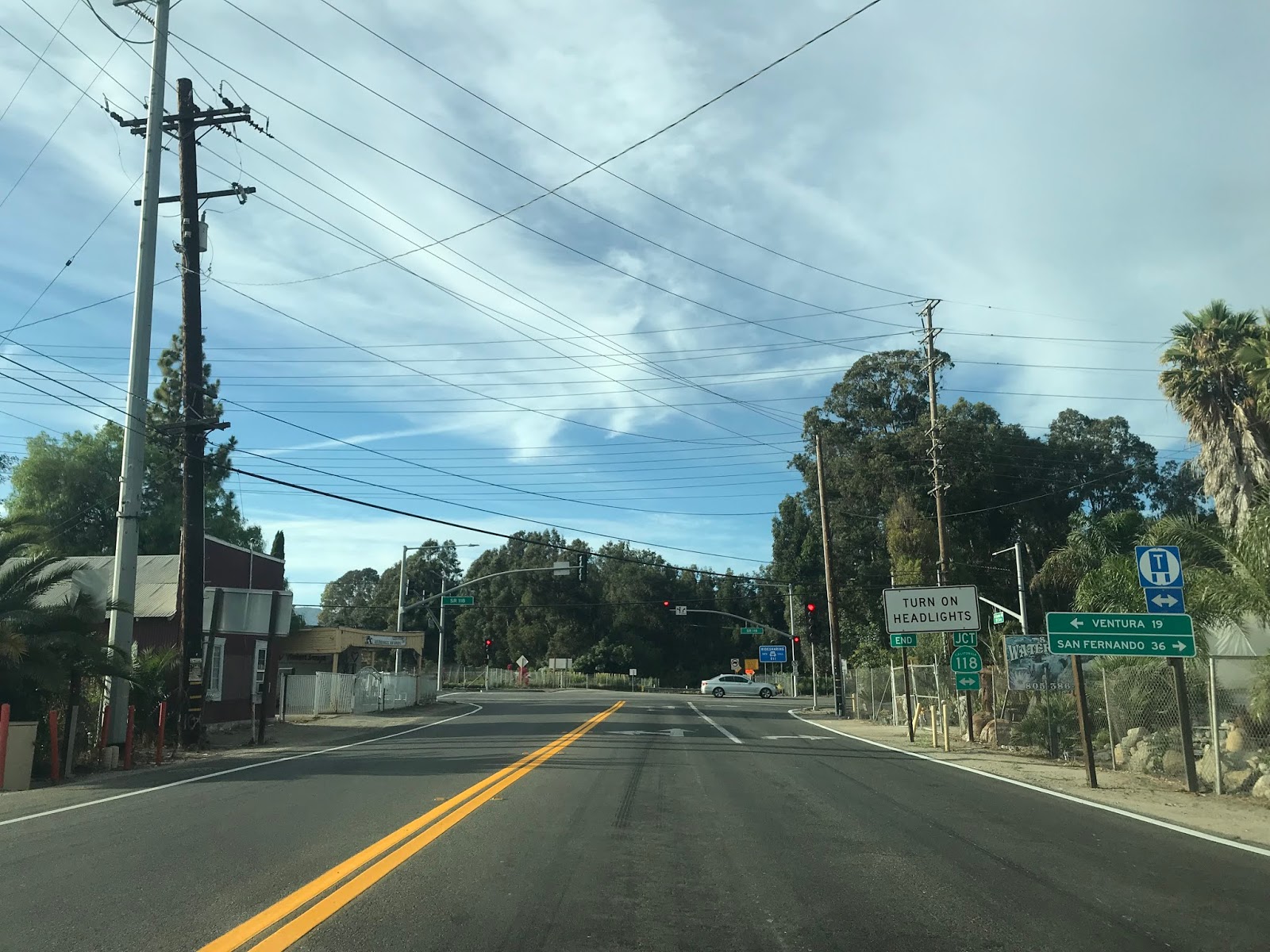
CA 34 east terminates at CA 118 at Post Mile VEN 17.655 just north of Somis.


CA 34 is presently an approximately 11 mile State Highway which spans from future CA 1 on Rice Avenue in Oxnard east to CA 118 near Somis. The present route of CA 34 was added to the State Highway System as Legislative Route Number 153 in 1933 according to CAhighways.org.
CAhighways.org on LRN 153
The originally definition of LRN 153 began at Port Hueneme on Hueneme Road and swung north into Oxnard via Saviers Road. LRN 153 multiplexed LRN 60 (future CA 3 and US 101A) on Oxnard Boulevard to 5th Street. From 5th Street the route of LRN 153 is almost identical eastward to Somis as modern CA 34. The original alignment of LRN 153 can be seen on the 1935 Division of Highways Map of Ventura County.
1935 Ventura Highway Map
LRN 153 essentially remained unchanged until it was assigned CA 34 during the 1964 California State Highway Renumbering. The change from LRN 153 to CA 34 can be seen by comparing the 1963 State Highway Map to the 1964 Edition.
1963 State Highway Map
1964 State Highway Map
In 1965 the portion of CA 34 on Hueneme Road and Saviers Road was deleted which truncated the highway to CA 1 at 5th Street and Oxnard Boulevard. CAhighways.org states that CA 34 had a 1965 era planning map which showed a plan freeway route.
CAhighways.org on CA 34
The 1966 State Highway Map shows the planned freeway route of CA 34 traveling directly south from Camarillo towards CA 1 near Point Magu. Interestingly CA 34 between Port Hueneme and Oxnard is still displayed.
1966 State Highway Map
It seems that CA 34 between Port Hueneme and Oxnard may have been transferred temporarily to CA 257. CA 257 was defined in 1965 as a new freeway running between US 101 near Ventura to CA 34 near Point Magu according to CAhighways.org. The planned route of CA 257 first appears on the 1966 State Highway Map above. The 1967 State Highway Map shows that CA 257 appears to be assigned to the former segment of CA 34 between Port Hueneme and Oxnard.
CAhighways.org on CA 257
1967 State Highway Map
Former CA 34 between Port Hueneme and Oxnard finally disappears off the State Highway Map by 1975.
1975 State Highway Map
Daniel Faigin the webmaster for CAhighways.org offered an alternate explanation for why the former route of CA 34 between Port Hueneme and Oxnard appeared on State Highway Maps until 1975. The following was posted on the AAroads Forum on the CA 34 thread dated 11/9/19:
"In 1965, the portion from Port Hueneme to Route 1 was legislatively deleted, changing the definition to "from Route 1 between Point Mugu and the City of Oxnard
A 1970 Topographical Map was posted by Faigin as well which shows CA 34 still on it's recently deleted segment to Port Hueneme. Said 1970 Topographical Map can be found below:
1970 USGS Oxnard Topographical Overlay Map
The 2005 State Highway Map City Insert is the last to show the planned freeway route of CA 34 in great detail.
2005 State Highway Map City Insert
In 2008 CA 34 in the City of Oxnard was put up for relinquishment. In 2013 the route of CA 34 was relinquished in Oxnard to Rice Avenue which was the planned route of Rice Avenue. In 2014 the definition of CA 34 was changed to reflect the new west terminus of CA 34 was at Rice Avenue. Interestingly the relinquishment agreement states that the City of Oxnard will maintain CA 34 signage to Oxnard Boulevard. As of May of 2019 the City of Oxnard has continued to sign CA 34 from Oxnard Boulevard at 5th Street.
May 2019 Google Street Car Image of Oxnard Boulevard and 5th Street
My approach to CA 34 east was from future CA 1 north on Rice Avenue in Oxnard. CA 34 east officially begins at Post Mile Ven 6.27 on 5th Street.


The hang up with Caltrans adopting Rice Avenue appears to be the interchange at CA 34/Rice Avenue. Caltrans likely will not adopt Rice Avenue until a rail overpass at 5th Street (the rails are immediately north of CA 34) is constructed. Said railroad overpass is slated to be complete by 2023 according to CAhighways.org.
CAhighways.org on CA 1
Route 1/Rice Avenue in Oxnard on AAroads
At Post Mile VEN 8.42 CA 34 east has a major junction with Pleasant Valley Road.

CA 34 east of Pleasant Valley Road continues directly ahead towards the Santa Monica Mountains before curving northeast towards Camarillo at Post Mile VEN 11.647.


CA 34 east continues northeast on 5th Street before merging on to Pleasant Valley Road at Post Mile VEN 12.447.


CA 34 east traffic on Pleasant Valley Road is directed north towards US 101 via Lewis Road at Post Mile VEN 12.787.


CA 34 east enters the City of Camarillo on Lewis Road and utilizes a rail overpass to reach US 101 at approximately Post Mile VEN R13.589.


CA 34 east follows Lewis Road out of Camarillo as it becomes Somis Road. CA 34 east enters Somis at approximately Post Mile VEN 17.036.


CA 34 east terminates at CA 118 at Post Mile VEN 17.655 just north of Somis.


Comments