This past month I drove the entirety of California State Route 118 from Ventura County east into Los Angeles County.

CA 118 is a major 47 mile State Highway which begins in the City in Ventura County and traverses east into Los Angeles County by way of Simi Valley and Santa Susana Pass. From Santa Susana Pass CA 118 continues eastward through San Fernando Valley within the City of Los Angeles and terminates at Interstate 210. CA 118 contains within it's right-of-way some of the most historic highway corridors in California history.
The precursor route of CA 118 was Legislative Route Number 9 which was first added to the State Highway System during the First State Highway Bond Act of 1909. The original definition of LRN 9 was from San Bernardino westward to LRN 4 in San Fernando. LRN 9 was extended westward to LRN 2 near Montalvo (modern day Ventura) in 1933.
In a August 1934 Department of Public Works Guide the Signed State Highways were announced. CA 118 was announced to be aligned along LRN 9 from US 101/LRN 2 near El Rio via San Fernando to US 66/LRN 9 in Pasadena. CA 118 can be seen on a State Wide Map on Page 21 and the routing can be seen on Page 32.
1934 Department of Public Works Guide Page 21
1935 Department of Public Works Guide Page 32
The Signed State Highways functionally became effective at the advent of the New Year of 1935. The original surface alignment of CA 118 absorbed what was US 99 on LRN 9 between San Fernando and Pasadena. Originally US 99 had bypassed downtown Los Angeles in favor of using LRN 9 from San Fernando via the following route:
- From US 66 northwest on Foothill Boulevard (now Altendena Drive) to Altendena.
- From Altendena south via Fair Oaks Boulevard to Montana Street.
- West on Montana Street to Michigan Avenue (now Foothill Boulevard).
- Northwest on Michigan Avenue (now Foothill Boulevard) to San Fernando and Maclay Avenue.
- West on Maclay Avenue to San Fernando Road/LRN 4.
The original route of US 99 between Pasadena and San Fernando can be partially seen on the 1930 State Highway Map City Insert.
1930 State Highway Map City Insert
US 99 was still appears to be present on it's original alignment in early 1934 as evidenced by the State Highway Map City Insert from the same year.
1934 State Highway Map City Insert
1933 was a landmark year in terms of State wide transportation and a key reason US 99 was moved off LRN 9 between San Fernando and Pasadena onto LRN 4 into Los Angeles. The State Legislature removed restrictions that prevented State Funds from being used to maintain urban roadways. This change by the Legislature led to the addition of numerous urban highways being adopted including the extension of LRN 9 to Ventura.
The shift of US 99 into Los Angeles via LRN 4 likely occurred in early 1935. Much of the shift of US 99 into downtown Los Angeles was documented previously on the Arroyo Seco Parkway blog.
The Arroyo Seco Parkway and early US 66 terminus points in downtown Los Angeles
The route of early CA 118 between Pasadena and San Fernando can be seen on this 1935 Goshua Highway Map of Los Angeles. The 1935 Goshua Highway Map shows all the roadways described above between Pasadena and Los Angeles signed as Foothill Boulevard. The alignment of CA 118 appears to take a simplified route from US 66/LRN 9 on Colorado Street up Fair Oaks Boulevard and Lincoln Avenue to Foothill Boulevard on a bypass of Altendena.
1935 Goshua Highway Map of Los Angeles
The above alignment of CA 118 beginning at Colorado Street and Fair Oaks Boulevard seems to be confirmed on the 1935 Division of Highways Map of Los Angeles County.
1935 Los Angeles County Highway Map
The remaining initial surface alignment of CA 118 west from San Fernando is well documented by CAhighways.org:
- West from US 99/LRN 4 on San Fernando Road co-signed with CA 7 onto Brand Boulevard.
- West on Brand Boulevard to Sepulveda Boulevard south.
- South on Sepulveda Boulevard where CA 118 split from CA 7 at Devonshire Street.
- Devonshire Street west to Topanga Canyon Avenue. Topanga Canyon Avenue north to Susana Pass Road.
- West on Susana Pass Road over Susana Pass into Ventura County.
- Susana Pass Road west to Kuehner Drive.
- North of Kuehner Drive to Los Angeles Avenue.
- West on Los Angeles Avenue through Simi Valley to Madera Road.
- Madera Road north to Los Angeles Avenue.
- Los Angeles Avenue west to Princeton Avenue in Moorpark.
- Princeton Avenue and High Street in Moorpark to Moorpark Road.
- Moorpark Road south to Los Angeles Avenue.
- West on Los Angeles Avenue through Somis to Saticoy.
- Saticoy west on Wells Road to to CA 126/LRN 79 at Telegraph Road.
The CA 118 page can be found below.
CAhighways.org on CA 118
The original surface alignment of CA 118 in Ventura County can be viewed on the 1935 Division of Highways Map below.
1935 Ventura County Highway Map
In December of 1940 the Arroyo Seco Parkway was completed which led to US 66 being realigned. The shift in US 66 appears to have extended CA 134 east on Colorado Street past the eastern terminus of CA 118 on Fair Oaks Boulevard.
1940 State Highway Map City Insert
According to CAhighways.org in 1957 part a small part of CA 118 between Gould Avenue in La Canada Flintridge and Montana Avenue in Pasadena was completed to freeway standards. This new segment of freeway can be seen on the 1958 State Highway Map and was later bypassed by I-210 on the Foothill Freeway when it was built over the Arroyo Seco in 1974.
1958 State Highway Map
CA 118 essentially went through the 1964 California State Highway Renumbering unchanged in regards to field signage. That said, the route of CA 118 was slated to undergo massive changes starting with the 1964 State Highway Renumbering. CA 118 between Pasadena and San Fernando was assigned LRN 210 in anticipation I-210/Foothill Freeway being built eastward towards I-10. CA 118 itself was legislatively extended from San Fernando through the San Gabriel Mountains via Big Tujunga Canyon on what had been defined as LRN 266 in 1963 to the planned CA 249. All changes relating to CA 118 during the California State Highway Renumbering can be observed by comparing the 1963 State Highway Map to the 1964 Edition.
1963 State Highway Map
1963 State Highway Map City Insert
1964 State Highway Map
1964 State Highway Map City Insert
According to CAhighways.org the route of what would be become the CA 118/San Fernando-Simi Valley Freeway (Simi Valley Freeway) was adopted in July of 1964. The extension of the Simi Valley Freeway was approved later in 1964 west to Saticoy. The planned route of the CA 118/Simi Valley Freeway first appears on the 1965 State Highway Map west of the planned corridor of the I-210/Foothill Freeway.
1965 State Highway Map
Construction of the Simi Valley Freeway began in 1968. The 1969 State Highway Map shows the Simi Valley Freeway completed from the Chatsworth neighborhood of Los Angeles west of Santa Susana Pass towards Simi Valley.
1969 State Highway Map
1969 State Highway Map City Insert
The 1970 State Highway Map shows the Simi Valley Freeway completed west to Simi Valley.
1970 State HIghway Map
The 1979 State Highway Map City Insert shows the Simi Valley Freeway completed between Balboa Boulevard east to I-210. CA 118 and I-210 are shown to be co-signed on the incomplete Foothill Freeway east to Pasadena.
1979 State Highway Map City Insert
The 1981 State Highway Map City Insert shows CA 118 truncated to an east terminus at I-210 on the Foothill Freeway near San Fernando.
1981 State Highway Map City Insert
The 1982 State Highway Map shows the Simi Valley Freeway completed from I-210 west to Simi Valley.
1982 State Highway Map
It appears that CA 118 on the Simi Valley Freeway was extended to CA 23/Moorpark Freeway reported by 1993 (citation to John Corbett for confirming this on the Gribblenation Facebook page). Much of the Simi Valley Freeway from CA 23 (Post Mile VEN T18.238 to LA R13.933) east into Los Angeles was re-designated as the Ronald Reagan Freeway (Note; I'll still be referring to it as the Simi Valley Freeway the remainder of this blog) in late 1994.
My approach to CA 118 eastbound was from CA 126 eastbound on the Santa Paula Freeway in Ventura County. I pulled off Exit 5 onto CA 118 east on Wells Road in the eastern City Limits of Ventura.


At Post Mile VEN R1.017 CA 118 east enters Saticoy at Telephone Road. Saticoy was settled in the 1860s and was granted a Post Office by 1873. Saticoy eventually became a rail siding of the Southern Pacific Railroad in 1887 when a new line between Santa Barbara and Saugus opened.

CA 118 east crosses the presently Union Pacific Line in Saticoy at Post Mile VEN R1.207. Wells Road becomes Los Angeles Avenue at the Santa Clara River. From the Santa Clara River CA 118 east is signed as 16 miles from Moorpark, 26 miles from Simi Valley and 47 miles from San Fernando.


At Post Mile VEN 2.208 CA 118 east meets CA 232 at Vineland Avenue.


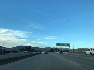
CA 118 east travels east through Oxnard Plain on Los Angeles Avenue with few features until Somis and CA 34. At Post Mile VEN 10.922 CA 118 east meets CA 34 on the outskirts of Somis.


CA 118 east of CA 34 on Los Angeles Avenue is presently signed as a Safety Corridor and runs alongside the northern flank of the rail road tracks. East of Balcom Canyon Road there is a truck weigh station along CA 118 eastbound.


CA 118 east traverses a railroad crossing at Post Mile VEN 14.115.


At Post Mile VEN 14.685 CA 118 east meets Grimes Canyon Road which serves as a short-cut to CA 23 north headed towards Fillmore.

At approximately Post Mile VEN 15.417 CA 118 east enters the City of Moorpark.


CA 118 east expands to four lanes on Los Angeles Avenue in Moor Park and picks up CA 23 south at Moorpark Avenue at Post Mile VEN R17.509.


CA 118 east/CA 23 south traverse east on Los Angeles Avenue to the Moorpark Freeway/Simi Valley Freeway interchange located approximately at Post Mile VEN T18.208. CA 23 south splits away from CA 118 on the Moorpark Freeway whereas CA 118 east heads towards Simi Valley on the Simi Valley Freeway.


CA 118 east on the Simi Valley Freeway crosses over the railroad tracks and meets Princeton Avenue at Exit 19A.


CA 118 east on the Simi Valley Freeway meets Collins Drive at Exit 19B.


East of Collins Drive the first "CA 118 Ronald Reagan Freeway" signage is seen.


CA 118 east enters the City of Simi Valley at approximately Post Mile VEN 21.268. At Exit 22 CA 118 east on the Simi Valley Freeway meets Madera Road. There is signage directing traffic towards the historic site of El Rancho Simi and the Ronald Reagan Presidential Library via Madera Road.


At Exit 23 CA 118 east on the Simi Valley Freeway meets First Street in Simi Valley.


At Exit 24 CA 118 east on the Simi Valley Freeway meets Erringer Road.


At Exit 25 CA 118 east on the Simi Valley Freeway meets Sycamore Drive.


At Exit 27 CA 118 east on the Simi Valley Freeway meets Tapo Canyon Road.


At Exit 28 CA 118 east on the Simi Valley Freeway meets Stearns Street and Yosemite Avenue at Exit 29.


CA 118 east begins to climb out of Simi Valley up hill to Santa Susana Pass which is roughly located at 1,200 feet above sea level. At Exit 30 CA 118 east meets Kuehner Drive and at Exit 32 meets Rocky Peak Road which accesses Santa Susana Pass Road. At Post Mile VEN R32.424 CA 118 east crosses over Santa Susana Pass, the Los Angeles County Line lies at approximately Post Mile VEN R32.600. CA 118 east begins to drop from Santa Susana Pass and descends into San Fernando Valley within the City of Los Angeles. Traffic headed towards Santa Susana State Historic Park is directed to take CA 27/Topanga Canyon Road located at Exit 34.


Santa Susana Pass is a historic low pass between the Simi Hills to the south and Santa Susana Mountains to the north. Most of Santa Susana Pass consists of sandstone rock formations which have heavily eroded with time. Santa Susana Pass was known to local tribes in California long before Spanish colonization of Las Californias. The Spanish first used Santa Susana Pass during the Portola Expedition on January 15th 1770. In the 1830s Santa Susana Pass became the path of a primitive wagon road which was used up to the American period. In the early American Period Santa Susana Pass was known as Simi Pass.
In 1859 the State of California appropriated $15,000 dollars to improve the wagon road over Santa Susana Pass. The Old Santa Susana Stage Road was built over Santa Susana Pass via the eastern ascent which was known as the Devil's Slide. The Old Santa Susana Stage Road primarily was used as a connector route between what was El Camino Real (which the name fell out of use well before American period) and the Stockton-Los Angeles Road near San Fernando. The Old Santa Susana Stage Road was a popular through route until the Southern Pacific Railroad built a tunnel through Newhall Pass in 1876.
In 1895 a new route over Santa Susana Pass known as the "El Camino Nuevo/The New Road" was constructed to replace the Devil's Slide. In 1904 the Southern Pacific completed a 7,369 foot long tunnel through Santa Susana Pass which is still in use by the Union Pacific. In 1917 Santa Susana Pass Road opened which was annexed into LRN 9 in 1933 and later became part of CA 118 in 1934.
At Exit 35 CA 118 east on the Simi Valley Freeway meets De Soto Avenue.

At Exit 36 CA 118 on the Simi Valley Freeway accesses Porter Ranch Drive.


CA 118 east on the Simi Valley Freeway enters the Northridge neighborhood and meets Tampa Avenue at Exit 37.


At Exit 38 CA 118 east accesses Reseda Boulevard.


CA 118 east on the Simi Valley enters the neighborhood of Grenada Hills and accesses Balboa Boulevard at Exit 40.


CA 118 east on the Simi Valley Freeway begins to approach I-405/San Diego Freeway and meets Woodly Avenue at Exit 41 just before the interchange. Exit 42A accesses I-405 north and south whereas Exit 42B accesses Sepulveda Boulevard.


CA 118 east on the Simi Valley Freeway approaches I-5/Golden State Freeway. Exit 44A accesses I-5 south and Exit 44B accesses Laurel Canyon Boulevard which is signed as access to I-5 north.


CA 118 east on the Simi Valley Freeway accesses San Fernando Road at Exit 44C.


CA 118 east on the Simi Valley Freeway accesses Glenoaks Boulevard via Exit 45 before terminating at I-210/Foothill Freeway. CA 118 east does have an "end" placard which is somewhat surprising at I-210. I turned west on I-210 to backtrack towards I-5 towards San Joaquin Valley.


CA 118 is a major 47 mile State Highway which begins in the City in Ventura County and traverses east into Los Angeles County by way of Simi Valley and Santa Susana Pass. From Santa Susana Pass CA 118 continues eastward through San Fernando Valley within the City of Los Angeles and terminates at Interstate 210. CA 118 contains within it's right-of-way some of the most historic highway corridors in California history.
The precursor route of CA 118 was Legislative Route Number 9 which was first added to the State Highway System during the First State Highway Bond Act of 1909. The original definition of LRN 9 was from San Bernardino westward to LRN 4 in San Fernando. LRN 9 was extended westward to LRN 2 near Montalvo (modern day Ventura) in 1933.
In a August 1934 Department of Public Works Guide the Signed State Highways were announced. CA 118 was announced to be aligned along LRN 9 from US 101/LRN 2 near El Rio via San Fernando to US 66/LRN 9 in Pasadena. CA 118 can be seen on a State Wide Map on Page 21 and the routing can be seen on Page 32.
1934 Department of Public Works Guide Page 21
1935 Department of Public Works Guide Page 32
The Signed State Highways functionally became effective at the advent of the New Year of 1935. The original surface alignment of CA 118 absorbed what was US 99 on LRN 9 between San Fernando and Pasadena. Originally US 99 had bypassed downtown Los Angeles in favor of using LRN 9 from San Fernando via the following route:
- From US 66 northwest on Foothill Boulevard (now Altendena Drive) to Altendena.
- From Altendena south via Fair Oaks Boulevard to Montana Street.
- West on Montana Street to Michigan Avenue (now Foothill Boulevard).
- Northwest on Michigan Avenue (now Foothill Boulevard) to San Fernando and Maclay Avenue.
- West on Maclay Avenue to San Fernando Road/LRN 4.
The original route of US 99 between Pasadena and San Fernando can be partially seen on the 1930 State Highway Map City Insert.
1930 State Highway Map City Insert
US 99 was still appears to be present on it's original alignment in early 1934 as evidenced by the State Highway Map City Insert from the same year.
1934 State Highway Map City Insert
1933 was a landmark year in terms of State wide transportation and a key reason US 99 was moved off LRN 9 between San Fernando and Pasadena onto LRN 4 into Los Angeles. The State Legislature removed restrictions that prevented State Funds from being used to maintain urban roadways. This change by the Legislature led to the addition of numerous urban highways being adopted including the extension of LRN 9 to Ventura.
The shift of US 99 into Los Angeles via LRN 4 likely occurred in early 1935. Much of the shift of US 99 into downtown Los Angeles was documented previously on the Arroyo Seco Parkway blog.
The Arroyo Seco Parkway and early US 66 terminus points in downtown Los Angeles
The route of early CA 118 between Pasadena and San Fernando can be seen on this 1935 Goshua Highway Map of Los Angeles. The 1935 Goshua Highway Map shows all the roadways described above between Pasadena and Los Angeles signed as Foothill Boulevard. The alignment of CA 118 appears to take a simplified route from US 66/LRN 9 on Colorado Street up Fair Oaks Boulevard and Lincoln Avenue to Foothill Boulevard on a bypass of Altendena.
1935 Goshua Highway Map of Los Angeles
The above alignment of CA 118 beginning at Colorado Street and Fair Oaks Boulevard seems to be confirmed on the 1935 Division of Highways Map of Los Angeles County.
1935 Los Angeles County Highway Map
The remaining initial surface alignment of CA 118 west from San Fernando is well documented by CAhighways.org:
- West from US 99/LRN 4 on San Fernando Road co-signed with CA 7 onto Brand Boulevard.
- West on Brand Boulevard to Sepulveda Boulevard south.
- South on Sepulveda Boulevard where CA 118 split from CA 7 at Devonshire Street.
- Devonshire Street west to Topanga Canyon Avenue. Topanga Canyon Avenue north to Susana Pass Road.
- West on Susana Pass Road over Susana Pass into Ventura County.
- Susana Pass Road west to Kuehner Drive.
- North of Kuehner Drive to Los Angeles Avenue.
- West on Los Angeles Avenue through Simi Valley to Madera Road.
- Madera Road north to Los Angeles Avenue.
- Los Angeles Avenue west to Princeton Avenue in Moorpark.
- Princeton Avenue and High Street in Moorpark to Moorpark Road.
- Moorpark Road south to Los Angeles Avenue.
- West on Los Angeles Avenue through Somis to Saticoy.
- Saticoy west on Wells Road to to CA 126/LRN 79 at Telegraph Road.
The CA 118 page can be found below.
CAhighways.org on CA 118
The original surface alignment of CA 118 in Ventura County can be viewed on the 1935 Division of Highways Map below.
1935 Ventura County Highway Map
In December of 1940 the Arroyo Seco Parkway was completed which led to US 66 being realigned. The shift in US 66 appears to have extended CA 134 east on Colorado Street past the eastern terminus of CA 118 on Fair Oaks Boulevard.
1940 State Highway Map City Insert
According to CAhighways.org in 1957 part a small part of CA 118 between Gould Avenue in La Canada Flintridge and Montana Avenue in Pasadena was completed to freeway standards. This new segment of freeway can be seen on the 1958 State Highway Map and was later bypassed by I-210 on the Foothill Freeway when it was built over the Arroyo Seco in 1974.
1958 State Highway Map
CA 118 essentially went through the 1964 California State Highway Renumbering unchanged in regards to field signage. That said, the route of CA 118 was slated to undergo massive changes starting with the 1964 State Highway Renumbering. CA 118 between Pasadena and San Fernando was assigned LRN 210 in anticipation I-210/Foothill Freeway being built eastward towards I-10. CA 118 itself was legislatively extended from San Fernando through the San Gabriel Mountains via Big Tujunga Canyon on what had been defined as LRN 266 in 1963 to the planned CA 249. All changes relating to CA 118 during the California State Highway Renumbering can be observed by comparing the 1963 State Highway Map to the 1964 Edition.
1963 State Highway Map
1963 State Highway Map City Insert
1964 State Highway Map
1964 State Highway Map City Insert
According to CAhighways.org the route of what would be become the CA 118/San Fernando-Simi Valley Freeway (Simi Valley Freeway) was adopted in July of 1964. The extension of the Simi Valley Freeway was approved later in 1964 west to Saticoy. The planned route of the CA 118/Simi Valley Freeway first appears on the 1965 State Highway Map west of the planned corridor of the I-210/Foothill Freeway.
1965 State Highway Map
Construction of the Simi Valley Freeway began in 1968. The 1969 State Highway Map shows the Simi Valley Freeway completed from the Chatsworth neighborhood of Los Angeles west of Santa Susana Pass towards Simi Valley.
1969 State Highway Map
1969 State Highway Map City Insert
The 1970 State Highway Map shows the Simi Valley Freeway completed west to Simi Valley.
1970 State HIghway Map
The 1979 State Highway Map City Insert shows the Simi Valley Freeway completed between Balboa Boulevard east to I-210. CA 118 and I-210 are shown to be co-signed on the incomplete Foothill Freeway east to Pasadena.
1979 State Highway Map City Insert
The 1981 State Highway Map City Insert shows CA 118 truncated to an east terminus at I-210 on the Foothill Freeway near San Fernando.
1981 State Highway Map City Insert
The 1982 State Highway Map shows the Simi Valley Freeway completed from I-210 west to Simi Valley.
1982 State Highway Map
It appears that CA 118 on the Simi Valley Freeway was extended to CA 23/Moorpark Freeway reported by 1993 (citation to John Corbett for confirming this on the Gribblenation Facebook page). Much of the Simi Valley Freeway from CA 23 (Post Mile VEN T18.238 to LA R13.933) east into Los Angeles was re-designated as the Ronald Reagan Freeway (Note; I'll still be referring to it as the Simi Valley Freeway the remainder of this blog) in late 1994.
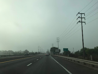
My approach to CA 118 eastbound was from CA 126 eastbound on the Santa Paula Freeway in Ventura County. I pulled off Exit 5 onto CA 118 east on Wells Road in the eastern City Limits of Ventura.


At Post Mile VEN R1.017 CA 118 east enters Saticoy at Telephone Road. Saticoy was settled in the 1860s and was granted a Post Office by 1873. Saticoy eventually became a rail siding of the Southern Pacific Railroad in 1887 when a new line between Santa Barbara and Saugus opened.

CA 118 east crosses the presently Union Pacific Line in Saticoy at Post Mile VEN R1.207. Wells Road becomes Los Angeles Avenue at the Santa Clara River. From the Santa Clara River CA 118 east is signed as 16 miles from Moorpark, 26 miles from Simi Valley and 47 miles from San Fernando.


At Post Mile VEN 2.208 CA 118 east meets CA 232 at Vineland Avenue.


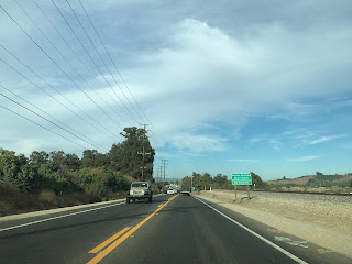
CA 118 east travels east through Oxnard Plain on Los Angeles Avenue with few features until Somis and CA 34. At Post Mile VEN 10.922 CA 118 east meets CA 34 on the outskirts of Somis.


CA 118 east of CA 34 on Los Angeles Avenue is presently signed as a Safety Corridor and runs alongside the northern flank of the rail road tracks. East of Balcom Canyon Road there is a truck weigh station along CA 118 eastbound.


CA 118 east traverses a railroad crossing at Post Mile VEN 14.115.


At Post Mile VEN 14.685 CA 118 east meets Grimes Canyon Road which serves as a short-cut to CA 23 north headed towards Fillmore.

At approximately Post Mile VEN 15.417 CA 118 east enters the City of Moorpark.


CA 118 east expands to four lanes on Los Angeles Avenue in Moor Park and picks up CA 23 south at Moorpark Avenue at Post Mile VEN R17.509.


CA 118 east/CA 23 south traverse east on Los Angeles Avenue to the Moorpark Freeway/Simi Valley Freeway interchange located approximately at Post Mile VEN T18.208. CA 23 south splits away from CA 118 on the Moorpark Freeway whereas CA 118 east heads towards Simi Valley on the Simi Valley Freeway.


CA 118 east on the Simi Valley Freeway crosses over the railroad tracks and meets Princeton Avenue at Exit 19A.


CA 118 east on the Simi Valley Freeway meets Collins Drive at Exit 19B.


East of Collins Drive the first "CA 118 Ronald Reagan Freeway" signage is seen.


CA 118 east enters the City of Simi Valley at approximately Post Mile VEN 21.268. At Exit 22 CA 118 east on the Simi Valley Freeway meets Madera Road. There is signage directing traffic towards the historic site of El Rancho Simi and the Ronald Reagan Presidential Library via Madera Road.


At Exit 23 CA 118 east on the Simi Valley Freeway meets First Street in Simi Valley.


At Exit 24 CA 118 east on the Simi Valley Freeway meets Erringer Road.


At Exit 25 CA 118 east on the Simi Valley Freeway meets Sycamore Drive.


At Exit 27 CA 118 east on the Simi Valley Freeway meets Tapo Canyon Road.


At Exit 28 CA 118 east on the Simi Valley Freeway meets Stearns Street and Yosemite Avenue at Exit 29.


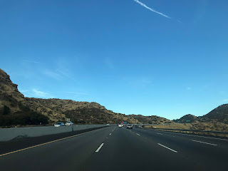
CA 118 east begins to climb out of Simi Valley up hill to Santa Susana Pass which is roughly located at 1,200 feet above sea level. At Exit 30 CA 118 east meets Kuehner Drive and at Exit 32 meets Rocky Peak Road which accesses Santa Susana Pass Road. At Post Mile VEN R32.424 CA 118 east crosses over Santa Susana Pass, the Los Angeles County Line lies at approximately Post Mile VEN R32.600. CA 118 east begins to drop from Santa Susana Pass and descends into San Fernando Valley within the City of Los Angeles. Traffic headed towards Santa Susana State Historic Park is directed to take CA 27/Topanga Canyon Road located at Exit 34.


Santa Susana Pass is a historic low pass between the Simi Hills to the south and Santa Susana Mountains to the north. Most of Santa Susana Pass consists of sandstone rock formations which have heavily eroded with time. Santa Susana Pass was known to local tribes in California long before Spanish colonization of Las Californias. The Spanish first used Santa Susana Pass during the Portola Expedition on January 15th 1770. In the 1830s Santa Susana Pass became the path of a primitive wagon road which was used up to the American period. In the early American Period Santa Susana Pass was known as Simi Pass.
In 1859 the State of California appropriated $15,000 dollars to improve the wagon road over Santa Susana Pass. The Old Santa Susana Stage Road was built over Santa Susana Pass via the eastern ascent which was known as the Devil's Slide. The Old Santa Susana Stage Road primarily was used as a connector route between what was El Camino Real (which the name fell out of use well before American period) and the Stockton-Los Angeles Road near San Fernando. The Old Santa Susana Stage Road was a popular through route until the Southern Pacific Railroad built a tunnel through Newhall Pass in 1876.
In 1895 a new route over Santa Susana Pass known as the "El Camino Nuevo/The New Road" was constructed to replace the Devil's Slide. In 1904 the Southern Pacific completed a 7,369 foot long tunnel through Santa Susana Pass which is still in use by the Union Pacific. In 1917 Santa Susana Pass Road opened which was annexed into LRN 9 in 1933 and later became part of CA 118 in 1934.
At Exit 35 CA 118 east on the Simi Valley Freeway meets De Soto Avenue.


At Exit 36 CA 118 on the Simi Valley Freeway accesses Porter Ranch Drive.


CA 118 east on the Simi Valley Freeway enters the Northridge neighborhood and meets Tampa Avenue at Exit 37.


At Exit 38 CA 118 east accesses Reseda Boulevard.


CA 118 east on the Simi Valley enters the neighborhood of Grenada Hills and accesses Balboa Boulevard at Exit 40.


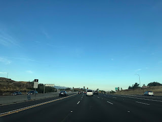
CA 118 east on the Simi Valley Freeway begins to approach I-405/San Diego Freeway and meets Woodly Avenue at Exit 41 just before the interchange. Exit 42A accesses I-405 north and south whereas Exit 42B accesses Sepulveda Boulevard.


CA 118 east on the Simi Valley Freeway approaches I-5/Golden State Freeway. Exit 44A accesses I-5 south and Exit 44B accesses Laurel Canyon Boulevard which is signed as access to I-5 north.


CA 118 east on the Simi Valley Freeway accesses San Fernando Road at Exit 44C.


CA 118 east on the Simi Valley Freeway accesses Glenoaks Boulevard via Exit 45 before terminating at I-210/Foothill Freeway. CA 118 east does have an "end" placard which is somewhat surprising at I-210. I turned west on I-210 to backtrack towards I-5 towards San Joaquin Valley.


Comments