Recently I had the opportunity to drive a large section of Interstate 5 from California State Route 54 in southern San Diego north to California State Route 99 in Wheeler Ridge in Kern County.

Interstate 5 in California is the second longest highway in the State at 796 miles. I-5 in California spans from the Mexican border in the southern City Limits of San Diego north to the Oregon State Line in Siskiyou County. Given that I-5 has such substantial length I thought it would be best to divide any blogs featuring it up into 150-200 mile segments. The first segment of the I-5 series in California as noted above traverses through much of the San Diego and Los Angeles Metro Areas to San Joaquin Valley over the Grapevine Grade. Much of this segment of I-5 was built over corridors once occupied by US 101, US 99 and US 6. For simplicity sake my intent it mainly to focus on the route of I-5 and the history of the construction of the freeway segments it occupies.
CAhighways.org has a substantial piece on the history of I-5. During draft of the first Interstate Highway plan in 1947 the route of what would become I-5 was largely approved in Southern California along the corridor it presently occupies. Interestingly when the second Interstate Highway plan was being finalized the route of I-5 was proposed to signed as I-11. Apparently the California Division of Highways wanted to use I-3/I-5 in the San Francisco Bay Area and I-7/I-9 in the San Francisco Bay Area.
CAhighways.org on Interstate 5
I-5 from the Mexican Border north to Wheeler Ridge utilizes the following freeway segments:
- The Montgomery Freeway from the Mexican Border to downtown San Diego at CA 94.
- The San Diego Freeway north to I-405.
- The Santa Ana Freeway from I-405 to the Boyle Heights neighborhood of Los Angeles to US 101.
- The Golden State Freeway from US 101 north to CA 99 in Wheeler Ridge in San Joaquin Valley.
The Montgomery Freeway was planned as part of Legislative Route Number 2 which would carry US 101. The Montgomery Freeway is named after John Joseph Montgomery of Yuba City who was a renown for the invention of the fixed winged glider. The planned path of what ultimately would become the alignment of the Montgomery Freeway appears first on the 1950 State Highway Map City Insert heading north from the Mexican Border to 8th Street in National City.
1950 State Highway Map City Insert
On the 1953 State Highway Map City Insert US 101/LRN 2 is shown moved onto Bay Boulevard from National City south to CA 75 in Imperial Beach.
1953 State Highway Map City Insert
On the 1955 State Highway Map City Insert US 101/LRN 2 is shown moved to a new alignment identical to modern I-5 south of CA 75 in Imperial Beach to the Mexican Border.
1955 State Highway Map City Insert
On the 1958 State Highway Map US 101/LRN 2 is shown as the Montgomery Freeway from the Mexican Border north to National City.
1958 State Highway Map City Insert
The planned route of the Montgomery Freeway north to CA 94 along with the planned route of LRN 2 on the San Diego Freeway in downtown San Diego appears on the 1960 State Highway Map City Insert.
1960 State Highway Map City Insert
The planned route of the San Diego Freeway on LRN 2 appears north of LRN 279 and La Jolla appears on the 1961 State Highway Map City Insert.
1961 State Highway Map City Insert
In 1964 the State Highway Renumbering occurred and Legislative Route Numbers were changed to match the highway they would ultimately be signed as. LRN 2 is shown replaced with LRN 5 to match the future Interstate designation on the 1964 State Highway Map City Insert. I-5 and US 101 are shown multiplexed on the completed section of Montgomery Freeway. Much of the San Diego Freeway in downtown San Diego is shown as completed.
1964 State Highway Map City Insert
On the 1965 State Highway Map City Insert I-5/US 101 are shown connecting to San Diego via the completed Montgomery Freeway. The San Diego Freeway is shown completed north of downtown San Diego to Laurel Street.
1965 State Highway Map City Insert
The 1967 State Highway Map City Insert shows US 101 truncated out of the San Diego Area in favor of I-5. The San Diego Freeway is shown almost fully completed towards Camp Pendleton aside from a segment from Laurel Street north to Mission Bay.
1967 State Highway Map City Insert
The 1969 State Highway Map City Insert shows all of I-5 on the San Diego Freeway complete aside from the interchange with I-8/CA 109.
1969 State Highway Map City Insert
The 1970 State Highway Map shows the route of I-5 on the San Diego Freeway completed.
1970 State Highway Map City Insert
The Santa Ana Freeway between Santa Ana and downtown Los Angeles was constructed between 1947 and 1956 as part of US 101. The Santa Ana Freeway was decidedly more complex consisting of various Legislative Route Numbers. On the 1948 State Highway Map City Insert the planned segments of the Santa Freeway appear south of downtown Los Angeles on LRN 2, LRN 166 and LRN 174. The future route of the Golden State Freeway north of downtown Los Angeles to Burbank is shown planned as LRN 161.
1948 State Highway Map City Insert
A segment of the Santa Ana Freeway south of downtown Los Angeles is shown complete on the 1949 State Highway Map City Insert.
1949 State Highway Map City Insert
The 1950 State Highway Map City Insert shows the Santa Ana Freeway completed almost to Olympic south of downtown Los Angeles.
1950 State Highway Map City Insert
The 1953 State Highway Map shows the Santa Ana Freeway signed as US 101 Bypass and completed to CA 19 on Rosemead Boulevard.
1953 State Highway Map City Insert
Part of the planned route of the Santa Ana Freeway between CA 55/LRN 43 and LRN 184 appears on the 1953 State Highway Map.
1953 State Highway Map
The 1954 State Highway Map City Insert shows US 101 removed from it's original routing on LRN 2 and shifted to the new Santa Ana Freeway. The same map shows the Santa Ana almost complete to CA 10 on LRN 174.
1954 State Highway Map City Insert
Much of the Santa Ana Freeway between CA 10 and CA 55 is shown completed on the 1954 State Highway Map.
1954 State Highway Map
The 1955 State Highway Map City Insert shows the Santa Ana Freeway connecting to LRN 174.
1955 State Highway Map City Insert
The 1956 State Highway Map City Insert shows US 101 south of downtown Los Angeles as running on the Santa Ana Freeway.
1956 State Highway Map City Insert
The planned route of the Golden State Freeway is shown extended towards San Fernando on the 1958 State Highway Map City Insert.
1958 State Highway Map City Insert
The 1959 State Highway Map shows the Santa Ana Freeway completed to El Toro just south of the future junction with I-405.
1959 State Highway Map
A segment of the Golden State Freeway south of CA 134/Colorado Boulevard is shown complete on the 1960 State Highway Map City Insert.
1960 State Highway Map City Insert
The Golden State Freeway is shown completed between US 101 on the Santa Freeway and the Arroyo Seco Parkway in the 1961 State Highway Map City Insert. US 99 is still shown taking the Arroyo Seco Parkway to reach US 101.
1961 State Highway Map City Insert
The Golden State Freeway is shown complete between Los Feliz Boulevard to LRN 159 on Lankershim Boulevard on the 1962 State Highway Map City Insert. US 6/99 are shown partially moved to the Golden State Freeway.
1962 State Highway Map City Insert
On the 1963 State Highway Map City the Golden State Freeway is shown completed between US 101/Santa Ana Freeway and LRN 159. US 99 is shown meeting US 101 along the Golden State Freeway.
1963 State Highway Map City Insert
The 1964 State Highway Map shows I-5 multiplexed with US 99 on the Golden State Freeway in downtown Los Angeles and US 101 south of it on the Santa Ana Freeway. US 99 is shown truncated to the junction of the Golden State Freeway at the Santa Ana Freeway. US 6 is shown truncated out of the Los Angeles Area completely.
1964 State Highway Map City Insert
The 1964 State Highway Map shows the Golden State Freeway completed to San Fernando as co-signed US 99/I-5. US 6 is shown truncated all the way to Bishop.
1964 State Highway Map
The 1967 State Highway Map shows US 101 truncated to I-105 (which would become US 101 again by 1968) and CA 110. US 99 is shown truncated out of the Los Angeles Area completely. I-5 is shown signed on the Santa Freeway and Golden State Freeway.
1967 State Highway Map City Insert
The remainder of the route of I-5 covered in this blog is the Golden State Freeway over the Grapevine Grade to San Joaquin Valley. The corridor occupied by the Grapevine Grade is essentially the same corridor as some of California's most historic highways; El Camino Viejo, the Stockton-Los Angeles Road, Old Ridge Route and Ridge Route Alternate. Rather than rehash the substantial histories of all the aforementioned highways I'll simply post a link to my previous blog covering all of them.
Legend of the Ridge Route; a history of crossing mountains between the Los Angeles Basin and San Joaquin Valley from wagon trails to Interstates
With all the above history of I-5 for the San Diego and Los Angeles Areas out of the way, onto the drive. My approach to I-5 north on the Montgomery Freeway was from CA 54 west in National City in San Diego County. CA 54 west meets I-5 along the Sweet Water River.


I-5 north crosses through National City before entering San Diego just past Division Street. At Exit 13A I-5 north meets CA 15 which is effectively is the southern connecting segment of I-15.


At Exit 14A I-5 north meets CA 75. CA 75 connects to Coronado via the San Diego-Coronado Bridge.


Approaching downtown San Diego I-5 north meets CA 94 at Exit 15A. Beyond the interchange with CA 94 the route of the Montgomery Freeway ends and the San Diego Freeway begins.


At Exit 16A I-5 north meets former US 395/80 on CA 163/Cabrillo Freeway.


I-5 north traffic is directed to take Exit 17A onto Hawthorne Street to access San Diego International Airport.


Landings at San Diego International Airport take flight paths often very close to I-5. Suffice to say there is an opportunity for a cool photo of a plane landing now and then.

At Exit 18A I-5 north meets former US 101 on Pacific Highway.


At Exit 19 I-5 north traffic is advised it can access Old Town San Diego via Old Town Avenue. Old Town San Diego is the original downtown area of the City before it was moved to the south.


At Exit 20 I-5 north meets I-8 and crosses over former CA 209 on Camino del Rio. I-8 west of I-5 used to part of the original CA 109.


At Exit 21 I-5 north meets Sea World Boulevard which accesses the attraction of the same name.

I-5 Exit 22 accesses Mission Bay Boulevard. Mission Bay Boulevard is aligned on the eastern shore of Mission Bay.


I-5 north snakes through canyons north of Mission Bay and meets CA 52 at Exit 26B.


I-5 north approaches I-805 and CA 56 but doesn't directly access either of them. I-5 north doesn't have a ramp directly accessing I-805. CA 56 traffic is directed to take the I-5 local bypass route to access the highway via Exit 33A.


I-5 north crosses San Dieguito Lagoon and enters Solana Beach. At Exit 36 I-5 north meets Signed County Route S6 at Via de la Valle.


At Exit 37 I-5 north meets Signed County Route S8 at Lomas Santa Fe Drive.


I-5 north crosses San Elijo Lagoon into Encinitas.

At Exit 42 I-5 north meets Signed County Route S9 on Encinitas Boulevard.

I-5 north crosses Batiquitos Lagoon into Carlsbad.

At Exit 47 I-5 north meets Signed County Route S12 at Palomar Airport Road.


Access to Legoland from I-5 north is signed via Exit 48.

I-5 north crosses Buena Vista Lagoon into Oceanside. At Exit 51B I-5 north meets CA 78.


I-5 north meets CA 76 and Signed County Route S21 (former US 101) in Oceanside at Exit 54A.


North of Oceanside I-5 north enters Marine Corps Air Station Camp Pendleton.


I-5 in Camp Pendleton essentially runs along the coast line and contains a Rest Area.


The ocean can be seen off in the distance from the northbound rest area of I-5.


I-5 and US 101 south of Los Angeles before it more or less followed the general path of El Camino Real. El Camino Real was a Spanish roadway connecting all the Catholic Missions of the Californian Coast (which includes Baja California and Baja California Sur) north to San Francisco Bay. Travel on El Camino Viejo was promoted by the Spanish starting in 1769. The name largely fell out of use by the Mexican period in Californian history but was picked up as an early example of an Auto Trail by 1906. El Camino Real was marked by bells which were replicated in the early 20th Century. I'm not sure of the vintage but the rest area on I-5 north does have El Camino Real bell.


There are informational stations which discuss the history of the Spanish Catholic Missions at both the north and south I-5 rest areas.

I-5 north continues along the coast through a largely undeveloped Camp Pendleton. I-5 north has a weigh station and passes by the San Onofre Nuclear Power Plant which can be seen next to the southbound lanes. San Onofre State Beach is signed as being accessible from I-5 Exit 71. North of San Onofre and Exit 71 I-5 north enters Orange County and San Clemente.


At I-5 north Exit 74 accesses former US 101 on El Camino Real.


In Dana Point I-5 north meets the southern terminus of CA 1 and splits away from the coast at Exit 79.


I-5 north enters San Juan Capistrano and meets CA 74 at Exit 82.


I-5 north enters Mission Viejo and meets CA 73 at Exit 85A. CA 73 recently has been converted to fully electronic tolling.


I-5 north enters Lake Forest and meets Signed County Route S18 at Exit 91 at El Toro Road.


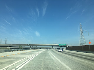
I-5 north enters the City of Irvine and meets I-405 at Exit 94A. The San Diego Freeway splits away onto I-405 and I-5 enters the Santa Ana Freeway.


I-5 north quickly meets CA 133 at Exit 95 in Irvine.


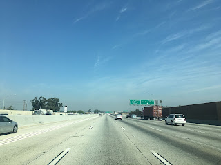
I-5 Exit 100 connects to CA 261 via Jamboree Road.


I-5 north enters Tustin and meets at CA 55 at Exit 103 A/B.


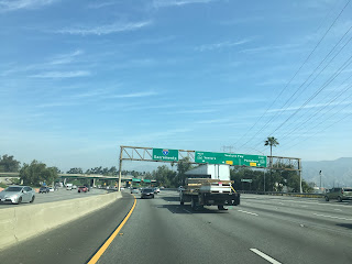
I-5 north enters Santa Ana and meets CA 22 at Exit 106. At Exit 107A I-5 north meets CA 57.


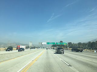
I-5 passes briefly through Orange north CA 22/CA 57 before entering Anaheim. At Exit 113C I-5 north has a junction with CA 91 west whereas CA 91 is accessed via Exit 114.


I-5 north meets CA 39 on Beach Boulevard in Buena Park.


North of CA 39 the route of I-5 enters Los Angeles County. I-5 north passes through La Mirada and Norwalk before meeting I-605 at Exit 124 in Santa Fe Springs.


I-5 north enters Downey and meets CA 19 at Exit 124 for Rosemead Boulevard.


I-5 north passes through Montebello and enters Commerce where it meets I-710 at the City Limits of East Los Angeles.


I-5 north passes briefly through East Los Angeles before entering the City Limits of Los Angeles.


I-5 north meets US 101 north and I-10 west on the outskirts of downtown Los Angeles. The Santa Ana Freeway ends at US 101 and I-5 north moves to the Golden State Freeway.


I-5 north on the Golden State Freeway merges onto a multiplex of I-10 east.


I-10 east quickly leaves I-5 north and exits the Golden State Freeway.


I-5 north on the Golden State Freeway skirts the eastern side of downtown Los Angeles.

At Exit 136A I-5 north accesses Main Street.

I-5 north meets CA 110/Arroyo Seco Parkway at Exit 137B and Figuroa Street at Exit 137A. Both the Arroyo Seco Parkway and Figuroa Street are former alignments of US Route 66.


I-5 north of CA 110 crosses the Los Angeles River and begins to follow it's western bank. At Exit 138 I-5 north meets CA 2 on the Glendale Freeway.


At Exit 140 I-5 north accesses Glendale Boulevard.


Suffice to say the underpass of Hyperion Avenue has the classic Los Angeles Area bridge look to it.

I-5 north has access to Griffith Park Drive at Exit 141B.

At Exit 142 I-5 north meets Colorado Boulevard. Interestingly Colorado Boulevard used to carry CA 134 on the east bank of the Los Angeles River where it would have met US 6/99 on San Fernando Road.

I-5 north meets CA 134 on the Ventura Freeway at Exits 144 A/B.


I-5 north crosses the Los Angeles River into Glendale. I-5 briefly crosses through Glendale and Burbank before entering the northern extent of Los Angeles. Near Sheldon Street I-5 north crosses under the north terminus of CA 170. I-5 north doesn't have access to CA 170 south.


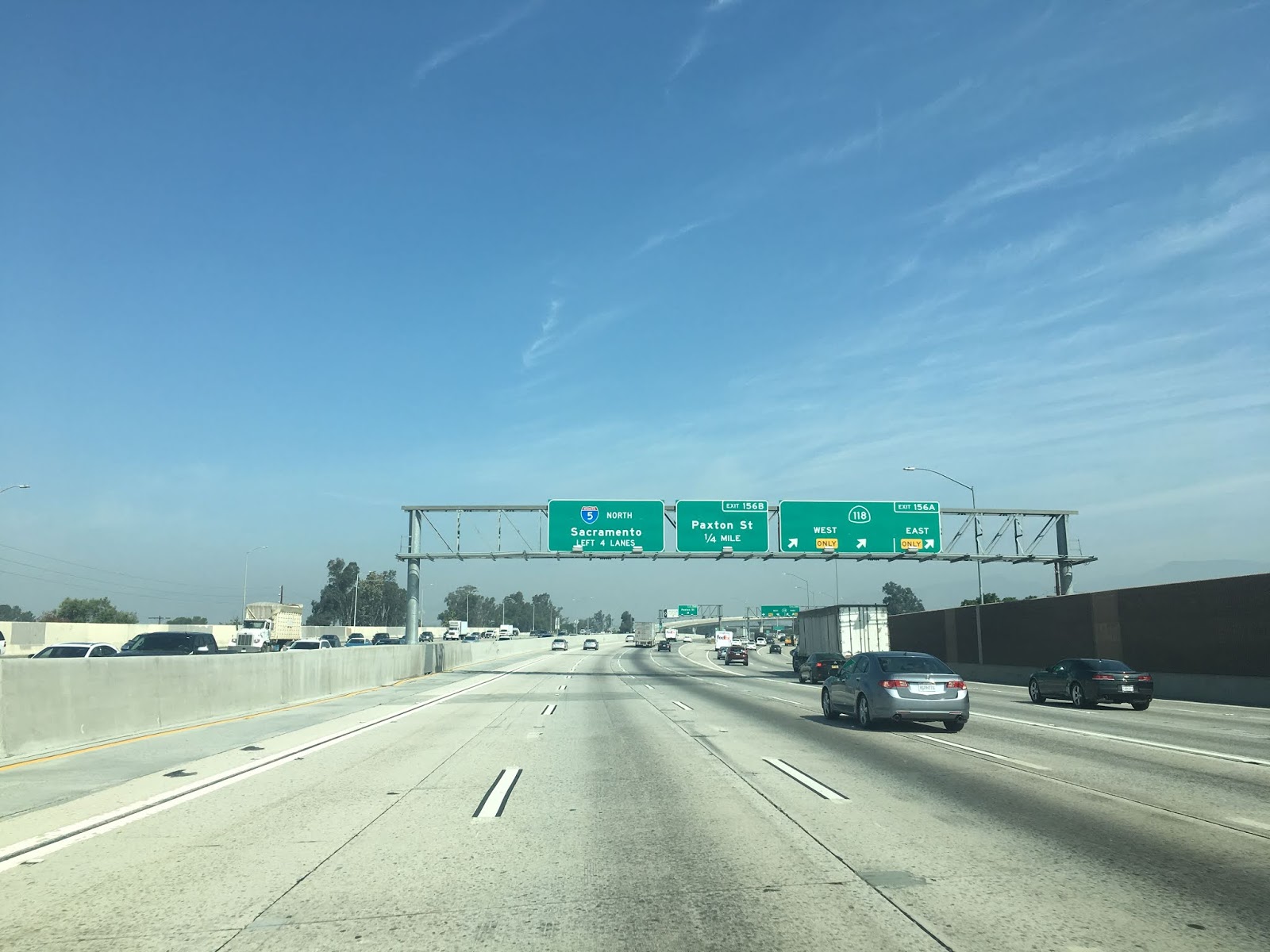
At Exit 156A I-5 north meets CA 118.


North of San Fernando Mission Boulevard I-5 north merges in with traffic from I-405. I-5 north doesn't have access to I-405 south.


At Exit 161 I-5 meets I-210.


I-5 north crosses over former US 6/99 on San Fernando Road and reaches the northern limit of Los Angeles at the junction for CA 14/Sierra Freeway.


I-5 north begins to ascend in elevation entering Santa Clarita. I-5 north crosses over various old alignments of US 99 on Old Road and Magic Mountain Parkway before crossing the Santa Clara River. Just south of CA 126 there is a weigh station for I-5 northbound traffic. At Exit 172 I-5 north meets CA 126 and it's relinquished alignment on Newhall Ranch Road. This is a good place in this blog to refer back to the "Legend of the Ridge Route" blog I linked above.


I-5 north of CA 126 begins to ascend into the Sierra Pelona Mountains on the Grapevine Grade. In Castaic at Exit 176A and Exit 176B I-5 north provides access to former US 99 on the Old Ridge Route via Parker Road in addition to Lake Hughes Road.


I-5 north on the Grapevine Grade partially follows a later alignment of US 99 on Ridge Route Alternate. I-5 north follows the alignment of Ridge Route Alternate and crosses under it's southbound lanes.


I-5 north traffic is advised to shut their air conditioner off for the ensuing 6 mile climb uphill.

I-5 north uses the grade of Ridge Route Alternate and quickly ascends to over 2,000 feet in elevation. Near the boundary of Angeles National Forest I-5 north crosses back over it's southbound lanes.


I-5 north splits from the grade of Ridge Route Alternate at Templin Highway. Ridge Route Alternate still is a road which can be traversed to the mouth of Piru Gorge and is signed as Golden State Highway. Some of Ridge Route Alternate has been converted into a trail which ends at the foot of Pyramid Dam.


I-5 north continues to ascend the Sierra Pelona Mountains. To west is the alignment of Ridge Route Alternate through Pyramid Lake which emerges via Pyramid Lake Road. The Old Ridge Route can be seen in places to the east of I-5. Pyramid Lake Road can be accessed via Exit 195 from Smokey Bear Road.


North of Smokey Bear Road I-5 leaves Angeles National Forest.

I-5 north follows the grade of Ridge Route Alternate over 3,000 feet in elevation and meets CA 138.


I-5 north continues to follow the grade of Ridge Route Alternate to Gorman at Exit 202. From Gorman the alignment of Ridge Route Alternate generally follows I-5 mostly to the west until Lebec. The alignment of Old Ridge Route is largely bisected by I-5 northward through Grapevine Canyon but has remaining concrete segments on both sides of the freeway. Again, I would recommend consulting the "Legend of the Ridge Route" blog for more specifics on the alignments of Ridge Route Alternate and Old Ridge Route.


I-5 north ascends to the 4,144 Tejon Pass. The current Tejon Pass was once known as Fort Tejon Pass and really wasn't used much until the Stockton-Los Angeles Road was well established in early American California. Old Tejon Pass in the Tehachapi Mountains to the east and connects directly to Antelope Valley via higher elevations. The precursor route to all modern highways between the Los Angeles Basin and San Joaquin Valley is El Camino Viejo. El Camino Viejo split west through the San Emigdio Mountains and emerged into San Joaquin Valley via Cuddy Canyon. In the fourth photo below the San Emigdio Mountains can be seen on the left, the mouth of Grapevine Canyon in the center and Tehachapi Mountains to the right.


North of Exit 205 on Frazier Mountain Park Road in Lebec I-5 enters Kern County at the mouth of Grapevine Canyon.


Traffic on I-5 north entering Grapevine Canyon is advised of high winds for the next 27 miles. Almost immediately after the advisory sign is the last I-5 northbound rest area until San Joaquin Valley.


Grapevine Canyon begins to narrow as I-5 north approaches Fort Tejon State Park at Exit


I-5 north descends rapidly through Grapevine Canyon and offers some of the best views found on a freeway grade in California. The Old Ridge Route can occasionally be spotted on the descent and is very obvious between the travel lanes of I-5 in Grapevine approaching Exit 215. I-5 through Grapevine Canyon is often referred to as "The Grapevine."


I-5 north emerges into San Joaquin Valley and meets CA 99 (former US 99) in Wheeler Ridge. The Golden State Freeway continues onto CA 99 towards Sacramento whereas I-5 splits away onto the West Side Freeway. Part two of this series will cover the West Side Freeway alignment of I-5 north to CA 152.


Interstate 5 in California is the second longest highway in the State at 796 miles. I-5 in California spans from the Mexican border in the southern City Limits of San Diego north to the Oregon State Line in Siskiyou County. Given that I-5 has such substantial length I thought it would be best to divide any blogs featuring it up into 150-200 mile segments. The first segment of the I-5 series in California as noted above traverses through much of the San Diego and Los Angeles Metro Areas to San Joaquin Valley over the Grapevine Grade. Much of this segment of I-5 was built over corridors once occupied by US 101, US 99 and US 6. For simplicity sake my intent it mainly to focus on the route of I-5 and the history of the construction of the freeway segments it occupies.
CAhighways.org has a substantial piece on the history of I-5. During draft of the first Interstate Highway plan in 1947 the route of what would become I-5 was largely approved in Southern California along the corridor it presently occupies. Interestingly when the second Interstate Highway plan was being finalized the route of I-5 was proposed to signed as I-11. Apparently the California Division of Highways wanted to use I-3/I-5 in the San Francisco Bay Area and I-7/I-9 in the San Francisco Bay Area.
CAhighways.org on Interstate 5
I-5 from the Mexican Border north to Wheeler Ridge utilizes the following freeway segments:
- The Montgomery Freeway from the Mexican Border to downtown San Diego at CA 94.
- The San Diego Freeway north to I-405.
- The Santa Ana Freeway from I-405 to the Boyle Heights neighborhood of Los Angeles to US 101.
- The Golden State Freeway from US 101 north to CA 99 in Wheeler Ridge in San Joaquin Valley.
The Montgomery Freeway was planned as part of Legislative Route Number 2 which would carry US 101. The Montgomery Freeway is named after John Joseph Montgomery of Yuba City who was a renown for the invention of the fixed winged glider. The planned path of what ultimately would become the alignment of the Montgomery Freeway appears first on the 1950 State Highway Map City Insert heading north from the Mexican Border to 8th Street in National City.
1950 State Highway Map City Insert
On the 1953 State Highway Map City Insert US 101/LRN 2 is shown moved onto Bay Boulevard from National City south to CA 75 in Imperial Beach.
1953 State Highway Map City Insert
On the 1955 State Highway Map City Insert US 101/LRN 2 is shown moved to a new alignment identical to modern I-5 south of CA 75 in Imperial Beach to the Mexican Border.
1955 State Highway Map City Insert
On the 1958 State Highway Map US 101/LRN 2 is shown as the Montgomery Freeway from the Mexican Border north to National City.
1958 State Highway Map City Insert
The planned route of the Montgomery Freeway north to CA 94 along with the planned route of LRN 2 on the San Diego Freeway in downtown San Diego appears on the 1960 State Highway Map City Insert.
1960 State Highway Map City Insert
The planned route of the San Diego Freeway on LRN 2 appears north of LRN 279 and La Jolla appears on the 1961 State Highway Map City Insert.
1961 State Highway Map City Insert
In 1964 the State Highway Renumbering occurred and Legislative Route Numbers were changed to match the highway they would ultimately be signed as. LRN 2 is shown replaced with LRN 5 to match the future Interstate designation on the 1964 State Highway Map City Insert. I-5 and US 101 are shown multiplexed on the completed section of Montgomery Freeway. Much of the San Diego Freeway in downtown San Diego is shown as completed.
1964 State Highway Map City Insert
On the 1965 State Highway Map City Insert I-5/US 101 are shown connecting to San Diego via the completed Montgomery Freeway. The San Diego Freeway is shown completed north of downtown San Diego to Laurel Street.
1965 State Highway Map City Insert
The 1967 State Highway Map City Insert shows US 101 truncated out of the San Diego Area in favor of I-5. The San Diego Freeway is shown almost fully completed towards Camp Pendleton aside from a segment from Laurel Street north to Mission Bay.
1967 State Highway Map City Insert
The 1969 State Highway Map City Insert shows all of I-5 on the San Diego Freeway complete aside from the interchange with I-8/CA 109.
1969 State Highway Map City Insert
The 1970 State Highway Map shows the route of I-5 on the San Diego Freeway completed.
1970 State Highway Map City Insert
The Santa Ana Freeway between Santa Ana and downtown Los Angeles was constructed between 1947 and 1956 as part of US 101. The Santa Ana Freeway was decidedly more complex consisting of various Legislative Route Numbers. On the 1948 State Highway Map City Insert the planned segments of the Santa Freeway appear south of downtown Los Angeles on LRN 2, LRN 166 and LRN 174. The future route of the Golden State Freeway north of downtown Los Angeles to Burbank is shown planned as LRN 161.
1948 State Highway Map City Insert
A segment of the Santa Ana Freeway south of downtown Los Angeles is shown complete on the 1949 State Highway Map City Insert.
1949 State Highway Map City Insert
The 1950 State Highway Map City Insert shows the Santa Ana Freeway completed almost to Olympic south of downtown Los Angeles.
1950 State Highway Map City Insert
The 1953 State Highway Map shows the Santa Ana Freeway signed as US 101 Bypass and completed to CA 19 on Rosemead Boulevard.
1953 State Highway Map City Insert
Part of the planned route of the Santa Ana Freeway between CA 55/LRN 43 and LRN 184 appears on the 1953 State Highway Map.
1953 State Highway Map
The 1954 State Highway Map City Insert shows US 101 removed from it's original routing on LRN 2 and shifted to the new Santa Ana Freeway. The same map shows the Santa Ana almost complete to CA 10 on LRN 174.
1954 State Highway Map City Insert
Much of the Santa Ana Freeway between CA 10 and CA 55 is shown completed on the 1954 State Highway Map.
1954 State Highway Map
The 1955 State Highway Map City Insert shows the Santa Ana Freeway connecting to LRN 174.
1955 State Highway Map City Insert
The 1956 State Highway Map City Insert shows US 101 south of downtown Los Angeles as running on the Santa Ana Freeway.
1956 State Highway Map City Insert
The planned route of the Golden State Freeway is shown extended towards San Fernando on the 1958 State Highway Map City Insert.
1958 State Highway Map City Insert
The 1959 State Highway Map shows the Santa Ana Freeway completed to El Toro just south of the future junction with I-405.
1959 State Highway Map
A segment of the Golden State Freeway south of CA 134/Colorado Boulevard is shown complete on the 1960 State Highway Map City Insert.
1960 State Highway Map City Insert
The Golden State Freeway is shown completed between US 101 on the Santa Freeway and the Arroyo Seco Parkway in the 1961 State Highway Map City Insert. US 99 is still shown taking the Arroyo Seco Parkway to reach US 101.
1961 State Highway Map City Insert
The Golden State Freeway is shown complete between Los Feliz Boulevard to LRN 159 on Lankershim Boulevard on the 1962 State Highway Map City Insert. US 6/99 are shown partially moved to the Golden State Freeway.
1962 State Highway Map City Insert
On the 1963 State Highway Map City the Golden State Freeway is shown completed between US 101/Santa Ana Freeway and LRN 159. US 99 is shown meeting US 101 along the Golden State Freeway.
1963 State Highway Map City Insert
The 1964 State Highway Map shows I-5 multiplexed with US 99 on the Golden State Freeway in downtown Los Angeles and US 101 south of it on the Santa Ana Freeway. US 99 is shown truncated to the junction of the Golden State Freeway at the Santa Ana Freeway. US 6 is shown truncated out of the Los Angeles Area completely.
1964 State Highway Map City Insert
The 1964 State Highway Map shows the Golden State Freeway completed to San Fernando as co-signed US 99/I-5. US 6 is shown truncated all the way to Bishop.
1964 State Highway Map
The 1967 State Highway Map shows US 101 truncated to I-105 (which would become US 101 again by 1968) and CA 110. US 99 is shown truncated out of the Los Angeles Area completely. I-5 is shown signed on the Santa Freeway and Golden State Freeway.
1967 State Highway Map City Insert
The remainder of the route of I-5 covered in this blog is the Golden State Freeway over the Grapevine Grade to San Joaquin Valley. The corridor occupied by the Grapevine Grade is essentially the same corridor as some of California's most historic highways; El Camino Viejo, the Stockton-Los Angeles Road, Old Ridge Route and Ridge Route Alternate. Rather than rehash the substantial histories of all the aforementioned highways I'll simply post a link to my previous blog covering all of them.
Legend of the Ridge Route; a history of crossing mountains between the Los Angeles Basin and San Joaquin Valley from wagon trails to Interstates
With all the above history of I-5 for the San Diego and Los Angeles Areas out of the way, onto the drive. My approach to I-5 north on the Montgomery Freeway was from CA 54 west in National City in San Diego County. CA 54 west meets I-5 along the Sweet Water River.


I-5 north crosses through National City before entering San Diego just past Division Street. At Exit 13A I-5 north meets CA 15 which is effectively is the southern connecting segment of I-15.


At Exit 14A I-5 north meets CA 75. CA 75 connects to Coronado via the San Diego-Coronado Bridge.


Approaching downtown San Diego I-5 north meets CA 94 at Exit 15A. Beyond the interchange with CA 94 the route of the Montgomery Freeway ends and the San Diego Freeway begins.


At Exit 16A I-5 north meets former US 395/80 on CA 163/Cabrillo Freeway.


I-5 north traffic is directed to take Exit 17A onto Hawthorne Street to access San Diego International Airport.


Landings at San Diego International Airport take flight paths often very close to I-5. Suffice to say there is an opportunity for a cool photo of a plane landing now and then.

At Exit 18A I-5 north meets former US 101 on Pacific Highway.


At Exit 19 I-5 north traffic is advised it can access Old Town San Diego via Old Town Avenue. Old Town San Diego is the original downtown area of the City before it was moved to the south.


At Exit 20 I-5 north meets I-8 and crosses over former CA 209 on Camino del Rio. I-8 west of I-5 used to part of the original CA 109.


At Exit 21 I-5 north meets Sea World Boulevard which accesses the attraction of the same name.

I-5 Exit 22 accesses Mission Bay Boulevard. Mission Bay Boulevard is aligned on the eastern shore of Mission Bay.


I-5 north snakes through canyons north of Mission Bay and meets CA 52 at Exit 26B.


I-5 north approaches I-805 and CA 56 but doesn't directly access either of them. I-5 north doesn't have a ramp directly accessing I-805. CA 56 traffic is directed to take the I-5 local bypass route to access the highway via Exit 33A.


I-5 north crosses San Dieguito Lagoon and enters Solana Beach. At Exit 36 I-5 north meets Signed County Route S6 at Via de la Valle.


At Exit 37 I-5 north meets Signed County Route S8 at Lomas Santa Fe Drive.


I-5 north crosses San Elijo Lagoon into Encinitas.

At Exit 42 I-5 north meets Signed County Route S9 on Encinitas Boulevard.

I-5 north crosses Batiquitos Lagoon into Carlsbad.

At Exit 47 I-5 north meets Signed County Route S12 at Palomar Airport Road.


Access to Legoland from I-5 north is signed via Exit 48.

I-5 north crosses Buena Vista Lagoon into Oceanside. At Exit 51B I-5 north meets CA 78.


I-5 north meets CA 76 and Signed County Route S21 (former US 101) in Oceanside at Exit 54A.


North of Oceanside I-5 north enters Marine Corps Air Station Camp Pendleton.


I-5 in Camp Pendleton essentially runs along the coast line and contains a Rest Area.


The ocean can be seen off in the distance from the northbound rest area of I-5.


I-5 and US 101 south of Los Angeles before it more or less followed the general path of El Camino Real. El Camino Real was a Spanish roadway connecting all the Catholic Missions of the Californian Coast (which includes Baja California and Baja California Sur) north to San Francisco Bay. Travel on El Camino Viejo was promoted by the Spanish starting in 1769. The name largely fell out of use by the Mexican period in Californian history but was picked up as an early example of an Auto Trail by 1906. El Camino Real was marked by bells which were replicated in the early 20th Century. I'm not sure of the vintage but the rest area on I-5 north does have El Camino Real bell.


There are informational stations which discuss the history of the Spanish Catholic Missions at both the north and south I-5 rest areas.

I-5 north continues along the coast through a largely undeveloped Camp Pendleton. I-5 north has a weigh station and passes by the San Onofre Nuclear Power Plant which can be seen next to the southbound lanes. San Onofre State Beach is signed as being accessible from I-5 Exit 71. North of San Onofre and Exit 71 I-5 north enters Orange County and San Clemente.


At I-5 north Exit 74 accesses former US 101 on El Camino Real.


In Dana Point I-5 north meets the southern terminus of CA 1 and splits away from the coast at Exit 79.


I-5 north enters San Juan Capistrano and meets CA 74 at Exit 82.


I-5 north enters Mission Viejo and meets CA 73 at Exit 85A. CA 73 recently has been converted to fully electronic tolling.


I-5 north enters Lake Forest and meets Signed County Route S18 at Exit 91 at El Toro Road.


I-5 north enters the City of Irvine and meets I-405 at Exit 94A. The San Diego Freeway splits away onto I-405 and I-5 enters the Santa Ana Freeway.


I-5 north quickly meets CA 133 at Exit 95 in Irvine.


I-5 Exit 100 connects to CA 261 via Jamboree Road.


I-5 north enters Tustin and meets at CA 55 at Exit 103 A/B.


I-5 north enters Santa Ana and meets CA 22 at Exit 106. At Exit 107A I-5 north meets CA 57.


I-5 passes briefly through Orange north CA 22/CA 57 before entering Anaheim. At Exit 113C I-5 north has a junction with CA 91 west whereas CA 91 is accessed via Exit 114.


I-5 north meets CA 39 on Beach Boulevard in Buena Park.


North of CA 39 the route of I-5 enters Los Angeles County. I-5 north passes through La Mirada and Norwalk before meeting I-605 at Exit 124 in Santa Fe Springs.


I-5 north enters Downey and meets CA 19 at Exit 124 for Rosemead Boulevard.


I-5 north passes through Montebello and enters Commerce where it meets I-710 at the City Limits of East Los Angeles.


I-5 north passes briefly through East Los Angeles before entering the City Limits of Los Angeles.


I-5 north meets US 101 north and I-10 west on the outskirts of downtown Los Angeles. The Santa Ana Freeway ends at US 101 and I-5 north moves to the Golden State Freeway.


I-5 north on the Golden State Freeway merges onto a multiplex of I-10 east.


I-10 east quickly leaves I-5 north and exits the Golden State Freeway.


I-5 north on the Golden State Freeway skirts the eastern side of downtown Los Angeles.

At Exit 136A I-5 north accesses Main Street.

I-5 north meets CA 110/Arroyo Seco Parkway at Exit 137B and Figuroa Street at Exit 137A. Both the Arroyo Seco Parkway and Figuroa Street are former alignments of US Route 66.


I-5 north of CA 110 crosses the Los Angeles River and begins to follow it's western bank. At Exit 138 I-5 north meets CA 2 on the Glendale Freeway.


At Exit 140 I-5 north accesses Glendale Boulevard.


Suffice to say the underpass of Hyperion Avenue has the classic Los Angeles Area bridge look to it.

I-5 north has access to Griffith Park Drive at Exit 141B.

At Exit 142 I-5 north meets Colorado Boulevard. Interestingly Colorado Boulevard used to carry CA 134 on the east bank of the Los Angeles River where it would have met US 6/99 on San Fernando Road.

I-5 north meets CA 134 on the Ventura Freeway at Exits 144 A/B.


I-5 north crosses the Los Angeles River into Glendale. I-5 briefly crosses through Glendale and Burbank before entering the northern extent of Los Angeles. Near Sheldon Street I-5 north crosses under the north terminus of CA 170. I-5 north doesn't have access to CA 170 south.


At Exit 156A I-5 north meets CA 118.


North of San Fernando Mission Boulevard I-5 north merges in with traffic from I-405. I-5 north doesn't have access to I-405 south.


At Exit 161 I-5 meets I-210.


I-5 north crosses over former US 6/99 on San Fernando Road and reaches the northern limit of Los Angeles at the junction for CA 14/Sierra Freeway.


I-5 north begins to ascend in elevation entering Santa Clarita. I-5 north crosses over various old alignments of US 99 on Old Road and Magic Mountain Parkway before crossing the Santa Clara River. Just south of CA 126 there is a weigh station for I-5 northbound traffic. At Exit 172 I-5 north meets CA 126 and it's relinquished alignment on Newhall Ranch Road. This is a good place in this blog to refer back to the "Legend of the Ridge Route" blog I linked above.


I-5 north of CA 126 begins to ascend into the Sierra Pelona Mountains on the Grapevine Grade. In Castaic at Exit 176A and Exit 176B I-5 north provides access to former US 99 on the Old Ridge Route via Parker Road in addition to Lake Hughes Road.


I-5 north on the Grapevine Grade partially follows a later alignment of US 99 on Ridge Route Alternate. I-5 north follows the alignment of Ridge Route Alternate and crosses under it's southbound lanes.


I-5 north traffic is advised to shut their air conditioner off for the ensuing 6 mile climb uphill.

I-5 north uses the grade of Ridge Route Alternate and quickly ascends to over 2,000 feet in elevation. Near the boundary of Angeles National Forest I-5 north crosses back over it's southbound lanes.


I-5 north splits from the grade of Ridge Route Alternate at Templin Highway. Ridge Route Alternate still is a road which can be traversed to the mouth of Piru Gorge and is signed as Golden State Highway. Some of Ridge Route Alternate has been converted into a trail which ends at the foot of Pyramid Dam.


I-5 north continues to ascend the Sierra Pelona Mountains. To west is the alignment of Ridge Route Alternate through Pyramid Lake which emerges via Pyramid Lake Road. The Old Ridge Route can be seen in places to the east of I-5. Pyramid Lake Road can be accessed via Exit 195 from Smokey Bear Road.


North of Smokey Bear Road I-5 leaves Angeles National Forest.

I-5 north follows the grade of Ridge Route Alternate over 3,000 feet in elevation and meets CA 138.


I-5 north continues to follow the grade of Ridge Route Alternate to Gorman at Exit 202. From Gorman the alignment of Ridge Route Alternate generally follows I-5 mostly to the west until Lebec. The alignment of Old Ridge Route is largely bisected by I-5 northward through Grapevine Canyon but has remaining concrete segments on both sides of the freeway. Again, I would recommend consulting the "Legend of the Ridge Route" blog for more specifics on the alignments of Ridge Route Alternate and Old Ridge Route.


I-5 north ascends to the 4,144 Tejon Pass. The current Tejon Pass was once known as Fort Tejon Pass and really wasn't used much until the Stockton-Los Angeles Road was well established in early American California. Old Tejon Pass in the Tehachapi Mountains to the east and connects directly to Antelope Valley via higher elevations. The precursor route to all modern highways between the Los Angeles Basin and San Joaquin Valley is El Camino Viejo. El Camino Viejo split west through the San Emigdio Mountains and emerged into San Joaquin Valley via Cuddy Canyon. In the fourth photo below the San Emigdio Mountains can be seen on the left, the mouth of Grapevine Canyon in the center and Tehachapi Mountains to the right.


North of Exit 205 on Frazier Mountain Park Road in Lebec I-5 enters Kern County at the mouth of Grapevine Canyon.


Traffic on I-5 north entering Grapevine Canyon is advised of high winds for the next 27 miles. Almost immediately after the advisory sign is the last I-5 northbound rest area until San Joaquin Valley.


Grapevine Canyon begins to narrow as I-5 north approaches Fort Tejon State Park at Exit


I-5 north descends rapidly through Grapevine Canyon and offers some of the best views found on a freeway grade in California. The Old Ridge Route can occasionally be spotted on the descent and is very obvious between the travel lanes of I-5 in Grapevine approaching Exit 215. I-5 through Grapevine Canyon is often referred to as "The Grapevine."


I-5 north emerges into San Joaquin Valley and meets CA 99 (former US 99) in Wheeler Ridge. The Golden State Freeway continues onto CA 99 towards Sacramento whereas I-5 splits away onto the West Side Freeway. Part two of this series will cover the West Side Freeway alignment of I-5 north to CA 152.


Comments