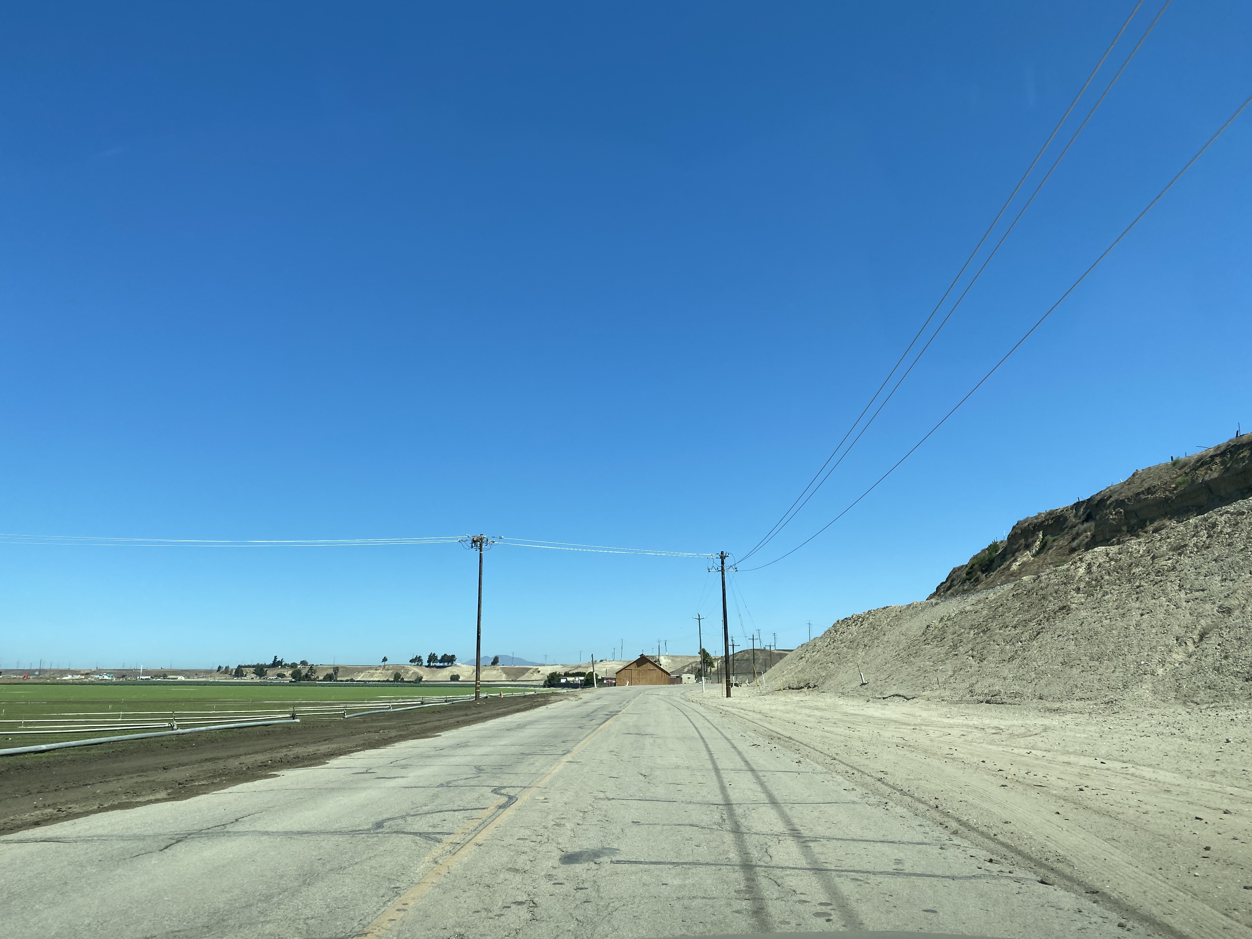
San Lucas is a small community located in Salinas Valley of Monterey County along Union Pacific Railroad. Modern US Route 101 and California State Route 198 both bypass San Lucas along alignments opened during 1972. The original alignment of US Route 101 was carried on Legislative Route Number 2 via a western frontage of San Lucas now known as Cattlemen Road. California State Route 198 originally followed Mary Street via Legislative Route Number 10 into San Lucas and Main Street. From Main Street California State Route 198 crossed the then Southern Pacific Railroad where it terminated at US Route 101 at the intersection of Cattlemen Road and Lockwood-San Lucas Road. Depicted above as the blog cover is a view from Cattlemen Road and Lockwood-San Lucas Road looking east to where California State Route 198 once began. Below the junction of US Route 101 and California State Route 198 can be seen on the 1935 Division of Highways Map of Monterey County.

Part 1; the history US Route 101 and California State Route 198 in San Lucas
The modern site of San Lucas was named in honor of Rancho San Lucas of Mexican Alta California. Rancho San Lucas was granted to José Rafael Estrada during 1842 who in turn sold it James McKinley during 1843. Following the Mexican American War, the property claims of the Mexican Ranchos were honored by the American Government which led to Rancho San Lucas being retained by James McKinley. Rancho San Lucas would be sold to Alberto Trescony during 1863 which was later consolidated into a 20,000-acre cattle ranch with nearby Rancho San Bernardo and Rancho San Benito.
By 1886 the Southern Pacific Railroad was extended southward from Soledad through Rancho San Lucas. The Southern Pacific Railroad established a railroad siding which took the name of "San Lucas" in honor of the property donated by Alberto Trescony. By 1887 Post Office service was transferred from nearby Griswold and has remained operating ever since.
Salinas Valley was ultimately part of the American El Camino Real which began being signed as an Auto Trail starting in 1906. The era of State Highway Maintenance through Salinas Valley would ultimately begin with the 1909 First State Highway Bond Act which was approved by voters in 1910. One of the highways approved through the 1909 First State Highway Bond Act was a 481.8-mile highway originating at the City Limits of San Francisco which terminated in San Diego. This highway would ultimately come to be known in time as Legislative Route Number 2 ("LRN 2"). Within Salinas Valley much of LRN 2 would follow the existing corridor along the frontage roads of the Southern Pacific Railroad which included the community of San Lucas.
1915 Legislative Chapter 404 extended LRN 10 from Hanford west to San Lucas via the road through Warthan Canyon. Early LRN 2 and LRN 10 can be seen intersecting in San Lucas on the 1917 California State Automobile Association Map. LRN 2 is shown following two at-grade crossings of the Southern Pacific Railroad onto Main Street in San Lucas. LRN 10 is shown terminating at LRN 2 in San Lucas via Mary Street.
The January 1915 California Highway Bulletin references surveys for the location of LRN 2 as being completed branching north and south from San Lucas.
LRN 2 appears shifted west of the Southern Pacific Railroad in San Lucas onto what is now Cattlemen Road on the 1
925 California State Automobile Assocation Map. It isn't clear when LRN 2 was shifted to Cattlemen Road, but it led to LRN 10 being extended through San Lucas via Main Street to a new terminus at Lockwood-San Lucas Road.
The extension of LRN 10 through San Lucas aligned it directly with the
1915 Salinas River Bridge located on Lockwood-San Lucas Road.

The initial draft of the US Route System was approved by the Secretary of Agriculture during November of 1925. The US Route System within California was approved by California Highway Commission with no changes recommended by
January 1926. The initial alignment of US Route 101 was planned to follow LRN 2 from San Francisco to San Diego via Salinas Valley. US Route 101 is shown on a map published in the 1926 California Highways & Public Works following LRN 2 south from San Francisco towards San Diego.
During November of 1926 the US Route System was approved by the ASSHO. US Route 101 can be seen aligned through San Lucas on the
1926 Rand McNally Junior Map of California. US Route 101 inherited the existing alignment of LRN 2 through San Lucas on Cattlemen Road.
The
September/October 1928 California Highways & Public Works announced LRN 10 from San Lucas to the Mustang Grade had been rebuilt to state standards which included an oil surface. The same article stubs noted the completion of macadam shoulders on US Route 101/LRN 2 between San Lucas and San Ardo.


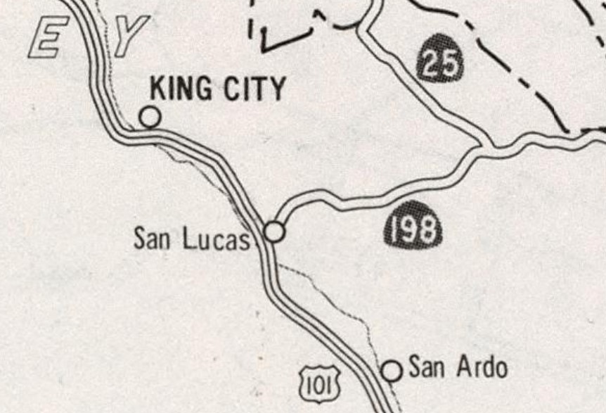
As part of the 1964 California State Highway Renumbering the Legislative Route Numbers were dropped. Thusly both US Route 101 and California State Route 198 were both assigned as the legislative highway designations through San Lucas. California State Route 198 can be seen with a western terminus point in San Lucas on the 1964 Division of Highways Map.
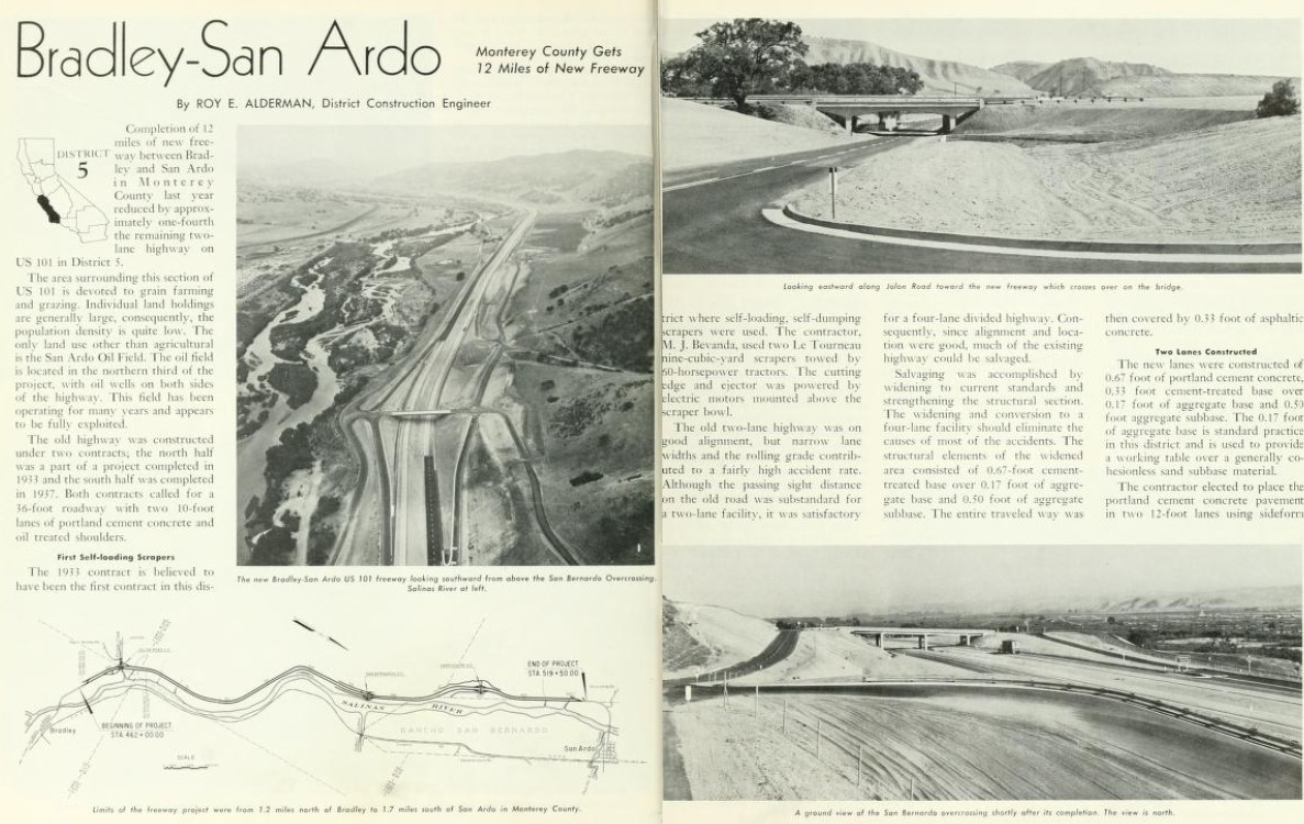
The May/June 1965 California Highways & Public Works featured the realignment of US Route 101 between Bradley and San Ardo. The article goes onto to describe the numerous upcoming projects to realign US Route 101 to a freeway grade between San Ardo north to King City. Right of way acquisition to realign US Route 101 and California State Route 198 is stated to be planned to commence during 1965.
The July/August 1965 California Highways & Public Works announced the location of a 1.1-mile realignment of California State Route 198 to the planned US Route 101 freeway in San Lucas had been selected at the May/June California Highway Commission meetings.
The planned realignments of US Route 101 and California State Route 198 near San Lucas appear on the 1967 Division of Highways Map.
As noted in the intro the US Route 101 and California State Route 198 bypasses of San Lucas opened during 1972. US Route 101 was shifted to a new freeway west of Cattlemen Road and California State Route 198 was extended directly to it via an interchange structure south of San Lucas. Former California State Route 198 in San Lucas was partially severed after the highway was realigned. Mary Street no longer directly connects traffic from California State Route 198 to Main Street. The Southern Pacific Railroad crossing from Main Street to Cattlemen Road/Lockwood-San Lucas Road was removed. The new alignments of US Route 101 and California State Route 198 appear on the
1975 Caltrans Map.

Part 2; a drive on former US Route 101 on Cattlemen Road in San Lucas
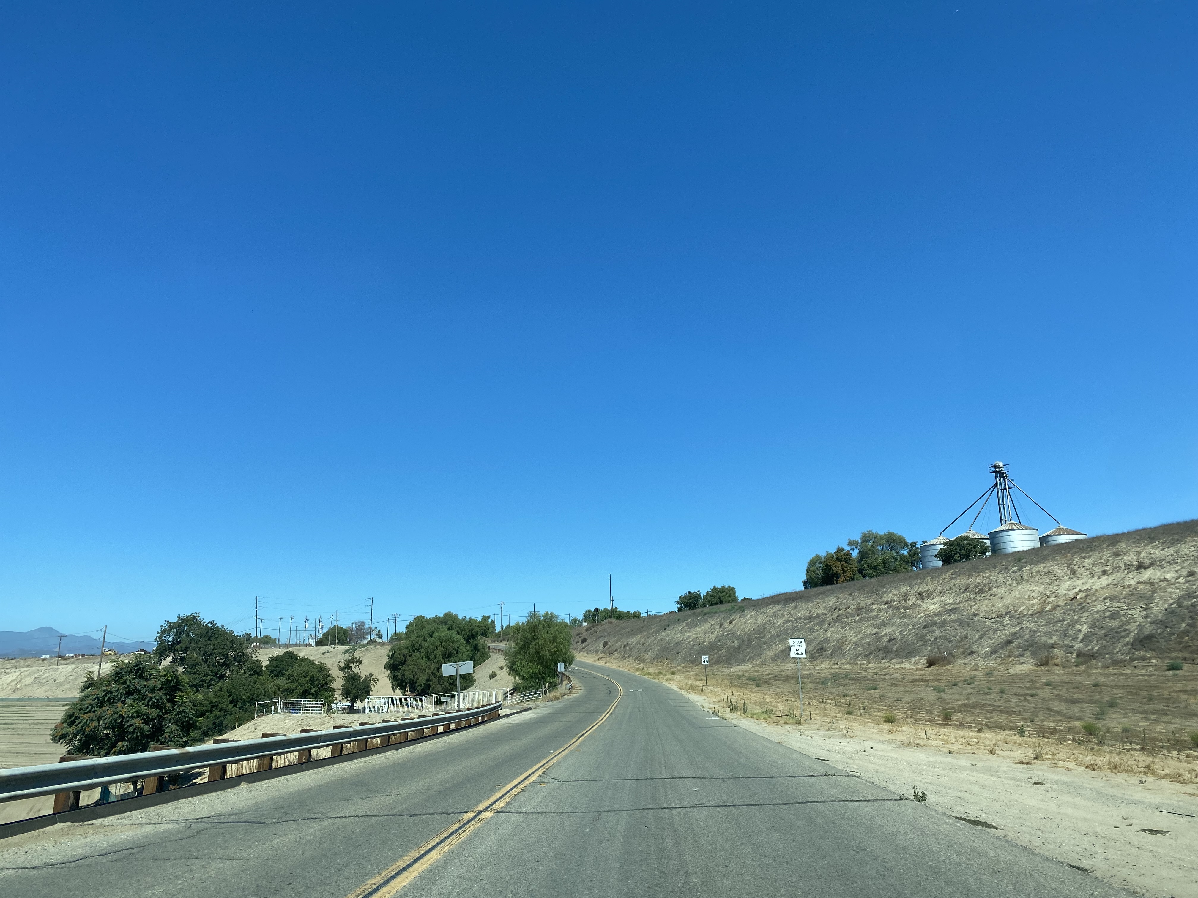
From modern California State Route 198 westbound traffic can access former US Route 101 through San Lucas by turning north on Cattlemen Road.
Cattlemen Road northbound climbs a bluff west of the Union Pacific Railroad and intersects Lockwood-San Lucas Road. Prior to 1972 California State Route 198 eastbound would have begun by turning right over the railroad tracks towards Main Street in San Lucas.
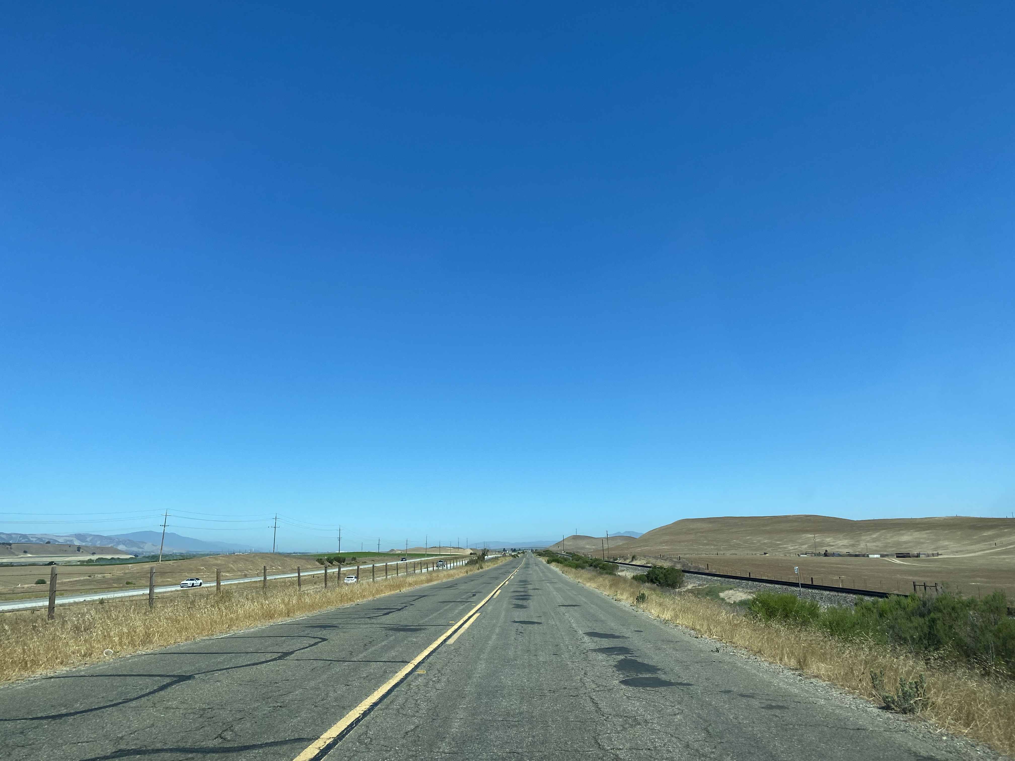
Cattlemen Road departs the frontage facilities of San Lucas and runs above the modern US Route 101 freeway towards Wildhorse Canyon.
Cattlemen Road follows the eastern flank of Wildhorse Canyon and terminates at Wildhorse Road. A concrete stub of former US Route 101 can be seen disappearing at the modern freeway alignment north of Wildhorse Road.
Part 3; exploring former California State Route 198 in San Lucas
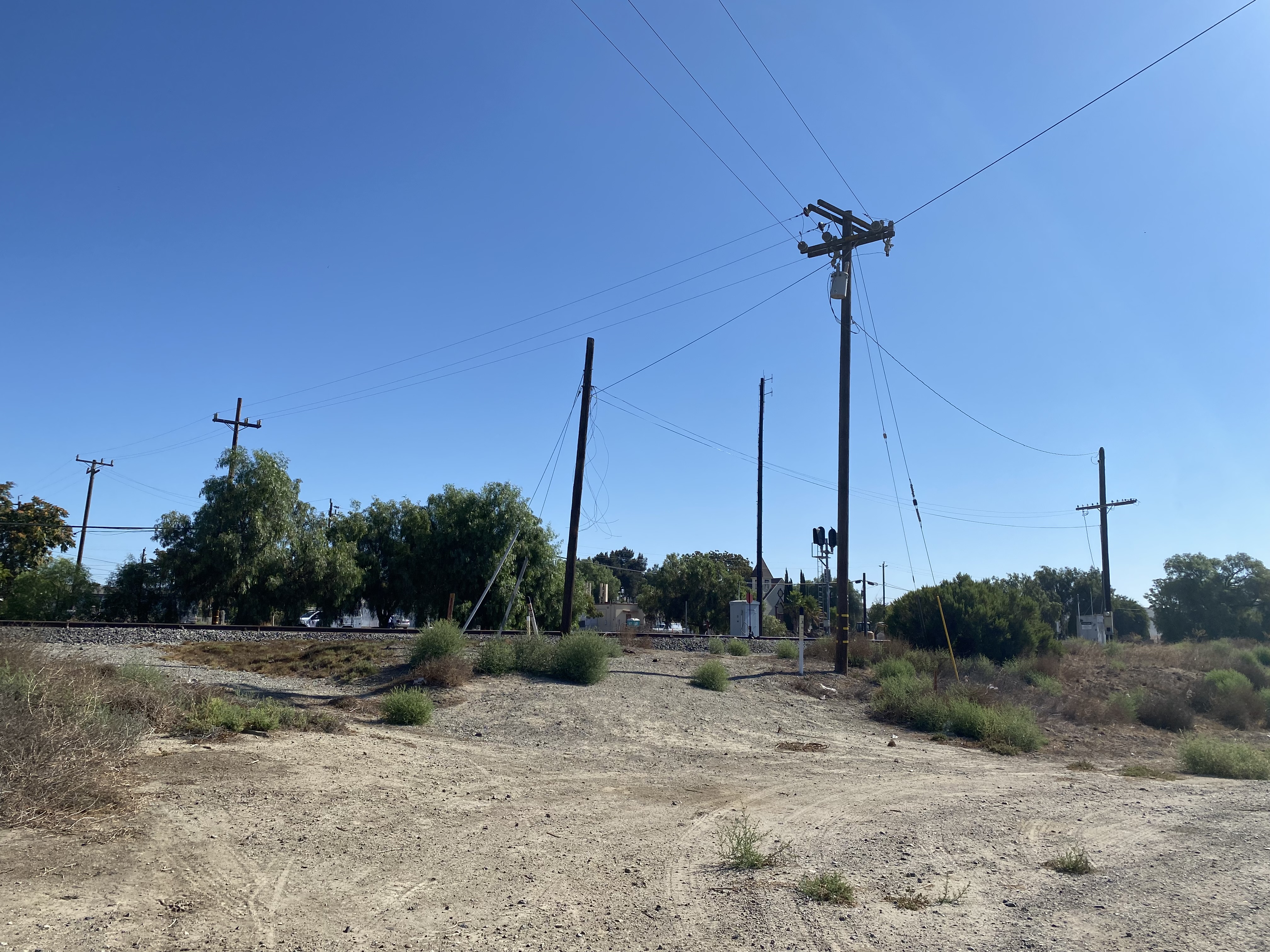
From the intersection of Cattlemen Road and Lockwood-San Lucas Road the razed former grade of California State Route 198 to Main Street in San Lucas can be observed.
The reverse view from Main Street towards Cattlemen Road doesn't offer much evidence that it was once the western terminus of California State Route 198.
Church of St. Luke along Main Street in San Lucas is easiest way to spot where California State Route 198 once crossed the Southern Pacific Railroad.
Below the transition of what was once California State Route 198 eastbound from Main Street to Mary Street can be observed. As noted above the connection on Mary Street to modern California State Route 198 has been razed.


Comments