Abandoned Foresta Road between Foresta and El Portal (Yosemite National Park and Stanislaus National Forest)

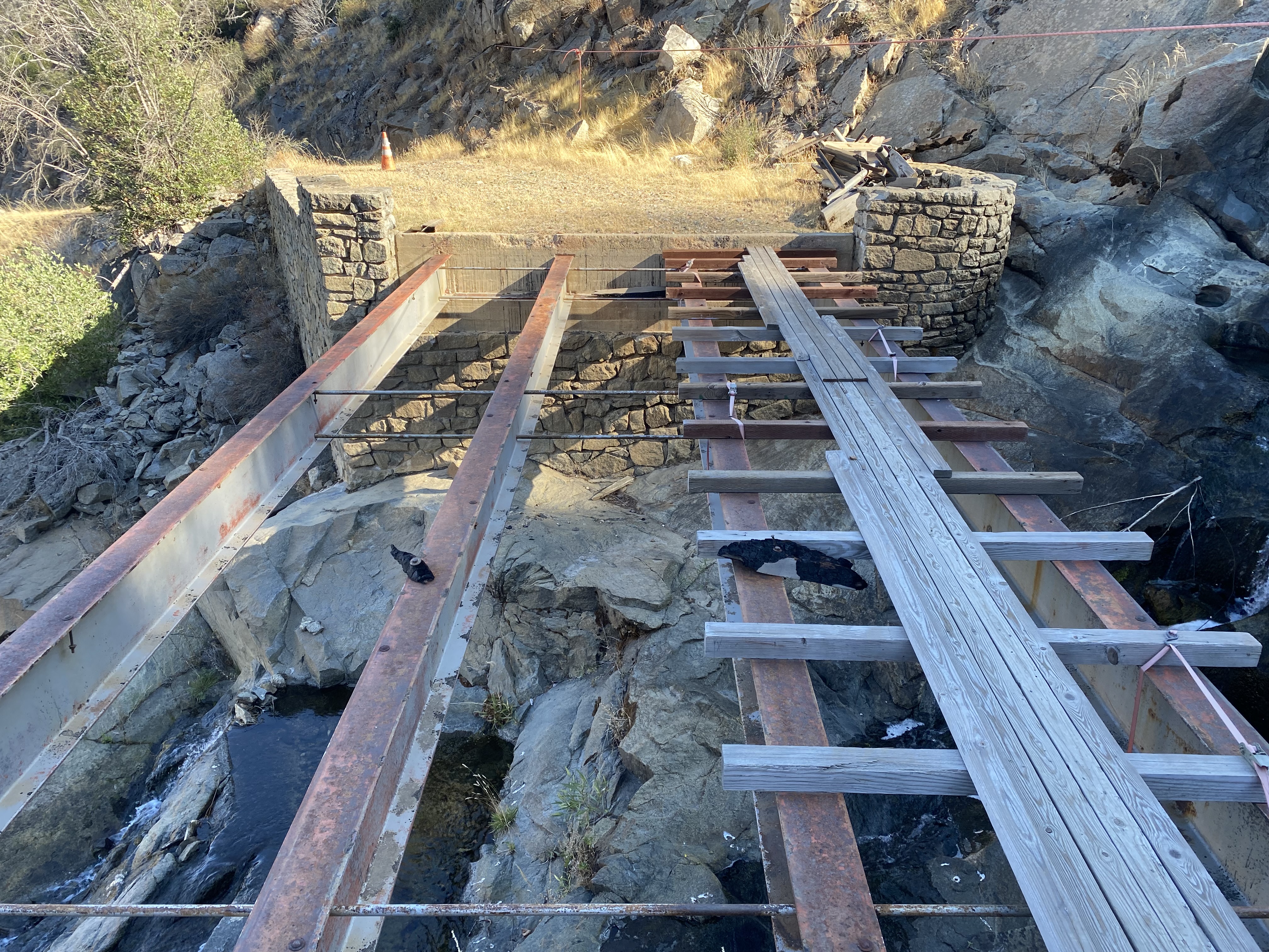
Foresta Road is an approximately nine-mile roadway which connects the Old Coulterville Road in the community of Foresta in Yosemite National Park to California State Route 140 in El Portal on the Merced River. Foresta Road originally opened during 1913 as lumber haul road from Foresta to the eastern terminus of the Yosemite Valley Railroad in El Portal. From Foresta the alignment of Foresta Road is notable for the approximately 2,300-foot elevation drop it descends through over the course of six miles towards El Portal in the Merced River Canyon. Much of Foresta Road was abandoned after the 2009 Big Meadow Fire destroyed the wooden deck of the Lower Foresta Falls Bridge. Since 2009 Foresta Road has largely been abandoned and is beginning to erode into the Merced River Canyon. Pictured as the blog cover is the partially destroyed Lower Foresta Falls Bridge. Below Foresta Road can be seen as a major County Highway on the 1935 Division of Highways Map of Mariposa County.

Foresta Road is tied to the fortunes and history of Big Meadow and the McCauley Ranch Addition to Yosemite National Park. Big Meadow lies at elevation of 4,314 feet above sea level west of Yosemite Valley north of the rim of the Merced River Canyon. During the early 1870s German immigrants Peter Mieson and George Meyer settled in Big Meadow where they grazed cattle.
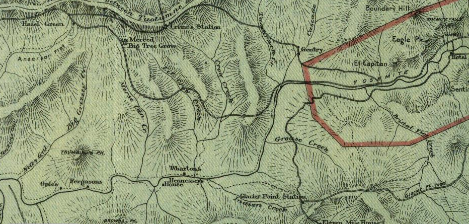
Big Meadow would be on the alignment of the Coulterville Road which was the first highway to Yosemite Valley. The Coulterville Road barely beat the Big Oak Flat Road to Yosemite Valley having been completed by the Coulterville & Yosemite Turnpike Company during June of 1874. Mieson and Meyer upon the completion of the Coulterville Road began to work for the Coulterville & Yosemite Turnpike Company to collect tolls at Big Meadow. The Coulterville Road can be seen passing through Big Meadow before descending Yosemite Valley the 1897 Punnett Brothers Map of California.

During 1878 Thomas A. Rutherford homesteaded 160 acres of land in Big Meadow after staking claims to the Cranberry Mine in the Merced River Canyon. Rutherford set up a blacksmith shop and sawmill along Crane Creek. Upon Rutherford's death in 1884 his holdings were purchased by James McCauley. McCauley was already tied to the history of Yosemite Valley having been behind the construction of the Four Mile Trail to Glacier Point during 1871 and beginning the tradition of the Yosemite Firefall during 1872. McCauley prior to the death of Rutherford already owned 40 acres of land in Big Meadow.
During February 1905 the borders of Yosemite National Park were redrawn by the Federal Government. The border of Yosemite National Park was drawn in during October 1890 without regard for private land holdings and stretched as far west of as Jenkins Hill. The redrawn boundary of Yosemite National Park left the land holdings of James McCauley's Ranch in Big Meadow outside the park boundary.
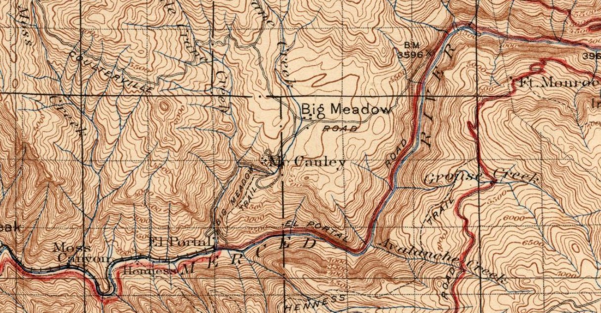
The 1906 United States Geological Survey map of the Yosemite area depicts a spur road branching from the Coulterville Road to McCauley Ranch. A trail from McCauley Ranch can be seen descending to the Merced River where Thomas Rutherford's sawmill was once located at Crane Creek.

The first Yosemite Valley Railroad passenger train to El Portal arrived on May 15, 1907. The terminus of the Yosemite Valley Railroad was located at El Portal near Crane Creek and the Big Meadow Trail. McCauley Ranch would begin making shipments down the Big Meadow Trail to take advantage of the trains arriving in nearby El Portal. McCauley Ranch can be seen connected to El Portal and the terminus of the Yosemite Valley Railroad via the Big Meadow Trail on the 1909 United States Geological Survey map of the Yosemite area.

James McCauley would be killed in a stagecoach accident while descending to Yosemite Valley via the Coulterville Road during 1911. Following the death of McCauley his ranch holdings in Big Meadow would be purchased by the Foresta Land Company during 1912. By August 1913 the Foresta Land Company completed the Davis Cutoff Road as a replacement for the Big Meadow Trail. The Foresta Land Company intended to use the Davis Cutoff Road to haul lumber and materials to be loaded onto the Yosemite Valley Railroad's train cars.
Yosemite National Park began to permit automobiles during 1915. The emergence of the automobile era at Yosemite National Park had an unintended side effect on the Davis Cutoff Road as numerous drivers would opt to descend down it to El Portal rather than using the steep final descent on the Coulterville Road. Public access to the Davis Cutoff Road was banned by the Foresta Land Company during 1916 which was reported in the July 2, 1916, Modesto Morning Herald (courtesy Ephriham Dickson of the Yosemite History Facebook page). Notably the July 2, 1916, Modesto Morning Herald is one of first known references to the community of Foresta in place of McCauley Ranch.

The July 1926 California Highways & Public Works declared the completion of the Yosemite All-Year Highway segment of Legislative Route Number 18 (future California State Route 140) along with a publicized opening date to motorist travel on July 31. The opening of the Yosemite All-Year Highway greatly reduced the importance of the Coulterville Road and would lead to a drop in ridership on the Yosemite Valley Railroad. By proxy the decline of both facilities would also affect the importance of the Davis Cutoff Road.


During the 1930s the bridges along the Davis Cutoff Road were rebuilt and modernized by the Forest Service (information courtesy Russ Marks). It is likely during this era of improvement that Davis Cutoff Road came to be known as Foresta Road. Foresta Road can be seen as a major County Highway in conjunction with the Coulterville Road west of Big Meadow on the 1935 Division of Highways Map of Mariposa County.


During the 1930s the bridges along the Davis Cutoff Road were rebuilt and modernized by the Forest Service (information courtesy Russ Marks). It is likely during this era of improvement that Davis Cutoff Road came to be known as Foresta Road. Foresta Road can be seen as a major County Highway in conjunction with the Coulterville Road west of Big Meadow on the 1935 Division of Highways Map of Mariposa County.
During the Great Depression and World War II the amount of freight operations on the Yosemite Valley Railroad declined significantly. The Yosemite Valley Railroad would last run on August 24, 1945. Having no real outlet for lumber the land holdings in Foresta began to be repurposed towards the development of cabins. Foresta would receive power during 1951 when lines were run over the Big Meadow Trail and Foresta Road. During the next two decades over 70 cabins would be constructed at Foresta. During 1974 the holdings of the Foresta Land Company would be purchased by Yosemite National Park as the McCauley Ranch Addition.
Foresta was heavily damaged by the Arch Rock Fire of 1990, but Foresta Road remained accessible to the public. The 2009 Big Meadow Fire further damaged Foresta and burned the wooden deck of the Lower Foresta Falls Bridge on Foresta Road. Since 2009 Foresta Road between Lyell Way in Foresta to Granite Road to El Portal has been closed to traffic. It is unclear if this segment of Foresta Road will ever open to traffic again and it effectively has weathered to the point that is likely abandoned.
Part 2; hiking the abandoned segment of Foresta Road
Foresta Road begins in Big Meadow at Old Coulterville Road via a lefthand Y junction. A historic plaque discussing the history of the Coulterville Road, Big Meadow and the Meyer's Barns can be found at the beginning of Foresta Road.


Foresta Road southbound enters Foresta and crosses an arch bridge at Crane Creek.


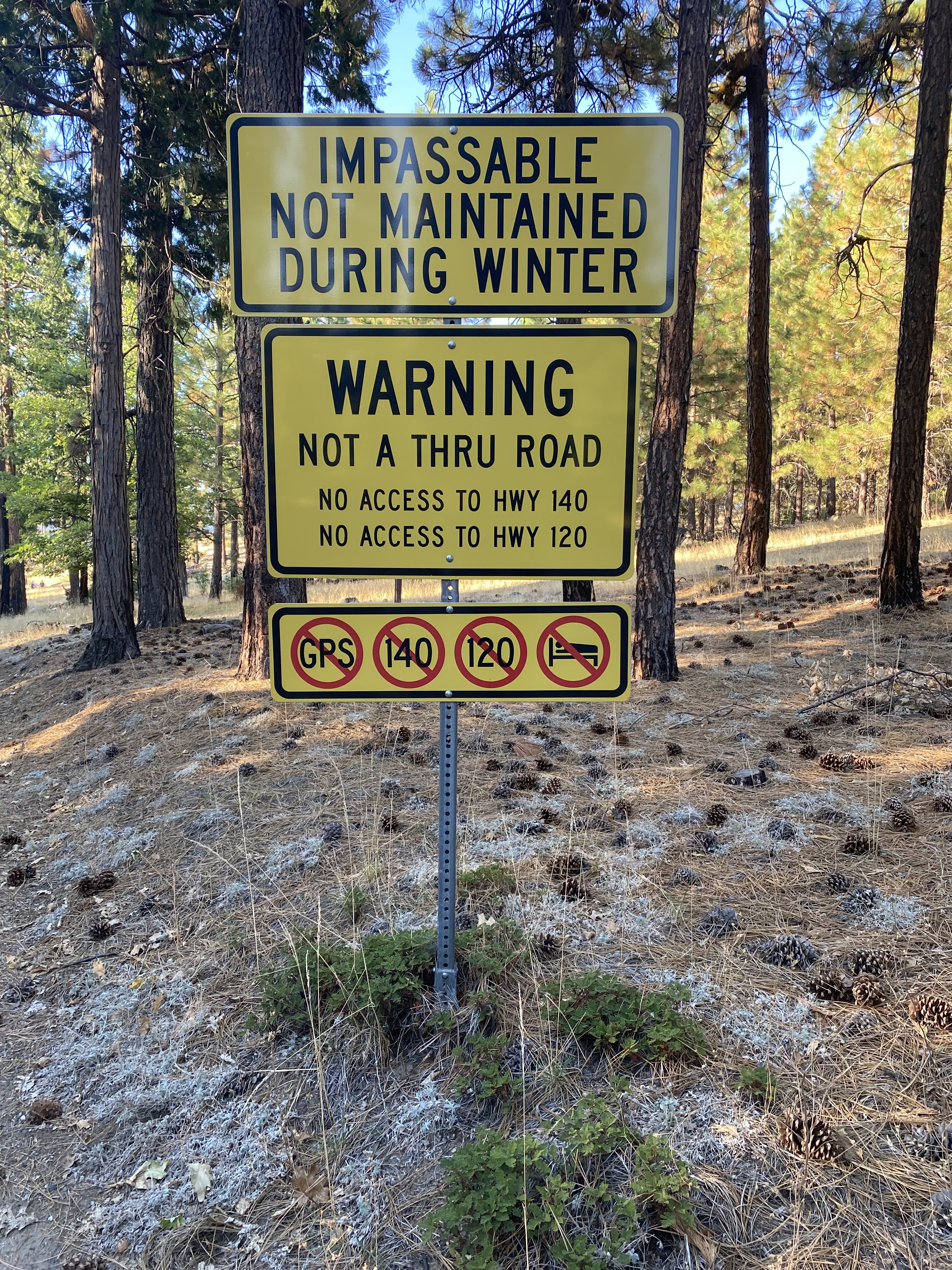
Traffic on Foresta Road southbound is notified that the road is closed approaching Lyell Way. A sign is still present denoting the weight capacity of the Lower Foresta Falls Bridge.




Hikers and cyclists can continue past the closure south on Foresta Road to the boundary of Yosemite National Park with Stanislaus National Forest. A partially burned sign denoting the boundary of the McCauley Addition to Yosemite National Park can be found.


Foresta Road descends to a switchback at the ruins of what was a holding pen of McCauley Ranch.


Foresta Road continues to descend to the Upper Foresta Falls Bridge at Crane Creek.


The Upper Foresta Falls Bridge is a concrete and steel stringer bridge which was last signed with 6-ton weight capacity. The concrete slabs of the Upper Foresta Falls Bridge are heavily weathered and displaying significant gaps.




The Upper Foresta Falls Bridge can be seen in the below when it was in much better state of repair. This photo was taken by Brian Grogan in October 2001 for the Historic American Engineering Record (hosted on the Library of Congress webpage).

From the Upper Foresta Falls Bridge the route of Foresta Road approaches the rim of the Merced River Canyon and a closure gate. The closure gate on Foresta Road is located about one mile south of Foresta.


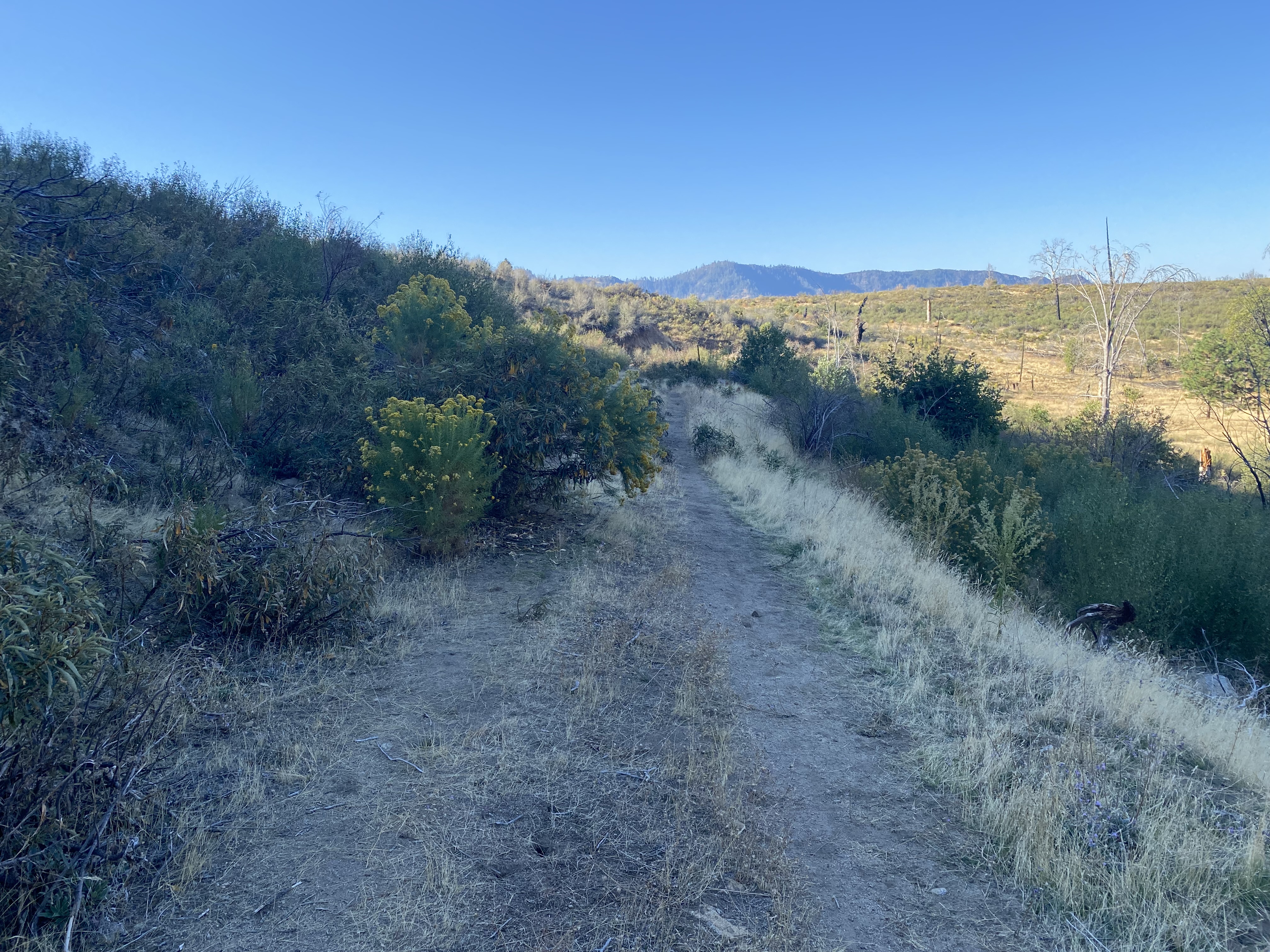


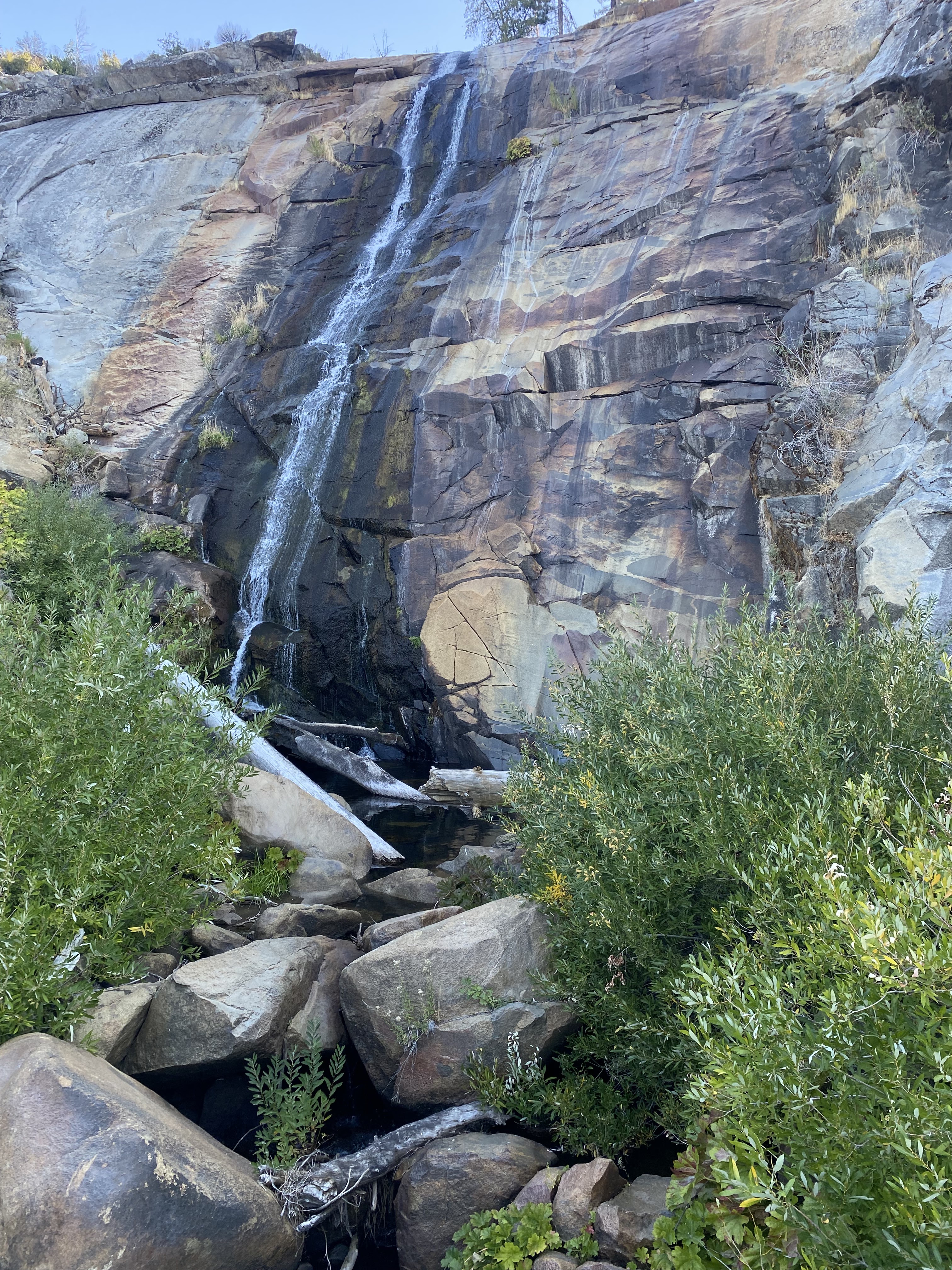
Foresta Road turns away from the Merced River Canyon and begins to descend towards Lower Foresta Falls at Crane Creek.
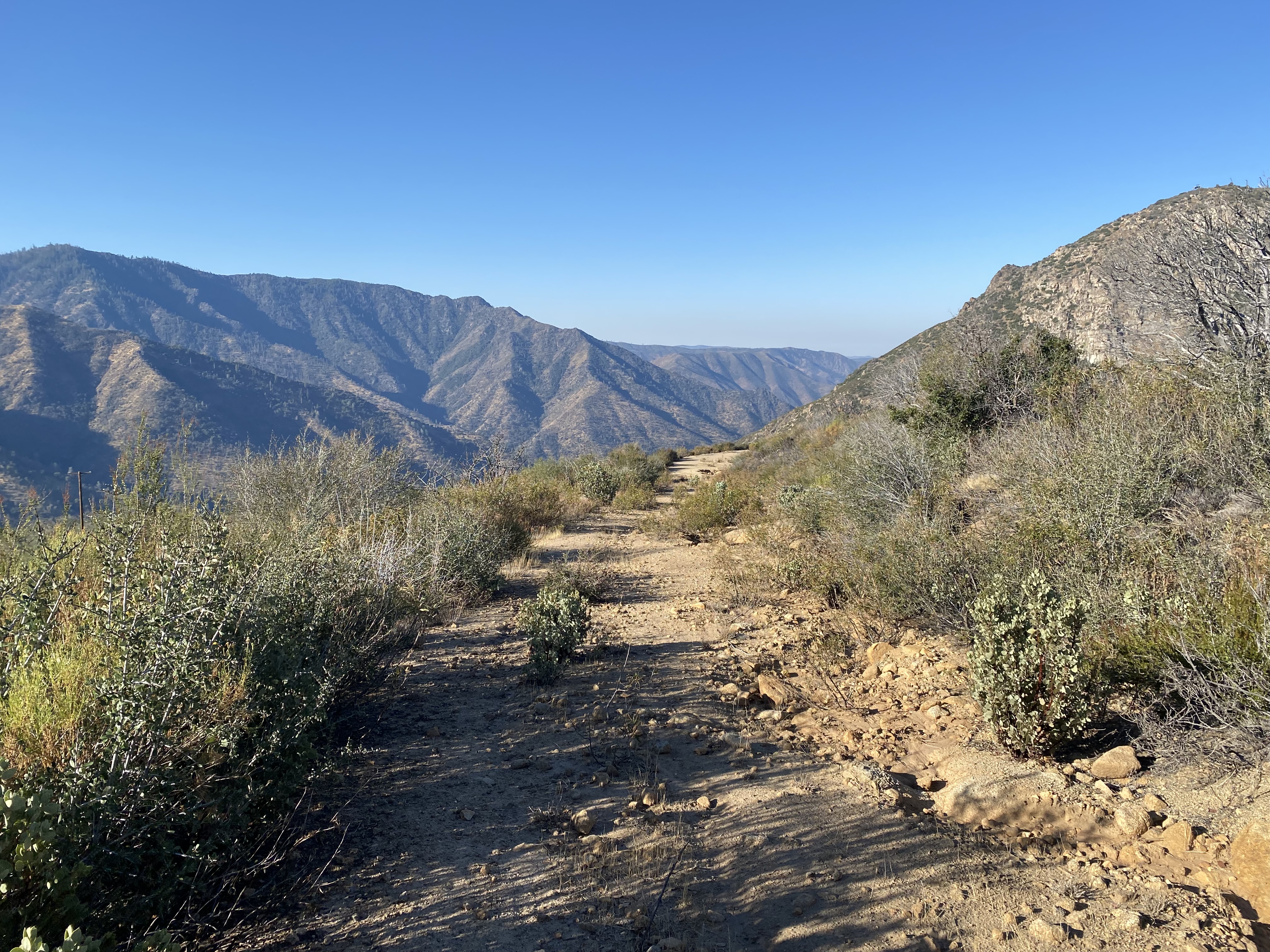


Foresta Road approaches the burned out Lower Foresta Falls Bridge at Crane Creek.


The Lower Foresta Falls Bridge is also a steel and concrete stringer bridge. The structural steel beams of the Lower Foresta Falls Bridge seemingly are intact and have temporary wood planks in place along with a line for pedestrians to cross. I personally found it easier to go under the bridge given the flow of Lower Foresta Falls was low. This structure was constructed in 1937 by the Forest Service (information courtesy Russ Marks).



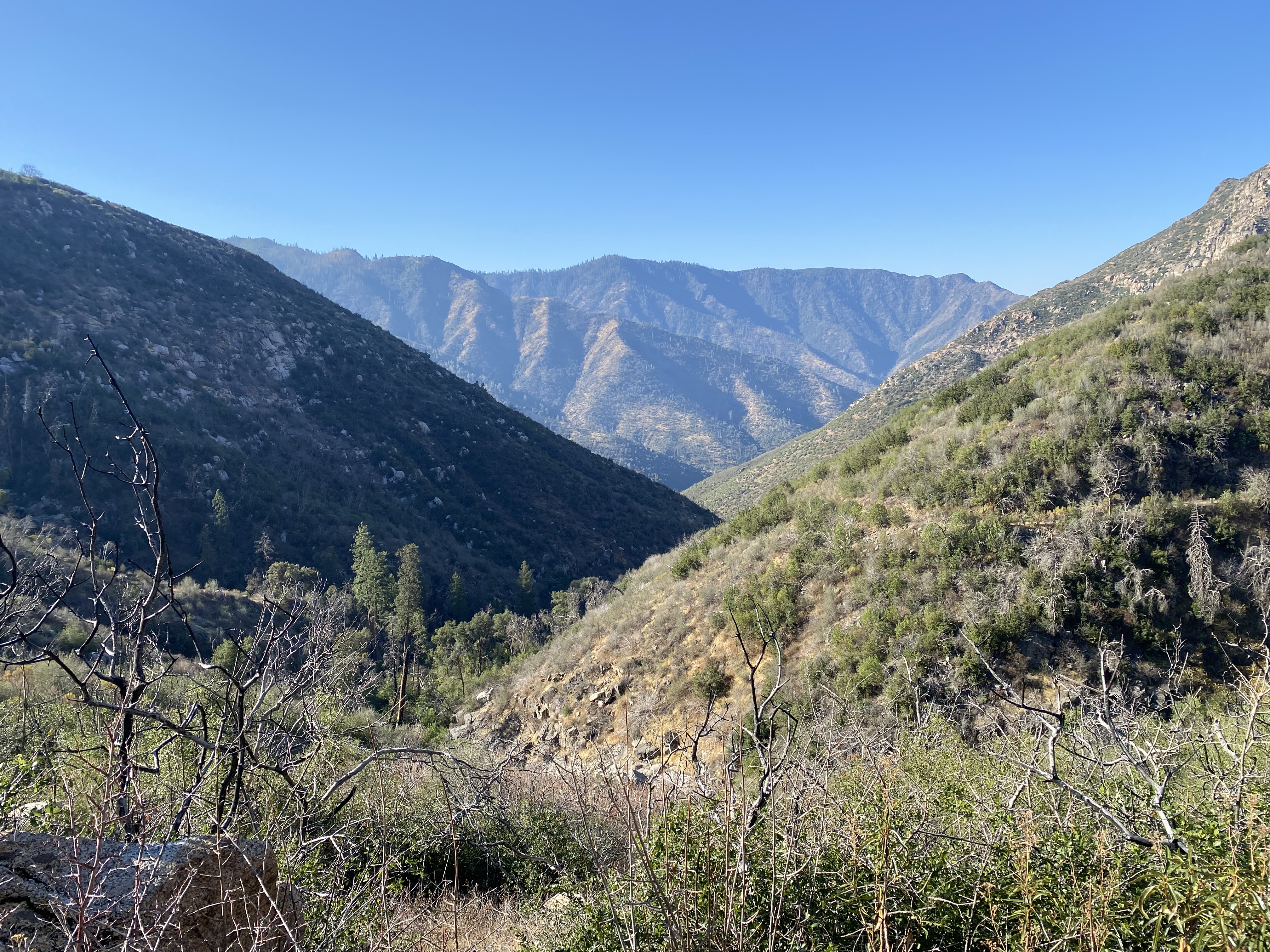
From the Lower Foresta Falls Bridge the alignment of Foresta Road descends to a brick bridge over Little Crane Creek.




The same brick bridge over Little Crane Creek can be seen in 2001 (Brian Grogan photo).
%20AND%20STONE%20CULVERT%20AT%20LITTLE%20CRANE%20CREEK.%20LOOKING%20S..png)
Given I didn't have a means of getting from El Portal back up to Foresta aside from hiking I doubled back at Little Crane Creek. A larger stringer bridge can be found at an unnamed stream just above El Portal. The bridge near El Portal can be seen below in two 2001 era photos by Brian Grogan.
%20AND%20FOREST%20ROAD%20BRIDGE.png)
.%20NOTE%20FORESTA%20ROAD%20BRIDGE%20IN%20LOWER%20LEFT.%20ROAD%20CURVE%20HIDDEN%20IN%20TREES%20AT%20CENTER.%20NOTE%20ROAD%20CUT%20AT%20LEFT.%20LOOKING%20SSW.png)
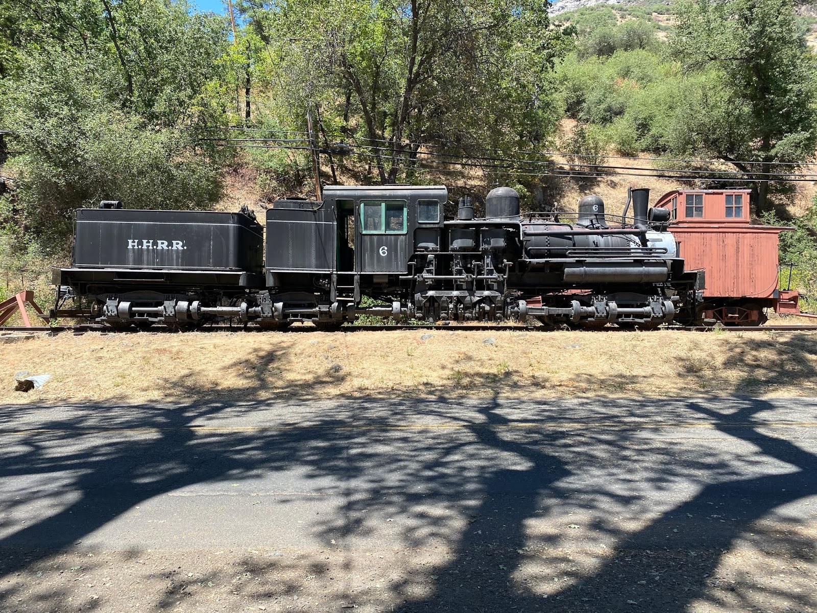
The Yosemite Conservancy has placed a railroad display at the corner of Foresta Road and El Portal Road. The display includes Hetch Hetchy Railroad Locomotive #6, Yosemite Valley Railroad Caboose #15, a Yosemite Railroad Valley Railroad turntable and several of the siding building from the ghost town of Bagby. Bagby was a siding of the Yosemite Valley Railroad which is now located under the waters of Lake McClure.




Comments