The San Juan Grade is a former segment of US Route 101 which once connected the community of Salinas north to San Juan Bautista over the Gabilan Range. The San Juan Grade was completed as a First State Highway Bond Act project during 1915 and was a replacement for Old Stage Road. The San Juan Grade was ultimately paved in Portland Cement which was common to the First through Third State Highway Bond Acts. US Route 101 was shifted west to the Prunedale Cutoff during 1932 which led to the San Juan Grade being retained as a spur of Legislative Route Number 2. The San Juan Grade was relinquished from the State Highway System during 1935 upon the completion of Legislative Route Number 22 west from San Juan Bautista to San Juan Bautista Y. The San Juan Grade today remains one of the best examples left in California of a First State Highway Bond Act road.
Part 1; the history of the San Juan Grade
The Gabilan Range between what is now San Juan Bautista and Salinas Valley was first explored during the second Juan Bautista De Anza Expedition of Las Californias. The De Anza expedition likely crossed very close to the present alignment of Old Stage Road their exact path isn't clear. Juan Bautista De Anza noted the following in his journal while passing near present-day San Juan Bautista on March 24, 1776:
"In the valley we saw many antelopes and white grey geese. In the same valley we found an arroyo...and then came to a village in which I counted about twenty tule huts. But the only two people we saw were two Indians who came out to the road and presented us with three fish more than a foot long."
In time the general route of the second De Anza Expedition became the path of El Camino Real ("The Royal Road"). The route of El Camino Real was intended to solidify a path of travel between the Catholic Missions of Las Californias. In 1797 Mission San Juan Bautista was founded which led to a need for a spur of El Camino Real to be built from Salinas Valley over the Gabilan Range. This spur of El Camino Real would become what is now Old Stage Road. While the Spanish El Camino Real was largely just a general path between the Missions there are several paths such as Old Stage Road which can be identified conclusively as part of the highway.
In 1804 Alta California was formed out of the larger Las Californias. El Camino Real would ultimately connect 21 Catholic Missions of Alta California ranging approximately 600 miles spanning from Mission San Diego de Alcala in San Diego north to Mission San Francisco Solano in Sonoma. The Missions of El Camino Real were established from 1769 through 1823. In the case of Mission San Francisco Solano, it was established two years after Mexico had won its independence from Spain in 1821. Each Mission was meant to be approximately 30 miles apart from each other which would require a single day of travel by horseback.
Following the advent of Mexican independence from Spain the usage of the term "El Camino Real" largely fell into disuse. Following the secularization of the Spanish Missions during August of 1833 the land holdings were split off into Ranchos. Despite El Camino Real functionally no longer existing the route's path over what is now Old Stage Road remained a popular route of travel over the Gabilan Range. What is now San Juan Bautista was founded as a town in 1834 known at the time as "San Juan de Castro."
Alta California was annexed by the United States in early 1848. San Juan Bautista became an incorporated City in 1869 (citation; San Juan Bautista Historical Society). San Juan Bautista was originally located in Monterey County but was among the land split into San Benito County in 1874. Old Stage Road remained the primary route of travel between Salinas Valley and San Juan Bautista into the 20th Century.
Old Stage Road shows up numerous maps as a primitive road. One such example is this 1857 Britton & Rey's Road Map of California.
Likewise Old Stage Road appears on the 1873 California Geological Survey Map of Central California as the road between Salinas Valley and San Juan Bautista.
In 1904 the American El Camino Real Association was formed with the goal to mark a modern highway that corresponded to the historical route between the Spanish Missions. Ultimately the path of American El Camino Real was to be marked by the signature bells the corridor is known by today. The first bell marking the American El Camino Real was placed in 1906 and it is estimated by 1915 that there may have been anywhere to 158 to 400 placed in-field. The American El Camino Real was one of the earliest analogs of what would become the signed Auto Trails. The American El Camino Real just as its Spanish predecessor crossed the Gabilan Range via Old Stage Road. The background of the American El Camino Real is covered extensively on CAhighways.org.
CAhighyways.org on the American El Camino Real
The era of State Highway Maintenance through the Gablian Range would ultimately begin with the 1909 First State Highway Bond Act which was approved by voters in 1910. One of the highways approved through the 1909 First State Highway Bond Act was a 481.8-mile highway originating at the City Limits of San Francisco which terminated in San Diego. This highway would ultimately come to be known in time as Legislative Route Number 2 (LRN 2).
Old Stage Road even by the conventions of the 1910s was woefully inadequate for usage by automobiles. The terrain of the Gabilan Range between San Juan Bautista and Salinas Valley was so rugged that an alternate route from Gilroy to Salinas by way of Watsonville and Castroville was considered. The proposed highway routings of LRN 2 are featured in the January 1913 California Highway Bulletin.
The rationale for selecting the routing of the San Juan Grade through the Gabilan Range (referenced as San Juan Mountain) is noted to be three-fold in the January 1913 California Highway Bulletin. The route through the Gabilan Range was the most direct and particle route between Salinas Valley-Santa Clara Valley, within seven miles of the San Benito County seat of Hollister and had an estimated gradient ranging from 2-6%. The existing route of American El Camino Real over Old Stage Road is noted to be direct, and it would be desirable for LRN 2 to follow nearby over a better grade.
The January 1913 California Highway Bulletin noted $75,000 in bonds had been sold which funded construction of the San Juan Grade.
The July 1914 California Highway Bulletin noted surveys for the San Juan Grade were complete in San Benito County and in Monterey County. LRN 2 from the Monterey County Line to San Juan Bautista is noted to be in the process of construction as an unpaved road. A contract to construct LRN 2 in paved Portland Cement north of San Juan Bautista is noted to have been awarded on July 6, 1914.
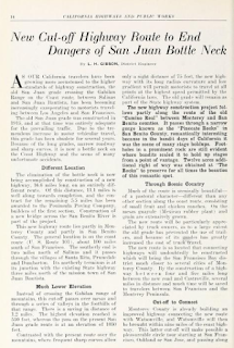
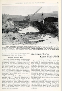
The April 1932 California Highways & Public Works noted the new alignment of US Route 101/LRN 2 was scheduled to open to traffic on July 1. The article stub notes that the San Juan Grade would be retained as part of the State Highway System. The Prunedale Cutoff alignment of US Route 101/LRN 2 is noted to pass by the former bandit's lair known as the Pinecate Rocks.
For comparison's sake the below maps have been prepared to illustrate the alignment differences between Old Stage Road, the San Juan Grade and the Prunedale Cutoff. The San Juan Grade is displayed on the maps below in red.
The original alignment of US Route 101 southbound followed San Juan Highway into San Juan Bautista which becomes 1st Street upon entering the city.
US Route 101 southbound followed 1st Street, Monterey Street, 3rd Street and The Alameda through the city of San Juan Bautista. Note: 3rd Street is no longer accessible to southbound traffic due to a one-way configuration.
The original alignment US Route 101 continued south of California State Route 156 along The Alameda to the start of the San Juan Grade which is known as Salinas Road in San Benito County. The Alameda between California State Route 156 south to San Juan Canyon Road is now part of San Benito County Route G1.
The asphalt quickly gives way to Portland Cement on the San Juan Grade upon passing Old Stage Road. The Portland Cement present on the San Benito County side of the San Juan Grade is a very obvious indicator it was once part of US Route 101.
Former US Route 101 on the San Juan Grade begins to climb into the Gabilan Range.
Despite lacking a center stripe the San Juan Grade southbound is wide enough for vehicles to pass each other. As noted in Part 1 the gradient of the San Juan Grade averages 2-6%.
Former US Route 101 southbound on the San Juan Grade crosses an unnamed summit at 1,016 feet above sea level approaching the Monterey County Line.
Upon crossing the Monterey County, the San Juan Grade has a top layer of asphalt covering the Portland Cement of the original alignment of US Route 101.
The Monterey County side of the San Juan Grade begins to descend from the Gabilan Range towards Salinas.
Approaching Crazy Horse Road, the grade of the San Juan Grade southbound flattens and jogs towards Main Street in Salinas.
The San Juan Cement Company was not successful and shuttered operations in late November of 1907. The assets of the San Juan Cement Company were eventually taken over by the Old Mission Cement Company in May of 1912. The Old Mission Cement Company rebranded the SJPR into the Central California Railroad. The Old Mission Cement Company built a narrow-gauge quarry line east of the processing facility deeper into San Juan Canyon. The first cement shipments began rolling from San Juan Canyon in 1916 but it wasn't until 1918 that the Old Mission Cement Plant was complete.
The Old Mission Cement Plant extended its quarry line another 1.5 miles to two new quarries in 1921. The Old Mission Cement Plant sold out to the Pacific Portland Cement Company in 1927. The Pacific Portland Cement Company announced it intended to add three additional miles of quarry line in 1929. The Pacific Portland Cement Company shuttered operations in 1930 due to the economic conditions of the Great Depression. In 1937-1938 (sources conflict) the standard gauge rails of the Central California Railroad were removed. The cement processing facility reopened in 1941 under the banner of Ideal Cement which operated to the 1970s when the cement plant was dismantled.


Comments
Really that was a pretty cool find that I honestly didn't know was there until this past week. I noticed the older alignment a couple months back on the 1935 San Benito County map but didn't realize that it was the original US 101 on the San Juan Grade. Either way it kind of makes me wonder if the Ridge Route really could be salvaged as a passable route if the slides were cleared off it. That concrete was in great shape for as old as it really is, totally bumpy, but totally passable still.